Mooney Falls
~ 3 Miles from Supai Village
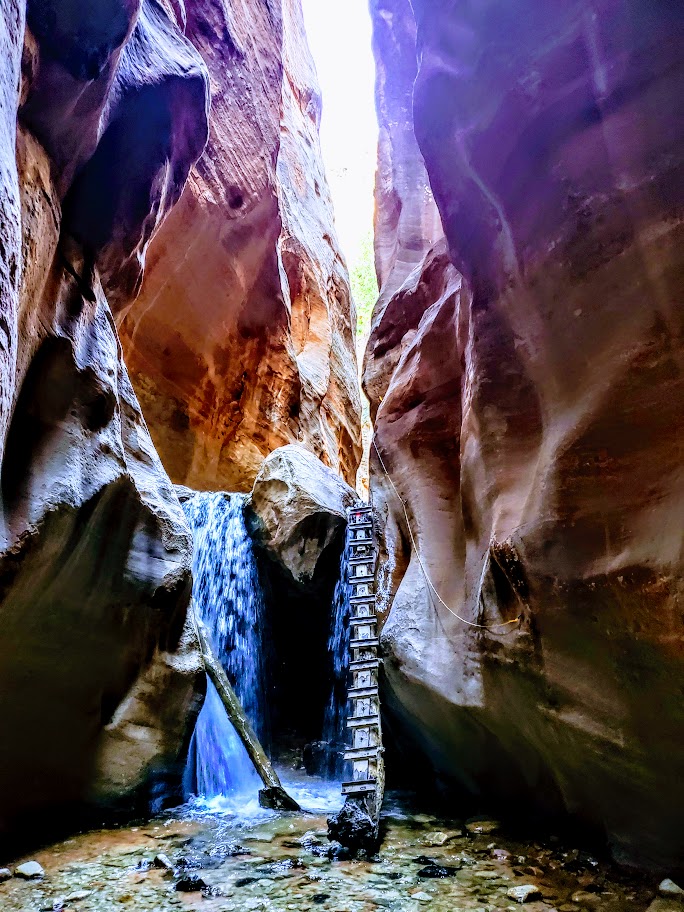
The descent to Mooney Falls requires ducking through a narrow, low sandstone tunnel carved into the cliffside, followed by cautious navigation down eroded and slippery sandstone “footholds” to the ladder far below. While there are chains bolted into the rock for handholds in the most exposed sections, even with them, it feels a bit sketchy. The new wood ladder was slick with mud and mist, and its rungs were spaced wider than a comfortable leg stretch for me. With 6 years of rugged hiking, scrambling, and the occasional canyoneering adventure in Utah under my belt, you’d think I’d have less trepidation navigating this than I did in my younger years. But still, it gave me moments of pause. (On the way back up, I saw a toddler and a young boy scramble ahead of their parents up the cliffside. Yikes!)


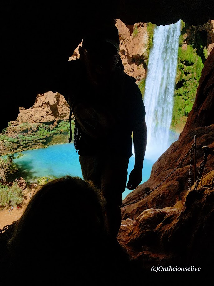


The power of the waterfall and the amount of mist the rushing water created were tremendous! The sunlight through the mist caused a magical effect in my photo on the right.
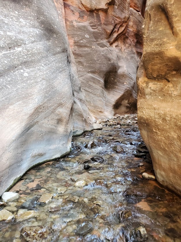
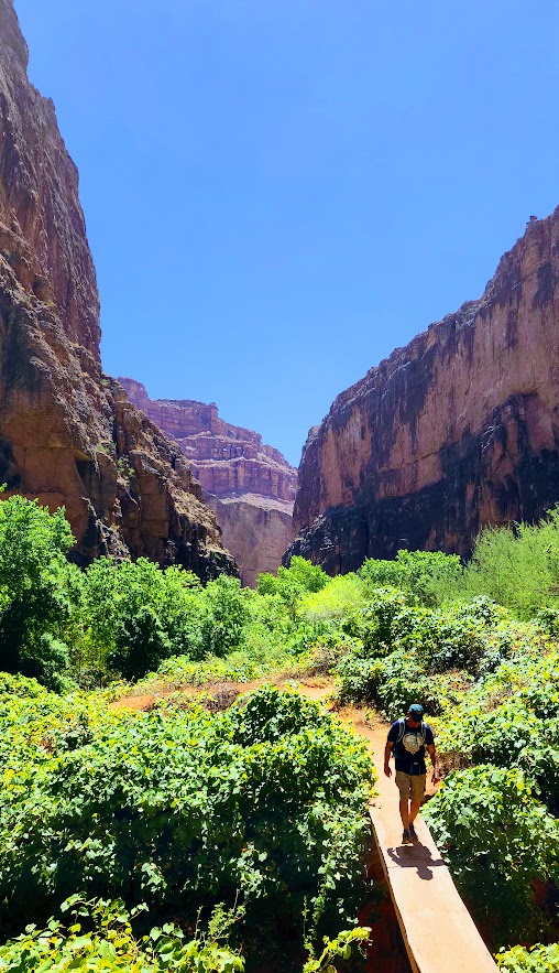
Beaver Falls
~3 Miles from Mooney Falls
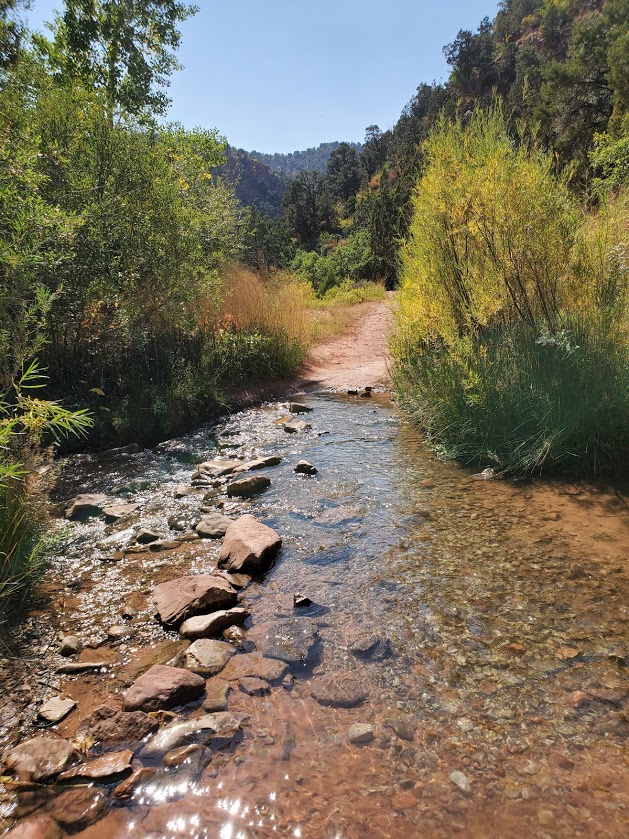
I’d never ventured beyond Mooney Falls before—there was never enough time. So I was especially grateful for the chance to explore further on this trip. The 3-mile hike from Mooney Falls to Beaver Falls is both enchanting and engaging, winding through a lush corridor of vines and trees along the turquoise creek. It feels like stepping into a jungle, with hidden oases revealing themselves around every bend.


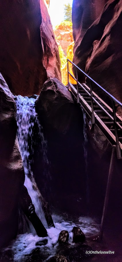
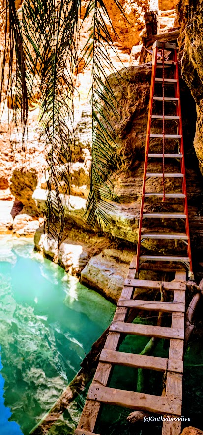
After a few refreshing creek crossings, the trail leads you through a striking sandstone archway to a short make-shift mini-bridge water crossing, followed by a ladder cliff climb. Thankfully, the footing here was drier and more stable than the slippery ladder at Mooney Falls.


Beaver Falls was truly stunning—cascading tiers of turquoise water —but it was also crowded. I hardly took any photos. A brief moment of uninterrupted zen there below.

Thankfully, there were plenty of quieter “private” oases along the way, perfect for a peaceful dip or simply taking a moment to soak it all in. Beaver Falls is absolutely worth it, and the hike to it is fun—just be sure to get an early start if you’d like to experience it in solitude.
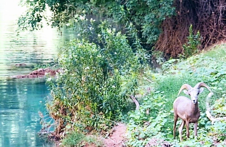
On the hike back, it was nearing critter hour. Much to my surprise, a bighorn sheep was just off the trail, seemingly scouting out a peaceful spot by the water to settle in for a nap. I had no idea that there were big horn down here!
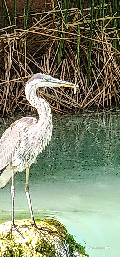
Closer to the campgrounds, I spotted a blue heron, focused, mid-hunt—clearly having some luck with its evening catch. Pics are a bit blurry due to distance.


Leaving Eden
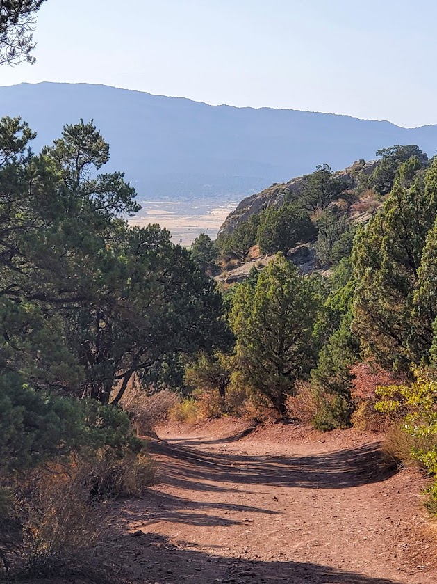
We started our return hike from the village just after dawn, hoping to beat the heat. Fortunately, most of the trail remained shaded until the final climb out of the canyon, which is fully exposed. Fortunately, there are a few rocky overhangs along the way—perfect spots to catch your breath and escape the unforgiving sun for a moment.


This adventure was nothing short of epic. I felt a pang of sadness as it came to an end, but also immense gratitude for the chance to return (thanks to my friend Bernie for securing the permits) and the opportunity to explore more than I ever had before. Among all my adventures near and far, the exquisite beauty and spiritual essence of Havasupai will forever hold a special place in my heart. I’ve never experienced anything quite like it. It remains one of my all-time favorites.

Happy Trails!
Leave No Trace!