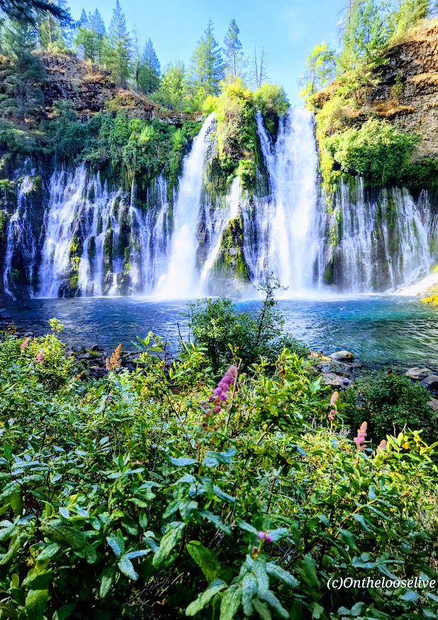
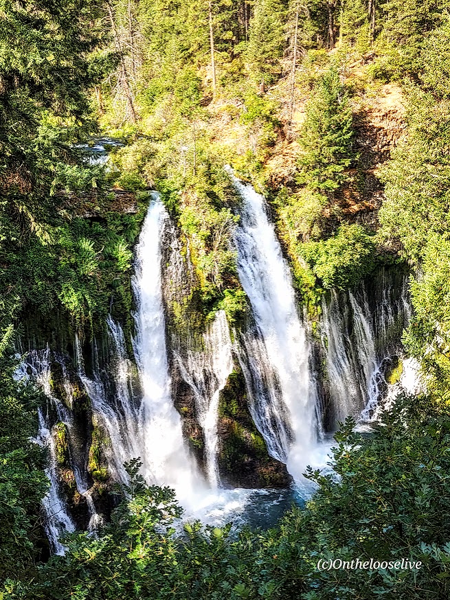
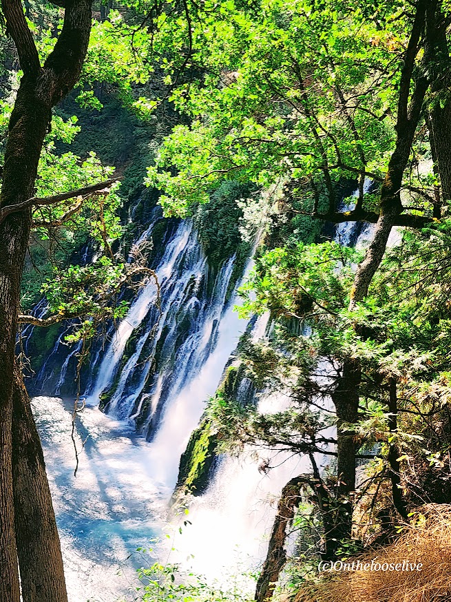
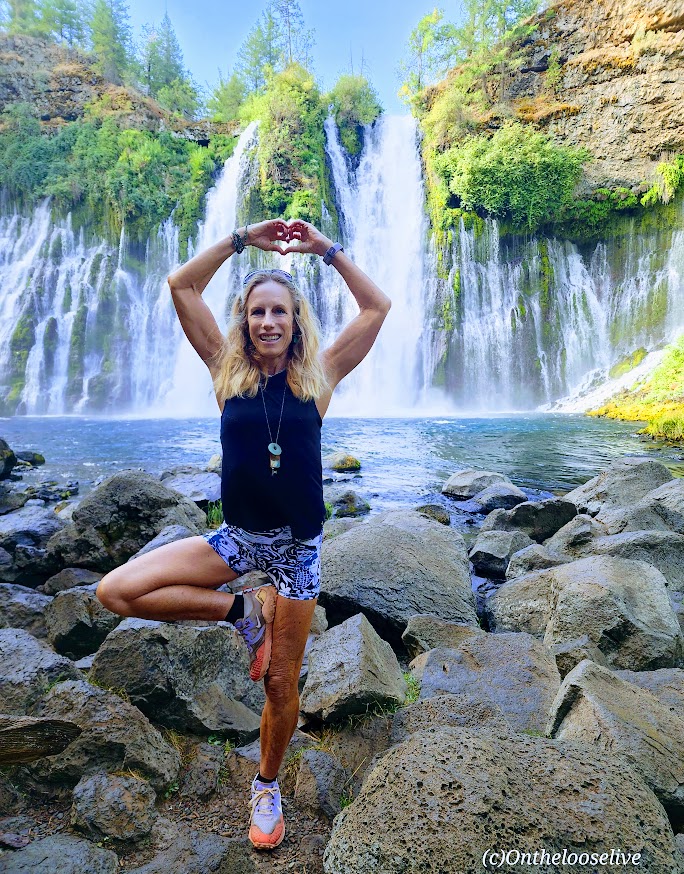
Wowza, I’ve chased a lot of waterfalls in my time, but Burney Falls stands out for its terraced, storybook, enchanting beauty.
And talk about an easy chase —huge reward for minimal effort— easy 1-mile round-trip stroll with an elevation gain of 161 ft
At 129 feet high, Burney Falls is the main attraction of California’s McArthur-Burney Falls Memorial State Park. I’d never heard of it, but it has to be one of the most gorgeous waterfalls that I’ve seen. It has an impressive daily flow of 100 million gallons, and the water temperature ranges from 42 to 48 degrees. While it was tempting, I didn’t take the cold plunge this time.
Apparently, there are 5 more miles of trails in the park, but it’s really all about the waterfall. If you’re adventuring in Lassen Volcanic National Park, Burney Falls is just ~40 miles North off of CA-89.
Notes: Day-use parking fee: $10. No dogs are allowed on trails or day-use areas. Go early; the small parking lot fills up fast.
Getting there: It’s off CA-89 N. (~40 miles from Lassen Volcanic National Park)
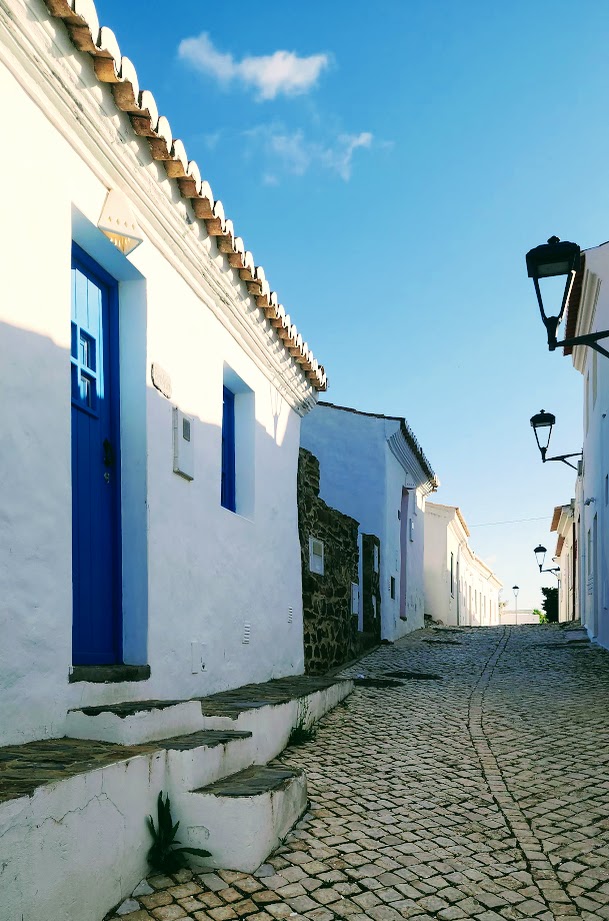
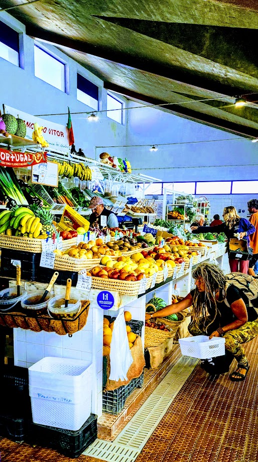
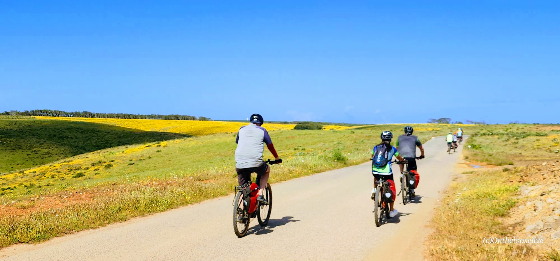
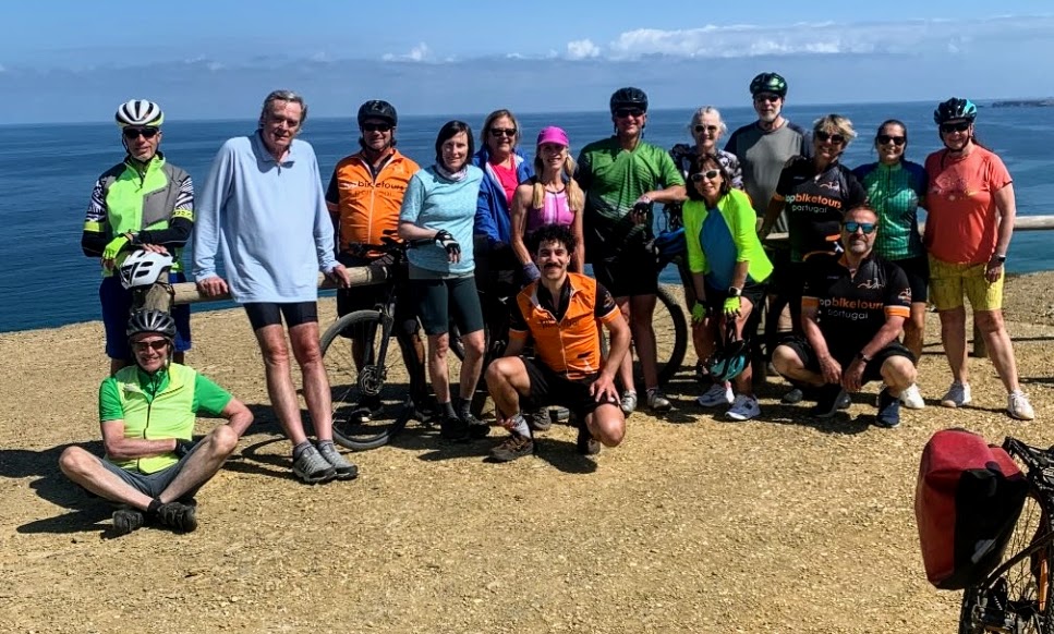
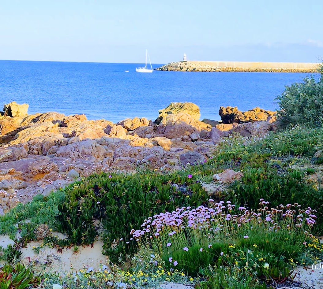
While every day of my Top Bike Tours Portugal adventure was dreamy, the days I enjoyed most were the ones when we arrived at our destination with enough time to simply be there—to wander, explore on our own, stroll along the beach, surf, swim, or just immerse ourselves in the local vibe.
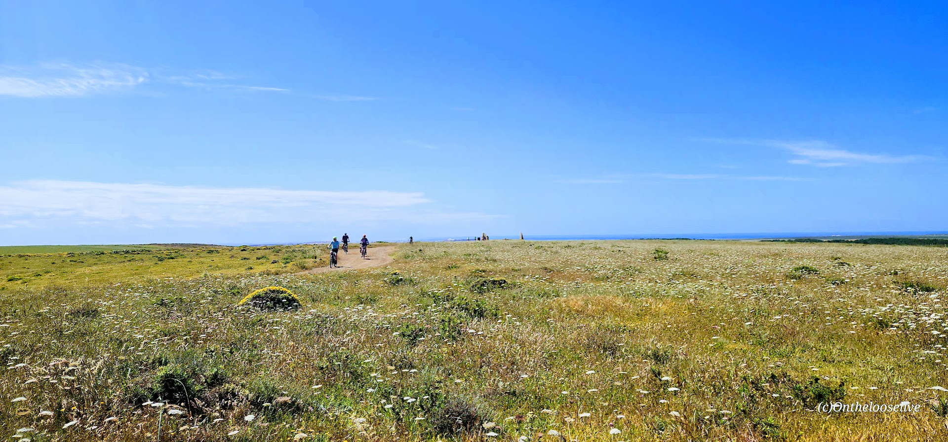
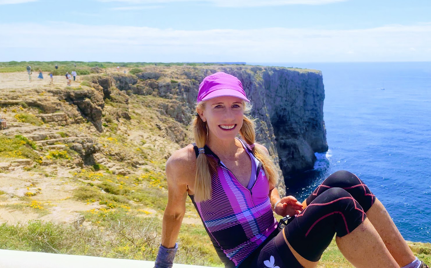
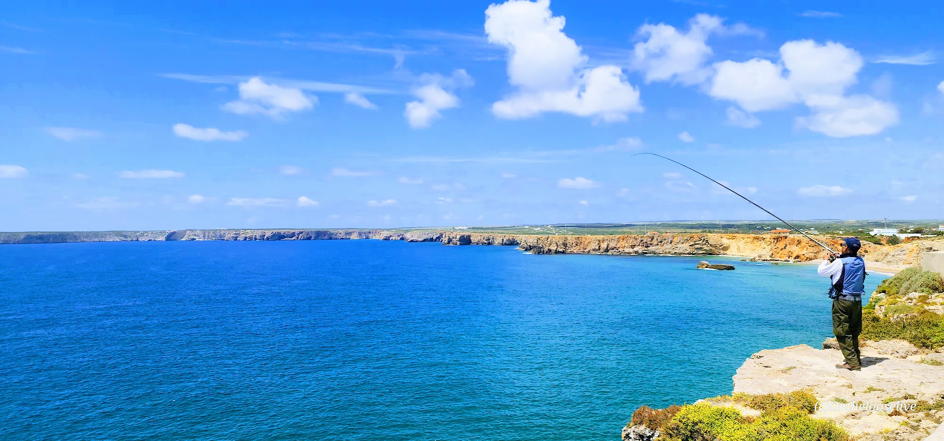
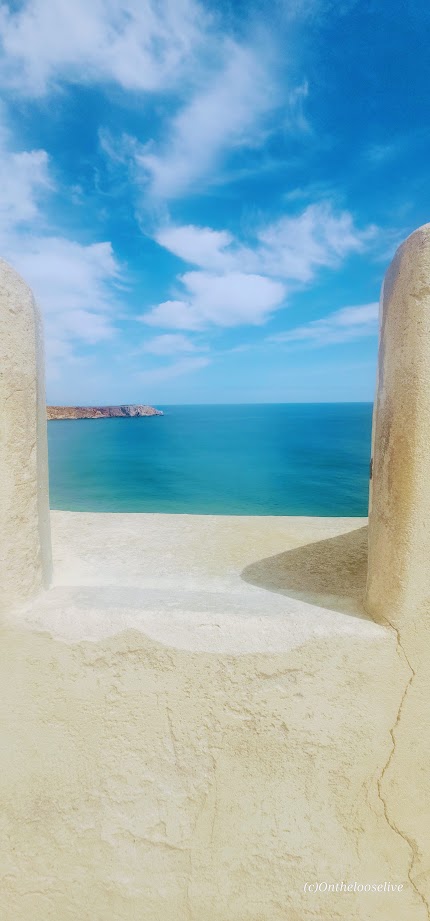
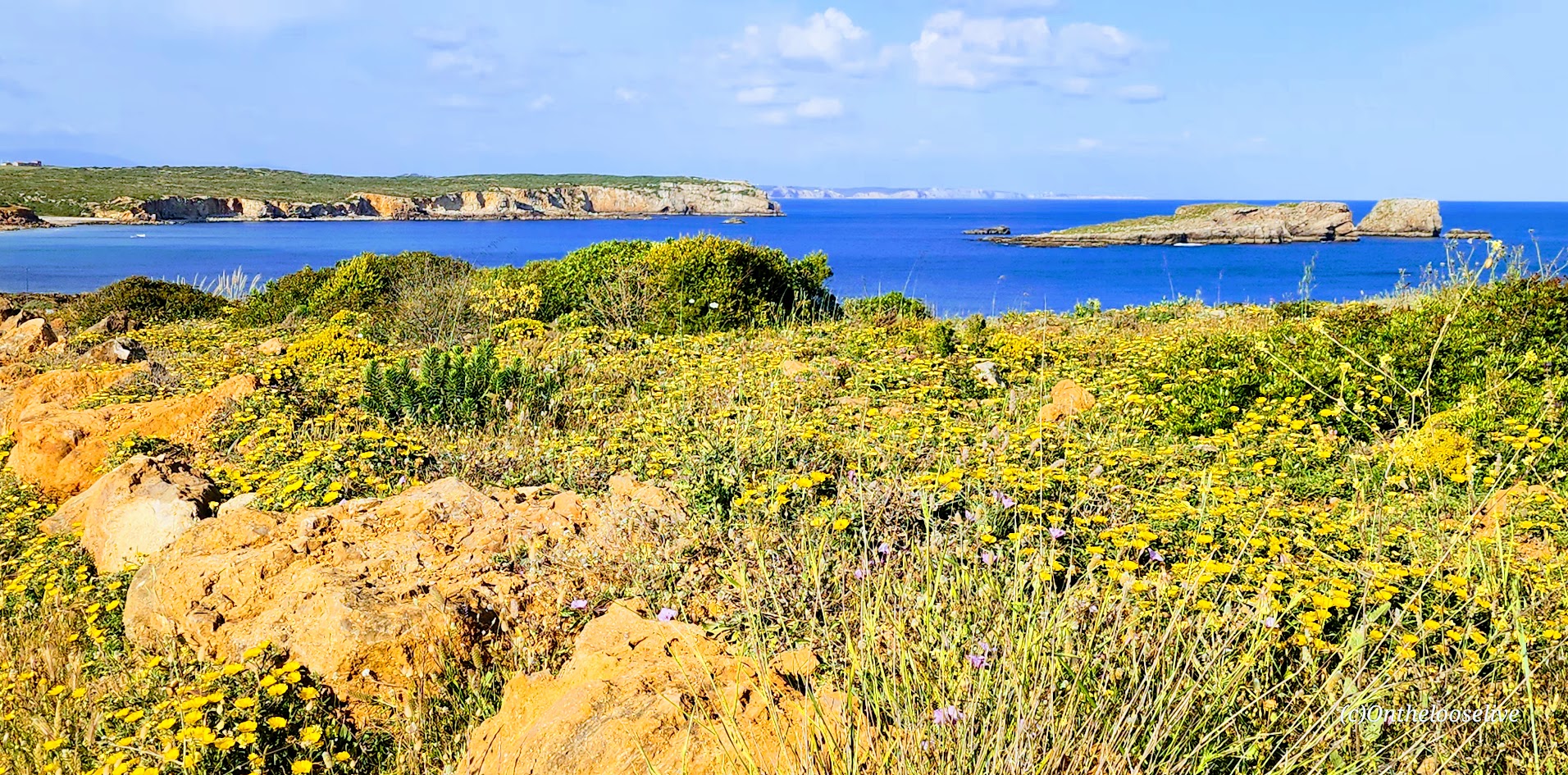
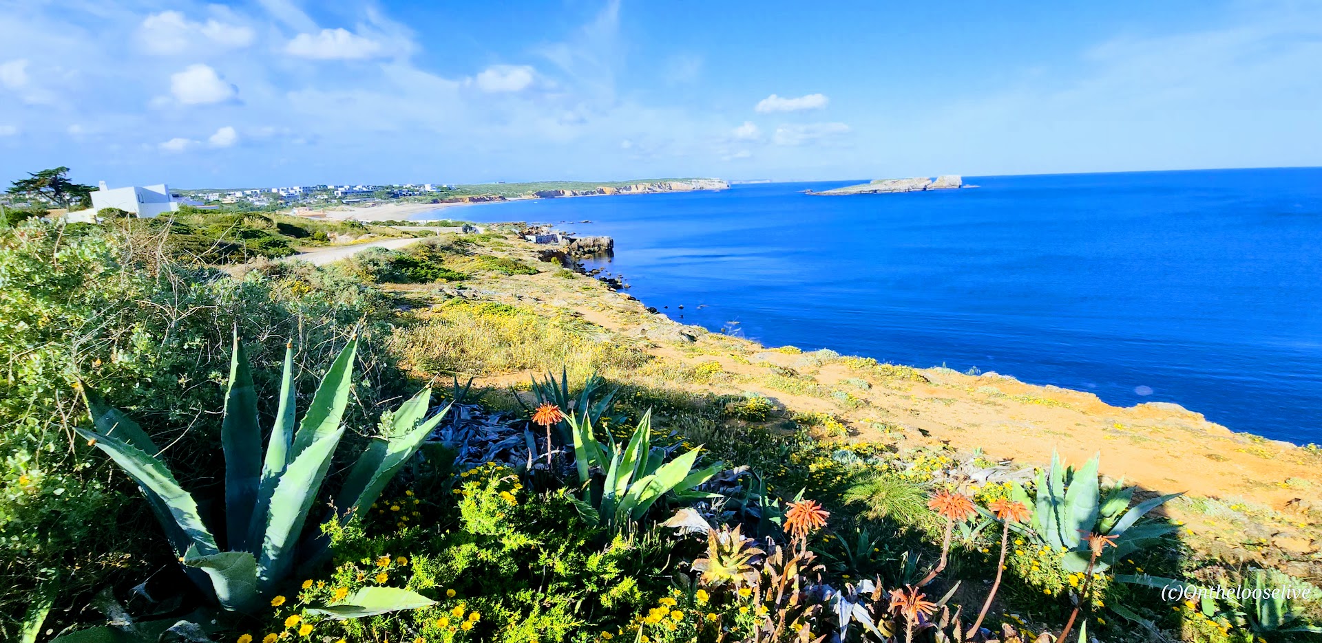
For that reason and others, the second-to-last day of my biking tour stands out as one of my favorites. The morning began with a long, challenging climb, which was rewarded with a cruise down smooth roads and along scenic, coastal gravel paths. With only 20 miles to cover, it was an easy day that left us with plenty of energy and time to enjoy our stops along the way, and to relax by the sea in Sagres that afternoon and evening.
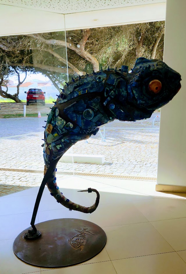
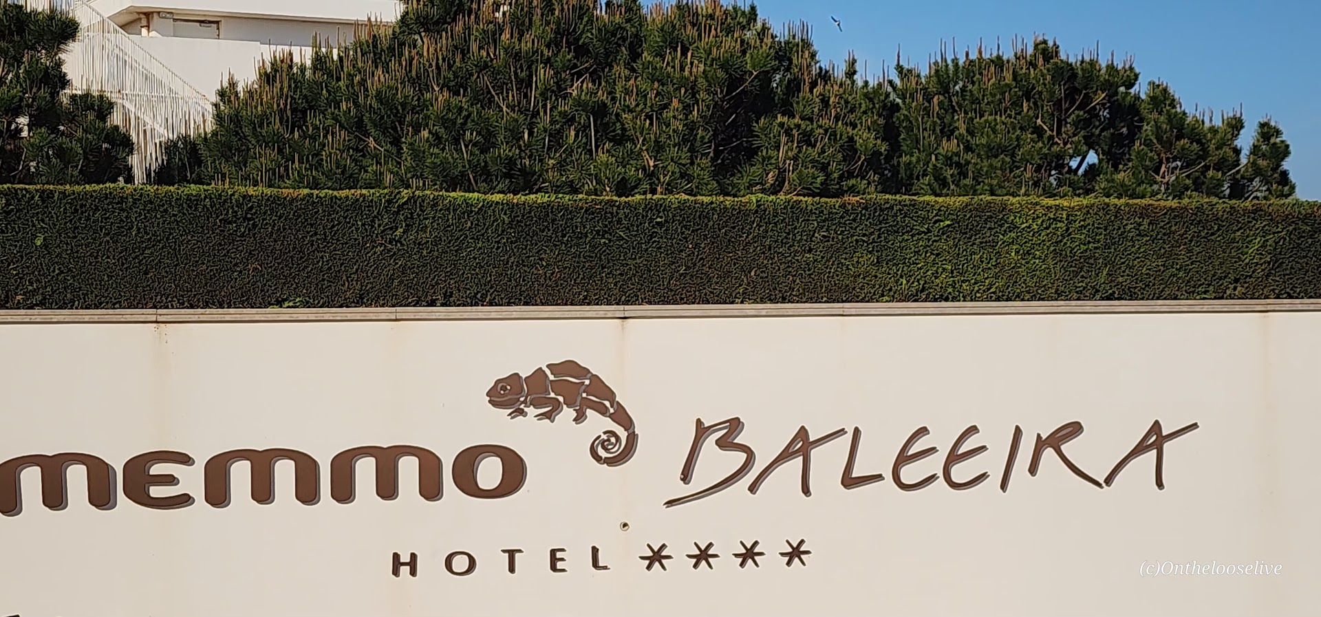
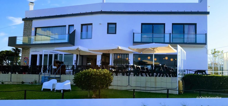
It certainly didn’t hurt that our accommodations for the night were at the 4-star Memmo Baleeira. This upscale, resort-style property is typically reserved for those who purchase the premium package. Not sure how I lucked out, but it was an unexpected and very welcome surprise.
Today’s Scenic and Historical Stops
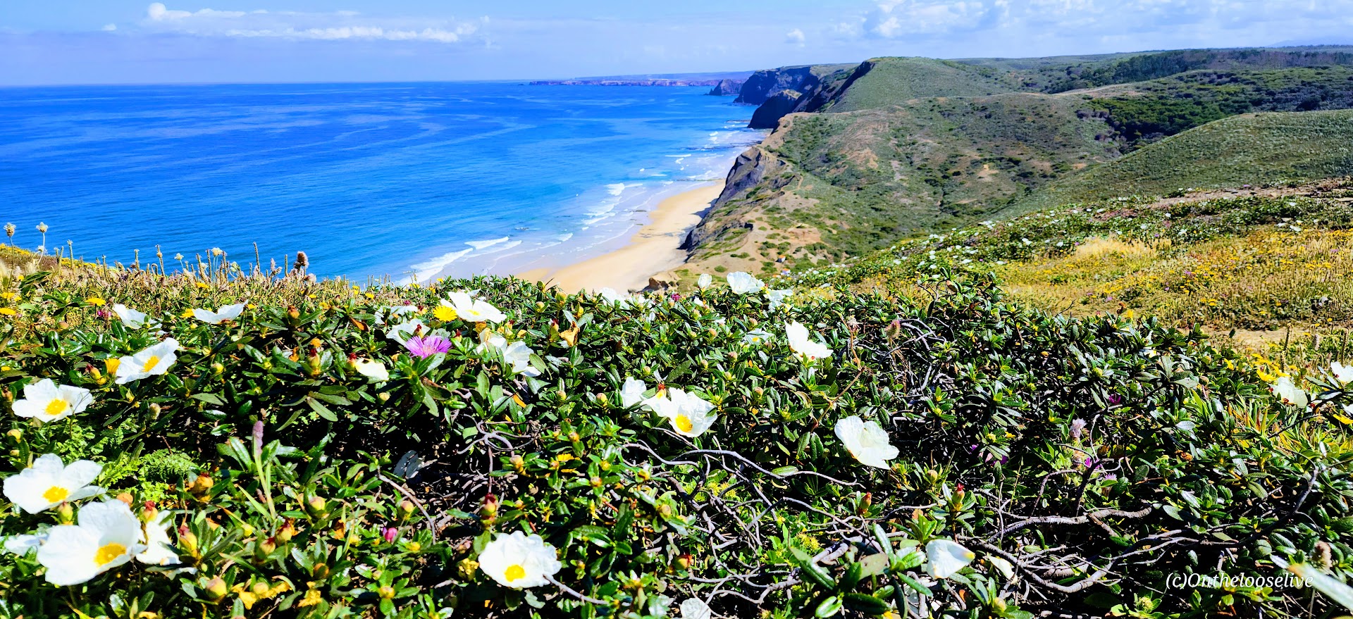
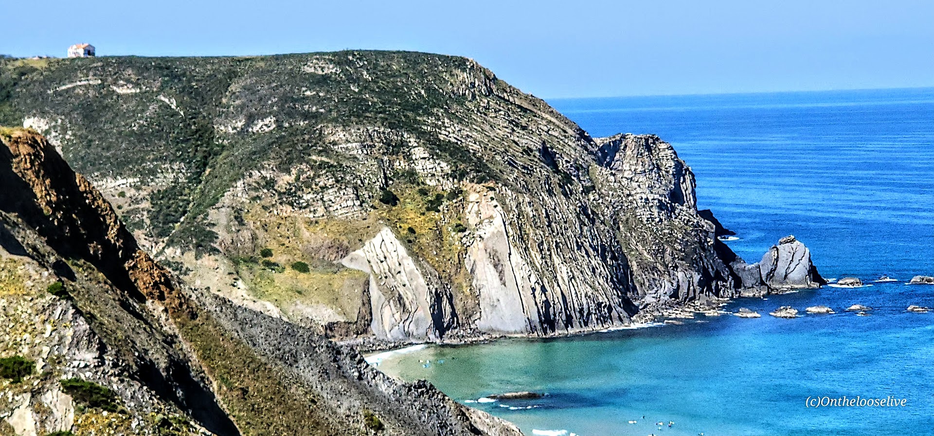
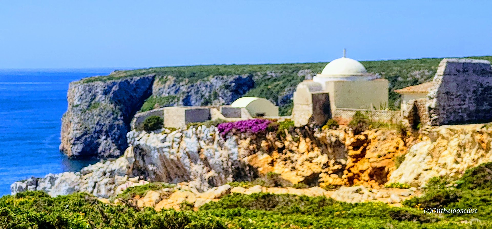
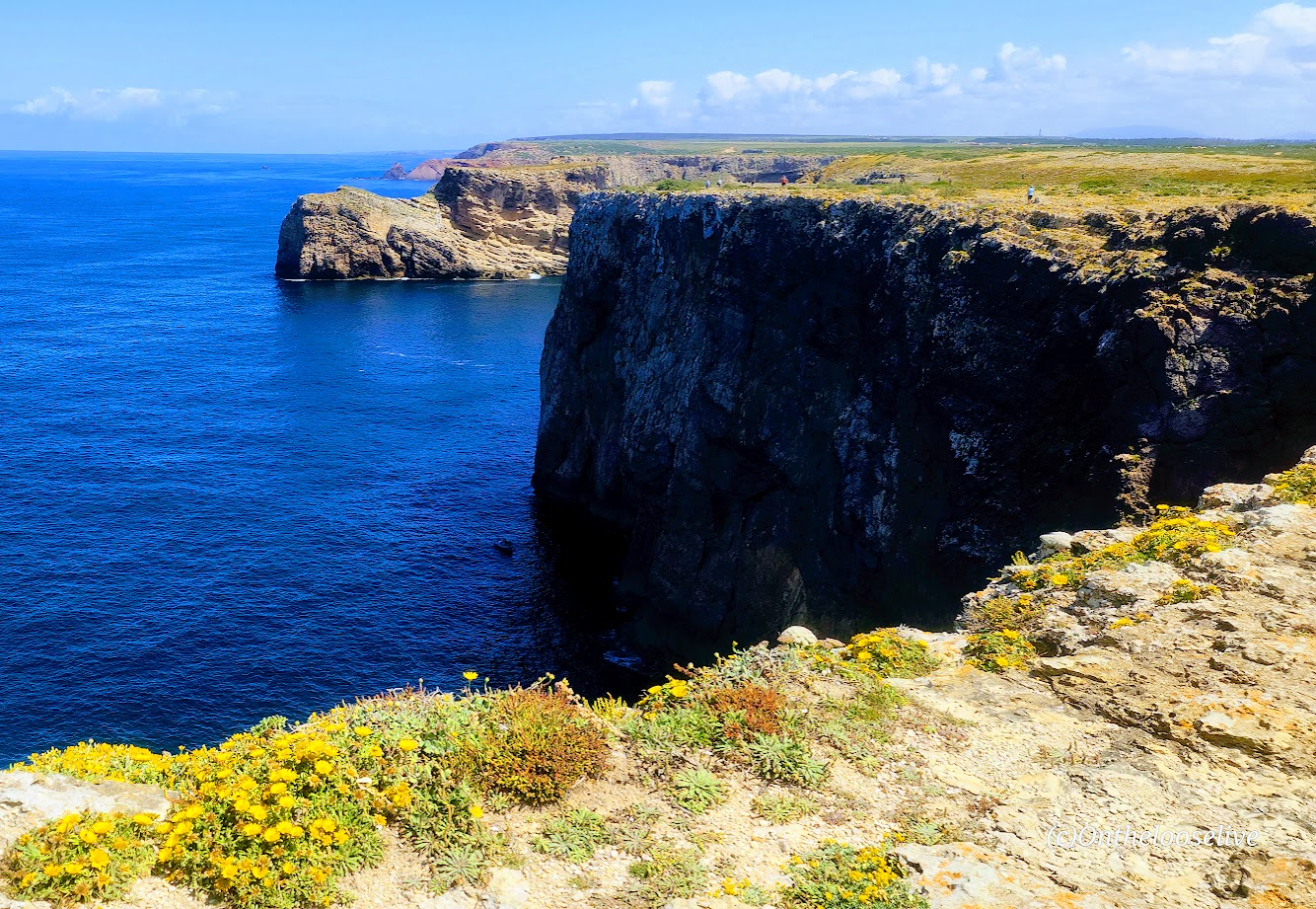
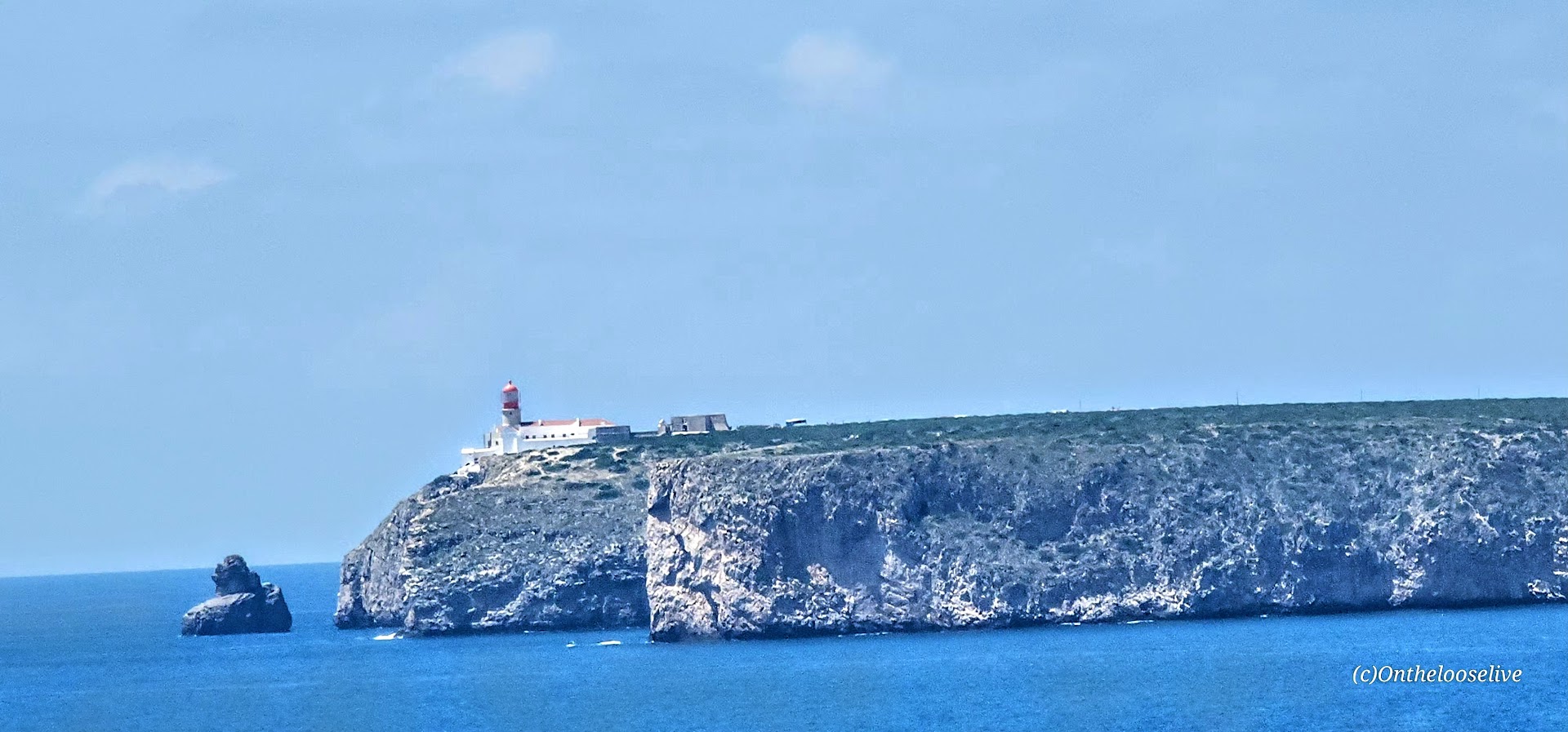
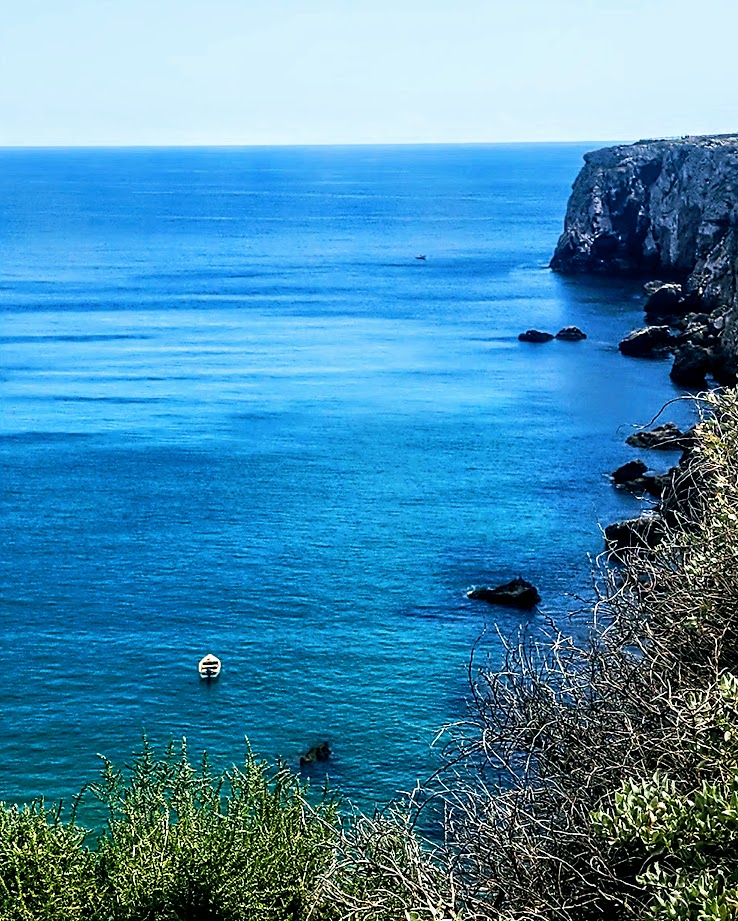
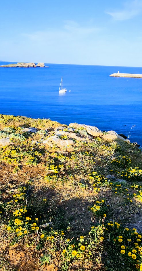
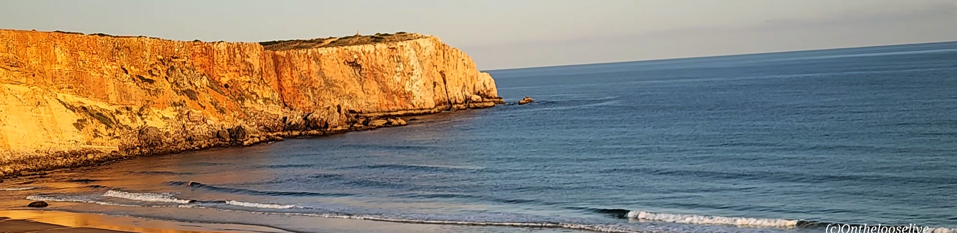
Cape St. Vincent (Cabo de São Vicente): This extreme southwestern point of mainland Europe was known as the legendary “end of the world” during the Age of Discoveries as it was the last explored point-the edge that dropped into the Atlantic and the unknown.
Indeed, ancient civilizations considered this windswept promontory a holy gathering place for their gods and the Romans referred to it as the Promontorium Sacrum (Sacred Promontory) or “the end of the world.” The name Sagres itself is derived from the Latin word sacrum (meaning “holy” or “sacred).
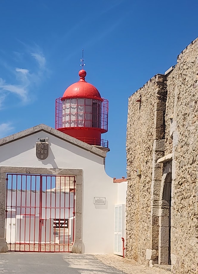
Farol doCabo de São Vicente Set on a dramatic cliff presiding ~ 250 feet above the restless and unruly Atlantic, thelighthouse (farol ) here is one of the most powerful lighthouses in Europe.
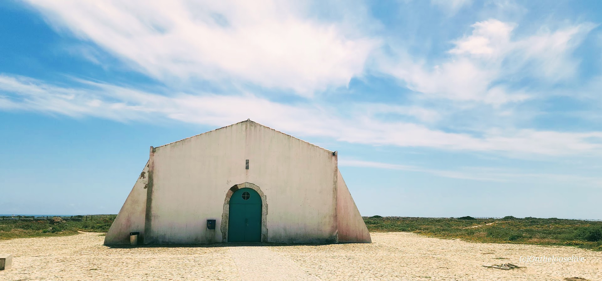
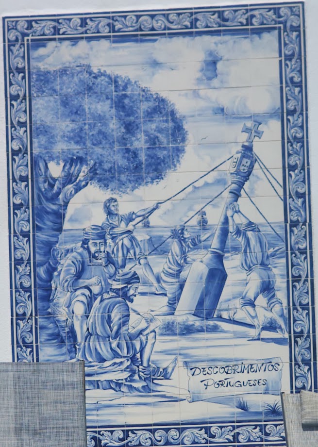
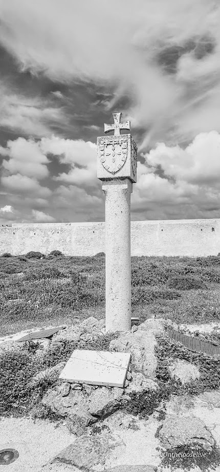
The Fortress of Sagres
Featuring Renaissance-Mannerist architecture, the impressive, photogenic 15th-century Fortress of Sagres was commissioned by Prince Henry the Navigator. Damaged in the 1775 Lisbon earthquake, it was rebuilt in the late 18th century and underwent major renovations in 1960s, 1990s, and 2010.
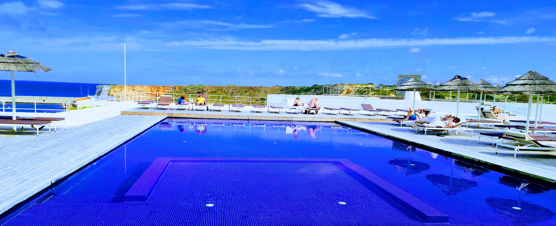
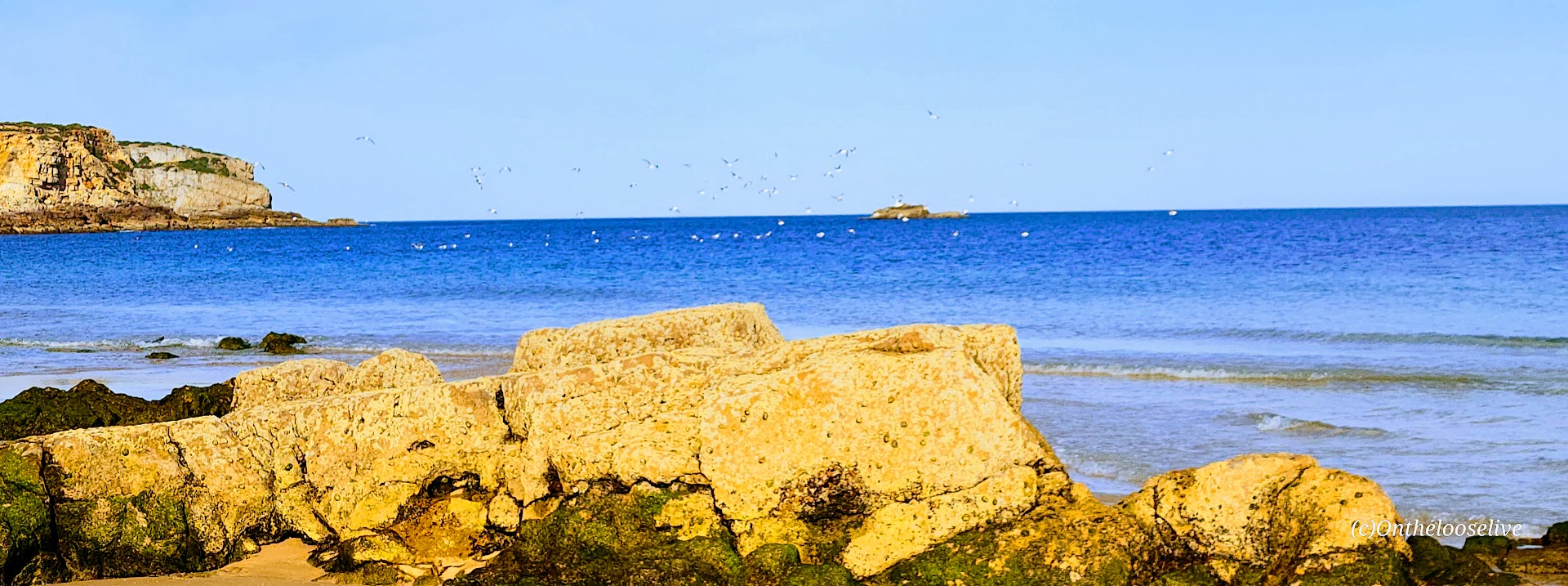
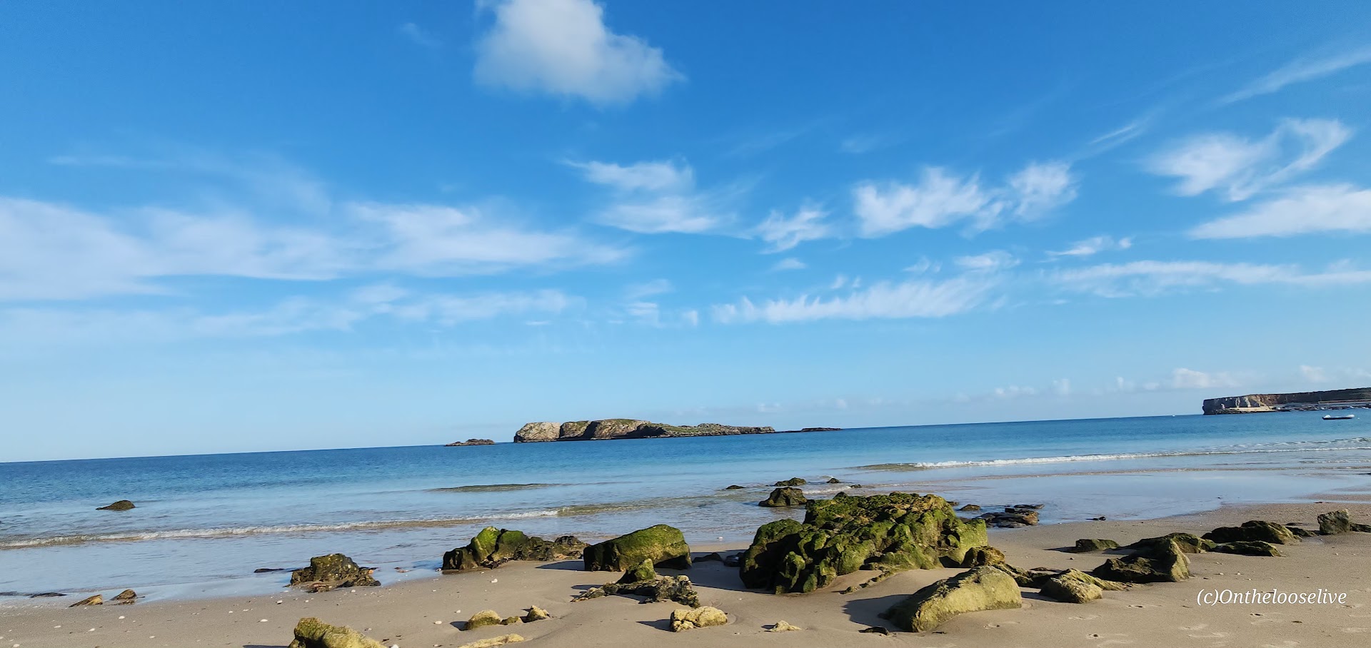
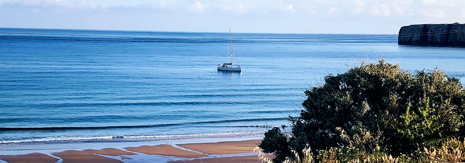
Staying at the Memmo Baleeira was a premium experience indeed — beautiful room and pool with sea views. And I took full advantage – went for a late afternoon swim in the pool, a sunset walk on the beach where I had it all to myself. While the water was calm and flat, I learned that Sagres is known for having some of the best and most consistent surfing in Europe because the peninsula juts out, capturing good waves regardless of wind direction.
After my stroll on the beach, I enjoyed dinner alfresco with a sea view. The owner introduced himself and treated me to shots of a potent local liquor to celebrate the restaurant’s recent opening. Oddly, I can’t recall the name of the alcohol…lol.
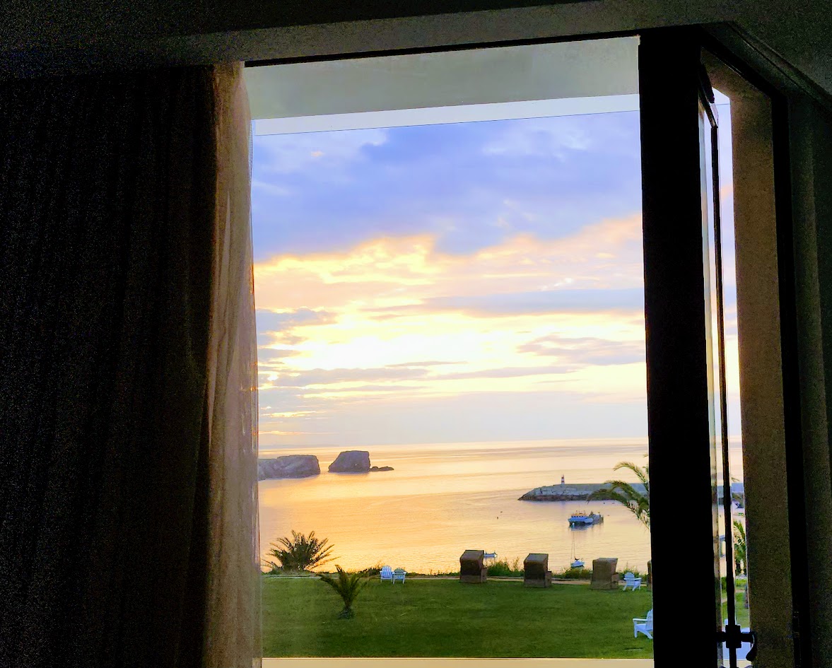
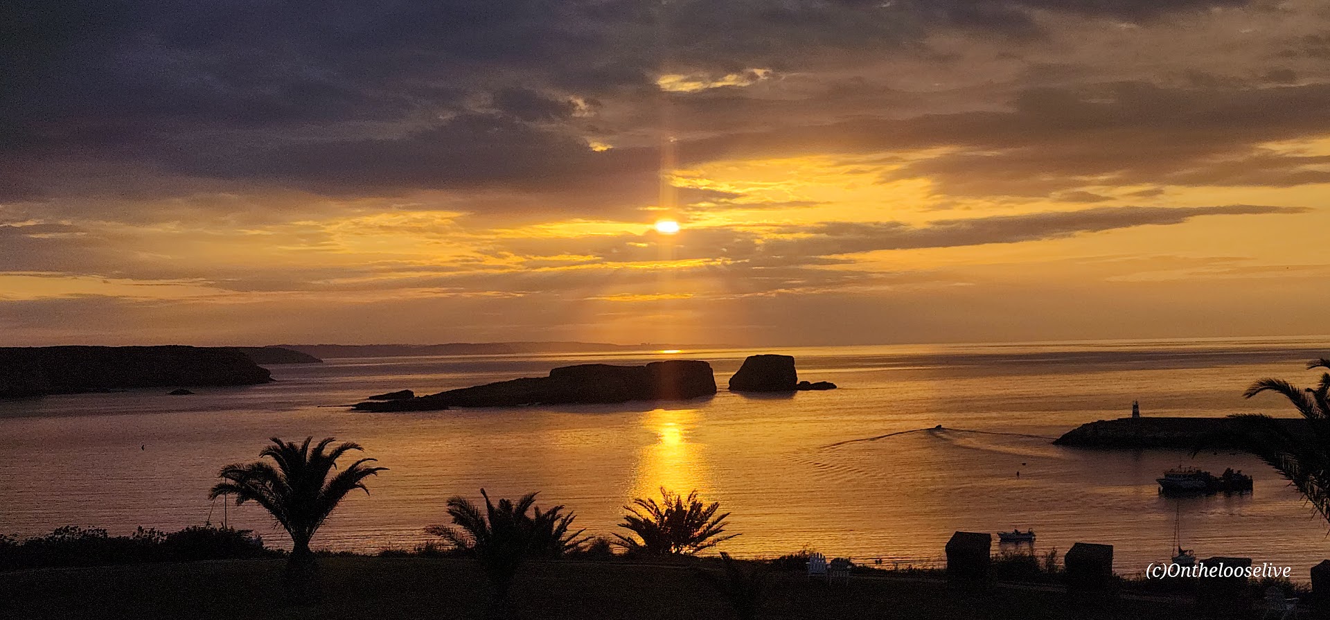
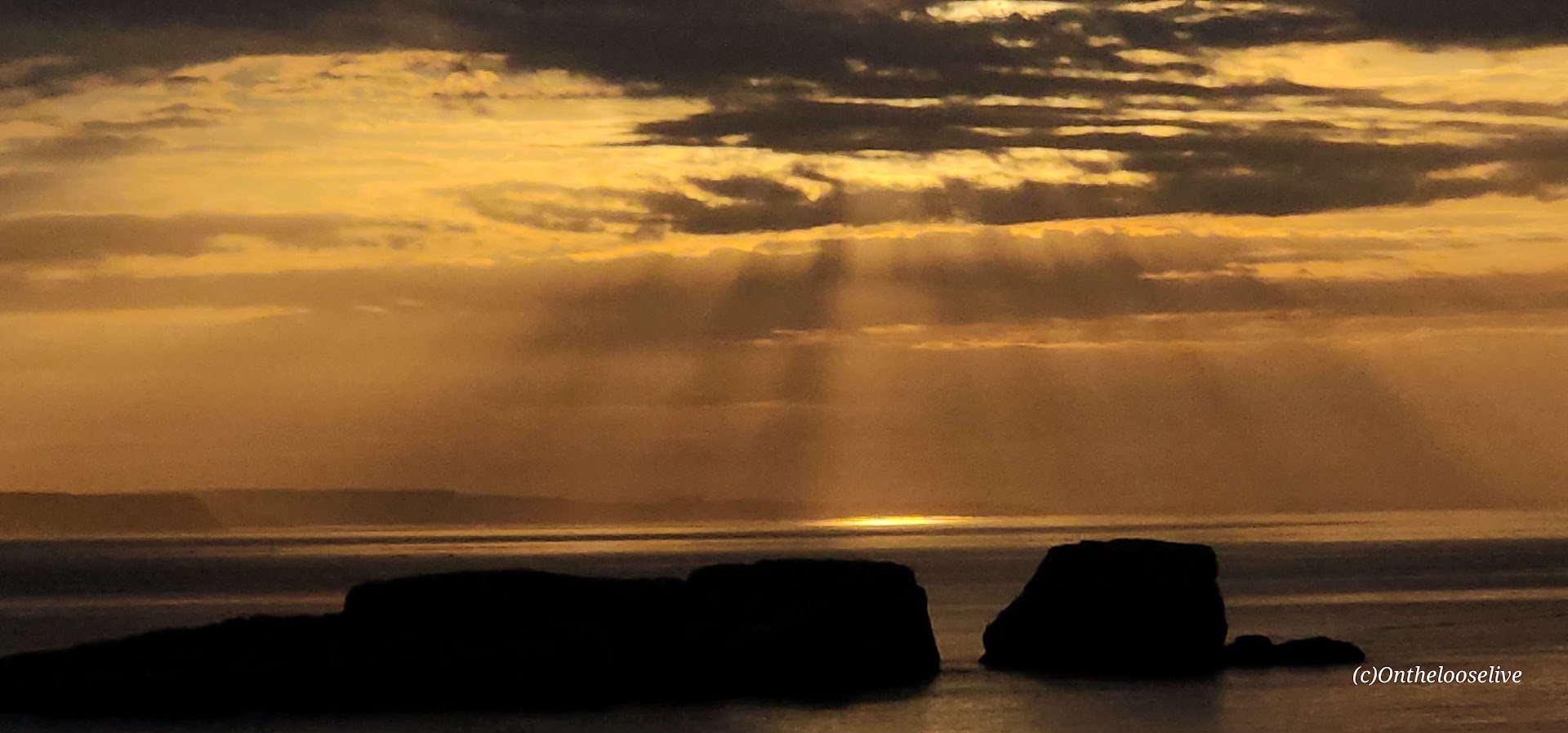
At the end of the day, I fell into my luxurious bed at the Memmo Baleeira and had my best sleep of the week. In the morning, I awoke well-rested to watch the sunrise over the sea as the swallows swooped and the seagulls called to each other.
It was bittersweet to realize that today would be the final day of our incredible bike tour. Usually, by the end of a touring adventure, I’m ready to move on. Not this time. I would have been perfectly happy to continue the journey through the country with Top Bike Tours of Portugal.
Tiki Trail/ Base of Gondola Start to SummitDistance rt from Tiki Trail: ~9.7 miles Elevation Gain: ~4,786
Top of Skyline Gondola Head Start to SummitDistance rt: ~7.1 miles Elevation Gain: ~3,310 ft
Difficulty: Moderate/difficult, depending on your fitness level. (AllTrails rates it as strenuous/advanced/highly challenging.)
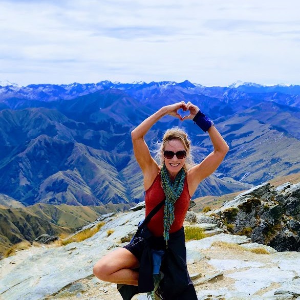
Of my two weeks of adventures in New Zealand, this was one of my favorite days—and easily one of my favorite days anywhere. Simply EPIC from start to finish.
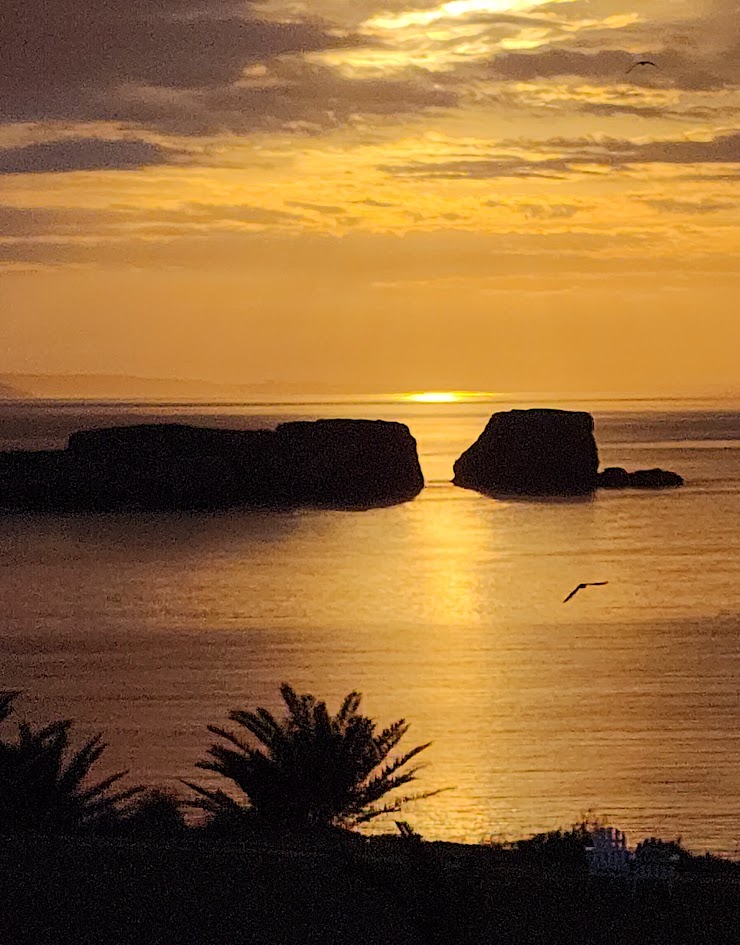
After hiking the Marian Lake Track and Key Summit the day before, I spent the night in a small, somewhat dilapidated motel in the scenic, lakeside village of Manapouri. While the accommodation left much to be desired, falling asleep and waking up to the spectacular view below more than made up for it—a fortuitous start to a day that would prove exceptional both on and off the trail.
Queenstown, the South Island’s Adventure Mecca
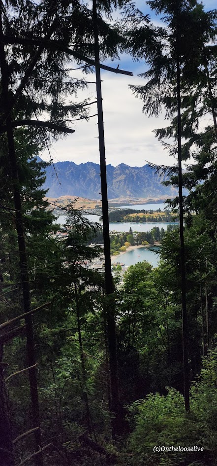
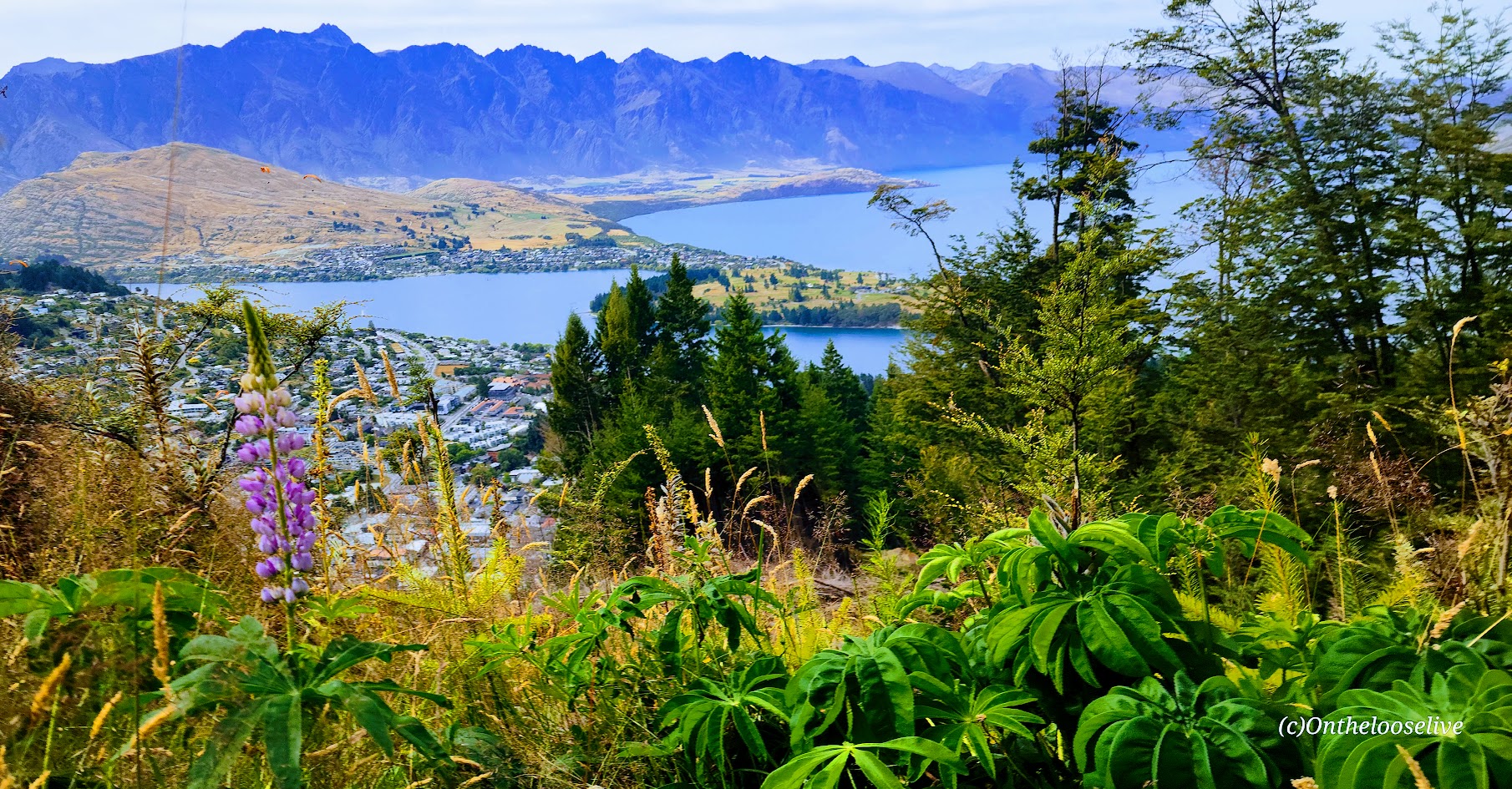
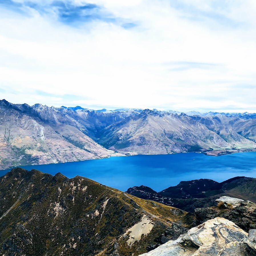
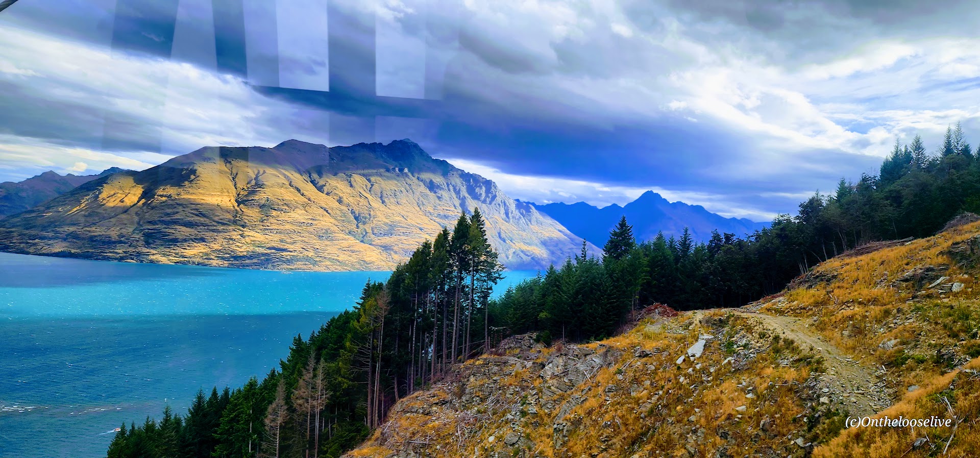
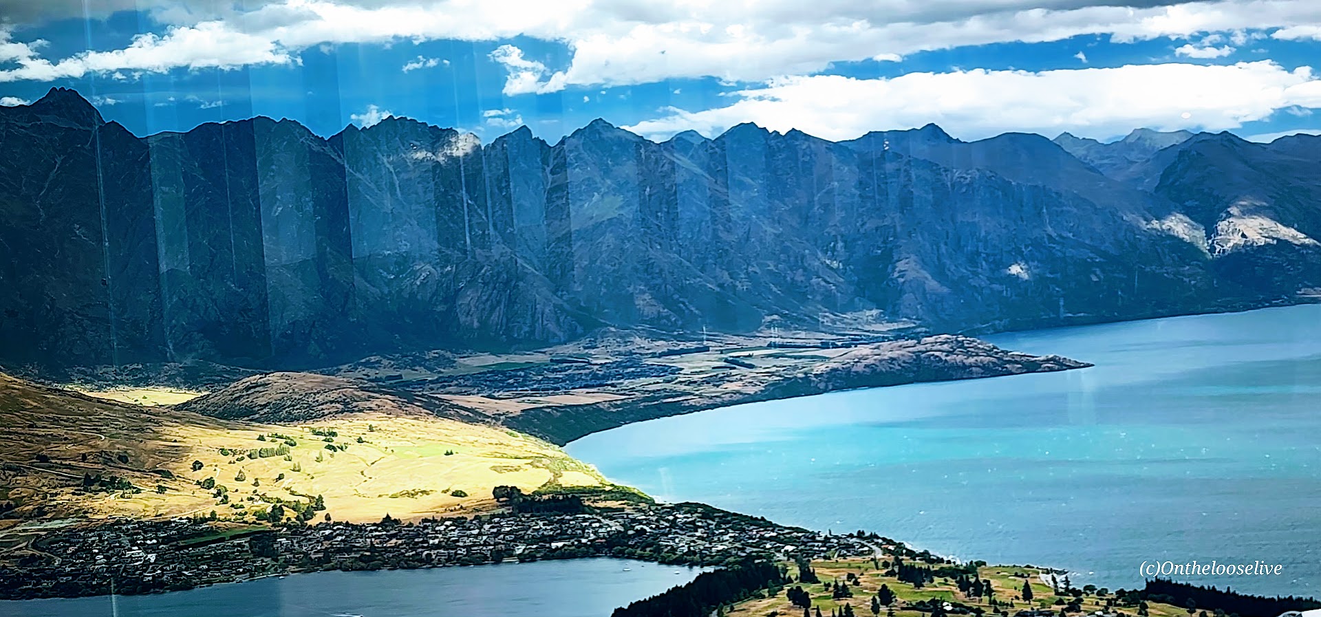
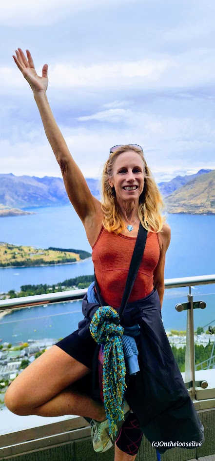
Here, every step you take leads to breathtaking scenery and an exhilarating experience. Set against the dramatic backdrop of the jagged peaks of The Remarkables mountain range with the shimmering waters of Lake Wakatipu (NZ’s longest lake – 50 miles long) reflecting the surrounding beauty, Queenstown is arguably one of the most stunning destinations in New Zealand and a gateway to some of the country’s most memorable outdoor experiences—including the spectacular Ben Lomond Track.
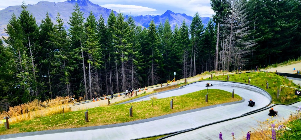
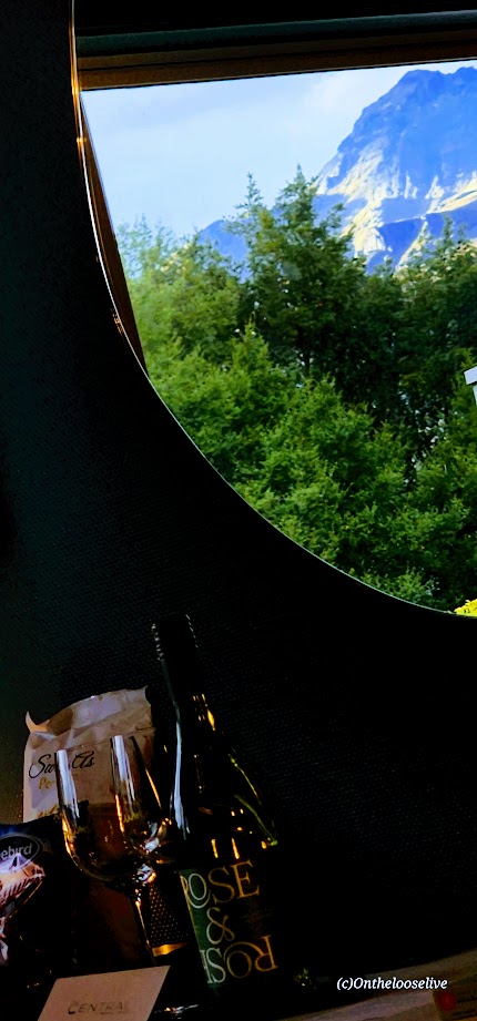
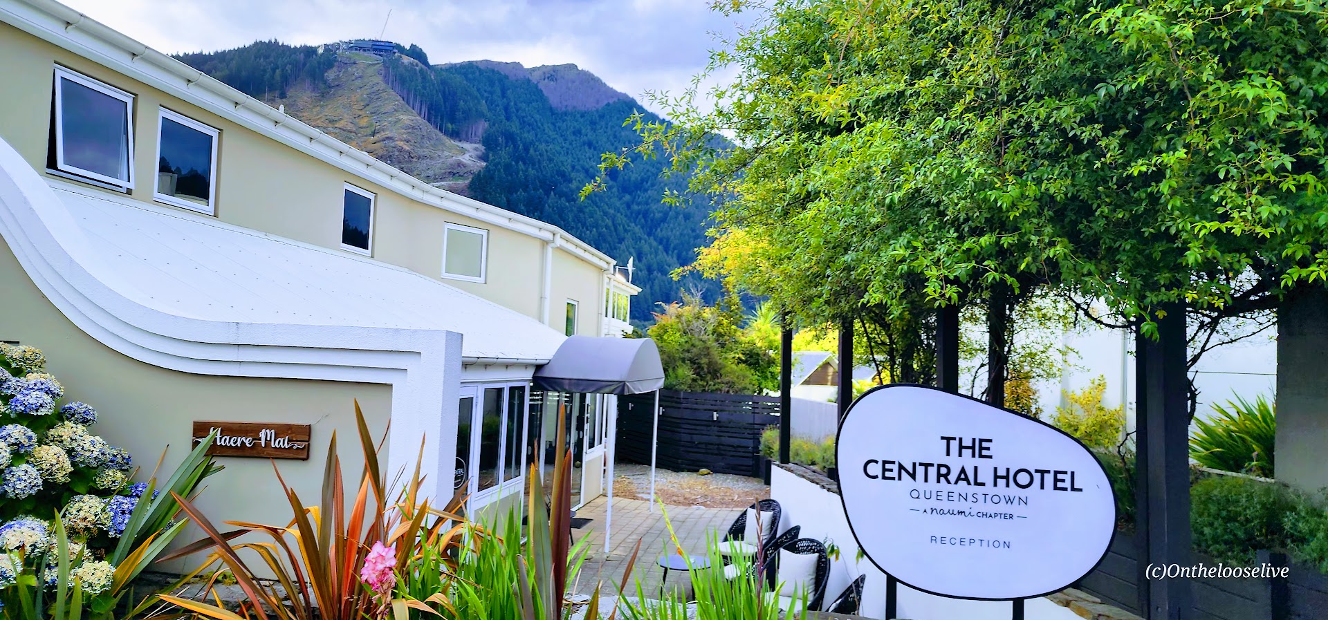
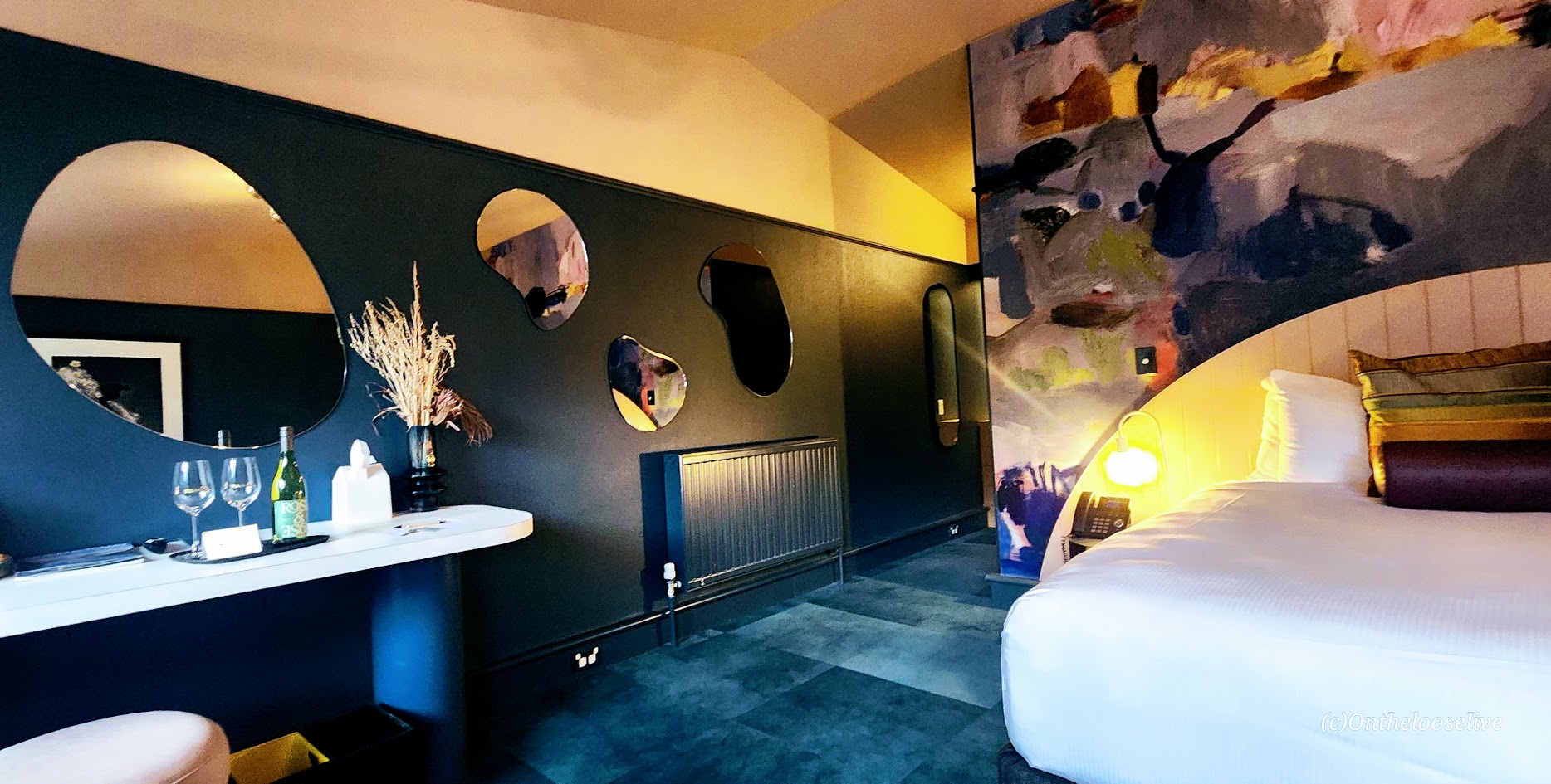
Whether you’re hiking alpine ridges, carving down mountain bike trails, riding gondolas, the luge, the Vortex Slide, or the Zipline, or mixing it up, your outdoor bliss awaits in Queenstown. The town itself doesn’t disappoint either—vibrant streets lined with galleries, restaurants, shops, and gorgeous boutique hotels like the one I stayed at, The Central Hotel, where the perks included a complimentary bottle of local wine, snacks, and continental breakfast.
While Kiwis, (as New Zealanders call themselves), may dismiss Queenstown as overly touristy, its popularity is clearly well-earned. (Also, in my opinion, the “touristy” vibe in NZ feels far more subtle than the US, and generally, crowds are smaller. than what you encounter stateside.)
A Queenstown Must Do: The Breathtaking & Ravishingly Beautiful Ben Lemond Track
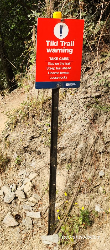
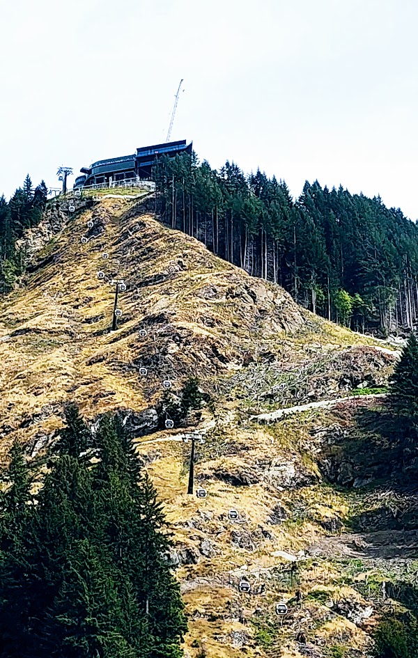
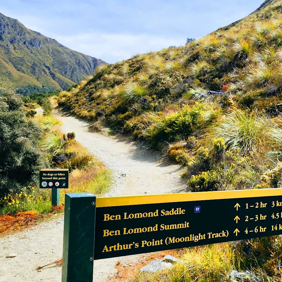
There are two ways to access the Ben Lomond Track: hike up the Tiki Trail from the base of the Skyline Gondola, or give yourself a head start by riding the gondola to the top.
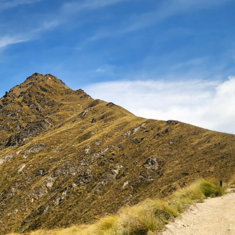
Obviously, starting from the Tiki Trail adds both distance and elevation to your adventure—about 2.6 miles round trip and 1,476 feet of additional climbing. Naturally, I took the Tiki Trail. Was it worth it? Yes, and no.
On the plus side, it added to the workout challenge, which I rarely resist. From a scenery perspective, it didn’t add much, as much of the trail winds through the forest, with the best views near the top.
If you have the time and enjoy earning every foot of elevation, the Tiki Trail is worthwhile. But if the Ben Lomond hike itself feels like enough of a challenge—or you’re simply short on time—take the Skyline Gondola.
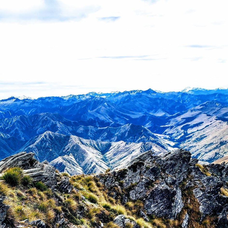
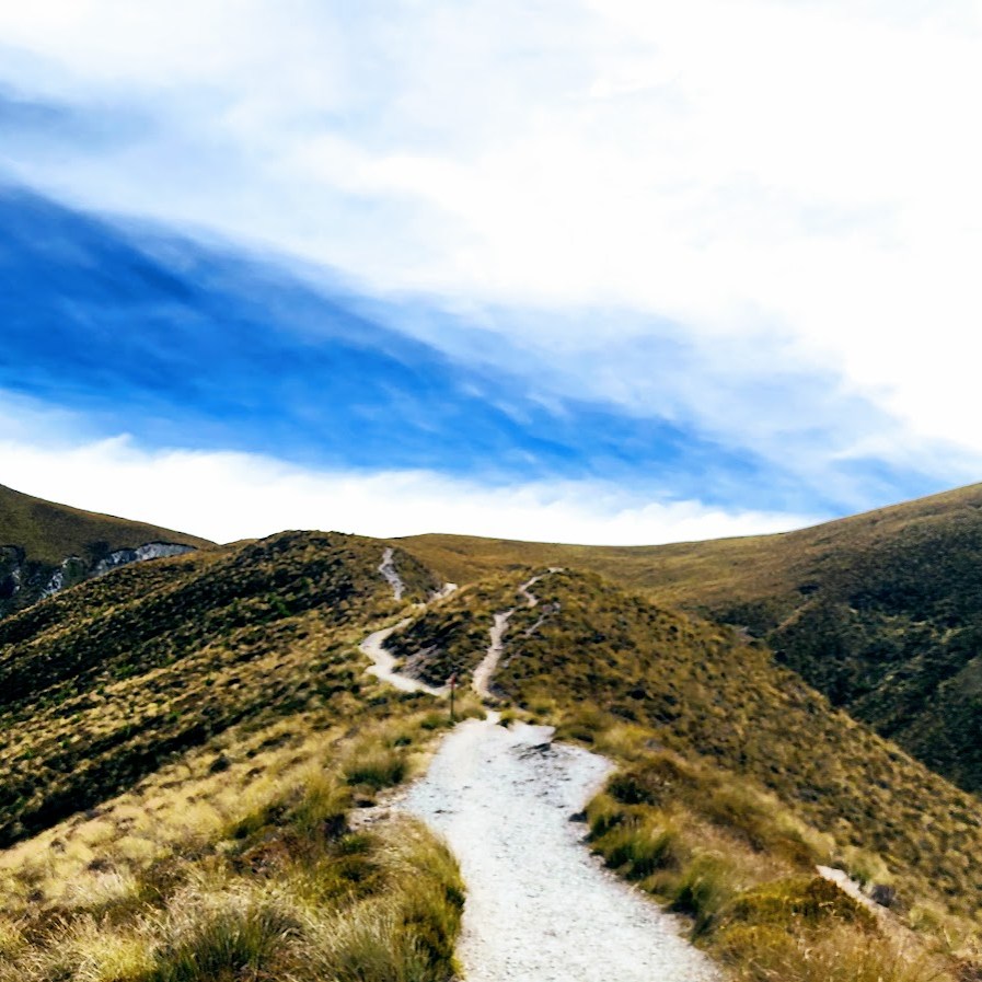
The Ben Lemond Track is well-marked, easy to follow, and easy on the feet, until the last rocky mile or so to the summit. Great for trail running. The mountain bike trails are separate (45 mountain biking trails and 10 e-bike trails), so no close encounters with bikes (thankfully), but it’s fun to watch them flying down the ridgelines from a distance. As you climb the ridgeline, the incline is consistent, but mostly gentle/moderate until that last mile. Your reward is expansive views of the dazzling Lake Wakatipu (NZ’s longest lake – 50 miles long) and Queenstown far below, and a stunning panoramic view of it all at the top. While the summit is only 5,735 feet in elevation, it is considered alpine as it’s above treeline, completely exposed, and subject to severe, volatile weather. (Be prepared and check the weather forecast in advance.) I’ve discovered that many alpine hikes in New Zealand offer plenty of elevation gain without the altitude factor—same magnificent alpine hiking and scenic rewards, but far less arduous than hikes at higher elevations. Super fun and doable for hiking, trail running, and biking, but not helpful if you need altitude training or will be competing at altitude.
While not an official “Great Walk” of NZ, the Ben Lemond Track is a GREAT hike—in my opinion, it’s a “must do” if you’re in Queenstown.
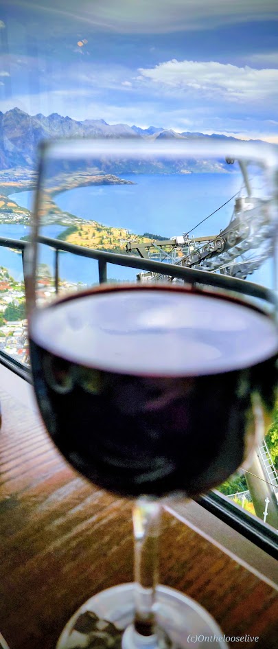
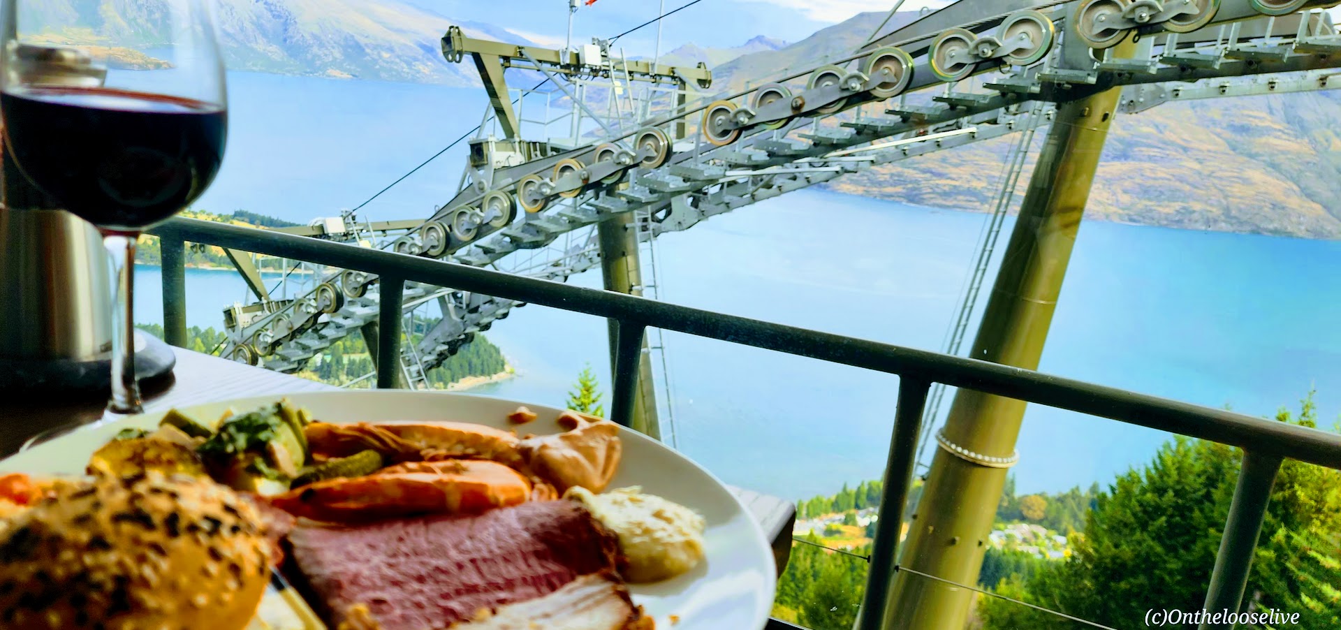
So many adventures, so little time! Definitely something for everyone here! Whatever Queenstown adventures you choose, be sure to work up a good appetite, and then treat yourself to the lavish all-you-can-eat feast (lunch or dinner) at the Stratosfare Restaurant. Enjoy the incredible views, live music, and decadent delights.
Pro Tip: Reservations are required at the Stratosfare Restaurant, but it’s 100% worth checking in to see if they have last-minute availability. You just may get lucky like I did!
Happiness is a challenging hike followed by an indulgent feast, a sunset gondola ride, and a cozy bed with a welcoming bottle of local wine and snacks—all with spectacular views! This was truly an epic day for me in NZ and in my life!
Difficulty: Easy to moderate, depending on your fitness level.
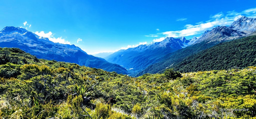
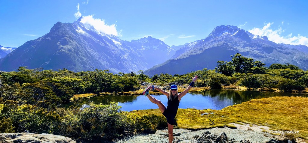
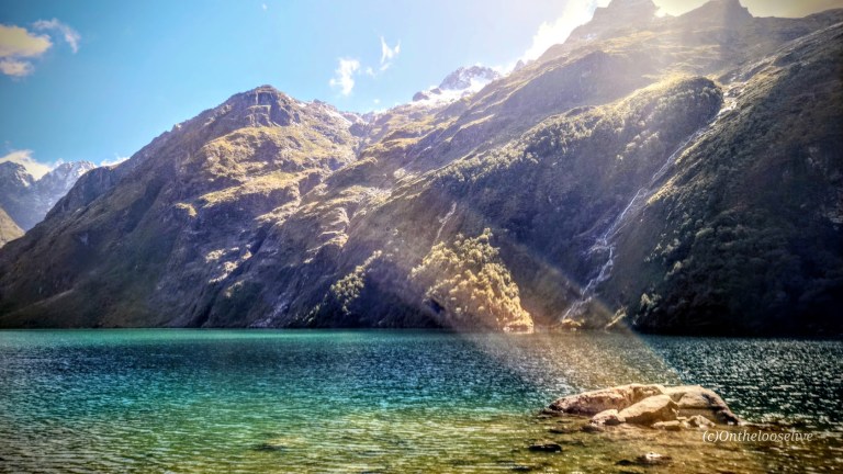
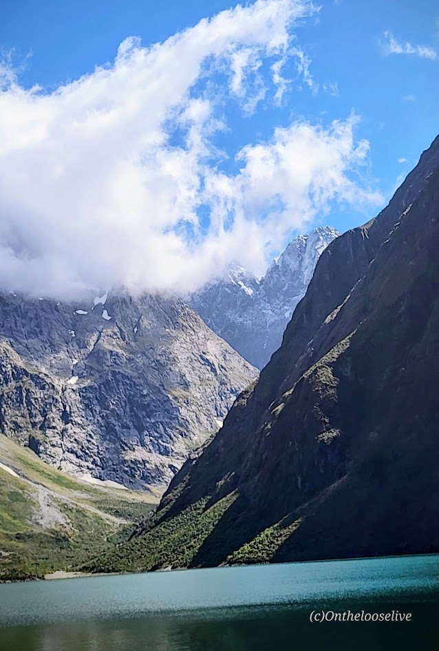
I took a microsample (~10%) of the Routeburn Track Great Walk on my afternoon hike to Key Summit. Having just scrambled up the slick, rugged obstacle course to Lake Marian, it was a refreshing relief to stride up the gravel path to Key Summit.
The climb is gradual and is rewarded with sweeping views of the Hollyford Valley, alpine tarns (lakes/pools), and Fiordland’s panoramic rugged peaks.
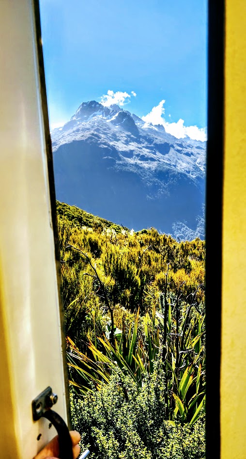
Possibly the best Port-o-Potty view ever!
Looking back, after doing both Lake Marian and Key Summit, I might have preferred covering more distance on the Routeburn Track vs the painstaking, slo-mo route up to Lake Marian. (Not the most adventurous take, I know.) I tend to enjoy a more vigorous pace—the former trail runner in me still craves that rhythm. Tortuous terrain that slows my flow tends to be more frustrating than fun for me. Lately, I’ve also been weighing the “risk versus reward” factor. That said, Lake Marian is undeniably spectacular, and the hike has a sense of challenge and excitement that Key Summit doesn’t.
That’s the beauty of the great outdoors: you get to choose your own adventure. And in New Zealand, there’s no shortage of ways to find it. Stay tuned for more Great Walk sampling on the South Island!
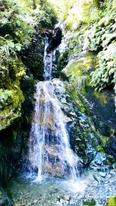
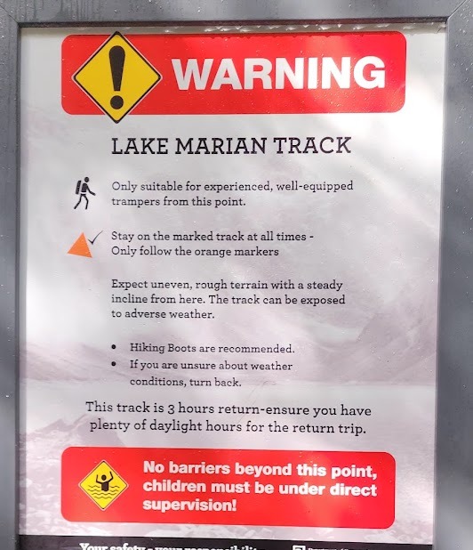
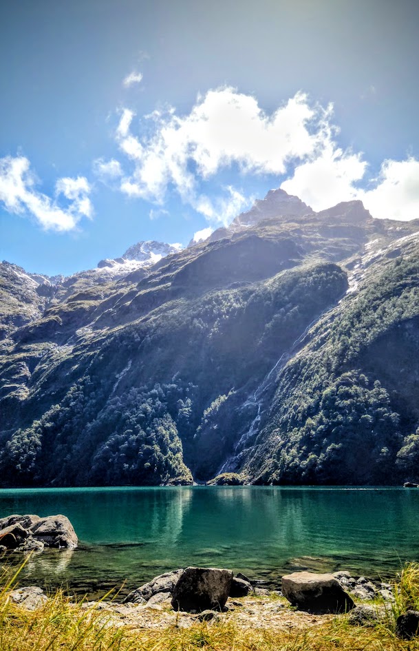
The Lake Marian hike is short, but risky business. A trail sign warns of “rough terrain” and advises that only experienced hikers continue.
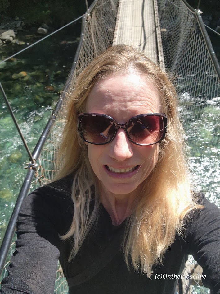
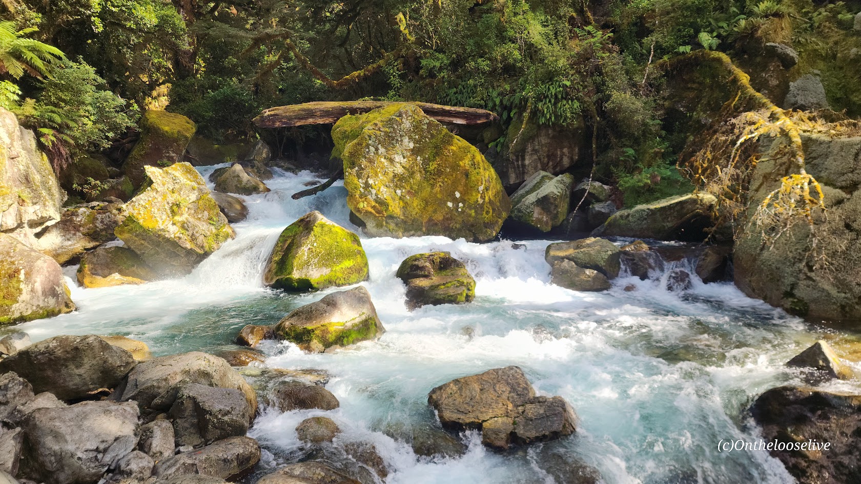
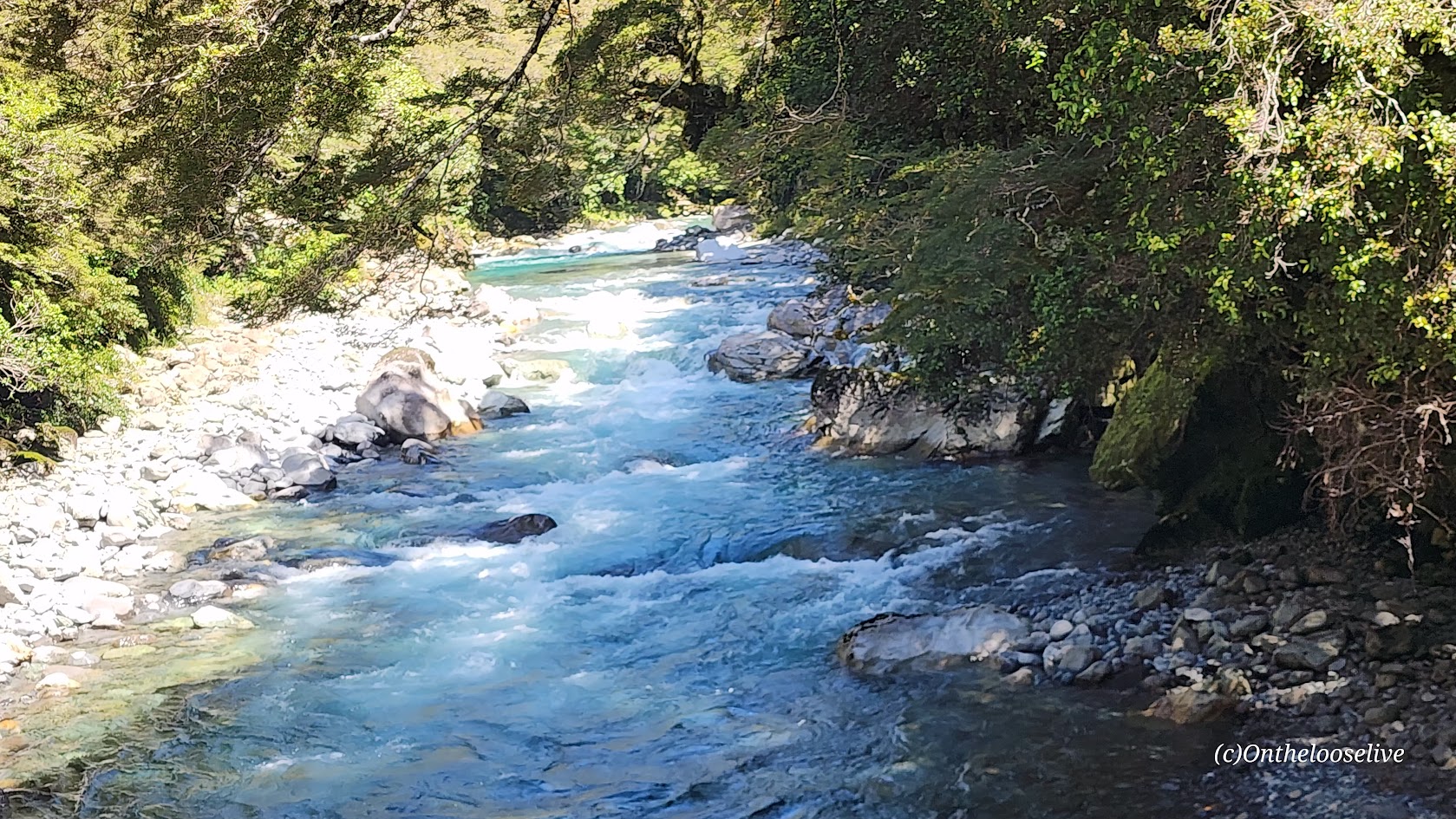
For the first half-mile, the path crosses a swing bridge over the Hollyford River and follows the magnificent, roaring Marian Creek, lulling you into a false sense of ease. The creek is dazzling, but dangerous too. (Sadly, in 2024, a 10-year-old girl slipped in and was washed away.)
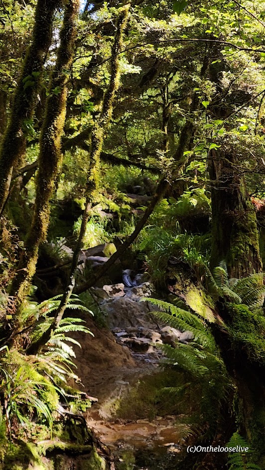
After the warning sign, you begin the slippery obstacle course, scrambling over wet roots, loose, slimy mossy rocks, and mud on a barely perceptible, steep trail. It is a painstaking, slow-motion journey, each step a careful calculation. I only have 1 photo of the trail because I needed to keep my hands free and my focus for fall / accident prevention. It’s the kind of hike best left to the nimble and sure-footed—reminiscent of some trails in the rainforests of Hawaii, but possibly more treacherous.
This hike stands in stark contrast to the meticulously groomed trails like the Kepler Track and the Tama Lakes Track that I hiked a few days before (some might argue those are over-groomed), but my knees and I have zero complaints.
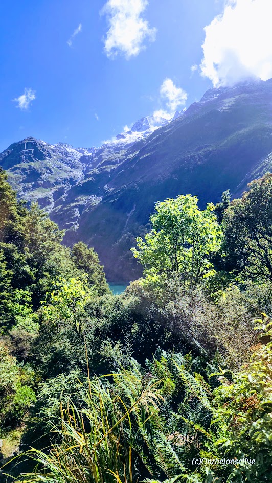
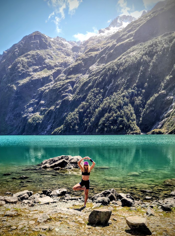
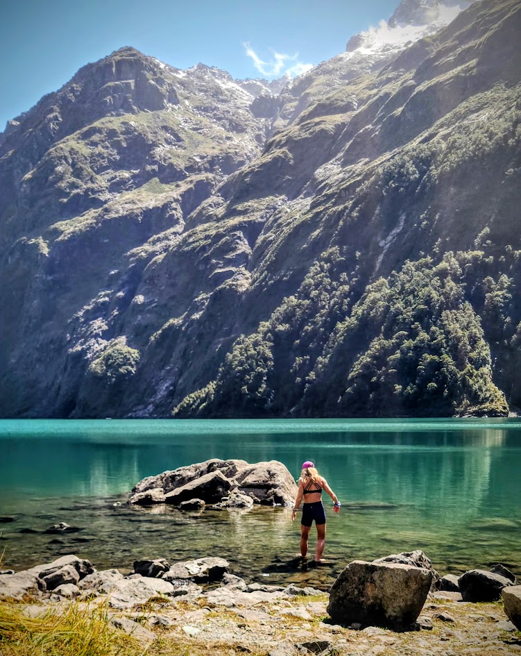
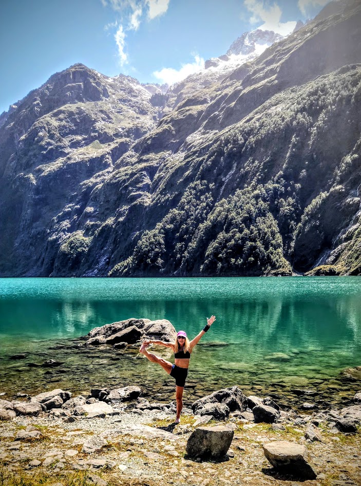
Everyone knows I love my alpine lakes and often go to great lengths to get to them. Lake Marian, with its granite glacier-carved basin, snow-capped peaks, and waterfalls, is spectacularly stunning, but having done it, I’m not sure I would choose it again. (Especially, with ALL the beauty of New Zealand to choose from and the more pristine “tracks” that don’t threaten a broken ankle, or leg at every turn…) For instance, after this hike, I went on the nearby Routeburn Track (one of New Zealand’s 11 “Great Walks”) to Key Summit (post to come). In retrospect, spending the day taking in more miles of that 20-mile track would have been time better spent.
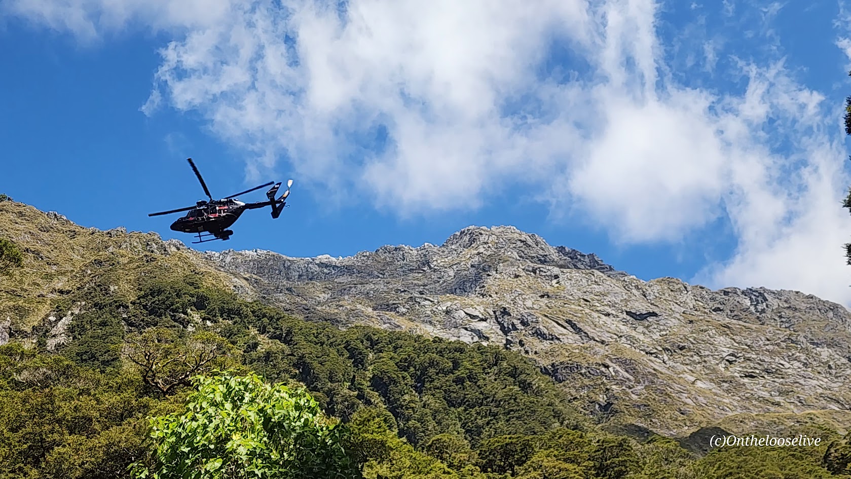
On the way down, a helicopter rescue was underway for a woman who had slipped and broken her leg. Unfortunately, the terrain was so rugged that they couldn’t maneuver the helicopter where it was needed. Instead, the rescuers would need to hike in to get her…(She was still waiting, hours later.) It made me think: perhaps a more effective warning sign for the hike would be one that shows the tally of rescues here. I have to imagine they are weekly, if not, daily in the high season.
While some might label me a risk taker, the risks I take are certainly becoming more calculated with each passing year…
Pro Tips: If you’re determined to do the Lake Marian hike, save it for your last day so an accident doesn’t ruin your entire vacation. Bring water shoes if you’re planning to go for an immersion, as there are sharp rocks at the shore. (I skipped my usual dip as the air was brisk, and I knew the hike back through the dense forest would be slow going, likely not enough vigorous movement to ward off hypothermia.)
Getting There: The Marian Lake trailhead is located in Fiordland National Park, just 1km off Milford-Te Anau Highway (SH 94) on Lower Hlyyfor Road.