Difficulty: Easy, depending on your fitness level and sensitivity to altitude (as the trailhead is at 6,700 ft and the falls are at ~7,315 ft)
If you know me by now, you know I like a big hike and chasing waterfalls. Topokah Falls, in this case, offered neither, but in my opinion, it was still 100% worth it. Perhaps the pictures below will convince you why.
Even when the 1,200-foot falls were but a trickle, as is often the case in late summer, this is still a delightful little hike on a well-groomed, easy trail alongside a stream, glades of wildflowers, and gradually up to some impressive granite slopes. As you near the falls, you’ll encounter short sections of rocky footing.
This area has a wonderful “back-country” Eastern Sierra vibe; it reminded me a bit of Yosemite.
(Given its easy accessibility, you may be sharing it with a Boy Scout troop or other large groups.) Go early and have it all to yourself.
From the Lodgepole Campground, there are other trails to add on if you have the time and inclination, including Cahoon Meadow (2.6 miles) and Twin Lakes (6.5 miles). If there’s a next time for me, I’d probably take the Twin Lakes Trail. If you’ve done these hikes, let me know how they were.
Happy Trails! Leave No Trace!Tread Lightly! (Note, I’m not tromping on the wildflowers; there’s a path going through them that’s obscured in this photo, but perhaps it’s a good time for a PSA: As pretty as wildflowers are, please don’t pick them. They are essential for the ecosystem, including the pollinators, birds, and wildlife. Also, it’s illegal in most areas, including National Parks, though you’ll often see people doing it.)
I’ve had the privilege of visiting this sacred Eden three times before. The first time was in 1993. I’ve hiked in, camped twice, and stayed at the Lodge—now twice. On one of those trips, a friend surprised me with a scenic, 10-minute helicopter ride back up to the rim. (He wasn’t keen on hiking out with a pack—or waiting while I did—so I scored my first helicopter ride, a quick thrill in exchange for sacrificing a good workout.)
Those earlier trips were quick overnights, back in the day—before permit complications and prohibitive costs. And two of them were after recent flash floods, so the water was churning chocolate.
While still awe-inspiring in any state, the falls are much more magnificent in their rushing turquoise glory.
In all my worldwide adventure travels, Havasupai and its falls remain unmatched. I’m so grateful that I had the opportunity to experience this special place again.
Background
Havasupai Village at the bottom of the south rim of the Grand Canyon is considered one of the most remote Indian Reservations in the country. The Havasupai Native American tribe has lived in the Grand Canyon for ~ 800 years. The name Havasupai translates to “people of the blue-green water” and refers to the stunning turquoise waters of Havasu Creek and its spectacular waterfalls (Navajo Falls, Havasu Falls, Fifty-foot Falls, Mooney Falls, Beaver Falls). The water’s surreal turquoise hue comes from a high concentration of calcium carbonate (lime) in the water. Over time, the lime deposits build up around sticks, leaves, and other debris, forming natural terraces that add to the spectacular landscape.
Why Pay the Price?
Words can’t begin to capture the magic and spiritual energy of this place. Yes, the most popular waterfalls—Havasu Falls, Mooney Falls, and Beaver Falls—draw the crowds. But the good news is, tucked along the trail are hidden oases that you can have all to yourself. Hopefully, the pictures speak for themselves.
Day 1: Grand Canyon Rim to Havasupai Village and Havasu Falls
Distance to Village: 8 miles Elevation Loss: 2,500 Ft
Circa 1998 vs 2025. It’s hard to out 6-pack my younger self, but I’m still trying and still finding as much or possibly more joy in my active adventures.
The hike down from the rim, through the dry Hualapai Wash and into the village via the Havasupai Trail, may feel unremarkable to those familiar with other Grand Canyon hikes.
Aside from a few interesting rock formations, the trail is mostly a sandy, gravelly, waterless, hot, dusty, potentially blister-inducing slog.
(1993 and 2025 – same spot, but there must have been an enormous rock slide, as you can see the huge slabs to the right of me in the recent pic !)
But of course, every step is 100% worth it! (Just be prepared with ample water, sunscreen, hat, moleskin, etc.)
Distance to Havasu Falls from the Village: ~4 miles RT
The pic below is from my first visit in 1993.
After grabbing a bite at the restaurant, we dropped our bags at the lodge and made a beeline for Havasu Falls—one of Havasupai’s crown jewels.
The lovely views begin about a mile from the village.
Havasu Falls was even more breathtaking than I remembered. The only thing better than marveling at its splendor is immersing yourself in it.
What’s Changed
As mentioned, the costs of visiting this sacred place have skyrocketed. It has been dubbed the most expensive hike/camping trip in America.
As of July 2025, it’s $455 per person for a 3-night stay at the campground and $2,277 total for a 3-night stay at the lodge in a double room. Note it’s a mandatory 3-night payment requirement in both cases—no refunds for shorter stays. For the luxury of having a mule carry your pack, it’s $400 RT for up to 4 bags; each bag must weigh less than 32 pounds. All I can say is if the system keeps the crowds down and supports the locals, I’m for it.
The cost of a helicopter ride to/from the village is $150 per person each way, with the additional cost of $50 per pack/bag.
The Good
I noticed more families and younger locals living in the village than my past visits, a shift that reflects community renewal. There’s now a Head Start program for young children and a new, modern medical clinic. The Lodge has been renovated as well; the air-conditioned double rooms are clean and updated, featuring comfortable beds, a fridge, and a microwave.
The village restaurant has also been upgraded. Its expanded menu now includes healthier options like salads and grilled chicken sandwiches, alongside traditional frybread and the usual burger-and-fries fare. Barstools at a large window offer a front-row view of the village center—including the regular whirlwind of helicopter landings and takeoffs with their sudden sandstorms and dust clouds.
There also seemed to be far fewer dogs roaming the village than in past visits—and the ones I did see appeared relatively healthy. I want to be clear: I understand that when people are struggling with basic necessities, pet care can’t be a priority. Still, in previous years, the heartbreaking sight of malnourished nursing dogs and sickly puppies left a lasting impression that deterred me from visiting again – until now. ( A friend secured the permit, and when he offered me the opportunity, I couldn’t refuse.)
Those images stayed with me—not in photos, but in memory. Possibly in response to past negative press surrounding animal treatment here, a strict no-photography policy now applies to pack animals and dogs, as well as the village itself and its residents. This is entirely understandable to protect the villagers’ privacy, dignity, and culture.
The Bad—Paradise Lost?
I’m not sure how long ATVs have been in use in the village, but they seem to be increasingly popular with locals. While I understand their practicality—and, no doubt, their fun—they do detract from the experience, especially in such a remote and natural place. The noise, dust, and trail erosion are hard to ignore. A local woman I spoke with shared her unsolicited disapproval of them.
The Ugly—Soapbox Warning
What disturbed me most on this trip, though, was the amount of trash—mainly empty plastic water and Gatorade bottles—littered everywhere along the Havasupai Trail—literally a Trail of Trash. I don’t recall seeing anything like this on previous visits. Next to animal welfare, littering is my “pet peeve”.
I honestly don’t understand it. People are paying a premium to visit this incredible place—yet they are disrespecting it and the locals by littering? Yes, hiking in the heat with a heavy pack is tough, but these bottles are empty. Carrying them out takes almost no effort. What the heck, people? Who does this? It’s truly appalling.
Thankfully, there’s noticeably less litter in the campgrounds and around the waterfalls—likely thanks to regular cleanup crews and maybe because the Instagrammers don’t want to tarnish their photos there. But the trail itself deserves the same care and respect. This place is a treasure, and it deserves better from all of us.
Despite the cons, there are still moments of paradise here for me. What about you?
What’s the Solution?
Havasupai should implement steep penalties for littering—$1,000 fine—and use the revenue to fund a dedicated litter patrol program employing local workers. Another idea: offer small incentives to visitors who pack out the trash they collect along the trail—perhaps a discount at the restaurant, Lodge, or campground. (Though yes, I know… someone will always try to game the system by raiding the trash can near the village.)
I’m just brainstorming here, trying to imagine practical solutions to this heartbreaking issue. I will never understand how people can journey to such an awe-inspiring place only to defile it with trash. It makes no sense.
If Arizona adopted a “bottle bill” like some other states—placing a refundable deposit on bottles and cans—I have no doubt it would reduce the problem dramatically. Short of that, maybe they could offer an off-season camping weekend in exchange for a few hours of supervised trail cleanup. A give-back program for those willing to help restore what others have damaged.
Although the “Leave No Trace” policy is clearly stated in the reservations paperwork, including a $1,000 fine for leaving trash or gear behind, I didn’t see any signage reinforcing this policy on the trail or at the campgrounds. What I did see, unfortunately, was tons of litter. Posting visible reminders about the rules and the consequences might help discourage the defilers.
Perhaps the tribe could also consider installing designated trash receptacles at key points, with a budget allocated from the high permit fees to manage its removal. I understand the original goal of a strict pack-in/pack-out system, but it’s clearly not working. I’d be very curious to know how many fines have been issued—and whether those funds have gone back into trail maintenance or cleanup efforts.
What do you think would make a difference?
So that’s the good, bad, and ugly of it. Is it worth it still? Emphatically 100%!
Plan Ahead: Permits are hard to get. Camping permits are available from February 1 through November 30, and reservations for the Lodge are available from April 1 through November 30. The area is closed in December and January.
Permits go on sale February 1 at 8 AM Arizona Time/Mountain Time. Up to 12 people can be on a camping permit for $455 each. If you don’t land a permit on February 1st, you can check in their transfer page, where newly available permits are listed daily at 8AM.
In 2025, there was a 2-week presale from December 16 to January 3. You pay a non-refundable $20 per person fee for the chance of securing one of your 3 reservation start times. If you win your permit, you’ll then pay the full price of either camper or lodging reservations. (Permits are only transferable through the official website.)
Note, Havasupai can close unexpectedly due to flash floods. Monsoons are frequent in the summer months. Pay attention to the weather forecasts.
Since there is no refund policy to cover this or any other eventuality, you may want to consider securing travel insurance before your trip.
Before you begin your hike, the designated trip leader must check in at Grand Canyon Caverns Inn to pick up the required documents and bag tags the night before or by 12 noon the day you wish to hike in; otherwise, your reservation will be canceled.
Stay tuned for the videos and the Mooney and Beaver Falls post.
Elevation Gain: 650 ft (You’re starting at about 6,100 ft)
Difficulty: Easy to moderate, depending on your fitness level
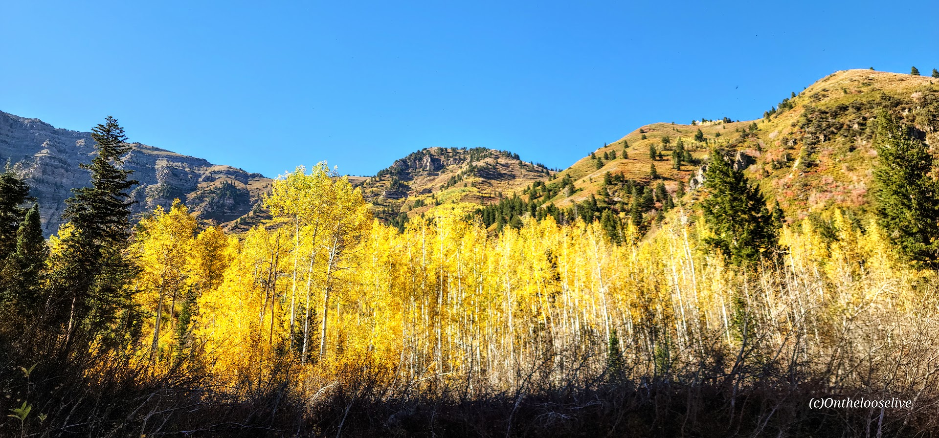
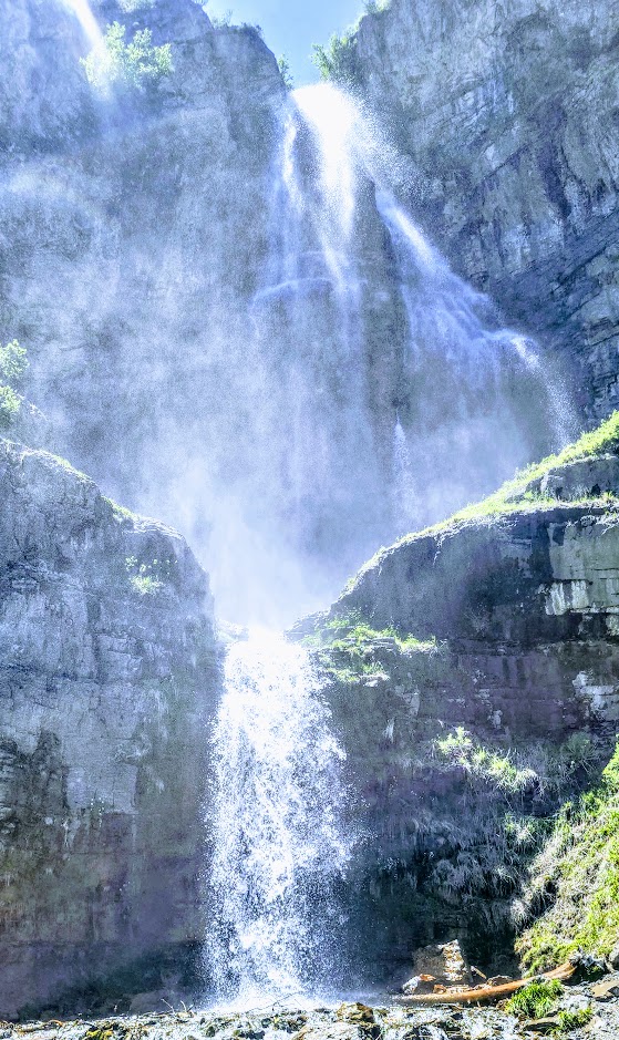
I finally made it to the spectacular 200-foot, double-tiered Stewart Falls! What took me so long?
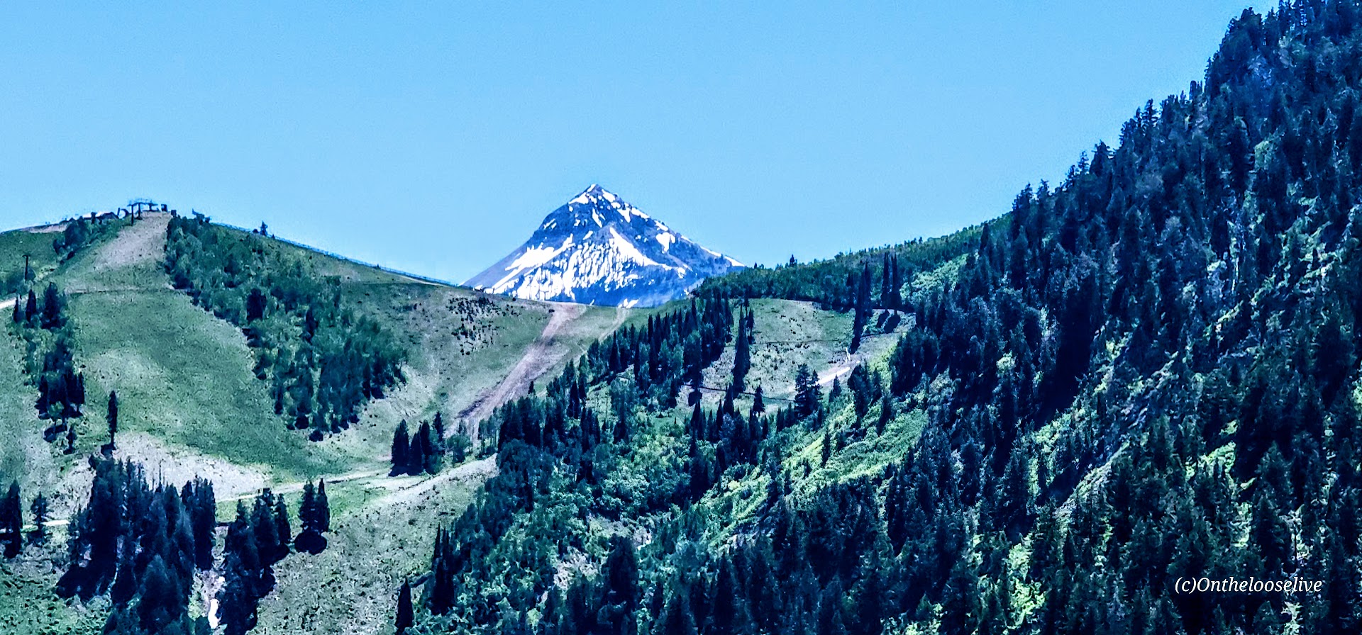
(The truth is, I’m guilty of prioritizing marvelous Mount Timpanogos via the Aspen Grove or Timpooneke routes when I’m up here and rarely have time to fit in this quickie.) This time, I fit in Lake Blanche in the morning and made this my afternoon destination. A bit of driving, but worth it.
This lovely, runnable, single-track trail through the forest is especially enchanting in the Fall, with the Aspens at the height of their color. You can’t beat the splendid reward of this shortie
Make a day of it; check out the beautiful grounds of the Sundance Resort, grab a bite, and browse the shops.
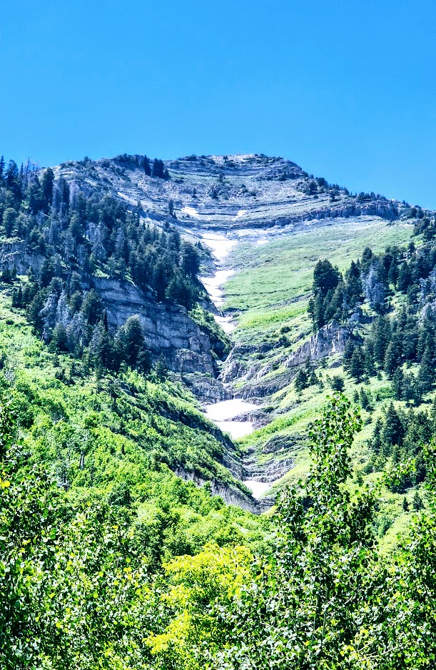
Turns out Stewart Falls is just as splendid in the summer. In fact, with the snow melt, it really rushes and mists, and you may get to see additional falls!
Getting there: The trail begins at the Aspen Grove Trailhead parking lot. The entrance fee is $10 or free with a National Park Pass. This lot fills early, and they do ticket cars along the street. Pay close attention to the “No Parking” signs; they’re easy to miss.
Just when I thought the scenery along Mirror Lake Highway couldn’t get better, I saw the sign for Provo River Falls and turned off (<15 minutes east of Kamas). This enchanting roadside waterfall has three tiers (upper, mid, and lower), lovely terraces, and multiple cascades. It’s a must-stop if you’re driving Highway 150. There’s a short paved path alongside the 3 waterfalls. The water temperature ranges from 35 to 55 degrees so the mist from the waterfall is wonderfully refreshing, especially on a hot day.
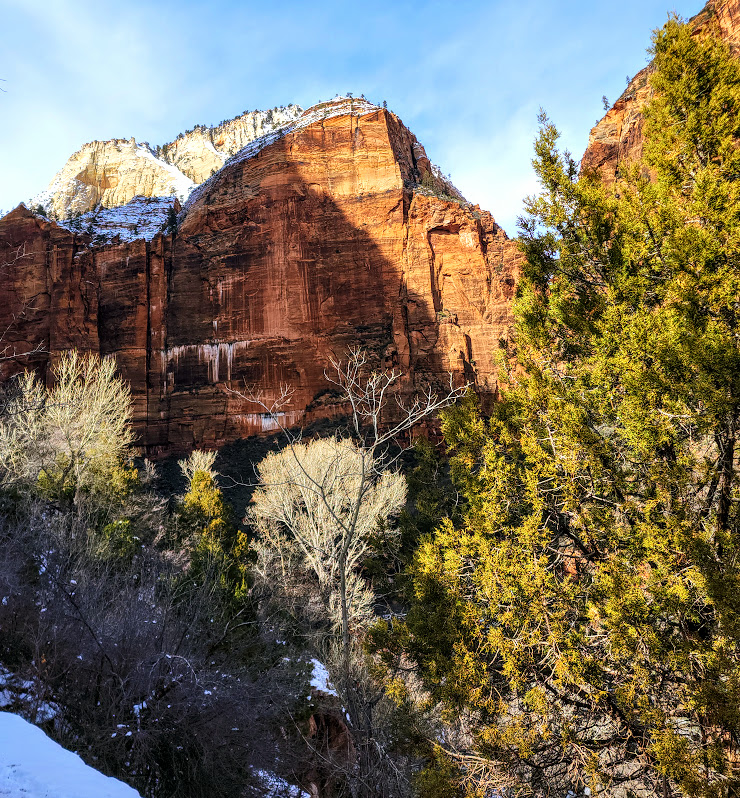
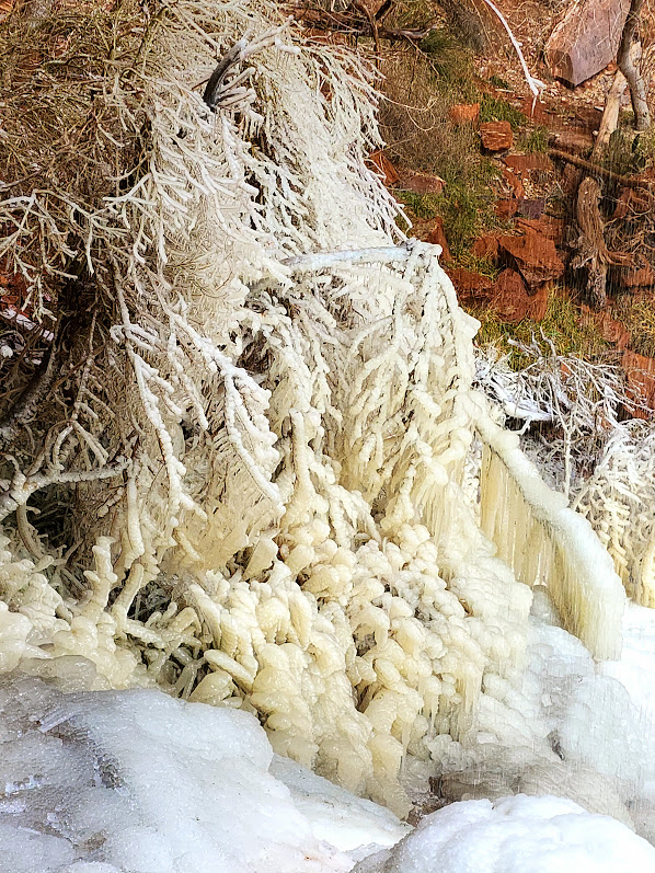
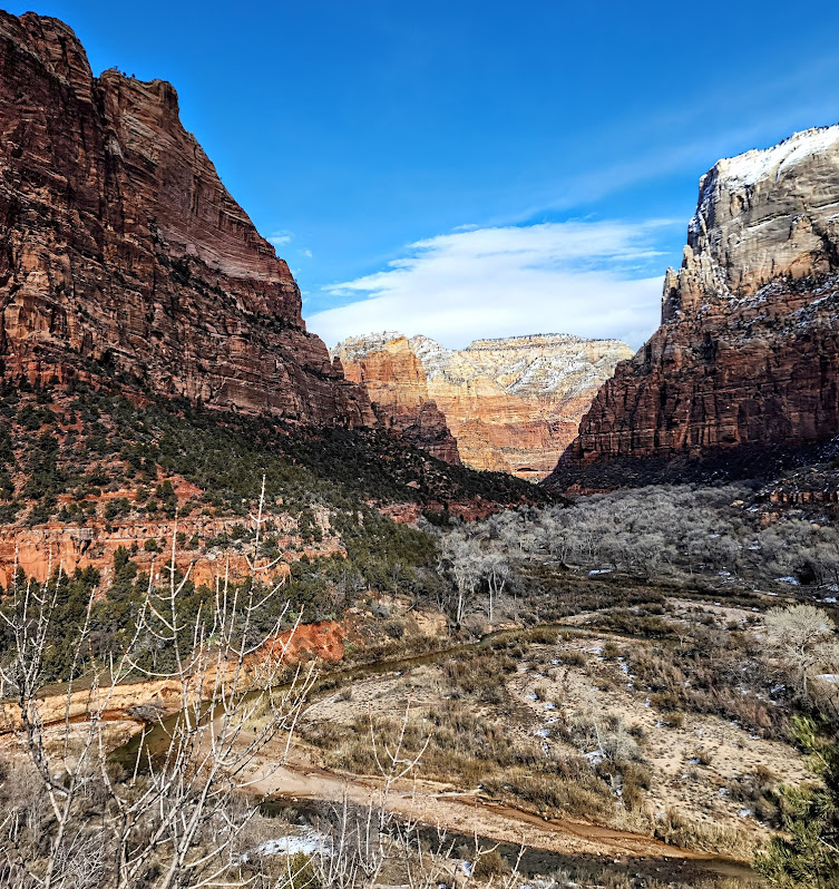
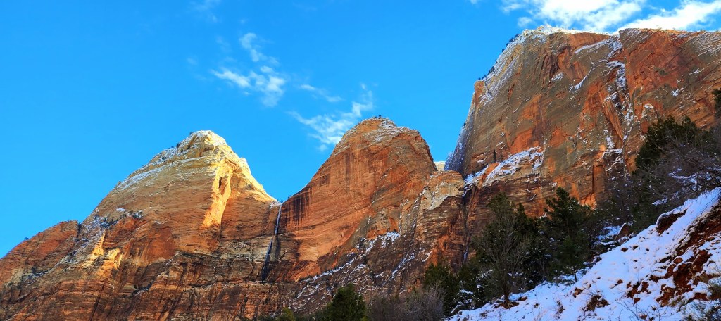
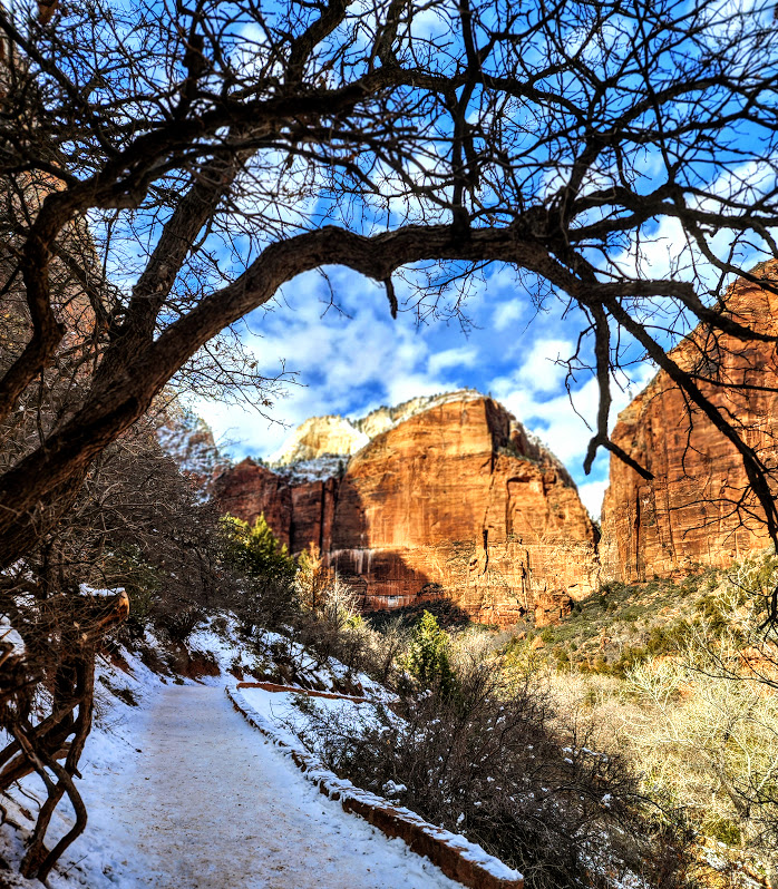
Turned into a human popsicle to get you this glimpse of Zion’s winter wonderland.
If you do venture out in the winter, be sure to over prepare. There have been many rescues and unfortunately too many deaths in Zion – mostly from hypothermia and exposure (even in the warmer months). The elements are no joke out here. Crampons are a must in icy conditions. Adequate layers, gloves, hats, etc…Hydratation is just as critical though harder to swallow in the winter (I know).