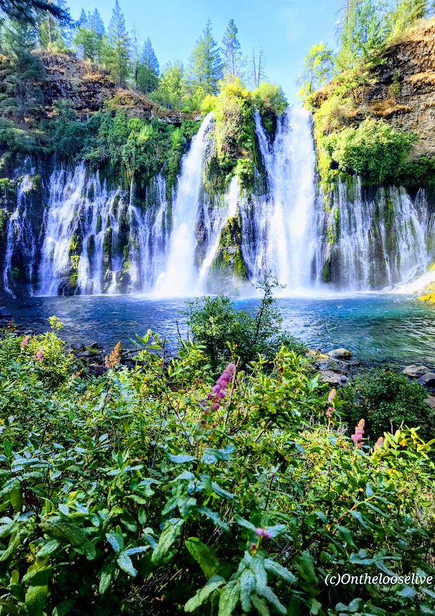
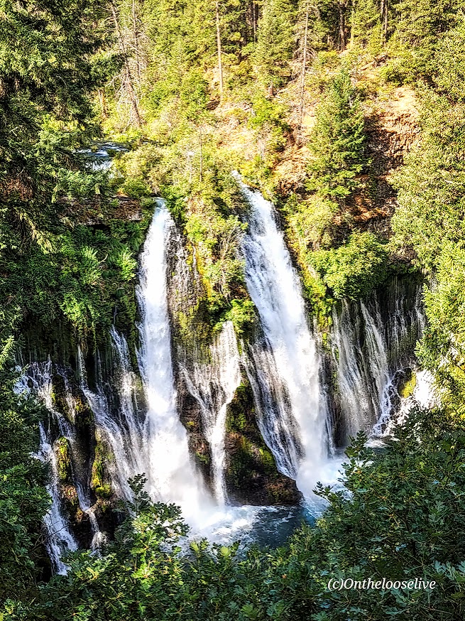
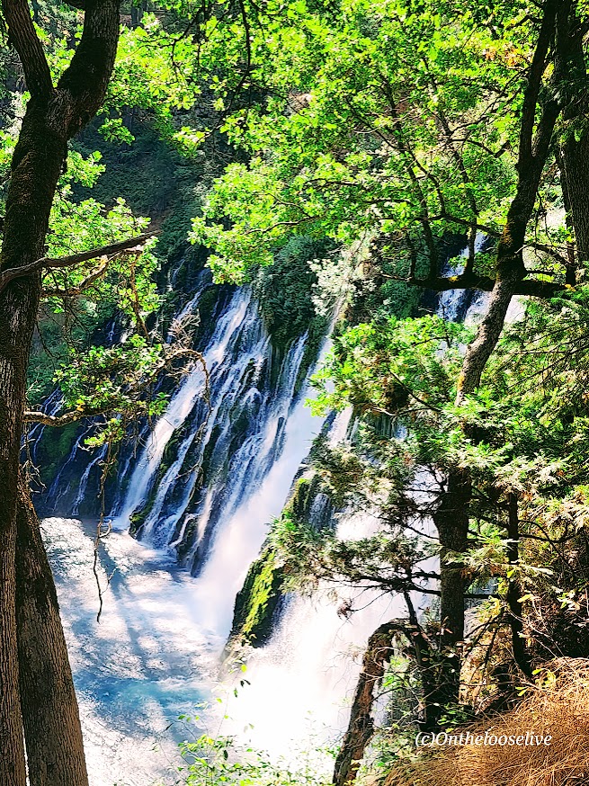
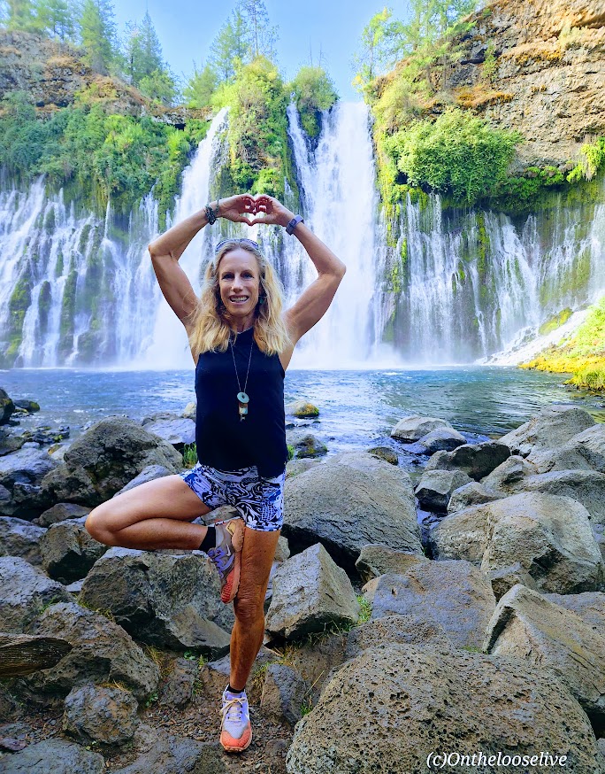
Wowza, I’ve chased a lot of waterfalls in my time, but Burney Falls stands out for its terraced, storybook, enchanting beauty.
And talk about an easy chase —huge reward for minimal effort— easy 1-mile round-trip stroll with an elevation gain of 161 ft
At 129 feet high, Burney Falls is the main attraction of California’s McArthur-Burney Falls Memorial State Park. I’d never heard of it, but it has to be one of the most gorgeous waterfalls that I’ve seen. It has an impressive daily flow of 100 million gallons, and the water temperature ranges from 42 to 48 degrees. While it was tempting, I didn’t take the cold plunge this time.
Apparently, there are 5 more miles of trails in the park, but it’s really all about the waterfall. If you’re adventuring in Lassen Volcanic National Park, Burney Falls is just ~40 miles North off of CA-89.
Notes: Day-use parking fee: $10. No dogs are allowed on trails or day-use areas. Go early; the small parking lot fills up fast.
Getting there: It’s off CA-89 N. (~40 miles from Lassen Volcanic National Park)
Tiki Trail/ Base of Gondola Start to SummitDistance rt from Tiki Trail: ~9.7 miles Elevation Gain: ~4,786
Top of Skyline Gondola Head Start to SummitDistance rt: ~7.1 miles Elevation Gain: ~3,310 ft
Difficulty: Moderate/difficult, depending on your fitness level. (AllTrails rates it as strenuous/advanced/highly challenging.)
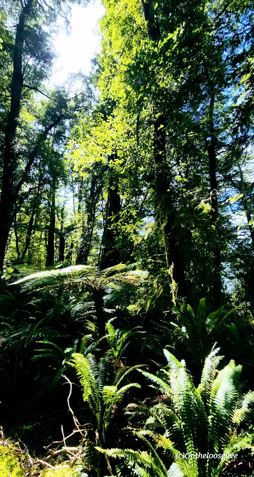
Of my two weeks of adventures in New Zealand, this was one of my favorite days—and easily one of my favorite days anywhere. Simply EPIC from start to finish.
After hiking the Marian Lake Track and Key Summit the day before, I spent the night in a small, somewhat dilapidated motel in the scenic, lakeside village of Manapouri. While the accommodation left much to be desired, falling asleep and waking up to the spectacular view below more than made up for it—a fortuitous start to a day that would prove exceptional both on and off the trail.
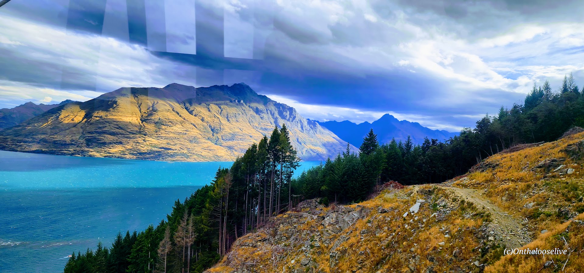
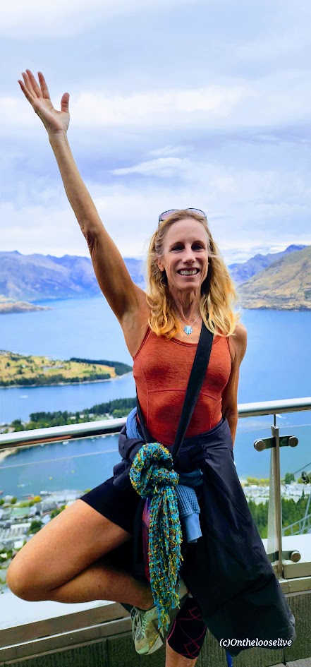
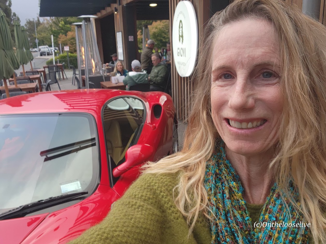
Queenstown, the South Island’s Adventure Mecca
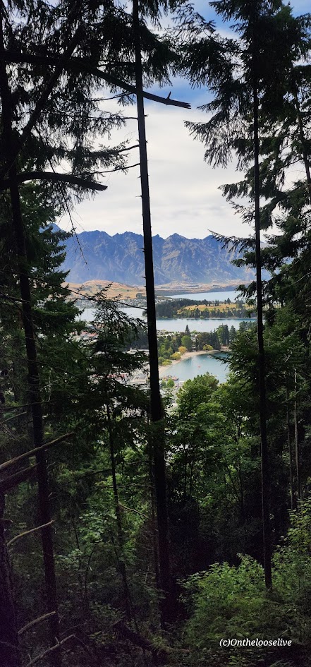
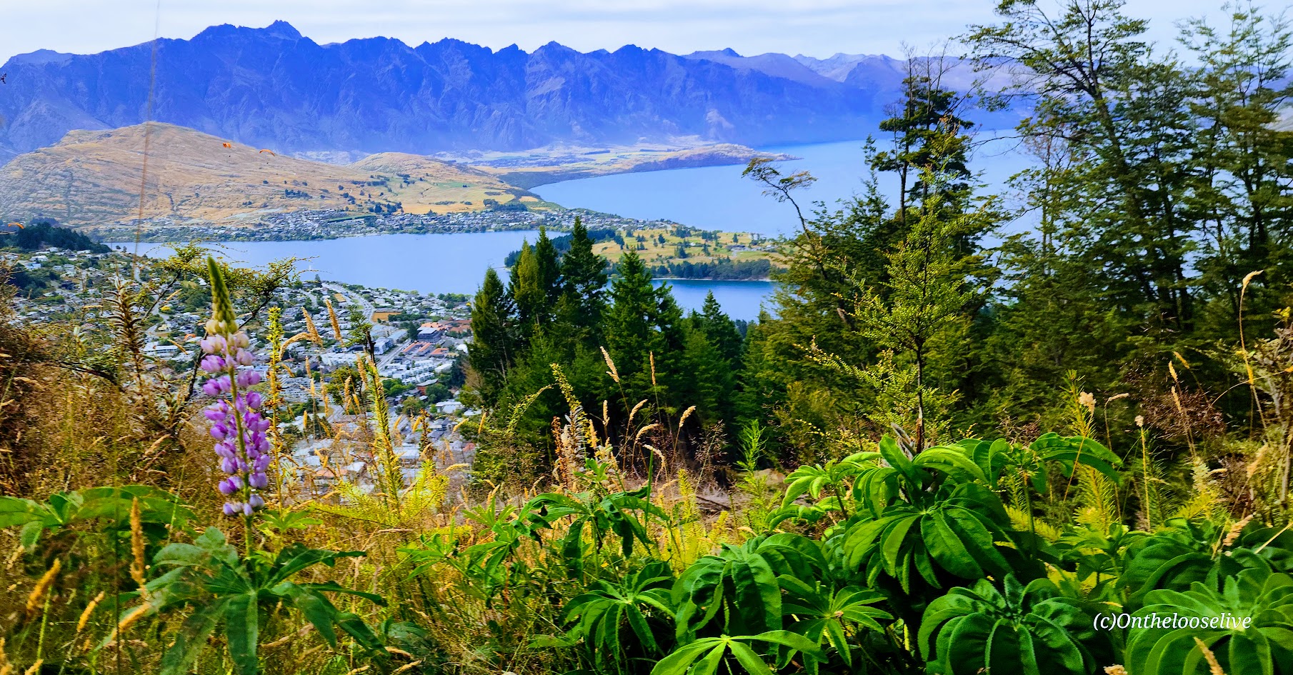
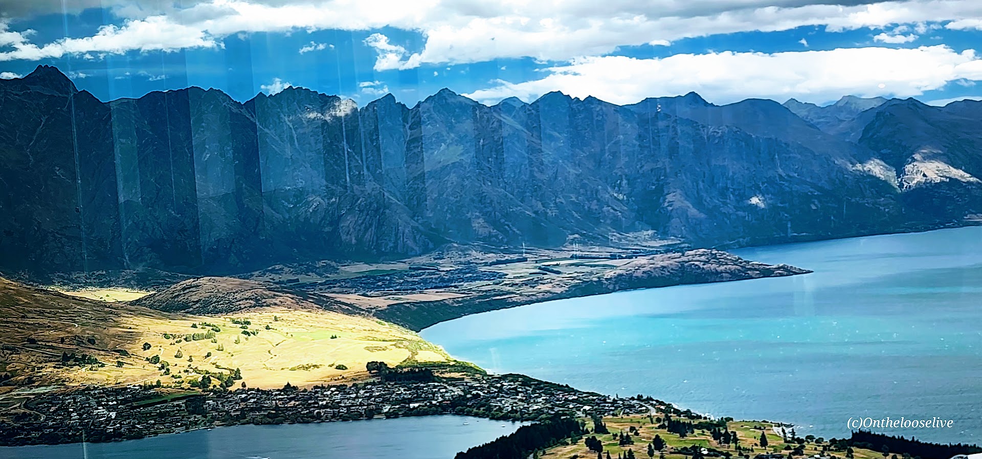
Here, every step you take leads to breathtaking scenery and an exhilarating experience. Set against the dramatic backdrop of the jagged peaks of The Remarkables mountain range with the shimmering waters of Lake Wakatipu (NZ’s longest lake – 50 miles long) reflecting the surrounding beauty, Queenstown is arguably one of the most stunning destinations in New Zealand and a gateway to some of the country’s most memorable outdoor experiences—including the spectacular Ben Lomond Track.
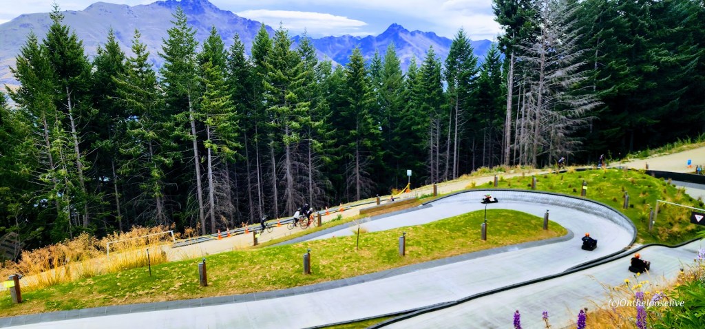
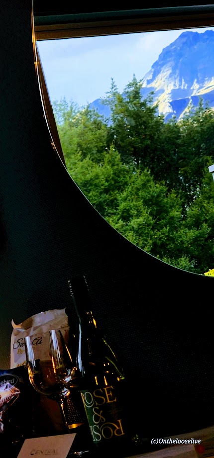
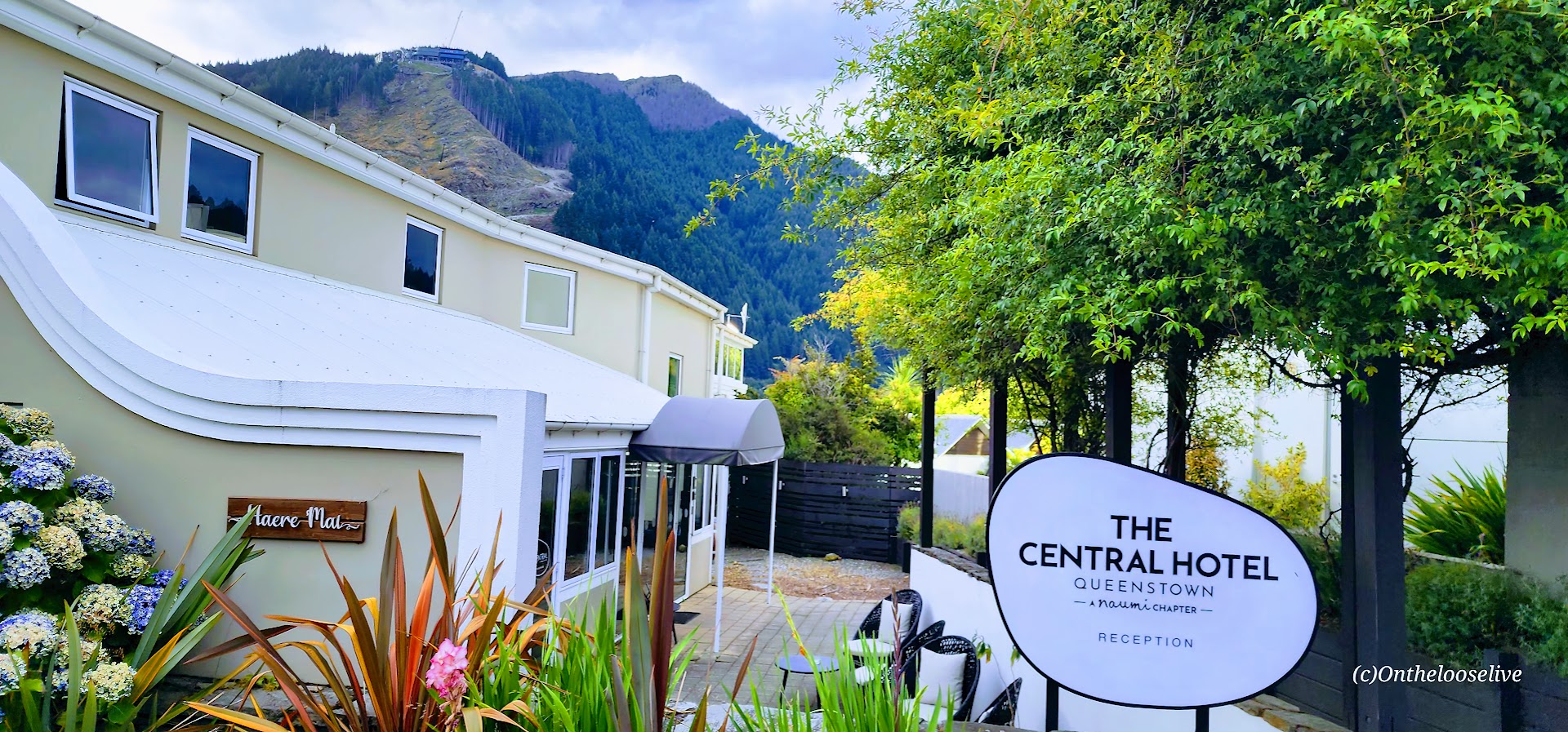
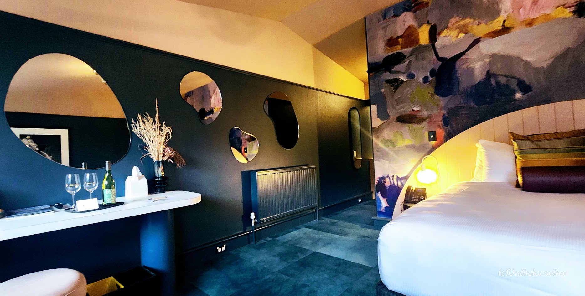
Whether you’re hiking alpine ridges, carving down mountain bike trails, riding gondolas, the luge, the Vortex Slide, or the Zipline, or mixing it up, your outdoor bliss awaits in Queenstown. The town itself doesn’t disappoint either—vibrant streets lined with galleries, restaurants, shops, and gorgeous boutique hotels like the one I stayed at, The Central Hotel, where the perks included a complimentary bottle of local wine, snacks, and continental breakfast.
While Kiwis, (as New Zealanders call themselves), may dismiss Queenstown as overly touristy, its popularity is clearly well-earned. (Also, in my opinion, the “touristy” vibe in NZ feels far more subtle than the US, and generally, crowds are smaller. than what you encounter stateside.)
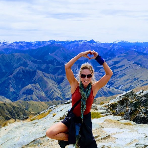
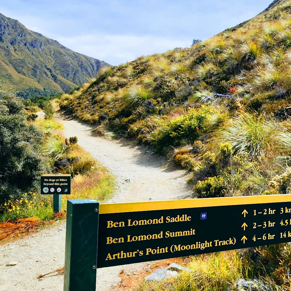
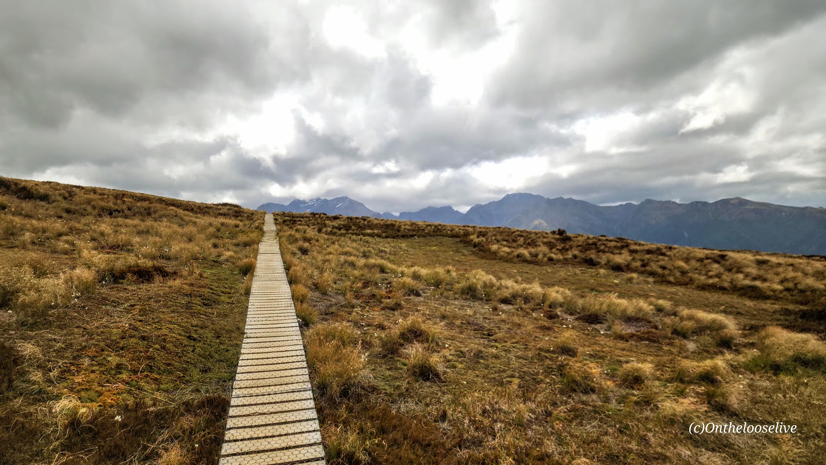
A Queenstown Must Do: The Breathtaking & Ravishingly Beautiful Ben Lemond Track
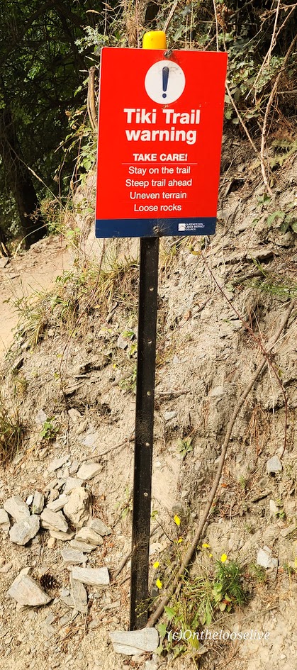
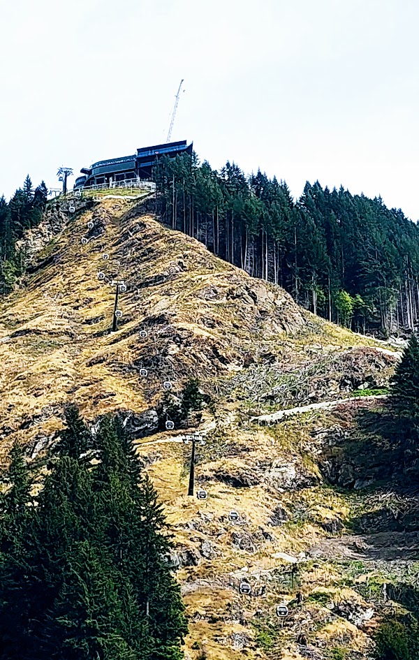
There are two ways to access the Ben Lomond Track: hike up the Tiki Trail from the base of the Skyline Gondola, or give yourself a head start by riding the gondola to the top.
Obviously, starting from the Tiki Trail adds both distance and elevation to your adventure—about 2.6 miles round trip and 1,476 feet of additional climbing. Naturally, I took the Tiki Trail. Was it worth it? Yes, and no.
On the plus side, it added to the workout challenge, which I rarely resist. From a scenery perspective, it didn’t add much, as much of the trail winds through the forest, with the best views near the top.
If you have the time and enjoy earning every foot of elevation, the Tiki Trail is worthwhile. But if the Ben Lomond hike itself feels like enough of a challenge—or you’re simply short on time—take the Skyline Gondola.
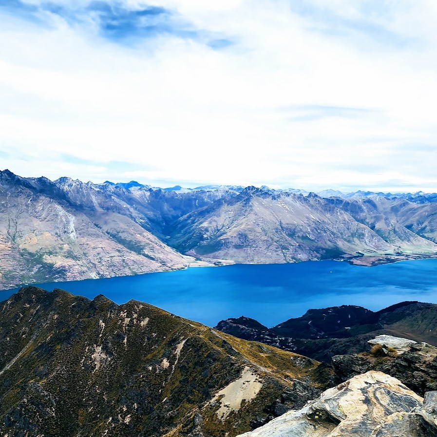
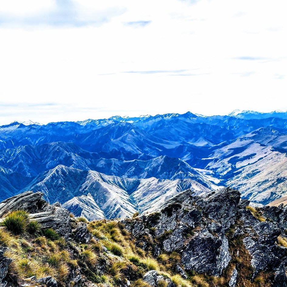
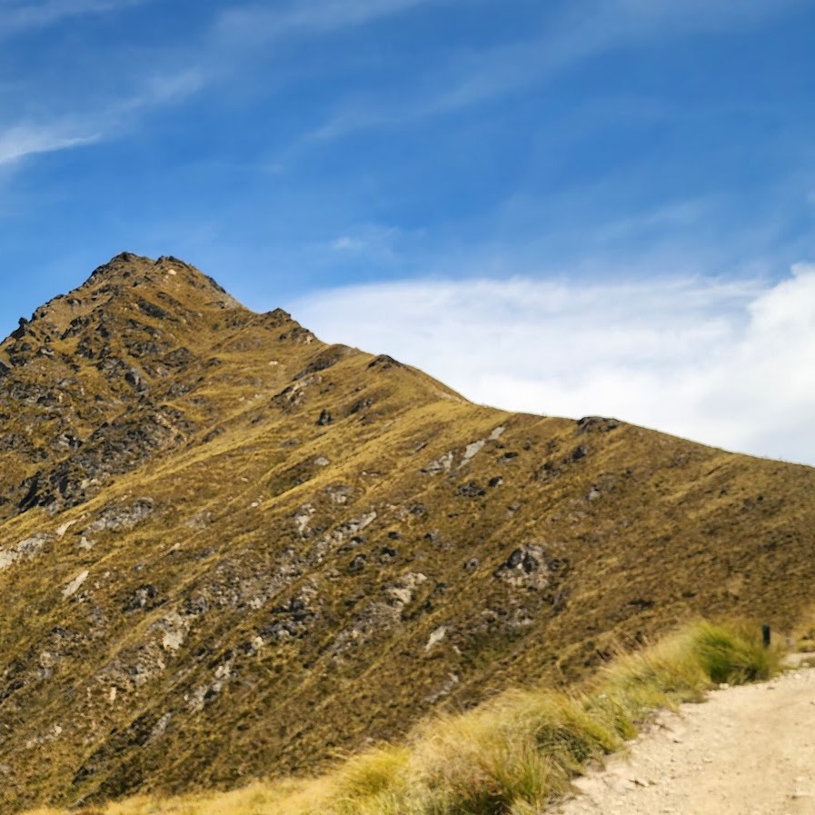
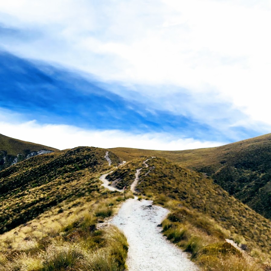
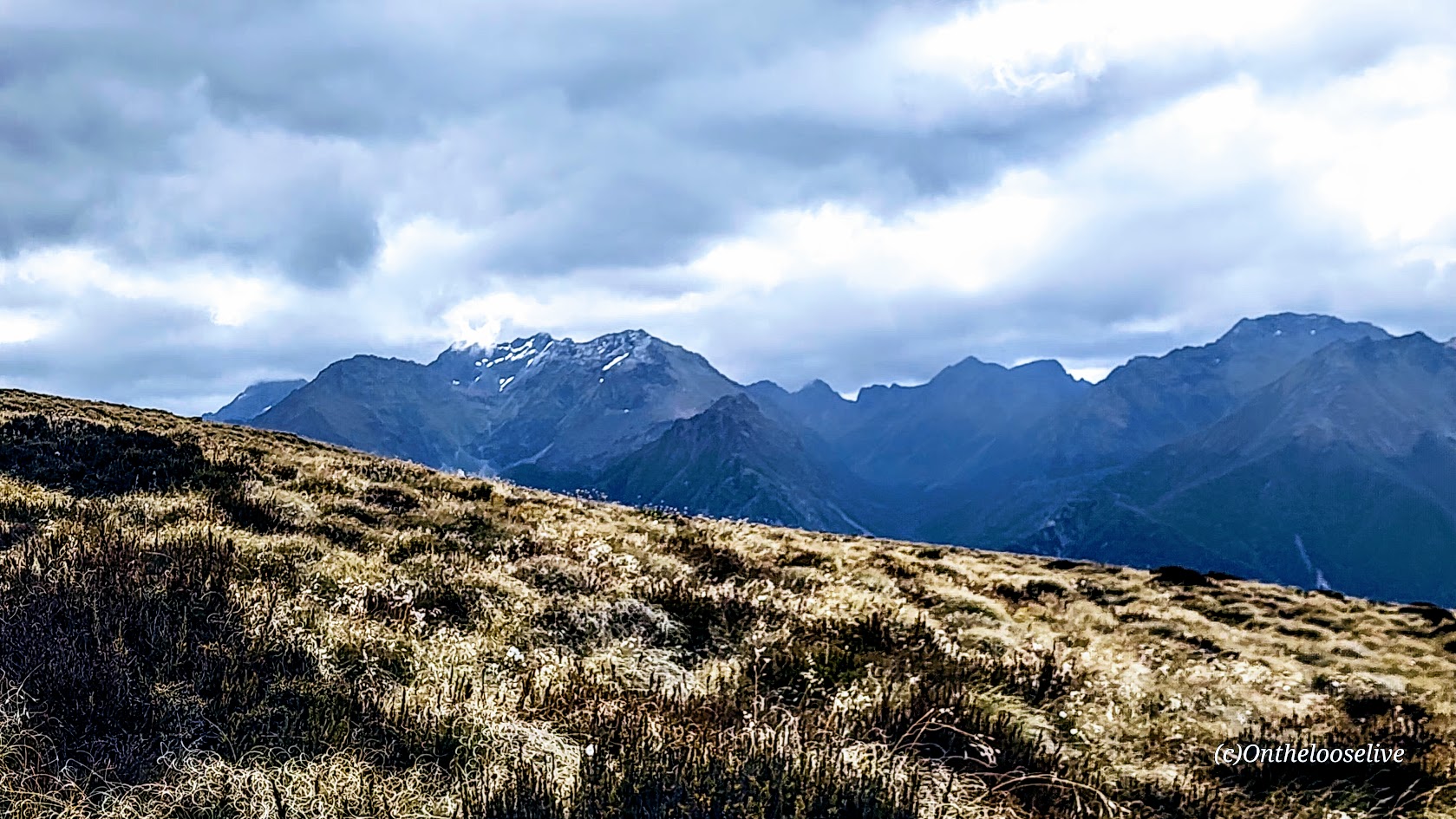
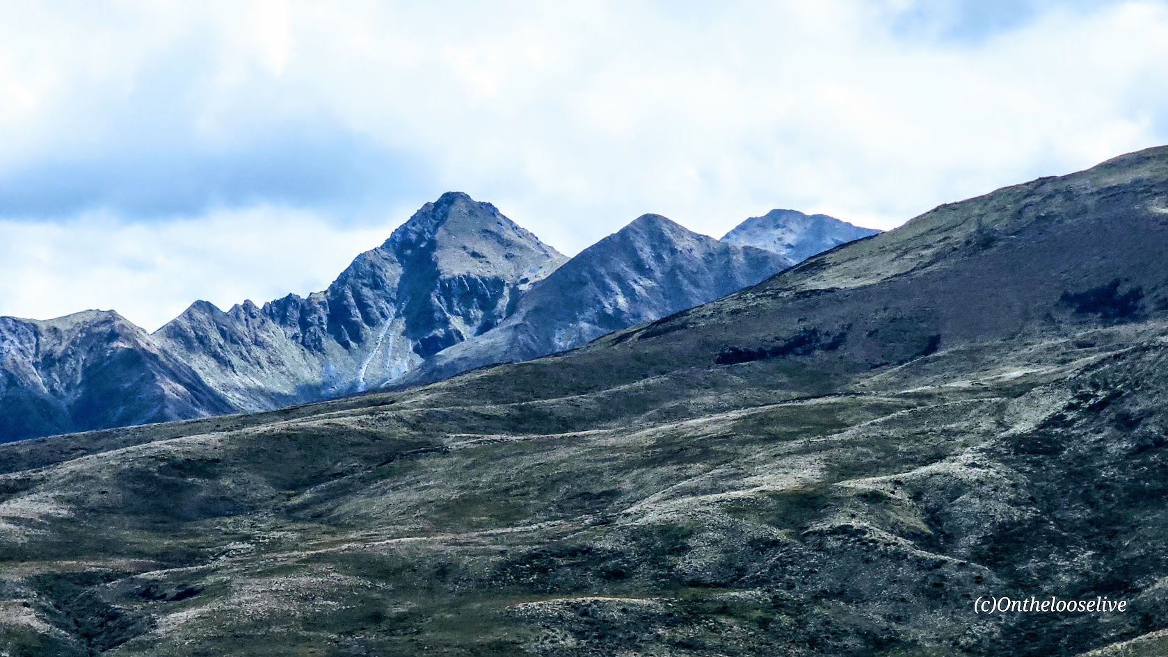
The Ben Lemond Track is well-marked, easy to follow, and easy on the feet, until the last rocky mile or so to the summit. Great for trail running. The mountain bike trails are separate (45 mountain biking trails and 10 e-bike trails), so no close encounters with bikes (thankfully), but it’s fun to watch them flying down the ridgelines from a distance. As you climb the ridgeline, the incline is consistent, but mostly gentle/moderate until that last mile. Your reward is expansive views of the dazzling Lake Wakatipu (NZ’s longest lake – 50 miles long) and Queenstown far below, and a stunning panoramic view of it all at the top. While the summit is only 5,735 feet in elevation, it is considered alpine as it’s above treeline, completely exposed, and subject to severe, volatile weather. (Be prepared and check the weather forecast in advance.) I’ve discovered that many alpine hikes in New Zealand offer plenty of elevation gain without the altitude factor—same magnificent alpine hiking and scenic rewards, but far less arduous than hikes at higher elevations. Super fun and doable for hiking, trail running, and biking, but not helpful if you need altitude training or will be competing at altitude.
While not an official “Great Walk” of NZ, the Ben Lemond Track is a GREAT hike—in my opinion, it’s a “must do” if you’re in Queenstown.
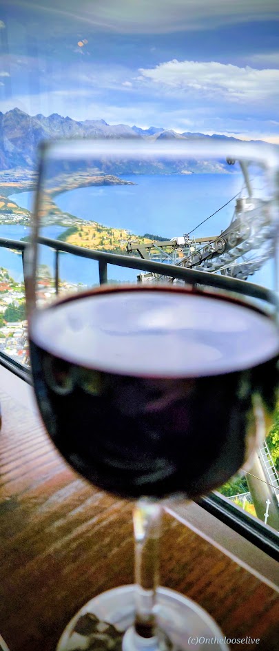
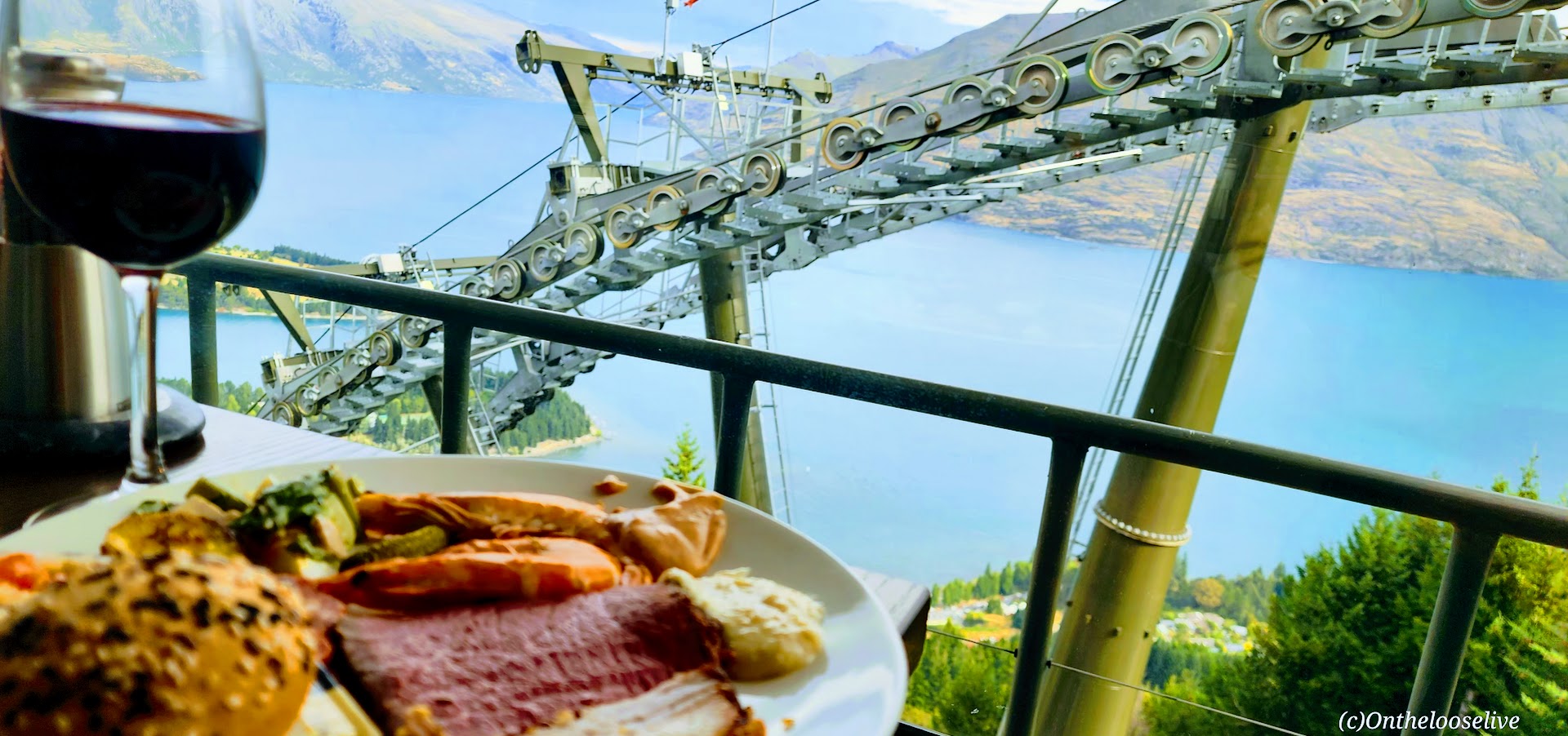
So many adventures, so little time! Definitely something for everyone here! Whatever Queenstown adventures you choose, be sure to work up a good appetite, and then treat yourself to the lavish all-you-can-eat feast (lunch or dinner) at the Stratosfare Restaurant. Enjoy the incredible views, live music, and decadent delights.
Pro Tip: Reservations are required at the Stratosfare Restaurant, but it’s 100% worth checking in to see if they have last-minute availability. You just may get lucky like I did!
Happiness is a challenging hike followed by an indulgent feast, a sunset gondola ride, and a cozy bed with a welcoming bottle of local wine and snacks—all with spectacular views! This was truly an epic day for me in NZ and in my life!
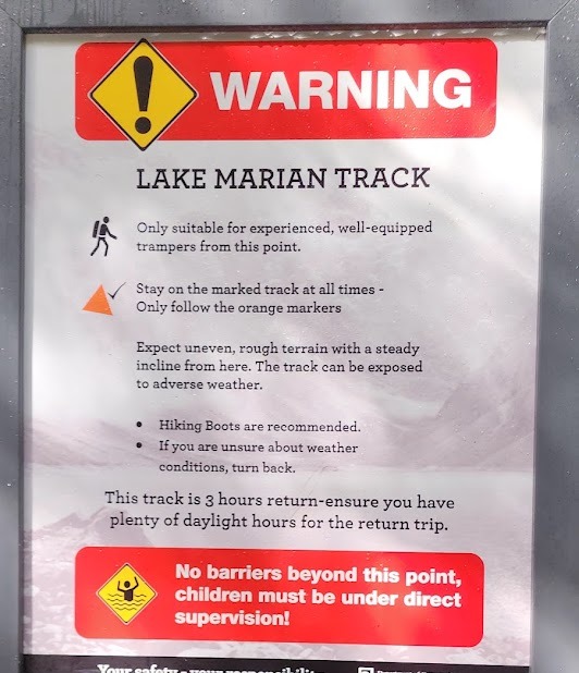
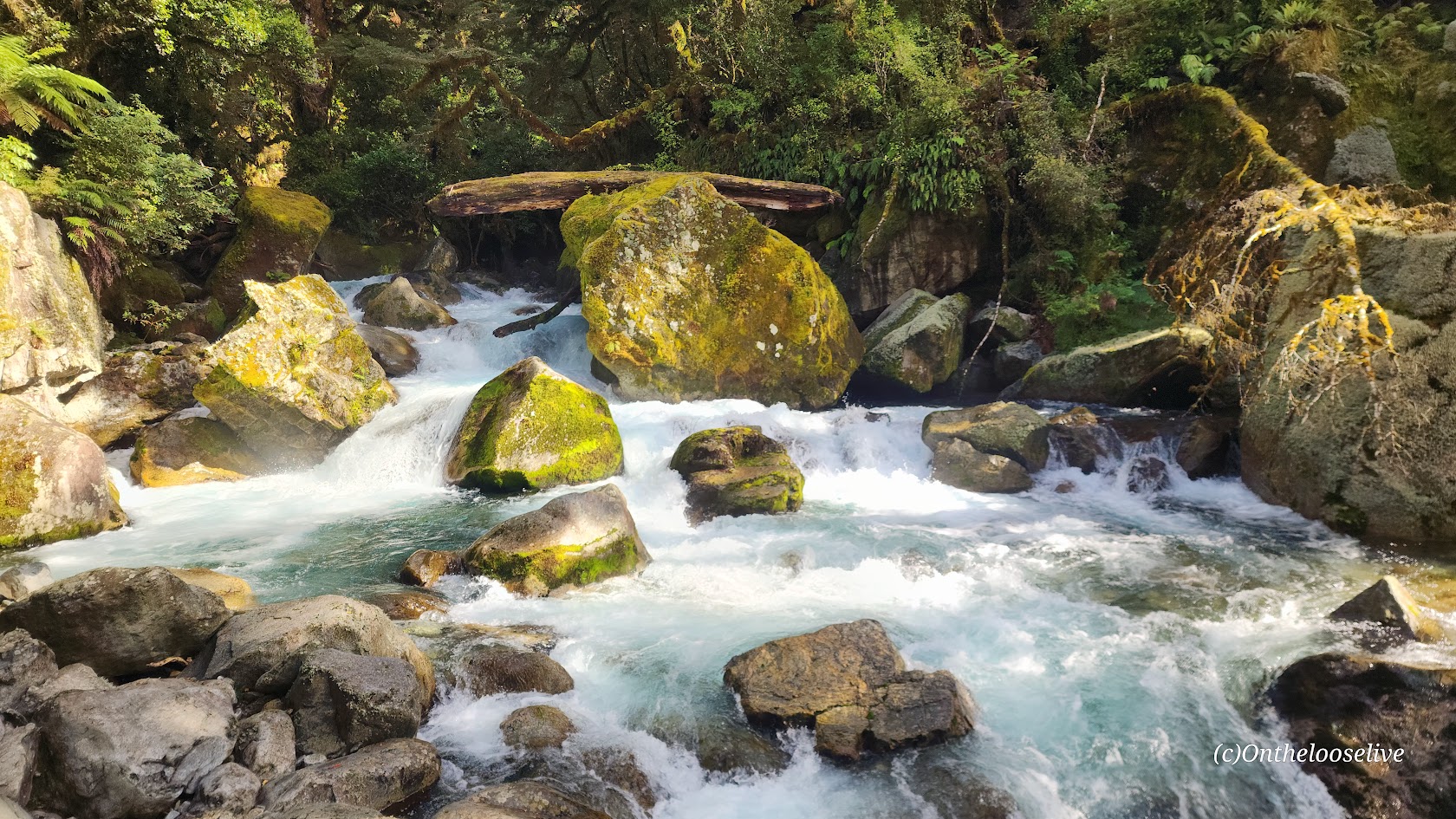
The Lake Marian hike is short, but risky business. A trail sign warns of “rough terrain” and advises that only experienced hikers continue.
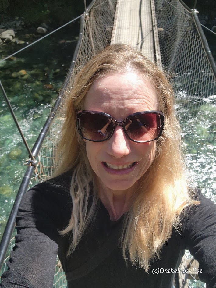
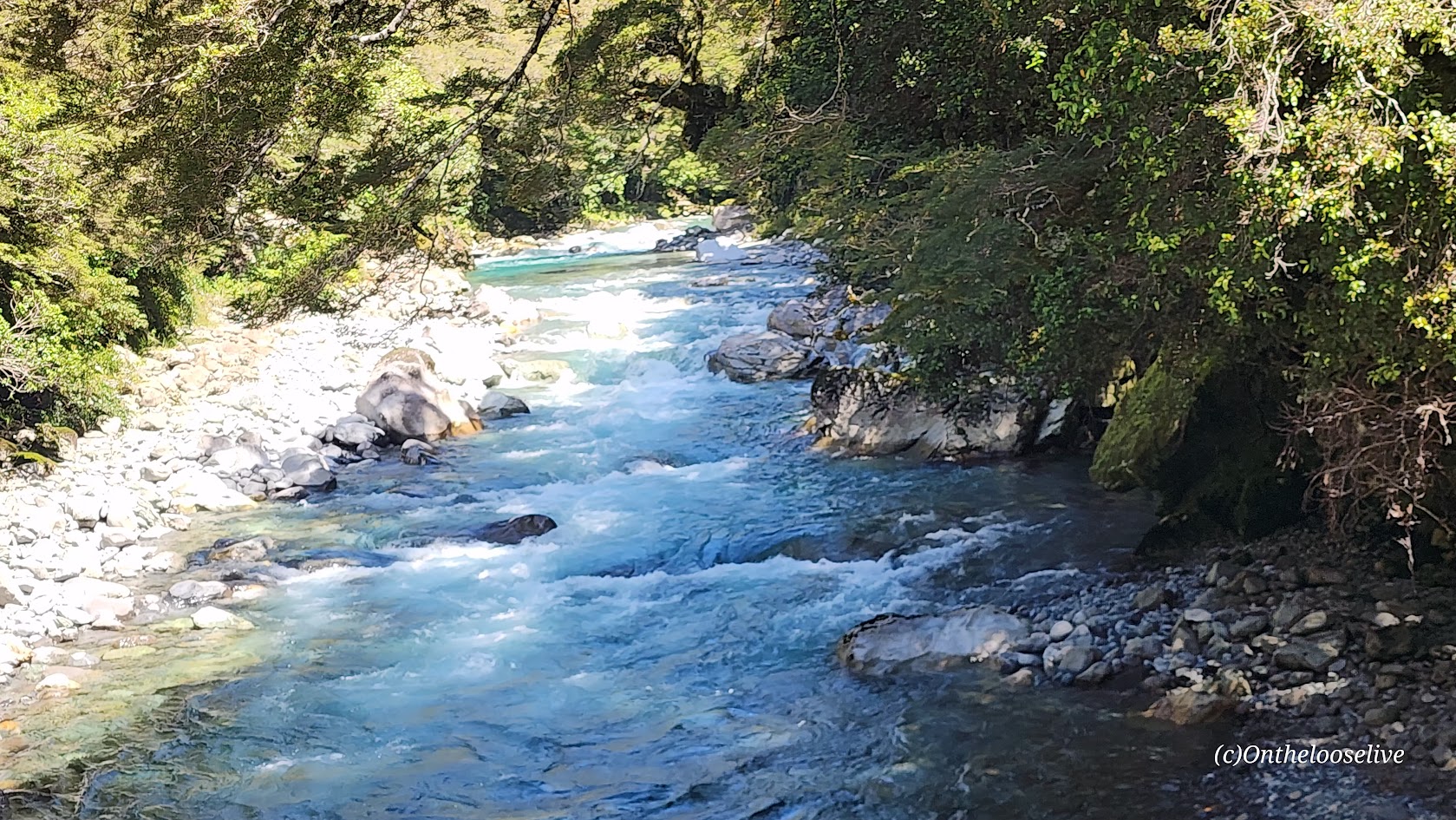
For the first half-mile, the path crosses a swing bridge over the Hollyford River and follows the magnificent, roaring Marian Creek, lulling you into a false sense of ease. The creek is dazzling, but dangerous too. (Sadly, in 2024, a 10-year-old girl slipped in and was washed away.)
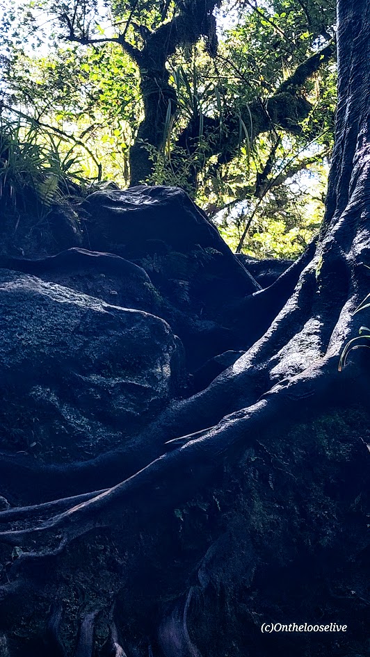
After the warning sign, you begin the slippery obstacle course, scrambling over wet roots, loose, slimy mossy rocks, and mud on a barely perceptible, steep trail. It is a painstaking, slow-motion journey, each step a careful calculation. I only have 1 photo of the trail because I needed to keep my hands free and my focus for fall / accident prevention. It’s the kind of hike best left to the nimble and sure-footed—reminiscent of some trails in the rainforests of Hawaii, but possibly more treacherous.
This hike stands in stark contrast to the meticulously groomed trails like the Kepler Track and the Tama Lakes Track that I hiked a few days before (some might argue those are over-groomed), but my knees and I have zero complaints.
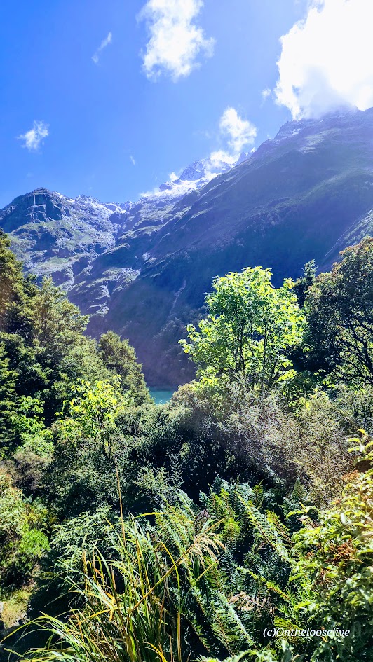
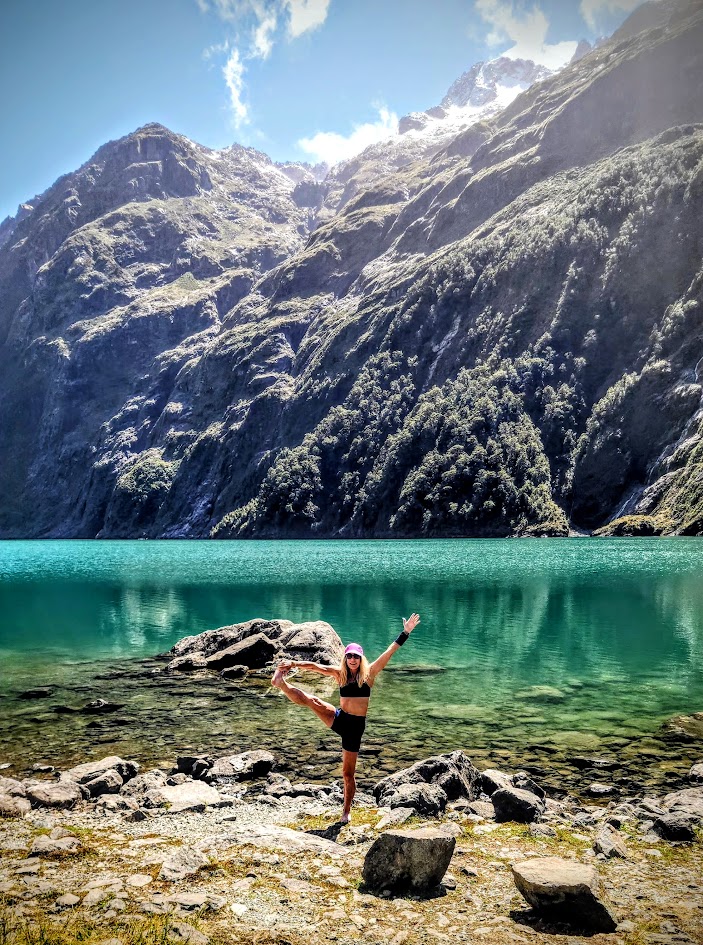
Everyone knows I love my alpine lakes and often go to great lengths to get to them. Lake Marian, with its granite glacier-carved basin, snow-capped peaks, and waterfalls, is spectacularly stunning, but having done it, I’m not sure I would choose it again. (Especially, with ALL the beauty of New Zealand to choose from and the more pristine “tracks” that don’t threaten a broken ankle, or leg at every turn…) For instance, after this hike, I went on the nearby Routeburn Track (one of New Zealand’s 11 “Great Walks”) to Key Summit (post to come). In retrospect, spending the day taking in more miles of that 20-mile track would have been time better spent.
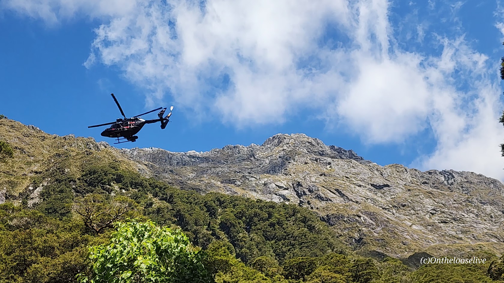
On the way down, a helicopter rescue was underway for a woman who had slipped and broken her leg. Unfortunately, the terrain was so rugged that they couldn’t maneuver the helicopter where it was needed. Instead, the rescuers would need to hike in to get her…(She was still waiting, hours later.) It made me think: perhaps a more effective warning sign for the hike would be one that shows the tally of rescues here. I have to imagine they are weekly, if not, daily in the high season.
While some might label me a risk taker, the risks I take are certainly becoming more calculated with each passing year…
Pro Tips: If you’re determined to do the Lake Marian hike, save it for your last day so an accident doesn’t ruin your entire vacation. Bring water shoes if you’re planning to go for an immersion, as there are sharp rocks at the shore. (I skipped my usual dip as the air was brisk, and I knew the hike back through the dense forest would be slow going, likely not enough vigorous movement to ward off hypothermia.)
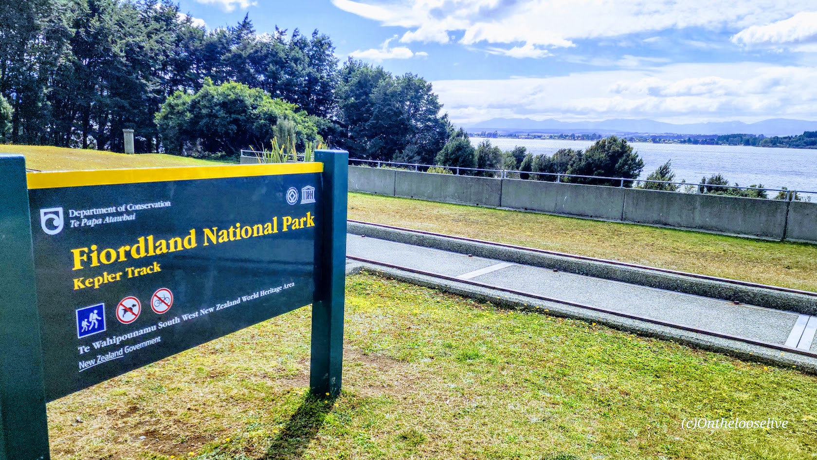
Getting There: The Marian Lake trailhead is located in Fiordland National Park, just 1km off Milford-Te Anau Highway (SH 94) on Lower Hlyyfor Road.
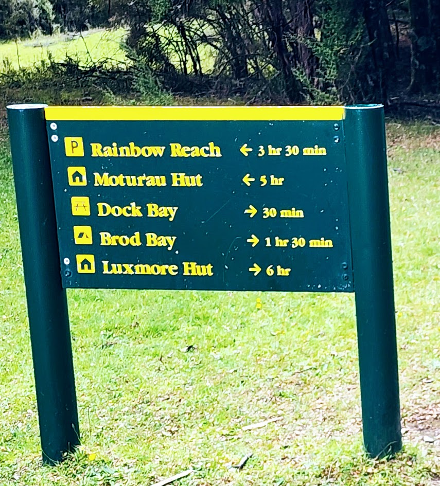
Distance from the Te Anau Control Gates to Luxmore Hut: 16 Miles Round-trip
Total Distance of the Multiday Loop: ~37 Miles
Elevation Gain: 3K Ft (Total for Multiday Loop: ~7K Ft)
Difficulty: Moderate (Depending on your fitness level.)
The 37-mile Kepler Track loop in Fiordland National Park is one of New Zealand’s 11 “Great Walks”—a network of meticulously maintained multi-day routes designed to showcase the country’s most spectacular landscapes. Across these trails, hikers move through a range of terrain, from the volcanic drama of the Tongariro Northern Circuit to Kepler’s alpine ridgelines and Fiordland views, coastal forests, glacier-carved valleys, and more.
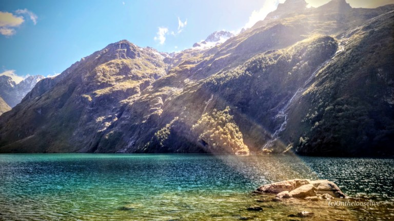
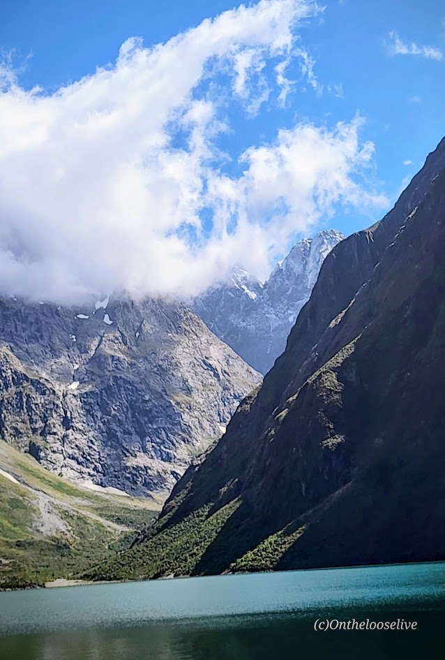
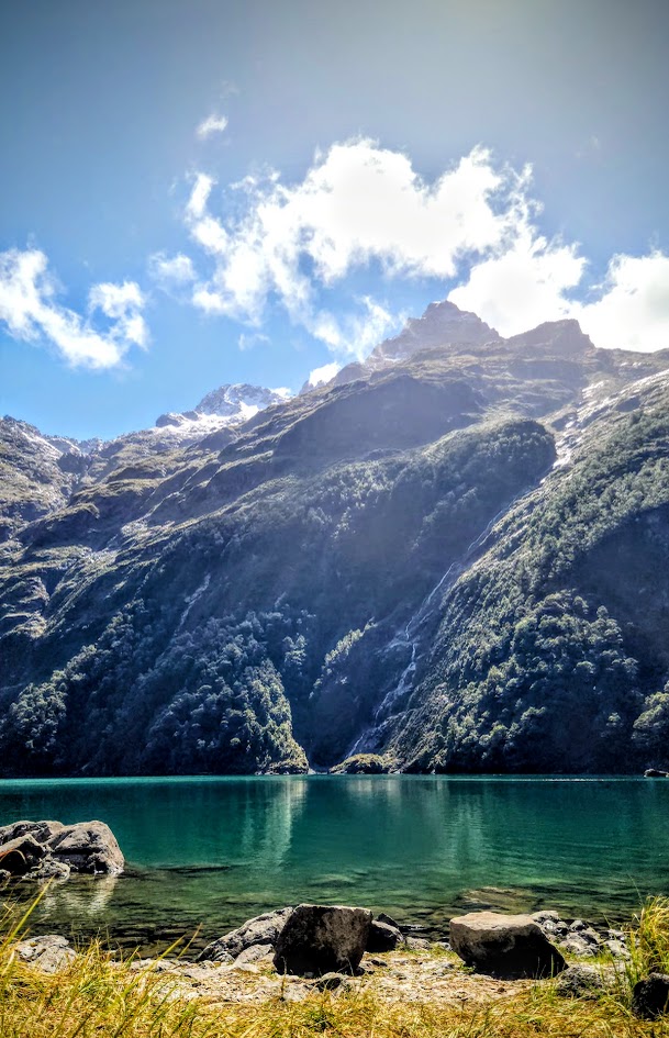
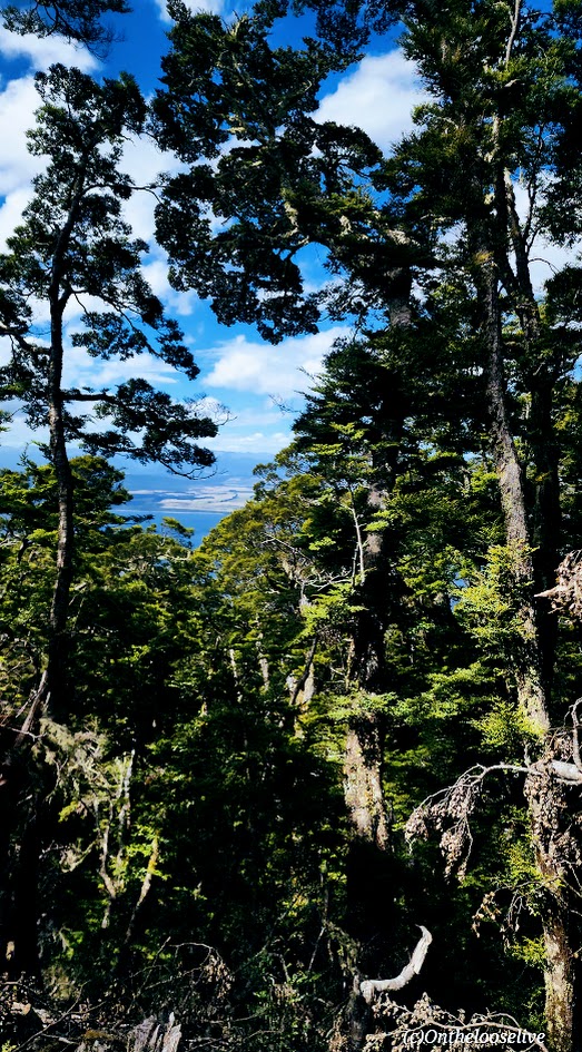
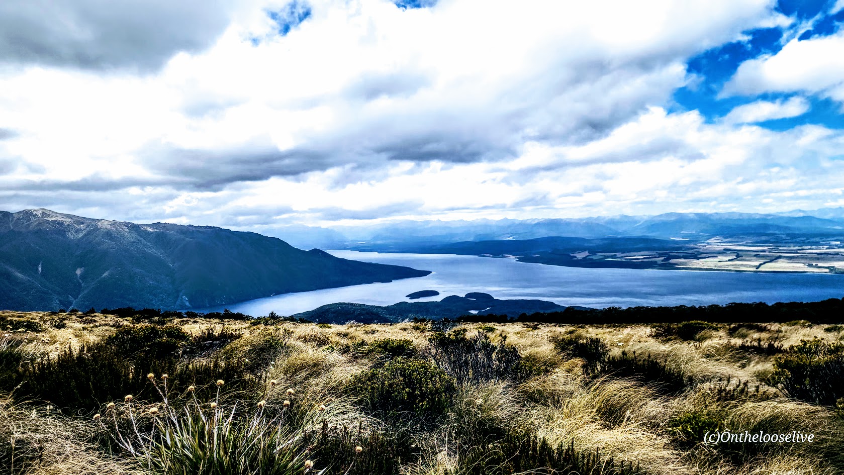
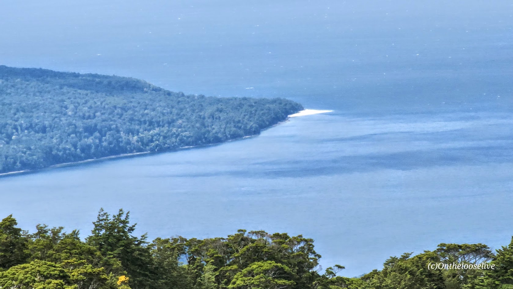
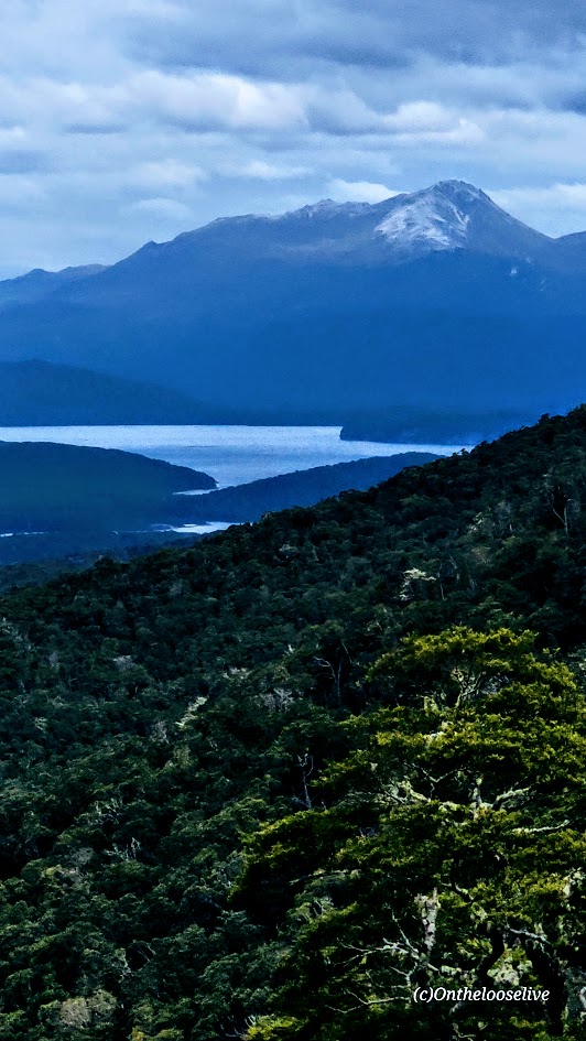
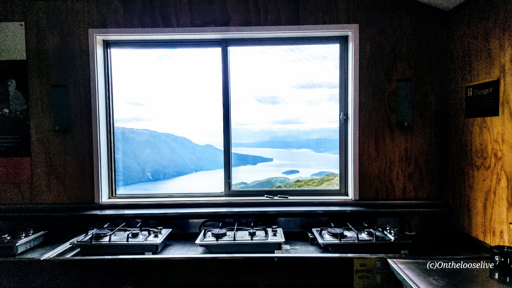
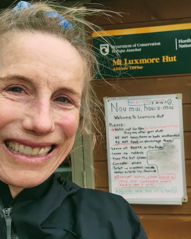
I hiked 16 miles of the Kepler Track to Luxmore Hut, which sits in a fully exposed alpine basin at 3,560 feet overlooking the deep blue expanse of Lake Te Anau and Fiords below.
You might question, as I did, “Alpine?” How can 3,560 feet possibly qualify? I had always assumed alpine conditions were strictly tied to high altitude. I was surprised to find that they’re not. “Alpine” refers instead to environments above the natural tree line that are defined by intense, volatile weather, strong winds, and exposure, regardless of how many feet above sea level they sit. That’s how, despite its modest altitude, the Luxmore Hut qualifies as alpine. (You’re welcome.) Both the Kepler ridgeline and Luxmore Hut are subject (as I was soon to discover) to the wild vagaries of Mother Nature…As is the Tama Lakes hike, I did on the North Island, with 4,724 feet being the high point there.
A “walk in the park” until…
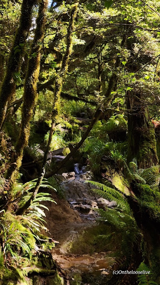
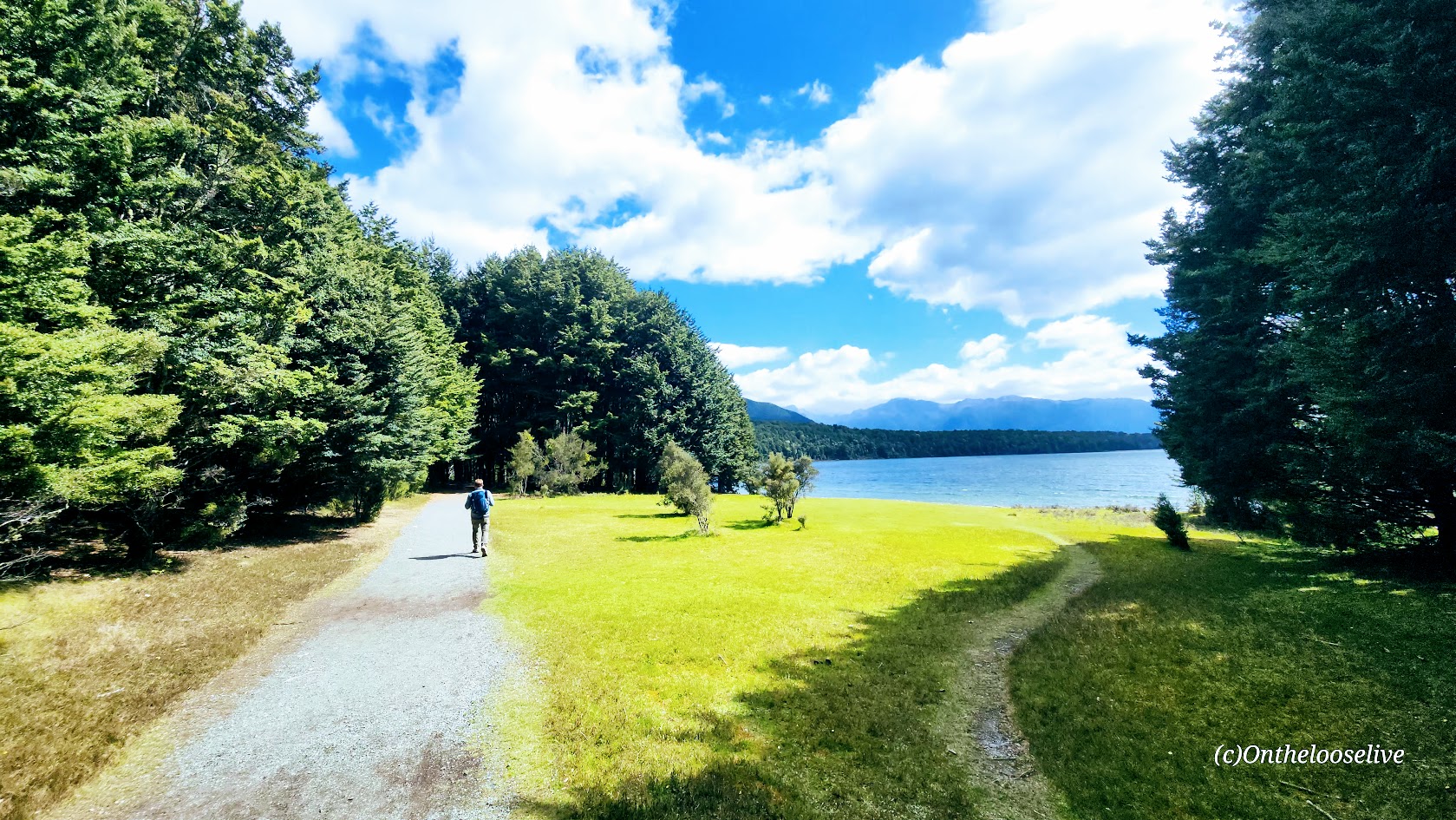
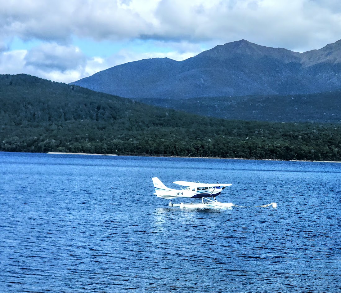
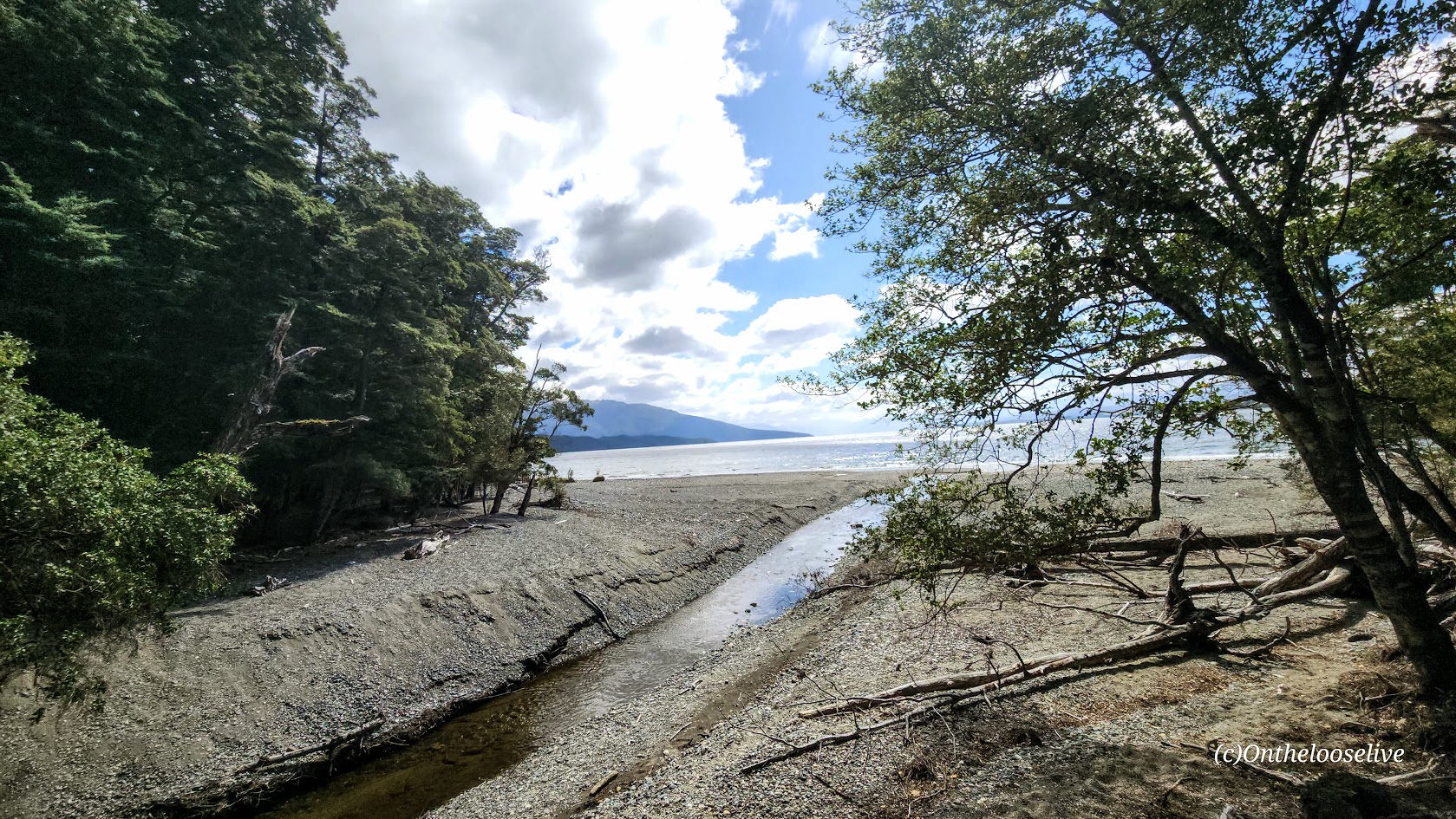
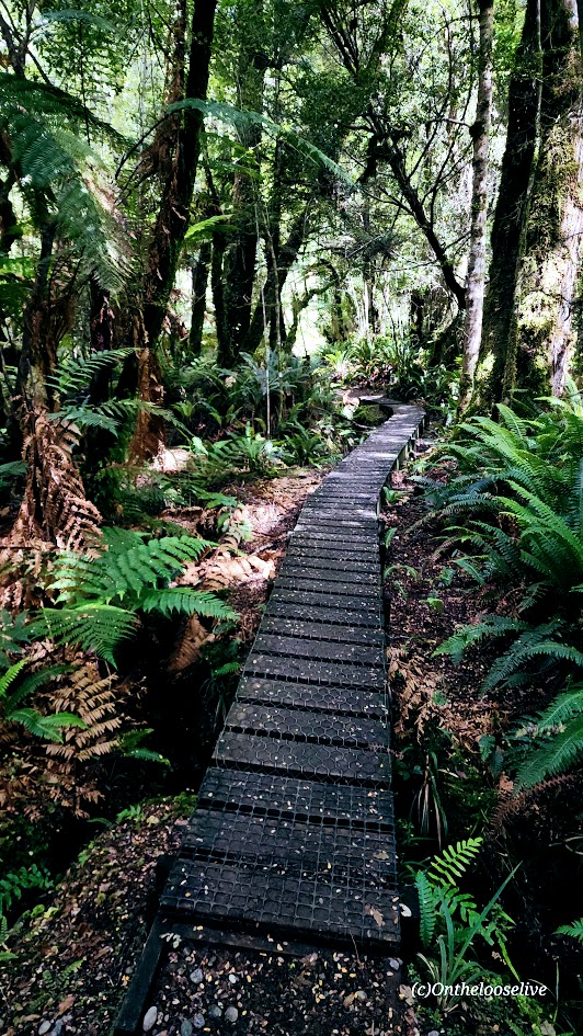
The hike begins as a true “walk in the park,” following pristine, well-groomed trails through beech forest and fern-lined trails that never stray too far from the lovely, sparkling shores of Lake Te Anau, the second-largest lake in New Zealand and the largest in the South Island.
In a mile and a half, the path brings you to the beach of Dock Bay (an easy family destination for picnics and swimming). At the 3-mile point, you’ll reach Brod Bay, which has 15 tent sites (reservations required), a cooking shelter, picnic tables, and a couple of port-o-potties. Despite the picturesque beauty, you may not want to set up camp here literally or figuratively as the sandflies are described as intense, relentless, and ferocious. I didn’t linger to find out.
Pro Tip: If you’re short on time and lucky enough to catch a water taxi from Te Anau to Brod Bay, you can cut off the first 3 miles of the hike and start at Brod Bay.
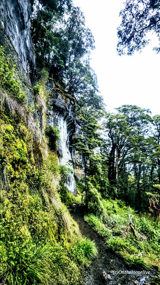
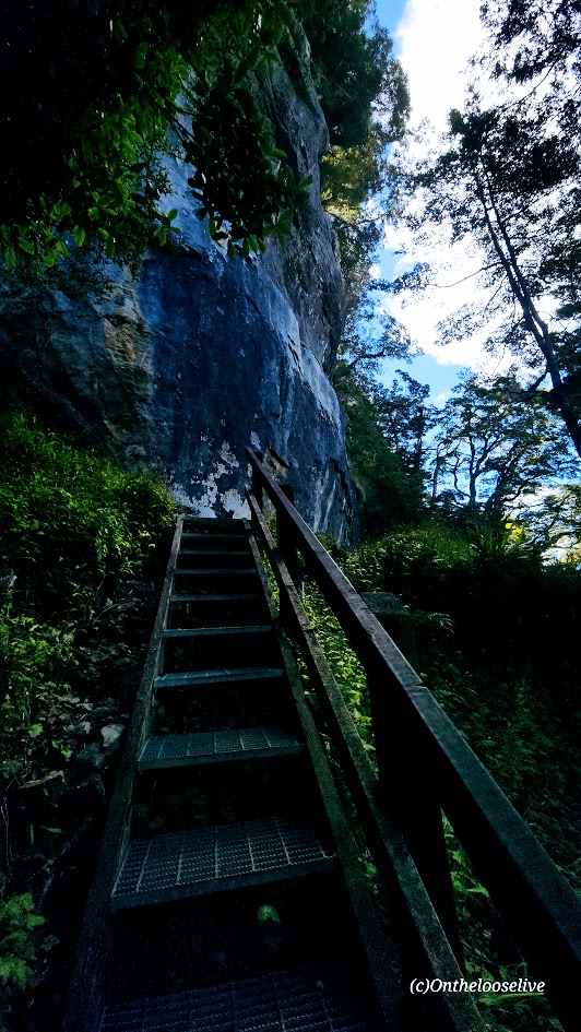
From Brod Bay, it’s 5 miles and 2,791 ft elevation gain to the Luxmore Hut. This is where the climb begins, but the grade is gentle for the most part, and there’s a short set of stairs to climb.
From the forest, you emerge onto the tussock-covered ridgeline with spectacular views of Lake Te Anau and Fiordland.
Pro Tip: Be prepared for sudden weather shifts with strong winds, rain, hail, or snow at the alpine level.
The moment I emerged from the protection of the forest onto the ridge, I was nearly blasted off it by cold, gale-force winds. The cloud bank was coming in fast. I had about a mile to go to reach the hut and was about to turn around when I ran into a hiker on his return trip who told me, “It’s just over the next hill…” (Note, in the video below, I’m a bit tongue-tied due to exertion and the wind; it’s Luxmore Hut, not Luxemburg Hut.)
I made it to Luxmore Hut, but I didn’t linger there either, as I wasn’t sure how bad the weather would get. Rain started mixing with the wild wind as I scurried back across the ridge.
As soon as I dropped into the forest, it was like being transported to a safe haven. Yes, it was still raining, but not much moisture was making it through the forest canopy, and almost none of the wind was getting through.
By the time I reached Brods Bay, though, the rain was heavier and more persistent. The previously serene lake looked more like an ocean with surfable white-water waves clobbering the shore. Happy, I wasn’t camping there and grateful for my rain jacket.
The Great Walks season is late October to April. Winter (May–October) is for experienced mountaineers only-requiring experience with snow, ice, avalanche hazards, and navigation. Consensus is that the moderate Kepler Track is more difficult than the Milford and Routeburn Tracks. While I did slightly less than half the miles and elevation gain of the whole Kepler Track, if the other half is similar, I’d rate it easy to moderate. For context, I’m used to the rugged terrain of Utah. So far, the groomed foot-friendly trails of the Kepler Track and the Tama Lakes Track have blown me away (almost literally, as you’ll see from the videos above) with how easy they are on the feet, knees, and body. I wore my Nike trail runners. It was dreamy, even in the wind and rain.
Getting There: The trailhead is at the Te Anau Control Gates a 3 mile drive or walk from Te Anau town center.
With its many restaurants and shops, the village of Te Anau itself is charming for a walkabout. Plenty of spots to come in out of the rain and refuel after a full, windy, wet day on the trail. Italian was the call that evening.
Happy Trails! Stay tuned for more New Zealand adventures!
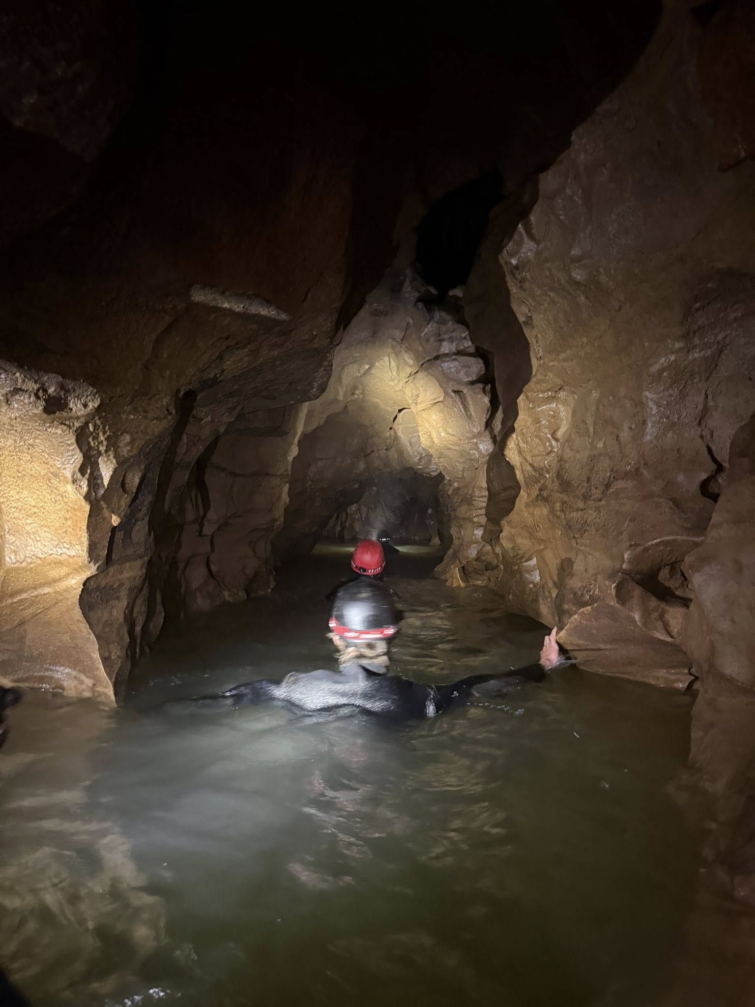
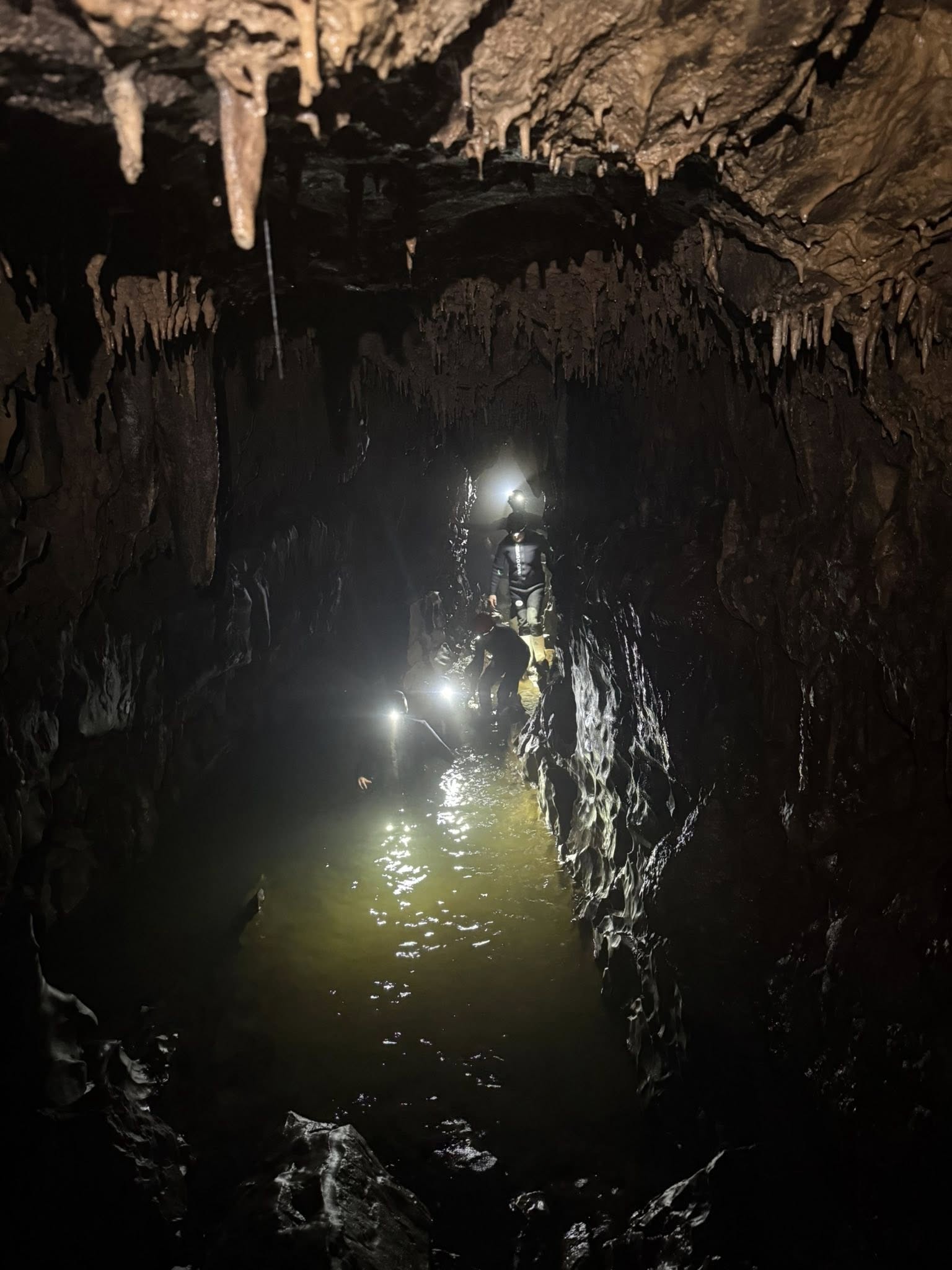
Disclaimer: none of the photos were taken by me, as we had to leave our cameras behind. In hindsight, that was for the best—having both hands free was essential given the slippery, wet, uneven, rocky terrain, and the crawling, wading, and swimming sections.
First Some Cave Context
Years ago, while traveling in Thailand, I explored a couple of miles of the Chiang Dao Cave—fascinating and not especially sketchy (unless you count the thousands of bats and the one tight crawl space).
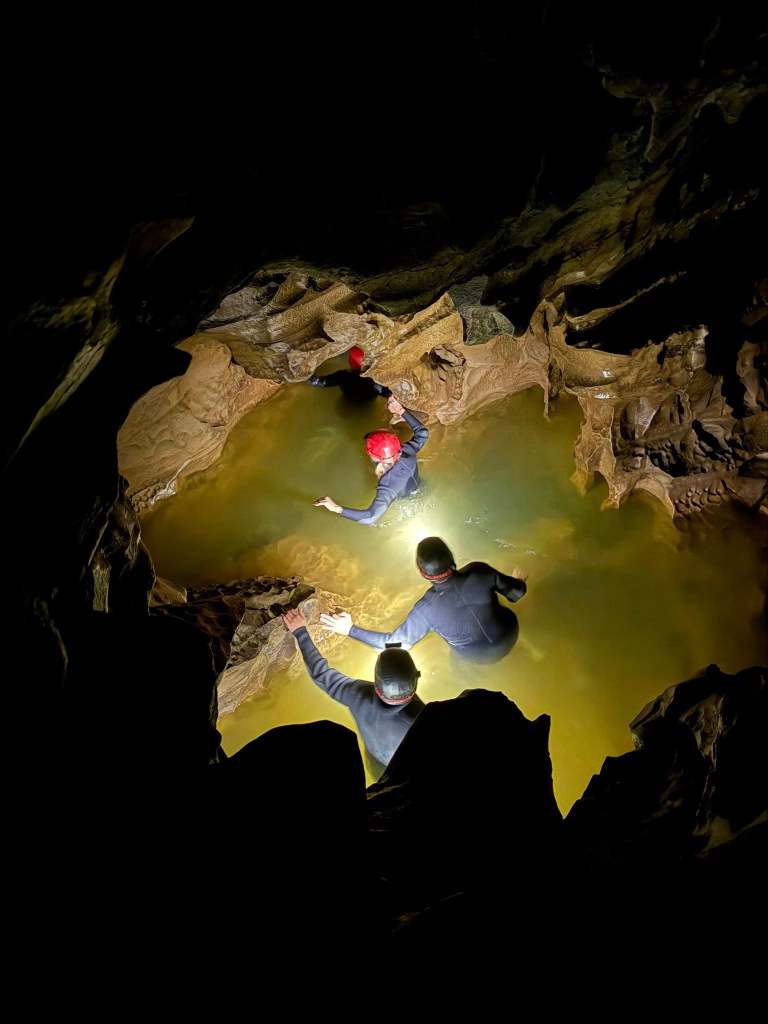
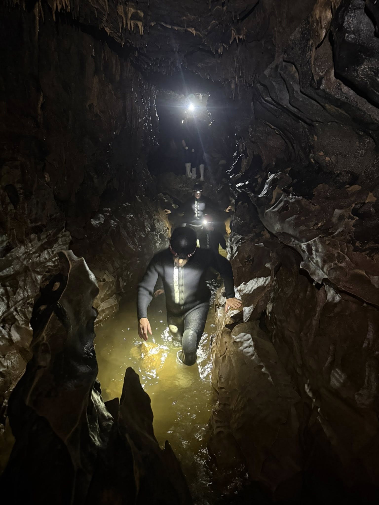
Well, nearly ten years later, here I am at the Waitomo Cave Experience. My travel partner chose this one, and I wasn’t about to be a spoil sport. So, I wrestled myself into a thick, heavy wetsuit, squeezed on the white rubber “go-go” boots, and trudged off in slow motion with the rest of our oversized sloth of a group, crossing the oddly undulating pasture—hinting at the contours of the cave below—toward the woods.
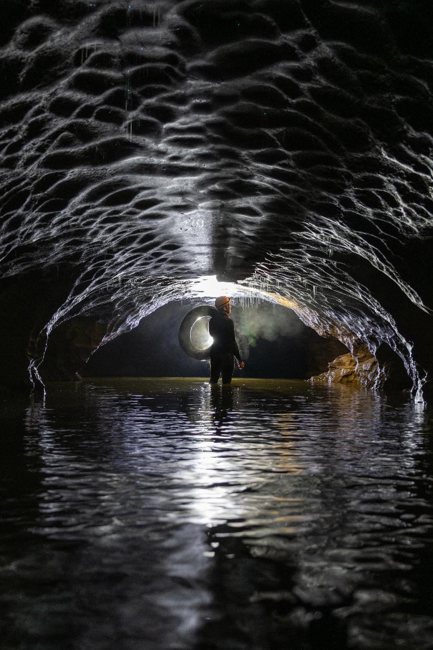
At the edge of the woods, we climbed down a steel ladder, descending into the pitch-black, damp abyss of the Okohua Cave, and the adventure began… We switched on our headlamps—bright third eyes piercing the darkness and, just as often, blinding one another.
After casually warning us to stay put if anything happened to him, our guide led us into the narrow, watery “slot canyons” of the 30-million-year-old limestone grotto.
“Watch your head!” “Watch your footing!” And “Hands off!” the dripping stalactites and other stalagmite formations. It was slow going.
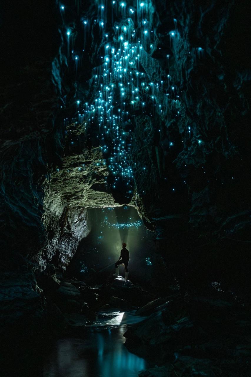
We stopped several times to turn off our headlamps and gaze up at the dark “sky” bespeckled with tiny lights from thousands of bioluminescent Arachnocampa luminosa (glow worm) larvae. (“Better worms than bats, I say.”) It was a lovely sight indeed.
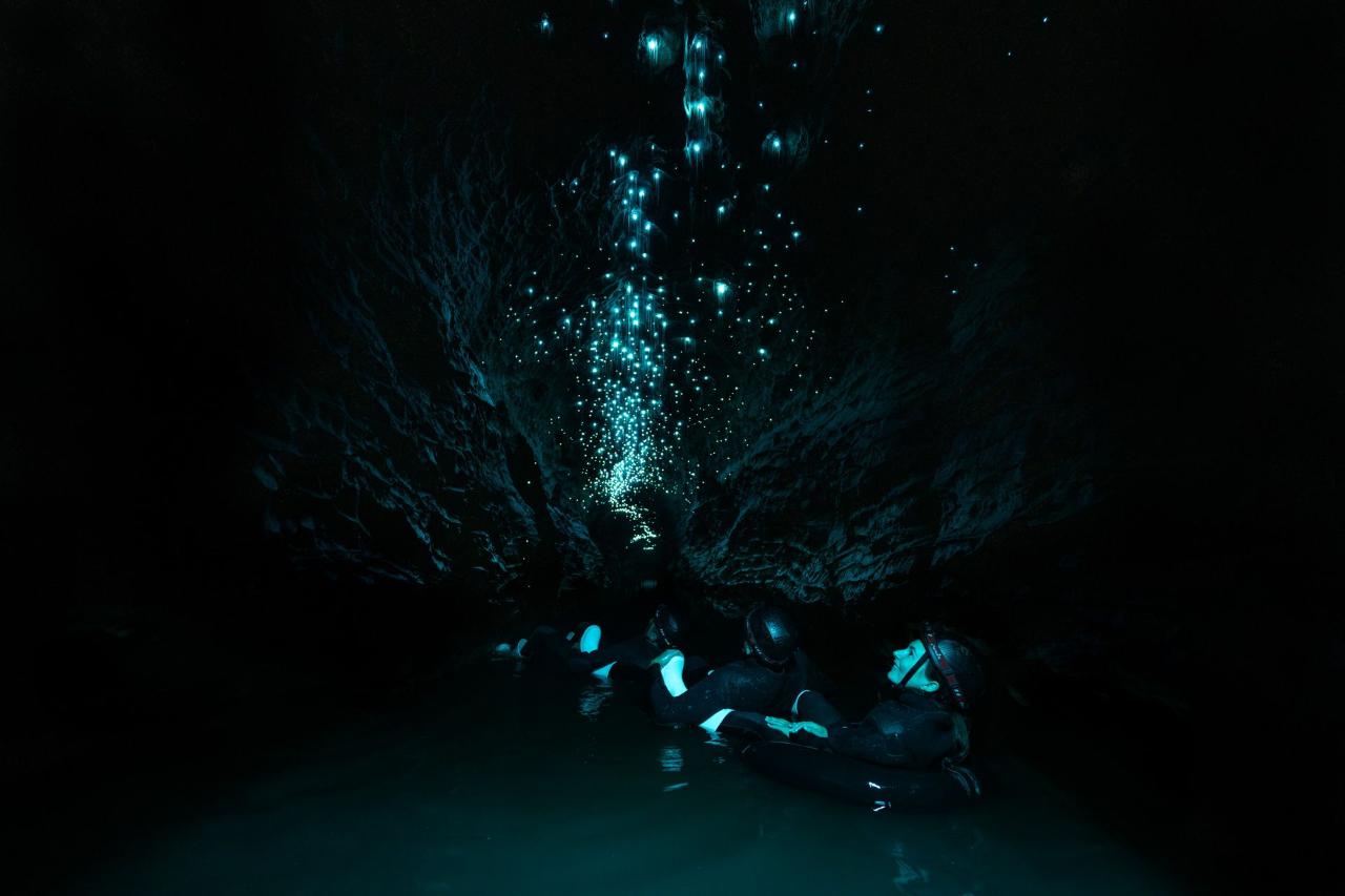
Later, we’d enter a canyon with deep water where inner tubes were waiting for us for a cruise down glow worm alley. It was magical and mesmerizing. The once chatty group fell silent in awe.
If you’re slightly claustrophobic like me, adding water to the equation amplifies it…as do the low ceilings and narrow tunnels. Of course, learning that you’ll be underground for over 3 hours and knowing that you can’t simply, easily, and quickly exit also contributes to that constricting feeling…Not to mention the heavy wetsuit weighing you down…
As a yogi, I practiced my relaxation breathing and tried to stay in the moment. There were a couple of opportunities to bypass the tighter, belly crawling, face-first-into-the murky water routes, but, well, where’s the fun in that?
It was an amazing adventure for sure, but I probably won’t be going into another cave anytime soon…(Yeah, I know…)