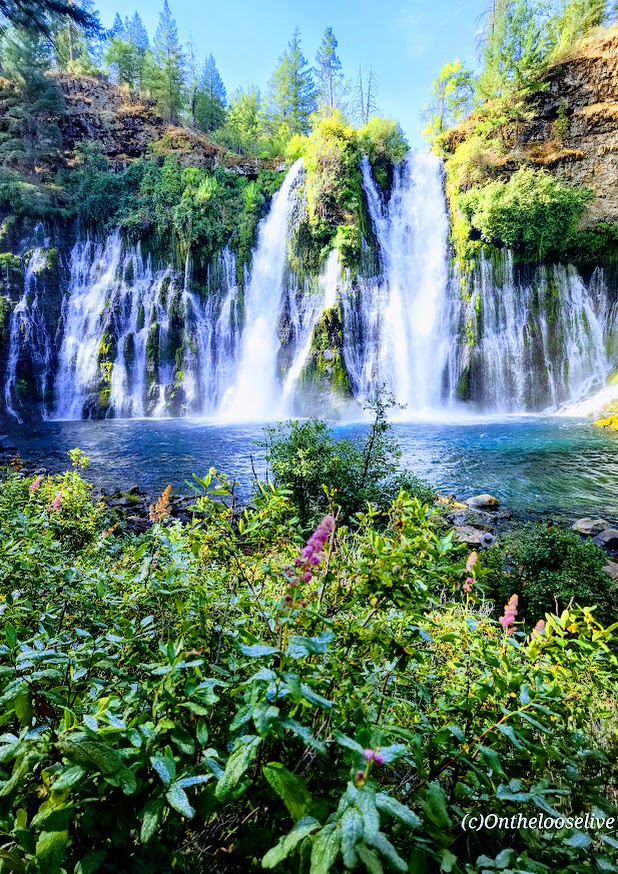
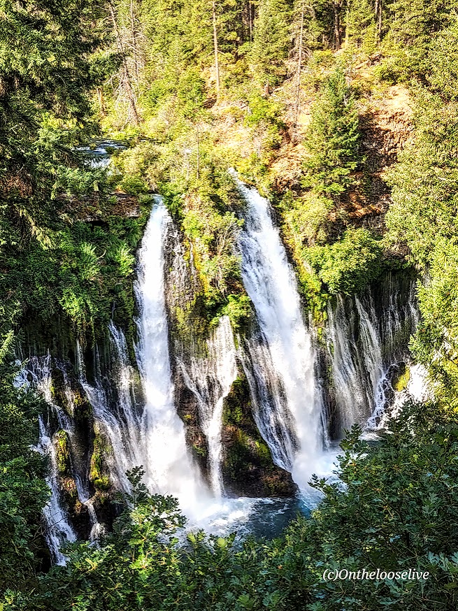
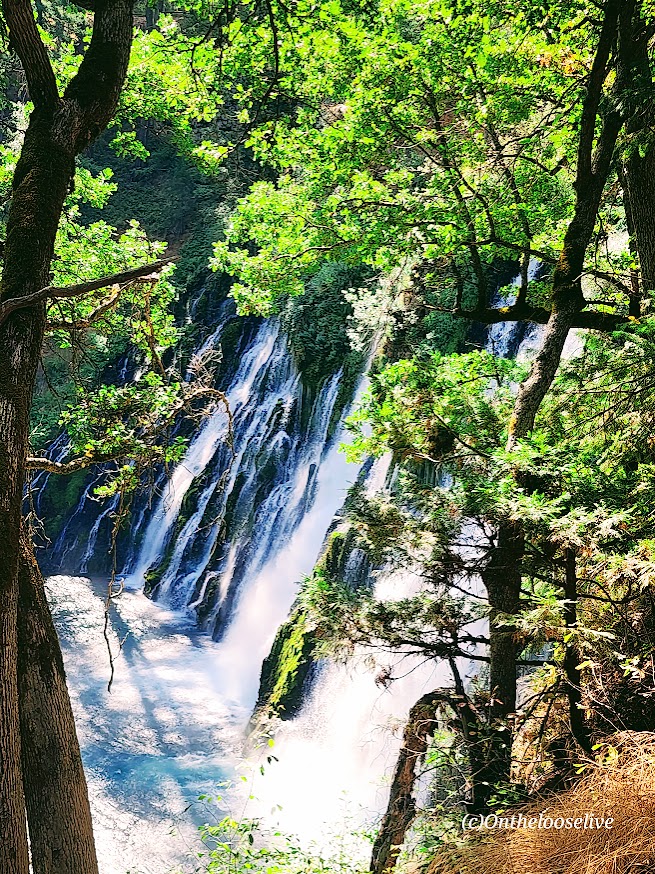
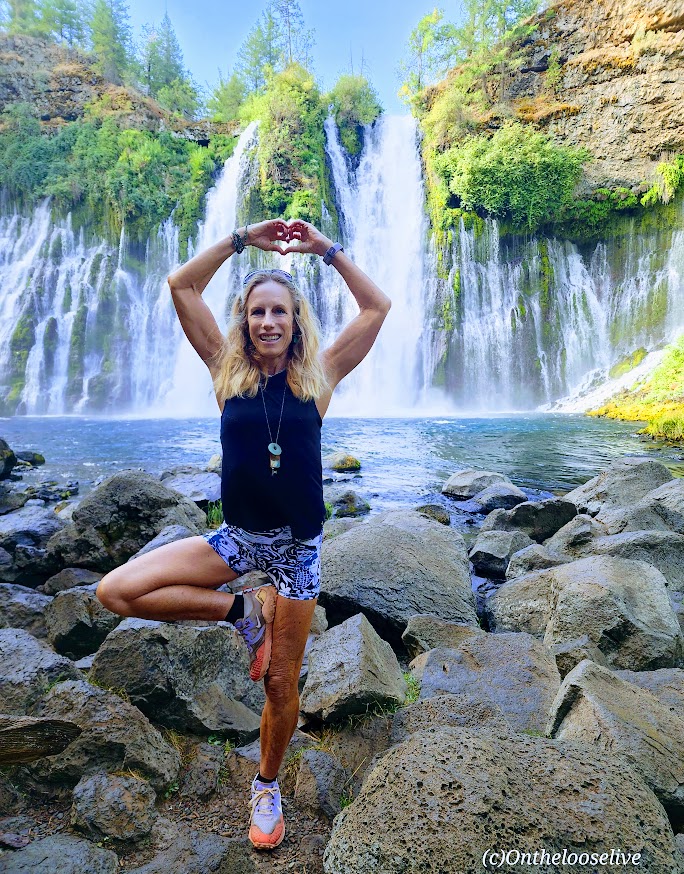
Wowza, I’ve chased a lot of waterfalls in my time, but Burney Falls stands out for its terraced, storybook, enchanting beauty.
And talk about an easy chase —huge reward for minimal effort— easy 1-mile round-trip stroll with an elevation gain of 161 ft
At 129 feet high, Burney Falls is the main attraction of California’s McArthur-Burney Falls Memorial State Park. I’d never heard of it, but it has to be one of the most gorgeous waterfalls that I’ve seen. It has an impressive daily flow of 100 million gallons, and the water temperature ranges from 42 to 48 degrees. While it was tempting, I didn’t take the cold plunge this time.
Apparently, there are 5 more miles of trails in the park, but it’s really all about the waterfall. If you’re adventuring in Lassen Volcanic National Park, Burney Falls is just ~40 miles North off of CA-89.
Notes: Day-use parking fee: $10. No dogs are allowed on trails or day-use areas. Go early; the small parking lot fills up fast.
Getting there: It’s off CA-89 N. (~40 miles from Lassen Volcanic National Park)
Difficulty: Easy to moderate, depending on your fitness level.
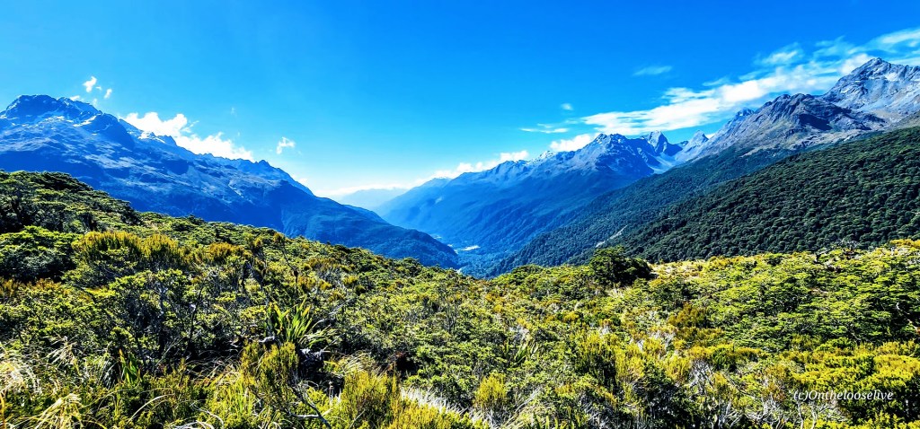
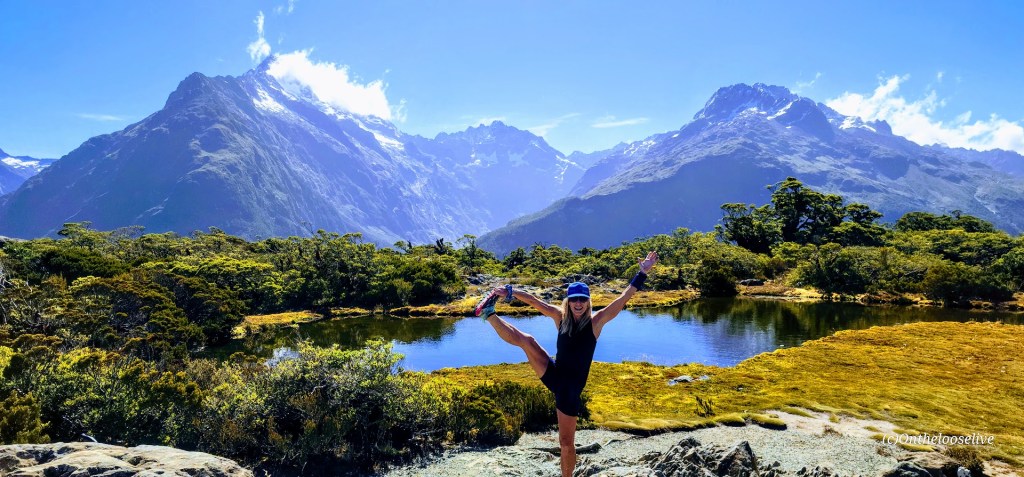
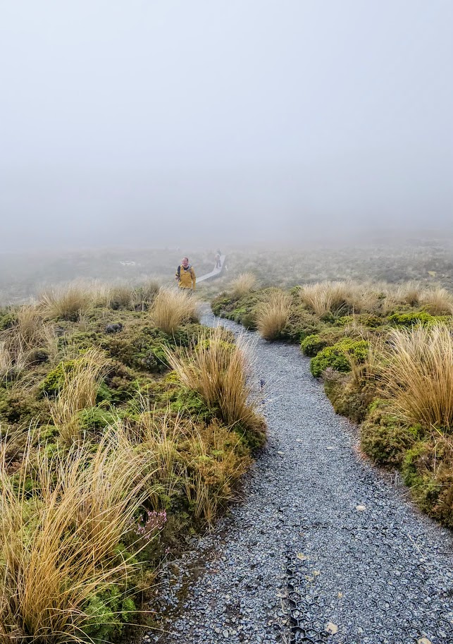
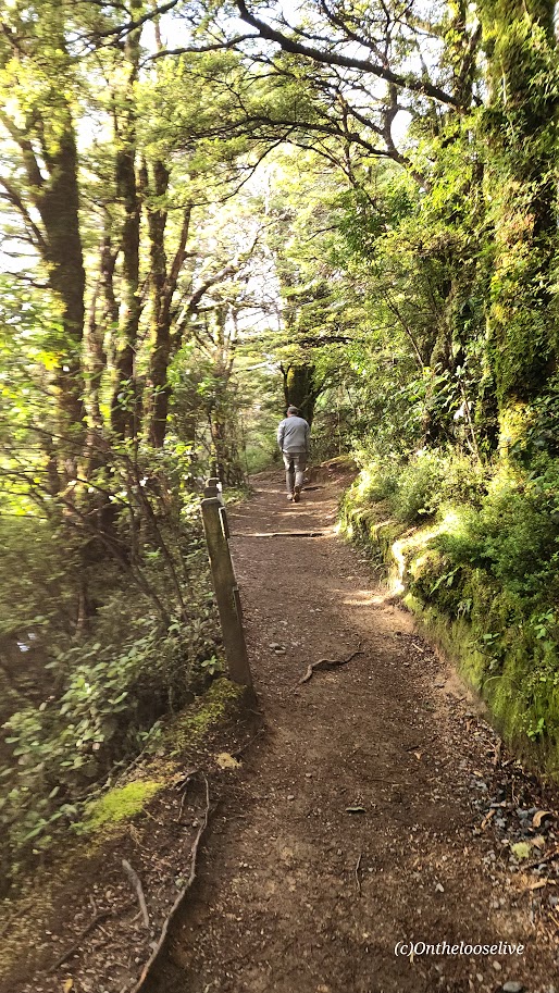
I took a microsample (~10%) of the Routeburn Track Great Walk on my afternoon hike to Key Summit. Having just scrambled up the slick, rugged obstacle course to Lake Marian, it was a refreshing relief to stride up the gravel path to Key Summit.
The climb is gradual and is rewarded with sweeping views of the Hollyford Valley, alpine tarns (lakes/pools), and Fiordland’s panoramic rugged peaks.
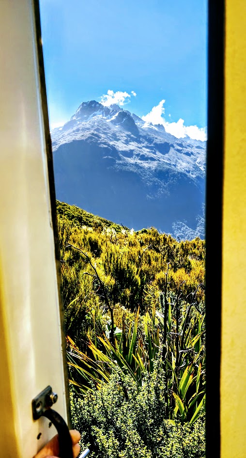
Possibly the best Port-o-Potty view ever!
Looking back, after doing both Lake Marian and Key Summit, I might have preferred covering more distance on the Routeburn Track vs the painstaking, slo-mo route up to Lake Marian. (Not the most adventurous take, I know.) I tend to enjoy a more vigorous pace—the former trail runner in me still craves that rhythm. Tortuous terrain that slows my flow tends to be more frustrating than fun for me. Lately, I’ve also been weighing the “risk versus reward” factor. That said, Lake Marian is undeniably spectacular, and the hike has a sense of challenge and excitement that Key Summit doesn’t.
That’s the beauty of the great outdoors: you get to choose your own adventure. And in New Zealand, there’s no shortage of ways to find it. Stay tuned for more Great Walk sampling on the South Island!
Difficulty: Easy to Moderate (depending on your fitness level). The trail is so gradual, I didn’t notice the elevation gain until the last half-mile climb up loose, rocky scree to Upper Tama Lake.
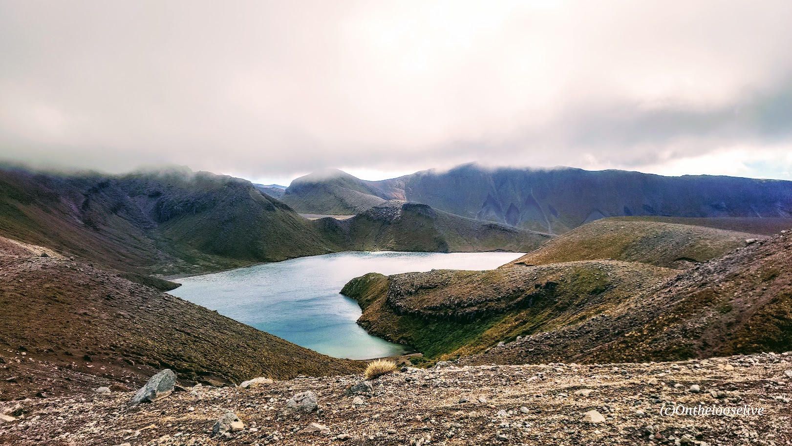
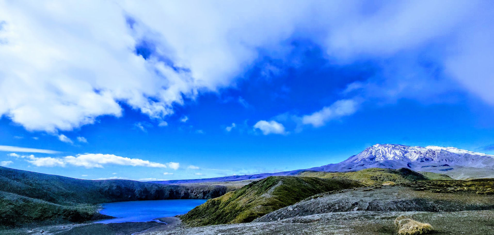
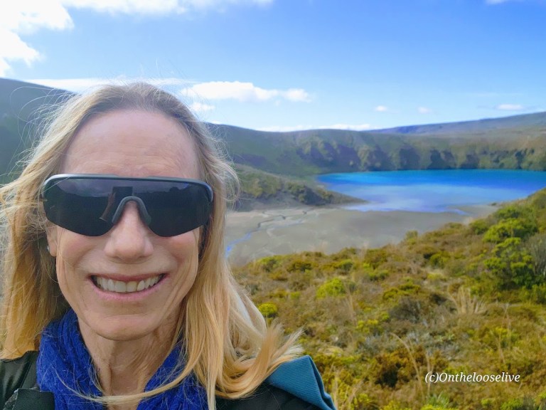
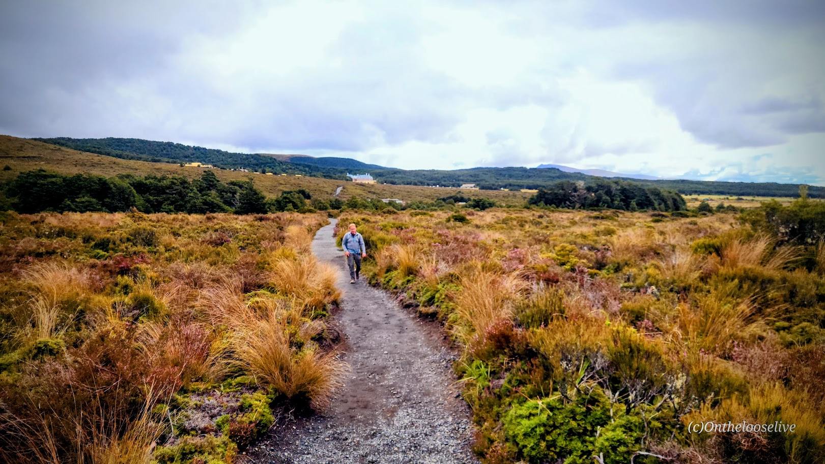
When we learned that the Tongariro Alpine Crossing—widely considered the park’s top hike—was closed due to high winds and poor weather, the Tama Lakes Track became our backup plan. It didn’t disappoint. (AllTrails rates it #3 behind both the Tongariro Alpine Crossing #1 and #2 Taranaki Falls. I would rate it higher than the falls. But they’re both gorgeous!
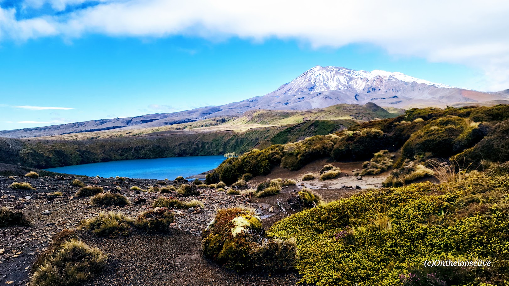
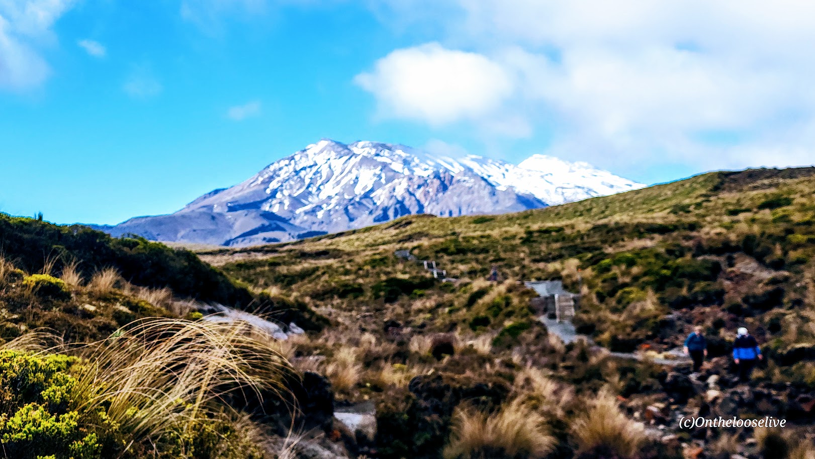
With sweeping views of Lower and Upper Tama Lakes, Mount Ruapehu and Mount Ngauruhoe, and the narrow gorge of the dazzling Wairere Stream, the hike more than delivered. While the Tongariro Alpine Crossing may be more dramatic, it’s also barren and often crowded. Of course, there were a fair number of people on the Tama Lakes Trail, likely due to the Crossing’s closure.
For most of the route, the terrain is a relatively gentle gravel path that’s runnable, with easy footing.
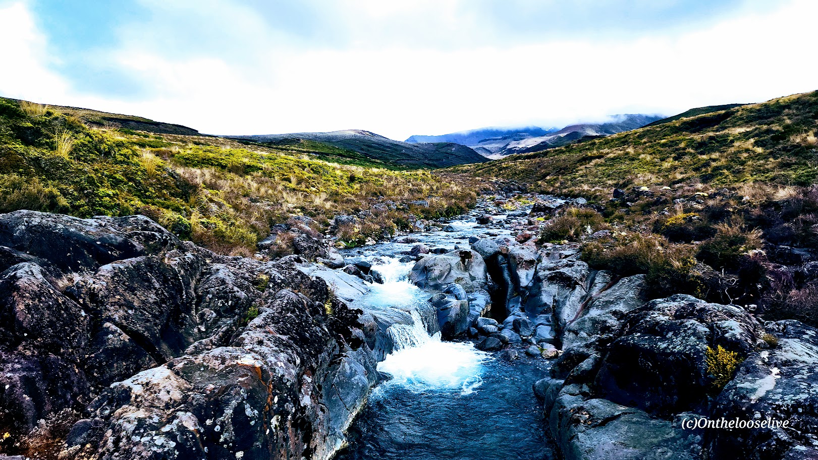
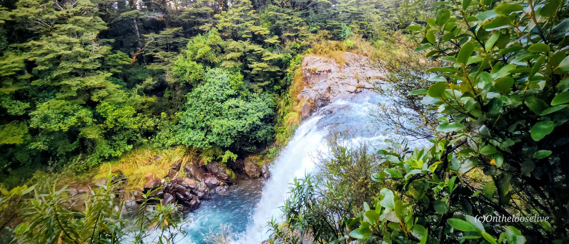
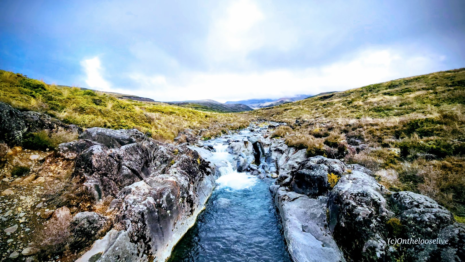
An invigorating scene, the trail crosses over the narrow gorge of the dazzling Wairere Stream.
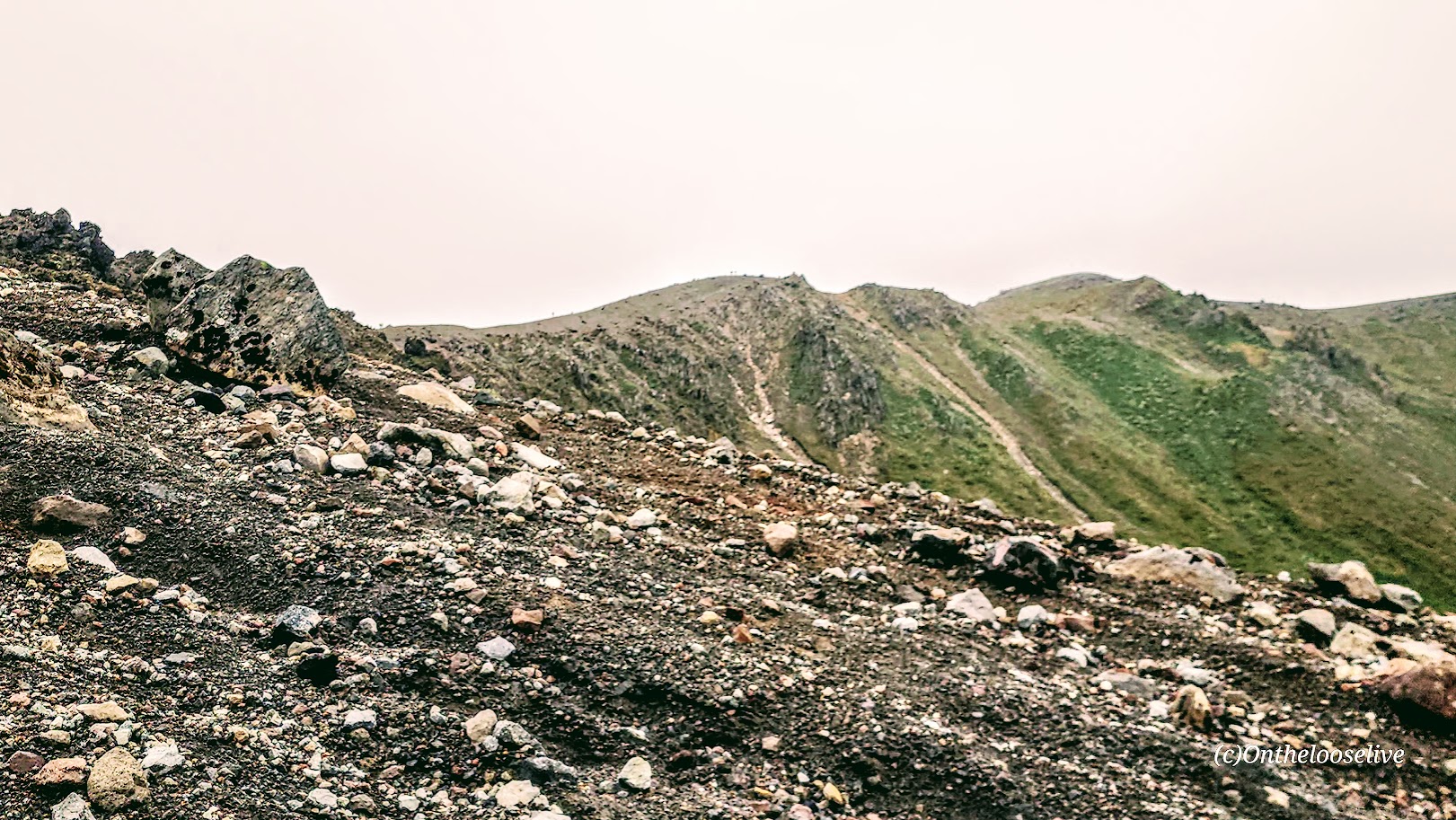
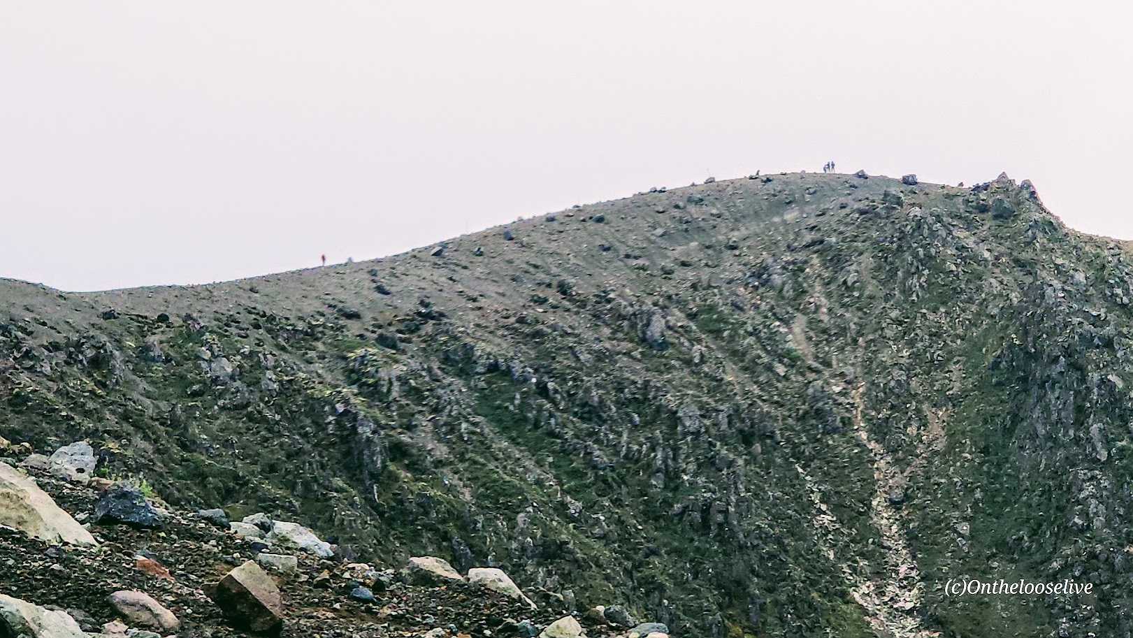
That changes during the final half-mile climb from Lower to Upper Tama Lake, where the trail steepens into loose, rocky scree that demands more attention and effort.
Here’s a video of the view from Upper Tama to Lower as the weather was changing.
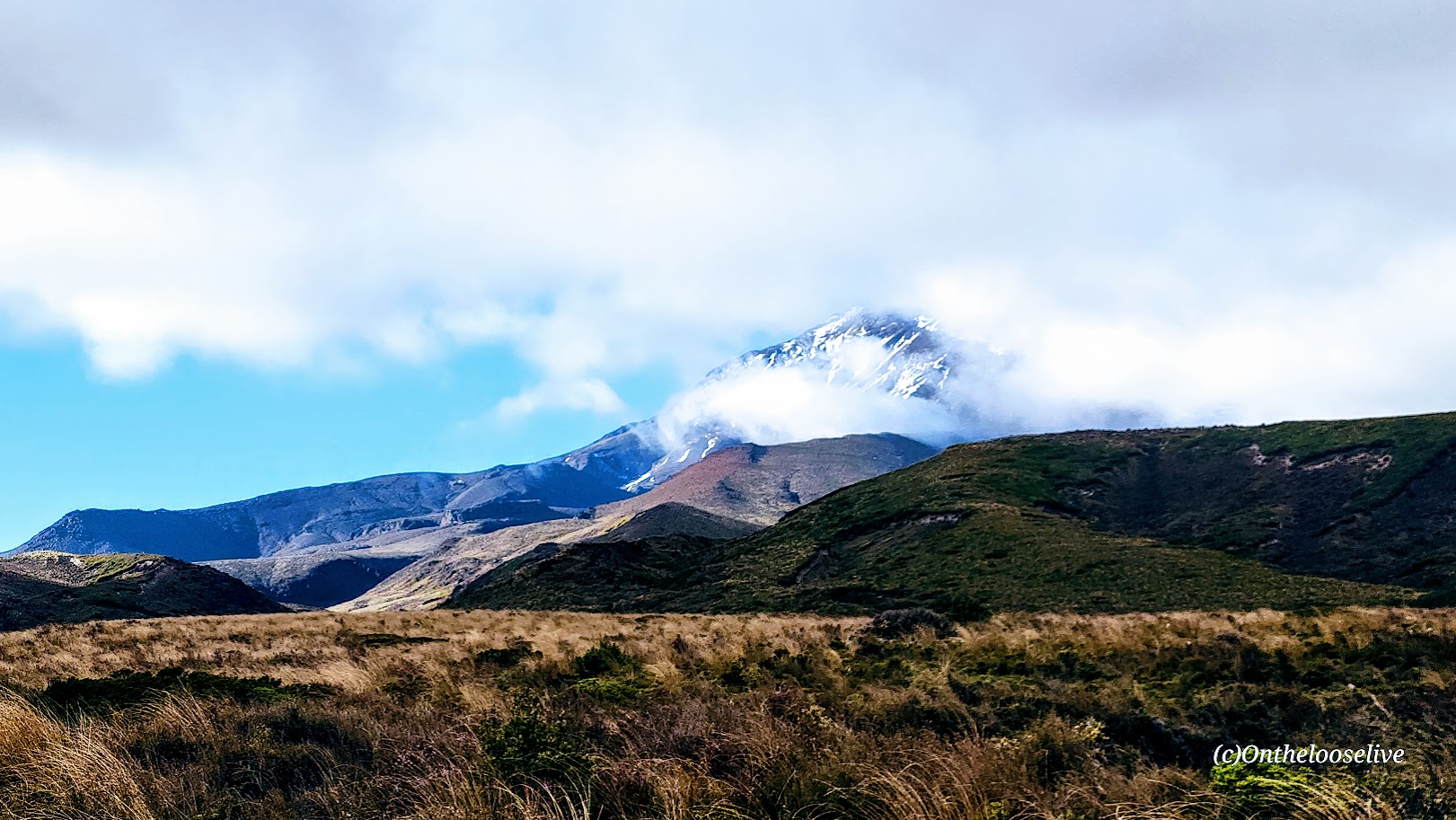
You can also check out Taranaki Falls along the way. I highly recommend doing it on the way back, as the weather moves quickly here. In fact, it can turn in an instant, as I experienced, waiting for a friend to make the climb to Upper Tama. I watched his bright yellow rain jacket vanish into a wall of fog. One moment, the skies were clear; the next, the fog rolled in, and visibility was nil.
It’s easy to see how conditions like this can catch hikers off guard—whether from sudden exposure, hypothermia, or simply losing their bearings. Come prepared with layers and proper rain and wind gear, and don’t hesitate to turn back if conditions deteriorate.
Getting there: The trail starts from the road about 100 yards below the Whakapapa Visitor Centre.
Founded in 1887 and officially established in 1894, Tongariro is New Zealand’s oldest national park and the 4th in the world. It is a dual UNESCO World Heritage site, recognized for both its outstanding natural volcanic features, including 3 active volcanoes: Mt. Ruapehu, Mt. Ngauruhoe, and Mt. Tongariro, and its cultural significance to the native Māori people.
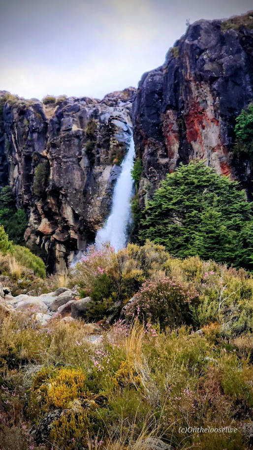
Tawhai Falls Distance: < .50 Mile (Ranking 6th of the Top Hikes in Tongariro National Park per AllTrails.)
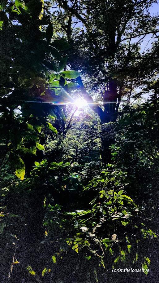
Up for a tame, super short stroll to a lovely waterfall? Tawhai Falls won’t disappoint. It’s an easy walk through the forest on a smooth trail to see the gorgeous, rushing, crystal-clear, turquoise waters of this 42-foot-high waterfall. You can take in the views from the top viewing platform and then follow the water’s journey to the base of the falls.
Getting to Tawhai Falls: It’s right off the SH48, about 2.5 miles below Whakapapa Village. Look for the large sign.
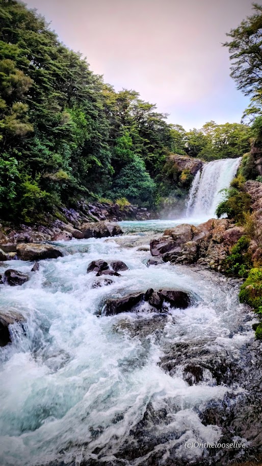
Taranaki Falls Distance: 3.73 Miles (The #2 Top Hike in the Park per AllTrails.)
Another tame and short walk to a waterfall is Taranaki Falls. Here, you’ll walk through the tussock (a golden, coppery red ornamental grass that is native to New Zealand) and alpine shrublands, enjoying expansive views of mountains and the beech forest, until you come to the star of the show— the dramatic 65 ft Taranaki Falls tumble down from top of the volcanic cliffs (formed by the Ruapehu eruption of 15,000 years ago) to a natural, boulder-ringed pool below.
In my opinion, this loop is most scenic clockwise, with the reward of rounding a corner for the big reveal (versus the anticlimax of seeing the comparatively anticlimactic top of the falls first). From the falls, the track climbs up to loop back, or you can continue your hike on the Tama Lakes Track (post to come).
Getting there: The trail starts from the road about 100 yards below the Whakapapa Visitor Centre.
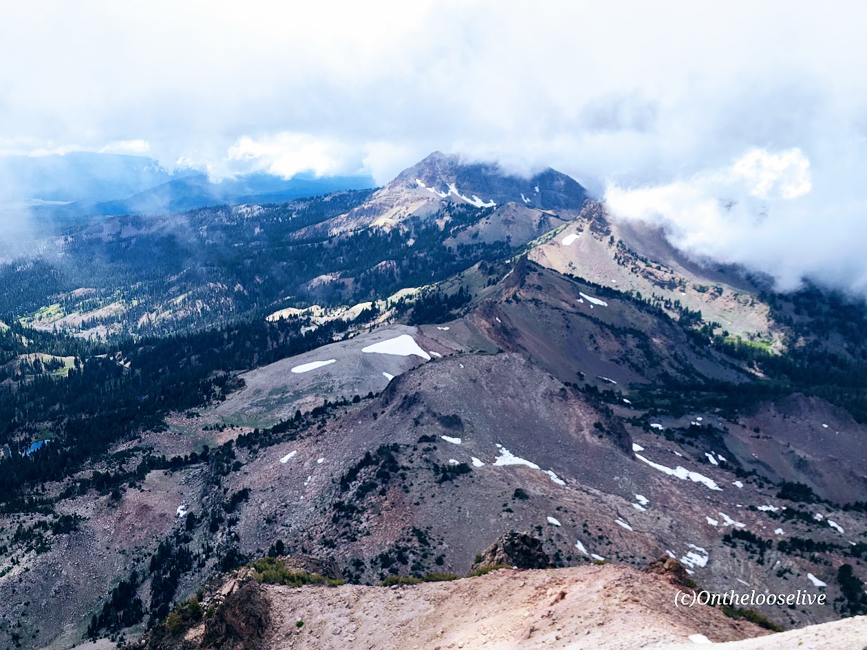
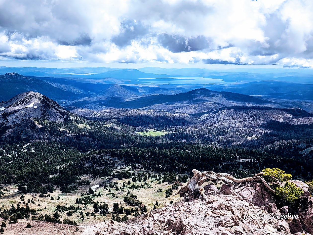
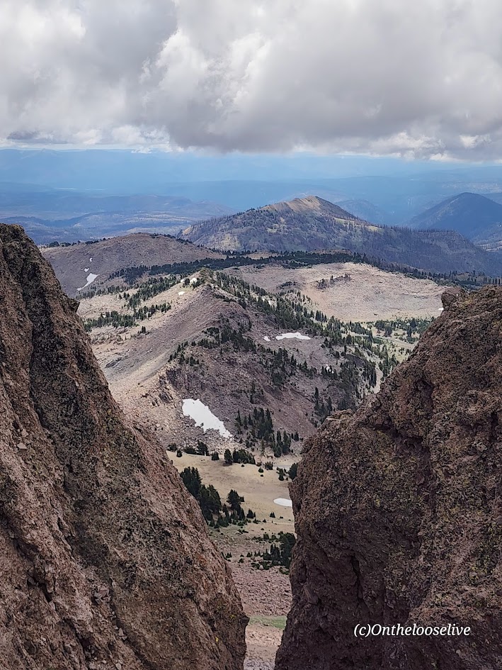
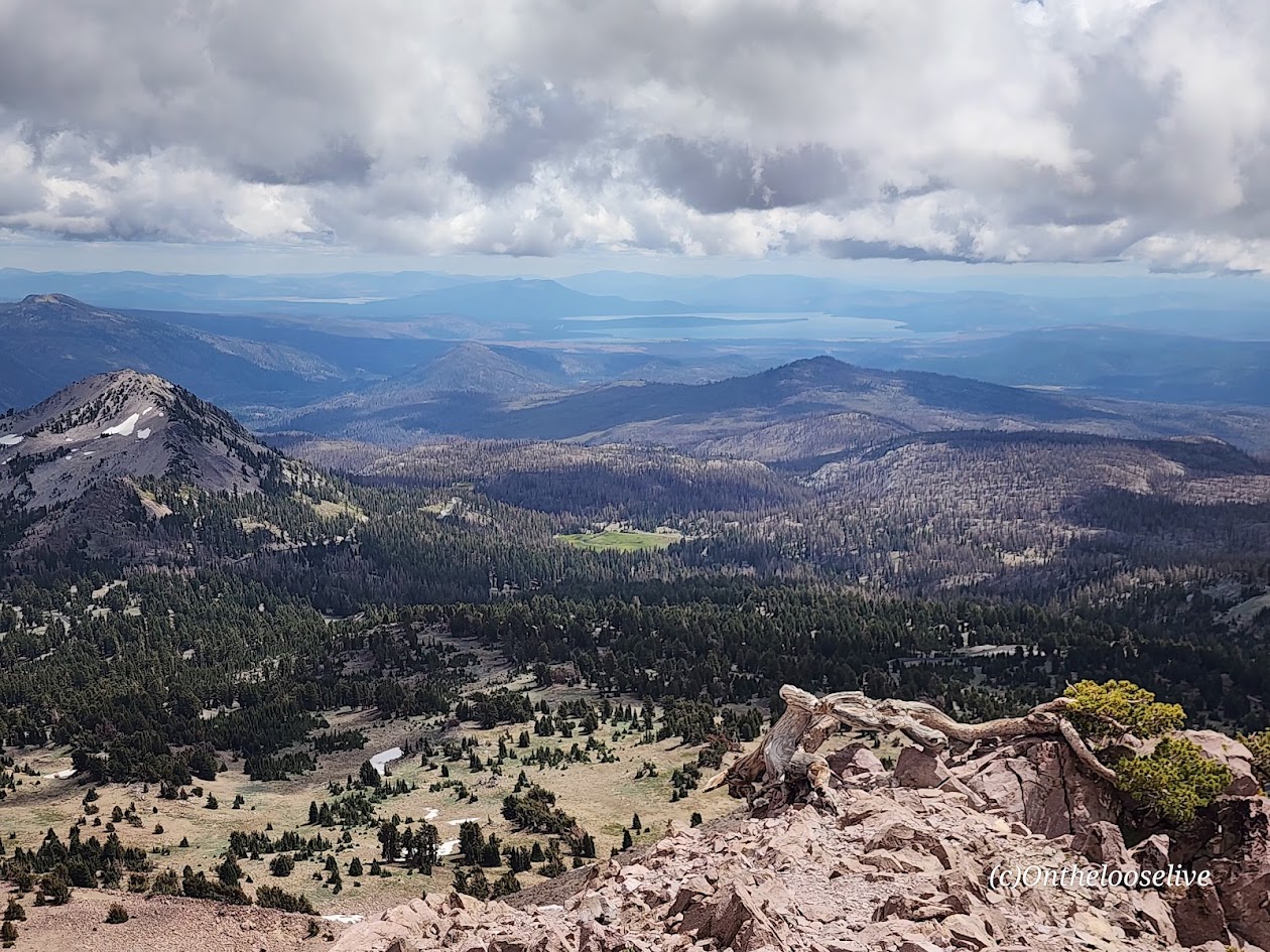
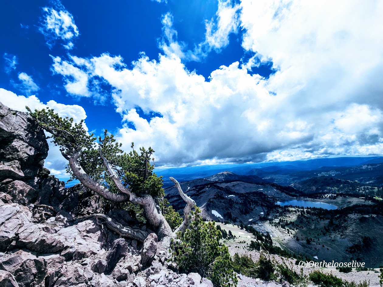
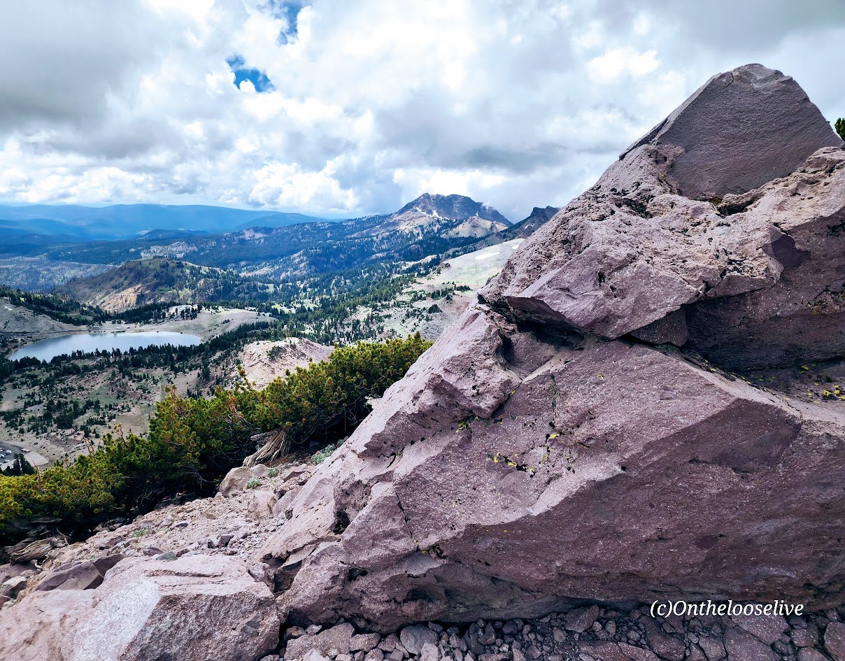
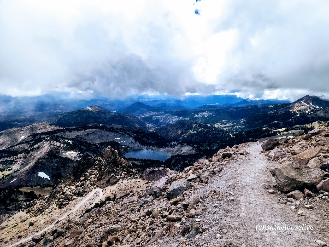
Elevation Gain: 1,957 ft (8,500 ft at the trailhead to 10,457 ft at the peak)
Difficulty: Moderate to difficult, depending on your fitness level and altitude acclimation.
(LVNP rates it as strenuous and suggests 4-5 hours. It took us 2 hours – the threat of a storm kept us on pace.)
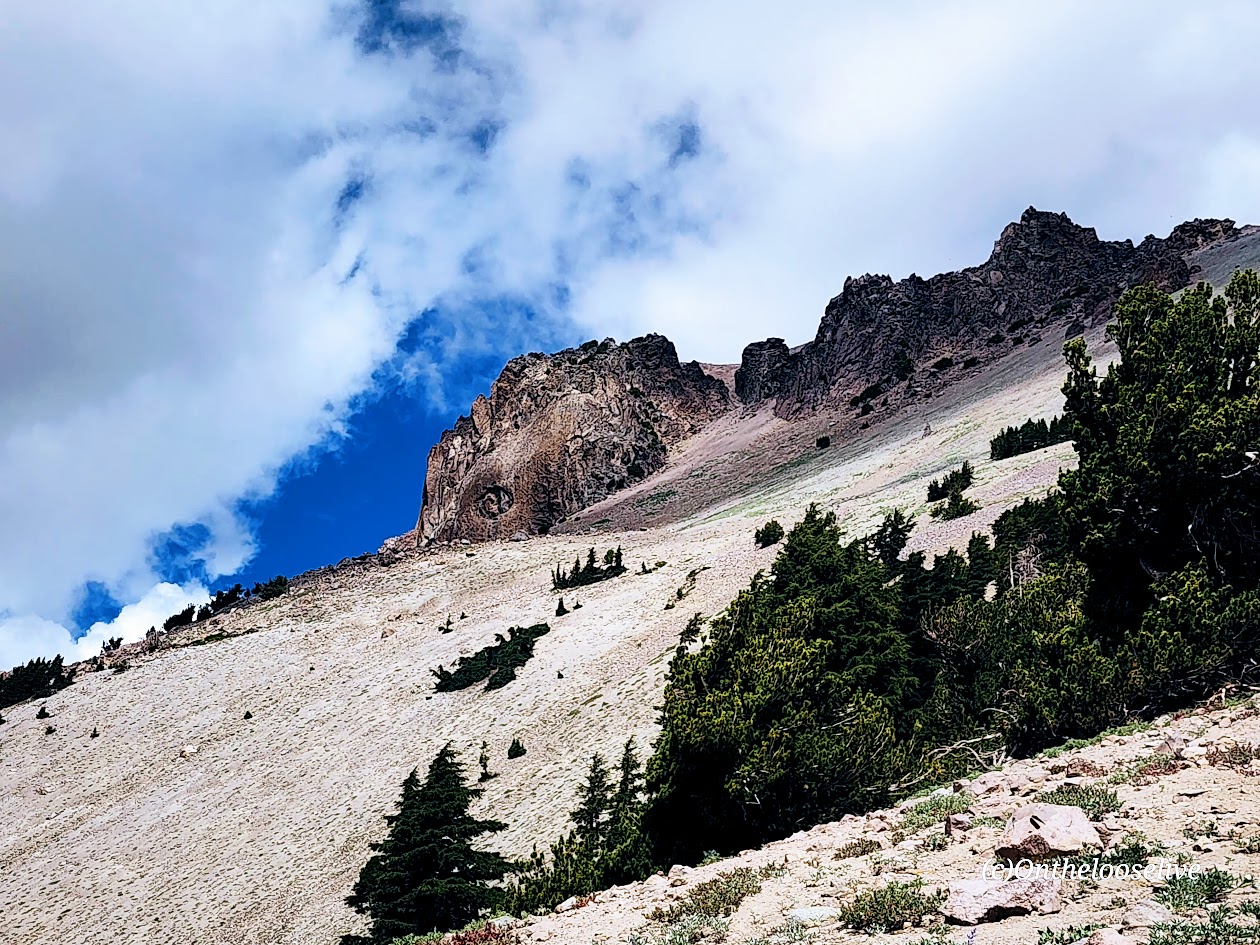
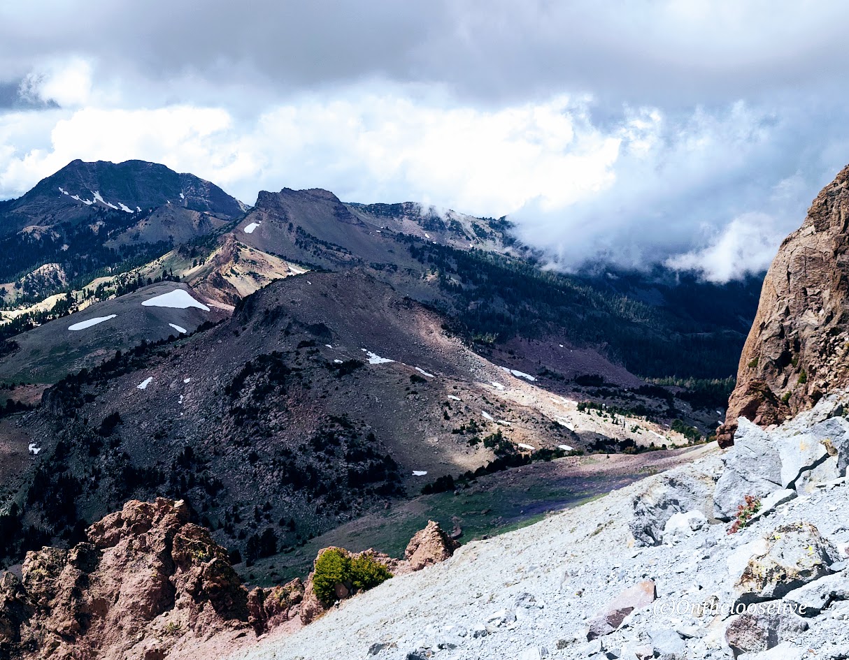
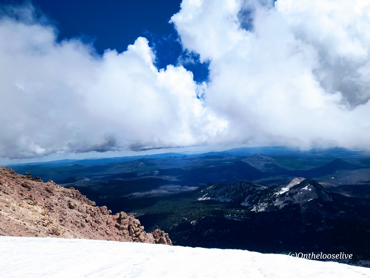
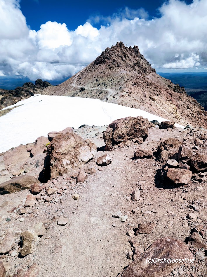
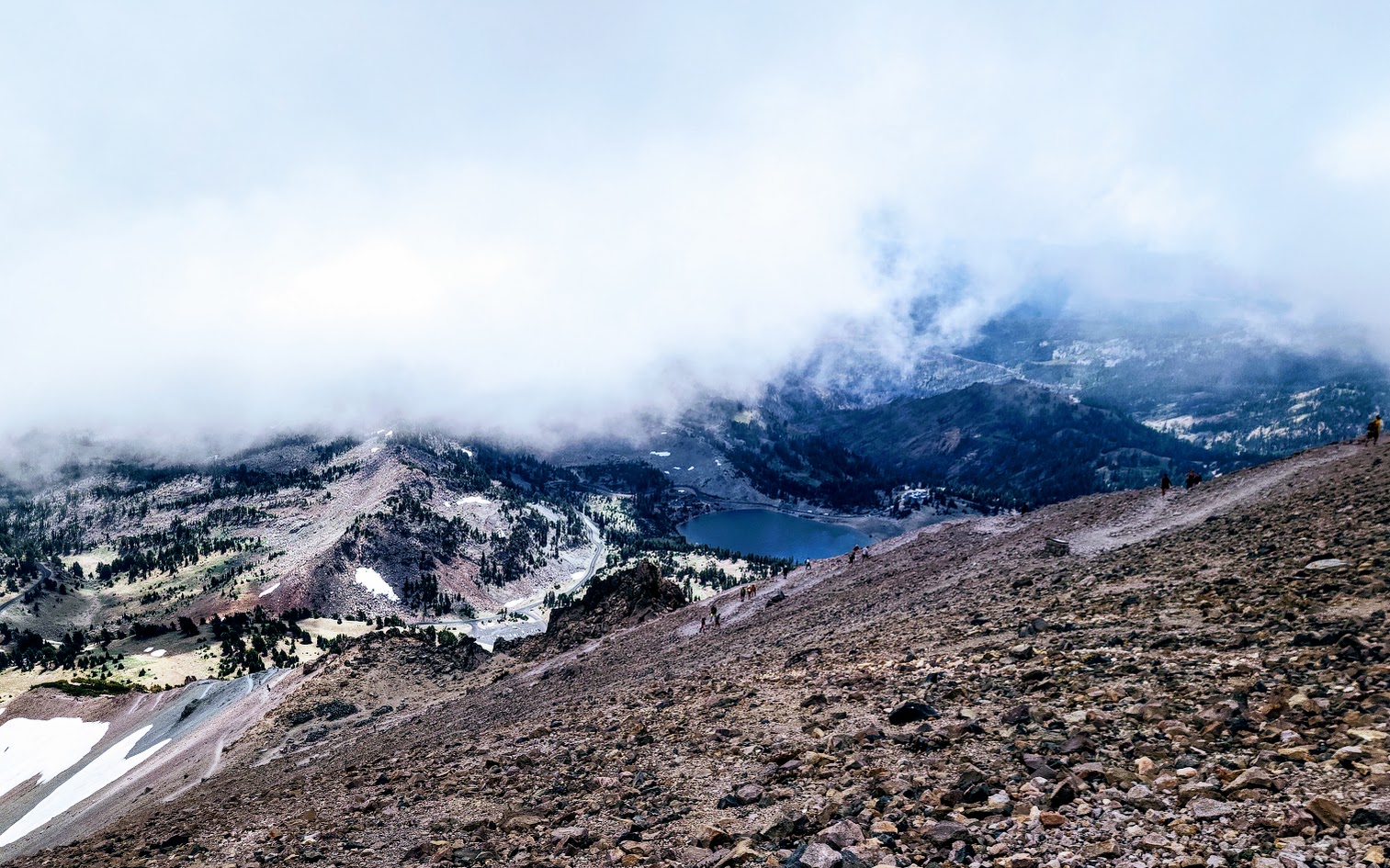
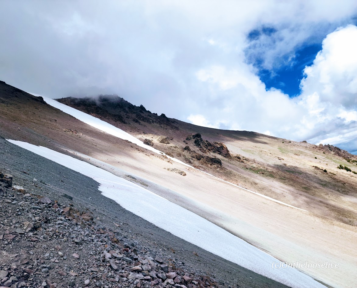
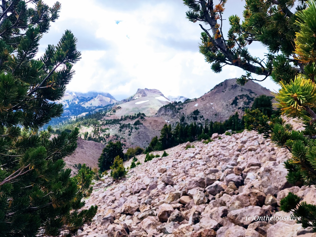
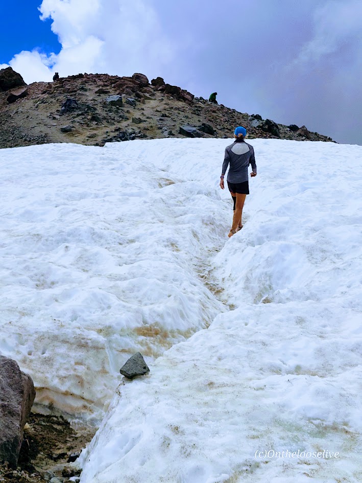
When it’s your last day in LVNP, and you haven’t “bagged” Lassen Peak yet, you make a run for it. And so we did. Actually, it was more of a fast walk than a trot, but a steady pace to try and outpace a looming monsoon. Mission accomplished. This was a fun hike and a solid workout. In my opinion, the trail is runnable – mostly smooth gravel with some short rocky sections. It’s a moderate, though consistent, incline with sweeping switchbacks. (Unfortunately, my knees no longer sanction running, so I have to settle for brisk walking.)
Since we had just hiked the Ridge Lakes Trail with 1k of elevation gain, we were warmed up for the climb. If you’re just hopping out of the car, you may want to take a little stretch band stroll before you hop on the “hill”.
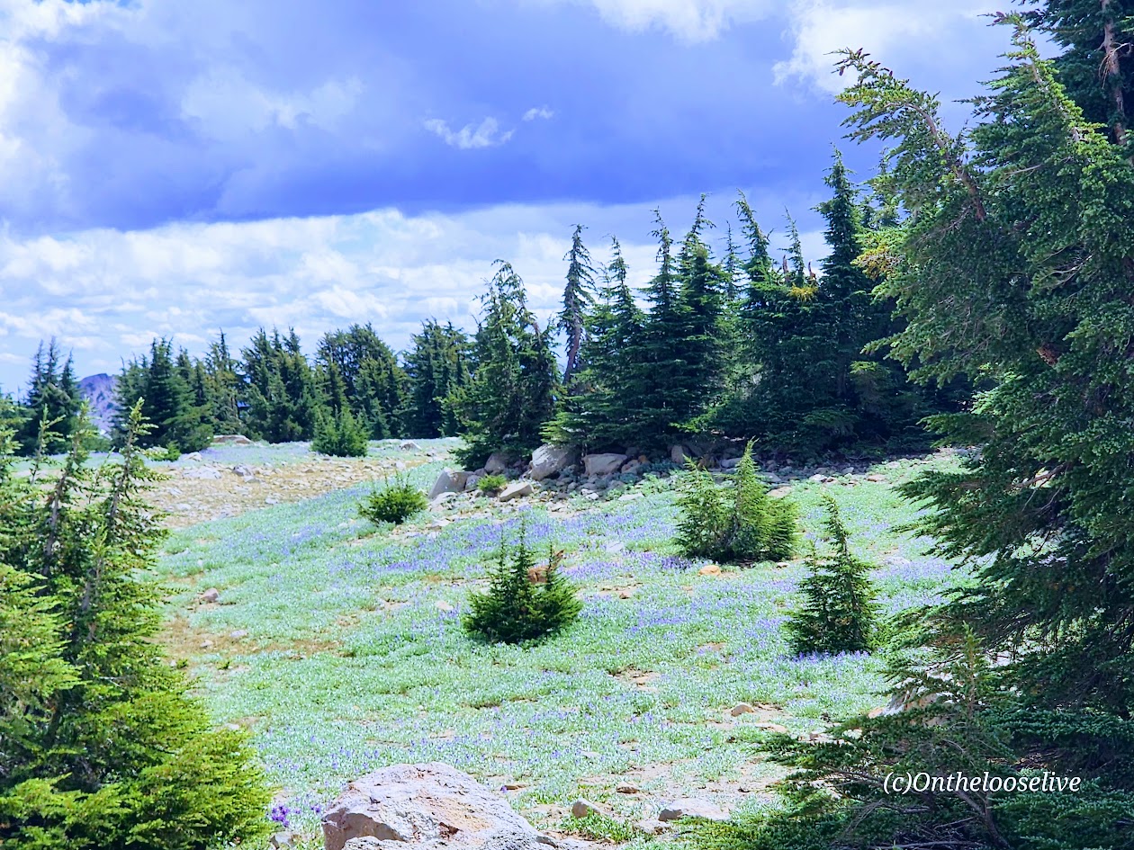
The immediate scenery is a bit stark, but the panoramic views are splendid.