Difficulty: Moderate or Difficult, depending on your fitness level and daring level with the ropes on top. (Some call it strenuous. All call it steep.)
The trail climbs persistently through the pine, cedar, and hemlock trees.
After countless switchbacks, you’ll be treated to several expansive views of Lake Crescent and, if you’re lucky, out to the Strait of Juan de Fuca.
The maintained trail ends at about 1.3 miles. If you are “up” for it, pun intended, you can continue on the “climbers trail”. Your scramble to further heights will be aided by several sections of ropes.
Ken on the ropes
Proceed with caution, it’s quite exposed and super slippery.
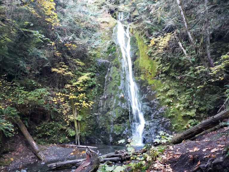
On the way down, follow the short marked trail to Marymere Falls for the cool solace of Barnes Creek and the waterfall.
Getting there: Parking and the trail head for both this hike and the Marymere Falls hike is located right next to the Storm King ranger station, Lake Crescent right off Hwy 101, 20 miles west of Port Angeles, milepost 228.
Parking: Free
Be sure to stop by The Lake Crescent Lodge and beach for some refreshments and photo ops before you leave.
Distance: ~8-10 Miles Out & Back ~16-20 Total Difficulty: Easy Terrain: Flat, friendly(pine-needle cushy single-track) Usage: Hikers, mountain bikers horses, leashed dogs Caution: Cougar and bear country
If you’re in the Port Angeles area, a visit to lovely Lake Crescent is a must do. It just a scenic 20-mile drive out of town. There you’ll find a delightful trail that meanders along the shore and through the forest on a pine-needle path lined with ferns. This is the splendid Spruce Railroad Trail, great for hiking, running, or mountain biking.
The trail is part of the 134-mile-long Olympic Discovery Trail, a mountain bike-able route that crosses the northern part of the Olympic Peninsula. The trail follows the former Port Angeles Western Railroad route.
The trail begins with a short paved section. Scenic views of Barnes Point and Mount Storm King (post coming soon) loom above the lake.
At ~ 2.5 miles in, you’ll traverse a short bridge and have a gander at the spectacular, “Punch bowl” of Lake Crescent—crystal clear as far 40 feet down.
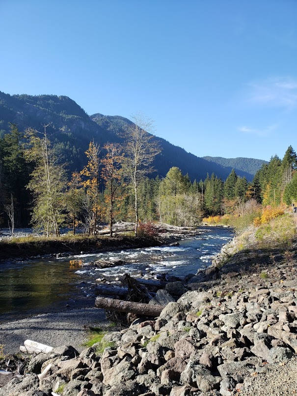
I was on (and off) a mountain bike for this wondrous single-track traverse through low-land forest and low-land river ecosystems. I’m not a very technical rider so I had to get off for the roots and rocks. Would love to come back to hike it sometime. Can’t provide much guidance about the trail as there was a major washout that I had to navigate with some detours. While the Elwha River Trail (ERT) spans the entire Elwha Valley, I was only able to make it up to the Glines Canyon Overlook before sunset.
History
Back in the day, the Elwha River ran wild from its headwaters in the Olympic Mountains to the Strait of Juan de Fuca and its valley supported many plants and animal species. As far back as ~ 2700 years ago (per radiocarbon dating), the Klallam people lived off the land, largely relying on fishing in the Elwha River. But that all changed 1913, when the Elwha Dam was built in 1913 to address demand for the lumber. To add insult to injury, the Glines Canyon Dam was built upstream in 1927.
Despite a state law that required accommodating for fish passage, neither dam did and fish runs were blocked. The consequences were devastating—impacting thousands of salmon per year and irrevocably changing the Klallam way of life.
Finally in 1992, Congress passed a law that required the removal of both dams and restoration of the Elwah River watershed. At 210 feet The Glines Canyon Dam is the tallest dam removed to date. It took 15 tons of explosives and 12,000 cubic feet of concrete were removed, Within months of the removal of the 2 dams, salmon were spawning and trout were returning for the first time in 100 years!
The Elwha River is one of the largest ecosystem restoration projects in National Park Service history.
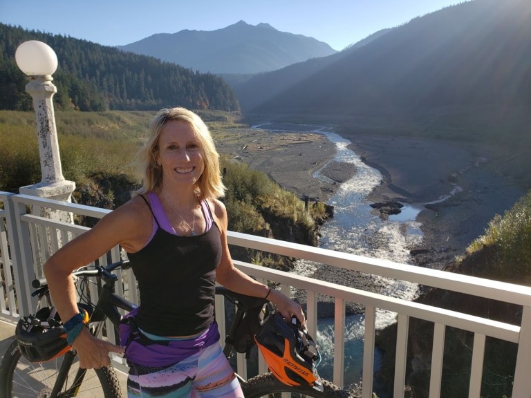
Glines Canyon Bridge
Educational Display Glines Canyon Overlook
Meanwhile back at the trail head, it’s feeding time
Note: As of 12/4/2018 Elwha Road was closed to vehicles beyond Madison Falls parking lot due to washout. Side trip: Madison Falls
This lovely 60-foot waterfall is wheelchair accessible via a .01 mile paved trail.
Side trip: Colville MTB Trails
Sneaked in a quickie mountain bike right before dark at the Coleville bike park on the way back to Port Angeles. Currently under construction, the completed trails include a flowy, fun perimeter trail, a pump track, drop zone and several jump lines (whatever the last 3 are – nontechnical me, just enjoyed the 1st).
Side Trip: West Elwah Beach
So ends a gloriously full day that included a hike on Hurricane Ridge, 2 mountain bike rides, and a sunset stroll on the beach. Yes, I like to pack as much adventure and exploration into my days.
Hurricane Ridge in Olympic National Park is so named because a prospector back in 1897 stood up there on a very windy day (100 mile an hour winds) and declared that it must be a hurricane. (It wasn’t, but the name stuck.) I lucked out with lovely weather the day I visited.
Hurricane Ridge is about 17 miles from Port Angeles and it’s a direct route to fun times. If you’re in the vicinity, it’s a must do.Whether you are just taking in the fantastic views, hiking, snowshoeing, skiing, snowboarding, or perhaps biking up. Yes, I said “biking up”. And yes, it’s a thing, if you’re into that kind of thing that is. With a challenging 5,242 ft ascent over 17 miles, the ride is known as one of Washington’s toughest and most scenic bike routes and what many say is one of the top cycling climbs in the U.S.. The climb averages a 5.3% grade with the steepest ½ mile at a 9.4% grade. Any takers?
It does sound intriguing though doesn’t it? I’d like to give it a go one day if my knees allow. It’s the downhill that really gives me the heebie-jeebies… I’d feel more secure on a mountain bile than road bike. A car shuttle might be an option…
In any case, whatever your activity pleasure, you’ll find the Olympic National Park a perfect playground. Get more scoop at Visitor Center at mile one and pay to play when you reach the park’s toll booth at mile 6.
I pulled off at the first opportunity for a hike and did a pleasant out and back on the Switchback Trail. As the sign indicates, there are a few options available to string together longer hikes.
I’m keeping my escapades short so I can cover more ground on my “PNW adventure sampler” tour. After driving up to the ridge to enjoy the panoramic views, I headed back down to plot my next excursion.
Evidence of “The Inconvenient Truth” – pictures are worth a thousand words…


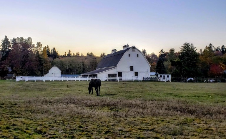
 As you explore the Port Angeles area, you’ll likely run into other friendly locals.
 Picturesque photo ops abound around every corner.
 Lots to do in this Pacific Northwest playground.
Hike or Mountain Bike the Spruce Railroad Trail
Hike the Storm King Trail
Hike or Mountain Bike the Elwah River Area and Do the Coleville Flow
Explore Hurricane Ridge , Olympic National Park
Lots to do in this Pacific Northwest playground.
Hike or Mountain Bike the Spruce Railroad Trail
Hike the Storm King Trail
Hike or Mountain Bike the Elwah River Area and Do the Coleville Flow
Explore Hurricane Ridge , Olympic National Park