Difficulty: Easy, depending on your fitness level and sensitivity to altitude (as the trailhead is at 6,700 ft and the falls are at ~7,315 ft)
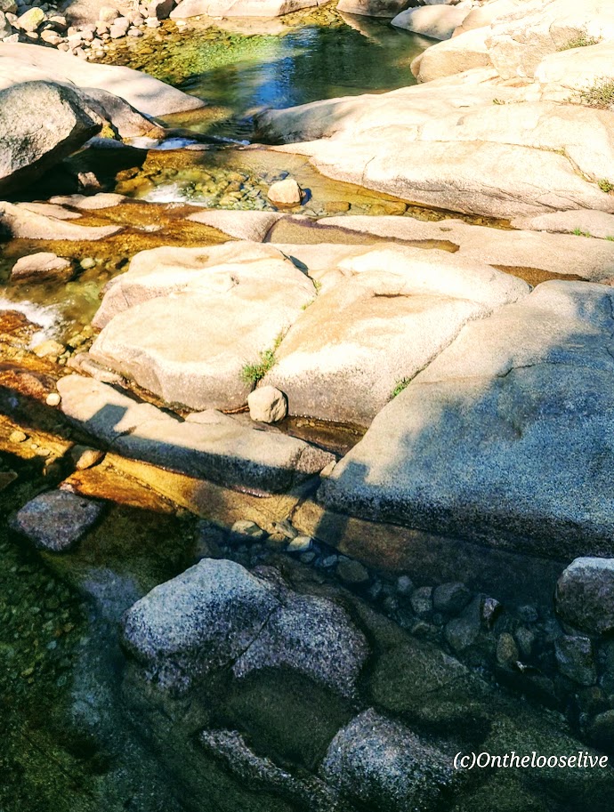
If you know me by now, you know I like a big hike and chasing waterfalls. Topokah Falls, in this case, offered neither, but in my opinion, it was still 100% worth it. Perhaps the pictures below will convince you why.
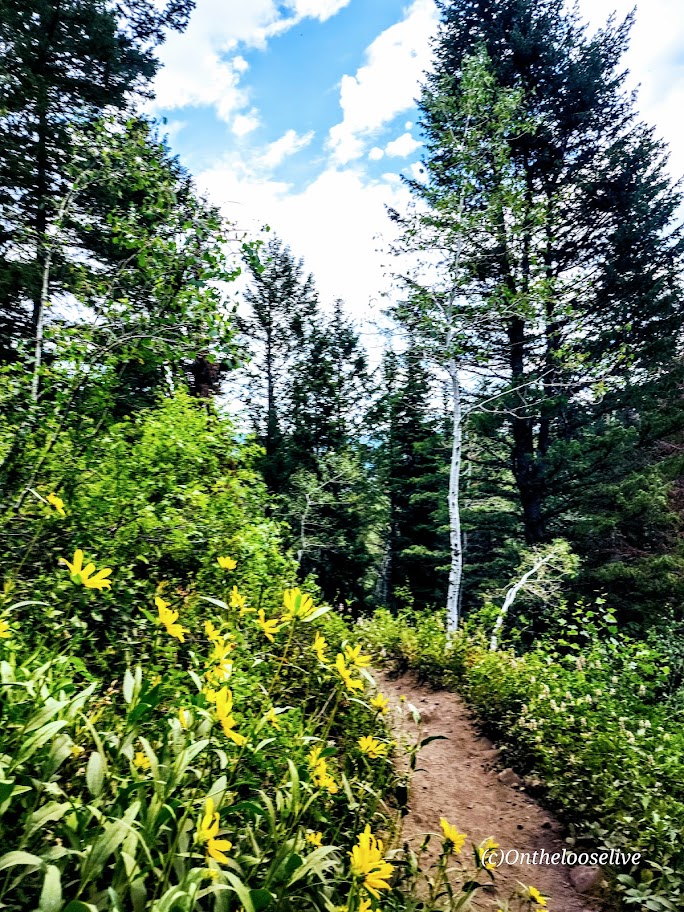
Even when the 1,200-foot falls were but a trickle, as is often the case in late summer, this is still a delightful little hike on a well-groomed, easy trail alongside a stream, glades of wildflowers, and gradually up to some impressive granite slopes. As you near the falls, you’ll encounter short sections of rocky footing.
This area has a wonderful “back-country” Eastern Sierra vibe; it reminded me a bit of Yosemite.
(Given its easy accessibility, you may be sharing it with a Boy Scout troop or other large groups.) Go early and have it all to yourself.
From the Lodgepole Campground, there are other trails to add on if you have the time and inclination, including Cahoon Meadow (2.6 miles) and Twin Lakes (6.5 miles). If there’s a next time for me, I’d probably take the Twin Lakes Trail. If you’ve done these hikes, let me know how they were.
Happy Trails! Leave No Trace!Tread Lightly! (Note, I’m not tromping on the wildflowers; there’s a path going through them that’s obscured in this photo, but perhaps it’s a good time for a PSA: As pretty as wildflowers are, please don’t pick them. They are essential for the ecosystem, including the pollinators, birds, and wildlife. Also, it’s illegal in most areas, including National Parks, though you’ll often see people doing it.)
Difficulty: Moderate to hard, depending on your fitness level and acclimation to altitude
My second splendid summit of Mount Timpanogos (11,753 ft) was via the Timpooneke Trailhead. (And yep, I’m sticking with the same title. Mount Timpanogos simply has ALL the ingredients for a great hike. I’ve seen Mt. Timpanogos from both sides now (Aspen Grove Trailhead and Timpooneke), and both routes are gorgeous. Mount Timpanogos still ranks as the best US hike I’ve done.
Trail Notes: Keep your eyes open; at Mile 1, the trail takes a sharp right turn. (I kept going straight on what appeared to be a wide, well-traveled trail that stopped short across a stream. I ended up scaling a waterfall avalanche chute before it dawned on me that I was on another one of my “off trail explorations”—yep, I know, lol. I later learned I wasn’t the only one and suggested to the ranger that a sign might be advisable.)
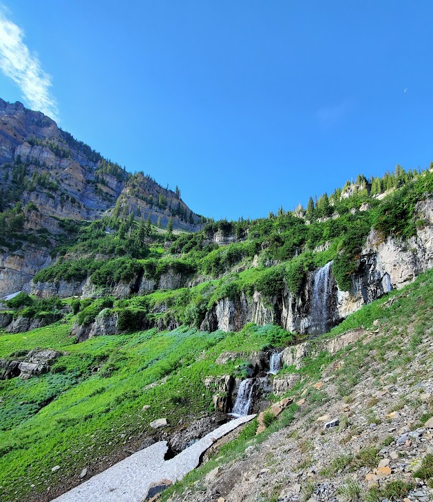
At the 3-mile mark, a “snow bridge” had collapsed across the middle of a waterfall, requiring careful traversing of the slanted, slippery snow field. The picture below may not look too treacherous, but there is a waterfall crevasse directly under the snow. One slip could be a big, potentially final slip if you know what I mean.
Crampons would help, but given the onslaught of the heat wave we’ve been having, this section won’t be an obstacle for long. Other than that, the trail is well-marked until you reach the Emerald Lake juncture. The Summit Trail (054) is the unmarked (I’m not sure why) trail to the right.
Cons: This route seems busier/more crowded. (I was there on a weekend. I’m sure it’s better on a weekday.) You may want to challenge yourself with the extra 1k of elevation that the Aspen Grove route delivers.)
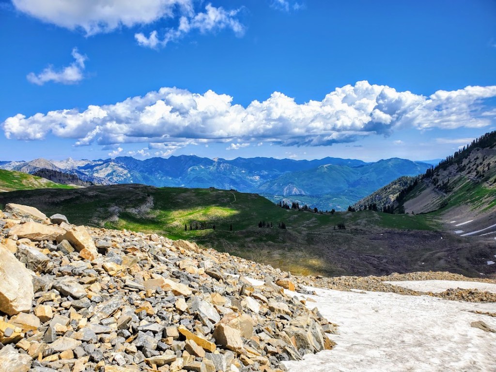
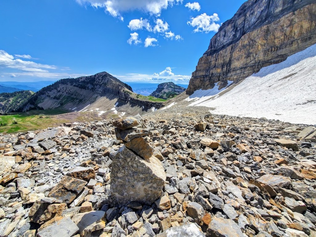
Pros: It’s easier—there is 1,000 feet less elevation gain, and a couple of miles shorter. Best of all, you completely bypass the tortuous snow and talus field that takes forever to painstakingly cross on the Aspen Grove route. (See picture below.) Footing is easy the entire way on the Timpooneke route perhaps that’s why it’s so popular with trail runners.
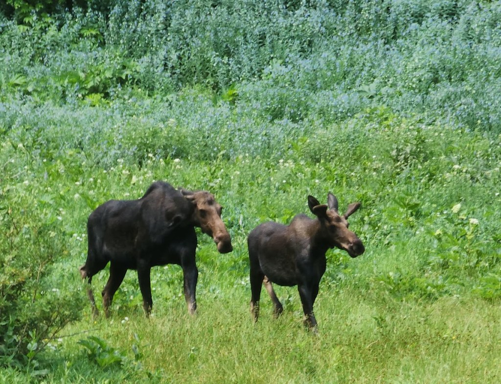
On the way up, you’ll go through what I’ll call “Moose Meadow,” where I saw the moose below with her calf.
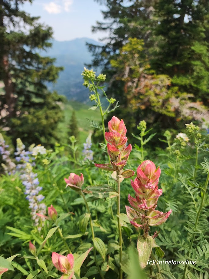
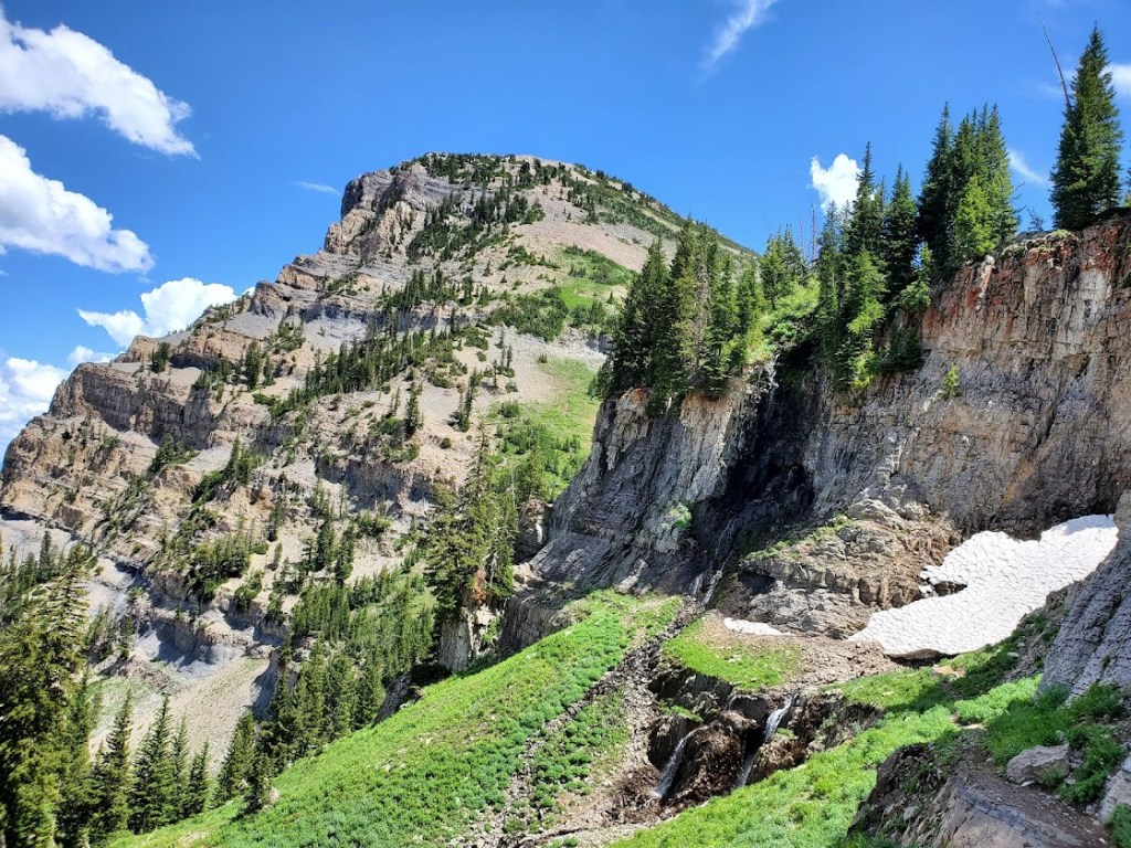
You get a great “bowl” view of Timp’s peak above and surrounding peaks from the wildflower-filled meadow basin.
After which, the trail begins to climb in earnest to the Timp Saddle, where you’ll enjoy sweeping views of Utah Valley and the summit ahead. If you’re lucky, you may see grazing, napping, or salt-licking mountain goats along the way. Give the mountain goats space and respect. I(I have a great magnifier on my camera.) (While the goats look docile, they have been known to kill loose dogs that harass them (3 loose dogs were killed by goats last year) and gore people who get too close.)
I saw several off-leash dogs—doesn’t seem prudent! I’m guessing the moose wouldn’t take kindly to the loose dogs, either.
To reach the summit, mild scrambling is required. The section is short and nontechnical, but it is not for the faint of heart or those scared of heights. The panoramic views are tremendous, but it was a bit hazy when I summited—perhaps due to the wildfires in the surrounding areas.
Caution: This hike involves significant elevation gain and hiking at elevation. Be aware of the signs of altitude sickness. It can sneak up on you even if you’ve never had it before. It happened to me recently on Wheeler Peak. On the way down Timpanogos, a teenage girl was in a fetal position by the trail, holding her head. Her family had called for rescue. Hopefully, she’s okay.
Summit: 11,752ft, the 2nd highest mountain in Utah
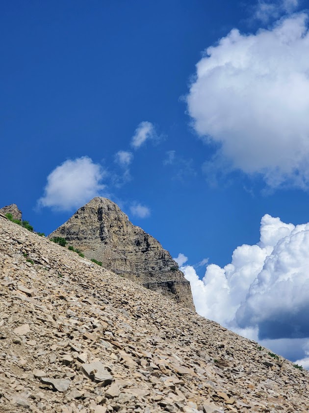
Difficulty: Hard, strenuous – due to altitude, elevation gain, and ~1.5 miles ea way of an unstable, tortuous, talus field
Happened to be in the area and made the spontaneous decision to hike Mount Timpanogos via the Aspen Grove Trailhead. So glad I did. By far, Mount Timp (as the locals call it) is my new, all-time favorite hike / peak. And I’ve done a ton of hiking across the country and around the world. I couldn’t stop smiling all the way to the 11,752-foot summit and back. Ok, maybe my smile was a bit of a grimace through the 1.5 miles back and forth across the treacherous talus strewn avalanche field. Rest assured, the grimace quickly reverted to ear to ear, exuberant glee once I reached the summit and then again as I descended back down to the lake.
What’s make Mount Timpanogos so wonderful, you ask? Well, the title gave it way, but in case you missed it:
Abundant colorful, wildflowers of more varieties than I’ve ever seen
Dazzling waterfalls around nearly very switchback
Pristine alpine lake and snow field a couple miles from the summit
Muscular mountain goats guarding the upper slopes and frolicking by the lake
5,384 ft elevation gain in altitude delivers a fitness challenge and solid workout
Sweeping views of Utah Valley from the saddle and spectacular panoramic views from the summit
This hike had it all—absolutely enchanting.
Started the trail in a steady rain, and walked up a verdant paved path for about a mile and a half or so before the pavement gave way to the elements. Plentiful wildflowers and sparkling waterfalls distracted from the effort of the climb and the sun’s radiance soon highlighted all of the beauty, mist rising. The trail is easy to follow with plenty of switchbacks to help mitigate the elevation gain. It felt almost tropical at times.
The lovely Hidden Lake Basin and Emerald Lake are destinations for many, including the mountain goats.
Those who push on beyond the mile and ½ talus torture field and onward and upward still, are well rewarded at the summit.
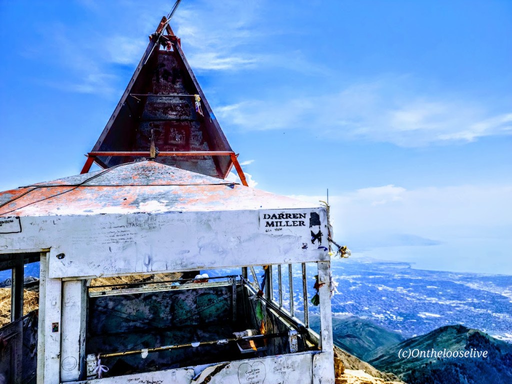
Pay your respects to the kings of the mountain along the way. If you have good eyesight, you might spy the summit hut from thousands of feet below. It’s a bit daunting and exciting because it seems so far away, almost out of reach.
From the summit, you’ll take in dizzying 360 degree views of Utah Valley and Utah Lake to the west, Lone Peak and American Fork Twin Peaks to the north and expansive views everywhere in between.
Disclaimer: I experienced Mt. Timp in her July glory. I was told by locals that I wouldn’t recognize her in the Fall when the waterfalls are dry, the wildflowers have disappeared, and the green meadows have turned to yellow hay. Others report that Fall colors are nice here. Someday, perhaps I’ll be back to see for myself. In the meantime, if you’ve been in another season, let me know what it was like.
Notes: I’d say hiking shoes are a must to navigate the talus field. There were some hard core, ultra runners in trail runners. (I know – WOW!) Hiking poles are also a nice to have, given the elevation gain and loss. Layers are always smart at altitude. Be aware of weather changes and avalanche danger.
Getting there: I-15N to Pleasant Grove, exit 275. Follow N County Blvd and UT-92 E to the Aspen Grove Trailhead.
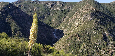
San Diego County’s 3-tiered seasonal waterfall in Cleveland National Forest is definitely worth a visit when the water is running.
At the beginning of the hike, these 3 lovely trees will greet you.
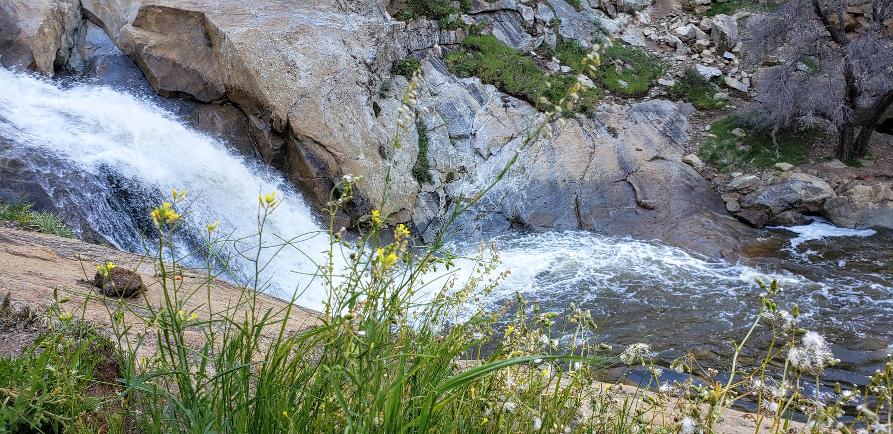
The falls are much more impressive than you might expect. As you hike down the trail, you can see the frothy, white veils in the distance.
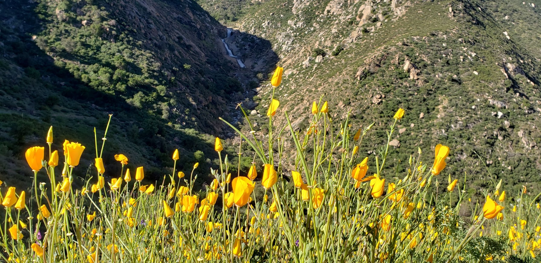
For me, it was vaguely reminiscent of Yosemite. Of course, I was fortunate to experience the area after a rainy season, during the spring super bloom. The hillsides were green and sprinkled generously with wildflowers. If you’ve been following my superbloom posts (Walker Canyon, Diamond Valley Lake, Denk Mountain) this spring, you know I can’t get enough of these wildflowers. (I wasn’t expecting any on this hike and what a wonderful surprise to see the colorful abundance along the trail – perfect wildflower filters for my distant water shots.)
It’s a pleasant single-track, out & back trail that takes you down to the falls and then bring you back up to the parking area.
The falls are a wonderful spot to have a picnic, cool off, and while away the afternoon – that is if you don’t mind being joined by too many humans who have the same idea. (Heavy sigh.) Be forewarned, this is one of San Diego’s most popular hikes so go early or be prepared for the crowds and a full parking lot.
If you want to add on another hike, the Cedar Creek Falls hike is in the vicinity too. Since I’ve done that one already, I decided to take the scenic drive out the other side on Descanso Road.
The Scoop on 3 Sisters Waterfall Hike
Distance: 4 miles RT (out & back)
Elevation gain/loss :1000 ft (downhill on the way out, uphill on the way back)
Difficulty: Easy to moderate, depending on your fitness level. Trail run friendly on a non-crowded morning.
Getting there: From the town of Julian, turn left on Pine Hills Road, right on Eagle Creek, and left on Boulder Creek Road, which will become dirt road for the last 5 miles.
Note: Both Boulder Creek and Descanso are dirt roads with potholes, but no suv or 4-wheel drive needed. A regular passenger car with adequate ground clearance will do the trick as you have patience with potholes and bumps. However, it might not be prudent to attempt it without a SUV or 4-wheel drive after a heavy rain.
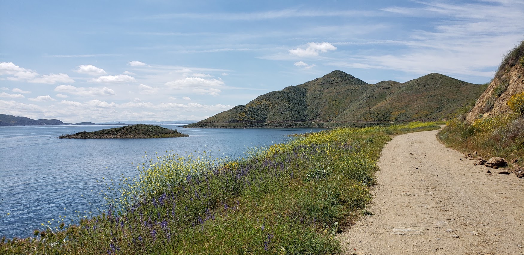
Cruising the 21.8 mile Lakeview trail around Diamond Valley reservoir on mountain bike during the wildflower super bloom last weekend was a delight. It’s a flat, family-friendly fire-road with lake and snow -capped mountain views that don’t disappoint. Yes, this was seeing it dressed in its wildflower season best. And no, you probably won’t want to do it in the blazing heat of the summer as it’s all exposed. But it’s just right, right now – for running, hiking, biking, boating, and fishing. (It’s stocked with rainbow trout, large mouth bass, striped bass, bluegill, small mouth bass – catch and release only though.)
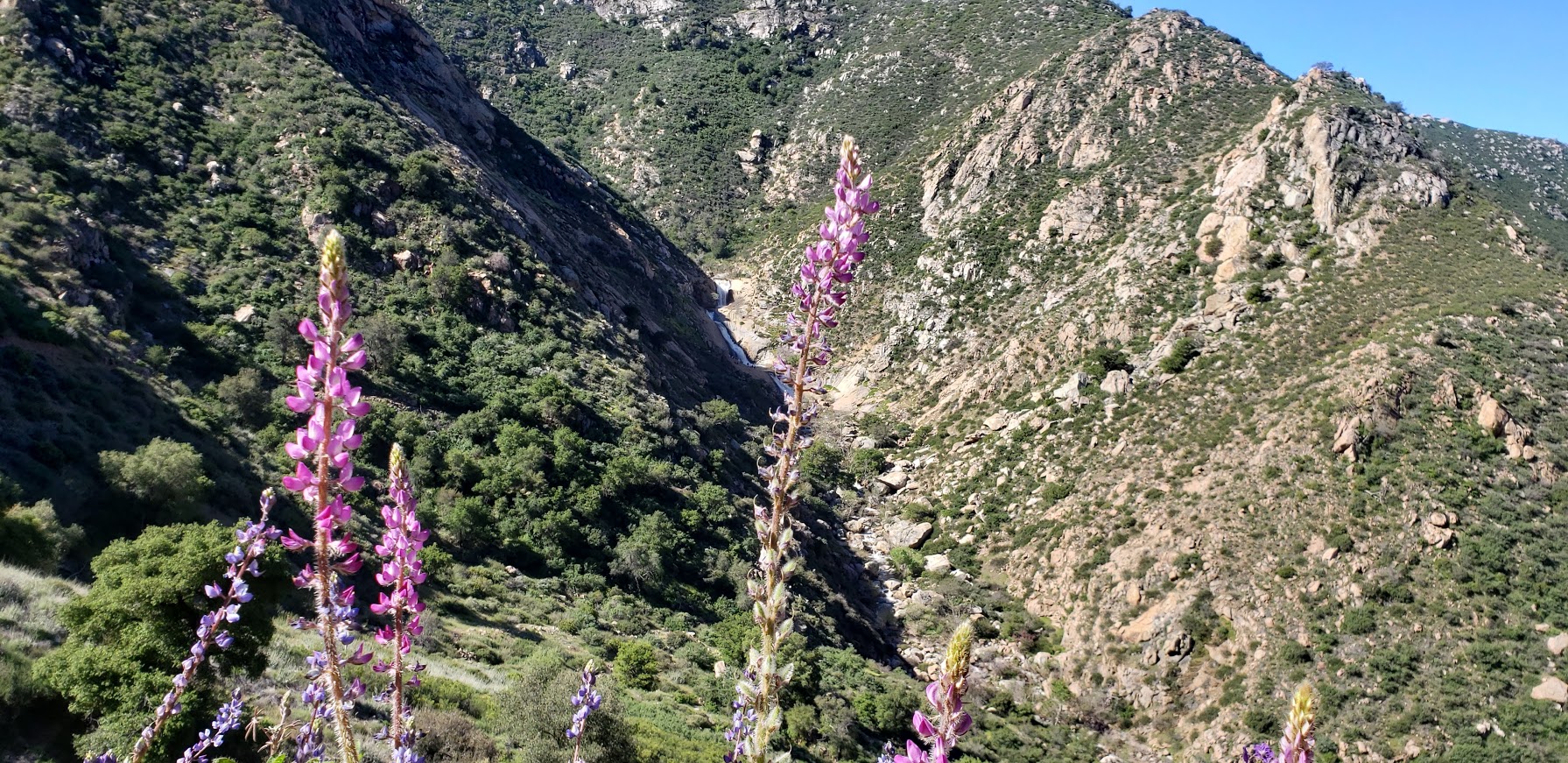
Lupine Filter
Lupine Filter
Poppy Filter
How many places can you take a scenic, peaceful 21 mile bike ride and have it virtually all to yourself on a weekend? Ok, Catalina, but where else? (Granted the little wildflower hike was much busier, but less by the time I was done with my mountain bike ride.)
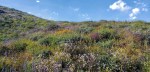
Mellow yellow wildflower extravaganza
Birds, bees, wildflowers and snow capped mountains
Here’s your wildflower sampling: Poppies, Arroyo Lupine, California Goldfields, Brittlebush, Owl’s Clover, Canterbury Bells, Chia, Baby Blue Eyes, and more!
Did I mention to be on the lookout for rattlesnakes?
[Rattlesnake video courtesy of Ken Wells.]
Fee: $10 per car, $3 per person for trail entry – worth it.
Getting there:
The entrance to Diamond Valley Lake is off of Domenigoni Parkway, which connects with Highway 79 on the west side of the lake and State Street on the east. You can take State Street south from Highway 74 in Hemet.
Mileage and Driving Times to Diamond Valley Lake
Miles
Hours
Mins.
Anaheim
77
1
24
Los Angeles
93
1
37
Pomona
63
1
10
Riverside
40
0
48
San Diego
87
1
34
Santa Barbara
188
3
06
Can’t get enough of the California Wildflower Superbloom 2019? Neither can I. Check out my Walker Canyon and Denk Mountain posts.