The Social Distancing Antidote: Nature Immersion

Solace in nature, always. At least that’s what I’ve always said. And yes, you can say I’m an outlier as social distancing is my default mode anyway. However, I’ve always maintained that our lack of connection with nature and our physical selves is at the root of so many of our 21st century ailments—physical and emotional. We are wired to spend 8+ hours a day being active, outdoors and I believe that is the key to really thriving.

Of course, for most of us, that’s not practical. But certainly, squeezing in some form of outdoor activity every day is. Probably, if you’re reading this, it’s because you’re like-minded and already reap the benefits of outdoor activities. It’s our indoor, sedentary neighbors we need to convert.  Perhaps, the silver lining of social distancing is that people will get stir crazy enough to venture outside and explore their corner of the natural world.  #optoutside

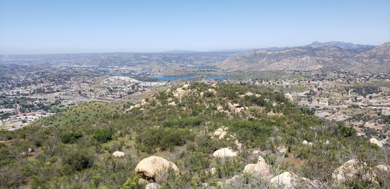
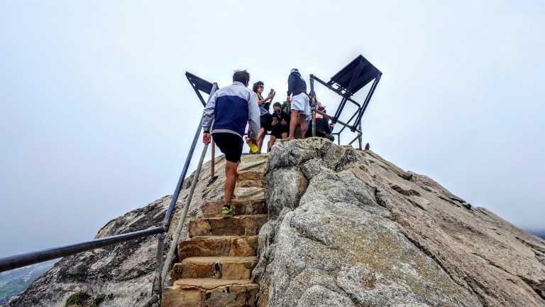
Here are some pictures from yesterday’s suburban hike in San Marcos. What a pleasant surprise to find a little network of trails right behind Palomar College. You can take a steep, direct approach to the “P”, or opt for the more, roundabout, meandering one. (You can probably guess, which one I took.)

up

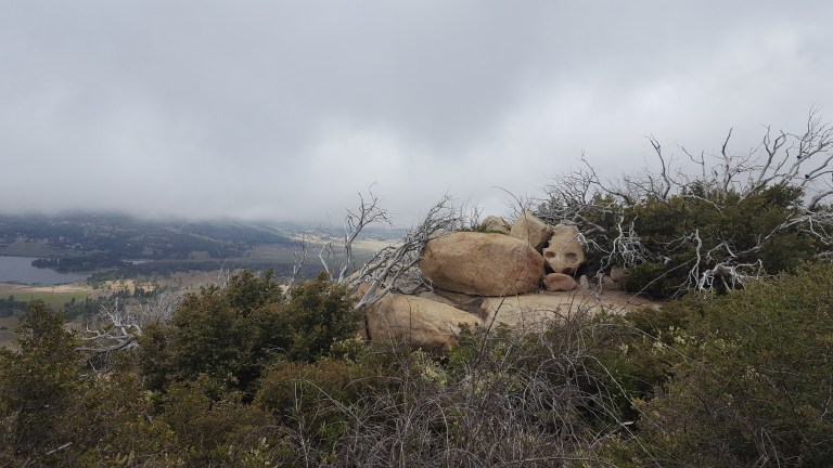
Once at the top, you can trace your way across the ridges as long as your heart desires.

P

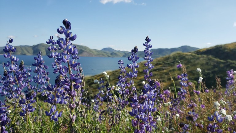
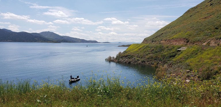
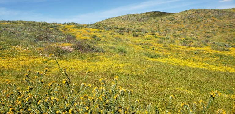
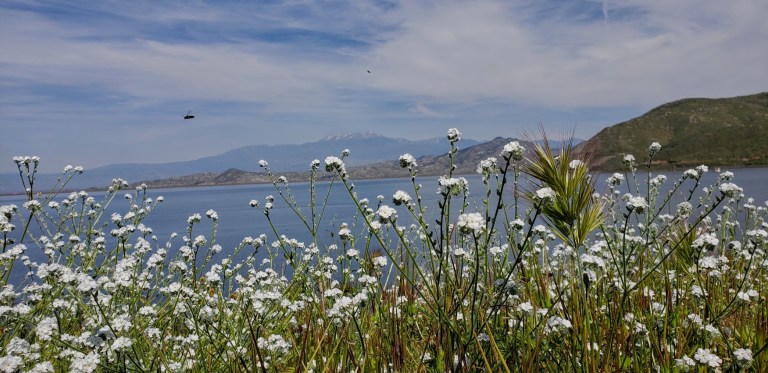
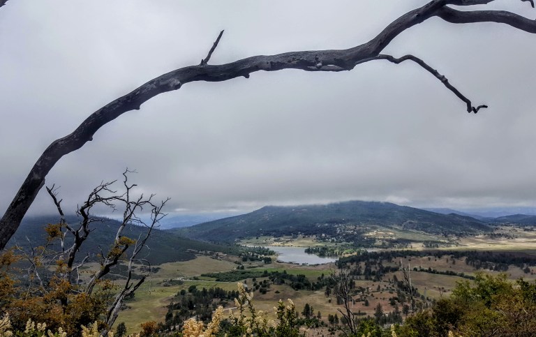
Either way, you’ll be rewarded with lovely views of the surrounding mountains and out to the Pacific.  The air was so fragrant and clean. The red dirt and delicious post-rain scents reminded me of hiking in Hawaii.

flora

Pacific Views From the P

Apparently, this area is popular with the off-roaders as evidenced by the debris. It appears many of them have lost control—careening and crashing through the rocks and scrub.

truck

The social distance—just right for a suburban hike.

L on P Trail

Short Peak Scramble, Flinn Springs County Park, San Diego

On the way back from 3 Sisters Falls, we decided to add on a roadside, quickie hike in Flinn Springs County Park. The hike begins at the back of the park.

This small 40-acre park near Lakeside has 1 short trail that takes you up a consistent, steep incline to a great vista above Escondido and Lake Jennings.

Once you reach the saddle you can go east to reach a short peak or west to climb Silverdome Peak or south for Flynn’s Peak. I’m not sure which one we scrambled up, but it was definitely a scramble.

views from flinn

It’s rated as moderate, but if you are less than moderately fit, it’s likely you will suffer. (Especially if it’s a hot day as the trail is completely exposed.) That being said, it’s a good, short workout and “bun burner”.


ken
A little trail eye candy

I wouldn’t go out of my way for this one, but if you’re driving by and want a leg stretcher / burnergo for it.

There’s picnic tables and a lovely wood pavilion too.

Flinn Pavilion

Total distance ~<4.3 miles RT

Elevation Gain: 1,443 FT

Parking Fee: $3

Address: 14787 Old Highway 80, El Cajon, CA 92021

Chasing Waterfalls and Wildflowers: Three Sisters Falls Hike, SD County

San Diego County’s 3-tiered seasonal waterfall  in Cleveland National Forest is definitely worth a visit when the water is running.

3 sisters fall trailhead sign


At the beginning of the hike, these 3 lovely trees will greet you.

3 lovely trees 3 sisters hike

The falls are much more impressive than you might expect. As you hike down the trail, you can see the frothy, white veils in the distance.


For me, it was vaguely reminiscent of Yosemite. Of course, I was fortunate to experience the area after a rainy season, during the spring super bloom. The hillsides were green and sprinkled generously with wildflowers. If you’ve been following my superbloom posts (Walker Canyon, Diamond Valley Lake, Denk Mountain) this spring, you know I can’t get enough of these wildflowers. (I wasn’t expecting any on this hike and what a wonderful surprise to see the colorful abundance along the trail – perfect wildflower filters for my distant water shots.)

poppy filter 3 sistersbest wildflower filter 3 sistersCactus bloom 3 sisters

It’s a pleasant single-track, out & back trail that takes you down to the falls and then bring you back up to the parking area.

L with flowers on the trail 3 sisters


Lydia taking pics


rock falls 3 sistersfalls flower filter

The falls are a wonderful spot to have a picnic, cool off, and while away the afternoon – that is if you don’t mind being joined by too many humans who have the same idea. (Heavy sigh.) Be forewarned, this is one of San Diego’s most popular hikes so go early or be prepared for the crowds and a full parking lot.

If you want to add on another hike, the Cedar Creek Falls hike is in the vicinity too. Since I’ve done that one already, I decided to take the scenic drive out the other side on Descanso Road.

Descanso dirt road

The Scoop on 3 Sisters Waterfall Hike

Distance: 4 miles RT (out & back)

Elevation gain/loss :1000 ft (downhill on the way out, uphill on the way back)

Difficulty: Easy to moderate, depending on your fitness level. Trail run friendly on a non-crowded morning.

Getting there: From the town of Julian, turn left on Pine Hills Road, right on Eagle Creek, and left on Boulder Creek Road, which will become dirt road for the last 5 miles.

Note: Both Boulder Creek and Descanso are dirt roads with potholes, but no suv or 4-wheel drive needed. A regular passenger car with adequate ground clearance will do the trick as you have patience with potholes and bumps. However, it might not be prudent to attempt it without a SUV or 4-wheel drive after a heavy rain.

Fee: Display a National Forest Adventure Pass – $5 day pass [purchase info]  https://www.fs.fed.us/portaldata/r5/ap/r5-ap-vendors.php

On the way home, I added on short, vertical hike / scramble at Flinn Springs County Park on old highway 80 off highway 8. Post to come.

Diamond Valley Lake: Hike, bike, run, or boat this lovely little gem, Hemet, CA

Cruising the 21.8 mile Lakeview trail around Diamond Valley reservoir on mountain bike during the wildflower super bloom last weekend was a delight. It’s a flat, family-friendly fire-road with lake and snow -capped mountain views that don’t disappoint. Yes, this was seeing it dressed in its wildflower season best. And no, you probably won’t want to do it in the blazing heat of the summer as it’s all exposed. But it’s just right, right now – for running, hiking, biking, boating, and fishing. (It’s stocked with rainbow trout, large mouth bass, striped bass, bluegill, small mouth bass  – catch and release only though.)

lupine filter dvl
Lupine Filter

Lupine Filterwildflower fireroad dvlsnow capped vista dvlpoppies and dvlfisherman dvldvl framed

dvl poppy filter
Poppy Filter

How many places can you take a scenic, peaceful 21 mile bike ride and have it virtually all to yourself on a weekend? Ok, Catalina, but where else? (Granted the little wildflower hike was much busier, but less by the time I was done with my  mountain bike ride.)

mellow yellow bloom dvl
Mellow yellow wildflower extravaganza

fisherman dvl

birds and the bees dvl
Birds, bees, wildflowers and snow capped mountains

Here’s your wildflower sampling: Poppies, Arroyo Lupine, California Goldfields, Brittlebush, Owl’s Clover, Canterbury Bells, Chia, Baby Blue Eyes, and more!

Did I mention to be on the lookout for rattlesnakes?

[Rattlesnake video courtesy of Ken Wells.]

Fee: $10 per car, $3 per person for trail entry – worth it.

Getting there:

The entrance to Diamond Valley Lake is off of Domenigoni Parkway, which connects with Highway 79 on the west side of the lake and State Street on the east. You can take State Street south from Highway 74 in Hemet.

Mileage and Driving Times to Diamond Valley Lake
Miles Hours Mins.
Anaheim 77 1 24
Los Angeles 93 1 37
Pomona 63 1 10
Riverside 40 0 48
San Diego 87 1 34
Santa Barbara 188 3 06

Can’t get enough of the California Wildflower Superbloom 2019? Neither can I. Check out my Walker Canyon and Denk Mountain posts.

Stunning Stonewall Peak Hike, Cuyamaca Rancho State Park, San Diego

Cuyamaca Peak‘s little sister, Stonewall Peak, (5,730 feet) outshines her big sister with her stunning granite crown, haunting tree skeletons (remnants of the Cedar Fire) and lovely vistas of Cuyamaca State Park and out to Anza  Borrego. Before I moved to North County and started exploring the area, I had no idea that all this wonderful natural beauty is an easy drive from greater San Diego.

20180526_123510
Gradual ascent on a friendly trail

20180526_123853

20180526_123918
Expansive views
20180526_1327051
Interesting rock formations along the way
20180526_131650
Stairway to heavenly vistas


20180526_132305
Something about these beautiful trees and boulders
20180526_131807
A bit crowded at the actual peak – silly people looking down at their phones
20180526_133310
Lovely Lake Cuyamaca views on the way down
20180526_141756
A sprinkling of dazzling wildflowers

20180526_140149

Planning your Cuyamaca adventure

You can make it a day or a weekend adventure and do as much or as little hiking as you like. Ambitious, fit hikers can take on both peaks (Cuyamaca & Stonewall)  in a day. For the less ambitious, there are plenty of opportunities to add on easy short strolls by the lake and up to Stonewall Mine. Lots of wildlife viewing with trails for the whole family. Stay tuned for my next post. Happy trails!

The historic gold mining town of Julian is a mile or two away with its quaint shops, B&Bs, restaurants and famous pies.

Notes: This is the most popular hike in the park so go early to avoid the crowds. After you reach the Stonewall Peak spur trail and make a right, there’s a really short scramble over some rocks before you hit the last rocky stairway.  Keep your eyes open for the metal handrails.  On the way back, I recommend taking a right at the junction for a different route down ton what becomes a pleasant single track trail d. At about 3.7 miles, you come to a trail intersection. Make the left onto Vern Whitaker Trail. Shortly after that (around 3.9 miles) there’s another junction, continue to stay left. At 4.2 miles or so,you’ll encounter another side trail; stay your course to the left again.

Miles: ~<4 miles rt if you just go up and down the main trail.  My scenic route adds about a mile & a half for ~5.5 miles rt.

Elevation gain: 1,050 feet

Terrain: Mostly sweet, clear terrain (as in trail runnable). It’s gets a bit rocky and pesky for a while near the top so watch your footing. .The single track down was mostly friendly.

Difficulty: Easy to moderate. Depends on your fitness level and the route you take.

Trailhead: Across the street from the Paso Picacho campground, Cuyamaca State Park

Parking: $10 State Park Fee

Dogs: Only allowed on paved roads and must be leashed.

Camping: Paso Picacho campground has family campsites with tables, firepits, running water and bathrooms.