Diamond Valley Lake: Hike, bike, run, or boat this lovely little gem, Hemet, CA

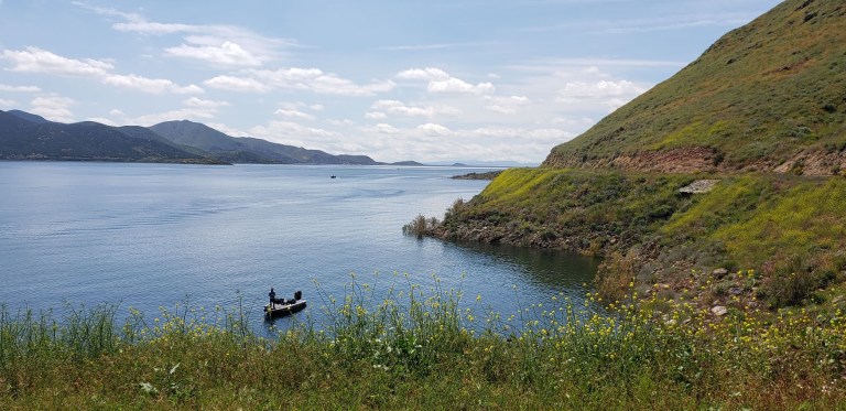
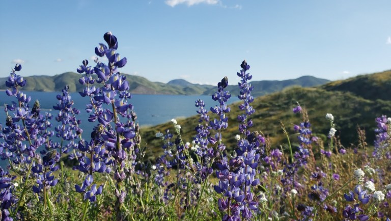
Cruising the 21.8 mile Lakeview trail around Diamond Valley reservoir on mountain bike during the wildflower super bloom last weekend was a delight. It’s a flat, family-friendly fire-road with lake and snow -capped mountain views that don’t disappoint. Yes, this was seeing it dressed in its wildflower season best. And no, you probably won’t want to do it in the blazing heat of the summer as it’s all exposed. But it’s just right, right now – for running, hiking, biking, boating, and fishing. (It’s stocked with rainbow trout, large mouth bass, striped bass, bluegill, small mouth bass  – catch and release only though.)
lupine filter dvl
Lupine Filter

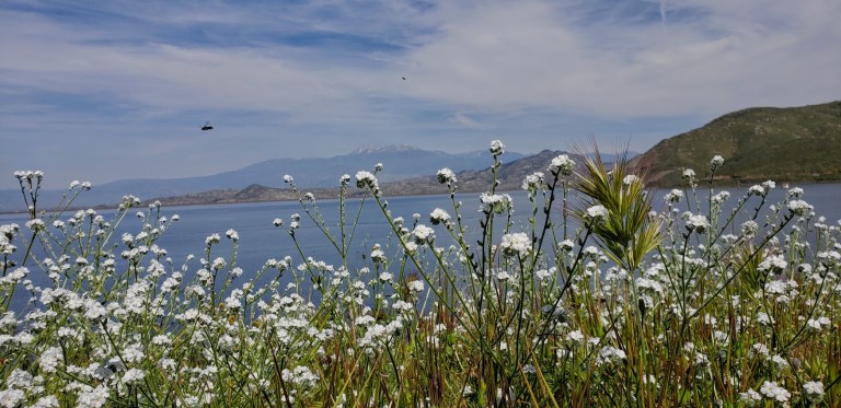
Lupine Filterwildflower fireroad dvlsnow capped vista dvlpoppies and dvlfisherman dvldvl framed

dvl poppy filter
Poppy Filter

How many places can you take a scenic, peaceful 21 mile bike ride and have it virtually all to yourself on a weekend? Ok, Catalina, but where else? (Granted the little wildflower hike was much busier, but less by the time I was done with my  mountain bike ride.)
mellow yellow bloom dvl
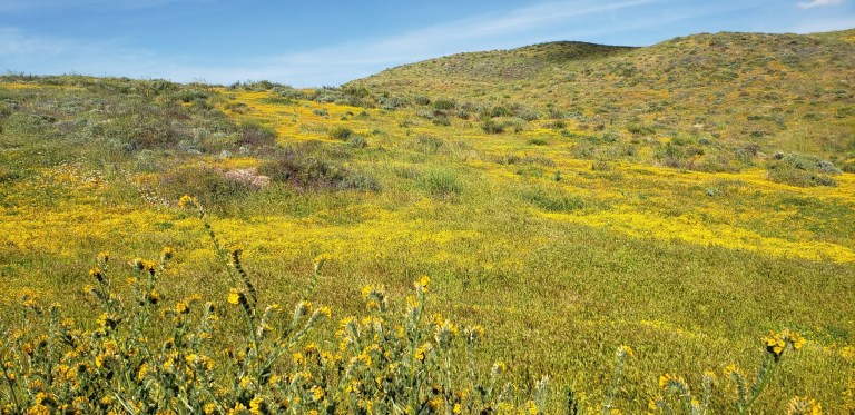
Mellow yellow wildflower extravaganza

fisherman dvl

birds and the bees dvl
Birds, bees, wildflowers and snow capped mountains

Here’s your wildflower sampling: Poppies, Arroyo Lupine, California Goldfields, Brittlebush, Owl’s Clover, Canterbury Bells, Chia, Baby Blue Eyes, and more!


Did I mention to be on the lookout for rattlesnakes?

[Rattlesnake video courtesy of Ken Wells.]

Fee: $10 per car, $3 per person for trail entry – worth it.

Getting there:

The entrance to Diamond Valley Lake is off of Domenigoni Parkway, which connects with Highway 79 on the west side of the lake and State Street on the east. You can take State Street south from Highway 74 in Hemet.

Mileage and Driving Times to Diamond Valley Lake
Miles Hours Mins.
Anaheim 77 1 24
Los Angeles 93 1 37
Pomona 63 1 10
Riverside 40 0 48
San Diego 87 1 34
Santa Barbara 188 3 06

Can’t get enough of the California Wildflower Superbloom 2019? Neither can I. Check out my Walker Canyon and Denk Mountain posts.

Denk “Mountain”, a lovely, little, local hike, Carlsbad, CA

Granted, I was lucky enough to hit this hike at its most beautiful, during the spring super bloom (poppies and native wildflowers galore), but year-round, on clear days , you can enjoy lovely views of Batiquitos Lagoon and the coastline from Camp Pendleton to La Jolla.


Denk Mountain is part of Rancho La Costa, a habitat conservation area in Carlsbad made up of several non-contiguous parcels of land, including Denk Mountain and Ridgeline Trail above Box Canyon. These are some of the most rugged in the area, which make it a local mountain bikers’ favorite.

Flowers and rock denk 2

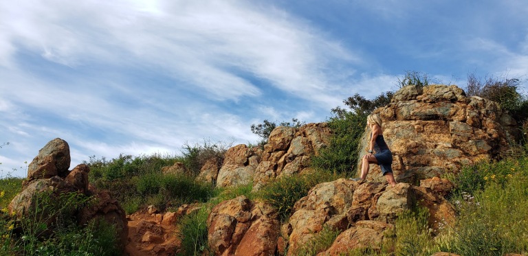
L climbing rock deck mountain

L profile at the rock denk

Trail notes: You have choices on this loop trail. For surer footing sake, I recommend you go up the steeper, more rugged / rocky Mule Deer Trail and come down the more moderate, less rugged Switchback Trail. The hike is completely exposed so be prepared with sunscreen, a hat and sunglasses.

Total Distance: 3.5 miles
Difficulty: Easy to moderate – depending on your fitness level
Total Ascent 690 feet
Dogs Leashed dogs allowed
Mt. Bikes Bikes allowed
Facilities None
Parking FREE, along Corte Romero

Getting there: From the 5, take the La Costa Ave exit East and continue for 4 miles. Turn left onto Rancho Santa Fe Road and at .8 miles, turn right onto Camino Junipero, then in ~ .2 miles turn left onto Corte Romero. Park along the street. The trail head is on the right.

Photo Post: Super Bloom 2017 & 2019, Anza Borrego, CA

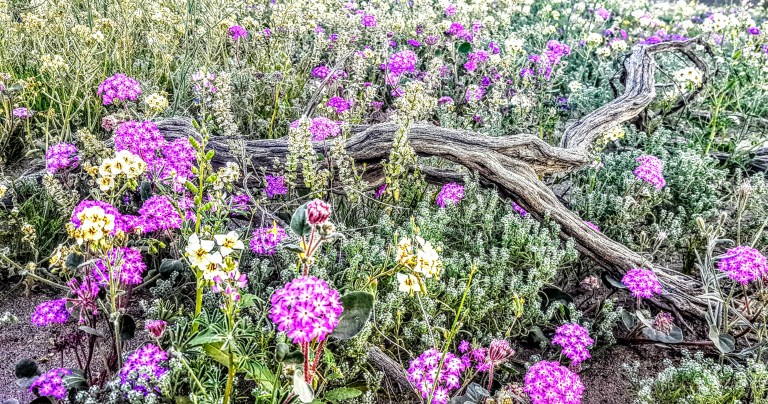
Just realized that I never posted my still photos from this year’s Super Bloom in Anza Borrego. In case you’re wondering, a Super Bloom is the term used to described an exceptionally abundant wildflower bloom that exceeds the usual seasonal Spring bloom.  When heavy rains and consistent wet weather come to the deserts of the southwest during late fall through winter as they did this year after a 5 year drought, the ideal condition for a Super Bloom is created. So ideal, in fact that this colossal colorful and fragrant explosion only occurs about once a decade. Seeds that lie dormant under rocks and sand for untold years, finally sprout when water washes away their protective coating…


This slideshow requires JavaScript.

20170313_072142_001


In our deserts, we typically see a sprinkling of purple sand verbena, white dune evening primroses, orange poppies (California’s state flower) and an occasional red-tipped ocotillo. This year, it was a breathtaking, surreal display with carpets of wildflowers, blooming cactus and red-tipped ocotillo forests. Be sure to check out my videos (1, 2, 3) for more of an immersion experience.


2019 Update – Timing is everything, didn’t see nearly as many blooms this year as 2017, but it’s always beautiful, especially at sunrise.

anza borrego 1Anza Borrego sunrise Aanza borrego sunrise

McGinty Mountain Trail: a sweet little gem in Jamul, CA

Location & directions

Trailhead: 13852-, 13998 Jamul Drive, Jamul, CA 91935

~25 miles from downtown San Diego.Take 94 East, exit at Campo Road. Follow Campo Road for ~ 4.5 miles, turn left onto Lyons Valley Road  and then left on Jamul Drive and you’ll see the dirt turnout / parking lot at 0.4 mile.Trail starts at the kiosk.

Main trail

~5 mile out & back

1,400 feet gain & loss

Moderate to strenuous depending on your fitness level

Dog and mountain bike friendly


My take

Drove down from North County for this one and so happy I did. Had low expectations as I’d never heard of this trail, but was pleasantly surprised. What a sweet little gem. This area is part of the San Diego National Wildlife Refuge. Not as well known as many of the popular SD area hikes nearby Mount Woodson, Iron Mountain, and Cowles Mountain, but definitely a contender for it’s beauty and views.

It’s a great hike with mostly friendly terrain, except for the steepest area not far from the top, which was a bit of a rock field. (If you have tender feet, you might be happier in hiking shoes versus running shoes.) Don’t worry, the steepest area is fairly short so you won’t suffer long.) Mountain bikes are allowed, but I didn’t see any and there were only a few hikers sharing the trail. It’s a good spot for a trail run too. It’s a relatively quick hike and a lovely way to spend a morning or afternoon.

Highlights

Late season wildflowers and wonderful views of San Miguel Mountain and Tecate peak to the East, Mount Helix , Cowles Mountain, El Cajon Mountain, and even Cuyamaca in the distance – apparently on some days you can see all the way to Coronado, Point Loma and the expanse of Pacific. And hiking uphill is always more rewarding —better views and better workout!


This slideshow requires JavaScript.


Rock scramble at the top – optional.


Caution

There are no trail signs so stay on the most obvious (widest & well traveled)  route. (You can take a couple viewpoint detours, but return to the main trail.) Be on guard for rattle snakes and ticks and bring water. The trail is exposed the entire way so you’ll want to avoid hiking in the heat of the day.

For more info, visit:

US Fish & Wildlife Service: McGinty Mountain trailhead

View route or download GPX from CalTopo