Cowles Mountain (1,593-foot summit) is the highest point in the city of San Diego. It’s part of Mission Trails Regional Park, a 5,800-acre open space preserve that is the 7th-largest open space urban park in the United States. It contains sixty miles of hiking, mountain bike and equestrian trails.
To call Cowles a mountain is to be very liberal with the word. I should note that the park has a 5 “peak” challenge if your hiking peeps want a minor challenge and want to document your feats – here’s the scoop. Cowles is the highest peak. This might be fun for kids, but apparently lots of adults do it for bragging rights too. I will say that on a clear day, the stunning views span 360 degrees from Lake Murray, downtown San Diego, Point Loma, La Jolla, and Mexico and out across the glimmering Pacific to the San Carlos Islands. See feature picture above. (Unfortunately, I dropped my camera on a rock so I have limited pics.)
Distance: 2.9 miles up & back
It’s a very popular trail so expect lots of humans and their canines…There are a couple of different ways to reach the top from various starting points and parking lots. The hike itself is moderate (with some steeper sections that will get those calves & glutes burning). It’s decent workout, especially if you run it. There are single track trails and some fire road. It’s short from any direction so I explored up and down on a couple of trails and was a little disappointed that there wasn’t more to see. You can’t really get lost so do as much or as little as you like.
Getting there:
The main trailhead is in the San Carlos neighborhood on the corner of Golfcrest Drive and Navajo Road
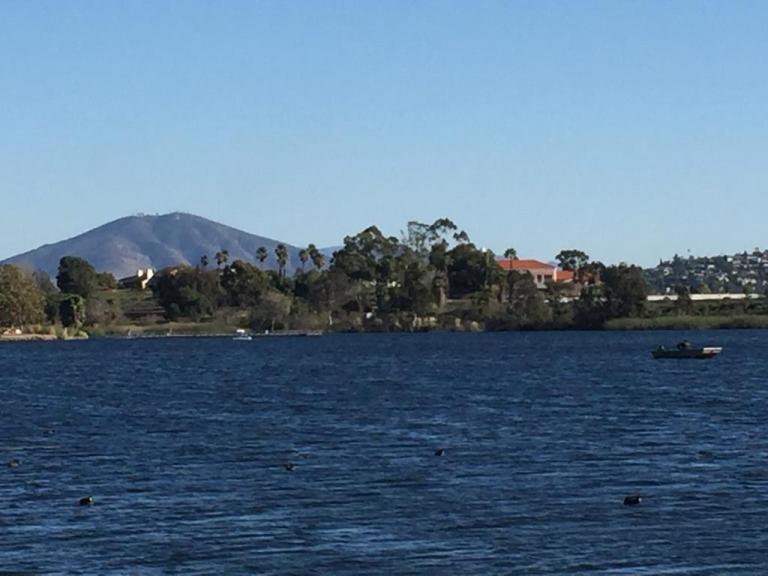
Lovely Lake Murray
Since I didn’t quite get enough enough of a workout / nature fix, I decided to check out alluring Lake Murray Reservoir, also part of the Mission Trails Regional Park. I strolled the paved road that navigates around most of the lake stopping short of the dam (no access). It’s another popular spot – walkers, runners, bladders, and even road bikers aplenty (the latter seems silly to me, because the path / road is only 3.2 mi long and there are many children and dogs on it).
Lake Murray is a great spot for birdwatchers with abundant ducks, geese, and herons abound and about 149 bird species to observe. It’s a pleasant spot for a picnic too.
Go Fish
Lake Murray is open for shore fishing and private boats, kayaks, and float tubes seven days a week from 5:30 a.m. to 8:00 p.m. Permits can be purchased onsite at the iron ranger boxes. The lake is stocked with Florida-strain largemouth bass, bluegill, channel catfish, black crappie, and trout. Minimum size limit for bass is 12 inches.
Fish limits: 5 trout, 5 bass (min. 12 inches), 5 catfish, 25 crappie and bluegill total, no other species limits
A designated national natural landmark and wilderness study area, Hell’s Half Acre Lava Field is a basaltic lava plain found in the desert ecosystem of the Snake River Plain of Idaho. It consists of about 150 sq miles of other-wordly terrain created by a lava flow from about 4,100 years ago. There’s a 1/2 mile trail marked by blue poles, you can follow those to the red poles that lead you out 4.5 miles to the central vent, where the lava broke through the surface thousands of years ago (9.4 mile round trip).
Hiking across a lava field is not for everyone, especially not for the tender footed. It’s cool, but the novelty wears off fast. While the trail is flat and easy, the terrain itself is tough and unforgiving. Lava rock is extremely sharp – like glass shards- and fragmented and the field is a trap of open cracks, gaping holes, jagged rocks and uneven, tortuous footing. It’s slow and treacherous going. One misstep can land your foot or your body in a hole. And if you trip, you’re likely to be broken, bruised or bleeding. Sneakers are not enough, the lava will eat them up. I’d recommend sturdy hiking shoes even for the short stroll. Also, it’s easy to get lost in the vast monotonous beauty of the lava field, you really have to look for those trail pole markers. Not a hike to set the kids loose on. Do not attempt the long hike in the summer as this place gets hot as hades.
Normally, I’m up for a hiking challenge, but I was happy to keep it short here, especially when I heard the rednecks firing shotguns close by…(sigh).
So I asked my athletic beau, Ken, “How about we take our mountain bikes to Catalina and ride from Avalon to Two Harbors, hang out and ride around there for a day, and then ride back? What do you think? ”
“Sure, sounds good,” he replied without blinking an eye…This is where I should have pulled out the disclaimers about the ~1700 foot climbs (that’s plural) that we’d be doing from sea level over the course of ~21 mile traverse across steep, unforgiving fire roads, and the fact that he’d be carrying a heavier pack than I…
I did dig out my old map of the marathon route with its epic elevation gains and losses, but he didn’t give it a glance. I declared with my usual exuberance, “It’s going to be a tough one, but it will be a great adventure!” You see, back in 2000, (yes, nearly two decades ago), I ran the Catalina Marathon, which takes you across some of the same routes so I had a distant, but visceral memory of how “challenging” the climbs on the island can be. (Decades of trail running has also taught me that’s it far easier to run up hills than it is to bike up them, especially if you are on heavy, beater bikes lugging packs on your back.) Of course, I’m nearly 2 decades older now and should also mention that we don’t mountain bike much (our last MTB adventure was Noble Canyon and we all know how that went. My bruises have finally faded,)
Bottom line, we both try to maintain a moderately-high fitness level for our weekend warrior and extended escapades and active adventures…(I’ve been focusing on yoga, swimming, hiking and a weekly road bike and he’s been running, and joining me for swims and road bikes as his schedule allows.) Unfortunately, I can’t run any more due to literally running out of cartilage in both my knees. Ugh, I know! For some reason, I thought I would be ok on the mountain bike with the hills…
About Catalina
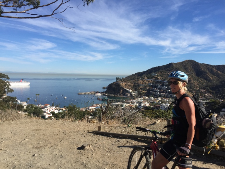
Catalina Island is a small (22 miles long & 8 miles at its widest point) rocky gem in the Pacific ~ 22 miles from Los Angeles, but thanks to nearly 50 years of the Catalina Islands Conservancy’s good work, it’s really worlds away! The island’s topography is a study in rugged beauty with steep cliffs and jagged coastline. Ninety percent of the island’s 4k population live in Avalon, which is also the Island’s major tourist destination with quaint shops, restaurants and bars. Yes, it has its charm, but you know by now that I’m more of a “wildlands” fan myself. That’s why we’re heading to the remote Westside of the island and staying in Two Harbors,
View point just after the initial climb out of Avalon on Stage Road – that’s the “What did I get us into this time?” look. Notice the over-packed backpack.
So I was wrong about that. Not long after the picture above was taken, 3/4 through the first climb from sea level up the airport road, I thought my knees were going to explode. No way I can make this, I thought. That’s when Ken pulled over and ordered me to empty everything heavy out of my pack and put it into his. I didn’t argue, toughing it out wasn’t an option if we were going to make it across. Yes, Ken is a stud and my hero! Wouldn’t have been able to make it without him taking on the extra poundage.
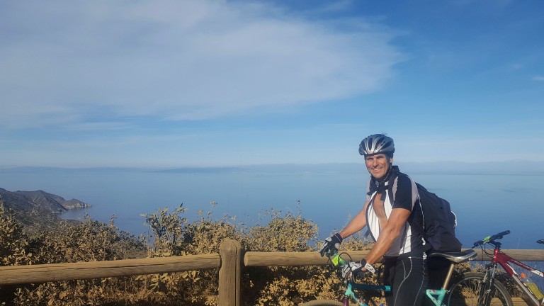
My hero, Ken, aka Superman, all smiles despite the extra weight in his pack. This is at the top of the first climb, he’s thinking the worst is over…I know we’ve only just begun.But views like these of the remote backside of Catalina can turn even my worst grimace into a smile…
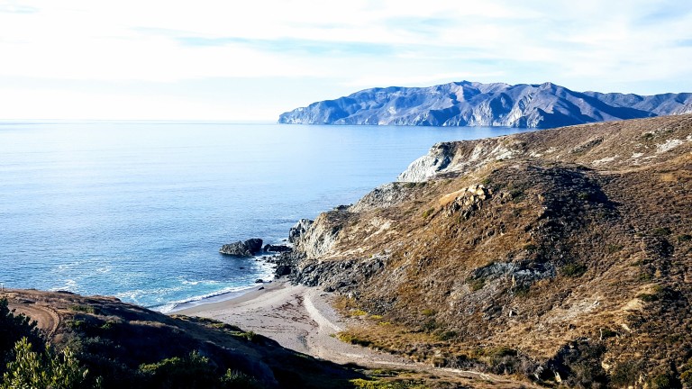
We left Avalon after 1PM and we didn’t pass the halfway mark until 3PM with all my knee breaks so we were getting a little worried that we might not make it by dark. There were no hikers or bikers out except for us and only a few cars and Island Conservancy trucks passed us. We had decided not to camp as we’d be carrying the weight of sleeping bags and Thermarests and possibly a tent too. Instead, we decided to treat ourselves to a stay at the Banning House Lodge for both our recent birthdays. So instead of stopping and relaxing at one of these gorgeous deserted beaches we pushed on and on…
We came around a corner and a gorgeous Catalina Fox crossed in front of Ken. Unfortunately, my camera was in my backpack and getting it out would have scared it away so we both just sat still and watched in quiet wonder as the beautiful creature took 5 steps looked back at us, took five more, looked back again, and once more before disappearing into the roadside brush. As if to say, “Hey, I’m giving you guys plenty of photo ops, what’s your problem?” This would be the first of several fox sightings in which I would be camera cursed each time. (Luckily, we met a great couple from Carlsbad (John & Julie) who caught some great pics while we were having dinner together at Harbor Sands. Stay tuned.)
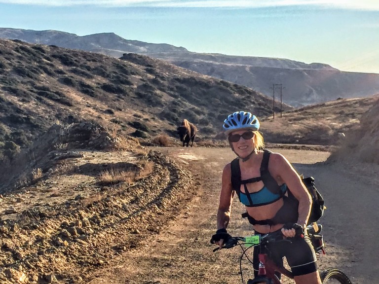
We would have one more notably larger critter encounter on our final climb out of Little Harbor, a brute of a buffalo was snorting and drooling his way up the hill. He was on the far right. We stayed as far left as we could.
Buffalo can charge at 35 mph and jump 6 feet high. And, we were told later, not unlike other aggressors, they have a thing for bikers. Yes, yikes. That’s my “Forget the picture and let’s keep moving.” look.
About Catalina’s Wild Buffalo
In 1924, 14 buffalo were brought to the island for a movie shoot and the rest, they say, is history. The bison thrived here and at one point the herd grew to 600. Today, the Catalina Island Conservancy manages the population (via birth control) to about 150, thereby striking the balance between protecting the sensitive ecosystem and keeping the herd healthy.
The weather was perfect and the visibility out to the mainland was the best I’ve ever seen it. Unfortunately, camera didn’t quite capture it. (Wasn’t going to bring my heavy Nikon.)
We made it just in time for sunset and the splendid wine and cheese welcome at the charming Banning House Lodge (another 150 ft climb) just to add insult to injury.
Big sigh of relief after our full, half-day adventure – brutal workout, spectacular views, a studly boyfriend who’s a great sport, a hot shower and a comfy bed – now that’s a birthday to remember. Stay tuned for Part II & III. (If you’re a mountain bike legend fan, you’re never going to believe who we ran into in the middle of the island on our way back to Avalon…)
Wanted to make it to the lake and back. The trail is one of the best in the area with 11 waterfalls on the way. It was heavily wooded so the views of the waterfalls and the dramatic canyons and the cliffs weren’t always visible without a slight ramble on spur to the right.
Hiking distance: 11 miles round trip
Elevation gain: 1,900 feet
Unfortunately, the trail was heavily iced and snow-covered so I had to turn back at Chasm Falls about a mile and a half short of the lake. In the video below, I misnamed the hike Hyacinth – it is Hyalite. Must have been the brain freeze.
Error
This video doesn’t exist
Here’s a close up of the icicles by the falls.
By the way, do you think my jacket is bright enough? I’m hoping the hunters will too. Heard a couple shotgun shots on the way down. Ended the hike via the accessible and lovely 1.5 mile Grotto Falls trail.
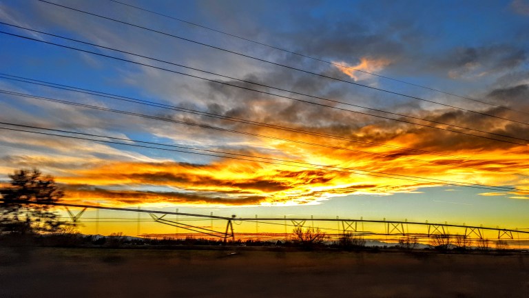
Ah, closing a day of hiking with a great meal at Ted’s Montana Grill and a big sky sunset, does it get better than this?