It’s relatively easy to “bag” the second highest peak in San Diego County as it tops out at just 6,515 feet. You’ve got a choice between two routes or a combo of them. I opted for the scenic trails up and took the paved road down to make a loop. Views were good on both routes, but far more solace, solitude and wildflowers on the less traveled, natural trail.
In 2003, the Cedar Fire , California’s biggest wildfire (started by a lost hunter who lit a signal fire that burned out of control) decimated 290, 278 acres, including 90% of the Park’s 24,700 acres. The ravages from that fire are still rampant, but these formerly rich forest (oaks, willows, adlers, and sycamore tress, cedar, white fir, ponderosa, Coulter, sugar and Jeffrey pine) and meadowlands are slowly making a comeback. More than 100 bird species abound in the park, including acorn woodpeckers, northern flickers and red tailed hawks, Mammals you might encounter here include gray fox, badger, bobcat, mountain lion and deer.

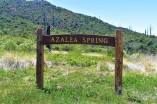 If you reach this sign, refill you water at the spring, but you want to turn back and follow the fireroad about a 1/4 mile to the Coneja Trail connector and take that on up to the peak.
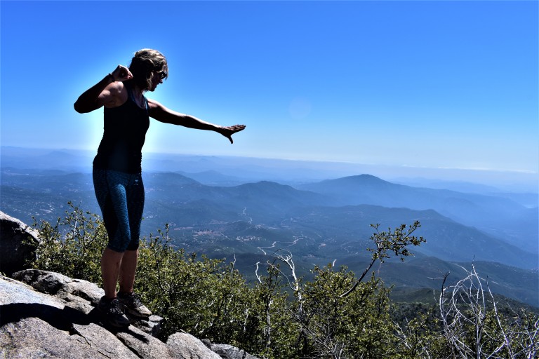
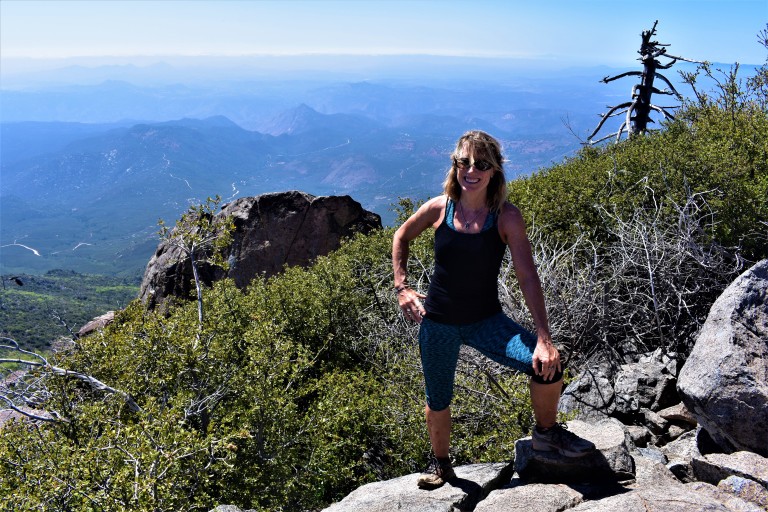
At the top
Unfortunately, it wasn’t a clear day so the Salton Sea and Anza-Borrego Desert to the east and Pacific coastline to the west and all the mountain vistas surrounding were a bit difficult to discern.

Is it just me or does the burnt tree in the picture above evoke an Indian chief bowing his head? (Kumeyaay Indians occupied the Cuyamaca mountains from antiquity until around 1857.)
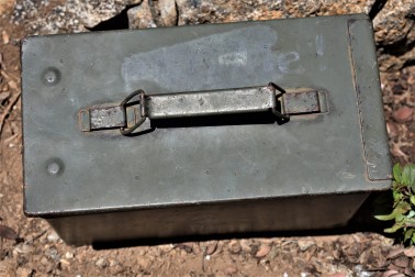
You can document your peak bagging effort by opening this box and signing in.


There are plenty of other trails to explore nearby including a switchback trail up and down alluring Stonewall Peak (4 miles rt) and hidden waterfalls somewhere…(I’ll let ya know when I find them.) If I’d had more time I would have done Stonewall too. (The trail head is right across the campground entrance.) There’s more than a 100 miles of trails for hiking, horseback riding and a select number for mountain biking here. I’ll be back.
Planning your excursion
You can make a day or a weekend of your Cuyamaca adventure. The historic gold mining town of Julian is a mile or two away with its quaint shops, B&Bs, restaurants and famous pies.
Notes
Miles: 7.7 miles rt (Or just 5 miles rt if you take the paved road both ways.)
Elevation: 1700 ft gain/ loss
My route: Azelea Glen Loop to Azalea Glen Road. Make a right on the Azalea Fire Road, a left on the single track Conejo Trail that comes up in a 1/4 mile. The Conejo Trail hooks up with Lookout Fire Road about a 1/2 mile from the top – the steepest portion.)
Terrain: Mostly sweet, soft terrain (as in trail runnable), until you get to the Conejo Trail. It’s gets a bit rocky and pesky for a while on there so watch your footing. (Another reason I chose the paved road downhill.)
Difficulty: Moderate. Depends on your fitness level and the route you take. The 1/2 mile incline at the top is tough, but it’s all quite reasonable. I brought hiking poles but did not bring take them on the trail and was fine. (I have bad knees.) It would be a bit relentless to take the paved road up. (I wouldn’t mind trying it on a mtb bike. Heard about some people who did on road bikes – that’s a little nutty. Took me 2 hours up and 40 minutes down – no running…
Trailheads: Both the paved Lookout Fire Road & the Azelea Glen Loop begin at the Paso Picacho campground, Cuyamaca State Park
Parking: $10 State Park Fee
Dogs: Only allowed on paved roads and must be leashed.
Camping: Paso Picacho campground has family campsites with tables, firepits, running water and bathrooms.