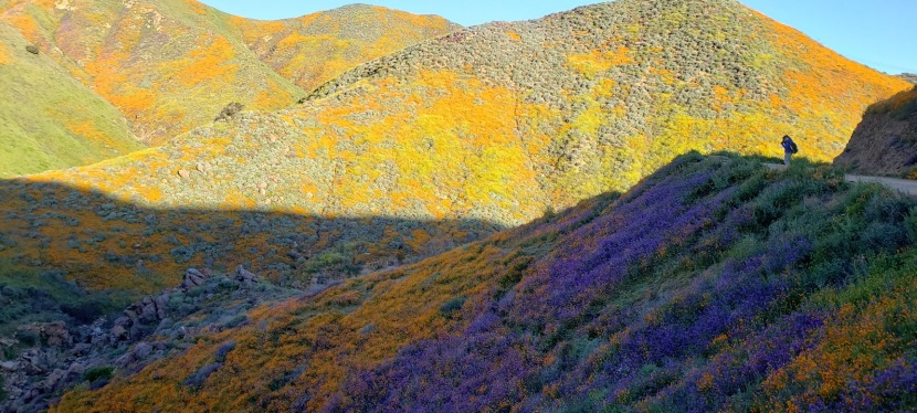
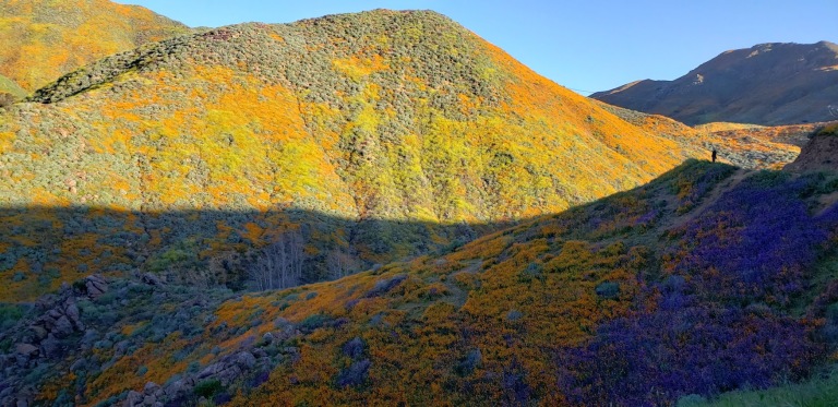
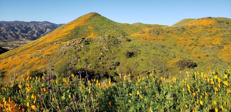
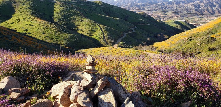
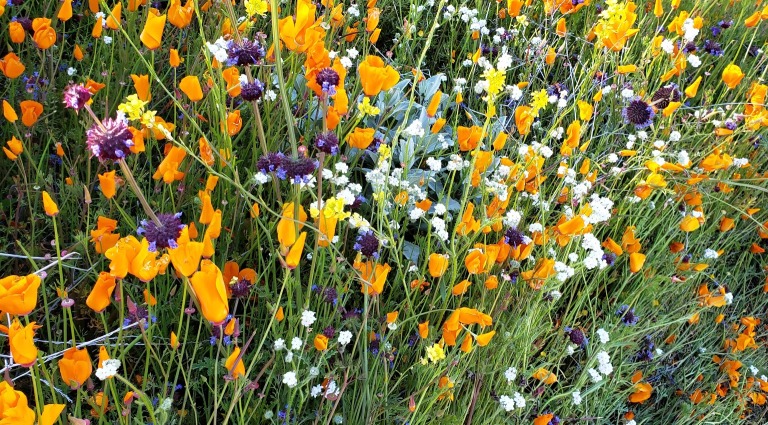
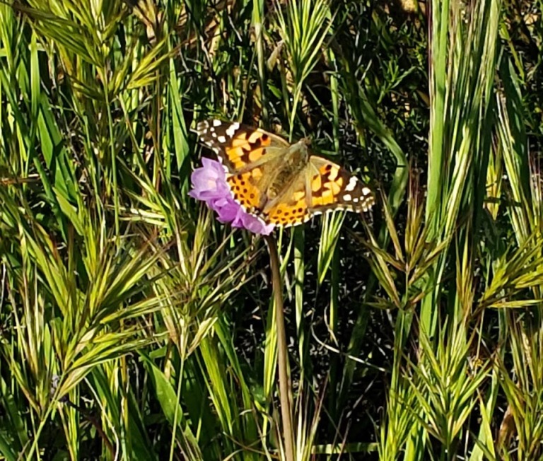
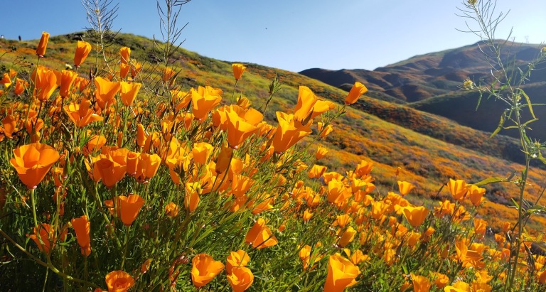
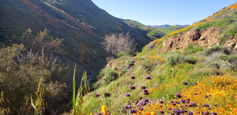
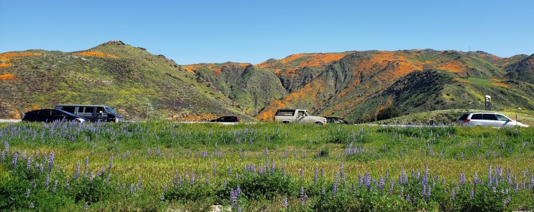
So glad I made the drive, not 1ce, but twice for this epic poppy bloom. How many times in our lifetimes does nature serve up such a spectacular treat? (Yes, I’ve experienced super blooms before, a couple years ago in Anza Borrego and way back when in Gorman, CA, but for me their magnificence never gets old.) You’ll have to pardon the abundance of pictures, I can’t help myself!
BTW, Walker Canyon is a 3.5 mile fire road out & back route in the Temescal Mountains. There’s a gradual incline, it’s perfect for trail running. The Temescal Creek flows through the bottom of the canyon. If you look closely you can see it from the trail and if you’re lucky, you might here it’s lovely musical melody too.
The downside of the super bloom? Too many humans, of course. Way, way too many humans and cars. They’re calling the Poppy Apocalypse and Flower Armageddon. But I am happy to see people getting outside and enjoying nature. (Not happy to see people trampling it though.)
Looking down on the Walker Canyon TrailMother Nature’s Splendid Bouquet
Day 2 – Spent my St. Patrick’s Day morning immersed in a flower rainbow
Yogi’s Bliss
To add to the amazing spectacle, there’s a painted lady butterfly migration going on right now too!
Temescal Creek
As always, happy trails to you. Let me know which pics you like better – day 1 or 2?
Getting there: Lake Street off the 15 freeway, Lake Elsinore
A popular spot for mountain bikers and hikers, the San Dieguito River Park in Escondido is squeezed between the I15 freeway and a couple housing developments. It’s not wilderness, but it still makes for a decent, suburban excursion and nature fix.
As I mentioned in my Cruising Lake Hodges post, the main mountain bike route on the Coast-to-Crest Trail is beginner friendly. The Bernardo Summit trail is not—it’s rated difficult due to loose rocks and steep technical sections. In other words, it’s way out of my mountain bike skill league so I left it undone on my last visit, vowing to come back and hike it. Note don’t let the words summit and mountain deter you. We’re only talking about a ~1k ft in elevation gain here. But that elevation is enough to deliver views that do not disappoint.
If you’re like me and want to bypass some concrete “hiking” and walking under the freeway, you may want to start your hike at the bicycle/pedestrian bridge (the world’s longest stressed ribbon bridge) which crosses the variably wet/dry section of Lake Hodges. After traversing the bridge, take the trail to the left heading towards the Lake. Before long, you’ll hopscotch on a couple rocks across Felicita Creek, a small perennial brook, and round the bend from there. Look for the summit trail splitting off to the right (the sign for it is facing the other direction). It’s a gradual, steady climb – mild to moderate and absolutely runnable – you just need to watch your footing on the loose rock sections. (I find it easier, more fun and less painful to run up vs. down.)
At the last and steepest section, you’ll encounter a fenced-in water tank – not very pretty, but don’t be discouraged. 
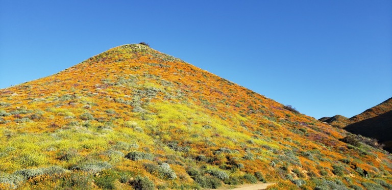
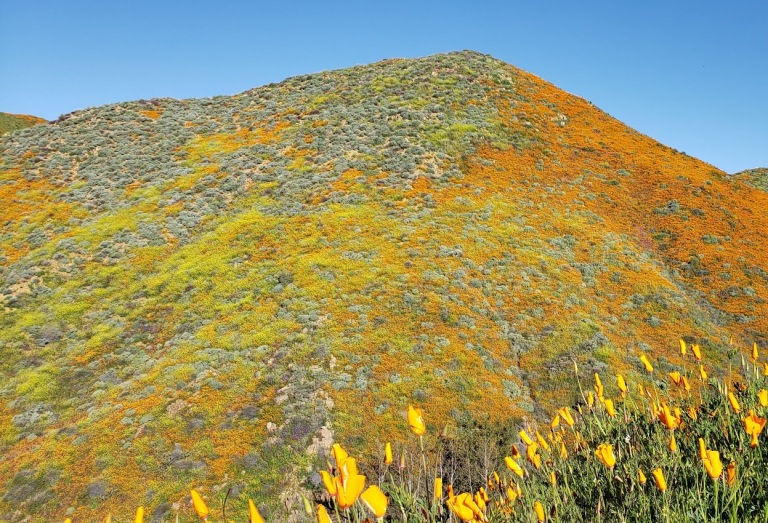
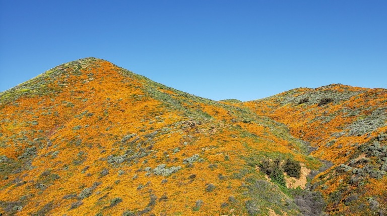
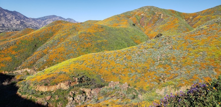
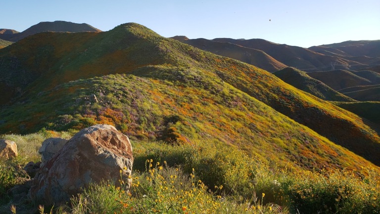
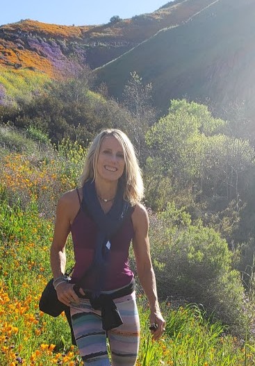
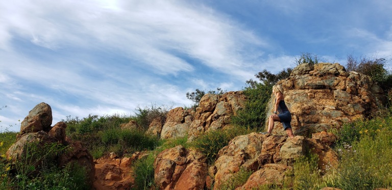
Your final ascent will be rewarded.
I highly recommend this hike for the best views in the park and a good workout. If you’re not up for incline, you can keep going straight along the North Shore trail to Del Dios Community Park and eventually, past the Lake Hodges Dam. Note it’s an out and back.
Hiking difficulty: Mild to moderate+ depending on your fitness level
Elevation change: ~1,000 ft
Distance: ~6.2-7.2 miles roundtrip, depending on where you start
Years ago, the Prescott East Railroad trains ran through here to the Iron King Mine and towns of Poland Junction and Crown King. Today, you can take in the area’s quintessential southwestern scenery and spectacular granite rock formations by horseback, two (or 3) wheels, or by two feet. It’s ~4 miles down to the Peavine Trail connection and then you can continue on for another ~6 miles to arrive at Watson Lake, Prescott (~20 miles RT).
The Iron King path is by far one of the easiest, smoothest, most family-friendly mountain bike “trails” I’ve ever encountered. Apparently they went to great lengths to convert this rail to trail and create its excellent surface. First they undercut and evened out the trail to eliminate the “washboard” effect and then they topped it with a blend of coarse and fine gravel. The path is so smooth and flat that a kid on training wheels or a tricycle could ride it. You could take a wheelchair on it (electric or person powered – if you were up for it) too. It all translates to fun times and cool scenery for all.
For me, the most scenic sections of the ride are in the middle where the Iron King and Peavine trails intersect and along the gorgeous Granite Dells and Watson Lake at the Prescott end.
This slideshow requires JavaScript.
Check out the video below of a hiking trail in the Granite Dells.
Keep an eye out for resident javalina, rattlesnakes, and mountain lions. I didn’t see any of them and only saw 2 other cyclists during my sunset pleasure tour. (Not sure if the hot weather (90+ degrees) – was keeping people away or what. I expect when the housing development in Prescott Valley completes, this will get much heavier use so enjoy some solitude while you can.
Getting there: The Iron King Trail begins in Prescottt Valley west of Glassford Hill Road, north of Spouse Drive – at the base of Glassford Hill. Unfortunately, that’s also where a new housing development is going in so the first mile or so is a bit of a bummer. Truth in advertising picture below. (Heavy sigh.). The Peavine Trail begins at the south end of Watson Lake in Prescott. Take Hwy 89 to Prescott Lakes Parkway, then to Sundog Ranch where you can park along the road .
Stay tuned for my top picks of places to stay and eat and for more of my active escapades in and around Prescott.
One misty morning, I drove to the park from Santa Cruz on windy Highway 9. I turned one of the many blind corners and almost ran over a vagrant walking down the middle of the road (literally the middle of the road) pulling his rolling suitcase. Yikes. Luckily I was driving cautiously through here because when I drove into town the day before I couldn’t help but notice that the pullouts were polluted with groups of what I am going to call “car people” in various states of inebriation and agitation and ankle-deep in their own litter and debris. Yes, that was my off-putting experience with the “Santa Cruz city greeters.”
I thought early morning might be a good time to explore Henry Cowell State Park, avoid those car transients and the crowds in general. I was mostly correct.
The 4,650 acre park is best known for its 40-acre grove of towering old-growth redwood trees, but it also includes 3 other habitats (grasslands, river/riparian and sand hills). The redwoods here are said to have inspired some of California’s earliest redwood preservation efforts. The tallest tree in the park is ~277 feet tall, ~16 feet wide, and estimated to be ~1,500 years old. Some trails run alongside the Sans Lorenzo River and there’s even a swimming hole.
When I arrived, the parking lot was empty as were the trails. I just ran into a couple trail runners and dog walkers.
The .8 Redwood Grove Loop trail is, of course, a must do. I also did the Cowell Highlights Loop to the Observation Deck (the park’s highest point at a meager 805 feet) Overlook Bench, Cathedral Redwoods, and Cable Car Beach about 6 miles.
It was pleasant but I never felt I was away from civilization – one “trail” is a paved road and you can hear people at the campground from different points on the trails. It’s a good place for a quick leg stretch or trail run, family hiking and camping experience. If you’re a hard-core hiker, I’d say if you miss it, you won’t miss that much. If you get it on a clear day, you might be rewarded with spectacular views of Monterrey Bay. I wasn’t, but the Santa Cruz mountains views were certainly pleasant. By the time I finished my hike, the parking lot was full of people crowding onto the trails in hopes that the mist would clear for them. It may have, but I’m glad I got out of there when I did. Go early, if you want to avoid the crowds.
This slideshow requires JavaScript.
After 2 somewhat disappointing days in Santa Cruz, I headed south for adventures in Carmel and Monterrey. They did not disappoint.
Cuyamaca Peak‘s little sister, Stonewall Peak, (5,730 feet) outshines her big sister with her stunning granite crown, haunting tree skeletons (remnants of the Cedar Fire) and lovely vistas of Cuyamaca State Park and out to Anza Borrego. Before I moved to North County and started exploring the area, I had no idea that all this wonderful natural beauty is an easy drive from greater San Diego.
Gradual ascent on a friendly trail
Expansive viewsInteresting rock formations along the wayStairway to heavenly vistas
Something about these beautiful trees and bouldersA bit crowded at the actual peak – silly people looking down at their phonesLovely Lake Cuyamaca views on the way downA sprinkling of dazzling wildflowers
Takes you back to the start
Biggest Dandelion Ever???
Planning your Cuyamaca adventure
You can make it a day or a weekend adventure and do as much or as little hiking as you like. Ambitious, fit hikers can take on both peaks (Cuyamaca & Stonewall) in a day. For the less ambitious, there are plenty of opportunities to add on easy short strolls by the lake and up to Stonewall Mine. Lots of wildlife viewing with trails for the whole family. Stay tuned for my next post. Happy trails!
The historic gold mining town of Julian is a mile or two away with its quaint shops, B&Bs, restaurants and famous pies.
Notes: This is the most popular hike in the park so go early to avoid the crowds. After you reach the Stonewall Peak spur trail and make a right, there’s a really short scramble over some rocks before you hit the last rocky stairway. Keep your eyes open for the metal handrails. On the way back, I recommend taking a right at the junction for a different route down ton what becomes a pleasant single track trail d. At about 3.7 miles, you come to a trail intersection. Make the left onto Vern Whitaker Trail. Shortly after that (around 3.9 miles) there’s another junction, continue to stay left. At 4.2 miles or so,you’ll encounter another side trail; stay your course to the left again.
Miles: ~<4 miles rt if you just go up and down the main trail. My scenic route adds about a mile & a half for ~5.5 miles rt.
Elevation gain: 1,050 feet
Terrain: Mostly sweet, clear terrain (as in trail runnable). It’s gets a bit rocky and pesky for a while near the top so watch your footing. .The single track down was mostly friendly.
Difficulty: Easy to moderate. Depends on your fitness level and the route you take.
Trailhead: Across the street from the Paso Picacho campground, Cuyamaca State Park
Parking: $10 State Park Fee
Dogs: Only allowed on paved roads and must be leashed.
Camping: Paso Picacho campground has family campsites with tables, firepits, running water and bathrooms.