A couple years back, I went for a pleasant mountain bike ride with a friend and have been wanting to return for a while. I couldn’t remember exactly where it was. Fortunately, my friend has a reliable memory and was able to direct me back to the spot. It’s part of the Coast to Crest Trail and in the San Dieguito River Park (92,000-acres)
If you read my Lake Hodges MTB post, this spot is on the other side of the I-15 freeway. The trail begins at the historic Sikes Adobe.
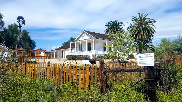
Established around 1870, the Sikes Adobe Historic Farmstead is one of San Diego’s oldest adobe homes. Tours are offered on Sundays, more info here.
The first 3-4 miles or so are completely flat with easy terrain and valley views. Perfect for beginners and kids. Next you have 2 options, you can climb up some lovely single track to the Raptor Rodge lookout (and continue on to Ysabel Creek RD Staging Area) or cross the road to the Old Coach Trail and climb a steep paved road.


(I did both this time.) Previously, I had chickened out of the Raptor Ridge single track as it looked a bit rutted. This time it appeared smooth so I went for it and didn’t regret it. What a sweet ride, great for a trail run too. Only ran into 3 people out there despite a sign warning about congestion on the trail. It was gorgeous and a decent workout. Distance to Raptor Ridge is 6.1 miles ea way. The lovely valley views really open up as you climb. Once at the top, you can continue on down to the to the Ysabel Creek Road Staging Area, a somewhat rutted and scrappy fire road. Unless you have a car shuttle, you’d have to climb back up that road. I opted to return to the intersection and climb up the Old Coach Road instead. Once you navigate through the grove of trees and climb the steep paved road, you can continue to follow the Old Coach Trail signs across the 2 residential roads until you get to the single track. (I haven’t followed the single track to see where it goes as it’s gets a bit technical for me – trails is rougher, rocky, etc…) And the map ends at the paved road. Perhaps I’ll have the gumption to explore more next time.
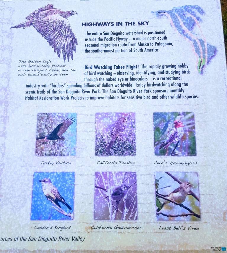
Raptor Ridge is aptly named. This area is great for bird watching.
Wonderful, well kept trails make for a splendid afternoon on foot or wheels. Gets hot in the summer so go early and bring water.
Getting there from the I-15:12655 Sunset Dr. Escondido
Exit Via Rancho Pkwy
Right onto Via Rancho Pkwy.
Right onto Sunset Dr. (1st traffic light from I-15N; 2nd traffic light from I-15S)
Left into the Sikes Adobe Staging Area (dirt lot ), or park along the street