Difficulty: Easy to moderate, depending on your fitness level.
I took a microsample (~10%) of the Routeburn Track Great Walk on my afternoon hike to Key Summit. Having just scrambled up the slick, rugged obstacle course to Lake Marian, it was a refreshing relief to stride up the gravel path to Key Summit.
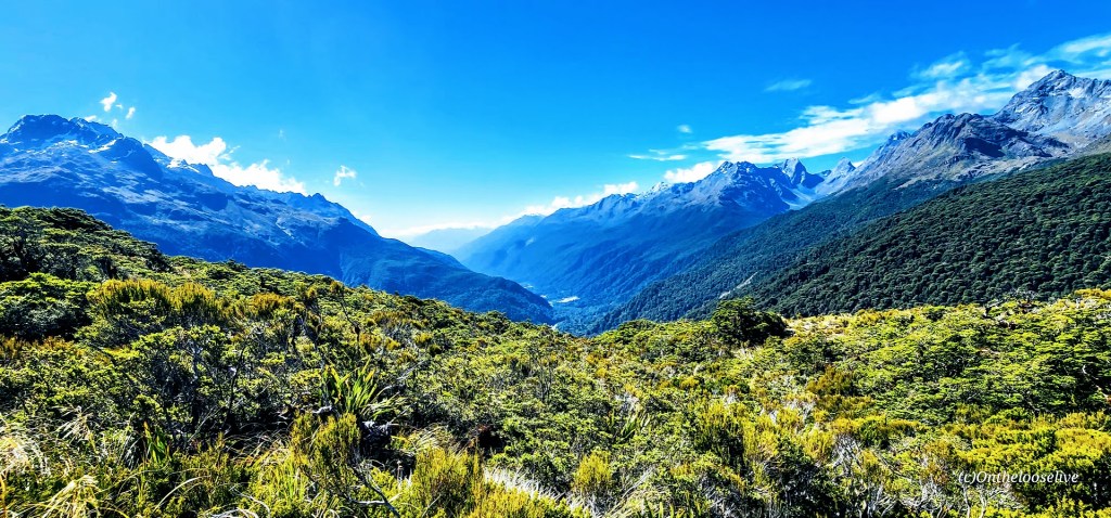
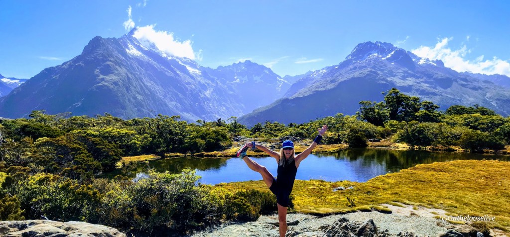
The climb is gradual and is rewarded with sweeping views of the Hollyford Valley, alpine tarns (lakes/pools), and Fiordland’s panoramic rugged peaks.
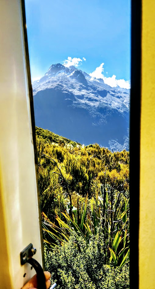
Possibly the best Port-o-Potty view ever!
Looking back, after doing both Lake Marian and Key Summit, I might have preferred covering more distance on the Routeburn Track vs the painstaking, slo-mo route up to Lake Marian. (Not the most adventurous take, I know.) I tend to enjoy a more vigorous pace—the former trail runner in me still craves that rhythm. Tortuous terrain that slows my flow tends to be more frustrating than fun for me. Lately, I’ve also been weighing the “risk versus reward” factor. That said, Lake Marian is undeniably spectacular, and the hike has a sense of challenge and excitement that Key Summit doesn’t.
That’s the beauty of the great outdoors: you get to choose your own adventure. And in New Zealand, there’s no shortage of ways to find it. Stay tuned for more Great Walk sampling on the South Island!
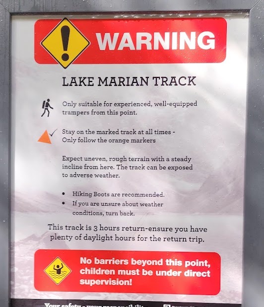
The Lake Marian hike is short, but risky business. A trail sign warns of “rough terrain” and advises that only experienced hikers continue.
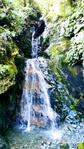
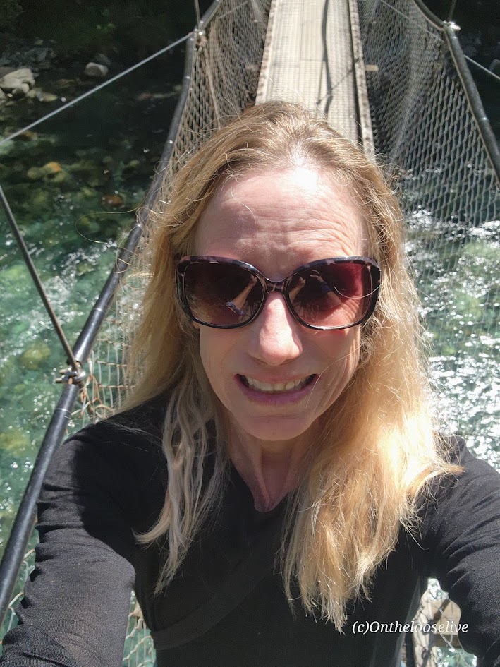
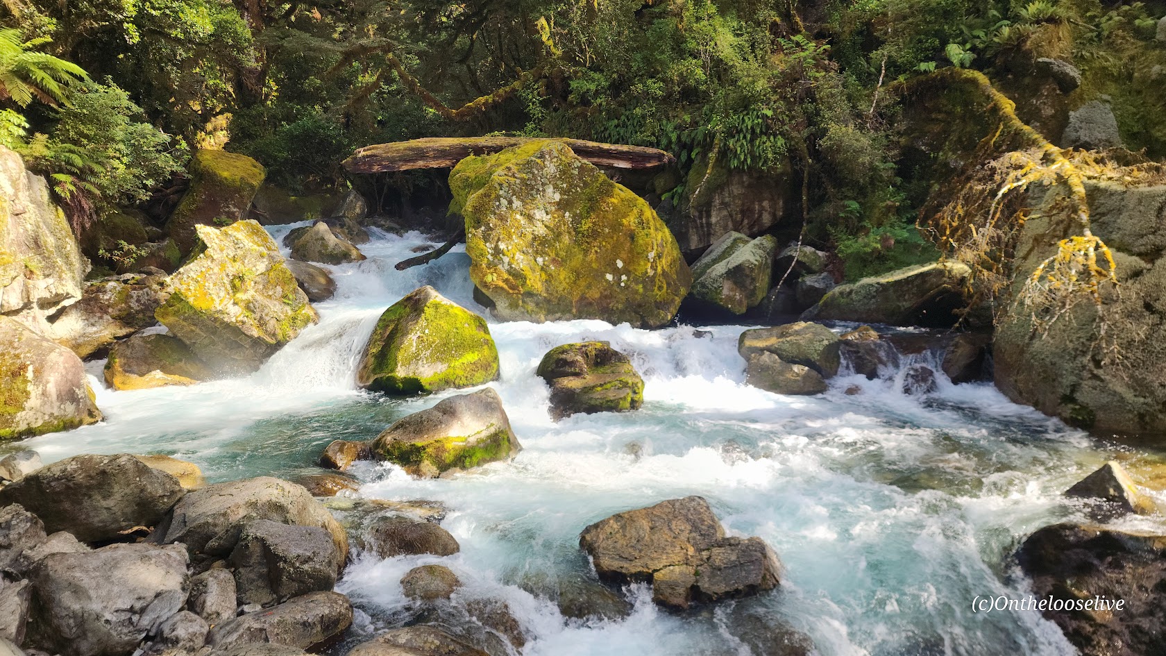
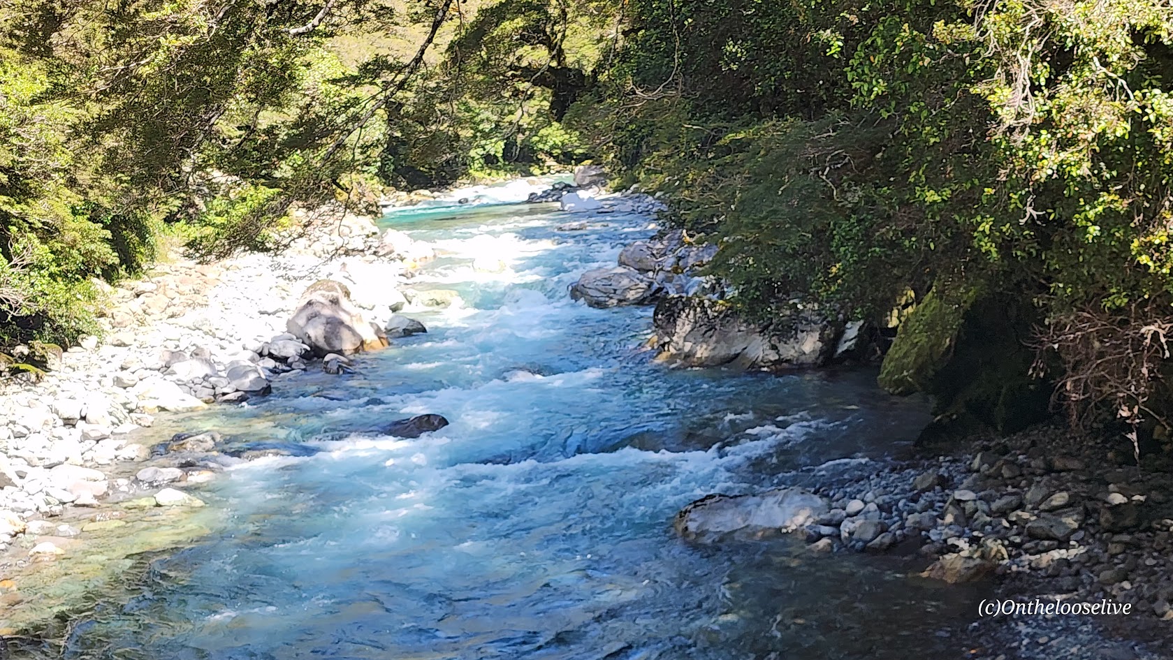
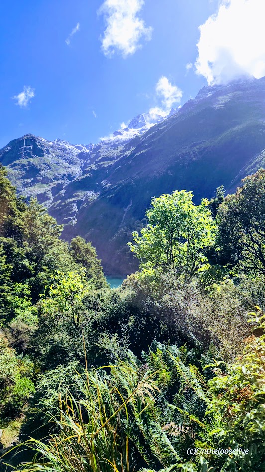
For the first half-mile, the path crosses a swing bridge over the Hollyford River and follows the magnificent, roaring Marian Creek, lulling you into a false sense of ease. The creek is dazzling, but dangerous too. (Sadly, in 2024, a 10-year-old girl slipped in and was washed away.)
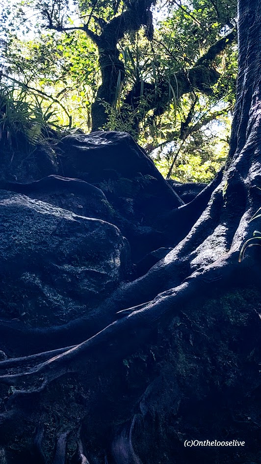
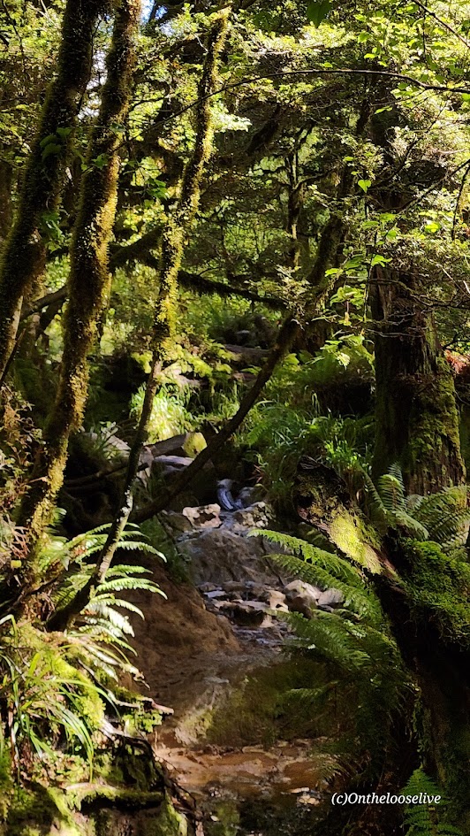
After the warning sign, you begin the slippery obstacle course, scrambling over wet roots, loose, slimy mossy rocks, and mud on a barely perceptible, steep trail. It is a painstaking, slow-motion journey, each step a careful calculation. I only have 1 photo of the trail because I needed to keep my hands free and my focus for fall / accident prevention. It’s the kind of hike best left to the nimble and sure-footed—reminiscent of some trails in the rainforests of Hawaii, but possibly more treacherous.
This hike stands in stark contrast to the meticulously groomed trails like the Kepler Track and the Tama Lakes Track that I hiked a few days before (some might argue those are over-groomed), but my knees and I have zero complaints.
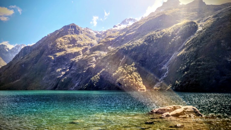
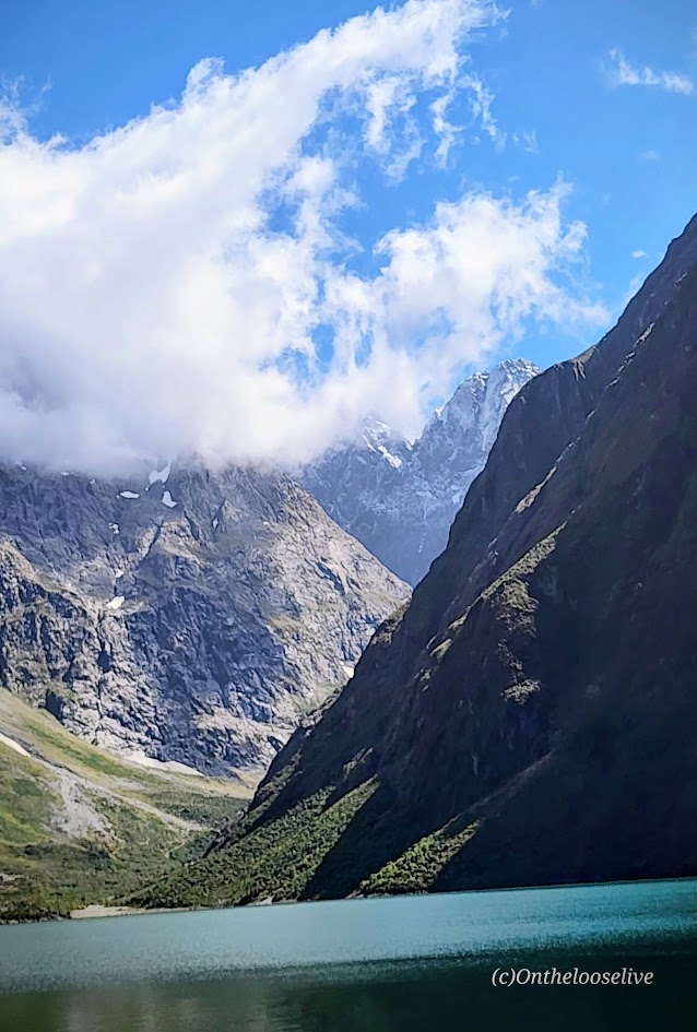
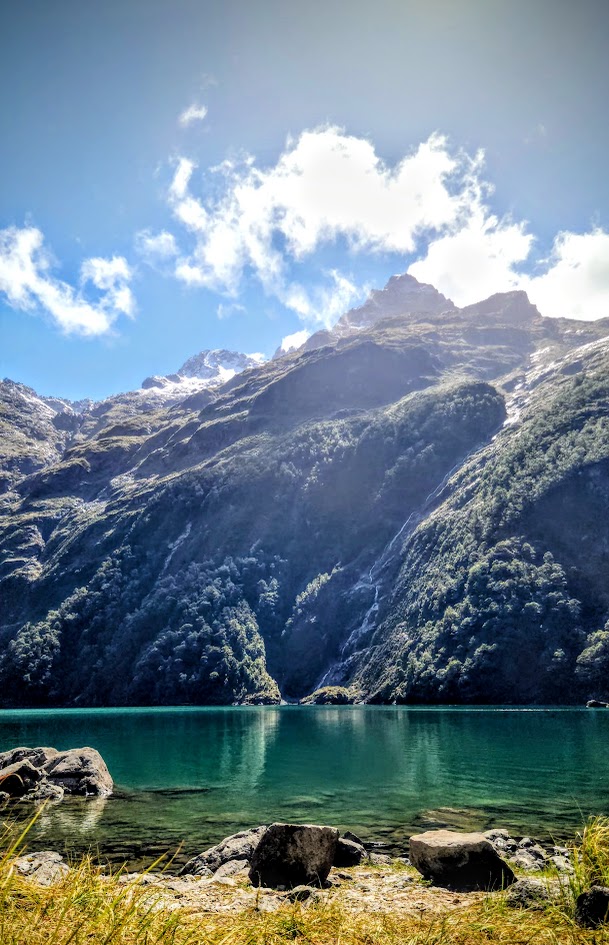
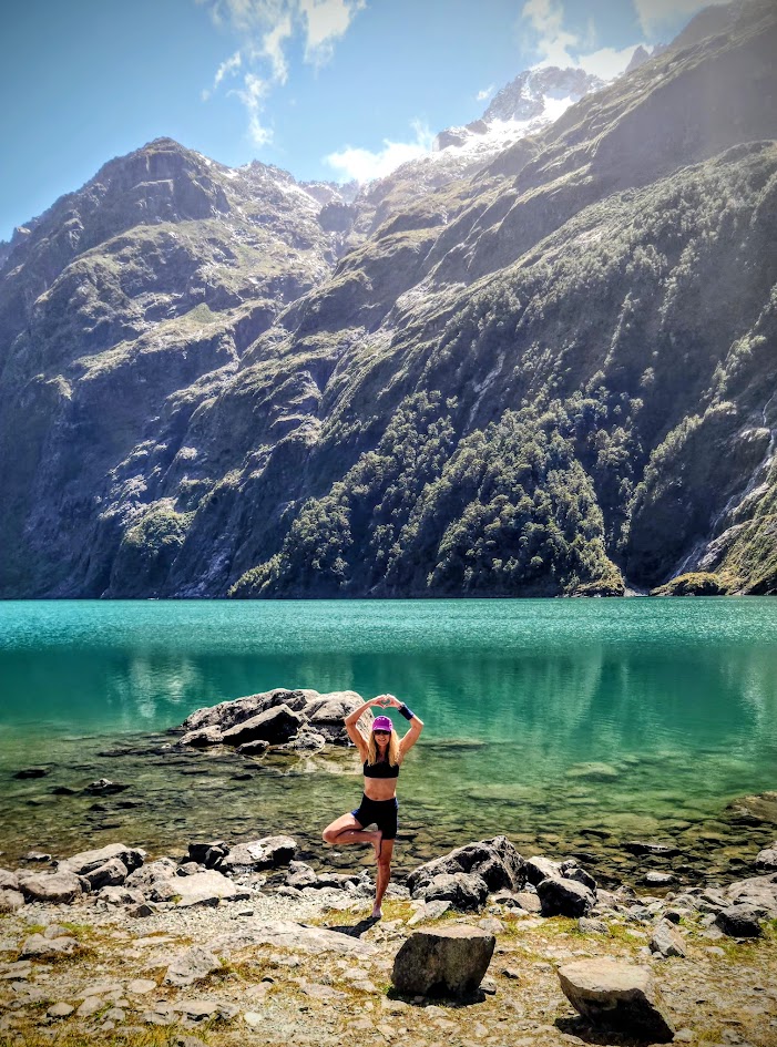
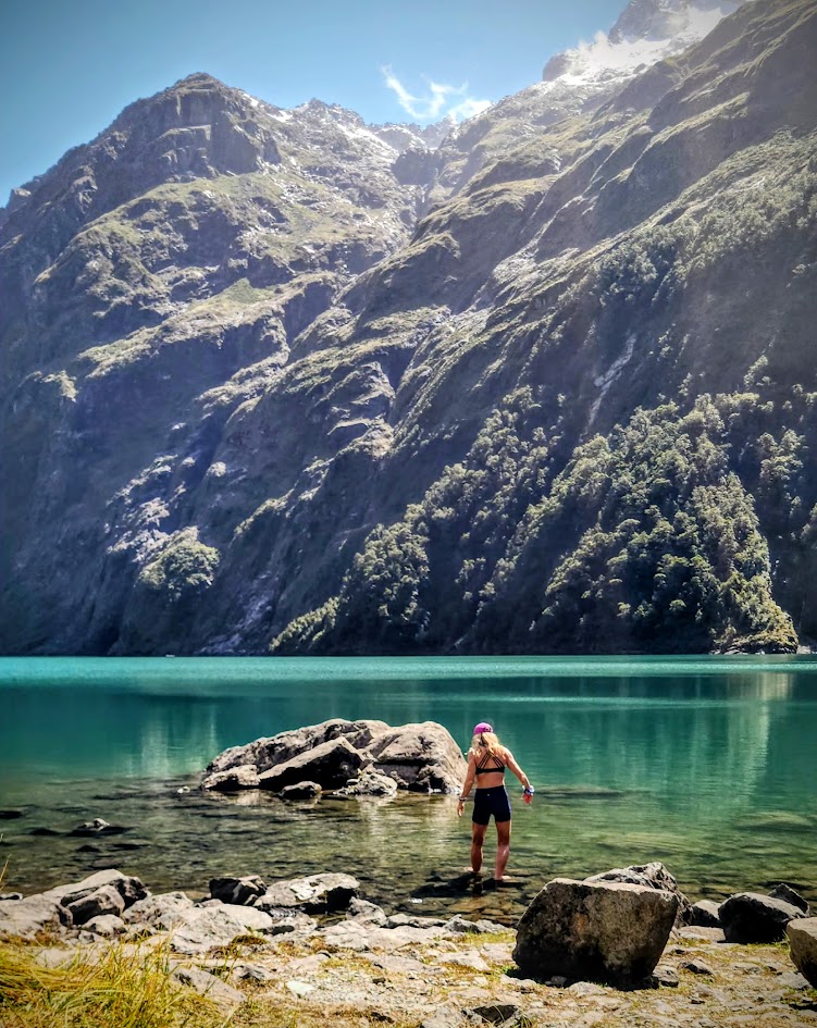
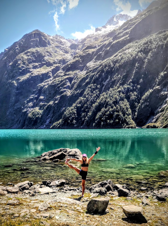
Everyone knows I love my alpine lakes and often go to great lengths to get to them. Lake Marian, with its granite glacier-carved basin, snow-capped peaks, and waterfalls, is spectacularly stunning, but having done it, I’m not sure I would choose it again. (Especially, with ALL the beauty of New Zealand to choose from and the more pristine “tracks” that don’t threaten a broken ankle, or leg at every turn…) For instance, after this hike, I went on the nearby Routeburn Track (one of New Zealand’s 11 “Great Walks”) to Key Summit (post to come). In retrospect, spending the day taking in more miles of that 20-mile track would have been time better spent.
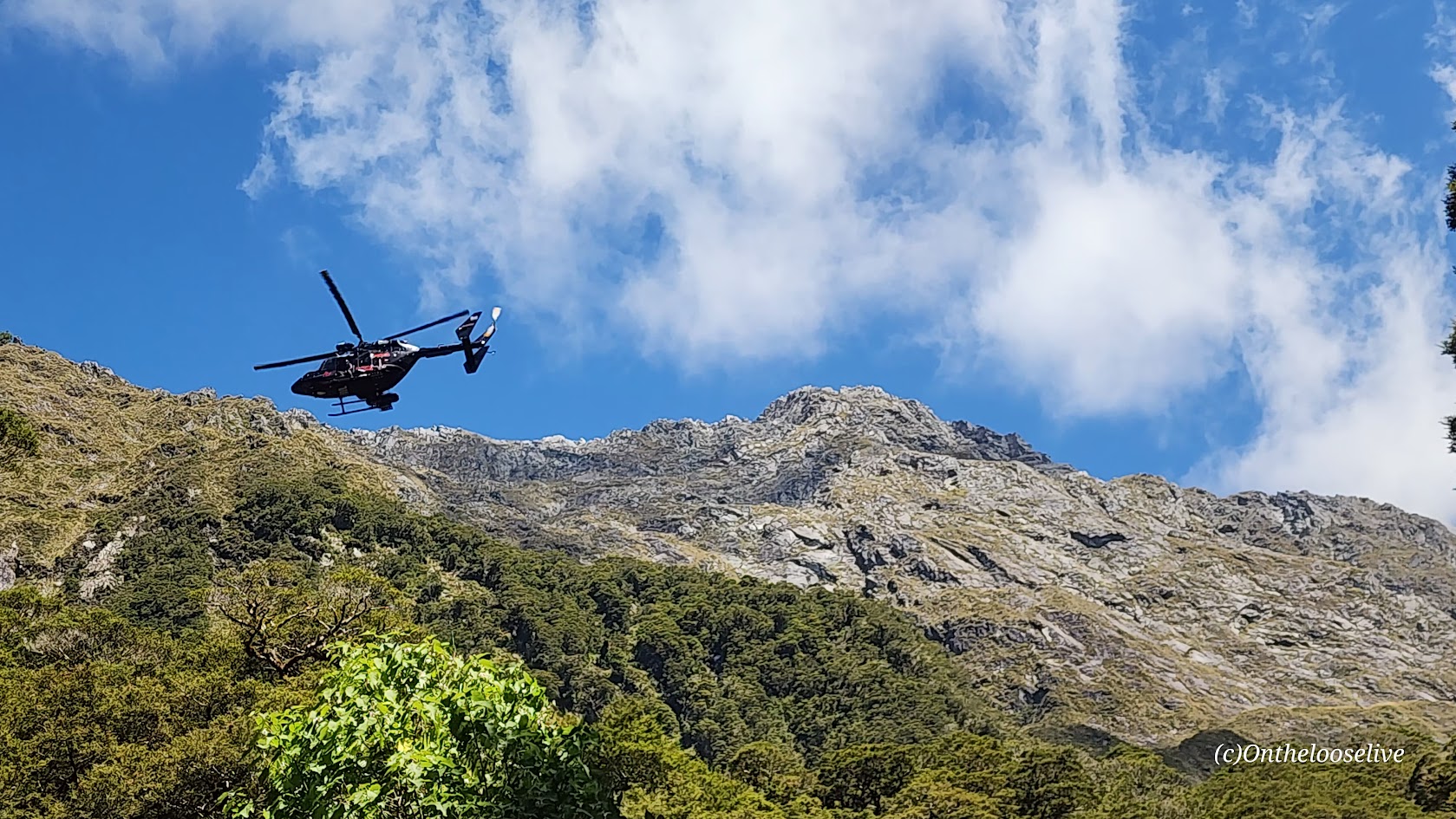
On the way down, a helicopter rescue was underway for a woman who had slipped and broken her leg. Unfortunately, the terrain was so rugged that they couldn’t maneuver the helicopter where it was needed. Instead, the rescuers would need to hike in to get her…(She was still waiting, hours later.) It made me think: perhaps a more effective warning sign for the hike would be one that shows the tally of rescues here. I have to imagine they are weekly, if not, daily in the high season.
While some might label me a risk taker, the risks I take are certainly becoming more calculated with each passing year…
Pro Tips: If you’re determined to do the Lake Marian hike, save it for your last day so an accident doesn’t ruin your entire vacation. Bring water shoes if you’re planning to go for an immersion, as there are sharp rocks at the shore. (I skipped my usual dip as the air was brisk, and I knew the hike back through the dense forest would be slow going, likely not enough vigorous movement to ward off hypothermia.)
Getting There: The Marian Lake trailhead is located in Fiordland National Park, just 1km off Milford-Te Anau Highway (SH 94) on Lower Hlyyfor Road.