Monserate Mountain is more of a steepish molehill than a mountain. You can hike, bike or run up the trail for a short, steep, incline workout and the reward of expansive views of the mountains (Agua Tibia, Red Mountain, Santa Ana Mountains), farmland in the valley below, and a sliver of Pacific Ocean way out to the west. I have mixed feeling about this one for reasons detailed below…
History
Monserate Mountain was part of an 13,323-acre Rancho Monserate Mexican Land Grant from 1853 that originally extended south and east of the present day Fallbrook down to the San Luis Rey River.
Pros
If you’re in or near the area, you can get a quick workout here with sweet 360 degree views at the top. Also, I think that it might be the right balance of tough and short for hardy hiker kids who get a feeling of accomplishment from doing something challenging.
There are a couple offshoot trails on the way up: Canoninta Trail and Red Diamond. I didn’t take those, but once at the top, headed south along a Ridge Trail to the water tank. This was the best part of the hike for me – it faced away from the freeway on a little stretch of single track with views into the valleys below and east across the mountain ridges. The Ridge Trail descends gradually with the help of a short wooden staircase and then drops you out on a paved road. (In the pic below, I turned around and ran up the staircase for the pure joy of a little more incline.)
Glutton for the incline.Mountains to the east from the Ridge Trail.
Cons
The barren, dirt trail going up has little to no aesthetic appeal. This trail gets lots of traffic, human and dog (too much I’d say). And I’m afraid it smells like it too. (I have a sensitive schnozz and the trail smelt like dog poop most of the way up.) Also read a review that someone got bitten by a dog twice on this trail. The roar of the 15 freeway below is also a bit off putting as are the weekend crowds that you have to hike around. (I was so uninspired and turned off by the dog poop smell, I didn’t take any pictures on the way up.) Yes, that bad – but then again, I’m a hiking snob. You’ll see why if you visit some of my other posts.
If you’re in the area, do it. Otherwise, I wouldn’t go too far out of your way for this one. Distance: 3.2 miles up and back without add ons, or 4.4 mile loop adding on the Ridge Trail loop to the water tank. Elevation gain /loss: ~1150 feet, moderately strenuous, depending on what shape you’re in. If you’re a trail runner, you’ll like it and you’ll want to add on the Ridge Trail water tank loop. Terrain: Mostly wide dirt path with rocks and some erosion, some single track, paved road & fire road if you do the 4.4 mile loop.
Another attraction to put on your top 10 things to do in Kyoto list. The Fushimi Inari Shinto Shrine in Kyoto dates back to the seventh century (~711 AD) when the Hata family built it and dedicated it to Inari, the god of rice and sake. Today, it remains the head shrine for over 30 000 Inari shrines across Japan and is one of Japan’s most visited shrines and a top sight-seeing destination. (TripAdvisor rates it as the #1 thing to do in Kyoto – not sure I agree. I was far more impressed with their #3 Kiyomizudera temple, but I was fortunate to experience a special night viewing there.)
The Fushimi Inari Shrine may look vaguely familiar to you if you’ve seen the movie Memoir of a Geisha, some of which was filmed here. But the shrine itself is not the main attraction―it’s the iconic orange torii gates (10,000 and counting) that crown the 2.5 mile pathway up Mount Inari (764 feet). While it’s a relatively short “hike” on a concrete path that winds its way up the hill past multitudes of mini-shrines, it can take a while given the crowds. The “summit” is a bit anti-climatic, city and mountain views were smudged with smog when I was there.
At the entrance…
Instead of returning the way you came, you can hike down the other side of the mount on forest trails into either Yamashina or Tofukuji, another temple area that’s especially popular when the leaves are turning. Really, you can’t go wrong walking anywhere in Kyoto. Kyoto is all about having a scenic, cultural and beautiful experience, but it is Japan so you’ll most likely be sharing that experience with the masses.
Not artsy, just editing out the crowd.
What’s with the gates?
Torii gates symbolize the division between the physical world and the spiritual world. The oldest Torri gates here date back to the 8th century, but new gates are still being added, “donated” by Japanese businesses in hopes of obtaining prosperity and good luck. Today, the price for good luck if you go with a big gate is around 10k; 4k for smaller gates.
What’s with the foxes?
You’ll also encounter many stone statues of foxes, messengers of the god Inari. The foxes often carry symbolic objects, such as a key to the granary (as in the fox in the picture with me at the entrance), a sheaf of rice or a scroll. You may see some fox statues wearing red scarves, which are thought to expel demons and illness. Some fox statues may be equipped multiple tails to symbolize older, wiser and more powerful foxes.
Hours: Open 24/7, best times – early morning or evenings, otherwise expect a crowd.
Cost: FREE!
Getting there: The shrine is located just outside JR Inari Station, two stops South from Kyoto Station (main station) along the JR Nara Line and takes 5 minutes one way. It is also a short walk from Fushimi Inari Station along the Keihan Main Line.
Notes: There’s a street market and shops and restaurants near the shrine’s entrance and also there are a couple of little food shops near the “top”.
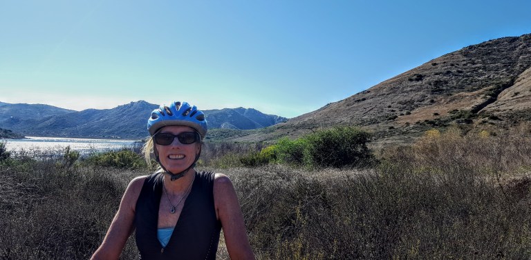
My back was a little tweaked from last week’s roller blade when I used my butt as a brake so I was looking for something mellow to do this weekend. That’s when I thought of mt.biking around Lake Hodges on the flat section of the San Dieguito River Park Coast to Crest Trail. This multi-use trail is open to hikers/runners, mountain bikers and equestrians. The main trail (a planned 70 miles – 45 miles of which currently exists ) extends from Del Mar to Volcan mountain in Julian. And there are over 20 miles of auxiliary trails within the River Park to play on.
I chose an easy cruise on a friendly wide dirt trail through the North side of the park. If you add on some single track on the flip side, you can make it around to the dam.)
(Option to stop in for some refreshments at Herandez Hidaway on Lake Drive.) We passed it up because my back was acting up (could have been the three falls). There are only about 3 spots where a mtb novice or clutz like me needs to walk (should have walked) hence the falls. Otherwise, super pleasant, beginner mtb trail. Managed to get about 16 miles in on the out and back.
Lake Hodges Dam in the DistanceSan Dieguito River Park Lake Hodges Bike & Pedestrian Bridge with Bernardo Mountain to the left.
I’ve ridden and run the South side too – not as much mileage there and much better views on the North side, in my opinion. If you’re tough and technical, you can go for the Bernardo Mountain Summit trail – looks fun. You can also find more trails under the pedestrian bridge, but you may encounter some challenging single track there. (I might hike a couple of these to scout them first and report back. I suspect they won’t be as scenic since they ride away from the lake.)
Other options to explore if you’re not afraid of some rugged single track
Getting there:
There are a number of ways to access the trails. The pedestrian / bike bridge is a good a starting point for explorations North or South.
I-15 freeway to West Bernardo/Pomerado Road, go west and park in the Bernardo Bay parking lot on the right just before Rancho Bernardo Community Park,
Or perhaps consider parking your car at Hernadez Hideaway on the other side of the lake so you can look forward to lunch and libations after your ride.
Hernadez Hideaway, 19320 Lake Drive Escondido, California 92029
In many ways, Torrey Pines State Natural Reserve Extension, the quiet younger park outshines her excessively popular, bigger sister. Especially if you like your nature served up with a bit of solitude as I do mine. This area was acquired in 1970, 11 years after Torrey Pines itself became an official State Park thanks to the work of local conservation groups.
The pros: You still get stellar (though more distant) views of the glimmering Pacific and bedazzling Penasquitos Lagoon (if it’s a clear day) and close-ups of the dramatic red, other-worldy, sculpted, sandstones cliffs and Torrey Pines. Some of the trails are boarding rows of McMansions so you don’t quite escape from suburbia unless you put your blinders on.
The cons: There trails are really short and easy on sandstone or sandy terrain. (Could be considered a pro for some, I know.) Apparently there’s some way to eek out 4 miles, not sure how. You’ll be hard-pressed to get in a workout here – unless you run them quickly. Also, there is no beach access.
When I went there were no trail maps in the box so I just meandered through the network of short trails. You can’t really get lost. If you’re going, you may want to check out the online map first.
To share a “secret” locale or not, that is the question.
I’ve lived in the Sand Diego area for about a decade and had never heard of this area. This spot is relatively quiet and underutilized. Yes, it’s nice to keep it that way so am I betraying it by writing this post? Well, this is part of a State Park, which means it is open to the public and shouldn’t be a secret. So on one hand, I believe it’s appropriate to share the information. And I believe, perhaps naively, that people who love this sort of place will respect it and tread lightly. On the other hand, I’d hate to see it get overrun. (Much controversy surrounds the instagram and social sharing phenomenon.) Then again, since this place is part of a State Park, I imagine that park officials would intervene as necessary should the area become compromised due to excessive use. Tell me, what’s your opinion of sharing vs. keeping your favorite spots secret?
Warning soapbox
It seems strange that the signs and literature at Torrey Pines State Park don’t make any reference to this area. It almost feels like the Del Mar locals (who may include some of the original conservationists) have played a role in keeping this on down low. Ok, am I approaching conspiracy theory level yet? (I’m just saying it seems awfully convenient that they have managed to keep the trail and the views all to themselves and their dogs.) Dogs, you say? Are they allowed? No, they aren’t and there are “No Dogs” signs posted everywhere. Yet, of the half dozen or so people we ran into, most had their 4-legged companions with them. Not only that, when we started out on the trail a Golden Retriever bounded down from the one of the homes and raced in front of us, eager to guide us through “his park”. Hey, I’m a dog lover, but there’s a reason they’ve posted no dog signs everywhere, right? Fragile ecosystem, etc…I guess if you live in Del Mar, the rules don’t apply to you. Ok, maybe not all the hikers with dogs were from Del Mar, but chances are…
Getting there: From I-5, take the Del Mar Heights Road exit. Head west on Del Mar Heights Road for approximately half a mile. Turn left onto Mercado Drive, then left onto Cordero Road. Make a right onto Mira Montana Drive and follow it to the end where you’ll find a couple parking spots and a trail head next to Del Mar Heights Elementary School. Parking and entry is free. There are other access points in the neighborhood with ample parking along the street.
Notes
No Dogs (Even though plenty of entitled peeps and pooches were violating this rule.)
A few people have asked me what I’d recommend for a couples’ 2 to 3 night camping trip in Catalina. For nature lover’s with limited time, I suggest you skip touristy (though charming) Avalon and head straight for Catalina’s “Wildland” gems. Most Catalina aficionados concur that the 2 most beautiful spots on the island (not that you can really go wrong anywhere) are Little Harbor Campground and Parson’s Landing Campground. I’ll focus this post on them.
If you like this sort of thing, you’ll love those 2 spots.
Contemplating the climb ahead from Little Harbor Cove
Leaving Lovely Little Harbor
Heading down to picturesque Parson’s Landing
MAP
How you plan your getaway comes down to your preferred balance of activity to relaxation.
If you want to see both Little Harbor and Parson’s Landing, the easiest way to do it is to take the San Pedro ferry direct to Two Harbors. Once there, you are equidistant to Parson’s Landing and Little Harbor – this gives you the most flexibility and the most relaxation and recreation options. You can grab a bite and set out for either destination as a day hike / bike or an overnight at one or both of them. You can also catch a shuttle one or both ways.
When you visit Two Harbors, enjoy a meal at Doug’s Harbor Sands – the only restaurant / bar in town. I recommend the Mahe and a Buffalo Milk or two for dessert. Buffalo Milk is a delicious libation named after the island’s iconic buffalo (think alcoholic chocolate milkshake). I’d post a picture of one, but I drank them so fast I forgot to take one.
Otherwise, you could stay over in Little Harbor night 1 and then work your way West to Two Harbors and Parson’s Landing. On a quickie? Perhaps you take the Safari Bus back to Two Harbors or Avalon. (Arrange in advance.)
Staying Overnight in Two Harbors
Two Harbors Campground (42 tent sites & 3 Group sites) about a 1/4 from “town” on a bluff overlooking the Pacific. Outdoor cold water showers & portapotties.
In “town”, the Camping Cabins offer simple comforts on a budget ($50-70 a night) They are available November through March only.
Note: There are coin operated hot water showers in Two Harbors.
After roughing it for a day or two, I always like to throw in a little luxury. See why the rustic Banning House Lodge in Two Harbors is myTop Pick .
Two Harbors Things to Do: Diving, snorkeling, swimming, stand-up-paddling, kayaking, fishing, exploring and relaxing. So yes, you can have tons of fun just hanging in gorgeous Two Harbors. Did I mention the Buffalo Milk? (Yeah, I did.)
Head from Two Harbors to Parson’s Landing (via West End Road – easy fire road ~7 miles & or the Trans Catalina Trail – hard single track ~11 miles) and camp out there. Note there is no running water at this campsite. You can hike from here to Starlight Beach (the Western most point of the island), but be prepared for 20 miles round trip as Starlight Beach is day use only.
Avalon to Two Harbors ~23 miles (MTB route – ~3,284 elevation gain)
Little Harbor to Two Harbors ~7 miles by fire road or shorter by single track, expect a fair amount of climbing in either direction
Two Harbors to Parson’s Landing ~7 easy miles West End Road or ~11 via a challenging portion of the Trans Catalina Trail (hikers only) Note: Parson’s Landing Campgraound has no running water.
Two Harbors to Starlight Beach ~17 to ~21 miles depending on your route (see above)
Catch the Catalina Express from San Pedro to go direct to Two Harbors ~$75 ea round trip.
Or treat yourself to a Helicopter ride, starting at ~$135 one way depending upon your departure point. It’s a quick way to spend $135, but it is a dazzling ~15+ minutes. (One way is enough, unless you’re in a hurry and have $ to burn.)
If you have a boat, you’ve got it made to explore your way.
If you start in Avalon, you can take the island’s Safari Bus to Little Harbor, Two Harbors, or Parson’s Landing, but you are limited by their schedule. Mountain biking or hiking is possible too, but only if you’re up for ~23 somewhat tortuous miles (especially if you’re going to be carrying a pack) see my Catalina mtb. adventure post 1 & 3). There is a new Catalina Back Country Concierge that offers gear haul and other services, but they may not be open on weekdays in the off season – – at least they weren’t when we called them.
Another option is to stay in Little Harbor the first night and save the final 7 miles to Two Harbors for Day 2…
So many fantastic options, so little time. Be safe and have a blast!
I’ve been all over the island, the terrain can be challenging and most of it is completely exposed. (Carry plenty of water and sunscreen.) Keep ~150 yards from Buffalo. (They don’t like bikers.) Stay on designated trails and fire roads. Taking that short cut through brush may be tempting, but my brother will tell you, it’s not worth it. He got bitten by a rattlesnake there doing just that and had to be airlifted off the island. He’s fine now, but it was a bit sketchy during his two weeks in ICU…And no, I wasn’t on that trip.
Let me know if you have questions and do tell me what you did on your Catalina getaway!