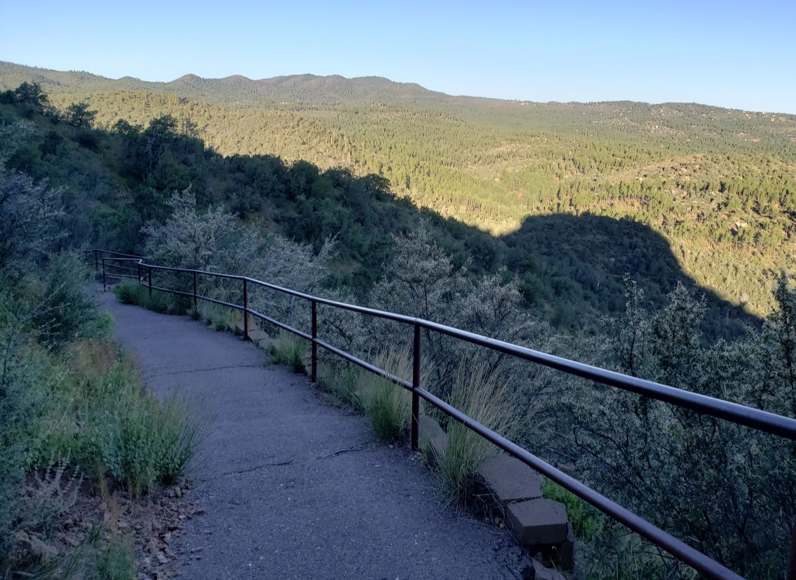
It’s a pleasant hike along the miniature creek under the shade of Ponderosa pines and Juniper and Manzanita trees. Some say it’s one of the prettiest trails in Prescott. Keep a lookout for the rock formations. If you’re lucky, and look carefully enough, you might see the “secret waterfall” hidden there. (No water was running when I went.) After a mellow climb, you’ll reach a crest that yields expansive views of the surrounding ranges— the Sierra Prietas, the Bradshaws, and the San Francisco peaks. Here you can retrace your steps or continue on trail 48 to the southwest or explore trail 94115 to the north east. I read some reports that there’s an 11-mile hike that takes you to Thumb Butte. (Sounds like a car shuttle might be in order for that one unless you’re mountain biking or up for a marathon hike.)
Prescott’s dedication to their extensive trail system is admirable. Over my 3 days here, I’ve had the pleasure of exploring a sampler of them by foot and wheel (Thumb Butte, Spruce Mountain, Granite Basin, Goldwater Lake, Petroglyph Trail, Constellation Trails, and the Peavine/ Iron King Trails .) Just beware that the disparate systems, naming conventions and maps can be confusing. People mistakenly refer to trails by the wrong numbers. Different city and national forest websites may provide conflicting information on hike mileage and other details. I couldn’t figure out what the mileage was for this one. Oh and it’s another double misnomer hike – there are no Aspen trees on this trail despite the name and the creek is only a dribble. Perhaps it’s more of a creek in the spring?
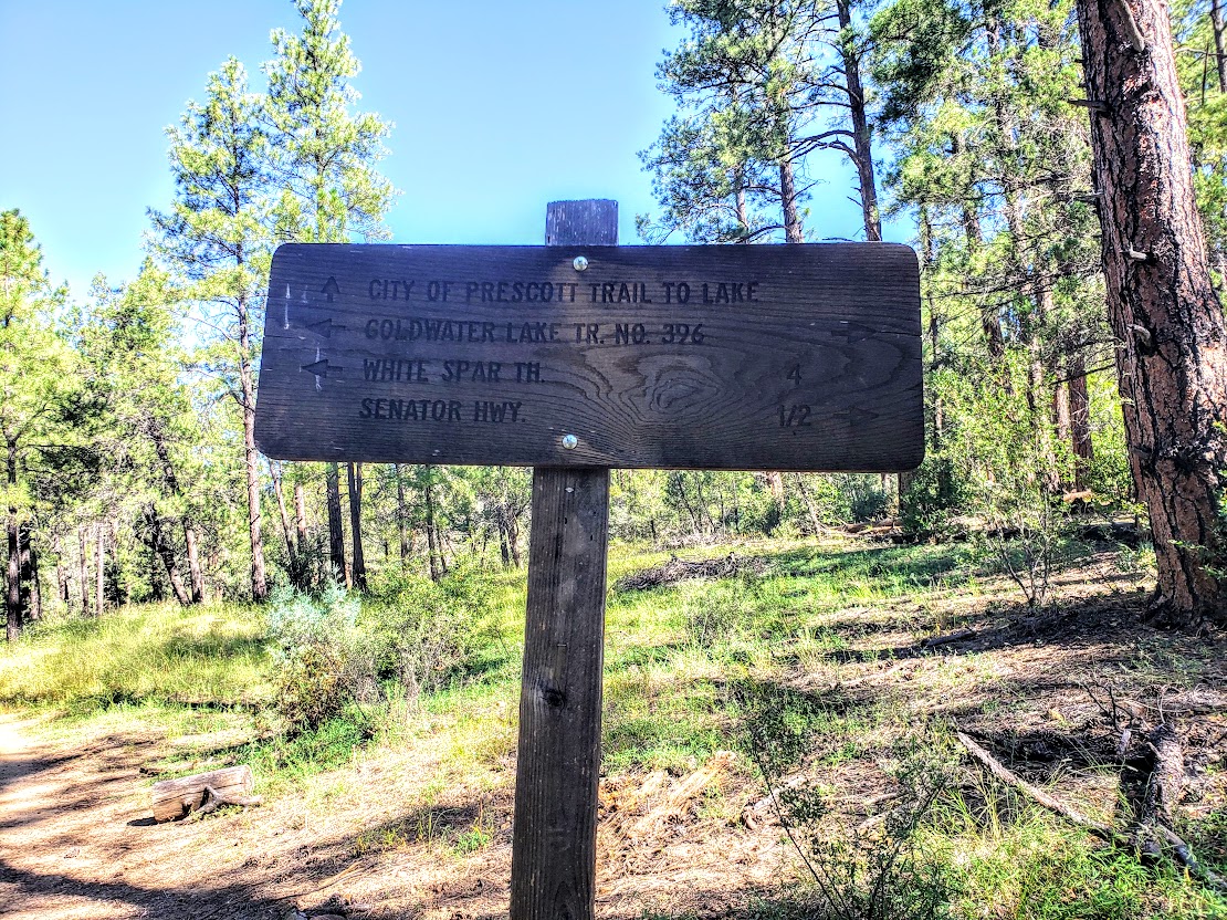
Trail details: The first mile of the trail is part of the Prescott Circle Trail – it takes you up to a junction for trail 48 to the southwest or trail 94115 to the northeast. I’d rate it as easy. The Prescott Circle Trail is a network of city and Prescott National Forest trails that combine to make a 54-mile loop around Prescott. I’ll have to investigate more of these trails next time I’m in the area.
Getting there: 20 minutes from downtown Prescott. The Aspen Creek trailhead is on Copper Basin Road ~ 2 miles after it changes from blacktop to dirt. Parking is on the right and the trail head is on the left.
If you hike around Prescott, you’ll notice that they name and number their trails, which is nice. The only problem you may encounter is when a local gives you a hiking tip by the number only and happens to be off a digit or two. Could be the Prescott way of telling you to “Go take a hike.”
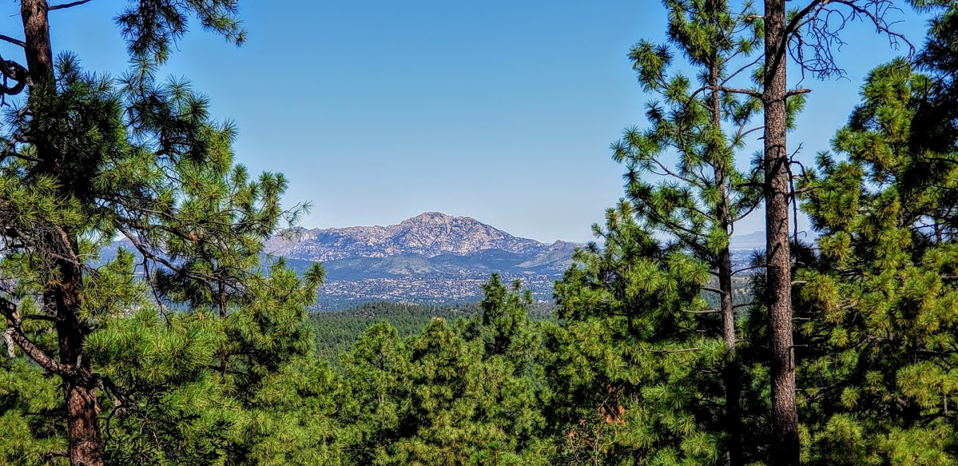
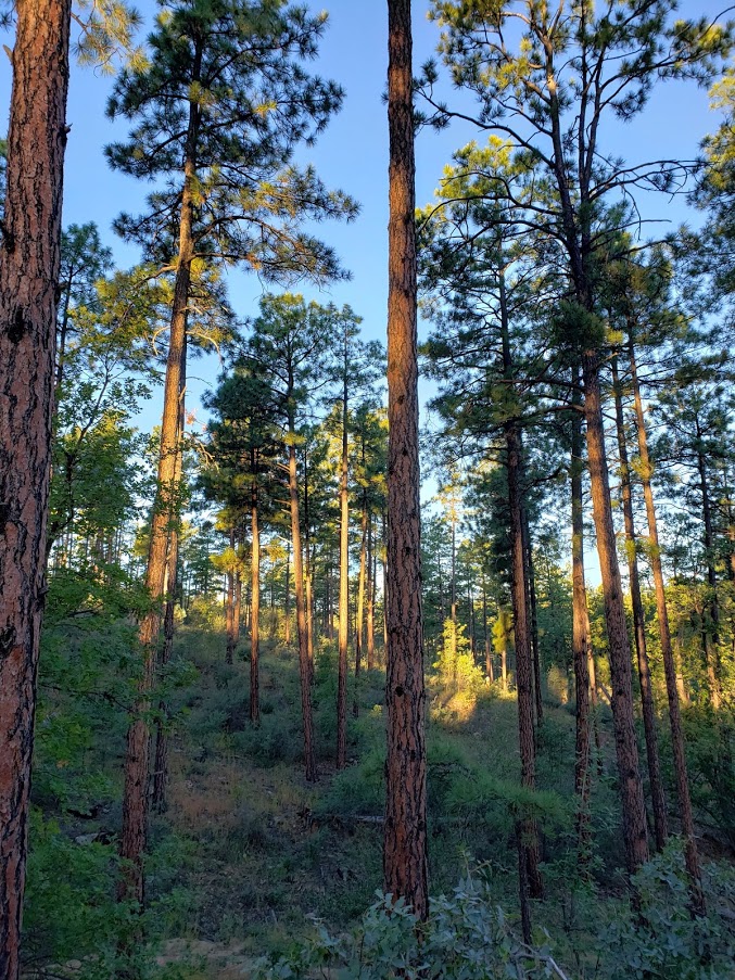
Anyway, I found the high-country trail that leads up Spruce Mountain, which isn’t hard to find if you know the trail’s name and number. It’s the Groom Creek Loop Trail #307. Some (Prescott National Forest Service peeps) say that it’s “one of the most attractive trails in the Prescott National Forest. Despite the misleading moniker, there are no Spruce trees on the trail to Spruce Mountain, but that’s okay—it’s a lovely shady trek through Ponderosa pine, Gambel oak and Douglass fir. I chose the trail to the left as it was a hot day and this side of the loop is pleasantly shaded. On a cooler day, I’d go for the loop. Perhaps start with the opposite, more exposed side (on the right) and come down the shady side as it gets later in the day.
The trail begins with a gradual climb and easy terrain, ramping up to a steady climb with rockier and rootier terrain near the top. You definitely have an opportunity to get your heart rate up if you’re so inclined (pun intended). The trail is runnable—the deer I startled on the way up concurs.
On top, you’ll find a picnic area with an outhouse and a fire lookout tower. If the lookout-in residence is accepting visitors, you might just be lucky enough to soak in the panoramic views of Prescott’s lakes and forest from the tower’s vantage point as I did.
Distance: ~6.5 miles, if you do the loop it’s ~8 miles
Elevation gain/ loss: ~1,400 ft (starting elevation is about 6300 feet and the top is 7693 ft)
Getting there: ~15 min drive from Prescott, AZ: Take Mt. Vernon Avenue south for 6.4 miles. It becomes Senator Highway and passes through the small community of Groom Creek. Look for the trailhead on the left side of the road.
Notes: Free parking. MT Bikes & Dogs allowed.
Stay tuned for my top picks of places to stay and eat and for more of my active escapades in and around Prescott.
Ok, some adventures just don’t go as planned. This was one of those. I spent at least 35 minutes hike-a-biking trying to find the mountain bike trail. Granted someone with better technical skills than me (just about anyone) probably could have biked much of what I had hiked. At one point, my phone fell out my bike jersey without my knowing. (Luckily, when I retraced my steps I found it with the screen in tact—thank goodness.) That’s how it started.
I’m sure Han’s No Way Rey and Missy Giove, the MTB legends I met on my Catalina mountain bike adventure would have popped over this little bridge no problem— not me.
When I finally jumped on the single track trail I’d originally intended, I had to keep jumping off the bike to navigate over rocks or roots.
My downfall When the trail opened up into a rough fire road, I thought, Ok, this should be doable for me now. Well, apparently not. After another 35 minutes of navigating loose gravel and pot holes, my tire slipped out from under me and I wiped out and landed hard
Sometimes knowing when to surrender is better than ruining your vacation or life with an injury, especially if you’re out there alone as I was. Sure I was tempted to get my bruised butt back on the bike and see where the bumpy fire road would take me, but I had a work conference call coming up and other places to explore on foot before nightfall anyway. Was glad that I didn’t have my Garmin to tell me how few miles I’d covered. After I wiped the dust off my backside, I pedaled away, grateful for the climb up the hill back to the car (at least a partial workout).
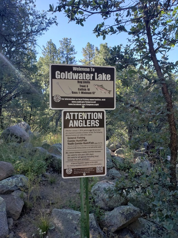
I didn’t run into any hikers or other mountain bikers, but there were about half a dozen people fishing at the lake. (None of whom knew the surrounding trails.) From what I can tell, 15-acre Goldwater Lake is a good spot for a family outing with summer kayak and canoe rentals, picnic tables, a playground, a horse shoe pit and a volleyball court. You’ll have to ask someone else about the trails.
Long story short, that’s why I only skimmed the surface of what the Goldwater Lake trails offer. I’ll give it another shot if I return to the area (most likely by foot or with a mountain biker that knows the trails).
Getting there: 2900 S. Goldwater Lake Road, from Prescott,go south on Mount Vernon Street, which becomes Senator Highway.
Fee: $3 for Parking
Ever had an adventure that just didn’t go as planned? Share your experience.
Stay tuned for my top picks of places to stay and eat and for more of my active escapades in and around Prescott.
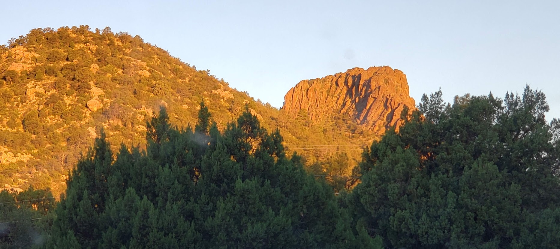
The iconic, natural landmark of Prescott, Thumb Butte hosts a short trail (#33). It’s quick and pleasant and a great way to start your day while it’s glowing in the dawn’s light. Unfortunately, the trail doesn’t take you to the top of the Thumb, but your hike to the ridgeline will reward you with panoramic views of the Prescott area, Bradshaw Mountains, Sierra Prieta Mountains, Granite Mountain, Mingus Mountain and out to the San Francisco Peaks.
With ~ 3k visitors leaving their footprints every month, Thumb Butte is the most heavily used trail in the Prescott National Forest. Go early and you’ll only run into a few locals taking their morning constitutional walk or runs.
Trail Notes:You ascend either the paved eastern section of the trail or the unpaved eastern section of the loop trail to reach a ridge just below the rocky crest of Thumb Butte. The eastern paved section is very uneven / “lumpy”, requiring careful footing, especially if you’re descending.
The western side is a double-wide trail. A dozen interpretive signs dot the route, identifying various vegetation and explaining forest ecology.
Backside Views
Distance: <2 Miles RT
Elevation: The Thumb’s elevation is 6,514 ft. The trail has a~688 gain/ loss – it’s runnable if you’re into hills and ok with uneven footing.
Use: Hikers only, Dogs ok on leashes
Fee: $5, Wednesday are free
Getting there: From Prescott take Gurley Street West (it becomes Thumb Butte Road) for 3.4 miles to the Thumb Butte Picnic area and parking lot on the right. Trail begins across the street.
Stay tuned for my top picks of places to stay and eat and for more of my active escapades in and around Prescott.
All smiles at the start. Pack Weight: His 40 lbs & Hers 20 lbs
Distance: 22 mi, rt
Difficulty: Yes, challenging – all depends on your fitness level & your knee health. Peak is 14, 505 ft elevation with a gain & loss of 6,100 ft & rocky, uneven, occasionally treacherous terrain. If you have arthritis in your knees, like me, going down is going to hurt. A lot. Even with poles.
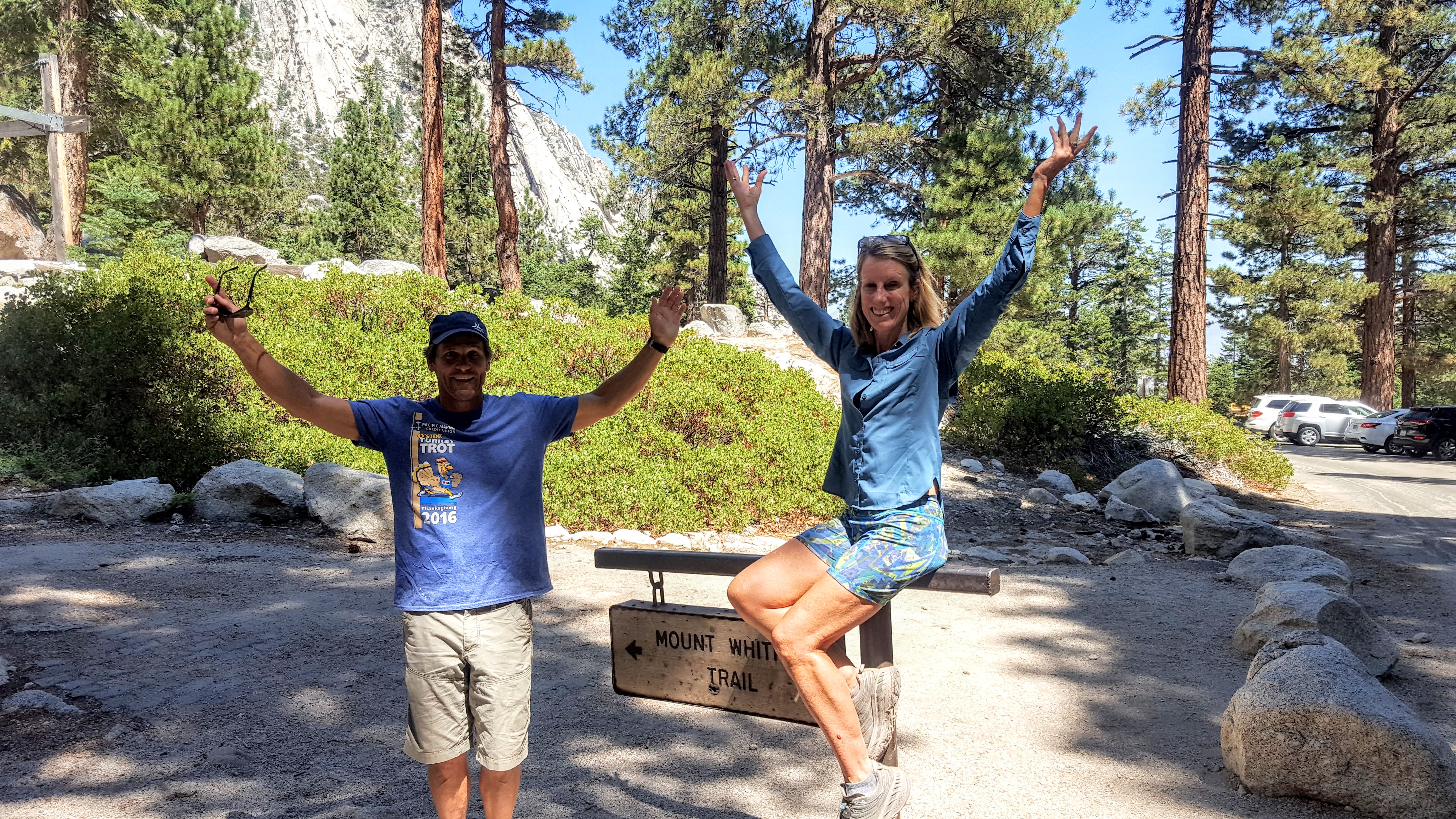
First of all, I probably wouldn’t have done Whitney again since I’d already been there and done that (1994) and I’m not much for redos.
Circa 1994
But we were up in the area. And my swim buddy, Rosie, and a group of her friends were doing it, and Ken wanted to do it, so I figured let’s leave it to fate.
If we’re able to get a last-minute permit, we’ll do it. We had planned on doing at least 1 overnighter anyway so why not make it Whitney? Trouble is, day hike and overnight permits for Whitney are tough to get–only about 15% of people who want a permit get a permit so I didn’t have high hopes. No big deal, there are so many wonderful places to explore in the sierras, we were just winging it day by day anyway. We’d started in the Mammoth area 2 days prior and had already enjoyed a short lovely waterfall-filled, sunset hike with a tricky ending at Lundy Lake and a spectacular 11 mile day hike to Valentine Lake.
We raced down from Mammoth Lakes to Lone Pine and lined up at the Ranger and Visitor Center at 11AM sharp as instructed. Ken picked a lucky #3 out of the hat, which put us in the lead to capture a spot. Fate would have it that Mt. Whitney and I would meet again. Off we went equipped with the requisite bear canister.
Note the trail is difficult (altitude, terrain, length, elevation gain/loss). Many people train and prepare for months to do it. We are both endurance athletes and accustomed to pushing our boundaries (sometimes we are [i am] a bit too ambitious though – see our Catalina mt. bike adventure). While we were a little concerned about altitude sickness, we were relatively sure we could handle the hike.
Our trip to the mountains was last minute. We packed up in about 30 minutes and accidentally left out some key items (water purifier, hats, gloves, headlamps) at home. We stopped at the Lone Pine grocery and loaded up on munchies and water and then strolled across the street to pick up a couple headlamps at the Outfitters store.
Note, we were not prepared for high-altitude sub-freezing temps the night we camped (without a tent to keep the packs light) and the morning we hiked to the peak. I’m going to put together a camping checklist and post it here so we don’t leave home without the essentials again.
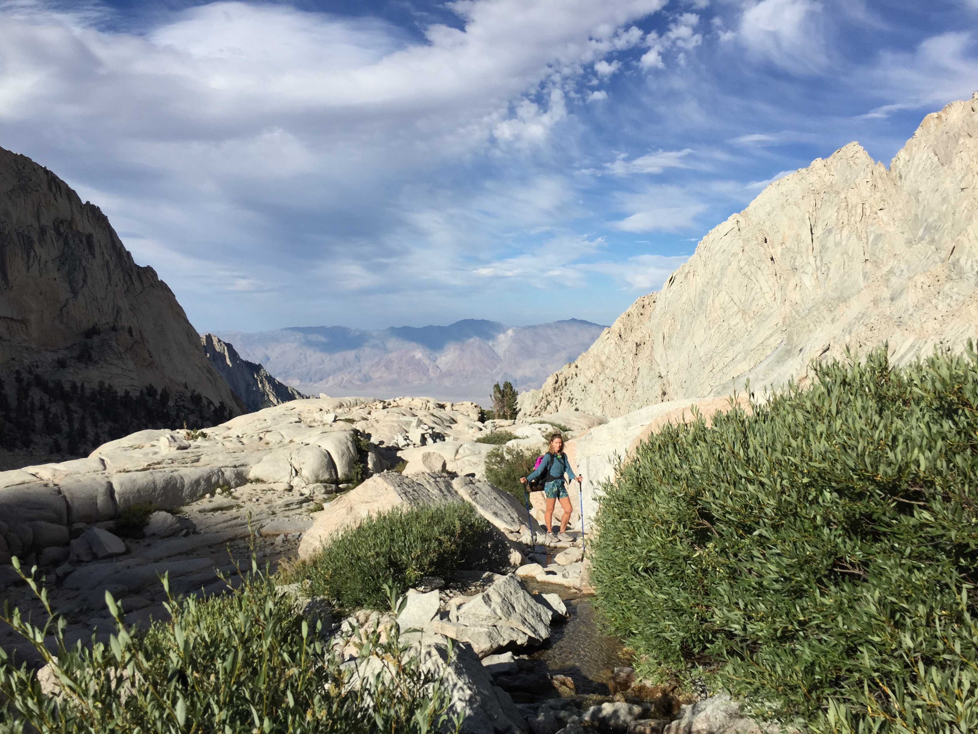
We could have cut the weight in our packs significantly if we’d brought the water purifier. Contrary to memory of 1994 there was plenty of water along the trail and at Trail Camp – lakes, streams and waterfalls.
We started on the trail at 2:30 PM with the goal of camping at Trail Camp 6 miles up, elevation 12,000 ft. I had a vision of sunrise on the peak that I wanted to fulfill – that would certainly make hiking this monster twice worth it. I had no memory of the lovely lakes, streams, and waterfalls (perhaps it was a dry year) and the beauty of the Whitney.
Note there is an earlier opportunity to camp near a waterfall at Outpost Camp just 3.8 miles up and 10,800 feet elevation.
Waterfall at Outpost Camp
About a mile after Outpost Camp the terrain begins to get a bit more ornery (rocky)…Of course, the views become more beguiling to take your mind off the occasionally tortuous footing. Speaking of footing, I hiked both times in trail runners. Ken wore running shoes and said his feet took quite a beating. It’s really personal preference. A visual poll of hikers, coming and going, was about 50/50 hard-toe hiking shoes, running / trail running shoes.
Some hikers wore no shoes at all.
We arrived at Trail Camp at 6:30 PM just in time for sunset. At least a half dozen other hiking parties had already set up their tents. We laid out our mats and sleeping bags. I jumped in immediately, the temperature was already dropping. The video and the picture below were taken from my sleeping bag vantage point. How dreamy to experience sunset on Whitney and (fingers-crossed) sunrise too.
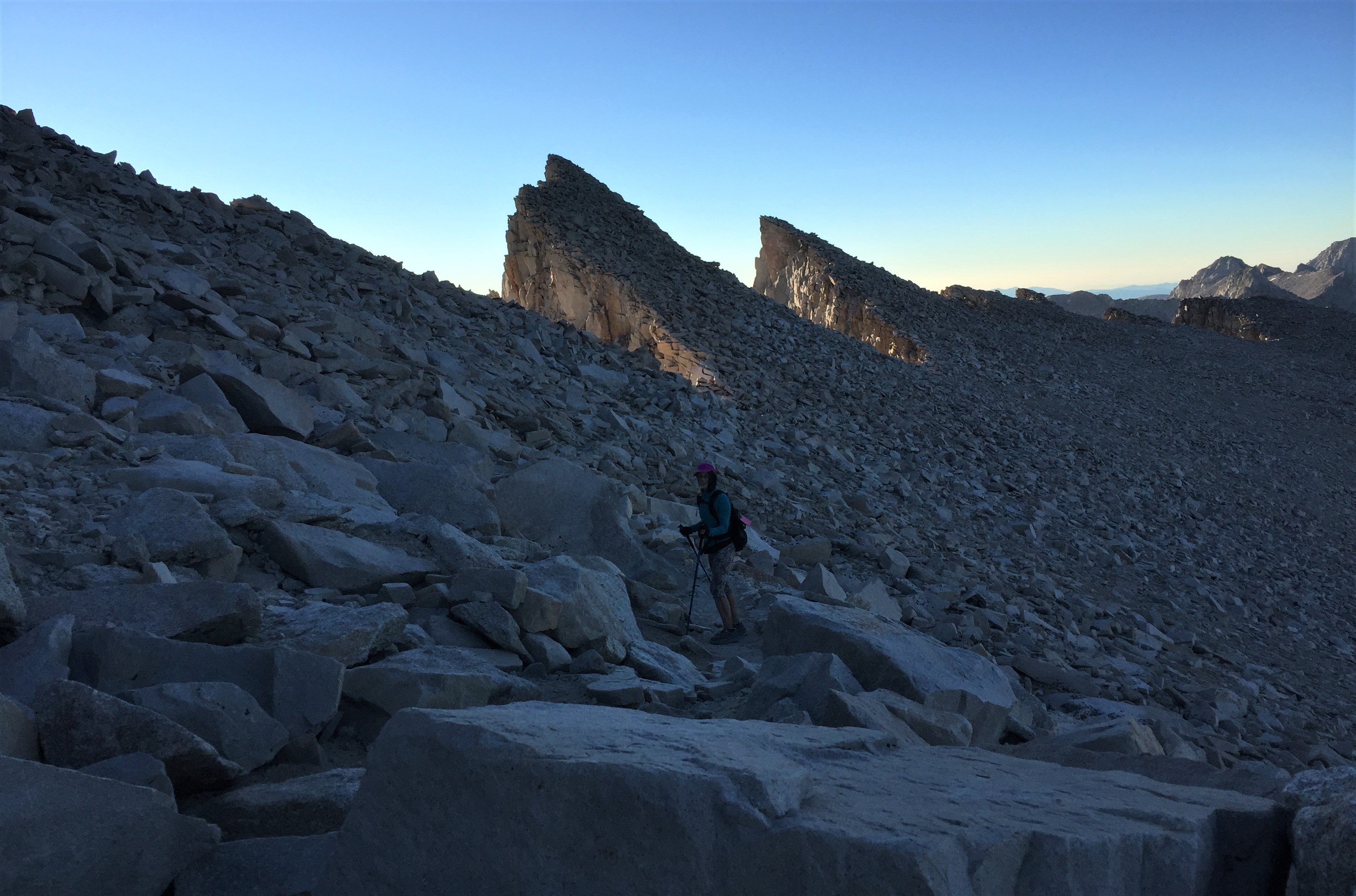
After chowing down on some nuts, Slim Jim’s and other munchies “in bed”, Ken put the bear canister ~150 yards away and it was lights out. My plan was for a 3:30 AM start. We didn’t sleep much—it was quite chilly (understatement). At 2:30, I saw another group rustling around with their headlamps and beginning their hike to summit. We got our start around 30 minutes later, rising at the crack of darkness to make a run for sunrise at the summit. Watching the string of headlamps bobbing in the darkness ahead and above us, snaking around the ridges through the infamous 97 switch backs was like being in an adventure film. I wish I had taken some pictures or videos, but my phone battery was low and my hands were freezing, despite my improvised sock mittens.
Unfortunately, my headlamp failed (note to self – bring extra batteries – duh). Since my eyesight is so bad, Ken let me lead with the other headlamp. The footing is quite tricky and some areas were wet so it slowed us down a bit. (The puddles had turned to ice when we reached them on the way back.)
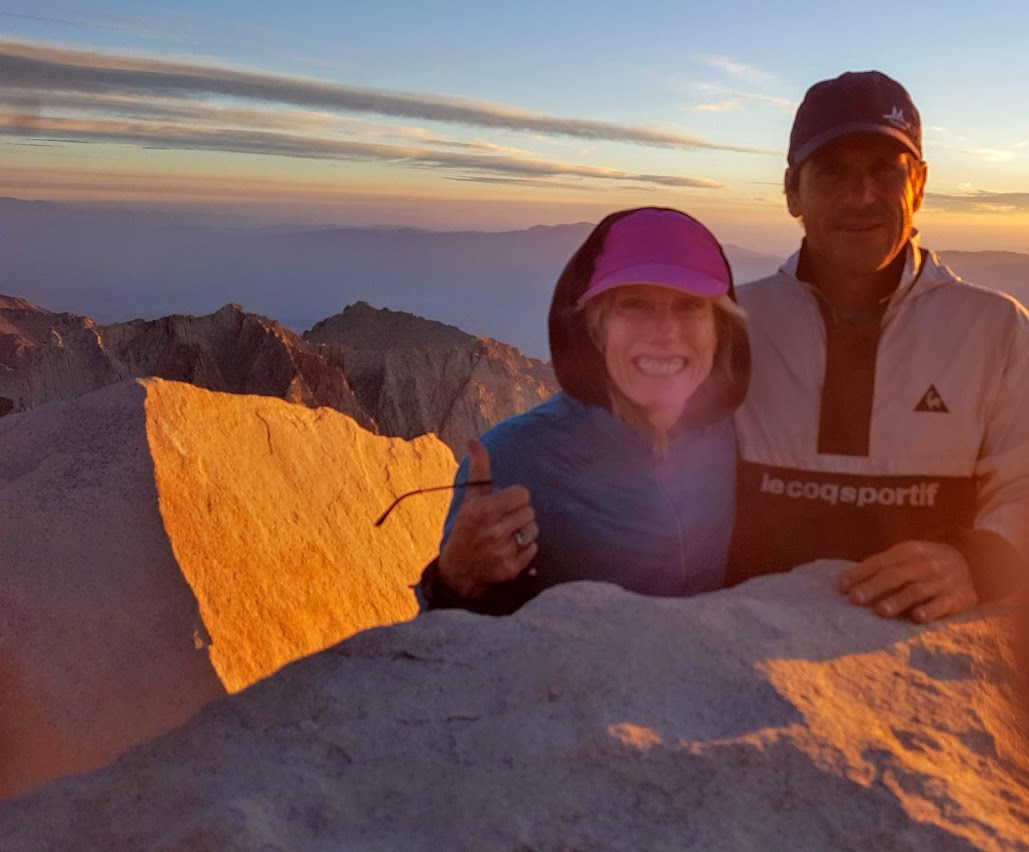
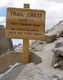
When we arrived at Trail Crest, the highest trail pass in the US (13,645 ft) it was still pitch dark and we were half -asleep and perhaps a bit altitude touched. Somehow, we misread the sign and went the wrong way – going about 1/2 mile off course. We thought it was odd that we’d be descending before the peak, but we saw some headlamps down there and none in the other direction…Despite the wrong turn, we made it to the top in time for one of the most memorable sunrises of my life.
This time, no altitude sickness at all, but you can hear me slurring my speech a tad in the video – from the cold & altitude (no mimosas, unfortunately). These past 24 years and my history of running have not been kind to my knees so the way down was much harder (hurt more) than the way up. Not sure I’ll be back again, but ya never know. Maybe I should do it every 24 years? Maybe not. Anyway, it was totally worth it.
The steep drop-offs on the upper trail were equally daunting in the dark and in the daylight.
Yes, those are socks on my frozen hands.
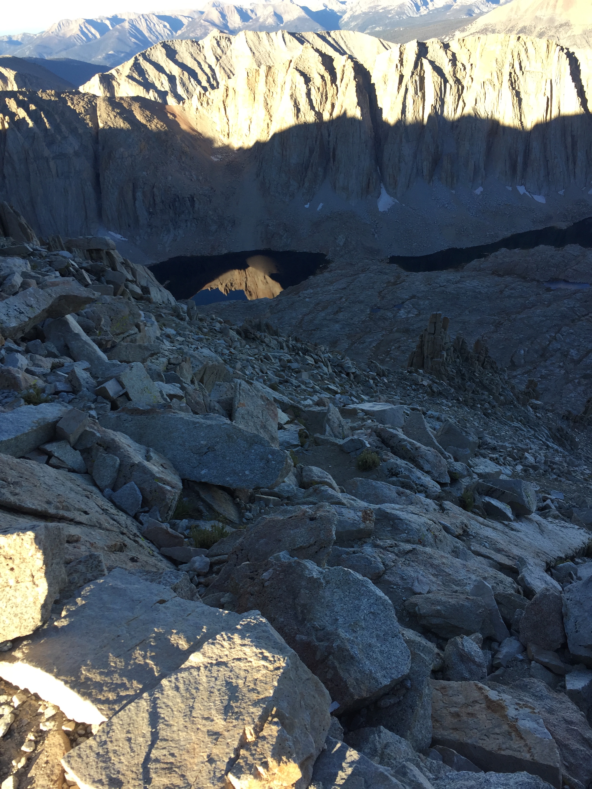
The view of a few of the infamous 99 switchbacks and the little lake by Trail Camp on the way down.
Ran into my swim buddy, Rosie, on the way down – her way up.
Ran into my swim buddy, Rosie, on my way down – her way up.
We made it back to Trail Camp by 9AM and out the bottom by 1:30PM – all in a days work – 23 hrs with camping. I recommend camping if you can, you get to enjoy the hike more and see more.
Many thanks to Ken for capturing and sharing his great photos on this post, for always being a great sport on my crazy escapades, and for carrying the heavier pack.
After – still smiling
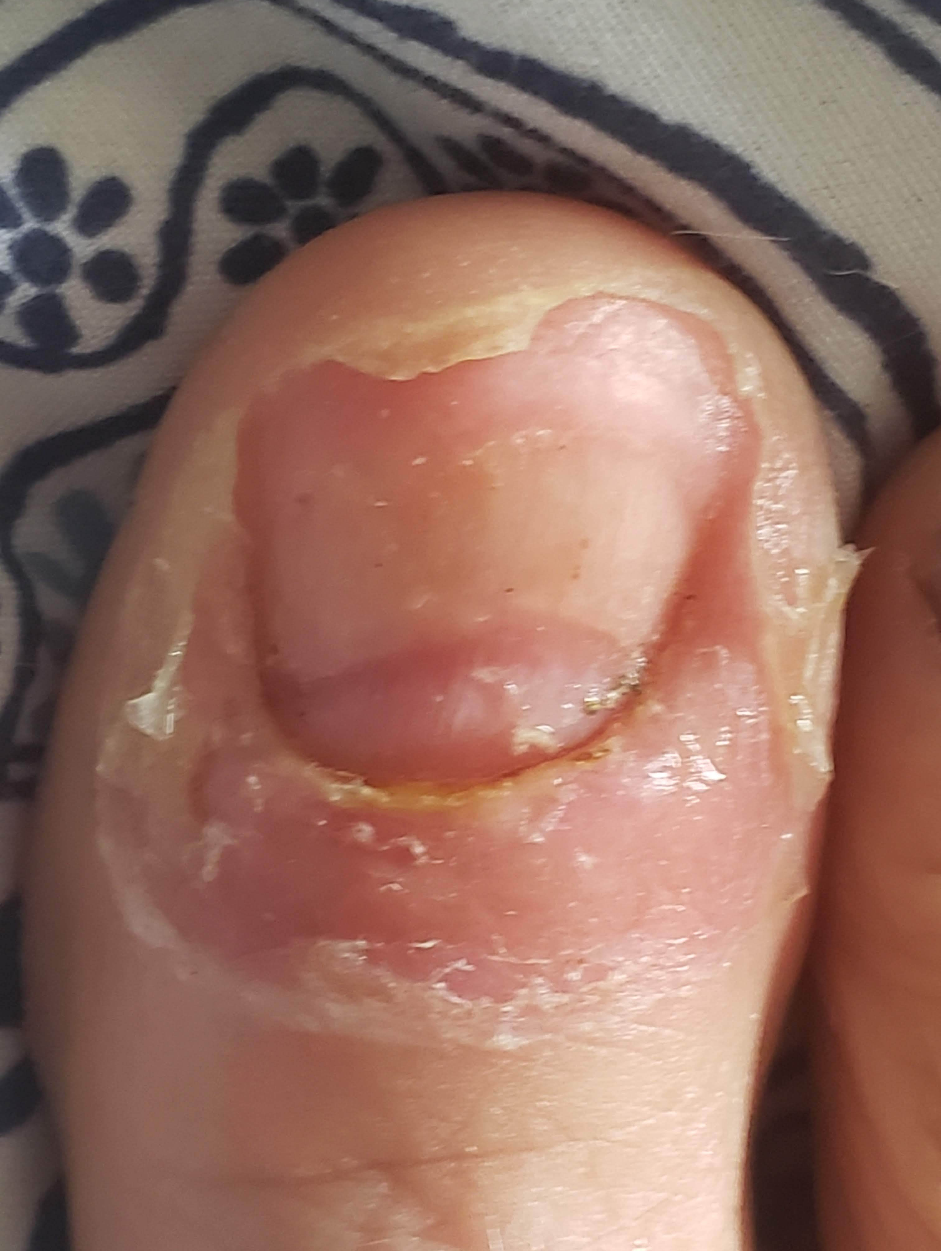
My toenail causality. Guess my foot modeling days are over.
Getting there: Take Whitney Portal road from Lone Pine


 My downfall When the trail opened up into a rough fire road, I thought, Ok, this should be doable for me now. Well, apparently not. After another 35 minutes of navigating loose gravel and pot holes, my tire slipped out from under me and I wiped out and landed hard


 When we arrived at Trail Crest, the highest trail pass in the US (13,645 ft) it was still pitch dark and we were half -asleep and perhaps a bit altitude touched. Somehow, we misread the sign and went the wrong way – going about 1/2 mile off course. We thought it was odd that we’d be descending before the peak, but we saw some headlamps down there and none in the other direction…Despite the wrong turn, we made it to the top in time for one of the most memorable sunrises of my life.