Cowles Mountain (1,593-foot summit) is the highest point in the city of San Diego. It’s part of Mission Trails Regional Park, a 5,800-acre open space preserve that is the 7th-largest open space urban park in the United States. It contains sixty miles of hiking, mountain bike and equestrian trails.
To call Cowles a mountain is to be very liberal with the word. I should note that the park has a 5 “peak” challenge if your hiking peeps want a minor challenge and want to document your feats – here’s the scoop. Cowles is the highest peak. This might be fun for kids, but apparently lots of adults do it for bragging rights too. I will say that on a clear day, the stunning views span 360 degrees from Lake Murray, downtown San Diego, Point Loma, La Jolla, and Mexico and out across the glimmering Pacific to the San Carlos Islands. See feature picture above. (Unfortunately, I dropped my camera on a rock so I have limited pics.)
Distance: 2.9 miles up & back
It’s a very popular trail so expect lots of humans and their canines…There are a couple of different ways to reach the top from various starting points and parking lots. The hike itself is moderate (with some steeper sections that will get those calves & glutes burning). It’s decent workout, especially if you run it. There are single track trails and some fire road. It’s short from any direction so I explored up and down on a couple of trails and was a little disappointed that there wasn’t more to see. You can’t really get lost so do as much or as little as you like.
Getting there:
The main trailhead is in the San Carlos neighborhood on the corner of Golfcrest Drive and Navajo Road
Lovely Lake Murray
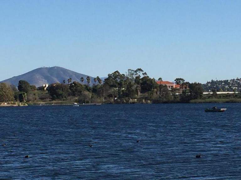
Since I didn’t quite get enough enough of a workout / nature fix, I decided to check out alluring Lake Murray Reservoir, also part of the Mission Trails Regional Park. I strolled the paved road that navigates around most of the lake stopping short of the dam (no access). It’s another popular spot – walkers, runners, bladders, and even road bikers aplenty (the latter seems silly to me, because the path / road is only 3.2 mi long and there are many children and dogs on it).
Lake Murray is a great spot for birdwatchers with abundant ducks, geese, and herons abound and about 149 bird species to observe. It’s a pleasant spot for a picnic too.
Go Fish
Lake Murray is open for shore fishing and private boats, kayaks, and float tubes seven days a week from 5:30 a.m. to 8:00 p.m. Permits can be purchased onsite at the iron ranger boxes. The lake is stocked with Florida-strain largemouth bass, bluegill, channel catfish, black crappie, and trout. Minimum size limit for bass is 12 inches.
Fish limits: 5 trout, 5 bass (min. 12 inches), 5 catfish, 25 crappie and bluegill total, no other species limits
A few people have asked me what I’d recommend for a couples’ 2 to 3 night camping trip in Catalina. For nature lover’s with limited time, I suggest you skip touristy (though charming) Avalon and head straight for Catalina’s “Wildland” gems. Most Catalina aficionados concur that the 2 most beautiful spots on the island (not that you can really go wrong anywhere) are Little Harbor Campground and Parson’s Landing Campground. I’ll focus this post on them.
If you like this sort of thing, you’ll love those 2 spots.
Contemplating the climb ahead from Little Harbor Cove
Leaving Lovely Little Harbor
Heading down to picturesque Parson’s Landing
MAP
How you plan your getaway comes down to your preferred balance of activity to relaxation.
If you want to see both Little Harbor and Parson’s Landing, the easiest way to do it is to take the San Pedro ferry direct to Two Harbors. Once there, you are equidistant to Parson’s Landing and Little Harbor – this gives you the most flexibility and the most relaxation and recreation options. You can grab a bite and set out for either destination as a day hike / bike or an overnight at one or both of them. You can also catch a shuttle one or both ways.
When you visit Two Harbors, enjoy a meal at Doug’s Harbor Sands – the only restaurant / bar in town. I recommend the Mahe and a Buffalo Milk or two for dessert. Buffalo Milk is a delicious libation named after the island’s iconic buffalo (think alcoholic chocolate milkshake). I’d post a picture of one, but I drank them so fast I forgot to take one.
Otherwise, you could stay over in Little Harbor night 1 and then work your way West to Two Harbors and Parson’s Landing. On a quickie? Perhaps you take the Safari Bus back to Two Harbors or Avalon. (Arrange in advance.)
Staying Overnight in Two Harbors
Two Harbors Campground (42 tent sites & 3 Group sites) about a 1/4 from “town” on a bluff overlooking the Pacific. Outdoor cold water showers & portapotties.
In “town”, the Camping Cabins offer simple comforts on a budget ($50-70 a night) They are available November through March only.
Note: There are coin operated hot water showers in Two Harbors.
After roughing it for a day or two, I always like to throw in a little luxury. See why the rustic Banning House Lodge in Two Harbors is myTop Pick .
Two Harbors Things to Do: Diving, snorkeling, swimming, stand-up-paddling, kayaking, fishing, exploring and relaxing. So yes, you can have tons of fun just hanging in gorgeous Two Harbors. Did I mention the Buffalo Milk? (Yeah, I did.)
Head from Two Harbors to Parson’s Landing (via West End Road – easy fire road ~7 miles & or the Trans Catalina Trail – hard single track ~11 miles) and camp out there. Note there is no running water at this campsite. You can hike from here to Starlight Beach (the Western most point of the island), but be prepared for 20 miles round trip as Starlight Beach is day use only.
Avalon to Two Harbors ~23 miles (MTB route – ~3,284 elevation gain)
Little Harbor to Two Harbors ~7 miles by fire road or shorter by single track, expect a fair amount of climbing in either direction
Two Harbors to Parson’s Landing ~7 easy miles West End Road or ~11 via a challenging portion of the Trans Catalina Trail (hikers only) Note: Parson’s Landing Campgraound has no running water.
Two Harbors to Starlight Beach ~17 to ~21 miles depending on your route (see above)
Catch the Catalina Express from San Pedro to go direct to Two Harbors ~$75 ea round trip.
Or treat yourself to a Helicopter ride, starting at ~$135 one way depending upon your departure point. It’s a quick way to spend $135, but it is a dazzling ~15+ minutes. (One way is enough, unless you’re in a hurry and have $ to burn.)
If you have a boat, you’ve got it made to explore your way.
If you start in Avalon, you can take the island’s Safari Bus to Little Harbor, Two Harbors, or Parson’s Landing, but you are limited by their schedule. Mountain biking or hiking is possible too, but only if you’re up for ~23 somewhat tortuous miles (especially if you’re going to be carrying a pack) see my Catalina mtb. adventure post 1 & 3). There is a new Catalina Back Country Concierge that offers gear haul and other services, but they may not be open on weekdays in the off season – – at least they weren’t when we called them.
Another option is to stay in Little Harbor the first night and save the final 7 miles to Two Harbors for Day 2…
So many fantastic options, so little time. Be safe and have a blast!
I’ve been all over the island, the terrain can be challenging and most of it is completely exposed. (Carry plenty of water and sunscreen.) Keep ~150 yards from Buffalo. (They don’t like bikers.) Stay on designated trails and fire roads. Taking that short cut through brush may be tempting, but my brother will tell you, it’s not worth it. He got bitten by a rattlesnake there doing just that and had to be airlifted off the island. He’s fine now, but it was a bit sketchy during his two weeks in ICU…And no, I wasn’t on that trip.
Let me know if you have questions and do tell me what you did on your Catalina getaway!
Anza Borrego State Park is named after the 18th century Spanish explorer Juan Bautista deAnza and borrego, the Spanish word for bighorn sheep.
The park covers 600,000 acres and is the largest state park in California and, the second largest in the contiguous United States. It contains 500 miles of dirt roads, 12 designated wilderness areas, and 110 miles of hiking trails.
The endangered peninsular bighorn sheep, often called desert bighorn sheep, make their home here. It’s said that visitors and residents seldom get to see them as they avoid human contact.
We arrived at the park about 45 minutes before sunset (golden critter hour) and decided to go for a quick run up the scenic and pleasant Borrego Palm Canyon Trail (3.25 miles) before dark.
This slideshow requires JavaScript.
We looked up the steep rock studded canyon walls at precarious boulders, wondering if they ever dislodged…We walked part of the way back hoping to see some wildlife. I told Ken to keep his eyes open. I have terrible eyesight and the stone and sunset shadows are perfect camouflage for anything that wants to evade notice. Then I heard something that sounded like a boulder crashing down…and Ken saw something in the distance…The head bangers in action! A group of 5, the one sitting on the rock officiating looked frail, perhaps an elder. I felt like I was in a National Geographic show. It was amazing!
The next morning we had breakfast at the local coffee shop. While we were there, we struck up a conversation with a ranger and local at the next table. We shared our adventure and the video on my phone. There was an elderly couple standing nearby, watching me with annoyed faces and their arms crossed. (Was I talking too loudly or did I steal their table?) Nope, the woman finally broke her silent glaring and told us in an exasperated voice that they had been hiking the canyon nearly ever day for years and had never had a big horn sheep sighting – not even 1. That’s how lucky we were.
Turns out one of the fellows that we were chatting with was the co-creator of the Desert Bighorn Sheep Book that I was browsing through. How cool is that?
And yes, this gorgeous book is available at AMAZON and the Anza Borrego Visitor Center.
And if all that wasn’t magical enough, on our drive out of the park, this healthy coyote couple appeared to see us off.
The Santa Margarita River, aka Temecula Creek / Temecula River, is one of the last free-flowing rivers in Southern California.
The park is said to contain 1400 acres with 14 miles of trails that loop and crisscross the river. Not sure about that, but I do know that the main trail is about 5.5 total out and back. There are a number of offshoot trails, but it’s hard to imagine that they add up to 3x as much distance…
The main trail is a pleasant meander along the river under a canopy of trees.
There are a couple of swimming holes within the first mile or so if you care to take a dip. Before too long you’ll encounter your first of a half dozen creek crossings. Since the terrain is mostly smooth path or sandy, you might consider Tevas, instead of running shoes or hikers as you’ll be taking them on & off frequently. (That being said, if you don’t mind getting your running shoes wet, it’s not a bad spot for a little trail trot.) There are also a couple of lovely little oases along the way.
Apparently, this river corridor is known for raptor sightings and home to deer and other large mammals. We saw one shy turtle basking on rocks and a little fishey who seemed to be guarding her eggs – see video below.
Certainly a great spot to spend an afternoon, have a picnic or take a dip. (I wouldn’t drive too far for it, but if you’re in the area by all means.)
Note: It gets super hot in Fallbrook in the summer, be prepared and bring water.
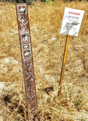
BEWARE: Abundant poison oak & quick sand???
Distance: ~5.5 out & back
Difficulty: Easy – family friendly
Location: Fallbrook near De Luz Road & Sandia Creek Dr intersection, right on Sandia Creek Dr. then the parking area and trailhead are 1.2 miles ahead on the right.
If you live in the San Diego area or have visited, you’ve no doubt driven by picturesque San Elijo Lagoon Ecological Reserve countless times via the coast road or the freeway. Perhaps you’ve ventured on trails as well. I have, dozens of times for a run or stroll and I thought I knew all the trails there. (Pretty, but mostly flat and easy fare.) I hadn’t heard about Annie’s Canyon until someone asked me about it. Of course I had to investigate…
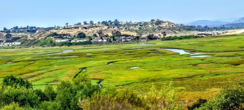
But first a couple words about these coastal wetlands. The reserve spans 1000 acres with a total of 7 miles of trails that connect the varied habitats from salt marsh to freshwater marsh areas to coastal sage and chaparral. Wedged between the freeway and the coast highway and surrounded on all sides by Solana Beach, Cardiff and Rancho Santa Fe, the lagoon remains home to more than 1,000 species of plants and animals – many endangered. Despite all the encroachment, it’s still a nice spot to savor nature and take in lagoon and ocean views.
Now for the unexpected delight of Annie’s Canyon. After a short, easy, less than mile hike to the canyon (look for signs), you’ll find yourself transported to a miniature canyon-land experience. Sure doesn’t feel like Southern California anymore, more like the slot canyons of Utah or Arizona. While it’s narrow, footing is fairly easy and there’s a steel ladder at the very top. Nothing treacherous here – just fun. It’s a super quickie (5 minutes), but super cool. What a great place to take young kids for a mini adventure with a little supervision and assistance. I know this kid at heart had some fun.
This slideshow requires JavaScript.
The view from the top. And no, it’s not a nudist colony, my hottie BF is wearing pants. ; )
Notes
Dog friendly in the lagoon – not so much for the canyon unless, they are trick pups trained to go up narrow steel ladders
No bikes
There’s a bunch of construction underway as part of the highway and rail improvements program in the North Coast Corridor. Click here for trail closure updates before you go.
Apparently this spot was previously vandalized and closed and has only recently reopened, which explains why I didn’t know about it. Please enjoy, respect and protect the nature around you.
Location
There are a number of entrances to the lagoon. Here’s ine
Solana Hills trail head address is 450 Solana Hills Drive, Solana Beach. From I-5, take the Lomas Santa Fe Drive exit (exit 37) West. At 0.2 mile turn right onto Solana Hills Drive for 0.3 mile. Park along the dead end street. There’s also a great nature center on the Cardiff-by-the-Sea side, which is quite nice and you can rent it for private events.