Blue Sky Ecological Reserve Hike to Lake Ramona, Poway, CA

Peaceful Blue Sky Ecological Reserve, a 700 acre canyon, is a welcome reprieve from the over-populated Mt. Woodson trail. I’d had enough of the crowds, but not enough of nature and workout so after lunch at a nearby Mexican cantina,  I followed up the Mt. Woodson hike with this one.

Distance: 4.8 RT Difficulty: Moderate ++ It’s all mild and friendly until you get the last half mile’s fierce grade, which is paved. Overall, the terrain itself is easy (fire road primarily) so it’s a great spot for trail running.

Trail advisory: It’s exposed so equip yourself with sunscreen and water rations. Also, you could be sharing the trail with bees, mountain lions, mosquitoes, poison oak, rattlesnakes & ticks (Friendlier potential trail mates include: deer, bobcats, quail, raptors, roadrunners, coyotes, squirrels, rabbits, and bats.)

This slideshow requires JavaScript.

And yes, you can fish at Lake Ramona Reservoir. While bite-friendly, the huge bass population here is comprised of small largemouth because few fisherpeople want to hike up that great big hill. (Did I get enough size comparison in there to make your head spin?) Unfortunately, the bass overpopulation results in their stunted growth. Come on fisher peeps, work for it! You’re missing a beautiful opportunity. Besides, where’s the fun in driving up and parking at Lake Poway?

Lake Ramona was lovely and the reserve was pleasant enough though small. Personally, I wouldn’t go out of my way to get here, but if you’re in the neighborhood – do it.

Mt. Woodson / Potato Chip Rock Hike, Poway, CA

Distance: 7.5             Elevation: 2070 feet

Difficulty: Moderate + (Depends on your fitness level and the weather (heat/sun factor)

No, the featured image is not Potato Chip Rock. It’s some cool unnamed split rock along the top of the  trail with a great view out to the rocky playground below and Lake Romona.

If you’re looking for solitude, you won’t find it here. This is one of the most popular hikes in San Diego because of the iconic Potato Chip Rock and obligatory photo op at the top.

Spoiler alert.

20171119_112900.jpg

The trail starts at Lake Poway and leads you up a fire road for a mile or so before it narrows and steepens.

20171119_101012.jpgDSC_0712

And the answer is yes, you can fish in Lake Poway. Sadly, swimming is not allowed.

DSC_0714
Here’s the scoop

DSC_0707

The view of the lake is lovely from the trail above. You can see how clean and clear the water is.

DSC_0709

The view from the top depends on  how clear of a day it is. Unfortunately, it was a bit hazy, In the picture below, you can make out Point Loma and the Pacific in the distant horizon on the right and the high rises of San Diego to the left of it.

.DSC_0713


20171119_114646.jpg
Another cool spot along the trail – my rock throne

So yes, lots of highlights and a great workout. (I hike fast and made it up in an hour  and 15min – down in 1hour 5.min.) The downhill gets my knees. There were a number of  people using poles. The downside of this hike is way too many humans, but what do you expect from a cool hike near a city? If I ever do it again, I’m going for dawn patrol. The parking lot opens at 6AM for early birds who enjoy more solitude and sunrises.

Because this hike didn’t quite sate my appetite for nature and solitude, after lunch I went up the road to the Blue Sky Ecological Reserve and hiked up to Lake Ramona.

A little slice of something nice: Annie’s Canyon, San Elijo Lagoon Ecological Reserve

If you live in the San Diego area or have visited, you’ve no doubt driven by picturesque San Elijo Lagoon Ecological Reserve countless times via the coast road or the freeway. Perhaps you’ve ventured on trails as well. I have, dozens of times for a run or stroll and I thought I knew all the trails there. (Pretty, but mostly flat and easy fare.) I hadn’t heard about Annie’s Canyon until someone asked me about it. Of course I had to investigate…

But first a couple words about these coastal wetlands. The reserve spans 1000 acres with a total of 7 miles of trails that connect the varied habitats from salt marsh to freshwater marsh areas to coastal sage and chaparral. Wedged between the freeway and the coast highway and surrounded on all sides by Solana Beach, Cardiff and Rancho Santa Fe, the lagoon remains home to more than 1,000 species of plants and animals – many endangered. Despite all the encroachment, it’s still a nice spot to savor nature and take in lagoon and ocean views.

Now for the unexpected delight of Annie’s Canyon. After a short, easy, less than mile hike to the canyon (look for signs), you’ll find yourself transported to a miniature canyon-land experience. Sure doesn’t feel like Southern California anymore, more like the slot canyons of Utah or Arizona. While it’s narrow, footing is fairly easy and there’s a steel ladder at the very top. Nothing treacherous here – just fun. It’s a super quickie (5 minutes), but super cool. What a great place to take young kids for a mini adventure with a little supervision and assistance. I know this kid at heart had some fun.

This slideshow requires JavaScript.

The view from the top. And no, it’s not a nudist colony, my hottie BF is wearing pants. ; )


Notes

Dog friendly in the lagoon – not so much for the canyon unless, they are trick pups trained to go up narrow steel ladders

No bikes

There’s a bunch of construction underway as part of the highway and rail improvements program in the North Coast Corridor. Click here for trail closure updates before you go.

Apparently this spot was previously vandalized and closed and has only recently reopened, which explains why I didn’t know about it. Please enjoy, respect and protect the nature around you.

Location

There are a number of entrances to the lagoon. Here’s ine

Solana Hills trail head address is 450 Solana Hills Drive, Solana Beach. From I-5, take the Lomas Santa Fe Drive exit (exit 37) West. At 0.2 mile  turn right onto Solana Hills Drive for 0.3 mile. Park along the dead end street. There’s also a great nature center on the Cardiff-by-the-Sea side, which is quite nice and you can rent it for private events.

Yosemite NP: Chilnualna Falls

We rolled into Yosemite a bit late in the day with only an hour and a half of sunlight left. We were set on an overnighter and consulted with the rangers at the Wawona Visitor Center to get their recommendations. We decided on the Chilnualna Falls Trail. We figured we could cover the  4.2 miles  and set up our sleeping bags by nightfall.

The trails climbs steadily, but fairly moderately (lots of switchbacks) with mostly easy terrain. We hadn’t gone 1,000 feet when we were assaulted by hordes of face flies. They form a pesky cloud around your face. Swiping at them with both hands as I hiked, I gave up and tried blowing them out of my face. Laughable as I later learned that they love the carbon dioxide that you exhale. Arrgh! It was absolutely miserable -so bad that a couple who had started ahead of us turned back after about a quarter mile. We soldiered on, but I was thinking if it’s like tonight, it won’t make for a pleasant slumber.

Just when we’d had enough, they vanished. (Later learned, they don’t survive over 6 thousand feet elevation.) Phew! I’ve added this little, lightweight headnet to my backpack so I will never endure that misery again. To think for just $2.50 I could have spared myself that misery. (I’ll let you know if it holds up to use.) Even if it works once, it’s worth it.

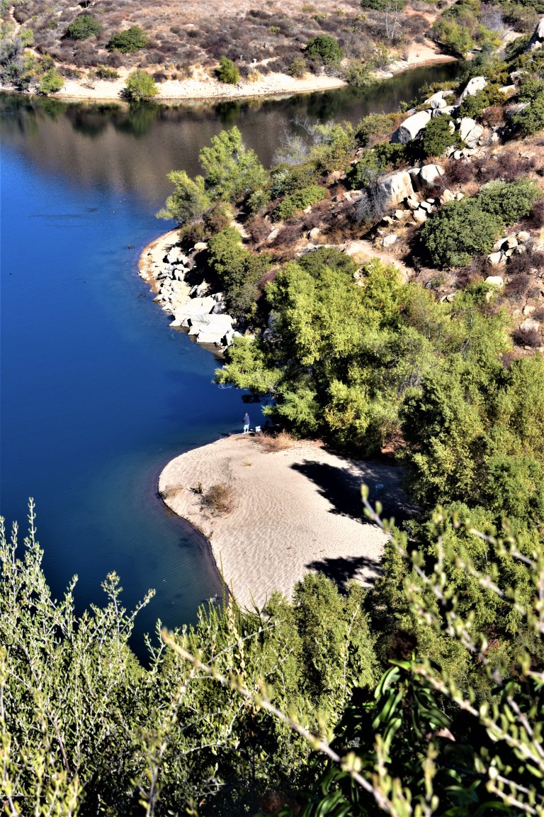
In addition to the face flies, there was an acrid odor in the air and the sky was a bit hazy. (Later learned that the only fire in Yosemite was just East of the falls.) Odd that the rangers didn’t mention the face flies or the fire.  Their way of hazing late season campers or what? We woke with our sleeping bags salt and peppered with ashes. Can only imagine how great inhaling all the particles was for our lungs. Anyhoo, how was the play aside from the blight of the face flies and ashy air? Fantastic! It was late season, so nature’s infinity’s pools down from the falls were the major draw for us. Wish we’d arrived earlier, would have been splendid to luxuriate in the pools in the heat of the day. A bit chilly at sunset, but that didn’t stop me.

So we laid out our sleeping bags above the pools, had some snacks, and got ready for bed. It was a long drive from LA and enduring the face flies and smokey stench had made us both tired and a bit irritable. I asked my boyfriend, Ken, to put his Gatorade in the bear canister and put the canister at least 100 yards downwind from us. He gave me some gruff about how he didn’t think it was really necessary and how he didn’t think there were really that many bears around… We got into a little spat as I insisted on it.

It was our first night sleeping out in a while so it took us a while to get into doze mode. Finally, just as I was drifting off, I hear Ken’s panicked voice “Did you hear that?” “What?” SSSSSSSSShhhh! I think there’s something out there.” This time I heard the brush crunching and cracking near us. He shined the headlamp in the direction of the noise and light bounced off the large animal eyes – a healthy, strong buck who stared back and then sauntered off casually. “I thought it was a bear.” Yup, I don’t think I’ll get much gruff next time I insist on putting food and beverage items into the bear canister and placing it 100 yards away.

This slideshow requires JavaScript.

Scenery: Great!                                                                                                                        Distance:  8.4 miles (13.5 km) round trip                                                                        Trailhead Elevation:  4,200 feet (1,280 meters)
Elevation Gain:  2,300 feet (700 meters)

Difficulty: Moderate to strenuous, depending on your fitness level

Notes: Be prepared for face flies! Bring your bathing suit for the falls or nature’s infinity pools.

Magnificent Mammoth Lakes’ Duck Lake Trail, John Muir Wilderness

If you like pristine wilderness and glimmering, translucent alpine lakes, you’ll love this hike in the Eastern Sierras near Mammoth Lakes, CA. You’ll be rewarded every couple miles of effort with one of the 6 refreshing gems along the route.  (If you’re into trout fishing, you’ll definitely want to bring your pole. They say the higher you go, the bigger the trout.)


This slideshow requires JavaScript.

You’ll come upon the first lake, Heart Lake, at mile 1. While you might feel a little silly stopping so soon after embarking, you won’t want to miss this little gem. And given the altitude and incline, you find that you’d like to enjoy the view for a minute or two. Arrowhead Lake is next at mile 1.2 (9,680 ft) followed by Skeleton Lake and Barney Lake (10,022 ft) at 2.5. Once you tear yourself away from Barney, you’ll hit some switchbacks. Spectacular Duck Lake (10,850 ft) will reveal herself to you around mile 4. While you’re there you can visit her adjacent,charming  little sister, Pika Lake. If you continue on, the pines close in on the narrow trail as you continue climbing, descending, climbing  and traversing to Purple Lake (8 miles). (You can camp anywhere along the way as long as you are at least a 100 feet from lakes or streams.) We camped above Purple Lake, which was a bit anti-climatic after Duck Lake. Purple Lake has its own more subtle, woodsy allure, but the outstanding beauty of Duck Lake was mesmerizing and where I found my bliss.

For a quick overnighter, I pack some luxuries. For this trip that included the cozy, warm pants and fuzzy top you see in the picture. I also like to forgo a tent and just enjoy the night sky and wilderness. The gloves and the hat were necessities. It gets cold at night at altitude even when temps have been in the high 70s during the day. Despite my suggestion, my boyfriend did not bring a hat or gloves. He said. “It won’t get that cold.” I should have snapped a pic of him with his mummy back zipped all the way up with only the tip of his red nose sticking out. In the morning as our boots crunched along on the ice slicked trail, he conceded, “I guess it did get cold last night.” (Yes, we’re at altitude in the Eastern Sierra’s so even in late August, it can get quite chilly at night or when a storm front comes through.)

This trail is doable for a day hike, trail run or an overnighter. And it connects to the Pacific Crest Trail so there’s ample opportunity to just keep going.  Kind of wish I could have, but I’ll be back.


Scenery: AWESOME

Difficulty: Somewhat strenuous given the altitude and fairly continuous climb

Access:  Via Coldwater  Campground 

Starting  elevation: 8,900 feet

Permit required. Pick it up with your bear canister (if you’re over-nighting with food) at the local Forest Ranger Station.