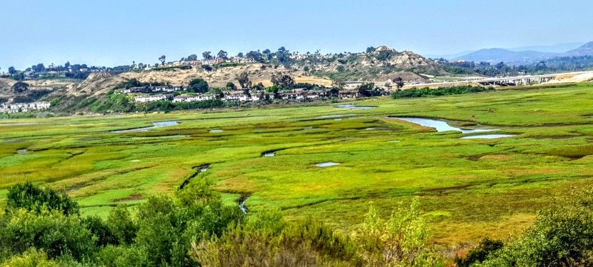
McGinty Mountain Trail: a sweet little gem in Jamul, CA

Location & directions

Trailhead: 13852-, 13998 Jamul Drive, Jamul, CA 91935

~25 miles from downtown San Diego.Take 94 East, exit at Campo Road. Follow Campo Road for ~ 4.5 miles, turn left onto Lyons Valley Road  and then left on Jamul Drive and you’ll see the dirt turnout / parking lot at 0.4 mile.Trail starts at the kiosk.

Main trail

~5 mile out & back

1,400 feet gain & loss

Moderate to strenuous depending on your fitness level

Dog and mountain bike friendly


My take

Drove down from North County for this one and so happy I did. Had low expectations as I’d never heard of this trail, but was pleasantly surprised. What a sweet little gem. This area is part of the San Diego National Wildlife Refuge. Not as well known as many of the popular SD area hikes nearby Mount Woodson, Iron Mountain, and Cowles Mountain, but definitely a contender for it’s beauty and views.

It’s a great hike with mostly friendly terrain, except for the steepest area not far from the top, which was a bit of a rock field. (If you have tender feet, you might be happier in hiking shoes versus running shoes.) Don’t worry, the steepest area is fairly short so you won’t suffer long.) Mountain bikes are allowed, but I didn’t see any and there were only a few hikers sharing the trail. It’s a good spot for a trail run too. It’s a relatively quick hike and a lovely way to spend a morning or afternoon.

Highlights

Late season wildflowers and wonderful views of San Miguel Mountain and Tecate peak to the East, Mount Helix , Cowles Mountain, El Cajon Mountain, and even Cuyamaca in the distance – apparently on some days you can see all the way to Coronado, Point Loma and the expanse of Pacific. And hiking uphill is always more rewarding —better views and better workout!


This slideshow requires JavaScript.


Rock scramble at the top – optional.


Caution

There are no trail signs so stay on the most obvious (widest & well traveled)  route. (You can take a couple viewpoint detours, but return to the main trail.) Be on guard for rattle snakes and ticks and bring water. The trail is exposed the entire way so you’ll want to avoid hiking in the heat of the day.

For more info, visit:

US Fish & Wildlife Service: McGinty Mountain trailhead

View route or download GPX from CalTopo


Take or leave it, just leave no trace: Los Peñasquitos Canyon Preserve

Location

Between Rancho Peñasquitos and Sorrento Hills to the north and Mira Mesa to the south, near the 5 & 805. The south side entrance is off of Sorrento Valley Boulevard, about a 1 mile east of Vista Sorrento Parkway.

History

Evidence of Native American prehistoric culture within the Preserve dates back as far as 7,000 years ago and apparently remains can still be found.

Apparently the ruins of the El Cuervo Adobe (1857) are at the West end of the Preserve, but somehow I’ve missed it on my half dozen trips here – must not be well marked. Next time, I’ll make a point to find it and update this post.

Flora & Fauna

Surprisingly biodiverse given its urban location, it’s reported that Los Peñasquitos Canyon and its tributary, Lopez Canyon are home to over 500 different plants, 175 bird types of birds, and a large variety of reptiles, amphibians and mammals (raccoons, mule deer, bobcat and coyotes). Many of these are rare or endangered and live a protected life in the Preserves 14 habitat types. From the steep slopes, flat mesa tops and grassy hillsides to the refreshing, shady riparian streams, apparently wildlife flourishes. In my visits here, I have seen little evidence of all the wildlife. No doubt, one would see more on foot at the prime wildlife watching hours of dawn or dusk…

Main Trail – Mild to Moderate

~7 mile loop

Some rutted and rugged terrain with a few climbs, but mostly flat and nontechnical. They’ve put down tons of rough rock on a mile stretch or so of the trail, which is a real pain in the butt (literally)  to traverse on mt. bike. Saw some guy with his young kids on bikes. They made it to the waterfall, but going through that rough rock section was an arduous journey that no doubt made for a very long day. You can avoid that section by taking the parallel trail out and back. Take the short bridge crossing from the starting trail (both directions).

Highlights

The waterfall that springs out of volcanic rock and the 5 bridges that cross the stream and connect either side of the loop trail that runs the length of the park.

This slideshow requires JavaScript.


My Take  

What can I say? When it comes to being immersed in beautiful places, I’m more spoiled than most. That being said, I wouldn’t go too far out of my way for this one. It’s good if you’re in the area and just want to get in a quick trail run, mt. bike ride or leisurely family stroll.  Also, it can be really crowded here with other bikers, hikers, families with small kids and dogs spread across the width of the trail. It always amazes / annoys me when people lack the common sense and courtesy to allow 2-way traffic.


 Warnings

Be on guard for poison oak and rattle snakes. The sign warns of mountain lions too, but highly unlikely in such a small area. Also, it can be super hot here in the summer – avoid the heat of the day.

Note

Trails may be closed intermittently due to flooding, call the county park ranger’s office for status after rains.  (858) 484-7504.


Have you been here? What’s your take? Like it, leave it, or love it?

Railay Cliffhanger

Of course, I couldn’t resist. Had to choose between the vista point and the lagoon as they were in opposite directions and it was getting dark.

Unfortunately, my videos don’t do justice to the pitch of the ascent and descent. Realize this is nothing to a rock climber, but it got my heart rate going a bit.

Well, it was a cliffhanger for me anyway.

Railay Rocks!

Spectacular scenery, iconic limestone crags of monolithic proportions rising out of the Andaman Sea – that’s Railay.


This slideshow requires JavaScript.

When I arrived by longtail boat, I checked into my hotel and took a walkabout to stretch my legs after the taxi (half hour), ferry (2hr), bus (2 hr) minivan (half hour with1 hr delay) and longtail boat ride (20 minute) – phew!

Actually, it wasn’t bad at all. It’s extremely easy to get around in Thailand. My full day of travel was coordinated by 1 agency for $33. Travel agencies are almost as ubiquitous as 7-Eleven’s here. Tip: It can be worthwhile to check with different agencies if you are looking for a specific itinerary and time. Some offer more choices than others.

I’ve been touring up and down Thailand for 3 weeks and the only wild things I’ve seen so far are some unruly Americans and Australians, feral cats, bats and myna birds. Accessible only by water, this tiny peninsula is literally crawling with wild things. And I’m not just talking about the rock climbers who flock here from around the world. Here there are macaques running amok, water monitors skulking about, squirrels flying overhead, and apparently some dusky langors in hiding too. You just follow the boardwalk from the pier in East Railay and head for West Railay Beach. When you make that right, you are in what I call monkey alley.


This slideshow requires JavaScript.


This slideshow requires JavaScript.

Tip: Pay close attention to your belongings (monkey’s steal) and keep an eye out for movement on the rocks. Monitor lizards blend in well, but you can detect them with a keen eye. They are a bit noisy going over brush, tree limbs or leaves so keep your ears open too.

Awesome, right? I know! And all within the first 20 minutes of my arrival. Next to a conspicuous “Danger” sign was a rope climb / hike to a vista point that beckoned to me. I’m a wee bit leery of heights and hence not the biggest fan of rock climbing though I’ve done it before. This looked a bit sketchy…To be continued…


Mae Wang Trek: Karen Hill Tribe Homestay

It’s only appropriate that there be a rather long, steep climb into the village of the Karen Hill Tribe. It is here that we joined in a family’s dinner preparations, enjoyed a sumptuous feast and spent the night in a bamboo hut.

Since 1949, the Karen people have been migrating to Thailand from Myanmar due to conflicts with the Burmese government. Approximately 400,000 Karen have made Northern Thailand their home. Their villages are scattered through the mountain and lowland regions bordering Myanmar. You’ll notice some of the women in the pictures wearing their traditional colorful, embroidered smocks and skirts. This is what married women wear; single girls wear white frocks. We did not see any as the younger generation has gotten away from this and other traditions.  Now, they only wear white on Sundays, In these villages, most marry by their early twenties and traditionally it’s the mothers who chose their children’s spouses. This is still true for ~50% percent of marriages though for some it’s a choice the child makes with his / her mother. Our guide, Tui, is Karen and he and his mother will agree on his future wife.

The village where we stayed has had electricity for about a year. It’s fairly limited though with a lightbulb here and there. Some homes are open air huts, others are concrete with tile roofs. It’s a place in transition. The people are warm and friendly. Every house has a pig, several chickens, roosters, dogs, and a wealthy few have cattle too. All seem to cohabit peacefully with the exception of the flash dog fight over scraps.

Speaking of cohabitate, in a village of 130 people, 4 religions are peacefully represented: Animism (an ancient belief system before organized religion that non-human entities—such as animals, plants, and inanimate objects—possess a spiritual essence) Buddhism, Christianity, and Catholicism.

Food preparation is arduous and everyone lends a hand. Multiple dishes with multiple ingredients are made in a wok using just 1 fire source.

Famished from our full day (~2 hour bike, 3.5 hour hike), we relished this royal feast! (It included a pumpkin, garlic dish, curry potatoes and chicken, a scallion and veggie dish – oh my!)

We slept well that night!

Next up, I will share some of my favorite pics!