Avalon to Two Harbors: Catalina MTB Adventure, Part 2

After mt. biking to Two Harbors from Avalon, enjoying sunset wine and cheese at the Banning House Lodge followed by a mahe fish dinner at the Harbor Sands Restaurant, we slept like hibernating bears.

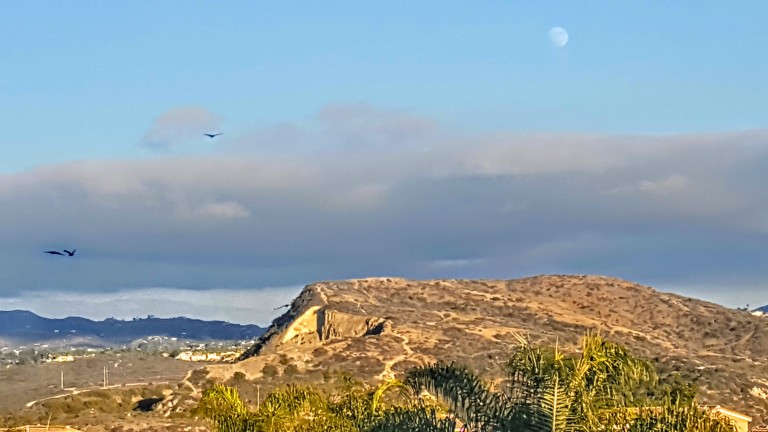
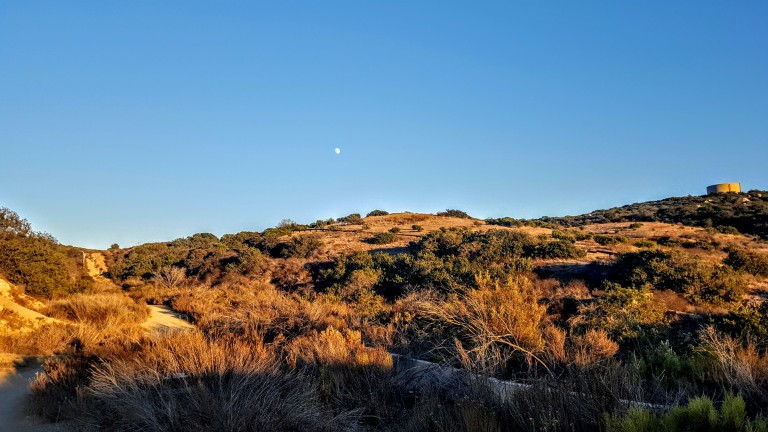
And nothing better than relaxing into the morning like this, eh?

20171212_085733.jpg
Enjoying the view of Catalina Harbor from the back patio of the Banning House Lodge

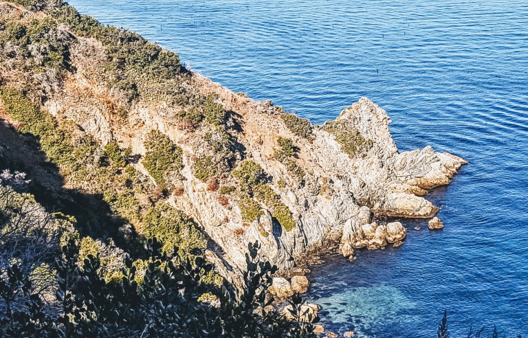
Two Harbors is so named for its topographic features (you guessed it) 2 harbors – the Isthmus Cove on the leeward side and Catalina Harbor on windward side, separated by a half mile of land or isthmus. What’s an Isthmus, you might ask? It’s a narrow sliver of land that connects two larger areas across an expanse of water which they are otherwise separated.

Bike logistics

You might also be wondering about mt. bike logistics on Catalina Island. There are a couple spots to rent bikes in Avalon or you can bring your own on the ferry, but you must purchase a Freewheeler Bike Pass from the Island Conservancy to ride the interior “wildlands” where the buffalo and Catalina fox roam and eagles fly overhead. The bike pass is only $35 for the year and goes towards the Conservancy’s efforts to protect this natural gem and its wildlife so it’s well worth it for an unforgettable experience and a worthy cause.

Parson’s Landing

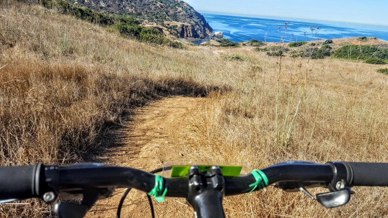
So the plan for Day 2 was to take it easy, recover from yesterday’s cross-island mt. bike slog with heavy packs, and explore the West End. So we set out on the lovely, coastal mt. bike ride out to Parson’s Landing (~14 mile round trip on mostly flat fire road). Great vistas along the way and the reward of Parson’s Landing’s pristine, rugged beauty all made for a wonderful day.

IMG_2211.jpg
Just one of the many splendid vistas out to sea and the mainland
20171212_101857.jpg
Rugged cliffs and turquoise, translucent seas
20171212_113100.jpg
Quick, brisk skinny dip at deserted Parson’s Landing before heading back


20171212_111137.jpg
Looking back at Parson’s Landing below so there was a little incline involved…
20171212_103534.jpg
Heading back to Two Harbors. If you look closely you can see the birds and dolphins having a fish feeding frenzy. Hard to capture this awesome sight.

We met a great couple from our home town who were also staying at the Banning House Lodge. They had the grand idea of biking out to the tip of Catalina Harbor for sunset. What a superb way to close out a perfect day exploring Catalina.

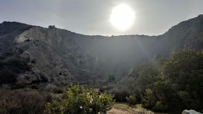
Check out the views!

20171212_172135.jpg

Oh, and we had a couple of Catalina Island Fox sightings today too, one at happy hour and one at dinner. See my Catalina Island Fox post. Stay tuned for our return bike ride to Avalon and to find out who we ran into in the middle of the island.


Take or leave it, just leave no trace: Los Peñasquitos Canyon Preserve

Location

Between Rancho Peñasquitos and Sorrento Hills to the north and Mira Mesa to the south, near the 5 & 805. The south side entrance is off of Sorrento Valley Boulevard, about a 1 mile east of Vista Sorrento Parkway.

History

Evidence of Native American prehistoric culture within the Preserve dates back as far as 7,000 years ago and apparently remains can still be found.

Apparently the ruins of the El Cuervo Adobe (1857) are at the West end of the Preserve, but somehow I’ve missed it on my half dozen trips here – must not be well marked. Next time, I’ll make a point to find it and update this post.

Flora & Fauna

Surprisingly biodiverse given its urban location, it’s reported that Los Peñasquitos Canyon and its tributary, Lopez Canyon are home to over 500 different plants, 175 bird types of birds, and a large variety of reptiles, amphibians and mammals (raccoons, mule deer, bobcat and coyotes). Many of these are rare or endangered and live a protected life in the Preserves 14 habitat types. From the steep slopes, flat mesa tops and grassy hillsides to the refreshing, shady riparian streams, apparently wildlife flourishes. In my visits here, I have seen little evidence of all the wildlife. No doubt, one would see more on foot at the prime wildlife watching hours of dawn or dusk…

Main Trail – Mild to Moderate

~7 mile loop

Some rutted and rugged terrain with a few climbs, but mostly flat and nontechnical. They’ve put down tons of rough rock on a mile stretch or so of the trail, which is a real pain in the butt (literally)  to traverse on mt. bike. Saw some guy with his young kids on bikes. They made it to the waterfall, but going through that rough rock section was an arduous journey that no doubt made for a very long day. You can avoid that section by taking the parallel trail out and back. Take the short bridge crossing from the starting trail (both directions).

Highlights

The waterfall that springs out of volcanic rock and the 5 bridges that cross the stream and connect either side of the loop trail that runs the length of the park.

This slideshow requires JavaScript.


My Take  

What can I say? When it comes to being immersed in beautiful places, I’m more spoiled than most. That being said, I wouldn’t go too far out of my way for this one. It’s good if you’re in the area and just want to get in a quick trail run, mt. bike ride or leisurely family stroll.  Also, it can be really crowded here with other bikers, hikers, families with small kids and dogs spread across the width of the trail. It always amazes / annoys me when people lack the common sense and courtesy to allow 2-way traffic.


 Warnings

Be on guard for poison oak and rattle snakes. The sign warns of mountain lions too, but highly unlikely in such a small area. Also, it can be super hot here in the summer – avoid the heat of the day.

Note

Trails may be closed intermittently due to flooding, call the county park ranger’s office for status after rains.  (858) 484-7504.


Have you been here? What’s your take? Like it, leave it, or love it?

3 Day Mt. Bike Adventure. Part 4: Thaton to Chang Rai.

It was late afternoon by the time we rolled into Ban Thaton, a charming Thai village near the Burmese border on the bank of the Maekok river. After a quick cleanup transition, I headed out to do a little exploring on foot.


This slideshow requires JavaScript.

Despite weary legs from my full day of mt. biking, I took a quick hike up a road to the White Buddha that I’d seen in the distance as we were coming into town. It was worth it.


This slideshow requires JavaScript.


On the way back, I stopped in for a sorely needed hour Thai massage before dinner. (Awesome and only $6!) Had a feast at a lovely riverside restaurant that evening and enjoyed a refreshing ‘cold” one. (Not a beer drinker, but it sure hit the spot.)


Next day we hit the road early, biking through parts of a national park on our way to Chiang Rai. What an incredible 3 day Mt. Bike adventure.

Our last lunch stop was superb!


Sad that it had to end. Many thanks to my guide Pan & support driver Som at Active Thailand!

20170419_134614

Tour company: ActiveThailand    Guide: Pan   My rating: Excellent, highly recommend

Mt. Bike Chiang Mai to Chang Rai Part 1

Tour company: activethailand.com
Tour guide: Pan
Difficulty: Moderate+++ (Depends on your fitness level. It’s not technical or too arduous, but some hills and scorching heat -mid to high 90s. Riding about 30 miles per day with breaks as you need them.)
Route: Chiang Mai – Chiang Dao – Ban Thaton – Chiang Rai
Experience: SPECTACULAR  trip and guide. Perhaps the best adventure of my life so far. I can’t begin to capture all the stunning scenery, savory meals and cultural sights we saw. And I can’t say enough about our wonderful guide Pan and our driver Som.

We biked through the countryside taking in the breathtaking sights along the Maekok river and valleys and through forests on singe-track trails, dirt roads and lesser traveled paved roads.

We visited hill-tribe villages, Buddhist sanctuaries, local eateries and the incredible Chiang Dao caves.  Truly an authentic, backroad, off the beaten track experience with no other tourists in sight.

Oh, I almost forgot to mention, another highlight was the longtail boat ride we took from one mountain bike area to another on the 3rd day. I’ll post videos from that next, followed by my favorite pics (people, scenery & food). I’m having so much fun, I’m getting behind on my updates.

This slideshow requires JavaScript.

 Pan

Back in the saddle: Celebrating the New Year on the trails @ Calavera Nature Preserve, N.County SD

If I can’t be on the loose in the wild somewhere, I usually commemorate New Year’s Day by giving myself at least a half day of vigorous nature time. (It could be trail running, surfing, hiking, biking, rollerblading, swimming, or any combination.) With “base camp” in Southern California, it usually means I get a crisp, bright, sun-shiny day in which to play. This year, I had some physical downtime that interfered so my celebration was delayed until yesterday. It was one of those splendid, crystal clear, high- resolution,  after the rain kind of days that puts a smile on your face. The air smells so fresh and sweet, you can’t get enough. Precisely what I needed after 17 days of relative inactivity and indoor imprisonment.

20161211_155815

It’s amazing how good it is to move freely outdoors after any amount of downtime – no matter the length or reason. This is what I am most grateful for and what I live for – the simple, primal pleasure of my body in motion out in nature.

While my body is still telling me to “take it easy”, I wanted to get my heart rate up just a bit so I pulled my mountain bike out for a short spin on the trails in the Calavera Nature Preserve. (And yes, I am spoiled to have this little gem in my backyard.) Not by accident mind you – it was one of the top 3 reasons I chose to live in this area.) Granted, the trails here can be a bit gritty, and there’s some rocky, rutted single-track and even nasty wide-track stuff that I can’t make on a mt. bike. Nevertheless, it’s a slice of nature in N.County , San Diego, a small habitat for many critters (49 bird, 10 mammal and 7 amphibian/reptile species) and a haven to two-legged critters like me who need a quick nature fix close to home.

A little about Calavera Hills.

it's a volcano.jpg
The word calavera, skull in Spanish, speaks to the preserve’s centerpiece, the ~500 ft mount, the remnant of a 22 million-year-old volcano.

the-volcano

According to some sources, this is one of only three volcanic plugs in Southern California. From the early 1900’s until ~1930, the area was mined for gravel, leaving a pocked and scarred West face.

Don’t expect well-marked trails, but you can easily navigate by the 3 landmarks – the lake, the top of the Mount, and the Water Tank with the new high school below it.

ch-water-tower
Water tank top right. (The “Mount” is to the left.)

If you’re hiking, biking, or running and want a good workout with some great views, go for both “heights”. If you’re a masochist for hills, there’s a brutal fire road that runs around the back rim. It’s punctuated by a half dozen or so steep rocky downs that flip in a matter of feet to fierce climbs. Guaranteed to get your heart rate up, up and over your comfort zone. Otherwise, there’s plenty of trails you can link together for some mileage that are flat or just a little rolly with a mix of easy to slightly technical. There’s fun discoveries for kids, including a cave,  the lake itself, cairns, a stone labyrinth, a funky memorial, (so much for leave no trace), a hidden wooden bridge, and more.

This slideshow requires JavaScript.

How did you commemorate the New Year?