Getting there: I-15N from St. George, Exit 10 to Washington. Left onto Green Springs Drive, immediate right onto Buena Vista Blvd. Follow. In about 1 mile, turn left onto the dirt road immediately after the fire station. Follow it for about 1.2 miles to the intersection of another dirt road and turn left onto this dirt road. In about a half mile you’ll see the parking area, gate and trailhead. (Directions are a bit tricky & terrain is variable–high clearance / 4-wheel drive vehicle helpful.) Took me 3x until I finally found it.
Notes: Full sun exposure, bring your water, hats, and sunscreen. (Spring, Fall & Winter are the best time of year for this one.) Leashed dogs allowed. Parking is free.
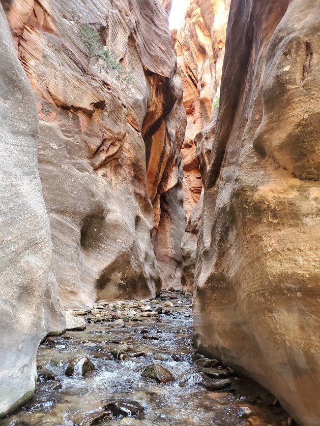
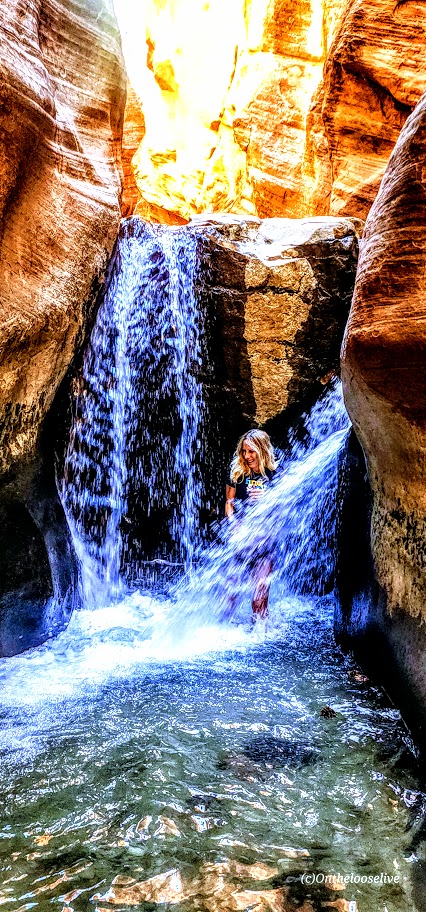
Difficulty: First and last 1.7 miles is on flat pavement–easy. After that–hard, due to icy water immersion (from ankle deep to hip deep) and treacherous footing over slippery rocks. Water is so murky that you must use your hiking stick / poles every step of the way.
Fortunately, my friend and I were of the first few to step our feet into the icy waters of the Narrows that morning so we were able to soak in its beauty in solitude. Unfortunately, on the way back, the multitudes had arrived—unruly mobs descending on a magnificent citadel destroying all vestiges of a nature’s magnificence.
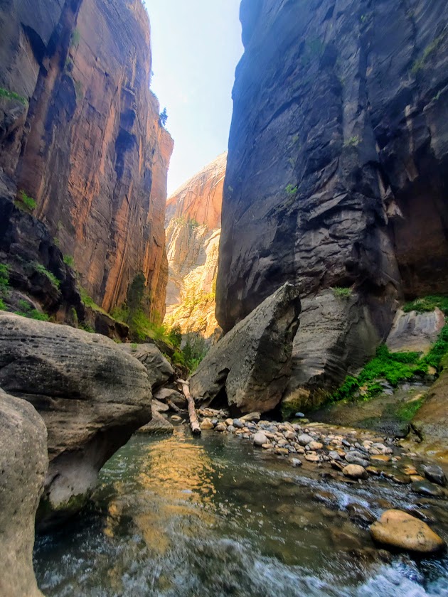
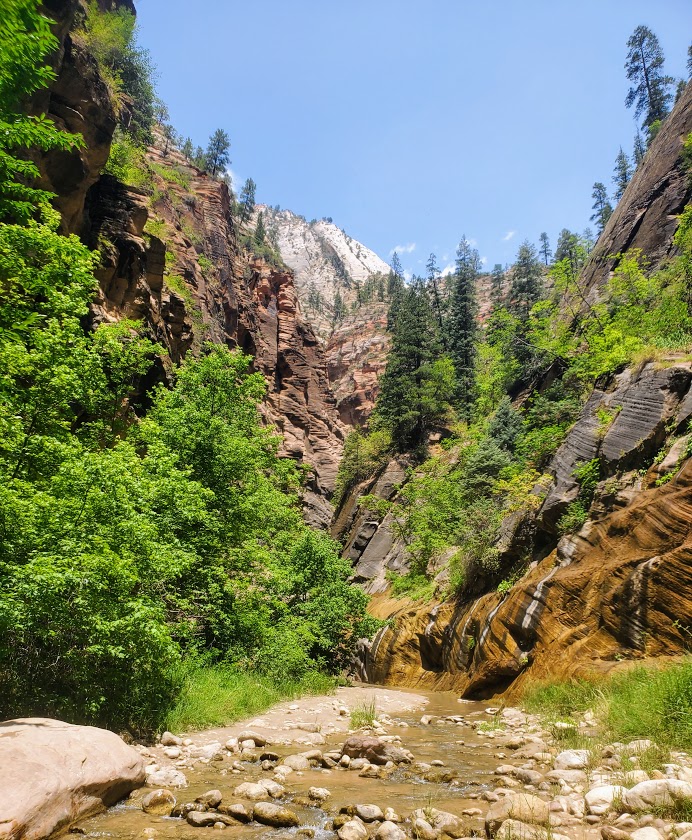
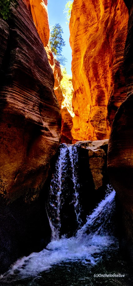
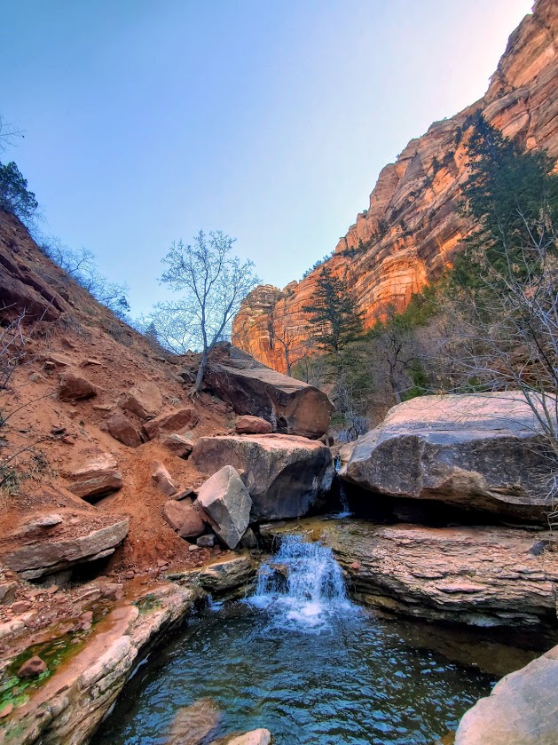
The waterfall in the feature picture above is the official turning around point for the Narrows. If you wish to add on a nice side trip on the way there, on the way back, or as an alternative, check out Orderville Canyon. It’s the right fork at about the 2.5 mile mark. It’s much greener, and in my opinion, prettier than the Narrows itself. Unfortunately, my bettery dies so I wasn’t able to take any pictures there. Guess, I’ll have to return. Orderville Canyon is also a bit less traveled, which in my book, is always a win
Yes, the Narrows is cool, but in my opinion, over-hyped. I’m so fortunate to be discovering so many equally or more beautiful, less-populated spots all over Utah. Zion National Park’s inability and/ or unwillingness to minimize crowds is discouraging and certainly offputting.
There is a 17-mile top-down challenging route that requires canyoneering and some swimming, likely it rules out the masses, but there’s no avoiding them for your final 5 miles when you’re most likely to be a bit hangry anyway… I’ll let you know if and when
Soapbox: In my opinion, ZNP needs to permit this hike ASAP to preserve the area from the irreversible impact of the HORDS of HUMANS and enhance visitor experience. They do it for the Subway and it works well. Never felt overwhelmed there, but the Narrows felt like being in a city subway. Perhaps they should flip the names.
Notes: Water temperature ranges from 40 to 60 degrees. In the fall, winter and spring, dry gear is recommended. (My first time was inMarch and I froze. Came back in July and was fine in shorts.) Rent info: https://www.zionguru.com/narrows-rental-equipment Hiking sticks/poles are a necessity. Go early to avoid the crowds as much as possible.
Difficulty: Easy +, though some might find the first 0.8 miles uphill challenging. After that, you’ll need to be mindful about your footing in the stream and on /off ladders and boulders if you attempt them. Know your limitations. It can take 7 hours for a rescue team to get here.
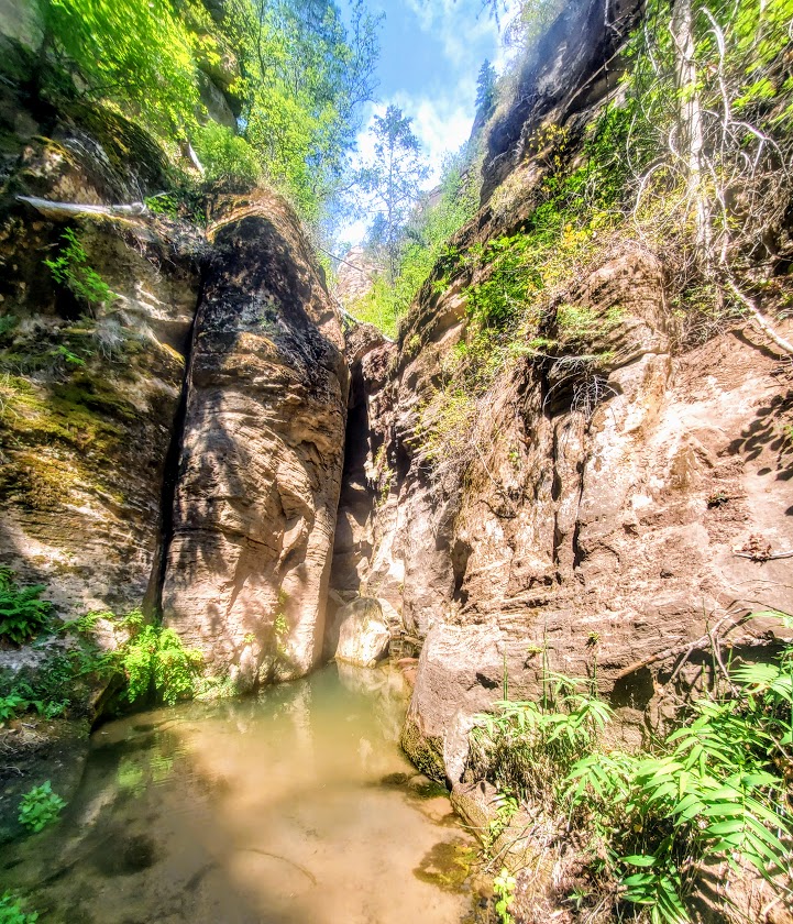
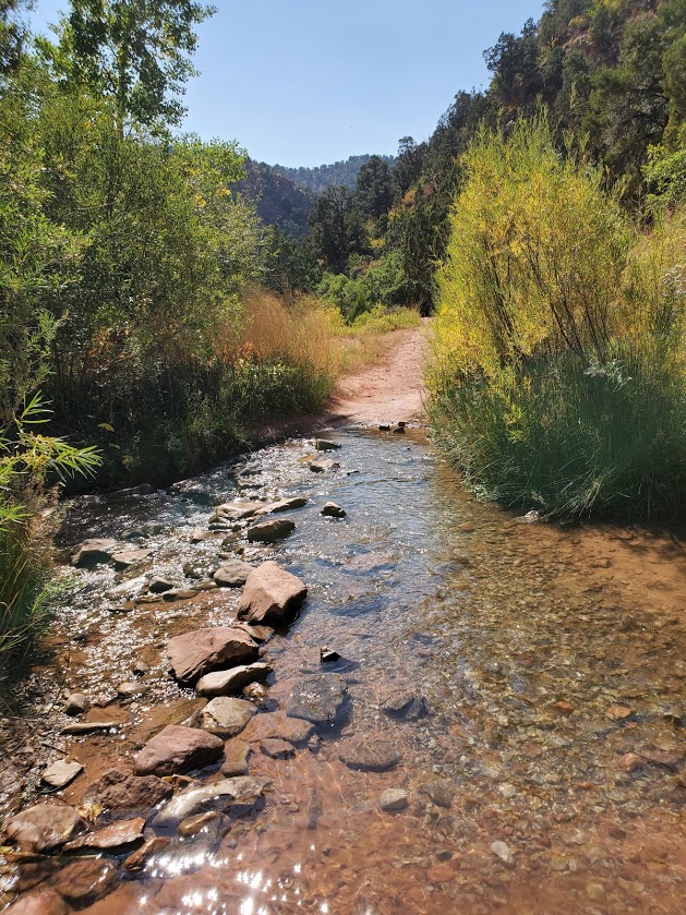
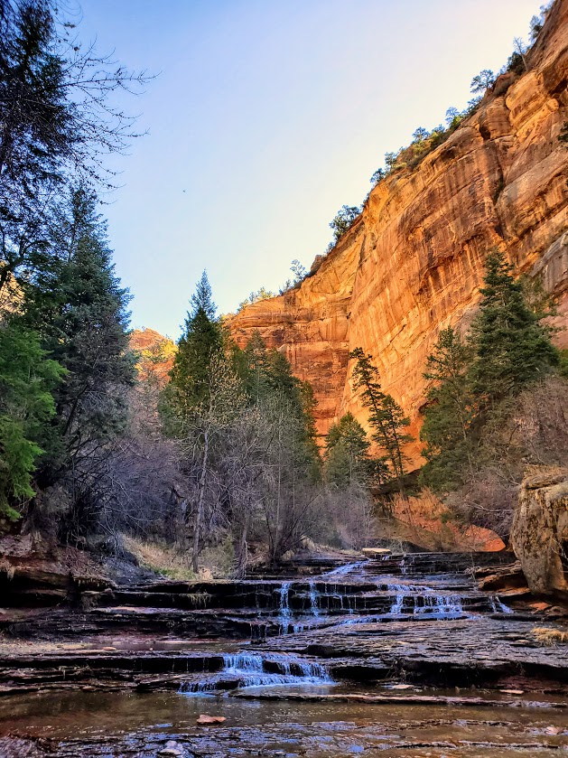
The first section of the trail follows an old access road (approximately 0.8 miles) up into Hurricane Cliffs before wandering into the lower, open sections of the canyon. This wonderful water hike takes you along a gurgling or rushing streambed (depending on the time of year) and into the narrows of the canyon.
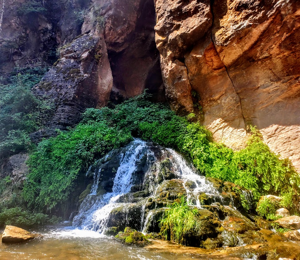
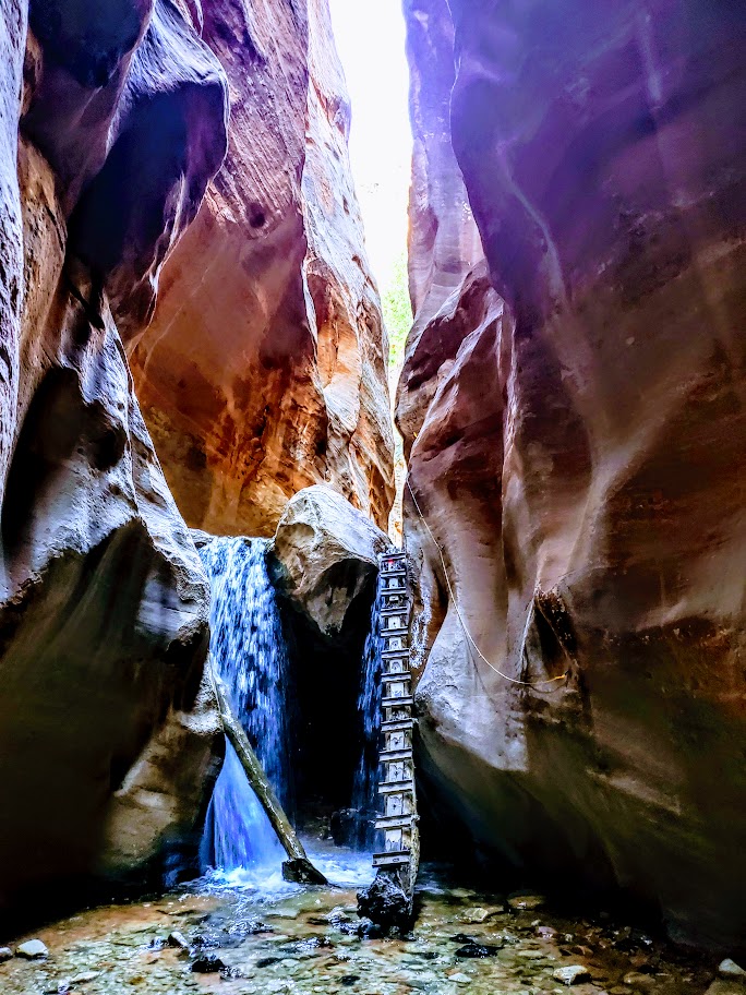
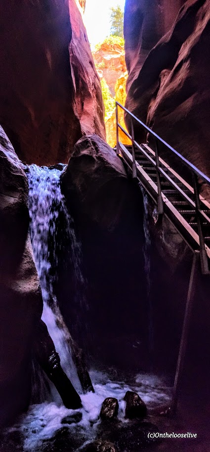
At 1.6 miles, you’ll reach the first waterfall.
Update 2024
At the first falls, the previous sketchy 20-foot leaning “ladder” with small metal rungs and no handrails has been replaced with a stable staircase with handrails. Sigh—the thrill is mostly gone, but it is safer and more accessible.
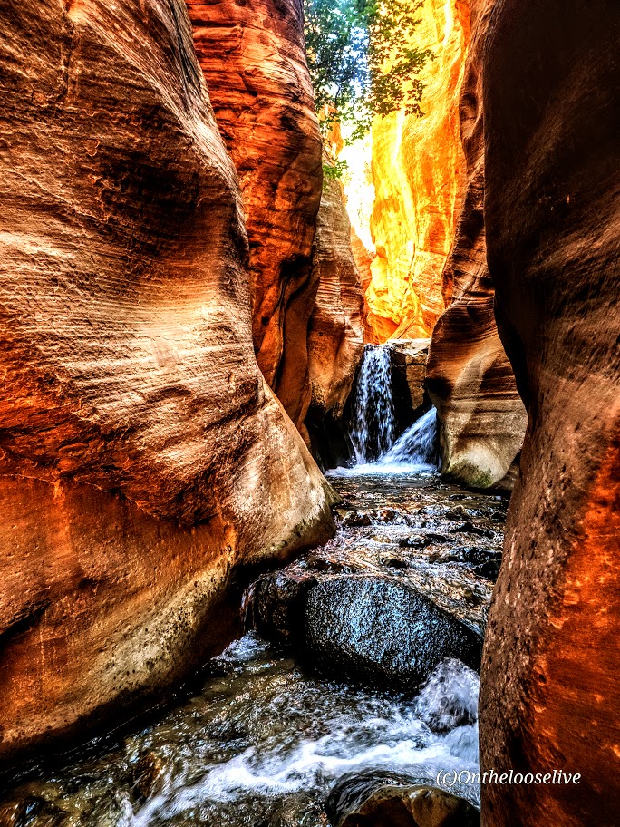
At 1.7 miles you’ll reach the second falls, which requires climbing over a slippery boulder. At 1.9 miles, you’ll reach the last falls and the turnaround point.
I caught some great light on my recent visit. Stay tuned for the videos.
WARNING: Flash floods can occur at any time of year but are most common in the afternoons from July through September.
Notes: Requires a nonrefundable permit for $15 per person. (WORTH IT.) Happy they permit this hike to limit the number of people per day and keep it clean. Unfortunately, they allow a whopping 200 permits a day PLUS large “commercial groups” of up to 20 people per day, which seems excessive (understatement) for this short trail with a single-file staircase, narrow slot sections, and the climb over the boulder. When crowded, it turns into a Disneyland waterpark madhouse with lines and logjams forming in those areas, which can ruin the experience for anyone else stuck behind or between groups.
Pro Tip: Your best bet to enjoy this beautiful area without the noisy hoards is to go early or late in the day on a weekday.
Open from dawn to dusk.
Wear water shoes or running shoes that you don’t mind getting wet. In my opinion, no need for poles.
No dogs. There are bathrooms at the trailhead.
Getting there: From Cedar City, take 1-15 South and then exit at 51, Kanarraville (if you’re coming from the south, on I-15, take exit 42). Either way, go east on 100 North, drive to the end of the road and the trailhead parking lot.
Distance: You decide, trail goes for 6+ miles out. (According to Alltrails, you can make it a 17.1mile loop, but that entails at least 5 miles of bland fire road, whereas an out and back avoids the fire road portion.)
Difficulty: Easy-+, depending on fitness level and length of your hike
Elevation gain:1,434
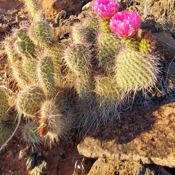
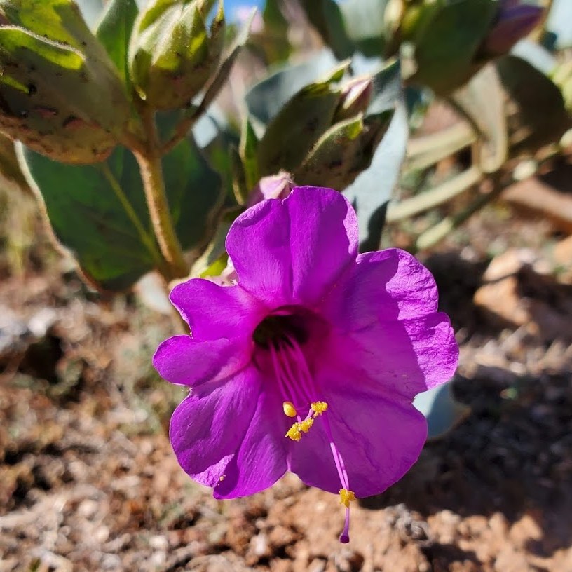
Highlights: Wildflowers, panoramic views, and some incline
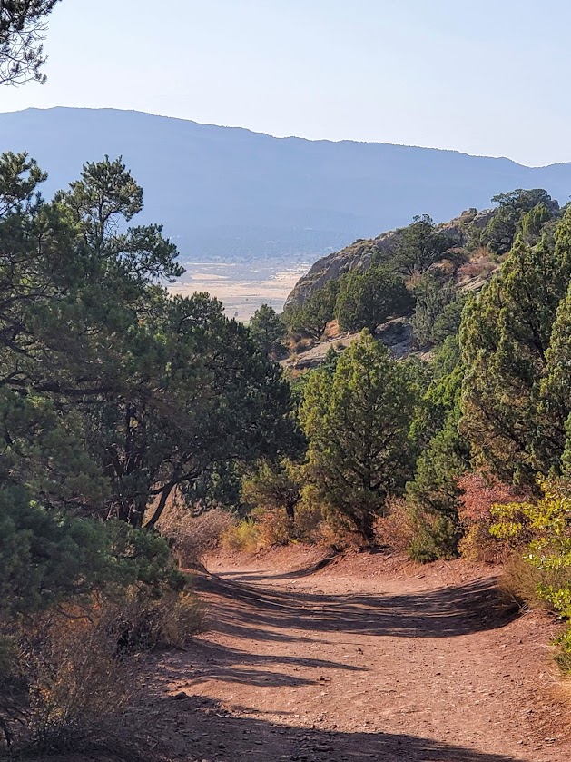
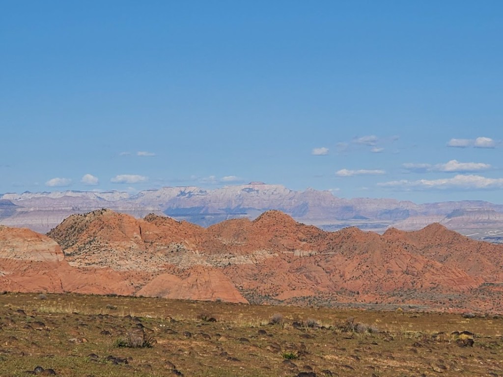
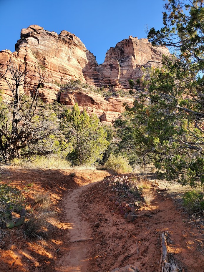
The Ice House trail runs up the side of a mesa (Broken Mesa) with an initial elevation gain of about 600ft. The terrain for the first incline section is a bit technical with chunky and loose rock. Hats off to the mountain bikers who can make that section without walking, I’m sure that I couldn’t. (And not sure I’d want to hike-a-bike that first half mile or so – perhaps nontechies like me can do it in reverse and turn around here.) After that it’s a gradual incline up the mesa on a single-track trail that is ridable, runnable, or strollable. Enjoy panoramic views (Pine Mountain, Zion, etc.) and wildflowers if you hit it at the right time.
Great hike for spring flowers, sunset, and some solitude.
Pleasant, but not a “must do” in my book. Good trail for endurance runners and backpack training.)
The trail is so named because it was route pioneers use to take to bring ice down for food storage from a storage pit located at higher elevation in the Pine Valley Mountains.
Notes:100% exposed trail so recommend avoiding it in the summer and suggest you bring plenty of water, a hat, and sunscreen.Leashed dogs allowed.
Getting there: The trailhead is at the back edge of the Green Springs Terraces development in Washington between house 2255 and 886. You can also access the Mustang Pass trail (looks like it could be interesting) and the Middleton Powerlines trail (looks like you can get some mileage on a mountain bike, but not very interesting for bike or hike).
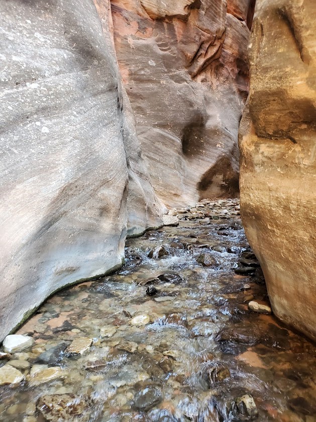
Difficulty: Moderate, depending upon your fitness level. (Zion National Park’s rating is strenuous.) Steep and exposed initial descent and return ascent, otherwise fairly mellow trail with lots of stream crossings / stream walking, some rock-hopping, and minor scrambles over boulders. (Good idea to have some longer hikes with some elevation challenge under your belt before attempting.) Since footing can be precarious at times, especially at the Subway itself, but also along the way, expect the hike to take longer than mileage would indicate. Also, you’ll want to take the time to savor the beauty that surrounds you. Average hike times range from 5 to 9 hours.
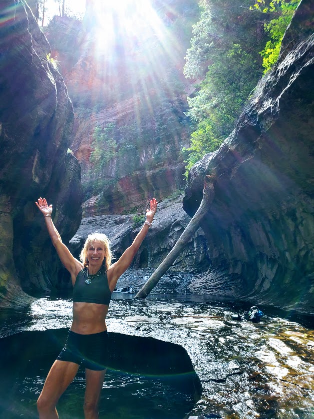
Definitely one of my favorite Utah hikes so far—epic scenery, waterfalls, the magnificent, iconic beauty of the Subway, and a solid workout.
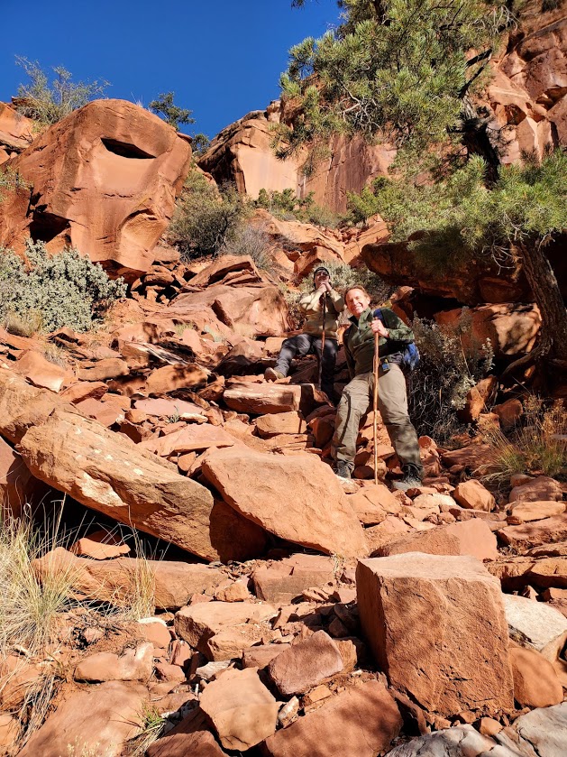
More than 1 of us accidently took the wrong “trail” down. Not sure how that happened – maybe it was too early in the morning, and too much excitement. If it looks and feels like you’re navigating down a precipitous, vertical avalanche area —retrace your steps back to the trail and continue on. While the descent and ascent are steep, they are on a definite trail.
The hike description noted a strenuous and steep descent / ascent so we didn’t think we’d gone astray until we found the real trail (pic on right) on the way back.
Apparently, there are some dinosaur tracks just off the “trail” somewhere – their whereabouts remain a mystery to me. I’ll let you know if I find them on my next trip.
Keep your eyes out for snakes, toads, and trout.
And yes, there’s also a top-down route to the Subway that requires canyoneering, rappelling, and swimming. It may be in my future—will report back, if and when.
Heads-up:
Walking stick with a solid rubber end and grippy shoes highly recommended. (You’ll be traversing many slippery rock sections through the stream and at the subway itself. Be cautious – safe is better than sorry. Many helicopter rescues occur here. Don’t be one of them.)
Be aware of flash flood danger and heat exhaustion exposure. Get the weather report and double-check with rangers. I went in April and it was 90 degrees by midday—some fellow had heat stroke on the trail. (Bring plenty of water, a hat, and sunscreen.)
This is a day use only area and permits are required. An advance lottery system applies from April to October and calendar reservation applies from November through March. There is also a last-minute drawing and you can always check for cancelations day of—unlikely, but we met a couple who nailed both a same day cancellation opening for the hike and a campsite so you never know. (Permits are $15 for 2, $20 for up to 7, and $25 for up to 12 people.) Lottery, reservation, and permit details here.
Good luck – it’s soooooooo worth it!
Getting there: Left Fork Trailhead on Kolob Terrace Road