Getting there: I-15N from St. George, Exit 10 to Washington. Left onto Green Springs Drive, immediate right onto Buena Vista Blvd. Follow. In about 1 mile, turn left onto the dirt road immediately after the fire station. Follow it for about 1.2 miles to the intersection of another dirt road and turn left onto this dirt road. In about a half mile you’ll see the parking area, gate and trailhead. (Directions are a bit tricky & terrain is variable–high clearance / 4-wheel drive vehicle helpful.) Took me 3x until I finally found it.
Notes: Full sun exposure, bring your water, hats, and sunscreen. (Spring, Fall & Winter are the best time of year for this one.) Leashed dogs allowed. Parking is free.
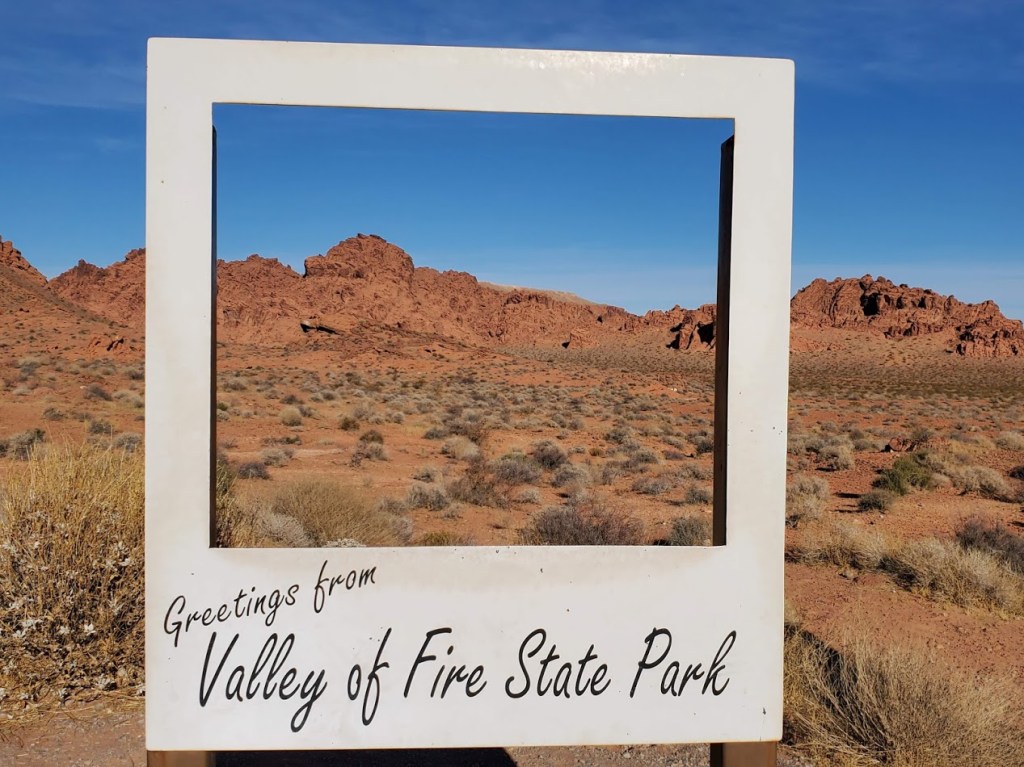
Why luke warm? I’ve seen some spectacular photos of Valley of Fire on social media–sometimes it’s hard for real life to live up to the hype—even in nature. The day I was there the light was not magnificent and the place was overrun with humans. The park’s close proximity to Las Vegas (55 miles) makes it an easy road trip for many (too many). (Granted, I made the rookie mistake of going on a weekend.) Also, I was disappointed by the hikes—the majority were short—just park and walk a mile or so on heavily stomped paths. Basically, you can see most of the park without much effort, which is great for families and those who can’t or don’t like to walk far.
I covered 7 of the hikes/ attractions in a half day. There were a couple of longer hikes that interested me, but 1 had signs warning about the trail not being marked, and the other 2 were slogs through deep sand. Since I was solo, I opted out of the poorly marked hike, not wanting to become another hiker lost, wandering in the desert…
Elephant Rock Loop (1.25 Miles) At the East Entrance of the park, Elephant Rock can be seen from your car. Like me, you may opt to stretch your legs and take a hike here. (Note half of the hike runs parallel with the road with the road visible so it’s a tad anticlimactic.)
Clark Memorial and [Charlie’s Spring (4.6 Miles RT, Natural Arches Trail] The Clark Memorial commemorates Sargent John J. Clark, a pioneer traveling cross-country who died of dehydration at the spot. There are 2 trailheads for longer hikes on the right side of the road. Both invite you to slog for miles through deep sand in either direction for negligible rewards. (The sign at the beginning of the Arch trail notes that the arch has crumbled and Charlie’s Spring starts with a tunnel under the road and offers a spring at the end…) While I wanted to a longer hike, I wasn’t enticed by the prospect of slogging through deep sand. Perhaps after a rain if the sand firms up instead of muds up? I went a half mile on through the tunnel into the wash on the Charlie’s Spring hike before I opted out.
Petrified Logs and historic CCC cabins Another roadside stop, this attraction features logs from an ancient forest of 225 million years ago. You can keep driving another ½ mile or so, or hike from the petrified log site to the historic native sandstone cabins built by the Civilian Conservation Corps in 1930s to provide shelter to travelers.
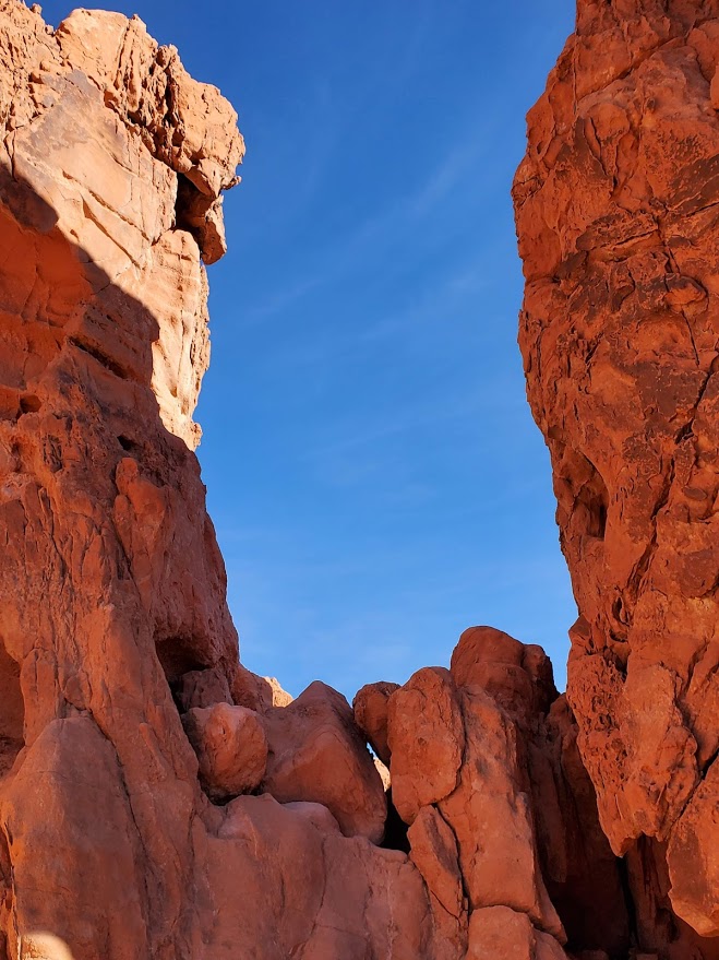
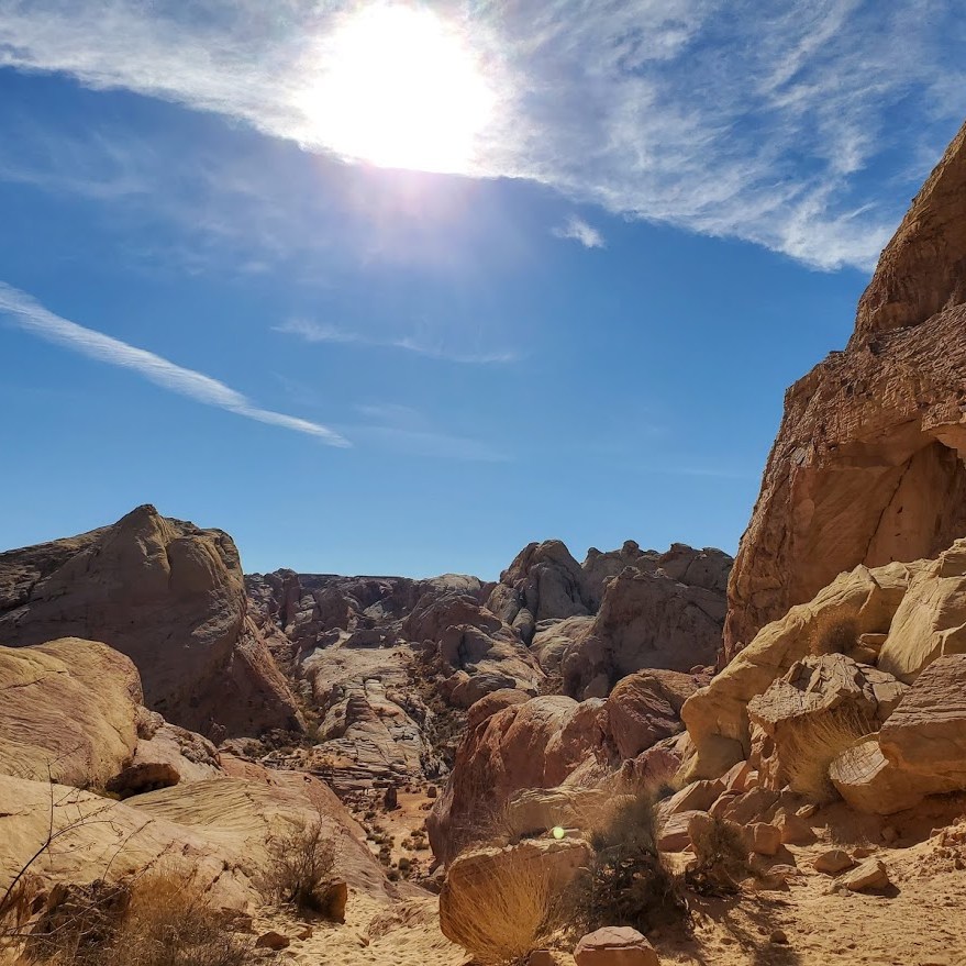
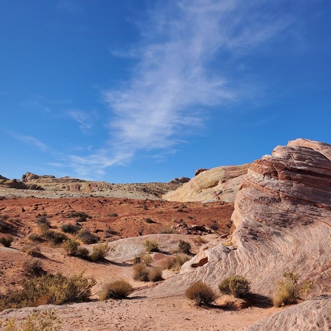
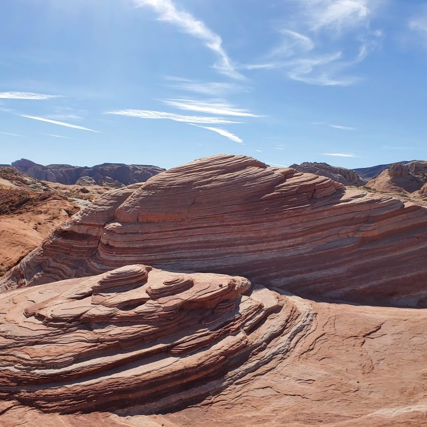
White Domes (1.36 miles) This was the most scenic of the hikes that I did. Several western movies were filmed here. There are arches, cool rock formations, and even a slot canyon to discover here.
Fire Wave (1.74 miles) This rock formation is most likely one of the most popular in the park. Since I’m accustomed to seeing this type of formation where I live, I was underwhelmed by the sight and overwhelmed by the crowd.
Rainbow Vista (1 mile) Single track stroll to a colorful rock overlook.
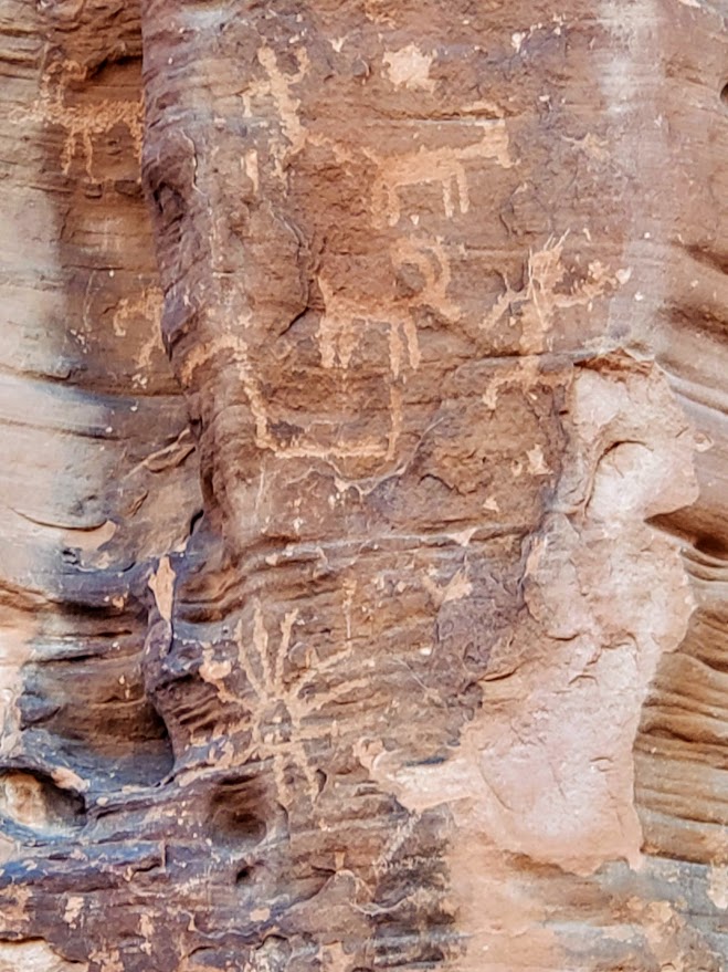
Mouse’s Tank (.78 Mile) This interesting little trail takes you to some of the best petroglyphs I’ve seen.
Don’t get me wrong, there’s plenty of breathtaking sights to see and lots of variety in the half dozen short hikes I mentioned, and more if you venture beyond. I’m just spoilt-rotten because but I happen to live within a couple miles of a similar stunning destination—Snow Canyon State Park, St. George. ( See Scout’s Cave, one of my favorite hikes.) Personally, I won’t go out of my way to return, but if it’s on your way—go for it.
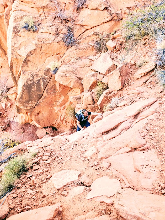
Difficultly: Easy to moderate depending on your fitness level (1 easy scramble required midway)
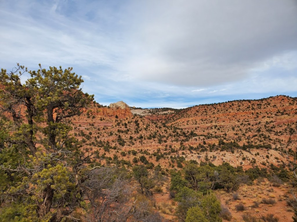
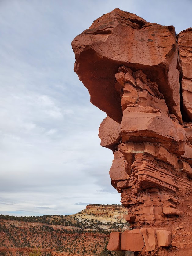
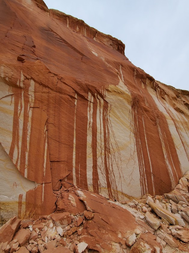
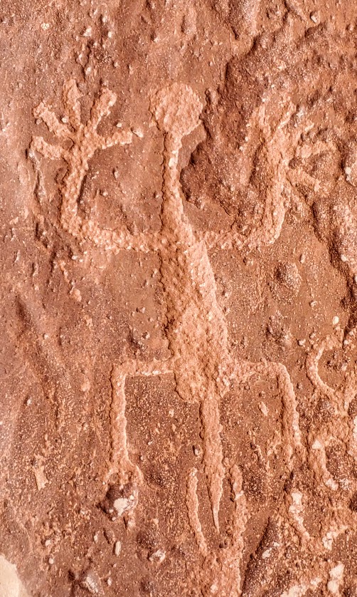
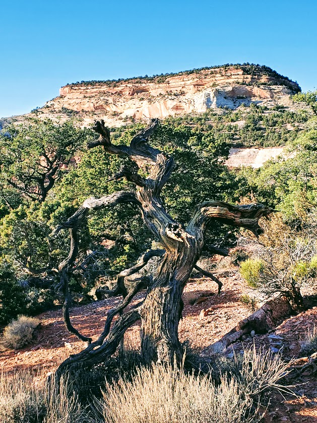
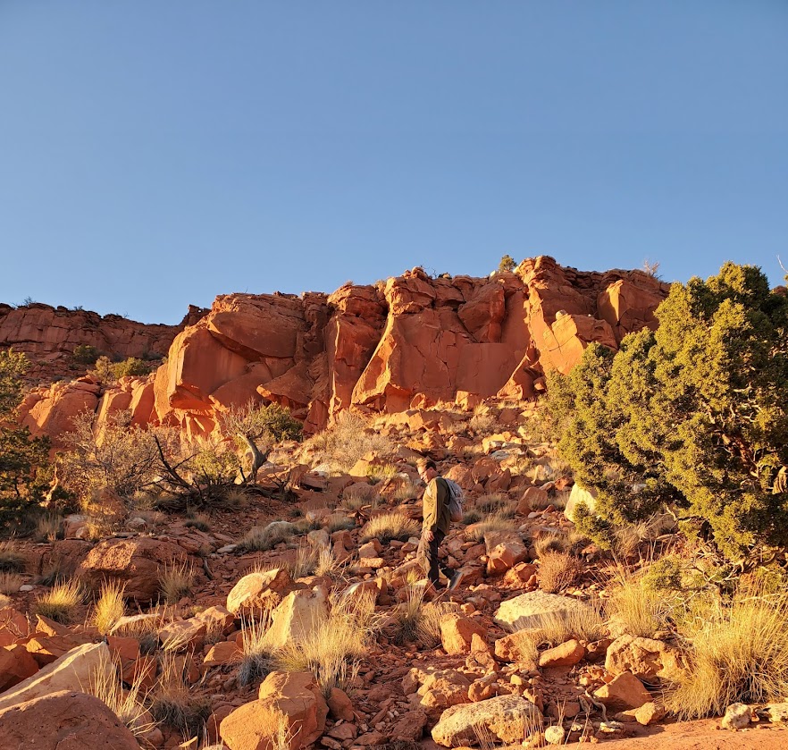
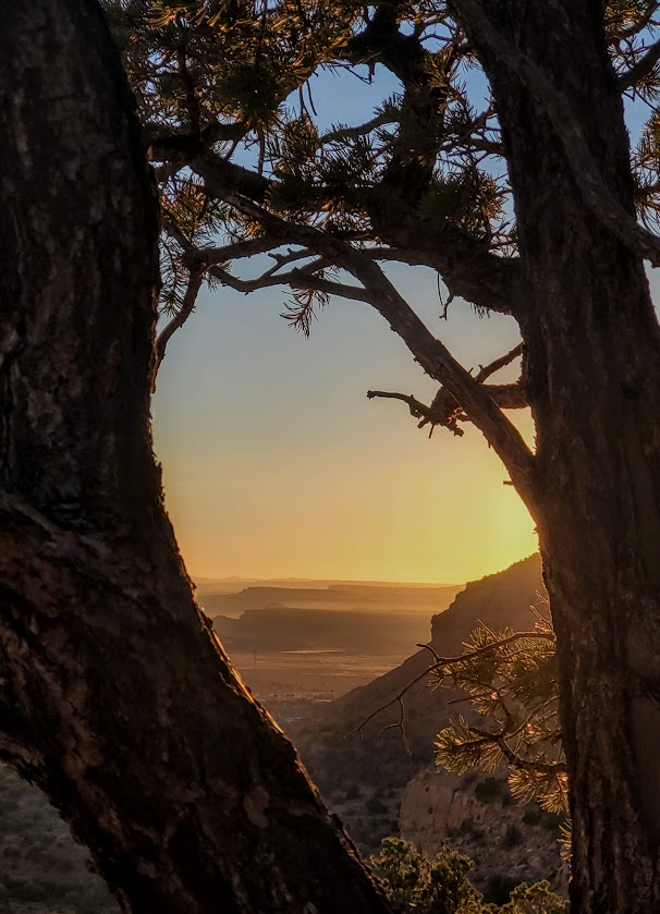
I loved this little hike. A feast for the eyes and spirit–the vermillion cliffs, the white rocks, the green pines and Bristlecones, the incredible rock formations along the way, the sweeping views of Kanab and the plateaus of northern Arizona, and the big reward of the magnificent alcove with its amazing petroglyphs. The single-track, switchback trail is red dirt most of the way up and thick, fine sand for the last 1/2 mile – great trail running terrain. If you’re in the Kanab area – it’s an absolute must do! Perhaps you can see why…
Notes: No permits needed. Free parking. The petroglyphs date back to the Anasazi period 0 AD to about 1250 AD and are on the floor of the alcove. Take care not to touch or step on any of the ancient art as oil from your hands or your pets’ paws can destroy the petroglyphs.
Getting there: The trailhead us just 6 miles east of the center of Kanab at 4825-4826 Rock Edge Lane