
Distance: ~9 mile round-trip (out and back)
Elevation: ~1900ft
Difficulty: Moderate, depending upon your fitness level. (Zion National Park’s rating is strenuous.) Steep and exposed initial descent and return ascent, otherwise fairly mellow trail with lots of stream crossings / stream walking, some rock-hopping, and minor scrambles over boulders. (Good idea to have some longer hikes with some elevation challenge under your belt before attempting.) Since footing can be precarious at times, especially at the Subway itself, but also along the way, expect the hike to take longer than mileage would indicate. Also, you’ll want to take the time to savor the beauty that surrounds you. Average hike times range from 5 to 9 hours.


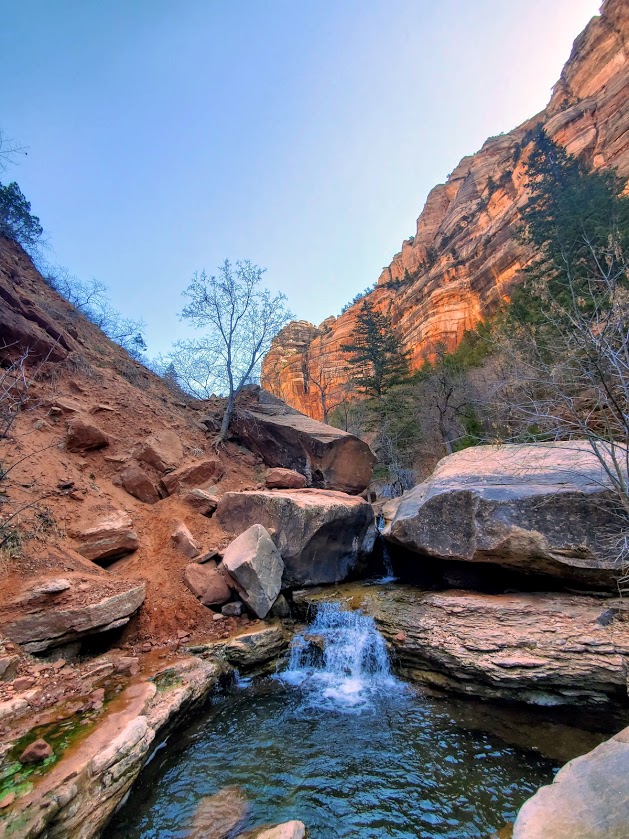
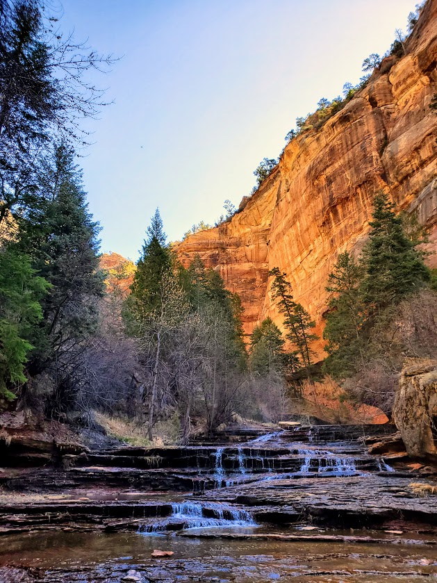
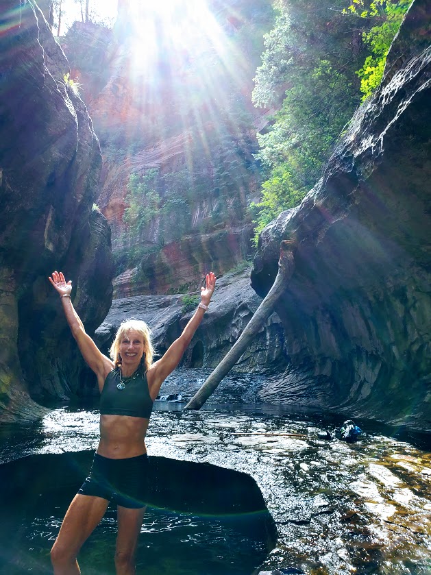
Definitely one of my favorite Utah hikes so far—epic scenery, waterfalls, the magnificent, iconic beauty of the Subway, and a solid workout.
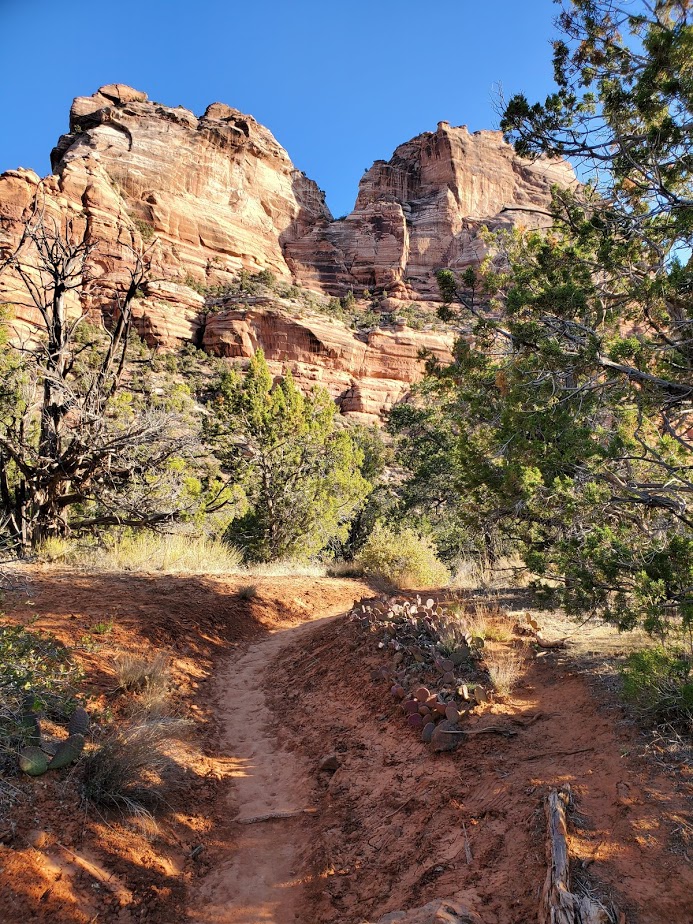


More than 1 of us accidently took the wrong “trail” down. Not sure how that happened – maybe it was too early in the morning, and too much excitement. If it looks and feels like you’re navigating down a precipitous, vertical avalanche area —retrace your steps back to the trail and continue on. While the descent and ascent are steep, they are on a definite trail.

Apparently, there are some dinosaur tracks just off the “trail” somewhere – their whereabouts remain a mystery to me. I’ll let you know if I find them on my next trip.
Keep your eyes out for snakes, toads, and trout.


And yes, there’s also a top-down route to the Subway that requires canyoneering, rappelling, and swimming. It may be in my future—will report back, if and when.
Heads-up:
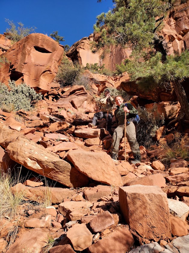
- Walking stick with a solid rubber end and grippy shoes highly recommended. (You’ll be traversing many slippery rock sections through the stream and at the subway itself. Be cautious – safe is better than sorry. Many helicopter rescues occur here. Don’t be one of them.)
- Be aware of flash flood danger and heat exhaustion exposure. Get the weather report and double-check with rangers. I went in April and it was 90 degrees by midday—some fellow had heat stroke on the trail. (Bring plenty of water, a hat, and sunscreen.)
- This is a day use only area and permits are required. An advance lottery system applies from April to October and calendar reservation applies from November through March. There is also a last-minute drawing and you can always check for cancelations day of—unlikely, but we met a couple who nailed both a same day cancellation opening for the hike and a campsite so you never know. (Permits are $15 for 2, $20 for up to 7, and $25 for up to 12 people.) Lottery, reservation, and permit details here.
Good luck – it’s soooooooo worth it!
Getting there: Left Fork Trailhead on Kolob Terrace Road
Happy Trails!


This looks like an awesome hike! I really need to get back to Zion ASAP!
LikeLiked by 1 person
Sure is!
LikeLike