Adventures Near & Far, St. George Yoga & Hike Retreats, Popup Yoga, Local Guiding
Search Icon
Author: livevigorously
Greetings, I’m a St. George local who is passionate about blending my love for yoga, and the great outdoors to create an unforgettable experience just for you. Enjoy outdoor yoga (all levels) in an iconic setting and/or a guided hike to secret petroglyphs, caves, and slot canyons. With stunning Snow Canyon as my backyard, I'd love to be your guide to the best this area has to offer! Ask about my "home stay" options.
Had the good fortune to travel to Japan on business and to stay in the luxurious Prince Hotel, Minato, Tokyo. My bathroom and room had tremendous view of Tokyo tower (aka Eiffel Tower knock off). I have never been in such a large or luxurious bathroom – huge walk in shower, deep jacuzzi bathtub and enough room left over for a small dance party. Seriously, the bathroom seemed more spacious and outfitted than the room itself. In case you haven’t heard, the Japanese have a thing for outfitted toilets (heated seats, warm water spritz wash (biddett & hot air dry, etc…) and deep soaking tubs. We Westerners could certainly learn a thing or two from Japan and improve our WC experience…
The bathroom was so big, I couldn’t get it all in 1 photo.
Tokyo Tower view from the shower, tub or throne.
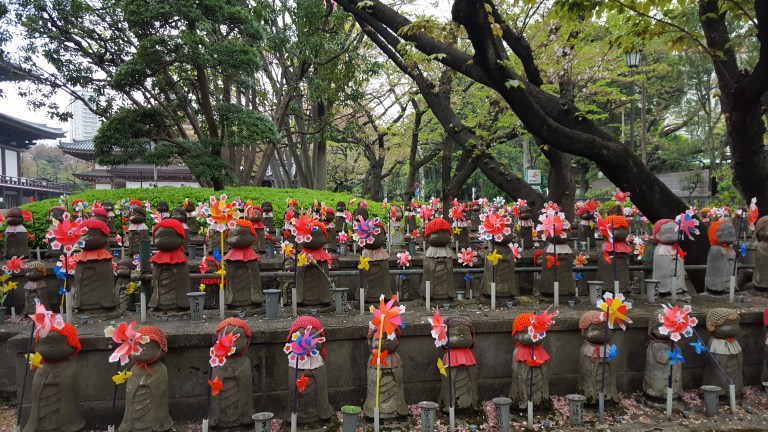
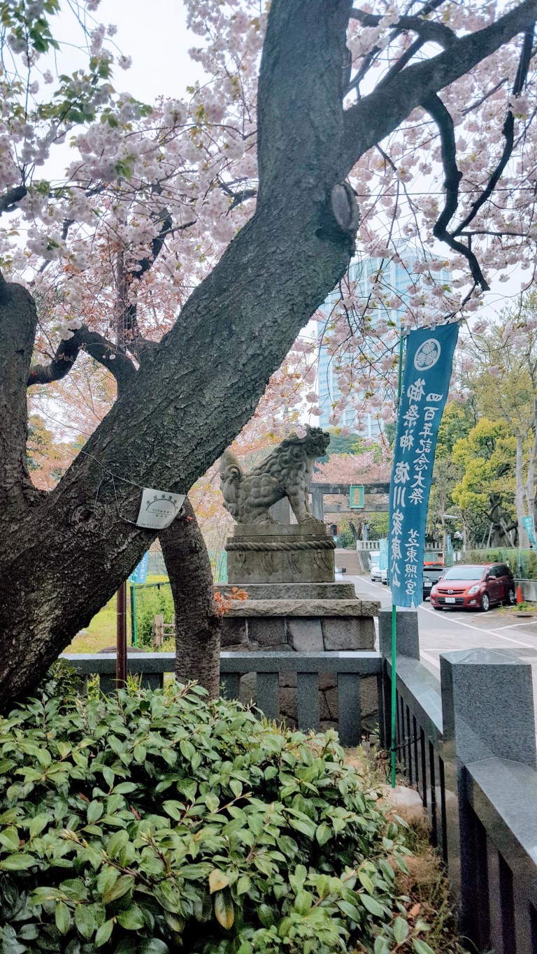
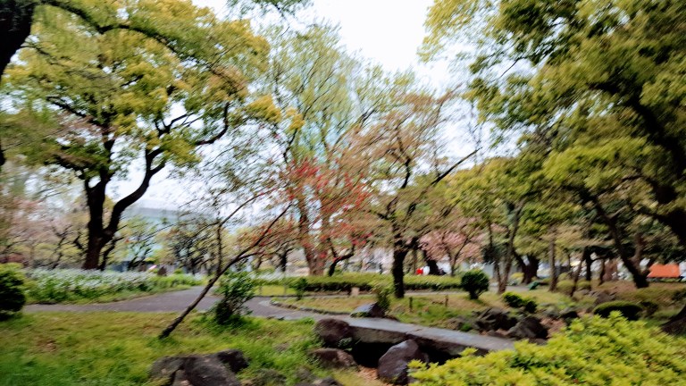
While I was in town for business meetings, I still managed to sneak in a couple strolls and a quick run around the area to take in a few of the nearby scenic highlights.
As my Japanese grand finale, I indulged in a sushi dinner at Hamashiba restaurant in the hotel. Forget everything you’ve heard about hotel restaurants – this one is superb. The sushi is outstanding, by far the best I’ve had and no doubt, will ever have. The maguro / tuna was absolutely exquisite and it was a treat and once in a lifetime experience to watch the master sushi chefs at work. Was it expensive? Duh. Was it worth it? Absolutely! (The company didn’t pick up this one.)
Sumptuous sushi assortment
Magnificent maguro & yellowtail
Sayonara!
Garden and City views from my room at The Prince
Oh, and it looks like the sole homeless person in all of Japan was sleeping under my window at The Prince.
Stay tuned for adventures in Kyoto and Hakone…Arigato.
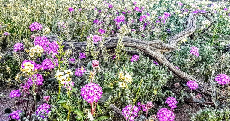
Just realized that I never posted my still photos from this year’s Super Bloom in Anza Borrego. In case you’re wondering, a Super Bloom is the term used to described an exceptionally abundant wildflower bloom that exceeds the usual seasonal Spring bloom. When heavy rains and consistent wet weather come to the deserts of the southwest during late fall through winter as they did this year after a 5 year drought, the ideal condition for a Super Bloom is created. So ideal, in fact that this colossal colorful and fragrant explosion only occurs about once a decade. Seeds that lie dormant under rocks and sand for untold years, finally sprout when water washes away their protective coating…
This slideshow requires JavaScript.
In our deserts, we typically see a sprinkling of purple sand verbena, white dune evening primroses, orange poppies (California’s state flower) and an occasional red-tipped ocotillo. This year, it was a breathtaking, surreal display with carpets of wildflowers, blooming cactus and red-tipped ocotillo forests. Be sure to check out my videos (1, 2, 3) for more of an immersion experience.
If you missed the bloom this year, plan in advance for next March and keep the Anza Borrego wildflower hotline on hand. (760) 767-4684
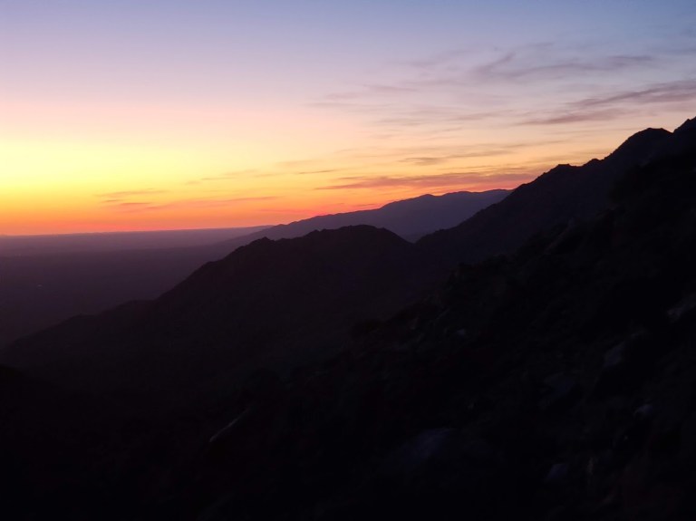
2019 Update – Timing is everything, didn’t see nearly as many blooms this year as 2017, but it’s always beautiful, especially at sunrise.
Anza Borrego State Park is named after the 18th century Spanish explorer Juan Bautista deAnza and borrego, the Spanish word for bighorn sheep.
The park covers 600,000 acres and is the largest state park in California and, the second largest in the contiguous United States. It contains 500 miles of dirt roads, 12 designated wilderness areas, and 110 miles of hiking trails.
The endangered peninsular bighorn sheep, often called desert bighorn sheep, make their home here. It’s said that visitors and residents seldom get to see them as they avoid human contact.
We arrived at the park about 45 minutes before sunset (golden critter hour) and decided to go for a quick run up the scenic and pleasant Borrego Palm Canyon Trail (3.25 miles) before dark.
This slideshow requires JavaScript.
We looked up the steep rock studded canyon walls at precarious boulders, wondering if they ever dislodged…We walked part of the way back hoping to see some wildlife. I told Ken to keep his eyes open. I have terrible eyesight and the stone and sunset shadows are perfect camouflage for anything that wants to evade notice. Then I heard something that sounded like a boulder crashing down…and Ken saw something in the distance…The head bangers in action! A group of 5, the one sitting on the rock officiating looked frail, perhaps an elder. I felt like I was in a National Geographic show. It was amazing!
The next morning we had breakfast at the local coffee shop. While we were there, we struck up a conversation with a ranger and local at the next table. We shared our adventure and the video on my phone. There was an elderly couple standing nearby, watching me with annoyed faces and their arms crossed. (Was I talking too loudly or did I steal their table?) Nope, the woman finally broke her silent glaring and told us in an exasperated voice that they had been hiking the canyon nearly ever day for years and had never had a big horn sheep sighting – not even 1. That’s how lucky we were.
Turns out one of the fellows that we were chatting with was the co-creator of the Desert Bighorn Sheep Book that I was browsing through. How cool is that?
And yes, this gorgeous book is available at AMAZON and the Anza Borrego Visitor Center.
And if all that wasn’t magical enough, on our drive out of the park, this healthy coyote couple appeared to see us off.
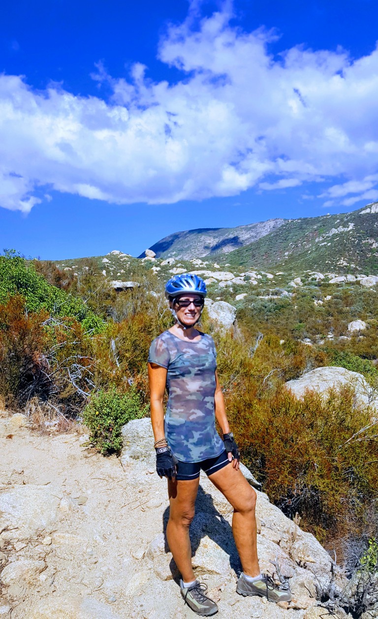
Was gunho to get away to somewhere new this weekend. Perhaps a little too gunho…Wasn’t quite as thorough with the research as I usually am, but had done enough to know that the Laguna Mountain Recreation Area is a great spot for mountain biking and enjoying great scenery as you traverse 3 ecosystems: mixed-conifer/black oak forest, alpine meadows and desert.
And it certainly served up some heavenly single track around Laguna Meadow and beyond.
I’d call it Bait & Switch Trail
Still blissful in the meadows
Sublime, right? And so it went for about 6 miles before things took a gnarly turn for the worse. Scattered rocks, became bulky blocks with jagged edges, boulders and ankle bashing bruisers galore. I didn’t get pictures of these tortuous areas because, I was too miserable fending off hordes of face flies while hike-a-biking my hefty 35 pound bike. Even if I’d had a Go Pro, you wouldn’t have been able to see beyond the blur of flies – that’s how bad it was. Brutal – yes.
We only saw 2 other mountain bikers on the rough lower portion. They were wearing completely padded body armor suits with full face helmets. Another clue that I was way out of my element…I’m tough, but I’m not technical and have horrible eyesight and depth perception so this it was more than a bit hazardous. I’m extremely lucky to have escaped with only a handful of bruises and scratches.
( I later discovered – post-research – that this area is notorious among mt.bikers and is affectionately called Stairway to Hell and Roman Road.)
Here are a couple links to youtube videos on the area.
We kept looking for a route that would loop us back as a couple people at the trail head had mentioned, but we never found it. And there was no way we were going back up the Stairway to Hell…I even thought of abandoning my beater mt. bike and hiking out even though I only had my bikes shoes.
A smile (or grimace) of relief after surviving Stairway to Hell
Instead, we made it out to the Pine Valley picnic area and then out the road. Realizing then that we would have to ride up the mountain via Sunrise Highway. Not much of a shoulder there, but a lesser evil than Stairway to Hell. Climbing 8 miles and 3K feet back to the car after the tortuous Noble Canyon was its own purgatory, and certainly, I’ve learned my lesson about doing my research. Perhaps next time, my BF will read the links I send him prior to departure too. (Snarkyness aside – selfreliance is critical even when you’re with a partner. If we both had read the trail reports thoroughly, one of us likely would have retained which trail to loop back on – though we still might not have found it…)
This day certainly put us to the test. Even though we both keep a fairly high fitness level – it kicked our butts. And to both our credits, we didn’t bite each others heads off. I did come close to meltdown with the face flies on attack while I was hefting my bike over boulder after boulder, but I held it together. We both did, taking the punishment mostly in silent, focused suffering. What was going to be a pleasant morning adventure, ended up being a whole day ordeal. Great workout – not so fun.
I’ve reread some of the trail reports and it sounds like there are other options if you want to avoid the burly section of Noble Canyon. I may be back, but need a cooling off period and time for my bruises to heal first.
Where: 40 minutes from downtown San Diego, near Pine Valley, off of Pine Creek Road North of I8 or off of Sunrise Highway to go top to bottom
What: Noble Canyon Trail, Laguna Mountain Recreation Area
Distance: 19.9 Miles out & back
Elevation gain/loss: 3,346
Rating: For hiking: Moderate. For Mt. biking: Advanced+++
Notes: Adventure Pass required.
Tip: Bring bug spray and plenty of water. Consider a car shuttle for a 10 mile option. Given that it’s single track and a mountain biker destination, it’s not the most peaceful option for hikers…The trail head maps aren’t great, do your research first. ; )
Have you had any small adventures turn into challenging ordeals? Do tell.
The Santa Margarita River, aka Temecula Creek / Temecula River, is one of the last free-flowing rivers in Southern California.
The park is said to contain 1400 acres with 14 miles of trails that loop and crisscross the river. Not sure about that, but I do know that the main trail is about 5.5 total out and back. There are a number of offshoot trails, but it’s hard to imagine that they add up to 3x as much distance…
The main trail is a pleasant meander along the river under a canopy of trees.
There are a couple of swimming holes within the first mile or so if you care to take a dip. Before too long you’ll encounter your first of a half dozen creek crossings. Since the terrain is mostly smooth path or sandy, you might consider Tevas, instead of running shoes or hikers as you’ll be taking them on & off frequently. (That being said, if you don’t mind getting your running shoes wet, it’s not a bad spot for a little trail trot.) There are also a couple of lovely little oases along the way.
Apparently, this river corridor is known for raptor sightings and home to deer and other large mammals. We saw one shy turtle basking on rocks and a little fishey who seemed to be guarding her eggs – see video below.
Certainly a great spot to spend an afternoon, have a picnic or take a dip. (I wouldn’t drive too far for it, but if you’re in the area by all means.)
Note: It gets super hot in Fallbrook in the summer, be prepared and bring water.
BEWARE: Abundant poison oak & quick sand???
Distance: ~5.5 out & back
Difficulty: Easy – family friendly
Location: Fallbrook near De Luz Road & Sandia Creek Dr intersection, right on Sandia Creek Dr. then the parking area and trailhead are 1.2 miles ahead on the right.


")