Difficulty: Moderate+, depending on your fitness level and sensitivity to altitude
As you drive and hike around Lassen Volcanic National Park, one of the first things you’ll notice is the extensive devastation from the Dixie Wildfire that occurred in 2021 and burned 73,240 acres of the park in 3 months (August through October)—the largest fire in the park’s history and the largest single fire in California history (963,309 acres). While Nature’s resilience is on display in terms of seedlings and new growth, it’s clear four years later that full recovery will take many decades.
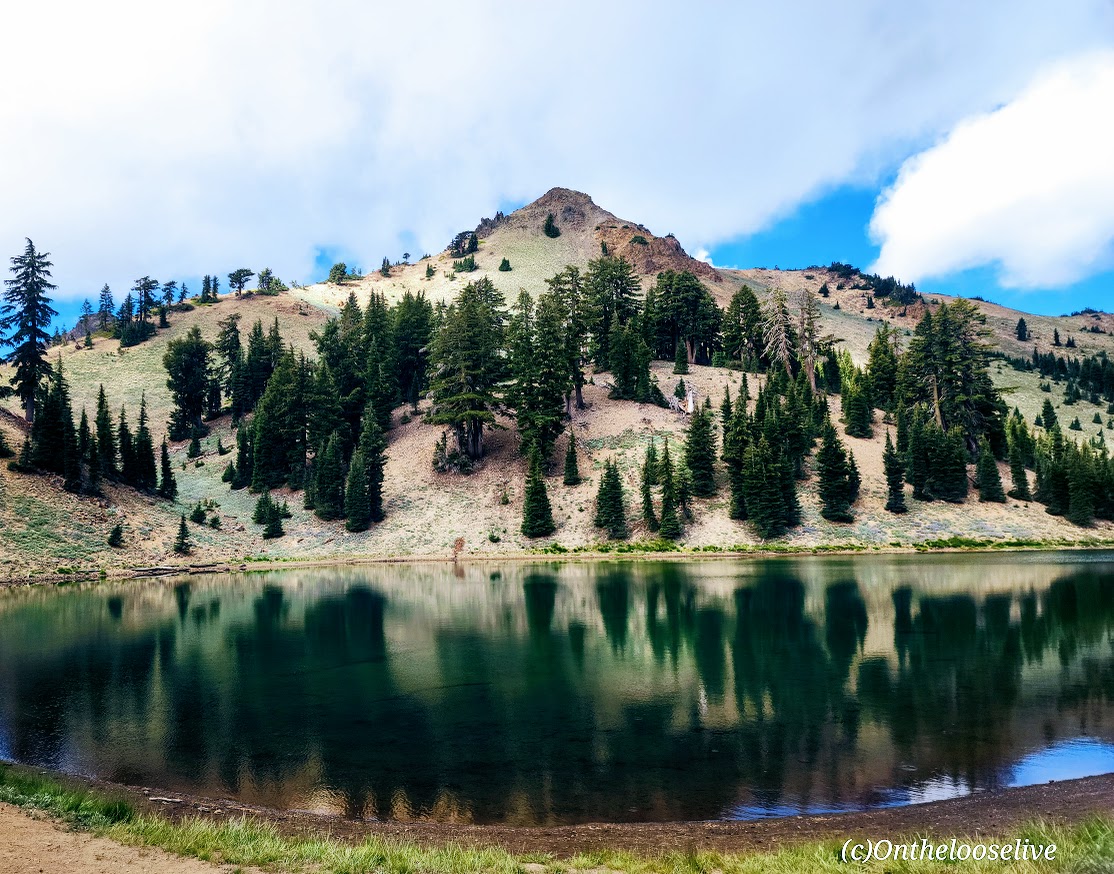
It’s hard to imagine what the park once looked like, but fortunately, a few untouched areas still offer us a glimpse into its former splendor. The Ridge Lakes Trail is one of them. This short (2 miles), steep (1k in 1 mile) hike is an idyllic little slice of paradise and a window into what Lassen Volcanic National Park must have been like before the fire.
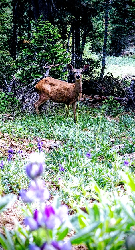
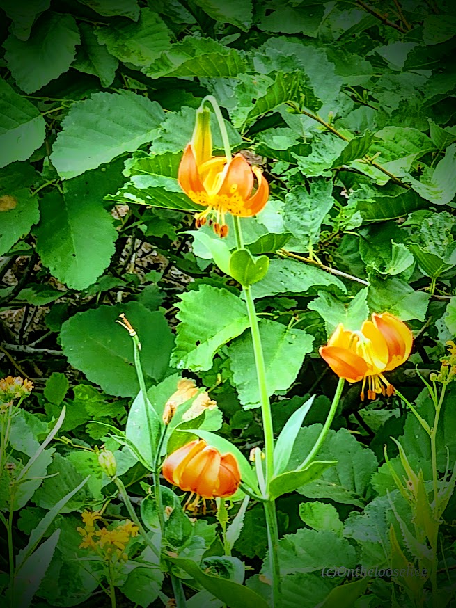
This was my morning “warm-up” hike before tackling Lassen Peak (post to come). The lovely single-track trail winds up through ferns, grasses, and wildflowers (Indian Paintbrush, Lupine) to two (it seems more like 1, as they’re connected) small alpine lakes cradled in a pristine basin with Brokeoff Mountain and Mount Diller as the scenic backdrop.
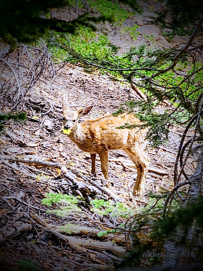
I had the hike all to myself (except for a Doe and her fawn), and as you can see, I thoroughly enjoyed my photo safari here. If you’re heading to Lassen Volcanic National Park, I’d put this one on your short list (pun intended).
Getting there: The trailhead is at the Sulphur Works parking area (1.1 miles past the southwest entrance).
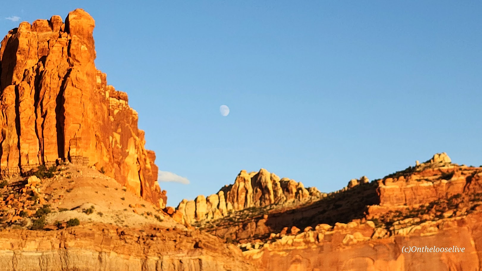
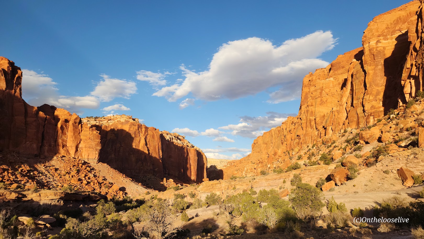
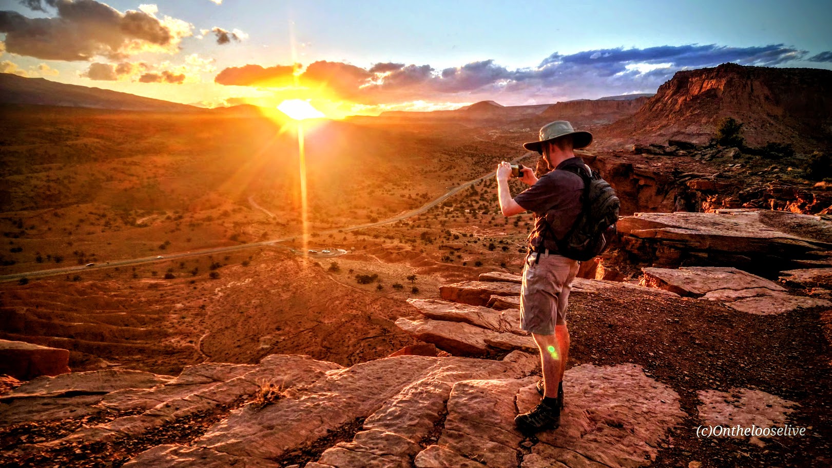
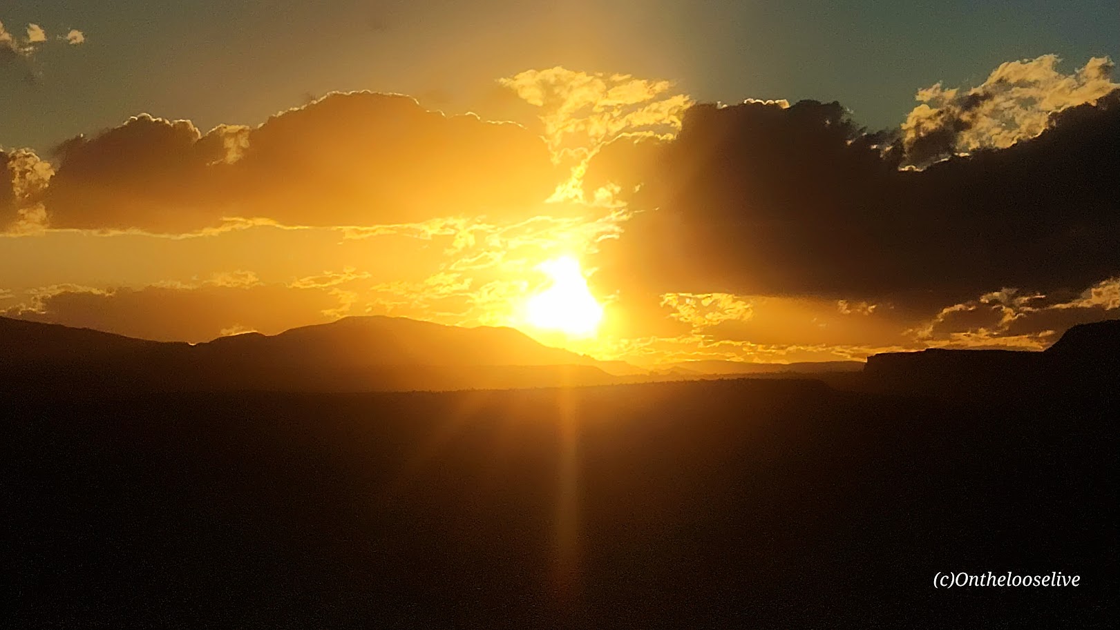
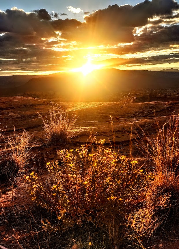
If you’re rolling into Capitol Reef at sunset or wrapping up a day of hiking but still have some energy left, the Chimney Rock Trail is a short, sweet hike that offers stunning panoramic sunset views. If you’re really short on time, you can take the official sunset “hike” in the park, Sunset Point Overlook—an easy half-mile trail that offers similar breathtaking vistas.
Chasing sunsets on the trails and yoga pose photobombing are two of my favorite things! What silly things do you do to express your exuberance in the wild?
Difficulty: Easy +, traverses slickrock, so shoes with good tread are recommended
Distance: 2.7 miles
Elevation gain: 423 ft
I’m guilty of only posting longer, more adventurous hikes, so here’s an easy St. George shortie that’s long on panoramic views.
If you only have time for a short hike in St. George, Owen’s Loop is one you might consider, especially for a sunset hike. While rated easy, this popular hike is an excellent introduction to Southwestern Utah’s varied, rugged terrain. You’ll be traversing red slick rock, white sandstone, and lava rock, so you may find yourself paying more attention to your footing and to the trail itself than usual. Even the “easy”, suburban hikes here have some elements of adventure. If you lose track of the “camouflaged” trail, don’t worry, the hike follows the rim across and back, and you’ll soon encounter footsteps or wheel tracks to get you back on track.
The sweeping 360-degree views from the Beaver Dam Mountains to Pine Valley Mountain, and even out to Zion, are especially breathtaking when blessed with one of our magnificent Southwestern Utah Sunsets. Plan to finish the hike before dark if you don’t have lights, but consider remaining on the ridge as night descends to watch the city lights sparkle below.
If you’re up for more mileage, there are options to add on with the City Creek Trail, or across the way at Pioneer Park. Visit the Red Cliff Desert Reserve website for current info on this and other local hikes.
Note: “Loop” is a bit of a misnomer as the loop part is a tiny lollipop at the far end of the trail overlooking the public Dixie Red Hills Golf Course and the Elk’s Club below. This trail is more of an out-and-back.
Getting there: Parking for the trailhead is at Brooks Nature Park, 452 North Main St., St. George. You can also park at the Pioneer Park trailhead and walk across the street. (Use the crosswalk or the underpass.)
Wizard Island, named for its resemblance to a wizard’s hat, is a striking volcanic cinder cone rising from the western side of Crater Lake in Oregon’s Crater Lake National Park. It was formed over 7,700 years ago during the cataclysmic eruption of Mount Mazama.
Exploring Wizard Island is one of the most unforgettable ways to experience Crater Lake up close — from its pristine shoreline to the sweeping panoramic views from the rim. It’s easily one of the top highlights of the entire park. I’m so glad my friend insisted we make the boat trip out there!
Unfortunately, the Cleetwood Cove Trail — the only public access point to the water at Crater Lake — is now closed for the 2025 season and may remain closed for up to three years due to a major rehabilitation project. As a result, boat tours to Wizard Island are suspended until the trail reopens.
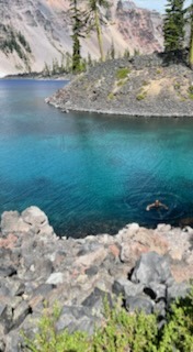
I was lucky enough to visit Crater National Park this past August, just before the closure. The excursion to Wizard Island was, without a doubt, the highlight of my trip there. While I enjoyed a few beautiful hikes in the Park (posts coming soon), it was on Wizard Island that I truly felt the spellbinding magic of Crater Lake. The colors are spectacular—the many blues of the water and the neon green of the moss and trees are surreal.
What truly made the visit unforgettable was standing on Wizard Island, surrounded by mesmerizing views of Crater Lake, and then immersing myself in the deepest, bluest, purest lake in the country (in the refreshing summer temps of ~57 F)—priceless.
Cleetwood Cove Trail
Distance: 2.2 miles RT
Elevation Gain: ~700 ft on the return (comparable to 65 flights of stairs)
Difficulty: NPS lists this hike as “steep and strenuous”, AllTrails lists it as “moderate” – it depends on your fitness level and altitude sensitivity. (It’s easy footing, and runnable though the pumice surface can be slippery.) I’d rate it easy++.
To the Top of the Wizard’s “Hat” (Cindercone Rim) & Lower Cove area, Wizard Island
Distance: 3.6 miles
Elevation Gain: 798 ft
Is Crater Lake National Park Worth Visiting If You Can’t Get To Wizard Island?
Knowing what I know now, would I visit Crater Lake if I couldn’t get to Wizard Island? Probably not. While the hike samplers I took in the park (posts to come) were wonderful, I don’t find them compelling enough to warrant a special trip here. Disclaimer: I would never discourage a visit to a national park if you’re in the area, but if you need help deciding when and where to go, and what to prioritize, this might be helpful. Also, if you feel Crater Lake is absolutely worth it, even if you can’t get to Wizard Island, comment below to let people know.
Notes: Boat reservations to Wizard Island must be made in advance. Since it’s likely the park will have a new system in place when the trail and boat excursions reopen, here’s a direct link to CLNP.
Swimming is only allowed within 100 yards of Cleetwood Cove and within 100 yards of Wizard Island. To keep the water pristine, the following items are not allowed: scuba and snorkeling gear, wet suits, masks, goggles, fins, inner tubes, kayaks, canoes, inflatable rafts, SUPs, flotation devices, personal life jackets or vests, waders, and personal boats.
Pro tip (wink): Apparently, it’s a “thing” to wear a Wizard’s hat to Wizard Island. There’s plenty of time for you to find one before it reopens if you’re so inclined. (No, I didn’t wear one.)
I wouldn’t rank Pinnacles near the top of my National Park experiences. To be fair, I’ve been lucky enough to hike in some of the most stunning areas across the U.S. and around the world—so I’ll admit it, I’m a bit of a hiking snob. That said, Pinnacles didn’t quite feel like it earned its National Park status. Honestly, it felt more like a solid regional park—State Park caliber at best.
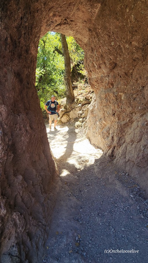
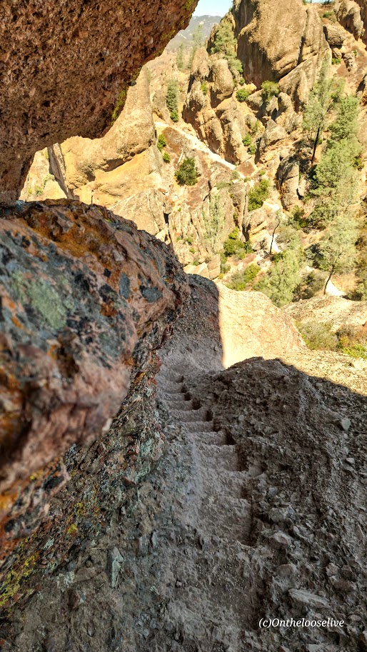
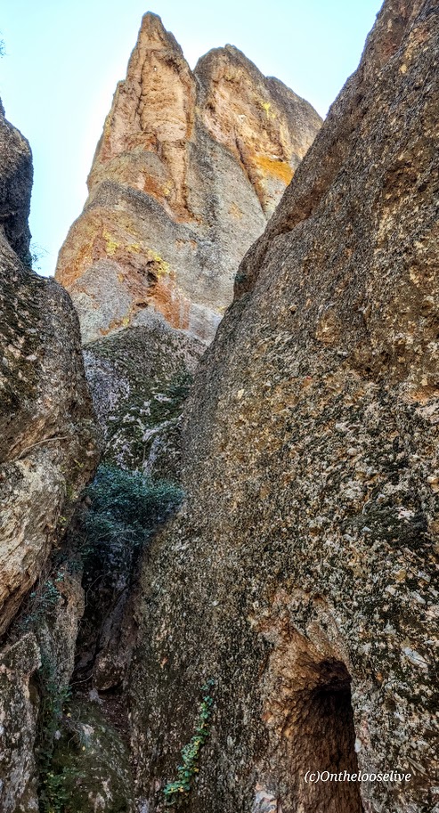
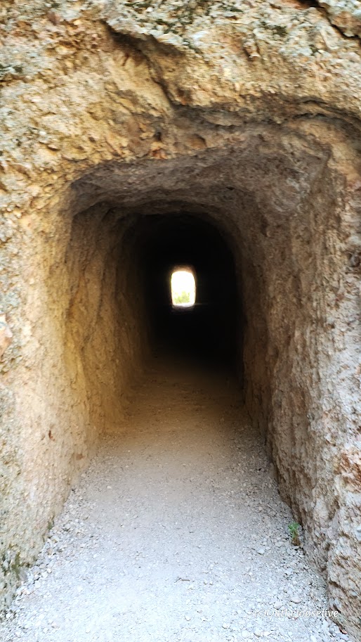
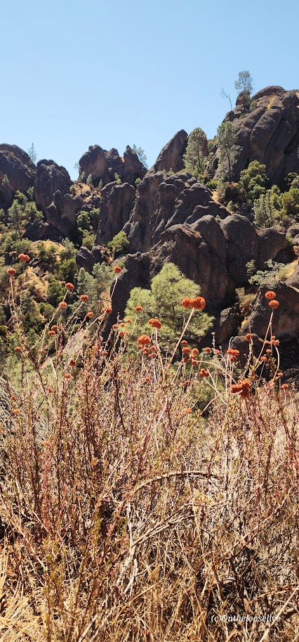
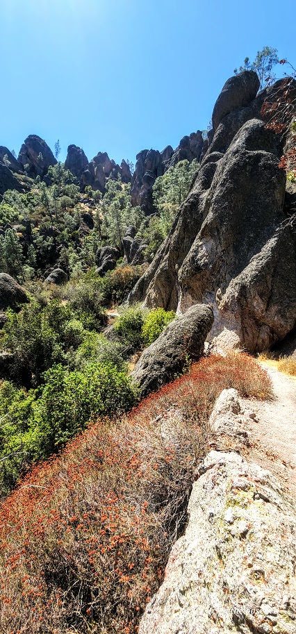
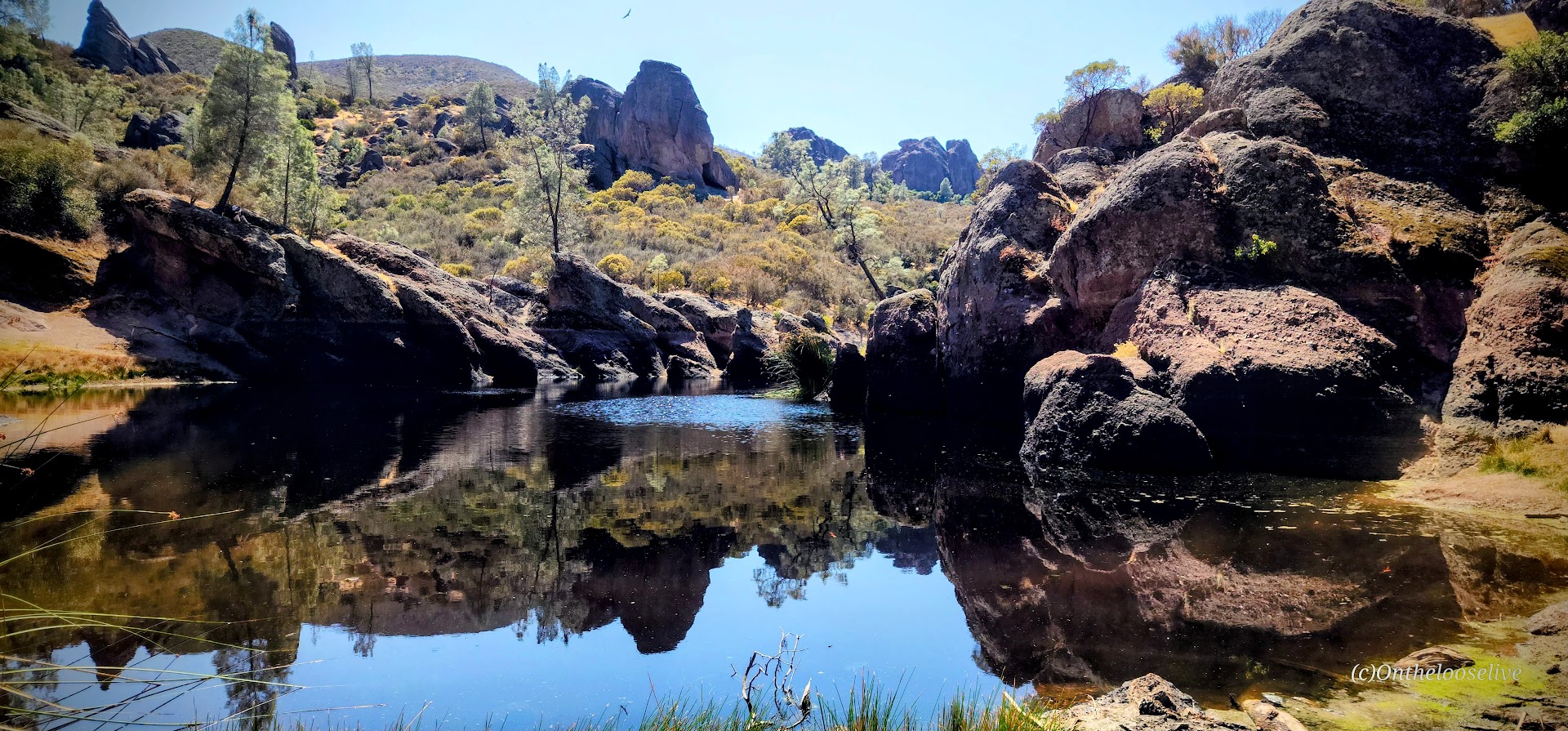
The landscape reminded me of the local parks I used to trail run back when I lived in California: pleasant, but not particularly awe-inspiring. The park offers about 30 miles of runnable trails. Yes, there are some unique features, like interesting rock formations (which is where the name ‘Pinnacles’ comes from—but since I live in southwest Utah, that’s something I see daily), the cool, dark caves—Balconies and Bear Gulch (bring a flashlight, headlamp, or a charged phone), a short tunnel on the trail, and a “steep and narrow” section on the High Peaks trail that might feel adventurous to hiking novices. But for anyone who’s tackled something like Angel’s Landing, it’s pretty tame, and some might say lame. There’s also Bear Gulch reservoir, which is mildly scenic, but small and stagnant (NOT a spot for immersion). These trails (except for the caves and the tunnels) are completely exposed—hot in the summer, so go early or late in the day to avoid the heat.)
I covered the main highlights of the Park with a 7.5 mile loop that included the High Peaks Trail, Tunnel Trail, and both cave areas. The elevation gain was nearly 2k ft, but the climb was gradual and spread out, so I would rate it as easy effort and terrain, but of course, it varies depending on your fitness level. I kept myself engaged by playing photographer.
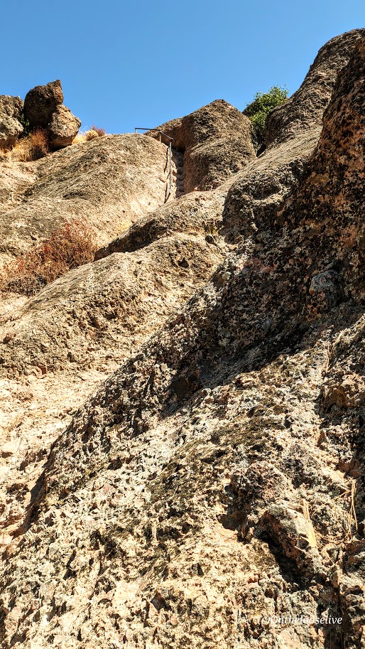
Most of the rocks in the High Peaks area are rhyolite breccia. These angular fragments were ejected by volcanoes and cemented together by ash and mud, giving them a slightly golden hue. (They are rare in the volcanic areas of Utah and Hawaii. In Hawaii, the volcanoes primarily erupt low-silica, low-viscosity basalt, which flows easily rather than fragmenting. And while rhyolite eruptions do occur in Utah, the conditions needed to form substantial rhyolite breccia are less common than other volcanic processes.)
Inside the Caves
Dark Skies, Rock Climbing, Birds, Bats, Bees, and a Small Pool at the Campground
While not designated as an official dark sky site (they should apply for it), the remote Park is committed to dark sky preservation and boasts about its night sky in its pamphlet. (I left before sunset, so I can’t speak to that.) I do know that the Park is out in the middle of nowhere, so it’s certainly free of light pollution. Apparently, there are hundreds of rock climbing routes here. And if you’re a birder, there are over 180 species here, including the endangered California condors, peregrine, and prairie falcons. (I did see a couple of wide-winged condors gliding high above the trail.) If you’re batty(?), the talus caves are home to Townsend’s big-eared bats, and 13 other bat species live in the park and roost in rock crevices and trees. Notably, the park has over 500 bee species, the highest diversity on earth!
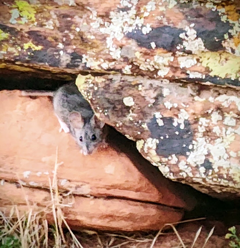
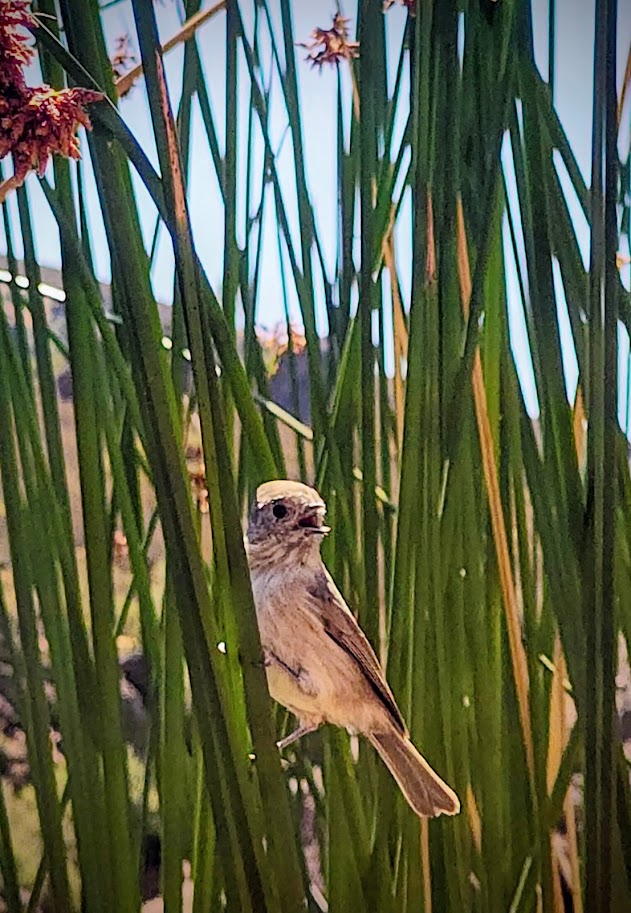
The Locals
Any time spent being active in nature is worthwhile. Still, while pleasant enough, perhaps Pinnacles is best suited for families with kiddos who would enjoy exploring the caves, climbing on the rocks, and cooling off at the small campground pool. It’s a one-and-done for me.
Have you been to Pinnacles? What did you think?Take it or leave it?