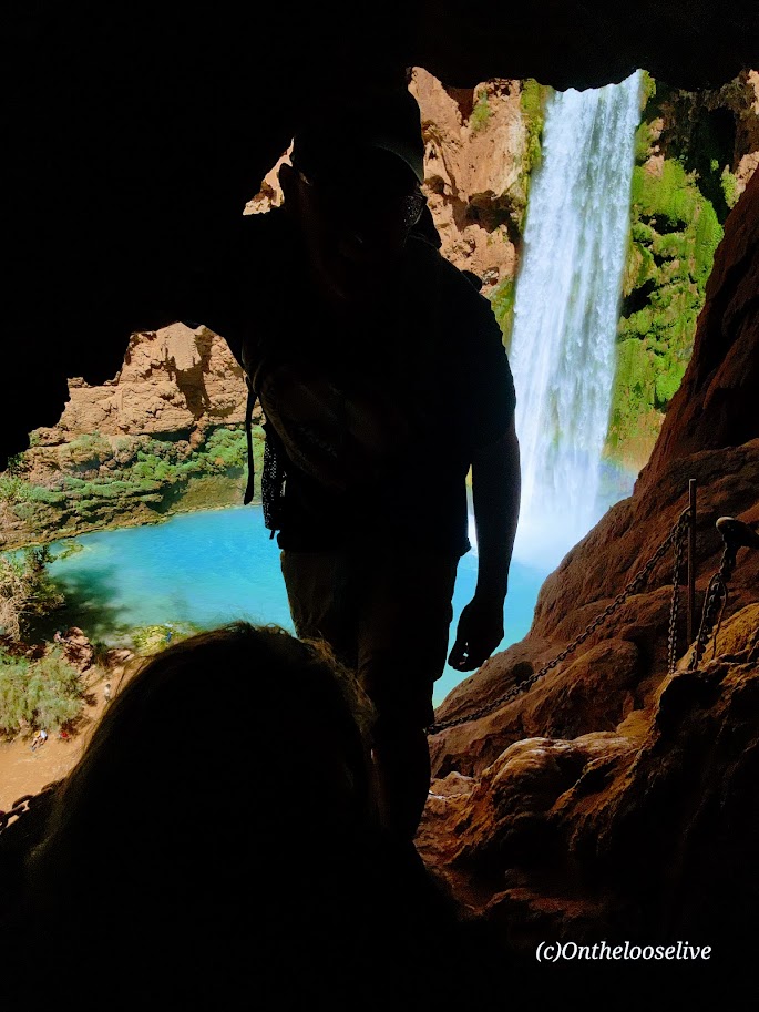
The descent to Mooney Falls requires ducking through a narrow, low sandstone tunnel carved into the cliffside, followed by cautious navigation down eroded and slippery sandstone “footholds” to the ladder far below. While there are chains bolted into the rock for handholds in the most exposed sections, even with them, it feels a bit sketchy. The new wood ladder was slick with mud and mist, and its rungs were spaced wider than a comfortable leg stretch for me. With 6 years of rugged hiking, scrambling, and the occasional canyoneering adventure in Utah under my belt, you’d think I’d have less trepidation navigating this than I did in my younger years. But still, it gave me moments of pause. (On the way back up, I saw a toddler and a young boy scramble ahead of their parents up the cliffside. Yikes!)
The power of the waterfall and the amount of mist the rushing water created were tremendous! The sunlight through the mist caused a magical effect in my photo on the right.
Beaver Falls
~3 Miles from Mooney Falls
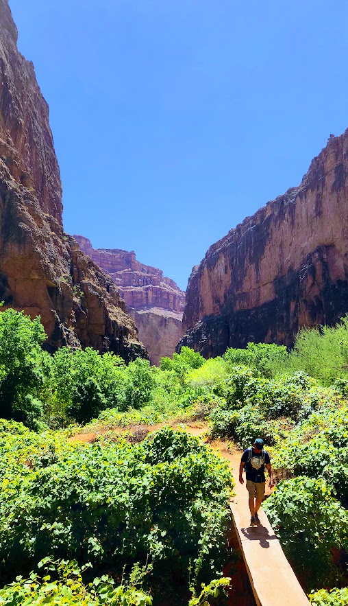
I’d never ventured beyond Mooney Falls before—there was never enough time. So I was especially grateful for the chance to explore further on this trip. The 3-mile hike from Mooney Falls to Beaver Falls is both enchanting and engaging, winding through a lush corridor of vines and trees along the turquoise creek. It feels like stepping into a jungle, with hidden oases revealing themselves around every bend.
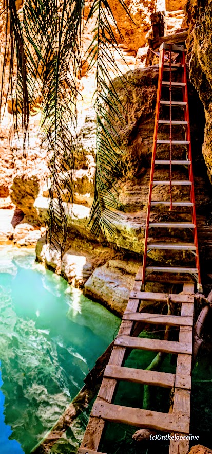
After a few refreshing creek crossings, the trail leads you through a striking sandstone archway to a short make-shift mini-bridge water crossing, followed by a ladder cliff climb. Thankfully, the footing here was drier and more stable than the slippery ladder at Mooney Falls.
Beaver Falls was truly stunning—cascading tiers of turquoise water —but it was also crowded. I hardly took any photos. A brief moment of uninterrupted zen there below.
Thankfully, there were plenty of quieter “private” oases along the way, perfect for a peaceful dip or simply taking a moment to soak it all in. Beaver Falls is absolutely worth it, and the hike to it is fun—just be sure to get an early start if you’d like to experience it in solitude.
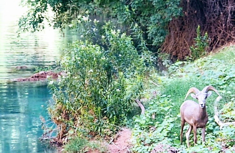
On the hike back, it was nearing critter hour. Much to my surprise, a bighorn sheep was just off the trail, seemingly scouting out a peaceful spot by the water to settle in for a nap. I had no idea that there were big horn down here!
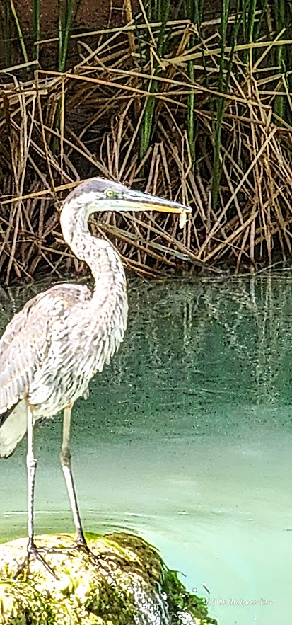
Closer to the campgrounds, I spotted a blue heron, focused, mid-hunt—clearly having some luck with its evening catch. Pics are a bit blurry due to distance.
Leaving Eden
We started our return hike from the village just after dawn, hoping to beat the heat. Fortunately, most of the trail remained shaded until the final climb out of the canyon, which is fully exposed. Fortunately, there are a few rocky overhangs along the way—perfect spots to catch your breath and escape the unforgiving sun for a moment.
This adventure was nothing short of epic. I felt a pang of sadness as it came to an end, but also immense gratitude for the chance to return (thanks to my friend Bernie for securing the permits) and the opportunity to explore more than I ever had before. Among all my adventures near and far, the exquisite beauty and spiritual essence of Havasupai will forever hold a special place in my heart. I’ve never experienced anything quite like it. It remains one of my all-time favorites.
I’ve had the privilege of visiting this sacred Eden three times before. The first time was in 1993. I’ve hiked in, camped twice, and stayed at the Lodge—now twice. On one of those trips, a friend surprised me with a scenic, 10-minute helicopter ride back up to the rim. (He wasn’t keen on hiking out with a pack—or waiting while I did—so I scored my first helicopter ride, a quick thrill in exchange for sacrificing a good workout.)
Those earlier trips were quick overnights, back in the day—before permit complications and prohibitive costs. And two of them were after recent flash floods, so the water was churning chocolate.
While still awe-inspiring in any state, the falls are much more magnificent in their rushing turquoise glory.
In all my worldwide adventure travels, Havasupai and its falls remain unmatched. I’m so grateful that I had the opportunity to experience this special place again.
Background
Havasupai Village at the bottom of the south rim of the Grand Canyon is considered one of the most remote Indian Reservations in the country. The Havasupai Native American tribe has lived in the Grand Canyon for ~ 800 years. The name Havasupai translates to “people of the blue-green water” and refers to the stunning turquoise waters of Havasu Creek and its spectacular waterfalls (Navajo Falls, Havasu Falls, Fifty-foot Falls, Mooney Falls, Beaver Falls). The water’s surreal turquoise hue comes from a high concentration of calcium carbonate (lime) in the water. Over time, the lime deposits build up around sticks, leaves, and other debris, forming natural terraces that add to the spectacular landscape.
Why Pay the Price?
Words can’t begin to capture the magic and spiritual energy of this place. Yes, the most popular waterfalls—Havasu Falls, Mooney Falls, and Beaver Falls—draw the crowds. But the good news is, tucked along the trail are hidden oases that you can have all to yourself. Hopefully, the pictures speak for themselves.
Day 1: Grand Canyon Rim to Havasupai Village and Havasu Falls
Distance to Village: 8 miles Elevation Loss: 2,500 Ft
Circa 1998 vs 2025. It’s hard to out 6-pack my younger self, but I’m still trying and still finding as much or possibly more joy in my active adventures.
The hike down from the rim, through the dry Hualapai Wash and into the village via the Havasupai Trail, may feel unremarkable to those familiar with other Grand Canyon hikes.
Aside from a few interesting rock formations, the trail is mostly a sandy, gravelly, waterless, hot, dusty, potentially blister-inducing slog.
(1993 and 2025 – same spot, but there must have been an enormous rock slide, as you can see the huge slabs to the right of me in the recent pic !)
But of course, every step is 100% worth it! (Just be prepared with ample water, sunscreen, hat, moleskin, etc.)
Distance to Havasu Falls from the Village: ~4 miles RT
The pic below is from my first visit in 1993.
After grabbing a bite at the restaurant, we dropped our bags at the lodge and made a beeline for Havasu Falls—one of Havasupai’s crown jewels.
The lovely views begin about a mile from the village.
Havasu Falls was even more breathtaking than I remembered. The only thing better than marveling at its splendor is immersing yourself in it.
What’s Changed
As mentioned, the costs of visiting this sacred place have skyrocketed. It has been dubbed the most expensive hike/camping trip in America.
As of July 2025, it’s $455 per person for a 3-night stay at the campground and $2,277 total for a 3-night stay at the lodge in a double room. Note it’s a mandatory 3-night payment requirement in both cases—no refunds for shorter stays. For the luxury of having a mule carry your pack, it’s $400 RT for up to 4 bags; each bag must weigh less than 32 pounds. All I can say is if the system keeps the crowds down and supports the locals, I’m for it.
The cost of a helicopter ride to/from the village is $150 per person each way, with the additional cost of $50 per pack/bag.
The Good
I noticed more families and younger locals living in the village than my past visits, a shift that reflects community renewal. There’s now a Head Start program for young children and a new, modern medical clinic. The Lodge has been renovated as well; the air-conditioned double rooms are clean and updated, featuring comfortable beds, a fridge, and a microwave.
The village restaurant has also been upgraded. Its expanded menu now includes healthier options like salads and grilled chicken sandwiches, alongside traditional frybread and the usual burger-and-fries fare. Barstools at a large window offer a front-row view of the village center—including the regular whirlwind of helicopter landings and takeoffs with their sudden sandstorms and dust clouds.
There also seemed to be far fewer dogs roaming the village than in past visits—and the ones I did see appeared relatively healthy. I want to be clear: I understand that when people are struggling with basic necessities, pet care can’t be a priority. Still, in previous years, the heartbreaking sight of malnourished nursing dogs and sickly puppies left a lasting impression that deterred me from visiting again – until now. ( A friend secured the permit, and when he offered me the opportunity, I couldn’t refuse.)
Those images stayed with me—not in photos, but in memory. Possibly in response to past negative press surrounding animal treatment here, a strict no-photography policy now applies to pack animals and dogs, as well as the village itself and its residents. This is entirely understandable to protect the villagers’ privacy, dignity, and culture.
The Bad—Paradise Lost?
I’m not sure how long ATVs have been in use in the village, but they seem to be increasingly popular with locals. While I understand their practicality—and, no doubt, their fun—they do detract from the experience, especially in such a remote and natural place. The noise, dust, and trail erosion are hard to ignore. A local woman I spoke with shared her unsolicited disapproval of them.
The Ugly—Soapbox Warning
What disturbed me most on this trip, though, was the amount of trash—mainly empty plastic water and Gatorade bottles—littered everywhere along the Havasupai Trail—literally a Trail of Trash. I don’t recall seeing anything like this on previous visits. Next to animal welfare, littering is my “pet peeve”.
I honestly don’t understand it. People are paying a premium to visit this incredible place—yet they are disrespecting it and the locals by littering? Yes, hiking in the heat with a heavy pack is tough, but these bottles are empty. Carrying them out takes almost no effort. What the heck, people? Who does this? It’s truly appalling.
Thankfully, there’s noticeably less litter in the campgrounds and around the waterfalls—likely thanks to regular cleanup crews and maybe because the Instagrammers don’t want to tarnish their photos there. But the trail itself deserves the same care and respect. This place is a treasure, and it deserves better from all of us.
Despite the cons, there are still moments of paradise here for me. What about you?
What’s the Solution?
Havasupai should implement steep penalties for littering—$1,000 fine—and use the revenue to fund a dedicated litter patrol program employing local workers. Another idea: offer small incentives to visitors who pack out the trash they collect along the trail—perhaps a discount at the restaurant, Lodge, or campground. (Though yes, I know… someone will always try to game the system by raiding the trash can near the village.)
I’m just brainstorming here, trying to imagine practical solutions to this heartbreaking issue. I will never understand how people can journey to such an awe-inspiring place only to defile it with trash. It makes no sense.
If Arizona adopted a “bottle bill” like some other states—placing a refundable deposit on bottles and cans—I have no doubt it would reduce the problem dramatically. Short of that, maybe they could offer an off-season camping weekend in exchange for a few hours of supervised trail cleanup. A give-back program for those willing to help restore what others have damaged.
Although the “Leave No Trace” policy is clearly stated in the reservations paperwork, including a $1,000 fine for leaving trash or gear behind, I didn’t see any signage reinforcing this policy on the trail or at the campgrounds. What I did see, unfortunately, was tons of litter. Posting visible reminders about the rules and the consequences might help discourage the defilers.
Perhaps the tribe could also consider installing designated trash receptacles at key points, with a budget allocated from the high permit fees to manage its removal. I understand the original goal of a strict pack-in/pack-out system, but it’s clearly not working. I’d be very curious to know how many fines have been issued—and whether those funds have gone back into trail maintenance or cleanup efforts.
What do you think would make a difference?
So that’s the good, bad, and ugly of it. Is it worth it still? Emphatically 100%!
Plan Ahead: Permits are hard to get. Camping permits are available from February 1 through November 30, and reservations for the Lodge are available from April 1 through November 30. The area is closed in December and January.
Permits go on sale February 1 at 8 AM Arizona Time/Mountain Time. Up to 12 people can be on a camping permit for $455 each. If you don’t land a permit on February 1st, you can check in their transfer page, where newly available permits are listed daily at 8AM.
In 2025, there was a 2-week presale from December 16 to January 3. You pay a non-refundable $20 per person fee for the chance of securing one of your 3 reservation start times. If you win your permit, you’ll then pay the full price of either camper or lodging reservations. (Permits are only transferable through the official website.)
Note, Havasupai can close unexpectedly due to flash floods. Monsoons are frequent in the summer months. Pay attention to the weather forecasts.
Since there is no refund policy to cover this or any other eventuality, you may want to consider securing travel insurance before your trip.
Before you begin your hike, the designated trip leader must check in at Grand Canyon Caverns Inn to pick up the required documents and bag tags the night before or by 12 noon the day you wish to hike in; otherwise, your reservation will be canceled.
Stay tuned for the videos and the Mooney and Beaver Falls post.
Difficulty: Easy +, depending on your fitness level and altitude acclimation
Elevation: 9,174 – 9,519 FT
Named after the Bloods family, a pioneering family who homesteaded the area (not for what’s circulating in your veins or the lake color), the Bloods Lake trail is a short, pleasant stroll through the woods with a gradual incline on the smooth terrain of a well-groomed trail (trail runnable).
I wanted to make this shortie longer, but there was far too much snow beyond this lake. If you arrive after snow melt or have snowshoes, you can continue on to Lake Lackawaxen, named after its namesake river in Pennsylvania (2.6 miles, 1 way), Clayton Peak (2.7 miles, 1k FT elevation gain, 1 way), and Peak 10420 (2.5 miles, 1 way). Even if you hit them all, you won’t be able to get much mileage here.
This area is part of the Bonanza Flat Conservation Area, which was saved from development in 2017 thanks to a collaborative effort of various organizations and individuals. While that is indeed something to celebrate, they are recouping their costs aggressively, presumably to “manage increasing use, reduce congestion, and protect the area”. This is the most expensive trailhead parking scheme I have EVER encountered. They charge by the hour! It’s $5 per hour on weekdays and $8 per hour on weekends. Apparently, those who are privileged enough to live in the 84060 Park City zip code can apply for a free parking permit.
I paid $16 in advance, hoping I would make it to Clayton Peak and back. Deep snow stopped me at Bloods Lake, so I finished my hike within an hour with no recourse for a refund. Was it worth $8, yes – $16, no. As you can tell, I find this fee system utterly obnoxious. Though the silver lining is that it does motivate you to keep a fast pace, which I like- lol.
Getting there: The trailhead is one of several hiking trails along the super scenic Guardsman Pass.
Notes: Parking fills early on the weekends! Exorbitant hourly parking fees ($5 per hour on weekdays and $8 per hour on weekends)!
Distance: ~33 Miles Elevation Gain: 1,047 Ft Terrain: A mix of road & off-road
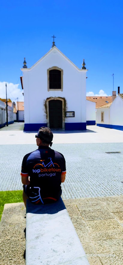
After a delicious buffet breakfast at the Octant Hotel, we saddled up, donned our new “Top Bike Tours Portugal” jerseys, and began our first day’s biking adventure.
We followed our wonderful guide, Pedro, [Top Bike Tours Portugal], into the lovely countryside via a maze of paved roads and gravel, dirt, and sandy paths. Encountering engaging vistas and a surprise around every corner.
At our morning rest stop, we were treated to our first glimpses of street art. The sea breeze foreshadowed that we would soon be at the captivating coast!
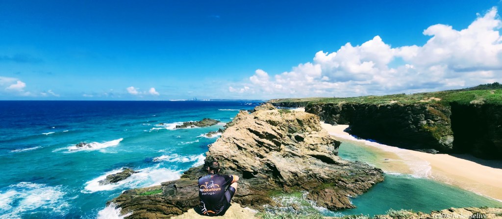
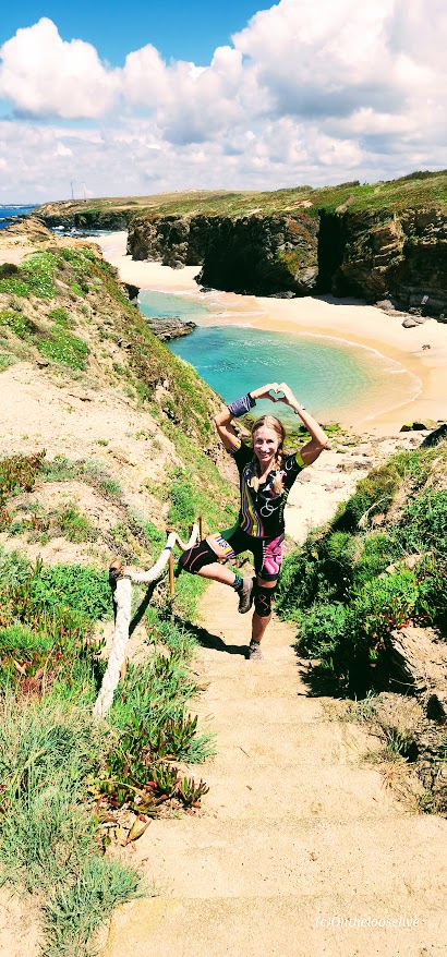
Soon we would be pedaling alongside the sea and taking scenic breaks to immerse ourselves in the rugged, ravishing natural beauty around each corner. Other than sharing it with a few hikers, we had much of the breathtaking scenery all to ourselves.
I kept thinking, “Wow, this must be the best part”, and it would just keep getting better and better. As would each moment, hour, and day of this epic bike adventure!
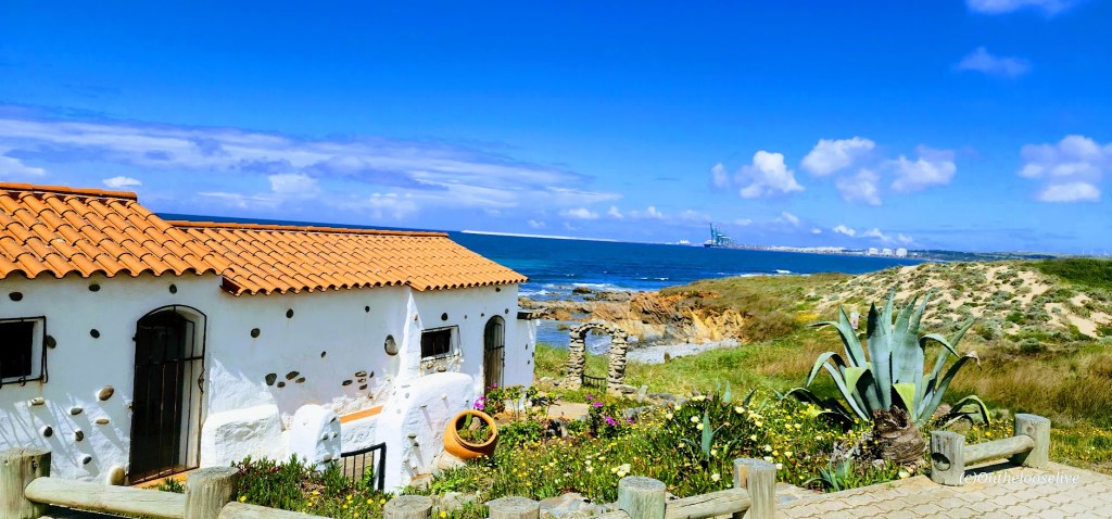
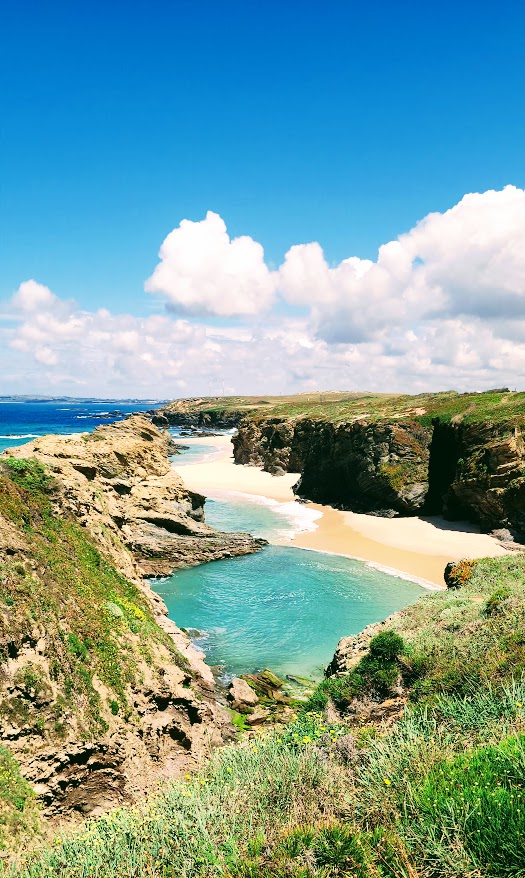
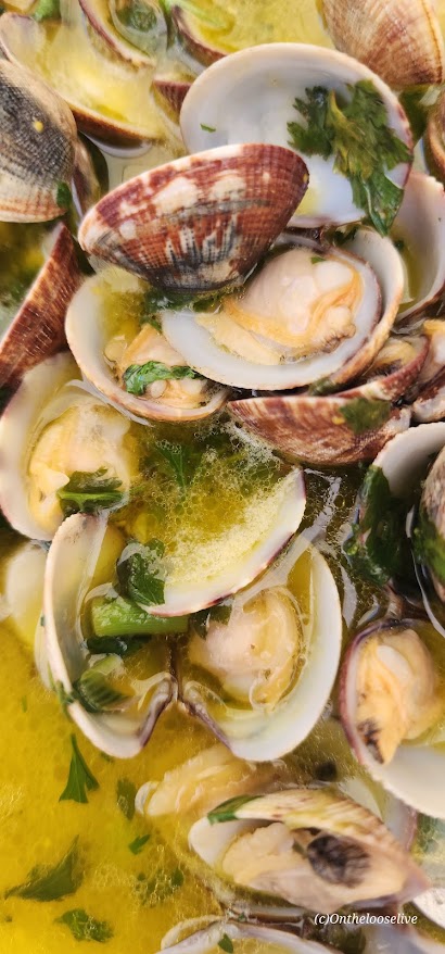
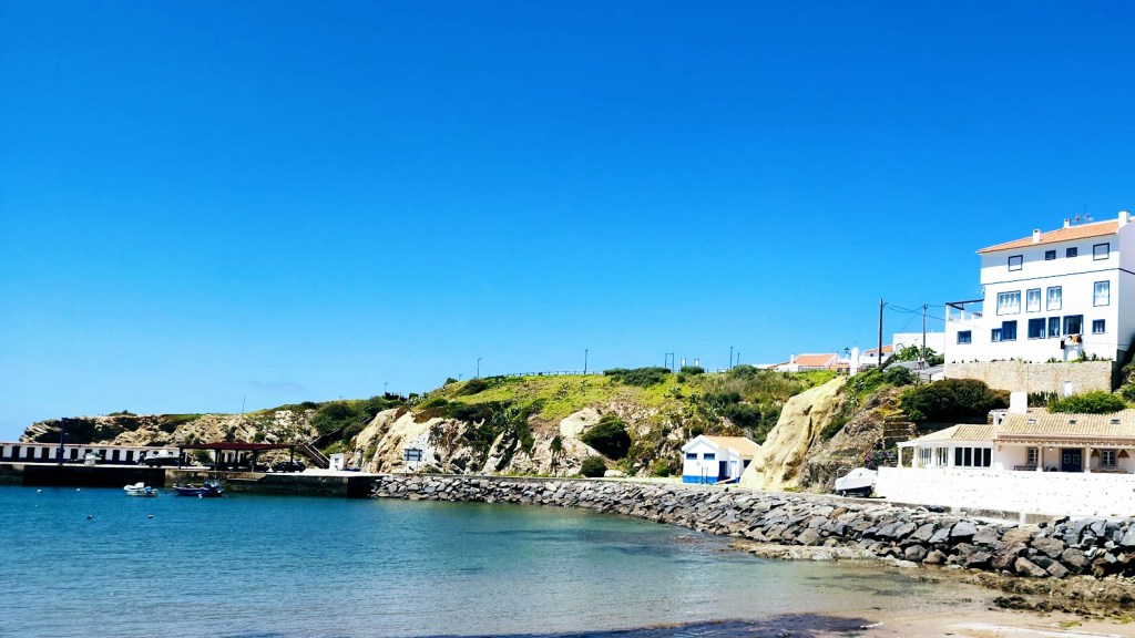
We enjoyed a leisurely lunch stop in the charming, fishing village of Porto Covo (population 1,400), where white-washed houses and restaurants with brilliant blue trim perch atop a hill overlooking the raging Atlantic Ocean and the rugged Alentejo western coast. I enjoyed the freshest tuna salad drizzled with the delicious local olive oil, and my friend had clams in garlic butter. (Fortunately, he was generous enough to share a couple of those sumptuous morsels.)
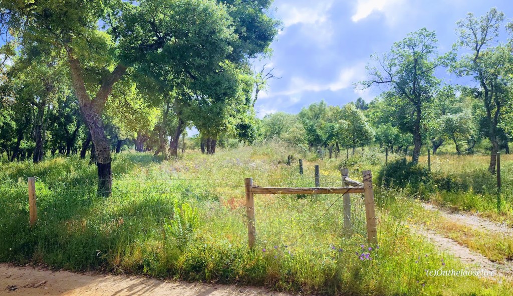
We would see many more hikers in the days that followed as our biking route encompassed segments of the Fisherman’s Trail, which is part of the Rota Vicentina, a network of hiking and biking routes throughout southwest Portugal, spanning the beautiful Alentejo and Algarve regions. The Fisherman’s Trail is a 78-mile-long coastal trail that’s described as one of the most stunning coastal trails in the world. (Indeed, I’m convinced!) Known for its spectacular seaside scenery, including dramatic cliffs, sandy beaches, and charming fishing villages, the route follows the wild Atlantic coastline from Porto Covo to Cabo de São Vicente.
After our tasty lunch, it was onward towards Vila Nova de Mil Fontes (population ~6k). However, first came a steep, rocky descent and a short dirt climb, which the e-bike group navigated with a little trepidation. Most had not ridden off-road before, and many were caught off guard by the “technical” challenges we encountered.
The view from our room at the Vila Nova de Mil Fontes Beach Hotel did not disappoint. The village was founded in 1486 by a royal charter granted by King João II and is located where the Mira River meets the sea.
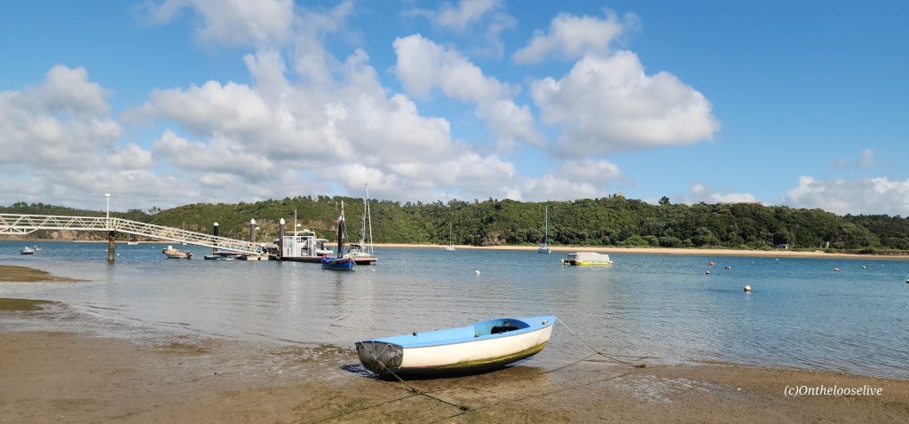
After a refreshing post-ride libation (a Caipirinha for me), we took a relaxing stroll on the beach. (I developed my taste for this quenching cocktail on my cycling trip in Cuba and was delighted to find that they’re popular in Portugal too.)
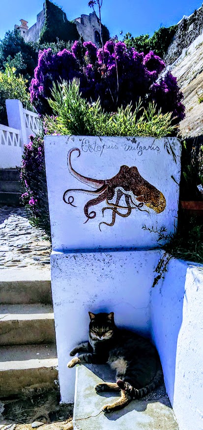
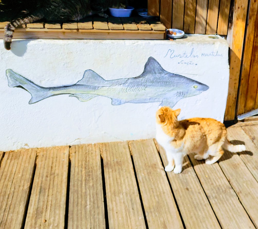
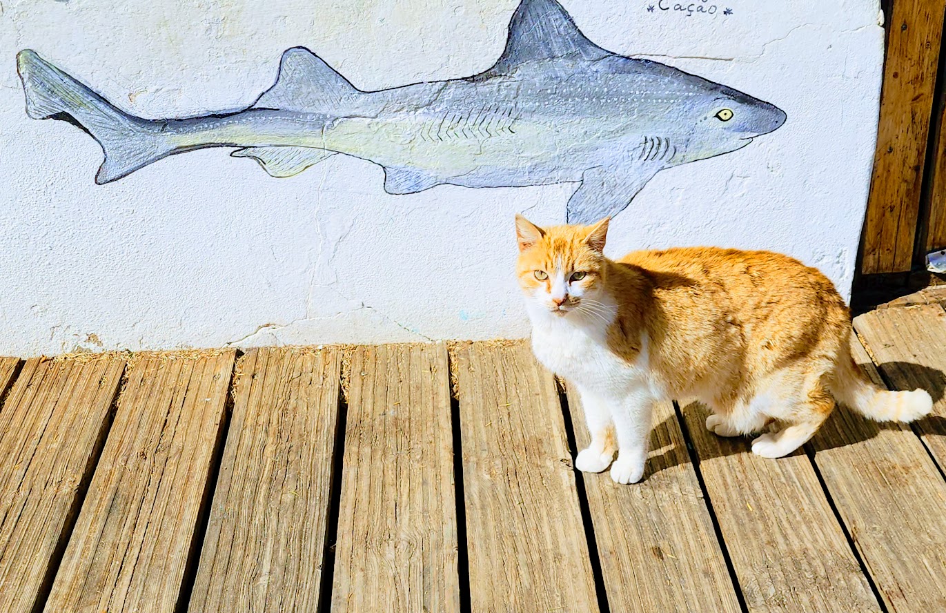
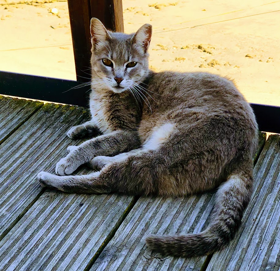
Meet the friendly, well-fed feral felines of Vila Nova de Mil Fontes. (Say that 5 times – lol!)
Fun to share this awesome adventure with my yogi and hiking friend, Bradley! Here’s before and after cleaning up for dinner, and officially in full vacation mode! (Things came together as they often do for me, “Last minute Lydia”, about 2 weeks prior to “take-off”, and Bradley spontaneously jumped in to join in the fun. (Luckily, we were able to get in some saddle time prior as the rides were more challenging than advertised…Let’s just say that 16% grade hills were not an anomaly.)
That evening, we enjoyed our group dinner at a charming restaurant where we both “accidentally ordered” a fish casserole. Each individual serving was enough to feed a family!
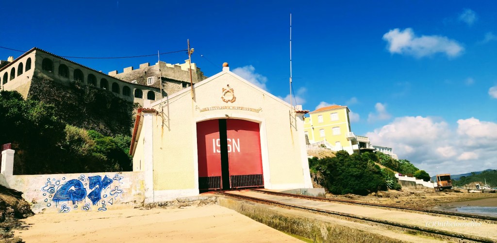
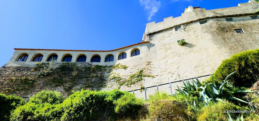
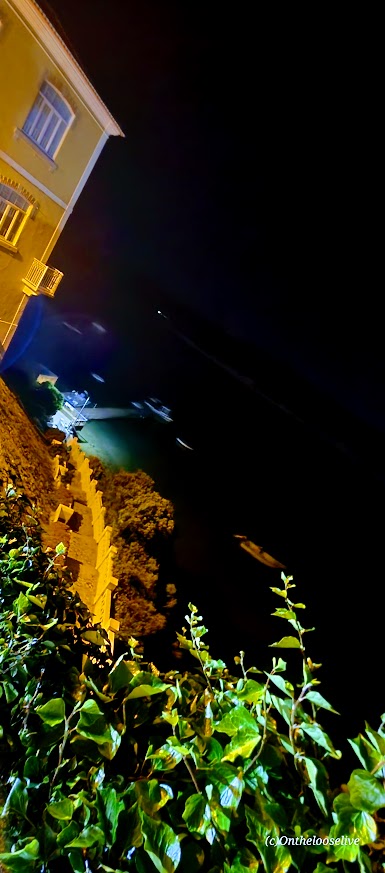
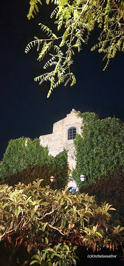
On our after-dinner walkabout along the cobblestone streets of the old town village, we discovered the cliffside fortress/castle (built in 1599 by Filipe II of Portugal to fend off the constant pirate attacks on the village). We’d seen it earlier from the beach below, but it was so much more enchanting at night.
What an amazing day! I was so excited to see what tomorrow would bring.
Happy Active Adventures from Vila Nova de Mil Fontes!
If you missed my previous arrival day post and it’s not obvious at this point, yes, I wholeheartedly recommend Top Bike Tours Portugal. If you’re thinking about booking a tour with them, don’t hesitate! And please tell them I sent you. If you have any questions, please don’t hesitate to message me.
Difficulty: Easy to moderate, depending upon your fitness level
This is definitely one of the more engaging official trails in Zion and now one of my favorites. From the trailhead, it begins as a tame, wide-open, flat route.
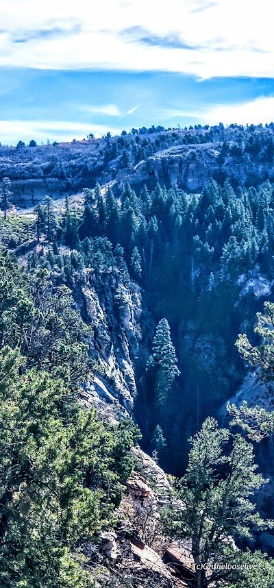
After a mile or so in, stop and look back for a glimpse into a dark canyon below.
As you continue along the trail, you’ll be treated to distant views of Zion, but don’t forget to watch your step as you descend the rocky trail into the lightly forested valley.
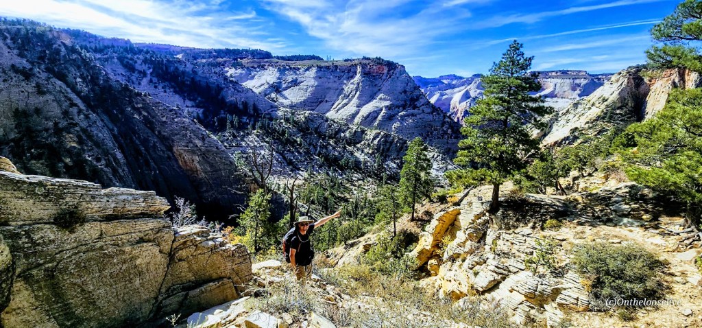
After reaching the other side of the valley, the climb will begin in earnest along the remnants of a concrete trail, zigzagging up to higher ground. It’s a friendly grade and easy terrain for fast hiking or trail running. It’s reminiscent of Walter’s Wiggles on Angel’s Landing, but the big difference is that you’ll likely have it and most of the hike from Stave Springs all to yourself!
This was my favorite part of the hike—a great workout with great scenery! (The picture above was taken on the return trip down.)
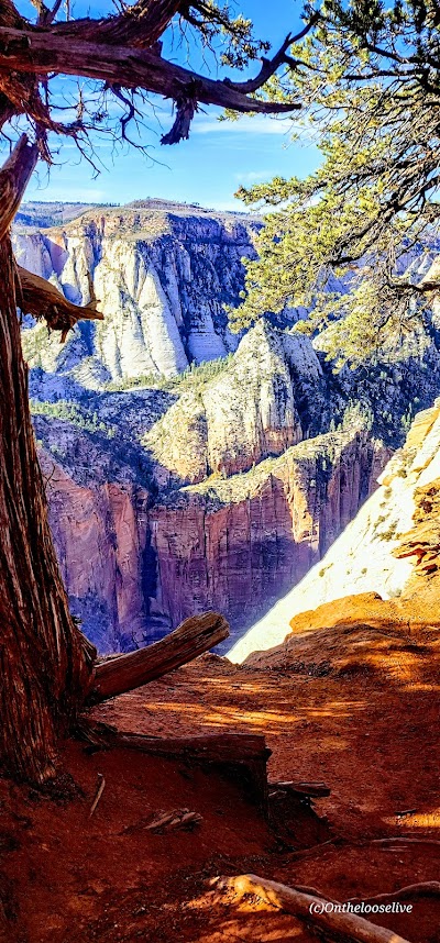
Once you reach the zenith, the views into Zion Valley are spellbinding, but you’ll want to keep your eye on your footing as you traverse along the slim cliff rim. (If you’re subject to vertigo and have a strong fear of heights, this might not be the hike for you.)
As you approach Observation Point, you can see Angel’s Landing below and across from you, a very cool perspective! This hike doesn’t have the rugged, chained, cliff-hanging social media over-posted appeal and crowds, and that’s exactly why it appeals to me.
Looks like angels are landing on Angel’s Landing. The picture above is taken from the trail along the rim. How dangerous is it? Might depend upon whom you’re with… In 1997, James Bottarin was accused of pushing his wife, Patricia Bottarini, off the cliff to her death here. Choose your hiking (and life partners) carefully!
Yes, Observation Point Views are grand, but in my opinion, they are no better than what you see en route, so you can always skip the last 1/2 mile or so if you want to skip the crowds.
There are two downsides: one is the long drive to reach the remote Stave Springs Trailhead, which is actually an upside, as it keeps the humans away. The second is the crowds you’ll encounter at Observation Point, who have taken the easier, shorter, less engaging route from East Mesa. It can be a shock to the system, especially after enjoying the splendid solitude of the Stave Springs route. Select the hike that suits you, but please note that both trailheads have limited parking, so arrive early to secure a spot.
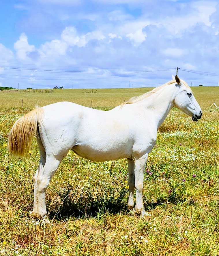
If you’re lucky, you might encounter some of the locals.
Driving back through Zion and capturing golden light is always a delight.
Getting there: Use the Zion Ponderosa Ranch Resort address for your GPS: Twin Knolls Rd, Orderville, UT 84758. Once there, signs will direct you to the trailhead. It’s a gravel road with a couple of rough spots by the small parking area. High clearance recommended.