On the Trail of the Elusive Borrego (Bighorn Sheep): Borrego Palm Canyon Hike, Anza Borrego State Park, CA

Anza Borrego State Park is named after the 18th century Spanish explorer Juan Bautista deAnza and borrego, the Spanish word for bighorn sheep.

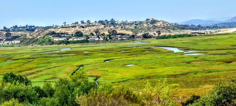
The park covers 600,000 acres and is the largest state park in California and, the second largest in the contiguous United States. It contains 500 miles of dirt roads, 12 designated wilderness areas, and 110 miles of hiking trails.

The endangered peninsular bighorn sheep, often called desert bighorn sheep, make their home here. It’s said that visitors and residents seldom get to see them as they avoid human contact.

We arrived at the park about 45 minutes before sunset (golden critter hour) and decided to go for a quick run up the scenic and pleasant Borrego Palm Canyon Trail (3.25 miles) before dark.


This slideshow requires JavaScript.

We looked up the steep rock studded canyon walls at precarious boulders, wondering if they ever dislodged…We walked part of the way back hoping to see some wildlife.  I told Ken to keep his eyes open. I have terrible eyesight and the stone and sunset shadows are perfect camouflage for anything that wants to evade notice. Then I heard something that sounded like a boulder crashing down…and Ken saw something in the distance…The head bangers in action! A group of 5, the one sitting on the rock officiating looked frail, perhaps an elder. I felt like I was in a National Geographic show. It was amazing!

The next morning we had breakfast at the local coffee shop. While we were there, we struck up  a conversation with a ranger and local at the next table. We shared our adventure and the video on my phone. There was an elderly couple standing nearby, watching me with annoyed faces and their arms  crossed. (Was I talking too loudly or did I steal their table?) Nope, the woman finally broke her silent glaring and told us in an exasperated voice that they had been hiking the canyon nearly ever day for years and had never had a big horn sheep sighting – not even 1. That’s how lucky we were.

Turns out one of the fellows that we were chatting with was the co-creator of the Desert Bighorn Sheep Book that I was browsing through. How cool is that?

20151214_082754_001 (1)
And yes, this gorgeous book is available at AMAZON  and the Anza Borrego Visitor Center.

And if all that wasn’t magical enough, on our drive out of the park, this healthy coyote couple appeared to see us off.

Coyotes Close up A B

What are your most memorable wildlife sightings?

Free Flowing in Fallbrook: Santa Margarita River Trail

The Santa Margarita River, aka Temecula Creek / Temecula River, is one of the last free-flowing rivers in Southern California.

The park is said to contain 1400 acres with 14 miles of trails that loop and crisscross the river. Not sure about that, but I do know that the main trail is about 5.5 total out and back. There are a number of offshoot trails, but it’s hard to imagine that they add up to 3x as much distance…

The main trail is a pleasant meander along the river under a canopy of trees.

There are a couple of swimming holes within the first mile or so if you care to take a dip. Before too long you’ll encounter your first of a half dozen creek crossings. Since the terrain is mostly smooth path or sandy, you might consider Tevas, instead of running shoes or hikers as you’ll be taking them on & off frequently. (That being said, if you don’t mind getting your running shoes wet, it’s not a bad spot for a little trail trot.) There are also a couple of lovely little oases along the way.

Apparently, this river corridor is known for raptor sightings and home to deer and other large mammals. We saw one shy turtle basking on rocks and a little fishey who seemed to be guarding her eggs – see video below.

Certainly a great spot to spend an afternoon, have a picnic or take a dip. (I wouldn’t drive too far for it, but if you’re in the area by all means.)

Note: It gets super hot in Fallbrook in the summer, be prepared and bring water.

BEWARE: Abundant poison oak &  quick sand???

20170520_140314

Distance: ~5.5 out & back

Difficulty: Easy – family friendly

Location: Fallbrook near De Luz Road & Sandia Creek Dr intersection, right on Sandia Creek Dr. then the parking area and trailhead are 1.2 miles ahead on the right.

Happy trails!

A little slice of something nice: Annie’s Canyon, San Elijo Lagoon Ecological Reserve

If you live in the San Diego area or have visited, you’ve no doubt driven by picturesque San Elijo Lagoon Ecological Reserve countless times via the coast road or the freeway. Perhaps you’ve ventured on trails as well. I have, dozens of times for a run or stroll and I thought I knew all the trails there. (Pretty, but mostly flat and easy fare.) I hadn’t heard about Annie’s Canyon until someone asked me about it. Of course I had to investigate…

But first a couple words about these coastal wetlands. The reserve spans 1000 acres with a total of 7 miles of trails that connect the varied habitats from salt marsh to freshwater marsh areas to coastal sage and chaparral. Wedged between the freeway and the coast highway and surrounded on all sides by Solana Beach, Cardiff and Rancho Santa Fe, the lagoon remains home to more than 1,000 species of plants and animals – many endangered. Despite all the encroachment, it’s still a nice spot to savor nature and take in lagoon and ocean views.

Now for the unexpected delight of Annie’s Canyon. After a short, easy, less than mile hike to the canyon (look for signs), you’ll find yourself transported to a miniature canyon-land experience. Sure doesn’t feel like Southern California anymore, more like the slot canyons of Utah or Arizona. While it’s narrow, footing is fairly easy and there’s a steel ladder at the very top. Nothing treacherous here – just fun. It’s a super quickie (5 minutes), but super cool. What a great place to take young kids for a mini adventure with a little supervision and assistance. I know this kid at heart had some fun.

This slideshow requires JavaScript.

The view from the top. And no, it’s not a nudist colony, my hottie BF is wearing pants. ; )


Notes

Dog friendly in the lagoon – not so much for the canyon unless, they are trick pups trained to go up narrow steel ladders

No bikes

There’s a bunch of construction underway as part of the highway and rail improvements program in the North Coast Corridor. Click here for trail closure updates before you go.

Apparently this spot was previously vandalized and closed and has only recently reopened, which explains why I didn’t know about it. Please enjoy, respect and protect the nature around you.

Location

There are a number of entrances to the lagoon. Here’s ine

Solana Hills trail head address is 450 Solana Hills Drive, Solana Beach. From I-5, take the Lomas Santa Fe Drive exit (exit 37) West. At 0.2 mile  turn right onto Solana Hills Drive for 0.3 mile. Park along the dead end street. There’s also a great nature center on the Cardiff-by-the-Sea side, which is quite nice and you can rent it for private events.

McGinty Mountain Trail: a sweet little gem in Jamul, CA

Location & directions

Trailhead: 13852-, 13998 Jamul Drive, Jamul, CA 91935

~25 miles from downtown San Diego.Take 94 East, exit at Campo Road. Follow Campo Road for ~ 4.5 miles, turn left onto Lyons Valley Road  and then left on Jamul Drive and you’ll see the dirt turnout / parking lot at 0.4 mile.Trail starts at the kiosk.

Main trail

~5 mile out & back

1,400 feet gain & loss

Moderate to strenuous depending on your fitness level

Dog and mountain bike friendly


My take

Drove down from North County for this one and so happy I did. Had low expectations as I’d never heard of this trail, but was pleasantly surprised. What a sweet little gem. This area is part of the San Diego National Wildlife Refuge. Not as well known as many of the popular SD area hikes nearby Mount Woodson, Iron Mountain, and Cowles Mountain, but definitely a contender for it’s beauty and views.

It’s a great hike with mostly friendly terrain, except for the steepest area not far from the top, which was a bit of a rock field. (If you have tender feet, you might be happier in hiking shoes versus running shoes.) Don’t worry, the steepest area is fairly short so you won’t suffer long.) Mountain bikes are allowed, but I didn’t see any and there were only a few hikers sharing the trail. It’s a good spot for a trail run too. It’s a relatively quick hike and a lovely way to spend a morning or afternoon.

Highlights

Late season wildflowers and wonderful views of San Miguel Mountain and Tecate peak to the East, Mount Helix , Cowles Mountain, El Cajon Mountain, and even Cuyamaca in the distance – apparently on some days you can see all the way to Coronado, Point Loma and the expanse of Pacific. And hiking uphill is always more rewarding —better views and better workout!


This slideshow requires JavaScript.


Rock scramble at the top – optional.


Caution

There are no trail signs so stay on the most obvious (widest & well traveled)  route. (You can take a couple viewpoint detours, but return to the main trail.) Be on guard for rattle snakes and ticks and bring water. The trail is exposed the entire way so you’ll want to avoid hiking in the heat of the day.

For more info, visit:

US Fish & Wildlife Service: McGinty Mountain trailhead

View route or download GPX from CalTopo


Railay Rocks!

Spectacular scenery, iconic limestone crags of monolithic proportions rising out of the Andaman Sea – that’s Railay.


This slideshow requires JavaScript.

When I arrived by longtail boat, I checked into my hotel and took a walkabout to stretch my legs after the taxi (half hour), ferry (2hr), bus (2 hr) minivan (half hour with1 hr delay) and longtail boat ride (20 minute) – phew!

Actually, it wasn’t bad at all. It’s extremely easy to get around in Thailand. My full day of travel was coordinated by 1 agency for $33. Travel agencies are almost as ubiquitous as 7-Eleven’s here. Tip: It can be worthwhile to check with different agencies if you are looking for a specific itinerary and time. Some offer more choices than others.

I’ve been touring up and down Thailand for 3 weeks and the only wild things I’ve seen so far are some unruly Americans and Australians, feral cats, bats and myna birds. Accessible only by water, this tiny peninsula is literally crawling with wild things. And I’m not just talking about the rock climbers who flock here from around the world. Here there are macaques running amok, water monitors skulking about, squirrels flying overhead, and apparently some dusky langors in hiding too. You just follow the boardwalk from the pier in East Railay and head for West Railay Beach. When you make that right, you are in what I call monkey alley.


This slideshow requires JavaScript.


This slideshow requires JavaScript.

Tip: Pay close attention to your belongings (monkey’s steal) and keep an eye out for movement on the rocks. Monitor lizards blend in well, but you can detect them with a keen eye. They are a bit noisy going over brush, tree limbs or leaves so keep your ears open too.

Awesome, right? I know! And all within the first 20 minutes of my arrival. Next to a conspicuous “Danger” sign was a rope climb / hike to a vista point that beckoned to me. I’m a wee bit leery of heights and hence not the biggest fan of rock climbing though I’ve done it before. This looked a bit sketchy…To be continued…