Elevation gain: 1,300 ft (From 8,750ft to 10,050ft)
Distance: 3.1 miles, loop (Note the 2 ends of the loop are about a half mile apart)
Difficulty: Moderate ++, depending upon your fitness level and altitude acclimation, most of the incline is packed into the 1st mile either way you go.
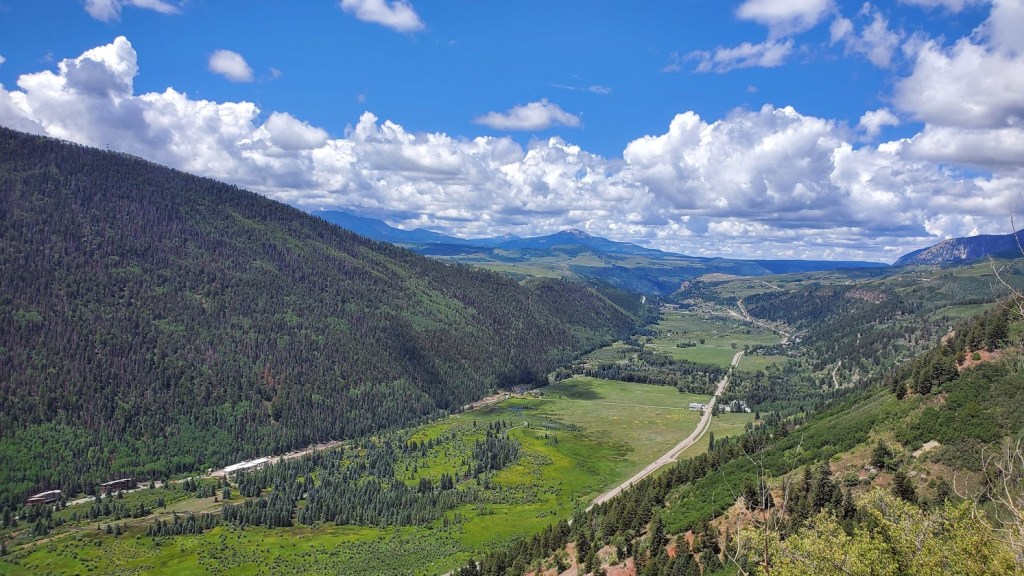
This wonderful panoramic trail was the vision of former Forest Service Recreation Manager Jud Wiebe and it is indeed a vision—from the panoramic view of Telluride below, the mountains beyond, the aspen groves, the foresty vibes, and the wildflowers sprinkled along the trail. You’ll be breathless from the beauty and the thin air.
Ps. There’s a short offshoot waterfall trail here that’s a must do too. Post coming soon.
Getting there: S. Take UT-46 E, CO-90 E and CO-145 S to N Aspen St in Telluride
Difficulty: Moderate to hard, depending on your fitness level and route-finding skills
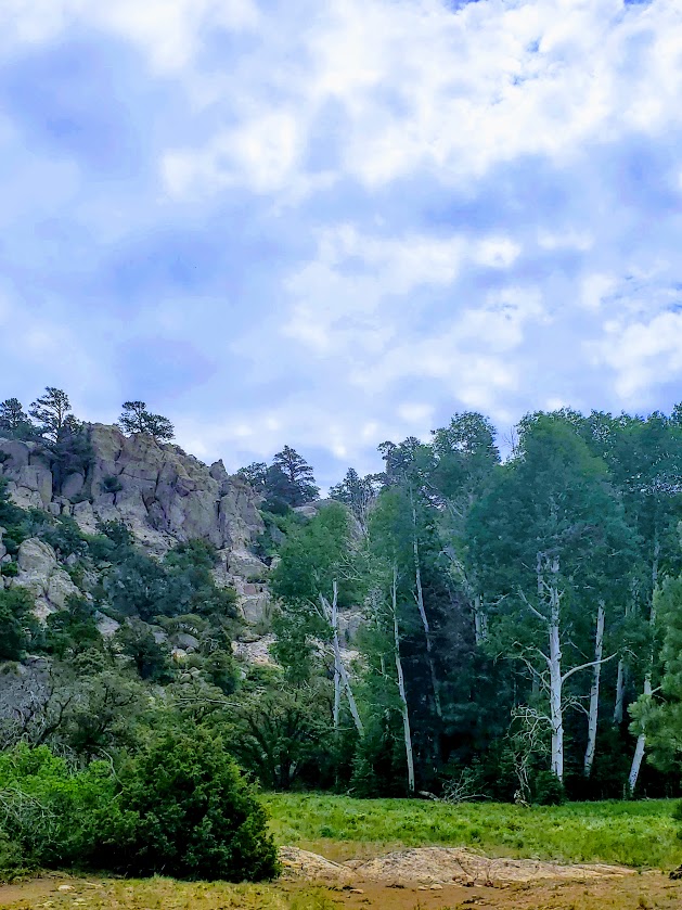
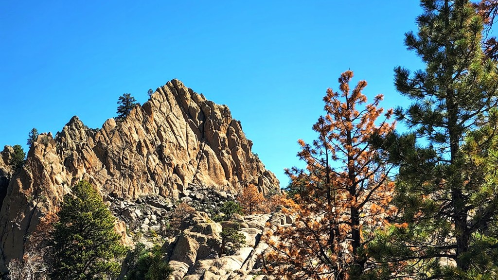
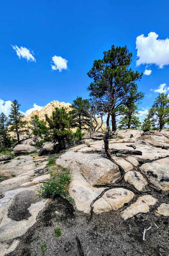
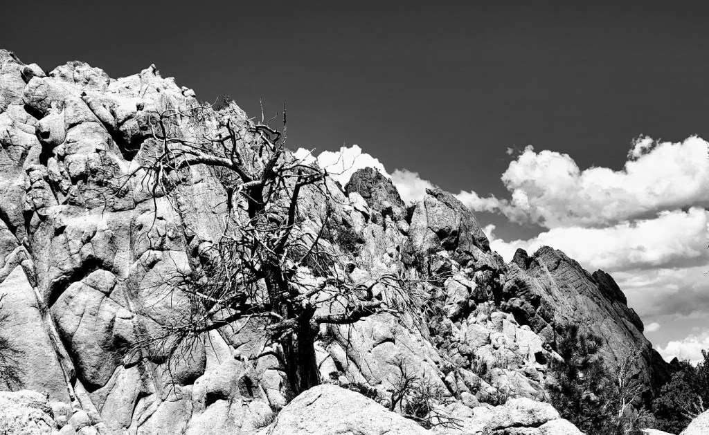
Highlights: Forest, meadow, wildflowers, rock gardens, peaks with panoramic views
Terrain: At times sandy, rocky, sooty, deadfall hopping, and scrambly fun
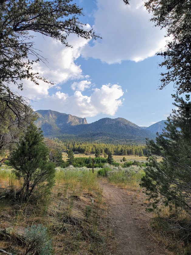
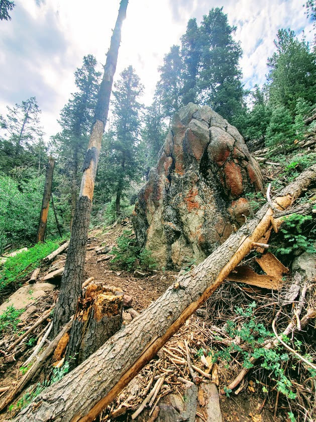
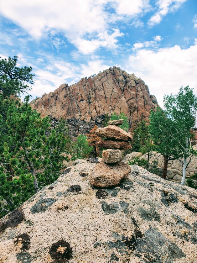
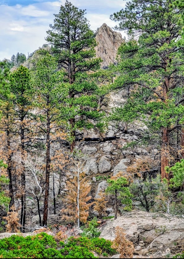
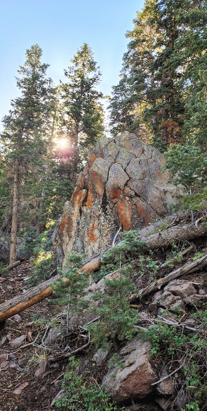
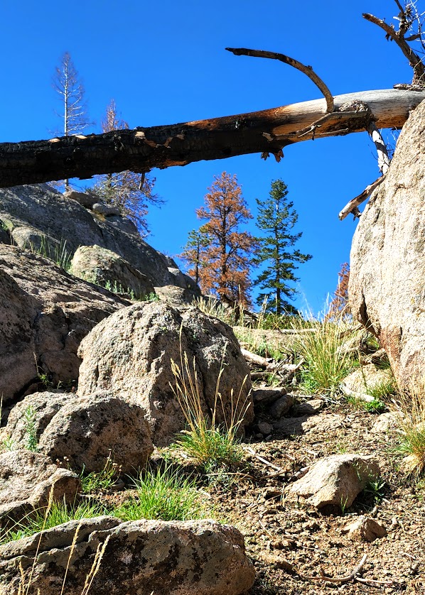
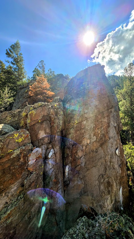
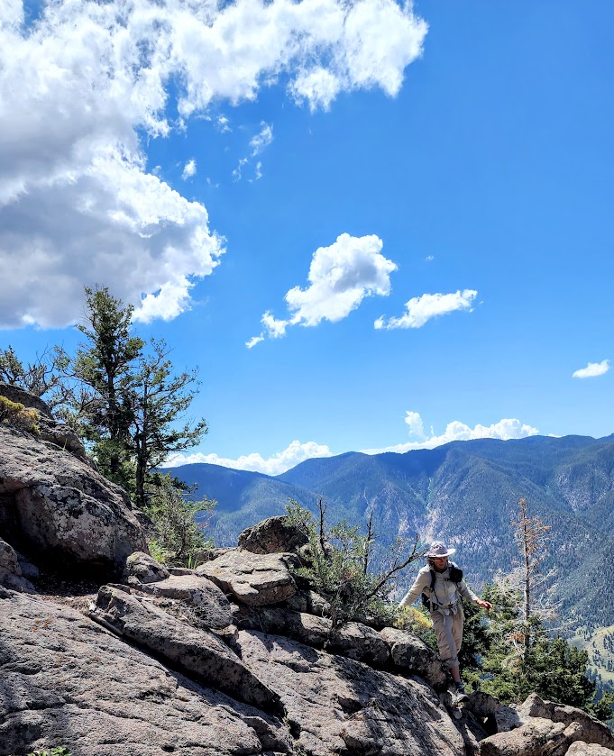
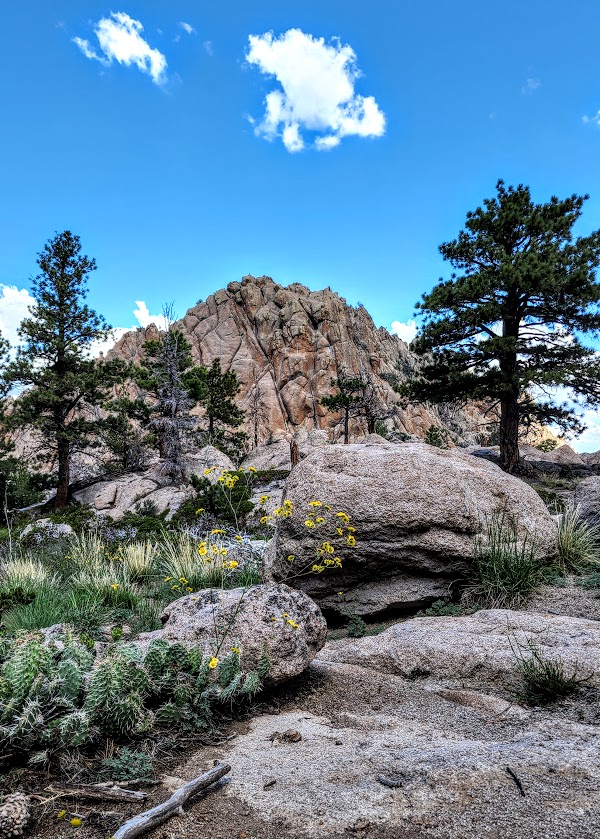
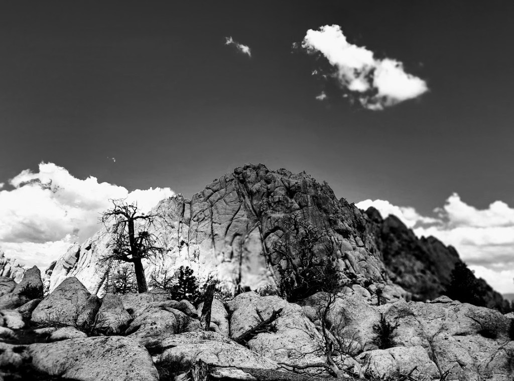
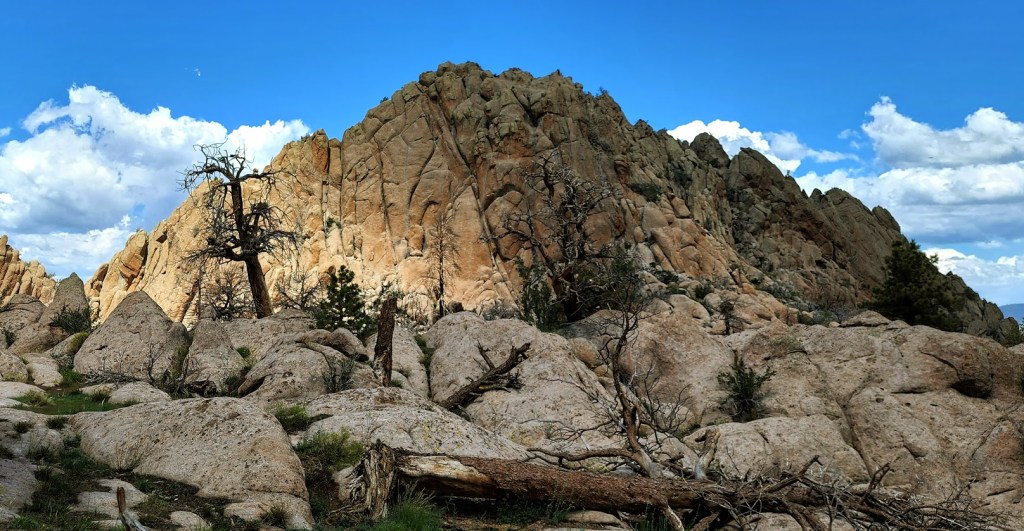
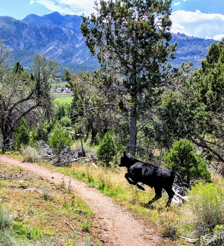
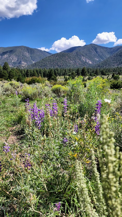
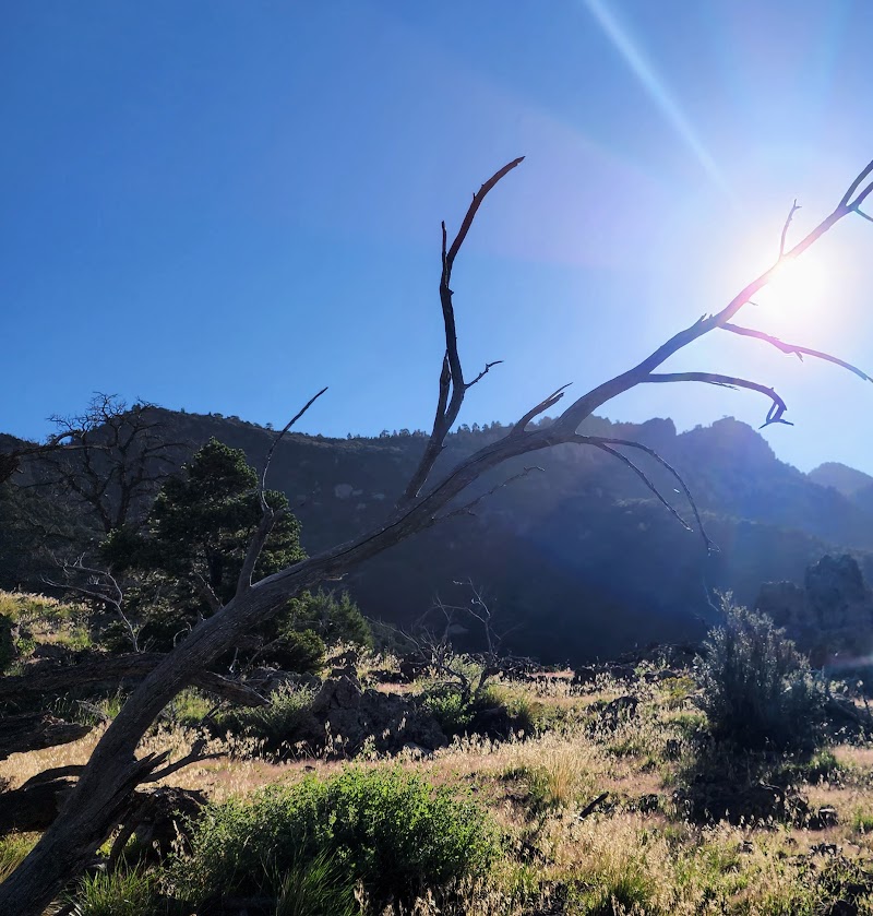
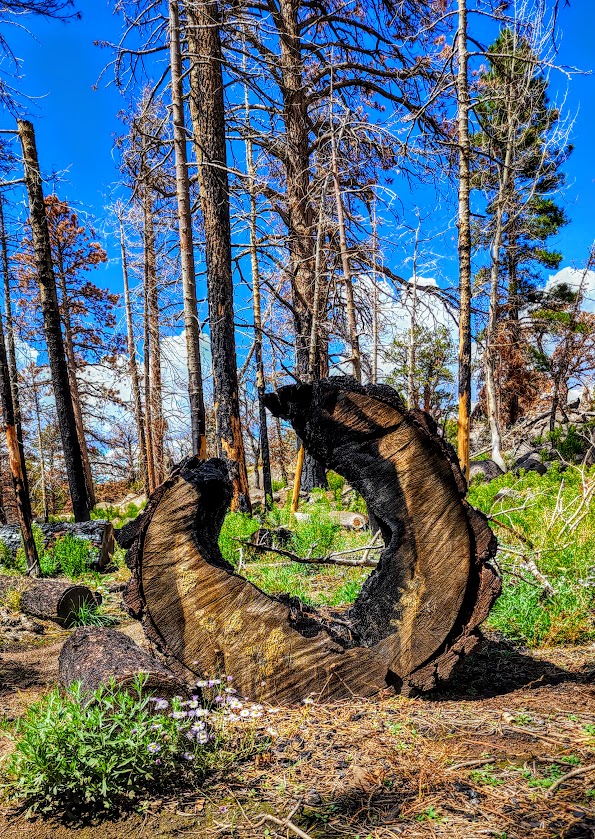
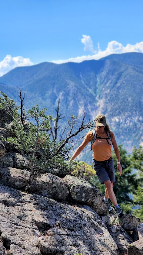
I found the Gardner Peak Trail in Pine Valley quite grand. Indeed, it may be my new favorite Pine Valley hike. The Gardner Peak Trail delivers on several levels—it’s varied and interesting all the way to the top. It’s a steady, but fairly gentle climb (2k) through forest, through nature’s rock gardens, through a meadow, (and a recent burn area), and on up to a couple of peaks—2 rocky and the one, eponymous, taller tree-lined Gardner. Pick a peak, any peak, and play. Plenty of grippy, rock scrambling opportunities. The panoramic views are a delightful reward as well. The trail is easy to follow and trail run-able until you get to mile 3. After that, all bets are off. It quickly becomes a route-finding (or create your own route) obstacle -course challenge through deadfall, boulders, scratchy shrubs, and more. If you don’t have a Garmin or All Trails, you might settle for the beautiful “false peak” rock outcropping with panoramic views a I did my first time through.
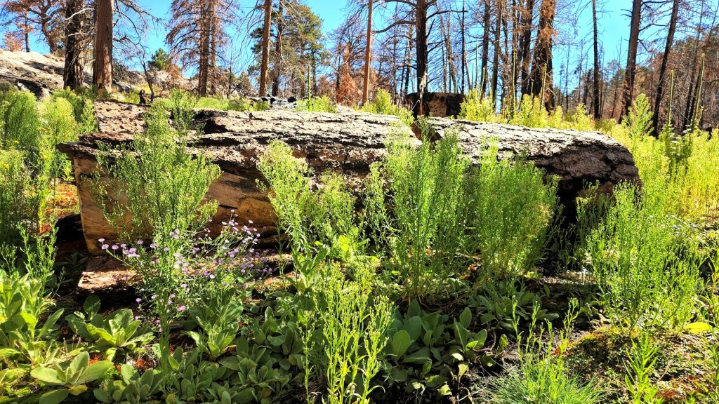
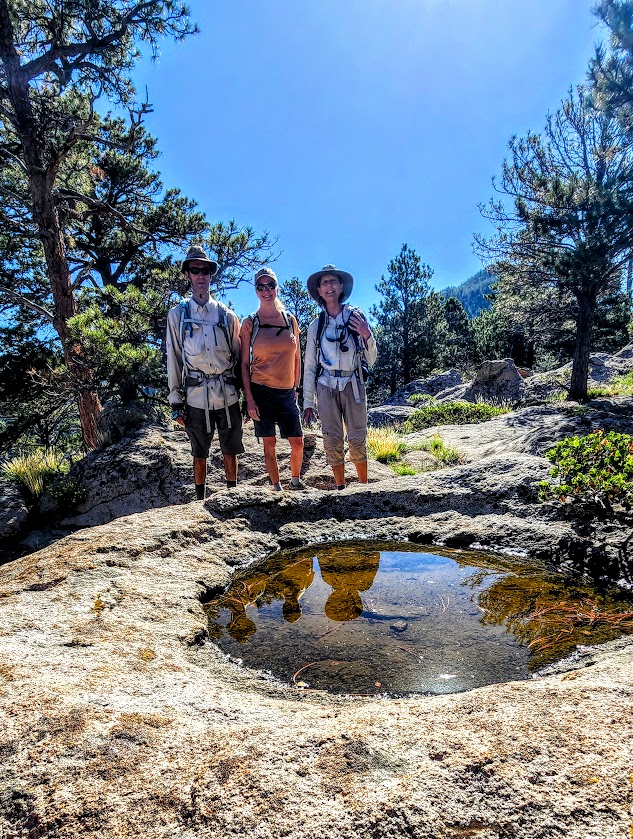
Second time is a charm of sorts. Went back to find the “real peak” —this time with my friend and extraordinary explorumentary blogger, Sue Birnbaum and her husband, who were nice enough to guide me and my friend Robin to Gardner Peak. It’s another mile or so from the false peak and about 800 feet higher. It involves some serious scrambling, deadfall and boulder obstacle course maneuvering, and some fancy footwork. Fun times for sure. (No major exposure or technical areas per se.) Would I do it again? Not so sure. There aren’t any panoramic views from the peak so when I do the hike next, I’ll be shooting for my preferred false peak – see slide show above. I did sign in to make the peak bag official. Interestingly enough, we came across another sign in “station”—one with rock mound around a encapsulated plastic container of old loose pages- – the other with an intact notebook. So I guess that makes 2 false peaks-lol. The next slide show is from my Gardner Peak take 2 . Extra bonus—lots of wildflowers from the recent rains and little Zen streams along the way. Nice to see the area green and thriving after the past fire.
Notes: If you’re going to the peak, I suggest using a GPS or the AllTrails app. Also, be sure to check out Sue’s blog for more detailed notes on this hike. Your feet and ankles might be happier in hiking boots. If you’re peak-bound, pants are recommended to spare the skin on your legs from scratches, scars, and impalement from errant branches, rocks, foreign objects – you get the idea. Mine looked like I had a brawl with a mountain lion and it won. If you have tender knees, a pole or 2 might come in handy on the descent. Dogs & horses are allowed.
At about .75 the Gardner Peak trail connects with the Canal Trail, which is both run-able and mountain bike-able.
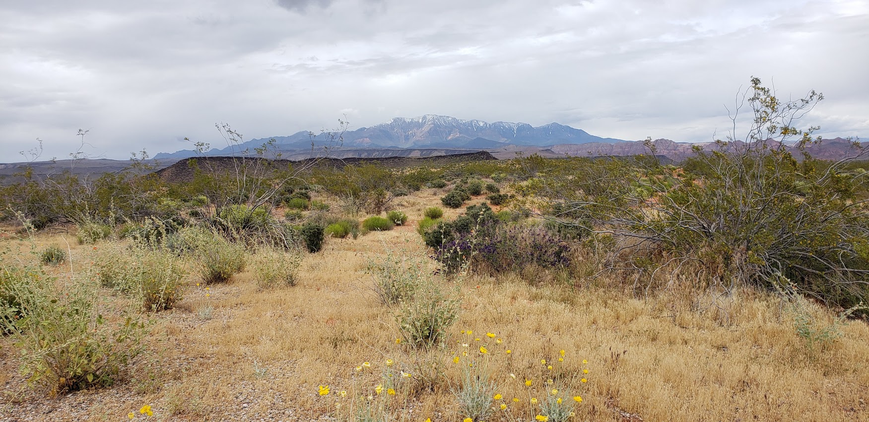
First stop on the Utah road trip after 6 hours cooped up in the car, the Red Cliffs Desert Reserve rolled out their welcome trails. Not a bad stop to stretch the legs for hike or a mountain bike cruise. This picturesque reserve with expansive views out to the snow capped mountain range is right next to town and boasts 200 miles of non-motorized trails. (Yes, that’s 200 miles so you can stretch those legs of yours to your hearts content.)
The reserve was established in 1996 to protect critical desert tortoise habitat form being destroyed by development. It worked. You’ll notice tortoise scat on the rocks everywhere. And if you’re lucky, you might see one.
I only hiked a couple miles here, but look forward to coming back to explore more. Perhaps on 2-wheels next time…
Note: the trails can be hard to follow in this terrain so bring a good map or GPS if you venture out very far, and plenty of water, of course, as it’s all exposed.
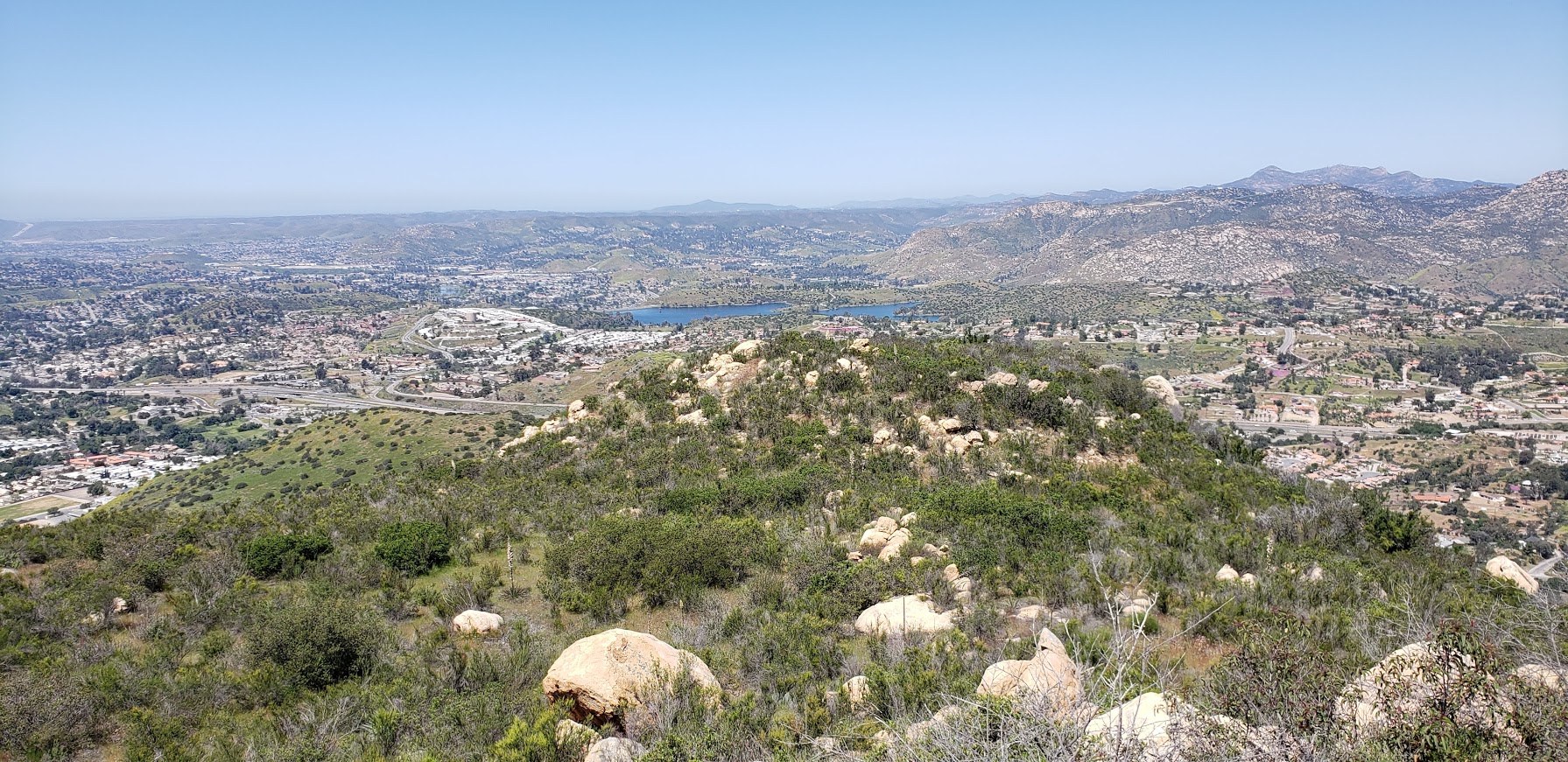
This small 40-acre park near Lakeside has 1 short trail that takes you up a consistent, steep incline to a great vista above Escondido and Lake Jennings.
Once you reach the saddle you can go east to reach a short peak or west to climb Silverdome Peak or south for Flynn’s Peak. I’m not sure which one we scrambled up, but it was definitely a scramble.
It’s rated as moderate, but if you are less than moderately fit, it’s likely you will suffer. (Especially if it’s a hot day as the trail is completely exposed.) That being said, it’s a good, short workout and “bun burner”.
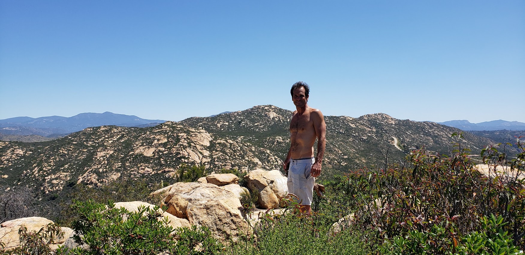
A little trail eye candy
I wouldn’t go out of my way for this one, but if you’re driving by and want a leg stretcher / burner—go for it.
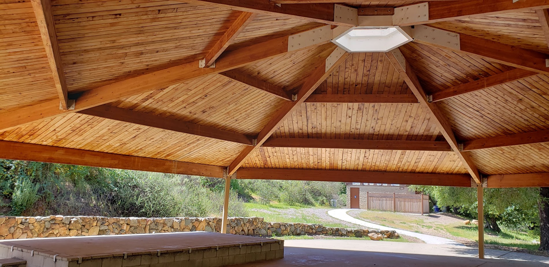
There’s picnic tables and a lovely wood pavilion too.
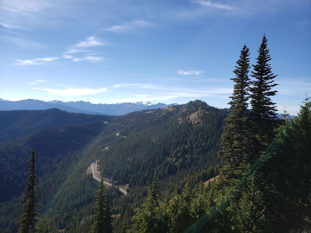
Hurricane Ridge in Olympic National Park is so named because a prospector back in 1897 stood up there on a very windy day (100 mile an hour winds) and declared that it must be a hurricane. (It wasn’t, but the name stuck.) I lucked out with lovely weather the day I visited.
Hurricane Ridge is about 17 miles from Port Angeles and it’s a direct route to fun times. If you’re in the vicinity, it’s a must do.Whether you are just taking in the fantastic views, hiking, snowshoeing, skiing, snowboarding, or perhaps biking up. Yes, I said “biking up”. And yes, it’s a thing, if you’re into that kind of thing that is. With a challenging 5,242 ft ascent over 17 miles, the ride is known as one of Washington’s toughest and most scenic bike routes and what many say is one of the top cycling climbs in the U.S.. The climb averages a 5.3% grade with the steepest ½ mile at a 9.4% grade. Any takers?
It does sound intriguing though doesn’t it? I’d like to give it a go one day if my knees allow. It’s the downhill that really gives me the heebie-jeebies… I’d feel more secure on a mountain bile than road bike. A car shuttle might be an option…
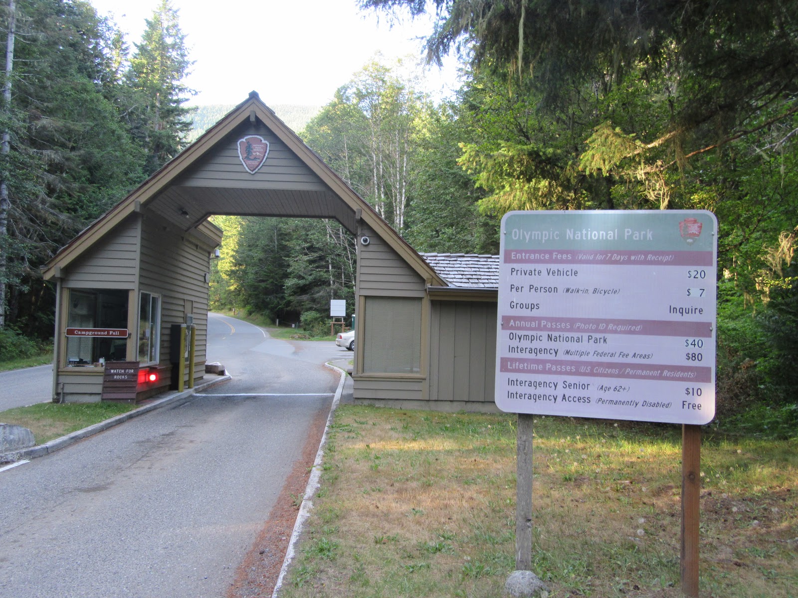
In any case, whatever your activity pleasure, you’ll find the Olympic National Park a perfect playground. Get more scoop at Visitor Center at mile one and pay to play when you reach the park’s toll booth at mile 6.
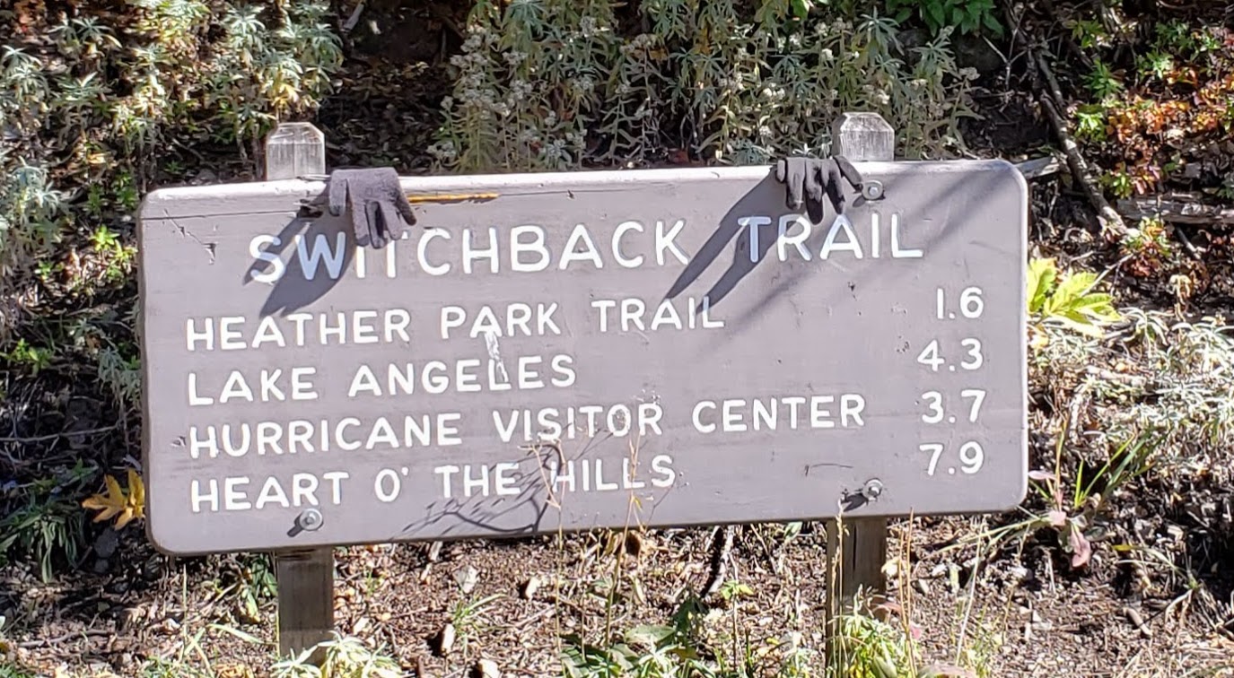
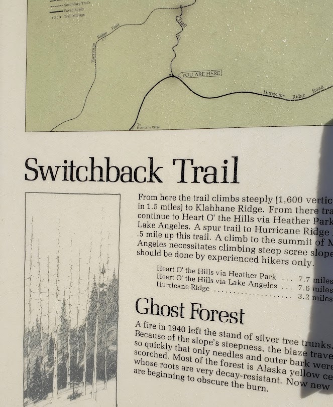
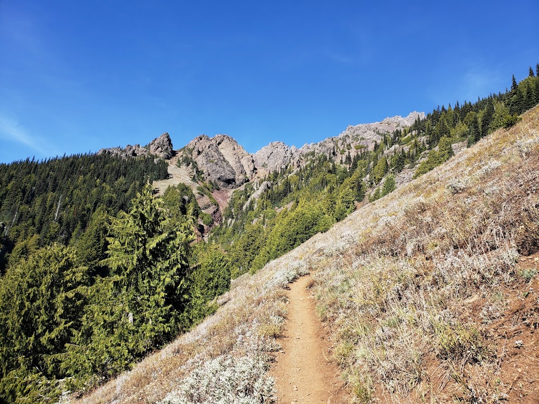
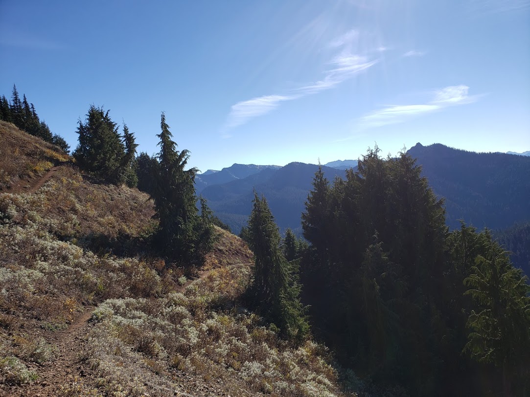
I pulled off at the first opportunity for a hike and did a pleasant out and back on the Switchback Trail. As the sign indicates, there are a few options available to string together longer hikes.
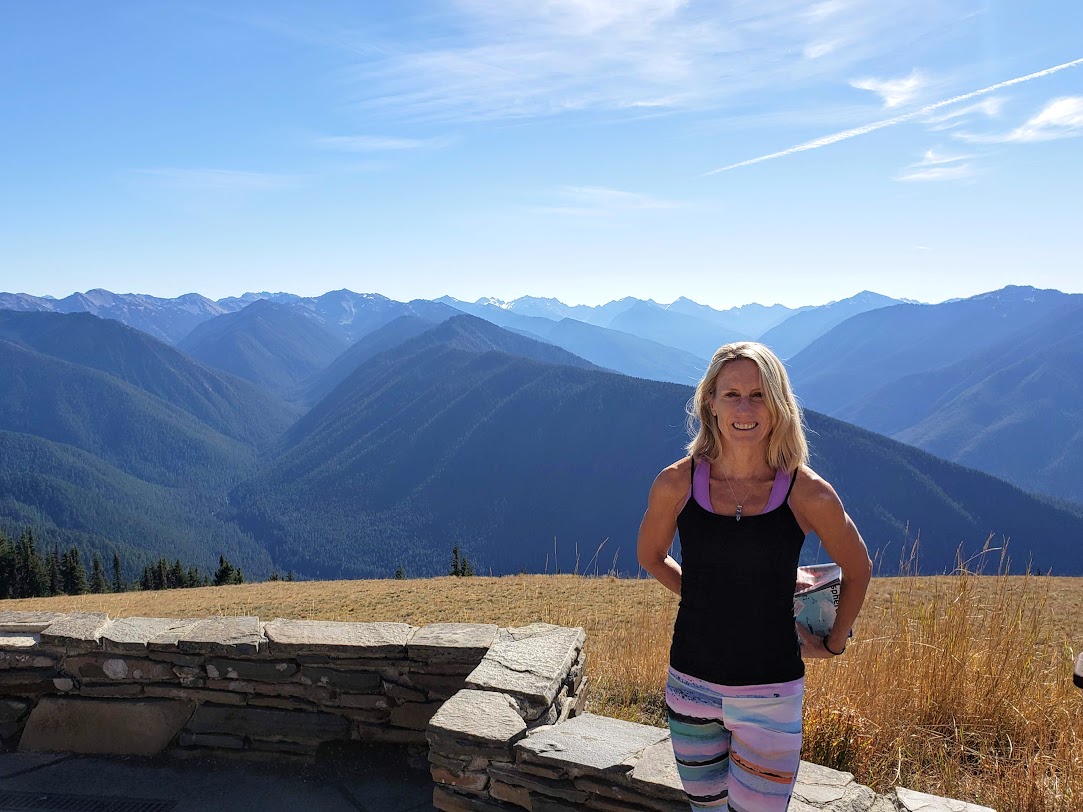
I’m keeping my escapades short so I can cover more ground on my “PNW adventure sampler” tour. After driving up to the ridge to enjoy the panoramic views, I headed back down to plot my next excursion.
Evidence of “The Inconvenient Truth” – pictures are worth a thousand words…