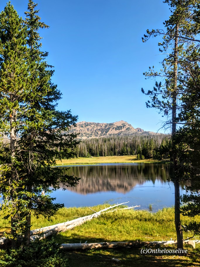
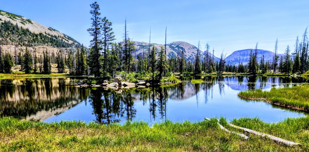
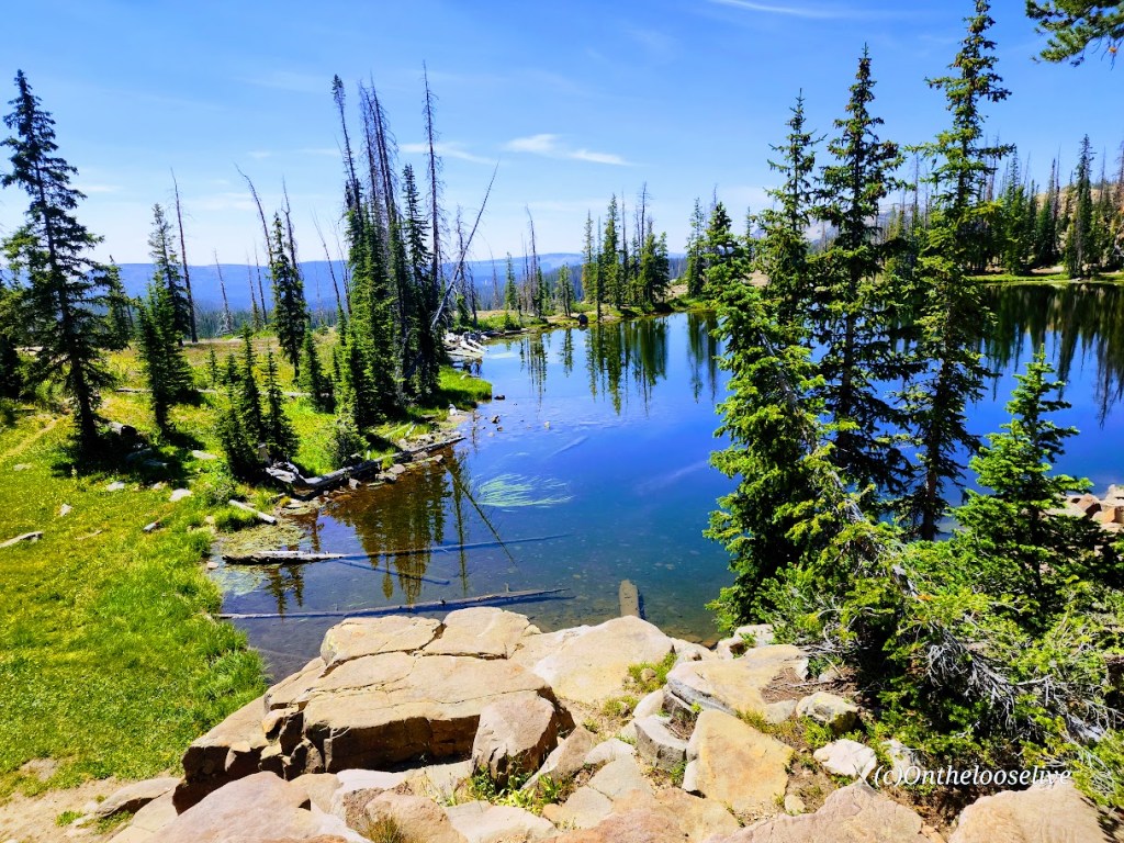
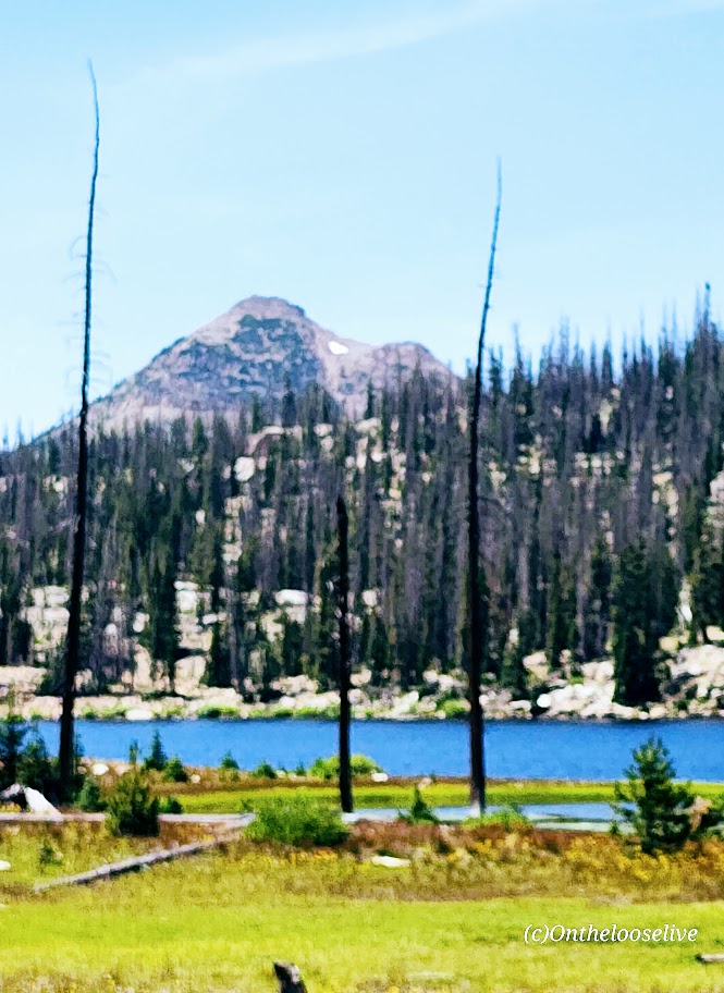
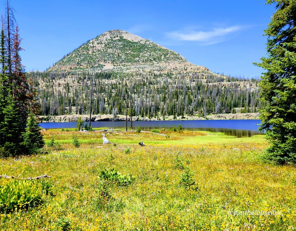
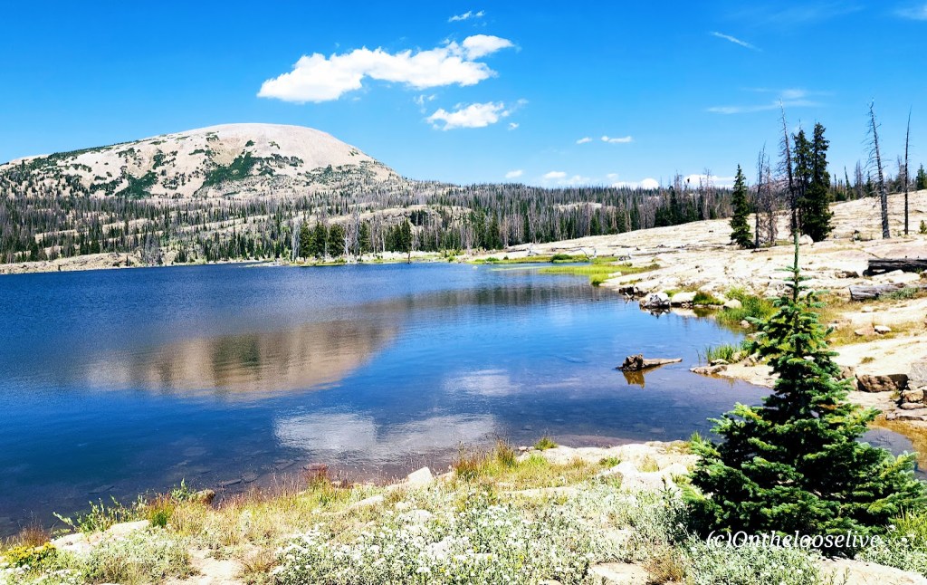
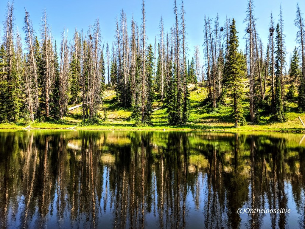
If you like alpine lakes and friendly trails, you’ll have plenty to choose from, starting at the Crystal Lake Trail and hiking in virtually any direction. Forget peak bagging for the day and enjoy some lake hopping instead. This area wins my record for most lakes and ponds in the least mileage. The more miles you cover, the more lakes and ponds you’ll see in this dazzling area of the Western Unitas. I combined 2 loops going in opposite directions and visited a mind-blowing 32 lakes and ponds in 15 miles—yep, that’s a whopping 2 sparkling lakes per mile. (But whose counting? LOL, the Garmin, thank goodness, as I lost track!) Despite the parking lots being jam-packed, surprisingly enough, the trails weren’t overrun. (Island Lake had the most people—big family groups.) Overall, I saw more lakes and ponds than people—now that’s a perfect scenario.
Distance: Create your own lake-hopping adventure.
Difficulty: Easy to moderate+, depending on your fitness level and altitude acclimation
Altitude: All hikes in the 10k ft range
Getting there: Milepost 25.5 off of the Mirror Lake Highway. (This highway is closed from late October through Memorial Day.)
Notes: Parking and overflow lots fill fast in peak season, especially on the weekends. There are several campsites in the area, but most require reservations. Boondocking and backpacking are options.
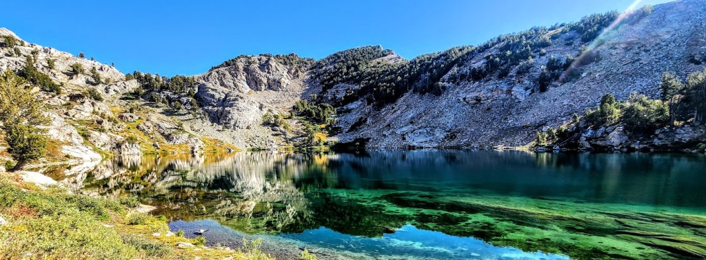
The Eastern Sierras Ruby Mountain range (often compared to the Alps) was named for the gems found there during the gold rush. The name is a misnomer, though, as the dark red gems discovered in these mountains were garnets, not rubies.
While no gold was ever found in the Ruby Mountains, treasures abound—two dozen dazzling alpine lakes and streams lively with Rainbow, Brook, and Lahontan Cutthroat Trout, meadows, and healthy forests. This rich wilderness area is home to one of the largest mule deer herds in Nevada and populations of mountain goats, bighorn sheep, and Himalayan Snowcock. (Oddly, I didn’t see any of them on my overnight backpack.)
The Ruby Mountains’ craggy, glacier-carved peaks rise nearly 5,000 feet above the valley below and are capped by Ruby Dome at 11,387 feet. The elevation on the trails ranges from 7,ooo ft to 11k. Trail length varies from a couple of miles to multi-day thru-hikes—choose your adventure. The main trails are well-marked and maintained, easy to follow, and easy on the feet. Explore for an afternoon or overnight backpack, as I did. If you’re like me, you’ll be dazzled by the glimmering alpine lakes and the sparkling night sky.
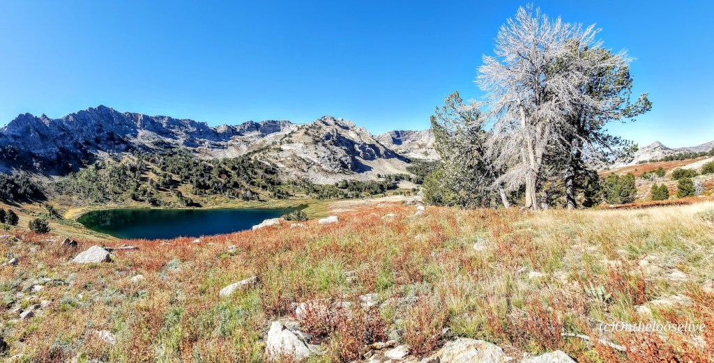
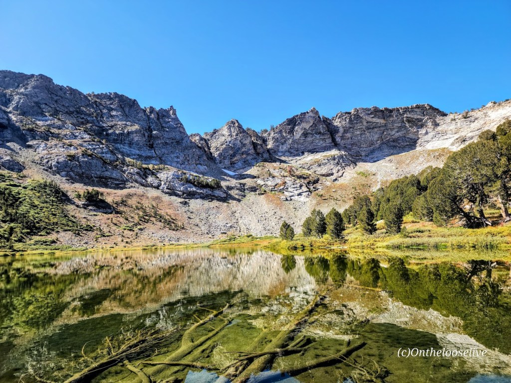
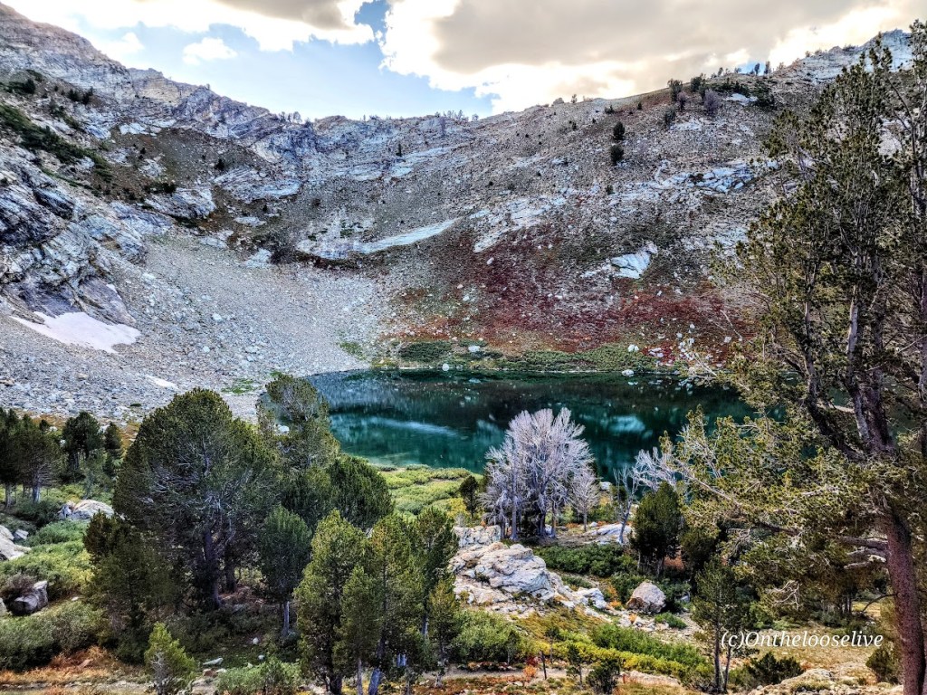
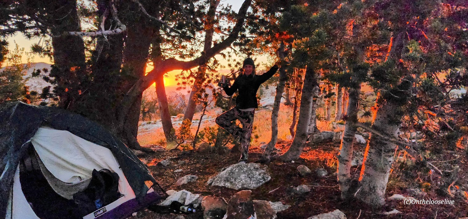
I went on an overnight backpacking trip here in September 2023. Yes, I’m way behind in my posts (understatement). I explored half a dozen lakes, including Liberty Lake, Lamoile Lake, Farvre Lake, and Castle Lake. I shall return and will provide more details then. Until then, click here for more info about the Rubies from “Travel Nevada.”
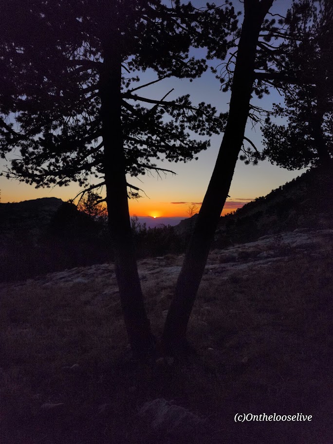
By now, you know that I have a thing for alpine lakes. While I could have lingered for days at any of the gems I visited, I did venture up above the treeline to take in the grand views as well. As you can see, it’s a completely ifferent vibe at a higher elevation – there are ten peaks over 10k feet here, and the highest is Ruby Dome at 11,387 feet
Night skies are wonderfulhere (Saw a rocket launch and a huge meteor!) And even on a weekend, solitude abounds!
Note of caution: Elko is 21 miles away from the Ruby’s; you’d think a place so close to this spectacular wilderness area would take pride in its gateway status. Sadly, Elko has one of the highest crime rates in America compared to communities of all sizes. (Elko’s population is only 20K!) The chance of becoming a victim of violent or property crime is 1 in 30. YIKES! Making it your adventure base camp, especially if you are a woman traveling solo, is ill-advised. Bring a hiking buddy and head for the mountains. (Common sense—don’t leave any valuables in the car.
Elko history: Elko was settled in 1869 with the development of the Transcontinental Railroad and became a base for gold and silver mining and livestock ranching. Unfortunately, it seems that it’s been downhill since then. There are 6 legal brothels in this small town of 20k, and the seedy element they attract is
Getting there:
From Elko, follow State Route 227 southeast toward the tiny town of Lamoille. Just before entering Lamoille town limits, turn right on the paved 12-mile Lamoille Canyon Scenic Byway and follow it to the parking area at its terminus.
Happy Trails!
(Here I am overloaded with my old heavyweight gear (3 lb surf backpack, 3.5 lb sleeping bag, 7.5 lb tent, 4 liters/8 lbs of water, etc., etc.). My last overnight backpack was years ago on Mt. Whitney. I guess my knees and back could still handle a heavy, poorly distributed load then. This time, the struggle was real. In the picture here, who knows if I’m grimacing or smiling in relief that most of the climbing was done. Since then I have opted for ultralight camping gear, which cuts my load by more than half. Stay tuned for an upcoming gear post.
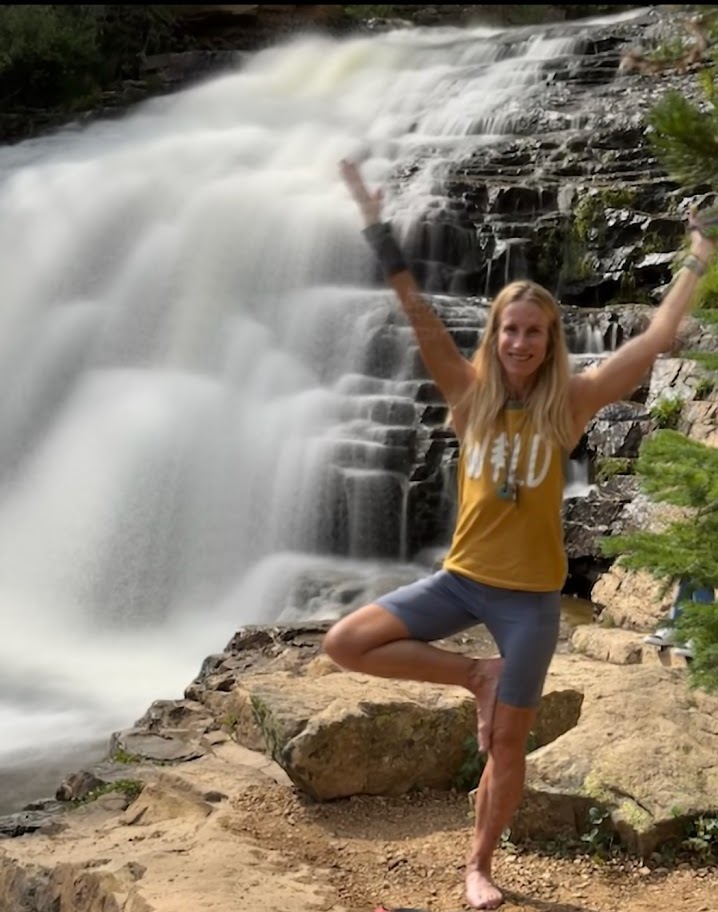
Just when I thought the scenery along Mirror Lake Highway couldn’t get better, I saw the sign for Provo River Falls and turned off (<15 minutes east of Kamas). This enchanting roadside waterfall has three tiers (upper, mid, and lower), lovely terraces, and multiple cascades. It’s a must-stop if you’re driving Highway 150. There’s a short paved path alongside the 3 waterfalls. The water temperature ranges from 35 to 55 degrees so the mist from the waterfall is wonderfully refreshing, especially on a hot day.
Difficulty: Moderate to hard, depending on your fitness level and acclimation to altitude
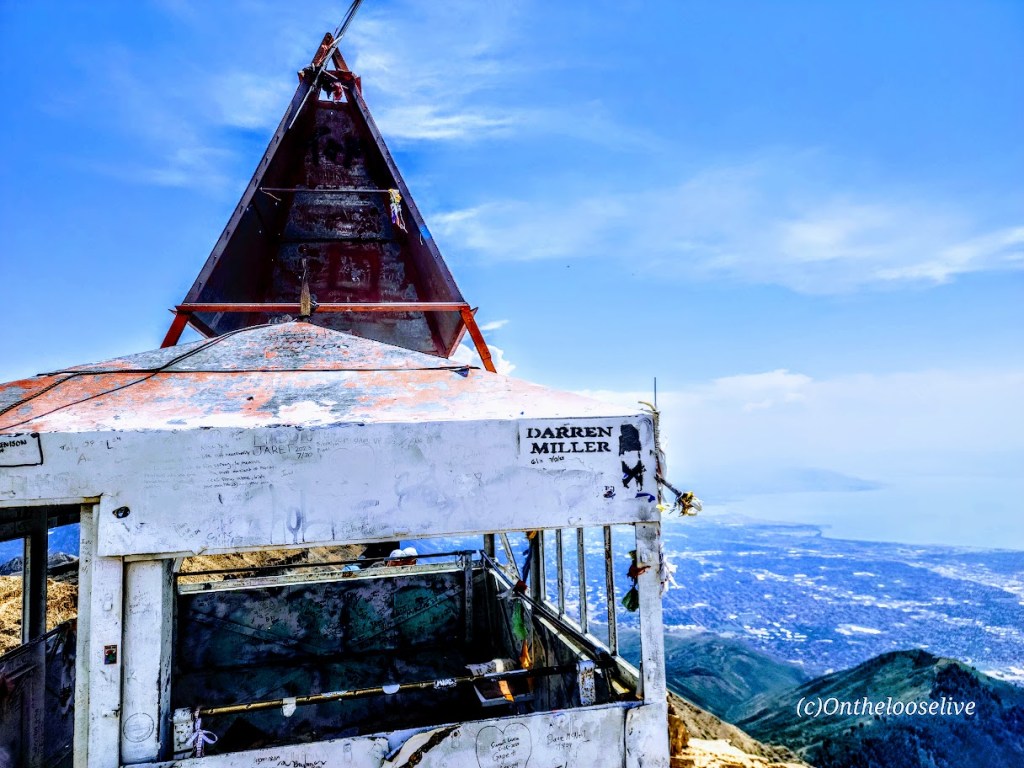
My second splendid summit of Mount Timpanogos (11,753 ft) was via the Timpooneke Trailhead. (And yep, I’m sticking with the same title. Mount Timpanogos simply has ALL the ingredients for a great hike. I’ve seen Mt. Timpanogos from both sides now (Aspen Grove Trailhead and Timpooneke), and both routes are gorgeous. Mount Timpanogos still ranks as the best US hike I’ve done.
Trail Notes: Keep your eyes open; at Mile 1, the trail takes a sharp right turn. (I kept going straight on what appeared to be a wide, well-traveled trail that stopped short across a stream. I ended up scaling a waterfall avalanche chute before it dawned on me that I was on another one of my “off trail explorations”—yep, I know, lol. I later learned I wasn’t the only one and suggested to the ranger that a sign might be advisable.)
At the 3-mile mark, a “snow bridge” had collapsed across the middle of a waterfall, requiring careful traversing of the slanted, slippery snow field. The picture below may not look too treacherous, but there is a waterfall crevasse directly under the snow. One slip could be a big, potentially final slip if you know what I mean.
Crampons would help, but given the onslaught of the heat wave we’ve been having, this section won’t be an obstacle for long. Other than that, the trail is well-marked until you reach the Emerald Lake juncture. The Summit Trail (054) is the unmarked (I’m not sure why) trail to the right.
Cons: This route seems busier/more crowded. (I was there on a weekend. I’m sure it’s better on a weekday.) You may want to challenge yourself with the extra 1k of elevation that the Aspen Grove route delivers.)
Pros: It’s easier—there is 1,000 feet less elevation gain, and a couple of miles shorter. Best of all, you completely bypass the tortuous snow and talus field that takes forever to painstakingly cross on the Aspen Grove route. (See picture below.) Footing is easy the entire way on the Timpooneke route perhaps that’s why it’s so popular with trail runners.
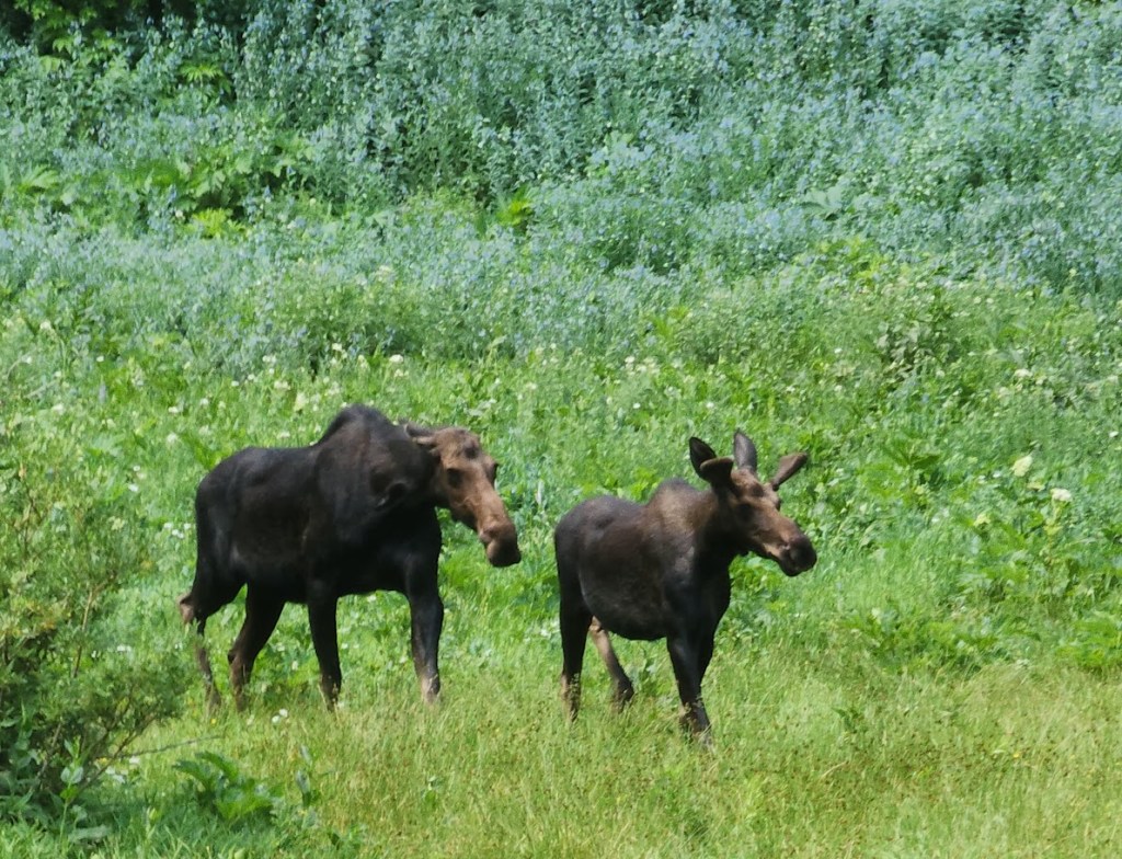
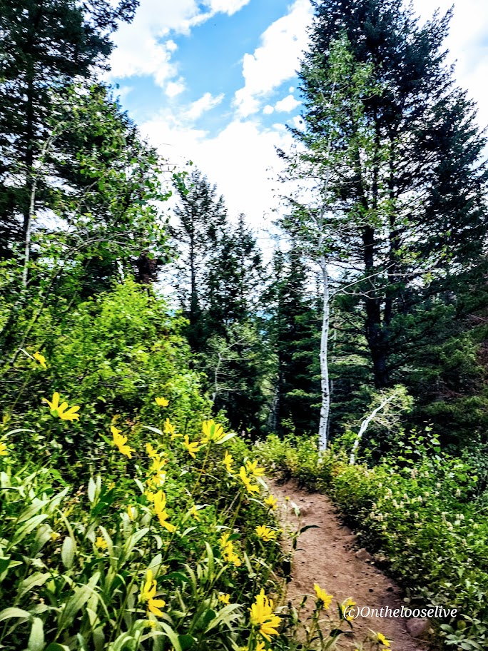
On the way up, you’ll go through what I’ll call “Moose Meadow,” where I saw the moose below with her calf.
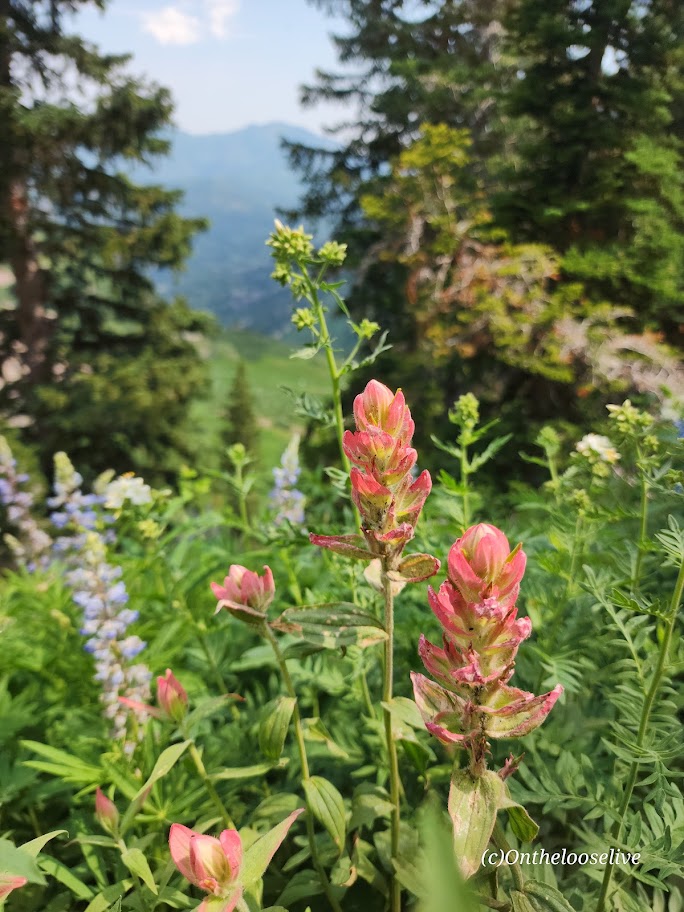
You get a great “bowl” view of Timp’s peak above and surrounding peaks from the wildflower-filled meadow basin.
After which, the trail begins to climb in earnest to the Timp Saddle, where you’ll enjoy sweeping views of Utah Valley and the summit ahead. If you’re lucky, you may see grazing, napping, or salt-licking mountain goats along the way. Give the mountain goats space and respect. I(I have a great magnifier on my camera.) (While the goats look docile, they have been known to kill loose dogs that harass them (3 loose dogs were killed by goats last year) and gore people who get too close.)
I saw several off-leash dogs—doesn’t seem prudent! I’m guessing the moose wouldn’t take kindly to the loose dogs, either.
To reach the summit, mild scrambling is required. The section is short and nontechnical, but it is not for the faint of heart or those scared of heights. The panoramic views are tremendous, but it was a bit hazy when I summited—perhaps due to the wildfires in the surrounding areas.
Caution: This hike involves significant elevation gain and hiking at elevation. Be aware of the signs of altitude sickness. It can sneak up on you even if you’ve never had it before. It happened to me recently on Wheeler Peak. On the way down Timpanogos, a teenage girl was in a fetal position by the trail, holding her head. Her family had called for rescue. Hopefully, she’s okay.
RT: 8.6 miles (started from the campground and added on the Alpine Lake Lake Loop)
Elevation Gain: 3,000ft
Peak Altitude: 13,065 ft
Difficulty: Moderate to Hard, depending on your fitness level and altitude acclimation…
Located in Great Basin National Park (Nevada), Wheeler Peak is a relatively easy peak to bag with a short hike up (<4 miles) and a total elevation gain of 3k. The hike doesn’t get serious (intense) until you hit the 3-mile mark. By then, you’re at about 12,000 ft elevation with another 1,000 ft of climbing packed into the last scrappy scree and talus-filled mile.
At 13,065 ft, Wheeler Peak is the tallest mountain in the Snake Range and the second-highest peak in Nevada. (Boundary Peak is the highest at 13,147 ft.) For perspective, in the first picture above, those tiny linear marks are people on the scree and talus section of the”trail”.
By “I got wonky”, I mean I got altitude sickness. And I don’t mean to downplay the potential seriousness of it. I’ve done higher peaks (Mount Whitney 14, 495 ft) and experienced headaches, but I’ve never experienced altitude-induced “aphasia.” It happened on the way down after spending over an hour taking in the views from the top. (Apparently, too long for me.)
After descending about a mile, I said something to my hiking partner, and my words came out jumbled. (I knew what I wanted to say, but the wrong words were coming out in random order.) Either I was having a stroke or experiencing altitude sickness. My heart rate was relatively low, 75 bpm, and I’m relatively fit – while that doesn’t rule out a stroke, altitude sickness was more likely. There were no other symptoms, although I stumbled a couple of times towards the top and on the way down, which I attributed to the loose, rocky terrain (talus and scree) and my bad knees.
It didn’t help that we drove from an altitude of 3,000 feet directly to the campground and trailhead, which sits at 10,000 feet and started hiking vigorously immediately. (We made it to the top in 2 hours.) In retrospect, this was probably not the best plan, but I’ve never experienced more than a headache at altitude, so I considered myself relatively impervious. (False; just because you haven’t had altitude sickness doesn’t mean you won’t get it. No one is impervious. Altitude sickness strikes randomly.) I had hiked in the local mountains to 10,000 feet that week without incident.
What to do? The best treatment for altitude sickness is to descend immediately, so I did. It took another 1,000 feet of descending before my ability to speak coherently returned, much to my relief. I count myself lucky, as there have been incidents of high-altitude hikers experiencing aphasia for as long as six months—yikes!
Of note, a thin 20-something-year-old man dressed in a black sweatshirt and sweatpants (overdressed for 70-80-degree temperatures) appeared to be having some difficulty as he approached the last 100 feet of the climb. He seemed out of it, angry/unfriendly, as we gave him the right of way on the single-track trail. As we were hiking out our last mile, a ranger approached us and asked if we’d seen a young man dressed in black as they’d received a distress call about a fellow with altitude sickness…
Flash forward to the following weekend; on my way down from Mount Timpanogos Peak (11,752 feet) a slight teenage girl was curled into a fetal position on the side of the trail, holding her head. Her father and brothers stood around her. They had brought her down as far as they could, but she was incapacitated with severe nausea and a headache. The rescue team was on its way.
Other than my bout of altitude sickness, Mount Wheeler is a “relatively easy” peak to bag though the last steep slippery scree and talus section isn’t much fun if you’re not nimble-footed or if you have knee issues. Both apply to me. I used a pole on the way down to keep myself from taking a spill.
I was back to feeling fine, so we added on a leisurely stroll around the scenic Alpine Lakes Loop Trail for views of Teresa and Stella lakes, both of which looked more alluring than the last time I visited them. Perhaps I just caught the light right this time? If you’re not into bagging peaks, the lake loop is an easy 2.6 mile trail, but the altitude of 10,000 feet can still be a factor.
Altitude SicknessPSA
There are 3 syndromes of altitude sickness: acute mountain sickness (AMS), high-altitude cerebral edema (HACE), and high-altitude pulmonary edema (HAPE)
Acute mountain sickness (AMS)
Symptoms: Headache, Dizziness. Loss of appetite, Nausea, Vomiting, Fatigue / Loss of Energy, Shortness of Breath, Irritability, Dizziness, Muscle Aches, Insomnia
High-altitude cerebral edema (HACE) is a potentially life-threatening form of AMS where the brain swells due to lack of oxygen. Symptoms: Extreme fatigue /Drowsiness, Confusion, Loss of Coordination, Hallucinations
High-altitude pulmonary edema (HAPE) is also a potentially life-threatening form of AMS that impacts the lungs. It can occur in rapid ascents above 8,200 feet when blood vessels narrow due to lack of oxygen, leading to fluid build-up in the lungs. Symptoms: Shortness of breath, Weakness, Cough
Altitude Sickness Facts
75% of people experience mild symptoms of AMS at elevations over 10,000 feet, dependent upon the elevation, the rate of ascent, and individual susceptibility.
14% of people with HAPE will also have HACE
Anyone (fit/unfit, old/young, male/female) can get altitude sickness
Men are more susceptible
Obese individuals are more susceptible
Genetics play a role
Fast rate of ascent can play a role
Your body loses water through respiration at high altitudes twice as fast as it does at sea level
Preventive Measures
Hydrate well
Carb load
Allow at least a day to acclimate to the altitude if possible