Pacific Northwest Explorations: Ferry Ride & Road Trip Part 1 Port Townsend & Sequim

Day 1

I’ve been wanting to return to and explore Washington State again ever since I spent a whirlwind week there on the back of boyfriend’s motorcycle nearly two decades ago. I recall that it rained nearly every day and was quite chilly, but somehow that didn’t dampen my spirits or my impression of the area. My boyfriend, a New Zealander, was quite fond of Washington because it reminded him of home—pristine, fresh and relatively underpopulated. Certainly, it was worlds away from the congestion, crowds and plastic vanity of Orange County, California where we both lived at the time. (Not that there aren’t gorgeous natural areas to enjoy in OC.)

I’ve been in Southern California for half my life and San Diego for nearly a decade. Yes, I live in one of the most beautiful, desirable areas in the country, (some would say, in the world), but that’s just the problem. Everyone is here and more are on their way. Don’t get me wrong, Cali-life has been very good to me. And it’s true, you can’t beat the weather, unless you go to Hawaii. I do love my warm, sunshiny days, but I also love mountains and time away from “civilization”. To feed my need for total nature immersion, I have to drive 8 hours to the Eastern Sierras—far too far for me. I’m craving a simpler life, closer to the nature, farther from the crowds, strip malls, traffic—you get the idea. If I could move to New Zealand, I’d do it in a minute, but unfortunately, that ship has sailed. While I’m going to pack my usual active adventures (hiking, biking) into this trip, it’s also a scouting mission for me. (As was my Prescott, AZ, trip. The trouble with these areas, a gallery owner in Prescott told me, is that too many Californians are moving into them, buying everything up, inflating housing values and creating traffic. She was a transplant from California to Prescott herself and she maintains that it has changed so much in ten years that she’s thinking of moving, but where to next?)

Where to next, indeed – that’s the conundrum. We can’t seem to escape ourselves, can we? In any case, I’m ready to escape, if only for a week or so.

First by plane, then by Bainbridge Ferry to the first stop on my PNW tour, Port Townsend.

mt rainer from ferry.jpg

Ferry Vistas.jpg
Vistas from the Bainbridge Ferry
Bainbridge Island.jpg
Golden light on the bluffs of Bainbridge Island


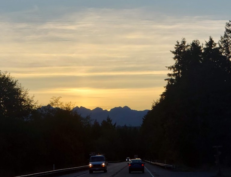
bridge sunset.jpg
Mountains on the horizon


roadtrip pnw.jpg
A road trip with promising views

In Search of the Rain Shadow

Another reason, I’m targeting the Port Townsend, Sequim and Port Angeles areas is because of the rain shadow phenomenon known as the orographic effect. Basically, as air is forced up the SW slopes of the Olympic mountains it condenses and vaporizes, resulting in copious amounts of rain. As the air descends the other side of the mountain, it warms and  evaporates, yielding dryer and sunnier climates than anywhere else in Washington State. Read more about this phenomenon and get the average rainfall of various PNW towns here.

Revisiting Port Townsend—somewhat disappointing

This little “artsy’ town has a certain rugged coastal charm, but I must admit that I didn’t find it quite as charming the second-time around. Famished from a long travel day, it was difficult to find an open restaurant at 7PM on a Monday. I walked in and ran out of a Mexican restaurant that had a terrible smell, filthy carpeting and grimy walls and counters. (Tip: Avoid Fiesta.) Settled on Sirens, a bar and restaurant with a great view from its outdoor deck. I’d been here many years ago. My salmon sandwich (just average) was delivered by a surly waitress who was obviously annoyed at the prospect of serving customers. The only other restaurant that was open other than fast food was a Thai restaurant. Next time, I’ll give it a try – heard good things about it. Lodging at the Port Townsend Inn was a disappointment as well. I went with “budget” because I got in late and wanted to walk to town. Rooms were dated and dingy. The mattress was lumpy and sagging. Camping would have been preferable. The indoor pool and jacuzzi looked decent and might be a draw for some. Many moons ago, I enjoyed a stay at the Swan Inn. and I see they’re still getting good reviews.

Day 2

After a poor night’s sleep, I went for a morning stroll and had a cup of Joe at Living Better Through Coffee, where I enjoyed spectacular views of the Puget Sound. Things were looking up.

Port T seagul.jpg
Port Townsend Town Crier
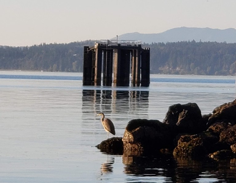
Port Townsend Heron.jpg
Port Townsend, the Silent Type

Next, I stopped into PT Cyclery to check into the bike rentals and decide if I wanted to cycle a portion of the Olympic Discovery Trail (ODT) starting in Port T or continue driving through Sequim and Port Angeles. If you’re into vintage bikes, this is the shop for you. If you want to rent a bike – road or mtb, this isn’t the shop – very poor selection. After discussing various options, the gearhead at the counter asked where I was going next. I mentioned Port Angeles. He immediately started bad mouthing it. “Why go there? It’s a dump.” He relayed a story about how he stayed in hotel there and put his chair up against the room’s door handle for extra safety at night. Wow, that bad, really? (Yikes, I’m thinking.)

 Fort Worden Historical State Park       

Fun Fact: Officer and a Gentleman was filmed here.

I made a brief stop at Fort Worden Historical State Park, a former military base on the Puget Sound shoreline that offers hiking, 2 miles of beachcombing, a lighthouse, a conference center, camping and house rentals. There’s also a marine discovery center (limited off-season hours – was closed when I visited) and WWI-era bunkers to explore. I took in the coastal views and foraged for wild raspberries, before continuing on to Sequim.


Views from Fort Warden.jpg

Wild Rasberries.jpg
Yum-wild raspberries!

Sequim

I stopped in the Chamber of Commerce / Visitor Center first and spoke with the older clerk there. She asked what my plans were. Again, the minute I mentioned Port Angeles, she began to bad mouth it, suggested that I skip it. “What’s so bad?” I asked. She replied, “It’s the drugs and the homeless.” Yes, I’m getting that message loud and clear. After listening to her brag about the safety and desirability of Sequim, I headed over to Ben’s Bike Shop to check out their bike rentals. When I pulled into the Sequim Village Marketplace, a strip mall that could be anywhere in the US, I noticed a homeless person panhandling at the entrance. (Hmm, seems the problem is not limited to Port Angeles.) Since it was off season, the clerk at Ben’s Bike told me that they’d sold all their rental bikes and had none to rent. Interesting policy. Second strike out for bike rentals.

 Dungeness National Wildlife Refuge

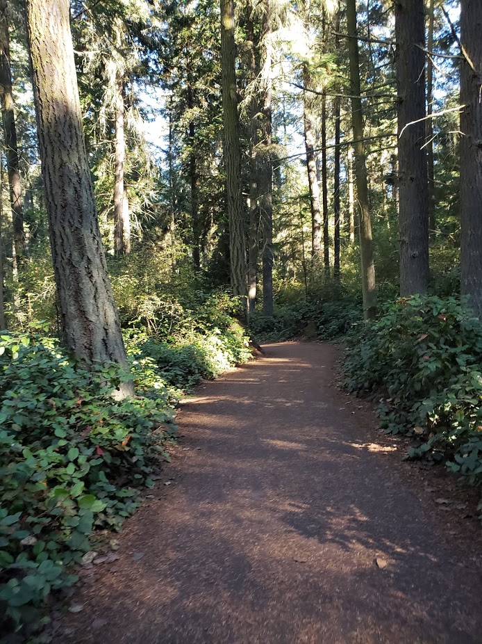
The day was slipping by and I hadn’t had my nature fix yet. Luckily, the Dungeness National Wildlife Refuge was on my way to Port Angeles. Extending five miles into the Strait of Juan De Fuca, the Dungeness Spit is the longest natural sand spit in the US. Its various habitats are home to 244 bird species, 18 types of land mammals, and 11 marine mammal species. Lots of opportunities to stretch the legs, take in some fresh air and perhaps get a glimpse of some wildlife. While I’d been here on my previous PNW tour (saw deer frolicking on the shore), it was worth revisiting. I have yet to make the 10-mile round trip trek to the Dungeness Lighthouse, which is on the National Register of Historic Places. If you love this spot, you can apply to be the resident light house keeper for a week . How cool is that? May have to consider that for another trip. If you’re just visiting for the day, you’ll need $3 per car for the entrance fee.
DS trail.jpg

DS view form above.jpg


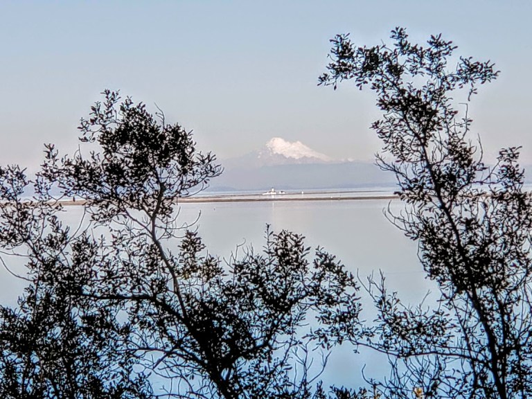
snowcap mt from DS.jpg

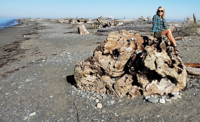
L on log DS.jpgL in log.jpg

Illuminating reading.jpg
Illuminating reading on the trail, Dungeness  National Wildlife Refuge #hemigram

Back in the car, I braced myself for the squalor of “frightful” Port Angeles. Given my early conversations in Port Townsend and Sequim, my expectations were now rock bottom. I’d heard that Port Angles was a diamond in the rough – had no idea just how rough. I’d read about the drug abuse, associated crime and a growing homeless population and its lackluster reputation. (It didn’t make my previous tour, but it was high on my list for this one.) The draw, of course, is the incredible natural beauty that surrounds the town – this area is pure Pacific Northwest Wonderland as they say. It is the gateway to Hurricane Ridge and Olympic National Park, the Elwha River, Lake Crescent, Lake Quinault, rain forests, and a plethora of PNW adventures. Road cyclists may be familiar with the annual Hurricane bike ride in late August inside Olympic National Park, One of the most scenic bikes rides in the country, this 18.6-mile bike ride has over 5,000-feet of elevation gain at an average grade of 5 percent and is not is not for those faint of heart or knee (me – though I might be tempted to give it go one day. The descent scares me more). At the base of the Olympic Mountains and on the shores of the Strait of Juan de Fuca, Port Angeles offers breathtaking views out to Victoria Island, Canada (a 90 minute ferry ride away) and flip-side views of the Olympic mountain range. With a population of about 20k, Port Angeles was hit hard by the recession and its economy continues to struggle. The timber industry was its original focus and it’s been a bit shifty ever since. As a deep-water port, Port Angeles continues to attract marine trades companies and the hope is that outdoor tourism will define its future. (If you’d like more than my opinion on Port Angeles, here’s a great Seattle Time’s article.)

Rolling over the crest of a hill, I caught my first glimpse of downtown Port Angles and its port in the distance. My first impressions were…To Be Continued…

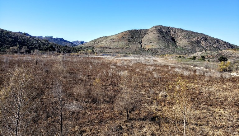
Bernardo Summit Rewards: 360 degree views of Lake Hodges and beyond

A popular spot for mountain bikers and hikers, the San Dieguito River Park in Escondido is squeezed between the I15 freeway and a couple housing developments. It’s not wilderness, but it still makes for a decent, suburban excursion and nature fix.

bernardo summit

As I mentioned in my Cruising Lake Hodges post, the main mountain bike route on the Coast-to-Crest Trail is beginner friendly. The Bernardo Summit trail is not—it’s rated difficult due to loose rocks and steep technical sections. In other words, it’s way out of my mountain bike skill league so I left it undone on my last visit, vowing to come back and hike it. Note don’t let the words summit and mountain deter you. We’re only talking about a ~1k ft in elevation gain here.  But that elevation is enough to deliver views that do not disappoint.

If you’re like me and want to bypass some concrete “hiking” and walking under the freeway, you may want to start your hike at the bicycle/pedestrian bridge (the world’s longest stressed ribbon bridge) which crosses the variably wet/dry section of Lake Hodges. After traversing the bridge, take the trail to the left heading towards the Lake. Before long, you’ll hopscotch on a couple rocks across Felicita Creek, a small perennial brook, and round the bend from there. Look for the summit trail splitting off to the right (the sign for it is facing the other direction). It’s a gradual, steady climb – mild to moderate and absolutely runnable – you just need to watch your footing on the loose rock sections. (I find it easier, more fun and less painful to run up vs. down.)

pleasant section of single track b summit

At the last and steepest section, you’ll encounter a fenced-in water tank – not very pretty, but don’t be discouraged. last climbYour final ascent will be rewarded.

I highly recommend this hike for the best views in the park and a good workout. If you’re not up for incline, you can keep going straight along the North Shore trail to Del Dios Community Park and eventually, past the Lake Hodges Dam. Note it’s an out and back.


Hiking difficulty: Mild to moderate+ depending on your fitness level

Elevation change: ~1,000 ft

Distance: ~6.2-7.2 miles roundtrip, depending on where you start

Mountain bikes and leashed dogs allowed

Free entry


Prescott Round-Up: 3 days of fun and adventure

I spent 3 incredibly fun days exploring the Prescott area and covered a fair amount of ground on foot and on bike sampling the local trails.

Downtown, historic Prescott, Arizona is charming, clean, friendly and fun. Lots of historic buildings, galleries, shops, restaurants, hotels and old-time saloons. I’m sure glad my road trip took me here. I had a blast exploring the area—hiking and mountain biking in the nearby Prescott National Forest by day and kicking up my heels on the saloon dance floors by night. As a solo woman traveler, I felt completely safe my entire trip. Nightlife – yes! Live music – yes! Dancing – yes!

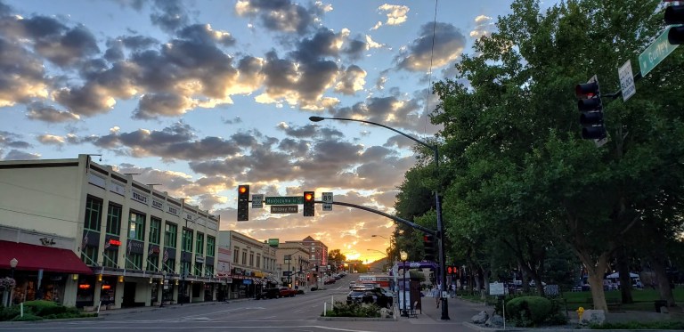
Downtown Prescott
Whiskey Row at Dawn

WHAT I DID

Hiking:

Granite Basin

Spruce Mountain

Constellation Trails

Mountain Biking:

Prescott Valley to Prescott via the Iron King & Peavine Trails

Goldwater Lake

Roadtrip to Jerome

WHERE I ATE

Restaurants: 

The Barley Hound Gastropub

Farm Provisions

WHERE I STAYED

Good night’s sleep on the “cheap” – basic, clean, quiet accommodations

Got into town late the first night and just needed a clean, quiet, safe place to stay. Here at the Rodeway Inn, I found friendly staff, a clean room, and comfy bed. Just basic was just right for that night for me. I left before the complimentary continental breakfast, but nice that they offer it.

Prescott Resort and Conference Center

Not quite on the same scale as a California “resort’, but nice enough. It certainly has stunning sunrise and sunset views across Prescott and a wonderful patio where you can enjoy them with a cocktail if you’re so inclined. The rooms were cozy, comfortable and clean and I’m guessing that most have great views too. I ate a decent, inexpensive meal in the casino and was pleasantly surprised by the quality. (The casino restaurant has daily specials so it’s worth checking out the restaurant there compared to the “resort restaurant” if you don’t care about ambiance.) I was traveling solo and had been hiking all day so it was just fine with me.

Sunset from the Prescott Resort and Conference Center Patio with Thumb Butte in the Distance

Hotel Saint Michael, Downtown/ Whiskey Row, Prescott, AZ

Location, location, location. On my final night in Prescott, I kicked up my heels and checked out the live music and saloon scene on Whiskey Row. If it’s a busy weekend you might need to pick your poison – some interior rooms with a super noisy generator or exterior room with rowdy crowds. Yes, the rooms and bathrooms are super dated – this is a historic (and word has it, haunted hotel – I expected that much. I didn’t expect the roar of the generator. Disclaimer, I’m a “sensitive sleeper”. But the noise was so LOUD, putting pillow over my head didn’t help. They should probably hand out earplugs here. Maybe they’re hoping you’ll come back from Whiskey Row so sloshed that you won’t hear a thing.

l in lobby saint michael hotel
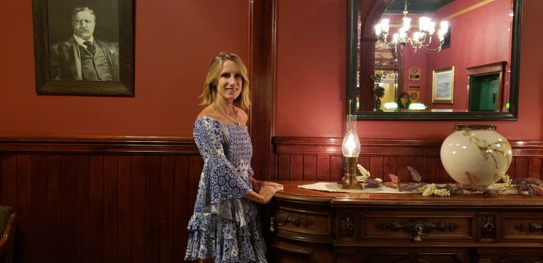
The Lobby of the Hotel Saint Michael

Much left to explore. I’ll be back!

Dipping my toes into the Aspen Creek Trail #48, Prescott, AZ

aspen creek trail sign

It’s a pleasant hike along the miniature creek under the shade of Ponderosa pines and Juniper and Manzanita trees. Some say it’s one of the prettiest trails in Prescott. Keep a lookout for the rock formations. If you’re lucky, and look carefully enough, you might see the “secret waterfall” hidden there. (No water was running when I went.) After a mellow climb, you’ll reach a crest that yields expansive views of the surrounding ranges— the Sierra Prietas, the Bradshaws, and the San Francisco peaks. Here you can retrace your steps or continue on trail 48 to the southwest or explore trail 94115 to the north east. I read some reports that there’s an 11-mile hike that takes you to Thumb Butte. (Sounds like a car shuttle might be in order for that one unless you’re mountain biking or up for a marathon hike.)

Prescott’s dedication to their extensive trail system is admirable. Over my 3 days here, I’ve had the pleasure of exploring a sampler of them by foot and wheel (Thumb Butte, Spruce Mountain, Granite BasinGoldwater Lake, Petroglyph Trail, Constellation Trails, and the Peavine/ Iron King Trails .) Just beware that the disparate systems, naming conventions and maps can be confusing. People mistakenly refer to trails by the wrong numbers. Different city and national forest websites may provide conflicting information on hike mileage and other details. I couldn’t figure out what the mileage was for this one. Oh and it’s another double misnomer hike – there are no Aspen trees on this trail despite the name and the creek is only a dribble. Perhaps it’s more of a creek in the spring?

Trail details: The first mile of the trail is part of the Prescott Circle Trail – it takes you up to a junction for trail 48 to the southwest or trail 94115 to the northeast. I’d rate it as easy. The Prescott Circle Trail is a network of city and Prescott National Forest trails that combine to make a 54-mile loop around Prescott. I’ll have to investigate more of these trails next time I’m in the area.

Getting there: 20 minutes from downtown Prescott. The Aspen Creek trailhead is on Copper Basin Road ~ 2 miles after it changes from blacktop to dirt. Parking is on the right and the trail head is on the left.

Notes: Mountain bikes & leashed dogs allowed

Suburban surprise: Panoramic views, petroglyphs and peaks, Prescott, AZ

PROS: Cool petroglyphs, mountain peak guide, and panoramic views all the way out to Humpreys Peak in Flagstaff

CONS: You’re surrounded by suburbia—it’s almost a stretch to call these “trails” as they intersect paved roads and housing developments and a golf course are always in sight. (Sigh.)

suburbia

If you’re into petroglyphs and /or just want to get some epic panoramic views of the area, it’s a must do. (Otherwise, you may not want to go out of your way for this one.) If you do, plan your visit at sunrise or sunset. (I wasn’t able to, but Ill bet the photo op would be epic.)

along the trail
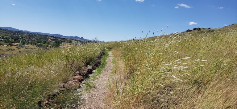
Sweet single-track trail with Thumb Butte to the left in the distance

The Panorama Trail is a single-track trail that climbs steadily up from the park in the Prescott Lakes housing development towards a mesa. It crosses Solstice Drive and connects with the Petroglyph Trail, taking you to the top of a mesa, where you can find unprecedented views of the entire area and various petroglyphs. There’s an interesting guide to the petroglyph symbols.


Near the petroglyphs, there’s an exceptional etched metal guide to all the peaks you can see in the distance. It lists how many miles away they are and their elevation. I’ve never seen a peak guide so artfully done. Kudos to its creator. A nice surprise and great information.


Despite the inevitable housing development’s encroachment on the natural beauty here, they’ve compensated well with the perks on top of the mesa.

Stay tuned for my top picks of places to stay and eat and for more of my active escapades in and around Prescott.

Hiking:

Granite Basin

Spruce Mountain

Constellation Trails

Mountain BikingPrescott Valley to Prescott via the Iron King & Peavine Trails

Goldwater Lake

Restaurants: The Barley Hound Gastropub

Farm Provisions