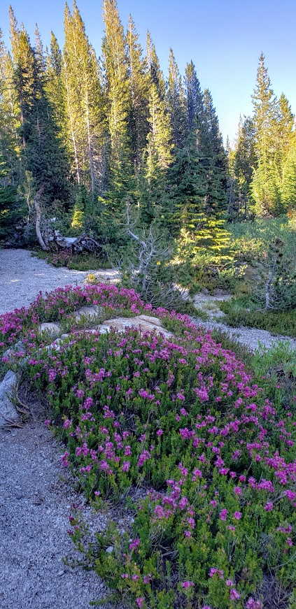
Distance: ~8-10 Miles Out & Back ~16-20 Total Difficulty: Easy Terrain: Flat, friendly(pine-needle cushy single-track) Usage: Hikers, mountain bikers horses, leashed dogs Caution: Cougar and bear country
If you’re in the Port Angeles area, a visit to lovely Lake Crescent is a must do. It just a scenic 20-mile drive out of town. There you’ll find a delightful trail that meanders along the shore and through the forest on a pine-needle path lined with ferns. This is the splendid Spruce Railroad Trail, great for hiking, running, or mountain biking.
The trail is part of the 134-mile-long Olympic Discovery Trail, a mountain bike-able route that crosses the northern part of the Olympic Peninsula. The trail follows the former Port Angeles Western Railroad route.
The trail begins with a short paved section. Scenic views of Barnes Point and Mount Storm King (post coming soon) loom above the lake.
At ~ 2.5 miles in, you’ll traverse a short bridge and have a gander at the spectacular, “Punch bowl” of Lake Crescent—crystal clear as far 40 feet down.
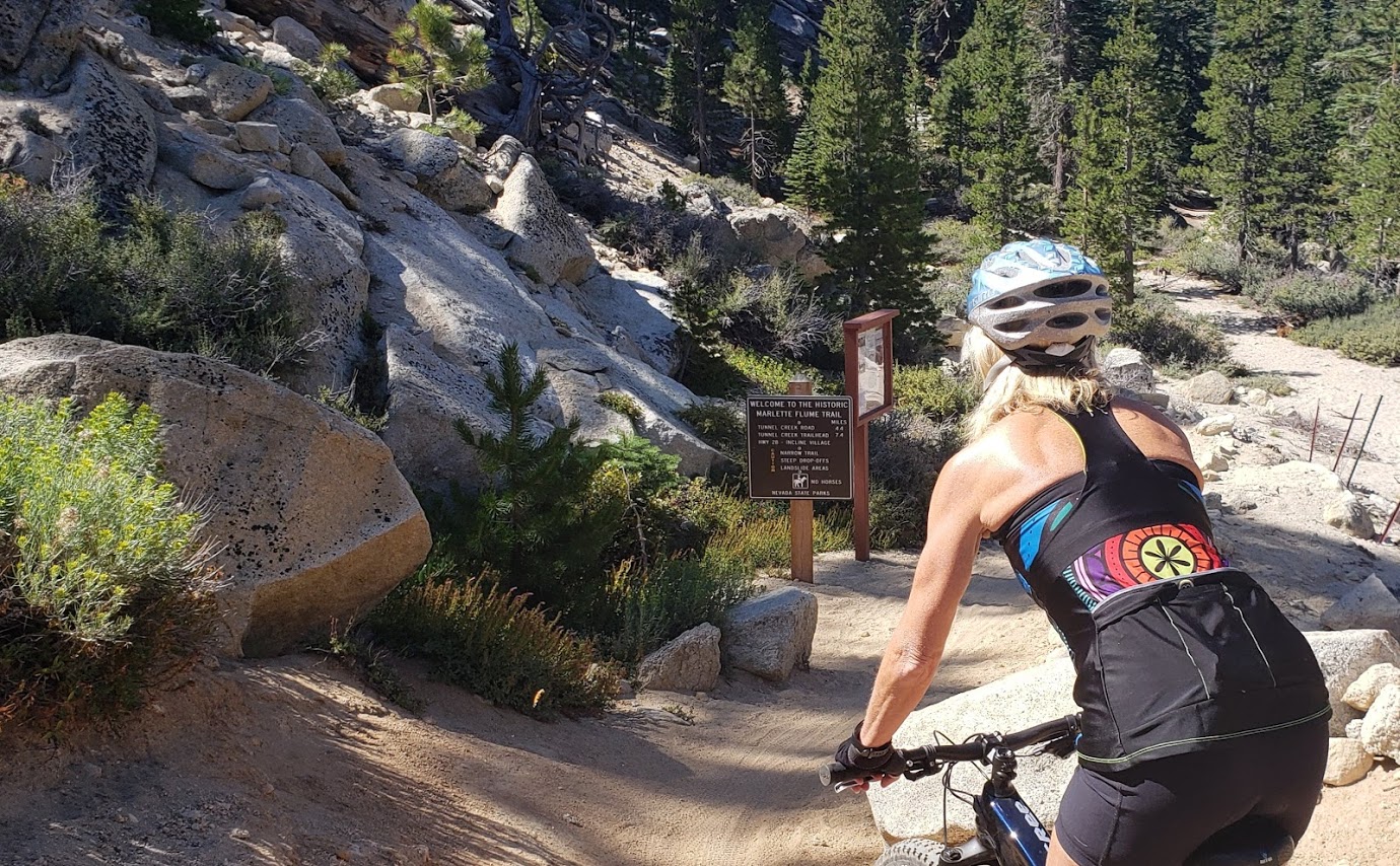
While there are plenty of more technical and longer rides around Lake Tahoe, the Flume Trail is world-renown for its scenic beauty and an absolute “must do” if you’re in the area. (I’m sure you’ll see why after you watch the videos.)
Difficulty: Moderately difficult due to elevation of 7000′ to 8157 and a 1000 ft climb in the 1st 4 miles, technically simple
Description: Ride begins at the trailhead in the Spooner Lake Day Use Area in the Lake Tahoe Nevada State Park on the east side of Lake Tahoe. Follow the Flume Trail signs from the parking area via the North Canyon Road. In the first 4 miles, you’ll climb 1000 feet on fire road through aspen groves and meadows, followed by short descent to picturesque Marlette Lake.
Marlette LakeMarlette LakeFlume Trail Single TrackLake Tahoe and Snow Capped Mountains BeyondFun Times on the Flume Trail
After ~1.5 miles of riding the dirt road along the lake, you’ll have ~4.5 miles of smooth, flat single track and breathtaking views 1600 feet above the east shore of Lake Tahoe. If you’re afraid of heights. some of the single-track sections might feel sketchy. Slow down and savor the beauty – the best section ends too quickly. You descend on a 3-mile fire road with lots of sand traps – beware.
Hourly shuttles summer and fall: $18 The Flume Trail Bike Shop (mtb rentals too), 1115 Tunnel Creek Road, 775-298-2501
Notes: I’d say a shuttle is a must. In my opinion (and others’) it’s not safe to ride on the roads in Lake Tahoe.
I did this trail 4 years ago and didn’t stop once on the climb. This time the ride was more of a workout with stops for me—a humbling combination of altitude, lack of bike training, the fact that I was in the hospital 2 weeks prior, and perhaps being 4 years older (sigh). Would definitely do it again if I have the chance–those views (unlike me) never get old.
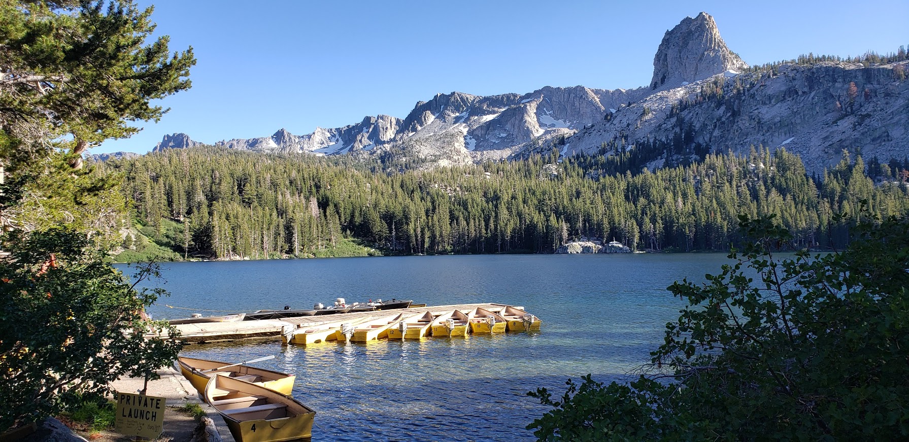
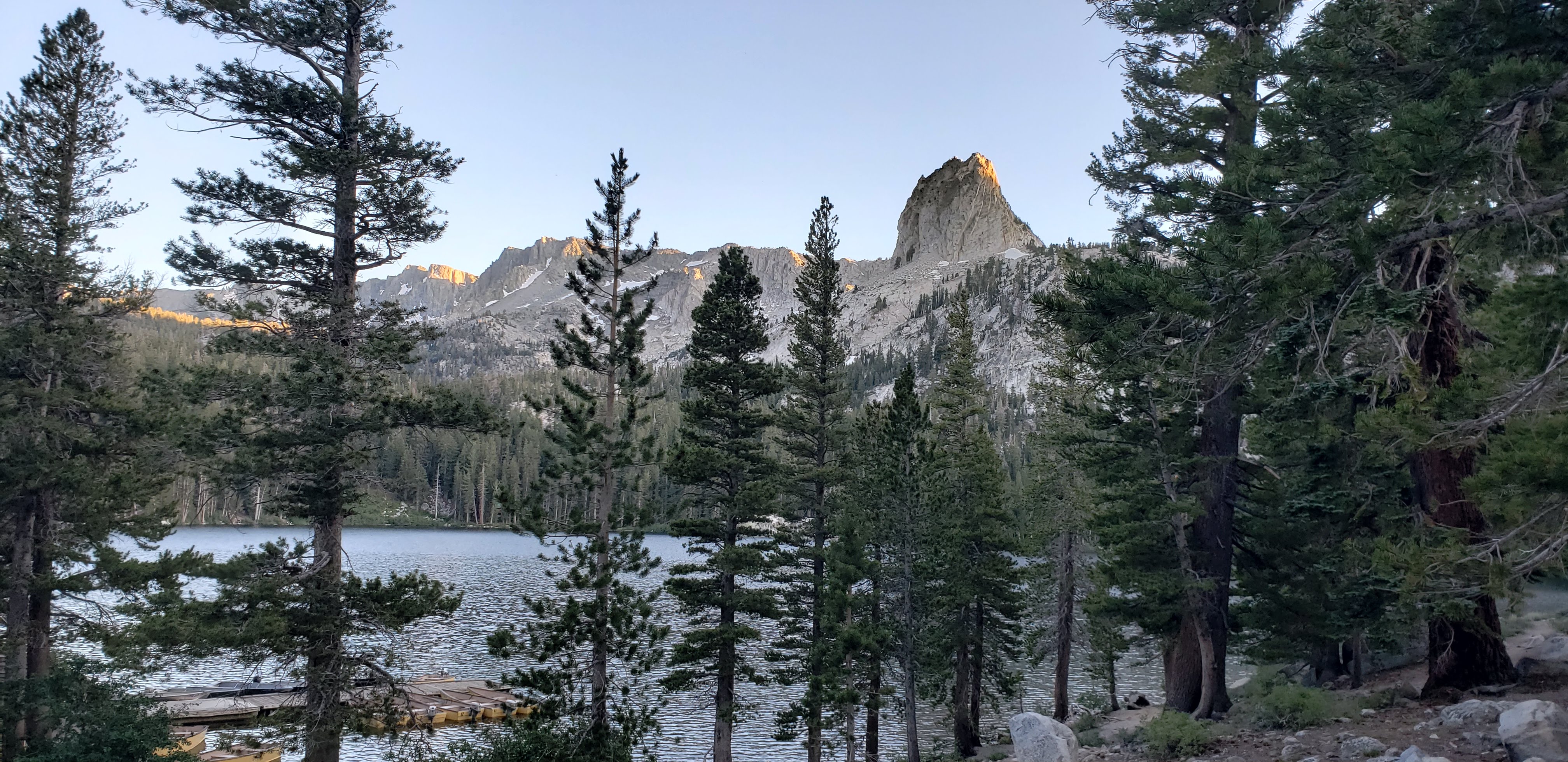
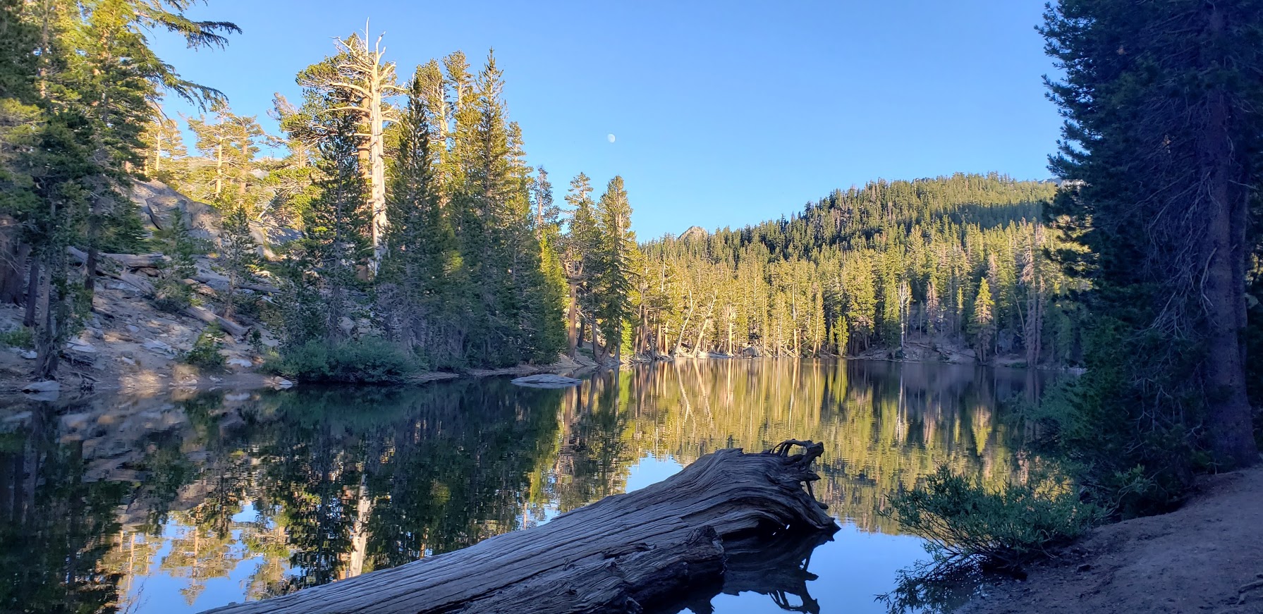
Framed by the iconic Crystal Crag and the wall of Mammoth Crest, Lake George is lovely spot for a quick nature immersion and possible wildlife sighting. It’s just a short drive out of town, and the highest road-accessible lake at 9,250 foot elevation.
Features: Hiking, fishing, camping, rustic cabins, boat rentals, a tackle and snack shop (seasonal), bear proof food storage, and bear sightings
Lake GeorgeLake George’s Clear Waters Lake George Light Lingering on the Granite
Winter access to Lake George is by ski or snowshoe only
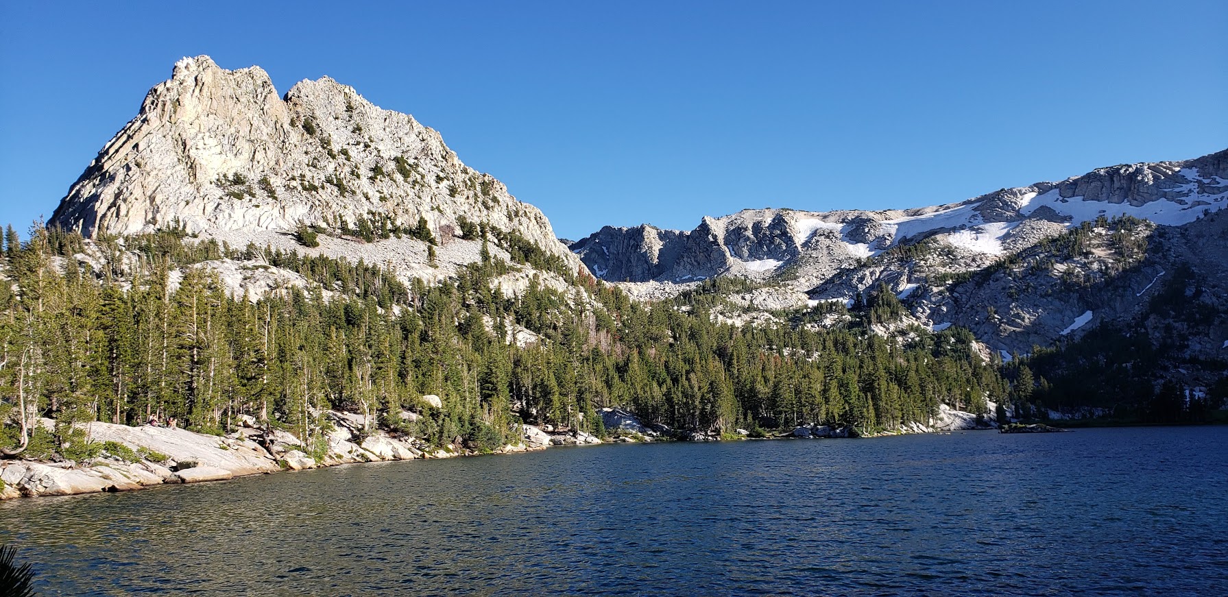
Crystal Lake Trail at Lake George
Distance: ~2.7 miles
Difficulty: Easy to moderate,
depending on your fitness level & altitude acclimation
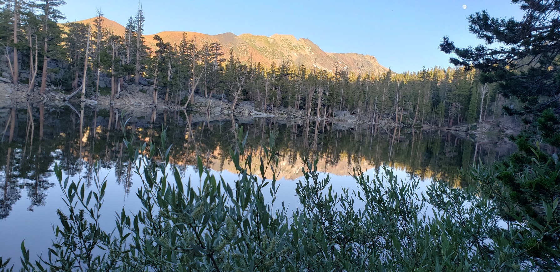
Highlights: Panoramic views of the Mammoth Lakes Basin, captivating Crystal Lake
Panoramic Views From the Trail: Lake George and Lake MaryGranite Rocks and Mountain VistasCrystal LakeCrystal LakeAlong the Crystal Lake Trail
Bartlett Lake & TJ Lakes
Distance: ~1.5 miles
Difficulty: Easy
Big views for little effort.
The trail crosses a stream then meanders up through lodgepole pines, hemlocks,
western white pines to the shore of Barrett Lake.
It was along this trail on the edge of Lake St. George that we encountered a large brown bear. I was coming around the corner fast (trying to get as much hiking in before sunset as possible) when I heard a fisherman standing in the lake say in a low voice “Bear there.”
Fisherman on the left. Shadow of the bear center bottom.
I stopped in my tracks. The bruin was blocking the trail and had its broad back to me. It was busy foraging in the fisherman’s backpack and appeared not to notice us. We quietly retreated up to a high spot off the trail. At one point, the bear looked up, I think he must have detected our scent. That’s when I snapped the shot. After taking another bear detour above the trail, we completed the TJ Lake loop, first passing Barrett Lake, Very picturesque and the light was perfect for reflection shots.
A Charming Section of the TJ Loop Trail Pic Doesn’t Do It JusticeI Couldn’t Get Enough of These Vistas
More Eye Candy On the TJ Lake LoopBarrett Lake ReflectionBarrett Lake ReflectionBarrett Lake Reflection
In all my years of hiking, this was my first bear encounter. (Well, I think there was one outside of my tent one night on top of San Jacinto, but I didn’t go out to greet it- just made loud noises to deter it.) What makes me sad is that this wild bear’s days are likely numbered due to it’s habituation to people.
More Mammoth Hikes
If you have more time than I did this trip, check out some of my favorite, longer hikes in the area :
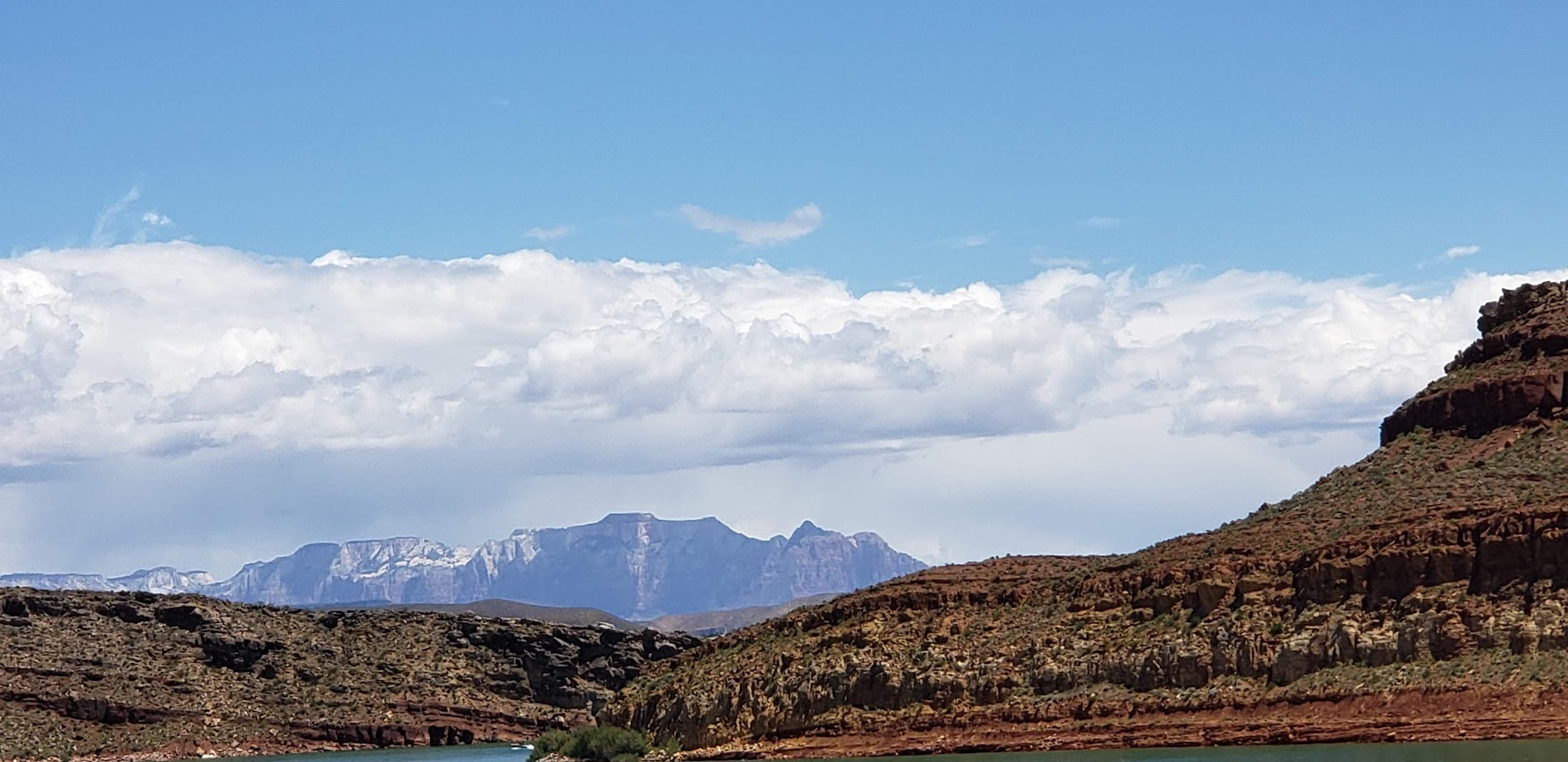
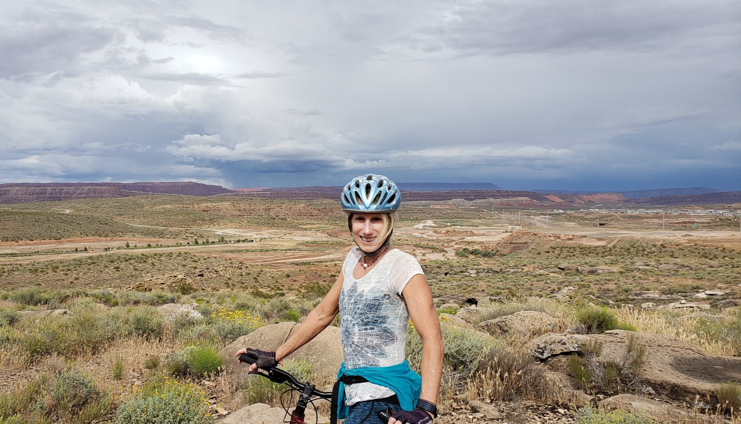
For those of you who might be wondering, here’s a sample of what biking (road biking and mountain biking) looks like around St. George, Utah. As you can see, the views for much of this 60-mile ride were splendid, quintessential Utah—Virgin River, canyons, red rock, and snow-capped mountains. Road quality varied. (Utah drivers were not quite as courteous as I’d hoped. Lots of trucks sped by us without moving to the left or braking.)
Roadside Red Rock off the 7Virgin River Views From River Rock Roasting CompanyVirgin River Views From River Rock Roasting CompanyRiver Rock Roasting Company: Definitely the Best Coffee / Gastropub and Views Around!
Not bad, eh?
Toquerville /La Verkin Road Bike Loop ~60 Miles, ~2500 feet of climbing
A friend of mine, now a St. George local, guided us on this 60-mile road bike sampler with ~2500 feet of climbing on surrounding highways and byways. We took the lovely, low traffic 7 to Sand Hollow Road (rough surface) by Sand Hollow Reservoir (Half-Ironman site) across to State Street / 9. (The 9 is a main thoroughfare with heavy, fast traffic -not so nice. Maybe save this one for Sunday mornings when most of the locals are at church.)
At the halfway point, we enjoyed some refreshments and superb views at the super scenic, ever popular River Rock Roasting, which is perched on a cliff overlooking Virgin River in La Verkin. If you’re in the area, River Rock Roasting is a must stop and is definitely my top pick for coffee, food, brews and views. It’s slammed on Sundays (apparently everyone who is not in church goes here) so pick a weekday if possible.
Our route back on State Street/9 was topped off with a stop at dazzling Quail Creek State Park and Reservoir. And yes, you can swim in it. No, I didn’t this time, but will next! It’s 120 feet deep in places and stocked with rainbow trout, bullhead catfish, crappie, largemouth bass. There’s boating, kayaking, SUPs, hiking, biking and camping here.
The Veyo Loop is another amazingly scenic route through the Gunlock and Snow Canyon area—one of the top ten routes in Utah -minimal traffic and maximum views!
Desert Canyons Mountain Bike Trails: Pushing Tin and Secret Sauce ~8 miles
Our mountain bike sampler was limited as it had recently rained, but we’ve heard there’s tons of epic trails around here. The driest trail option was the newly developed Desert Canyons Trail System. We cruised around two of the trails, Pushing Tin and Secret Sauce, both pleasant easy to moderate with views from the top of the mesa out to the horizon. Unfortunately, these views are slated to be filled in by a Master Community in the near future. (The developer’s concession / gift was this mountain bike trail system.) We were lucky to have it to ourselves with no building encroachment yet.
Wildflowers and Mesa Top ViewsMetal ArtKara Highlighting Crazy Technical OpportunitiesOpen Views for Now…
Directions: From St. George, take the I-15 S to Desert Canyon s exit and take a left under the overpass
We were told that there’s plenty of great mountain biking in and near St. George, but it wasn’t in the cards for this trip. We did make it to Moab for an epic mountain bike ride – stay tuned for that post.
As far as these 2 rides go, I’ll give them 2 thumbs up.
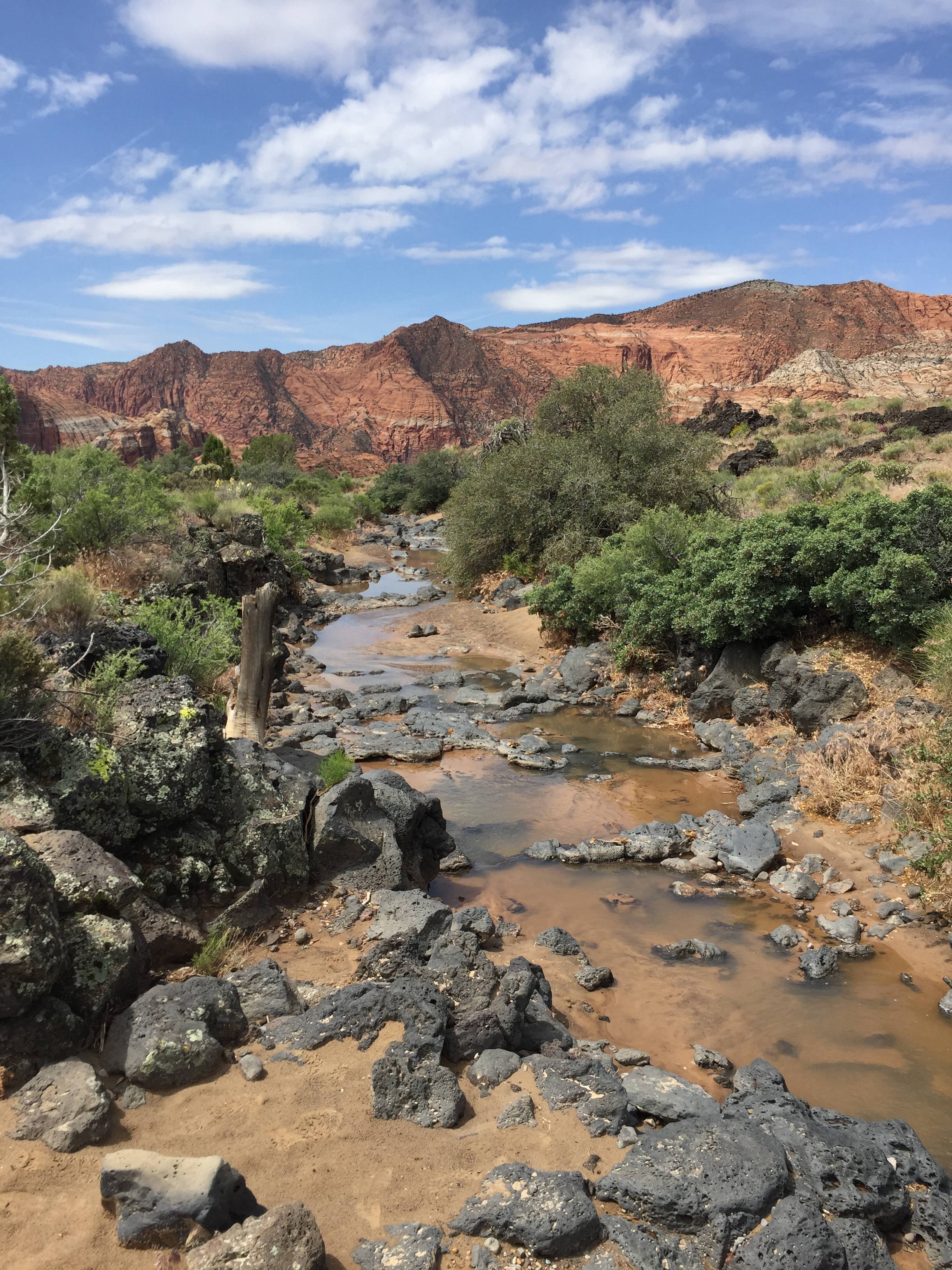
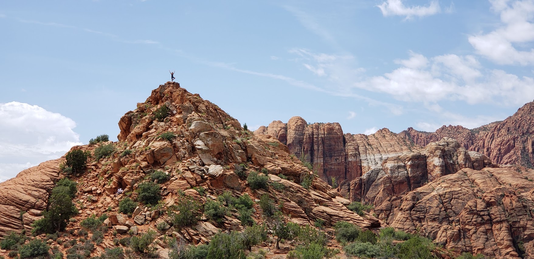
Spent a lovely morning exploring this spectacularly scenic Snow Canyon State Park near St. George, Utah. With dramatic, diverse scenery everywhere you turn, this park does not disappoint. If this epic landscape seems vaguely familiar, it’s because it was the backdrop for Butch Cassidy and the Sundance Kid, The Electric Horseman, and Jeremiah Johnson..
This 7,400 acre park has everything from black lava flows with tubes that you can crawl into to red rock and sandstone cliffs that you can scramble up. Here you’ll find 38 miles of hiking trails, a 3 mile paved trail, technical climbing (170 designated sport routes) and ~15 miles of equestrian trails. If that’s not enough for ya, there’s some mountain biking and road biking with great climbs here too. Oh, and there’s also a 33 unit campground.
Wildflowers, black lava rocks, and stunning red cliff vistas
Photo Credit: Ken Wells captured this spot much better than I did.
Into the lava tubes
Amazing textures
On top of the world in Snow Canyon
My attempt at dancer pose – a long way to go, I know
Black lava rocks, desert vegetation, and white sandstone cliffs – oh my!
The park is actually inside of the 62k acre Red Cliffs Desert Reserve that I romped around on my first day in town. Note, these areas are all exposed so not recommended in the summer heat. Be sure to bring water, sunscreen, and a hat.
I just had time for a quick stroll as I’d already visited Gunlock State Park earlier in the morning and still had more sights to see and things to do. (Mountain bike ride planned for the afternoon.) The trail I took by the lava flows was more suited to a stroll versus hiking at pace or trail running due to the sharp rocks. Not sure if all the trails in the park are like this, or if it’s just near the lava flows. If you’ve been here and hiked around let me know. Otherwise, I’ll update on my next trip to St, George.
You know me, trying to pack as much into my short Utah road trip as possible.