Exploring the Goat Canyon Trestle by Mountain Bike, Jacumba, CA

Deep in the heart of the Jacumba Mountains overlooking Carrizo Gorge in Anza Borrego State Park, you’ll find the Goat Canyon Trestle. Getting to the world’s largest curved wooden trestle is like being transported to the wild west of days done by. You’ll traverse dark tunnels in various stages of collapse, dodge rock slides, narrowly avoid precipitous drops into rock canyons, explore abandoned trains and endure the blazing desert sun. If this is your idea of fun, read on. Ok, it’s not that bad. In fact, it’s an easy, flat mtb cruise or a longish flat hike through some very cool (pun intended) desert terrain.

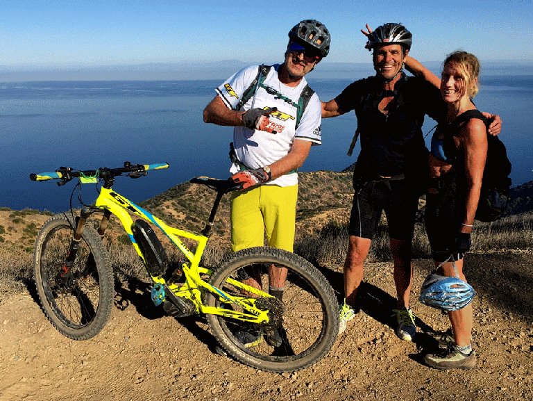
(Video credit and pics I’m in below: Ken Wells)

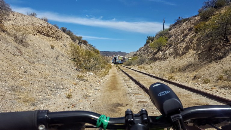
It’s slow going as there are several points where you have to lift your bike over one obstacle or another. You can’t speed through because you never know what’s around the next corner or if the bottom might drop out in front of you.

20180421_122141.jpg


Be alert and cautious all the way out and back. Headlamps are a must for the tunnels, lots of obstacles in there. Workout-wise, it’s easy – safety-wise, it could be considered a bit sketchy.

20180421_113342.jpg

20180421_130252.jpg

As you bike along the railway, sometimes the path is quite narrow with a precipitous drop into the rocky canyon below. A moment of distraction could make for a very bad day. Wouldn’t suggest mountain biking for kids here, unless they are quite skilled and cautious riders.

20180421_112723.jpg

20180421_112437.jpg

20180421_105723.jpg

Up close, the trestle seems a bit rickety, like a skinny, dilapidated Jenga set.


This slideshow requires JavaScript.


Background: The trestle was built in 1933, as part of the San Diego and Arizona Eastern Railway, aka “the impossible railroad” that ran through Baja California and Eastern San Diego County and ended in Imperial Valley. Over the years, collapsed tunnels and rock slides plagued the railroad, including the collapse of Tunnel 15, which led to the creation of the trestle. The trestle was constructed of wood (no nails used), rather than metal due to the area’s extreme temperature fluctuations, which can lead to “metal fatigue” / failure and it was designed with a 14 degree angle to offset Goat Canyon’s high winds. By 2008, rail traffic had ceased.  As recently as last year, another tunnel, Number 6, near the trestle collapsed…(Yikes.)

Distance: Roundtrip 10 -14 miles, depending on where you start

Getting there: 8E from San Diego, take the Jacumba Exit

Parking: Park for free in the dirt lot right off the freeway at the Jacumba exit and follow the dirt portion of Carrizo Gorge Road 2 miles towards the DeAnza Spring Resort, the largest “clothing optional” resort in North America. Optionally, pay $5 to park at the resort.  1951 Carrizo Gorge Rd.  There’s a Subway & gas station right off the freeway. You can also grab a bite & beer at the resort after your ride…20180421_102928.jpg

Note: This is the desert, plan accordingly – ample water, sunscreen, hat, etc…


Rediscovering the San Pasqual Valley via MTB along the Coast To Crest & Raptor Ridge Trails

A couple years back, I went for a pleasant mountain bike ride with a friend and have been wanting to return for a while.  I couldn’t remember exactly where it was.  Fortunately, my friend has a reliable memory and was able to direct me back to the spot. It’s part of the Coast to Crest Trail and in the San Dieguito River Park  (92,000-acres)

If you read my Lake Hodges MTB post, this spot is on the other side of the I-15 freeway. The trail begins at the historic Sikes Adobe.

20180407_150313.jpg

Established around 1870, the Sikes Adobe Historic Farmstead is one of San Diego’s oldest adobe homes. Tours are offered on Sundays, more info here.

The first 3-4 miles or so are completely flat with easy terrain and valley views. Perfect for beginners and kids. Next you have 2 options, you can climb up some lovely single track to the Raptor Rodge lookout (and continue on to Ysabel Creek RD Staging Area) or cross  the road to the Old Coach Trail and climb a steep paved road.


(I did both this time.) Previously, I had chickened out of the Raptor Ridge single track as it looked a bit rutted. This time it appeared smooth so I went for it and didn’t regret it. What a sweet ride, great for a trail run too. Only ran into 3 people out there despite a sign warning about congestion on the trail. It was gorgeous and a decent workout. Distance to Raptor Ridge is 6.1 miles ea way. The lovely valley views really open up as you climb. Once at the top, you can continue on down to the to the Ysabel Creek Road Staging Area, a somewhat rutted and scrappy fire road. Unless you have a car shuttle, you’d have to climb back up that road. I opted to return to the intersection and  climb up the Old Coach Road instead. Once you navigate through the grove of trees and climb the steep paved road, you can continue to follow the Old Coach Trail signs across the 2 residential roads until you get to the single track. (I haven’t followed the single track to see where it goes as it’s gets a bit technical for me – trails is rougher, rocky, etc…) And the map ends at the paved road. Perhaps I’ll have the gumption to explore more next time.


This slideshow requires JavaScript.

Raptor Ridge is aptly named. This area is great for bird watching.

20180407_134419.jpg

Wonderful, well kept trails make for a splendid afternoon on foot or wheels. Gets hot in the summer so go early and bring water.

Getting there from the I-15:12655 Sunset Dr. Escondido
Exit Via Rancho Pkwy
Right onto Via Rancho Pkwy.
Right onto Sunset Dr. (1st traffic light from I-15N; 2nd traffic light from I-15S)
Left into the Sikes Adobe Staging Area (dirt lot ), or park along the street


Cruising around Lake Hodges, Escondido, CA

My back was a little tweaked from last week’s roller blade when I used my butt as a brake so I was looking for something mellow to do this weekend. That’s when I thought of mt.biking around Lake Hodges on the flat section of the San Dieguito River Park Coast to Crest Trail.  This multi-use trail is open to hikers/runners, mountain bikers and equestrians. The main trail (a planned 70 miles – 45 miles of which currently exists ) extends from Del Mar to Volcan mountain in Julian. And there are over 20 miles of auxiliary trails within the River Park to play on.

I chose an easy cruise on a friendly wide dirt trail through the North side of the park. If you add on some single track on the flip side, you can make it around to the dam.)

(Option to stop in for some refreshments at Herandez Hidaway on Lake Drive.) We passed it up because my back was acting up (could have been the three falls). There are only about 3 spots where a mtb novice or clutz like me needs to walk (should have walked) hence the falls. Otherwise, super pleasant, beginner mtb trail. Managed to get about 16 miles in on the out and back.

20180203_135718(0).jpg


20180203_131530.jpg
Lake Hodges Dam in the Distance
20180203_140319-PANO.jpg
San Dieguito River Park Lake Hodges Bike & Pedestrian Bridge with Bernardo Mountain to the left.

I’ve ridden and run the South side too – not as much mileage there and much better views on the North side, in my opinion. If you’re tough and technical, you can go for the Bernardo Mountain Summit trail – looks fun. You can also find more trails under the pedestrian bridge, but you may encounter some challenging single track there. (I might hike a couple of these to scout them first and report back. I suspect they won’t be as scenic since they ride away from the lake.)

20180203_140617.jpg
Other options to explore if you’re not afraid of some rugged single track

Getting there:

There are a number of ways to access the trails. The pedestrian / bike bridge is a good a starting point for explorations North or South.

I-15 freeway to West Bernardo/Pomerado Road, go west and park in the Bernardo Bay parking lot on the right just before Rancho Bernardo Community Park,

Or perhaps consider parking your car at Hernadez Hideaway on the other side of the lake so you can look forward to lunch and libations after your ride.

Hernadez Hideaway, 19320 Lake Drive Escondido, California 92029

Cheers!


Two Harbors to Avalon: Catalina MTB Adventure Part 3

Even after a day of relative relaxation, I wasn’t sure that my knees were ready for the counter attack mountain bike ride back to Avalon…And there were options, we could take a shuttle up to the airport and then just cruise downhill the rest of the way…Or since, we had already set aside the day for the adventure back, we could just go ahead and do it…Yup, that’s what we did.

20171213_104220.jpg
The roller coaster fire road, Little Harbor is in the distance.


IMG_2282.jpg

And you’ll never guess who we ran into in the middle of the island – none other than Hans No Way Rey and Missy, the Missle, Giove. They blasted by us boisterously, which was just a tad demoralizing, until we discovered that they were on e-bikes – No fair! I was going to suggest a bike trade, but I don’t think they would have gone for it.

IMG_2287-ANIMATION.gif
Hans No Way Rey, Ken Stud Wells, & Lydia, onthelooselive

Missy was the first female downhill mountain bike superstar. She’s got two World Cup overall victories and a World Championship under her belt. Meeting  these two legends was definitely a highlight of my Catalina MTB adventure!

Below, I’m celebrating the final climb and Missy is giving me some downhill tips- not.


IMG_2303.jpg
Enjoying one last vista of Avalon before final descent


Turns out Ken and i have 5 secs of fame in the Catalina portion of his mountain bike film, Trans Angles. Here’s a 5 minute clip of the film with some great footage of the island. Our cameos are at 3:44)


Did you catch part I & II of the adventure?

Avalon to Two Harbors: Catalina MTB Adventure, Part 2

After mt. biking to Two Harbors from Avalon, enjoying sunset wine and cheese at the Banning House Lodge followed by a mahe fish dinner at the Harbor Sands Restaurant, we slept like hibernating bears.

And nothing better than relaxing into the morning like this, eh?

20171212_085733.jpg
Enjoying the view of Catalina Harbor from the back patio of the Banning House Lodge

Two Harbors is so named for its topographic features (you guessed it) 2 harbors – the Isthmus Cove on the leeward side and Catalina Harbor on windward side, separated by a half mile of land or isthmus. What’s an Isthmus, you might ask? It’s a narrow sliver of land that connects two larger areas across an expanse of water which they are otherwise separated.

Bike logistics

You might also be wondering about mt. bike logistics on Catalina Island. There are a couple spots to rent bikes in Avalon or you can bring your own on the ferry, but you must purchase a Freewheeler Bike Pass from the Island Conservancy to ride the interior “wildlands” where the buffalo and Catalina fox roam and eagles fly overhead. The bike pass is only $35 for the year and goes towards the Conservancy’s efforts to protect this natural gem and its wildlife so it’s well worth it for an unforgettable experience and a worthy cause.

Parson’s Landing

So the plan for Day 2 was to take it easy, recover from yesterday’s cross-island mt. bike slog with heavy packs, and explore the West End. So we set out on the lovely, coastal mt. bike ride out to Parson’s Landing (~14 mile round trip on mostly flat fire road). Great vistas along the way and the reward of Parson’s Landing’s pristine, rugged beauty all made for a wonderful day.

IMG_2211.jpg
Just one of the many splendid vistas out to sea and the mainland
20171212_101857.jpg
Rugged cliffs and turquoise, translucent seas
20171212_113100.jpg
Quick, brisk skinny dip at deserted Parson’s Landing before heading back


20171212_111137.jpg
Looking back at Parson’s Landing below so there was a little incline involved…
20171212_103534.jpg
Heading back to Two Harbors. If you look closely you can see the birds and dolphins having a fish feeding frenzy. Hard to capture this awesome sight.

We met a great couple from our home town who were also staying at the Banning House Lodge. They had the grand idea of biking out to the tip of Catalina Harbor for sunset. What a superb way to close out a perfect day exploring Catalina.

Check out the views!

20171212_172135.jpg

Oh, and we had a couple of Catalina Island Fox sightings today too, one at happy hour and one at dinner. See my Catalina Island Fox post. Stay tuned for our return bike ride to Avalon and to find out who we ran into in the middle of the island.