Distance: ~5 Miles RT, Out & Back (Down and Up)
Elevation gain: ~1,800
Difficulty: Somewhat strenuous due to consistent descent and ascent, some slippery footing and scrambling—minimal “exposure” as far as danger level, but 100% sun exposure. Not for the weak of knees or heart. Poles recommended.
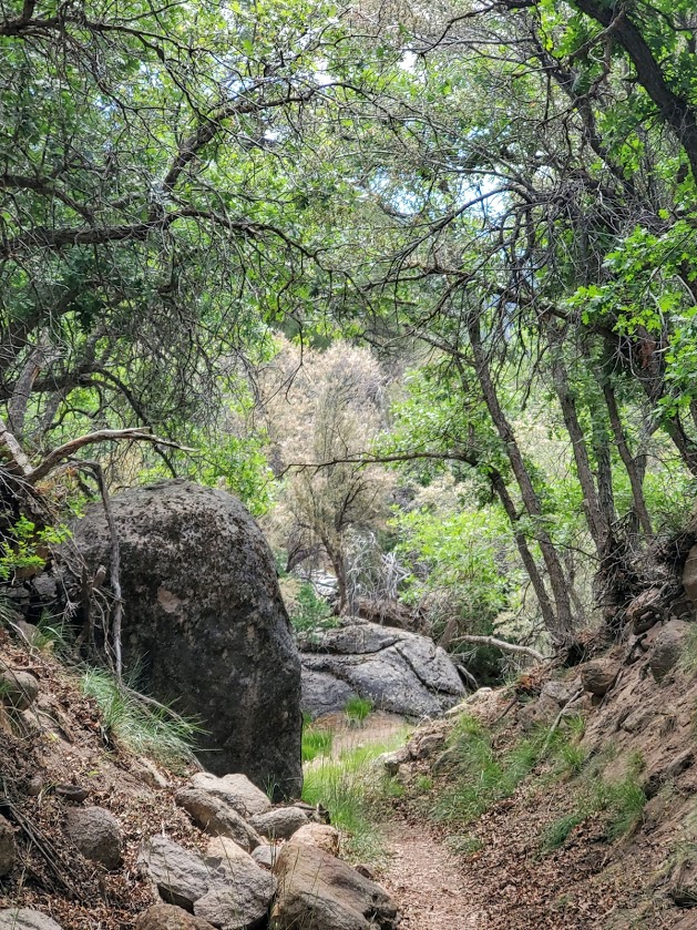
Named after its creator, Henry Honaker, this rugged route dates back to the 1890s and the heyday of Utah’s Wild West gold rush. Thank him for this scenic, cliff-hugging trail that originated as a supply route from the San Juan River to the rim ledges. While the gold rush here was short-lived, the trail has been a long-lived attraction for scientists, geologists, recreational hikers, and rafters. The dramatic geological formations date back 300 million years and are a source of fascination for all.

As you descend the trail, you may note how the rock colors and their composition change. As you pause to take in the panoramic views, catch your breath, and gulp some water, keep your eyes open for fossils (including crinoids, brachiopods, and various trace fossils). In the dry and sometimes unforgiving desert, it’s hard to imagine there was a time when all of this was underwater.

The yellow numbers that you’ll see painted on the cliffs are remnants from a 1952 field symposium on the rocks of the Honaker and Paradox Formations, not a tabulation of the numerous switchbacks though they may seem so.
While it’s always a reward to jump in a lake or a river on a hike, the silty San Juan River may refresh you but likely won’t dazzle you with her mud-colored water.

The Honaker Trail is a great, off-the-beaten-track adventure hike and a must-do for geology buffs. We only encountered a couple of rafters exploring the bottom reaches of the trail.
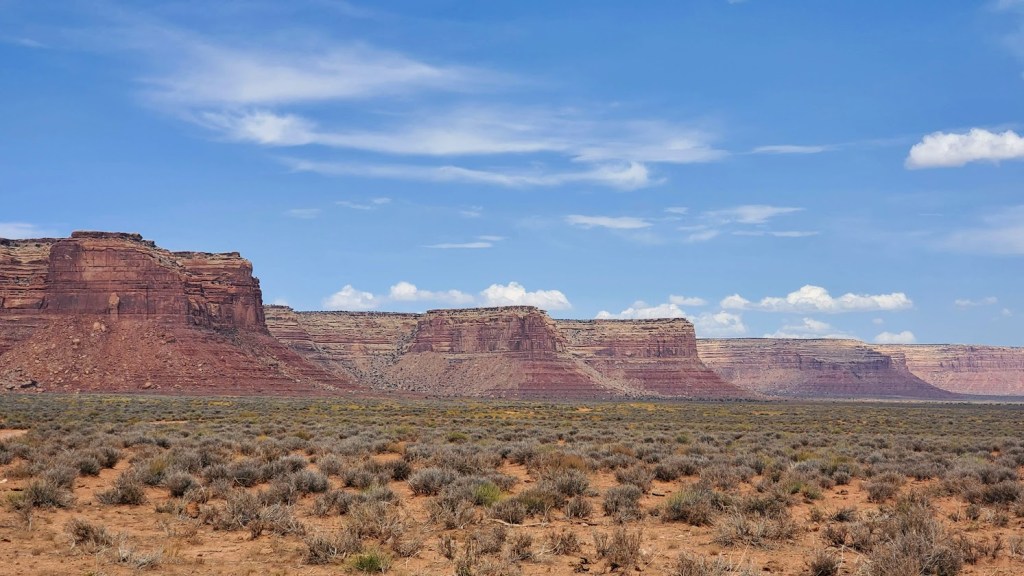
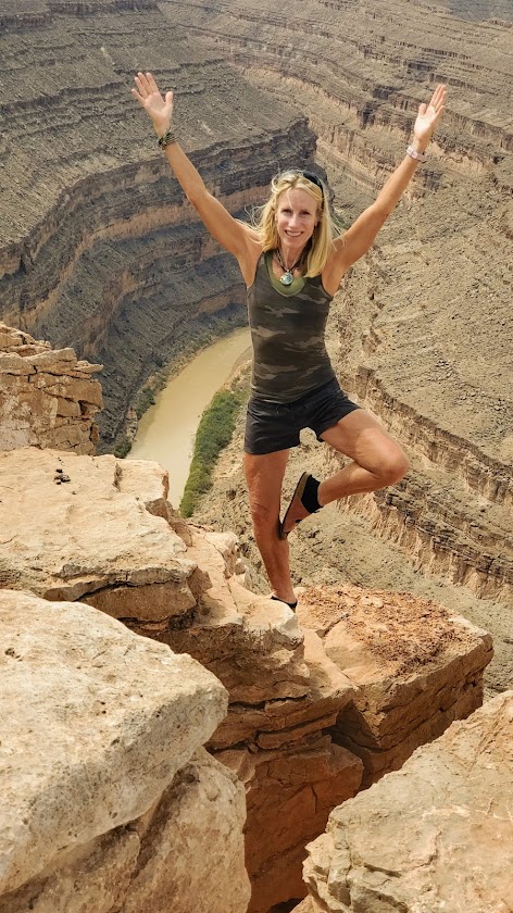
Notes: Of course, you must drive into Goosenecks State Park itself to enjoy the main panoramic viewpoint while you’re there. The feature photo is from that viewpoint as are these next two.

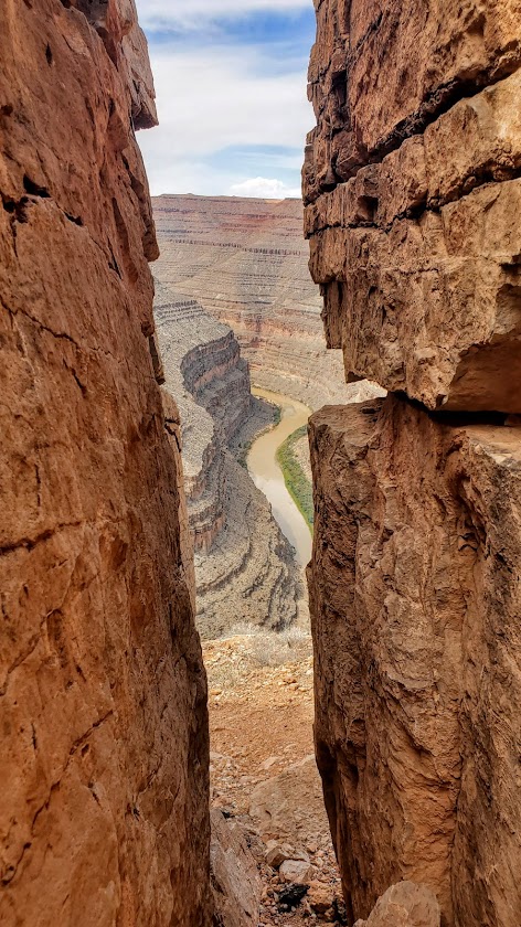
On a clear day, you can see Monument Valley in the distance. Bring an excess of water & Gatorade—what you think is too much will be just right. This trail is completely exposed, so get an early start if you’re going in the summer and be equipped with sunscreen, a hat, and EXTRA water. (Yes, I know I mentioned that already.)
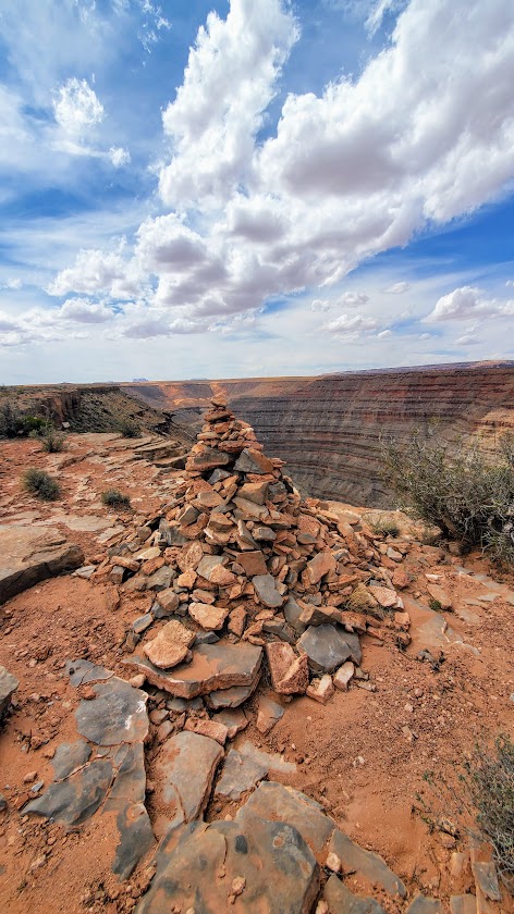
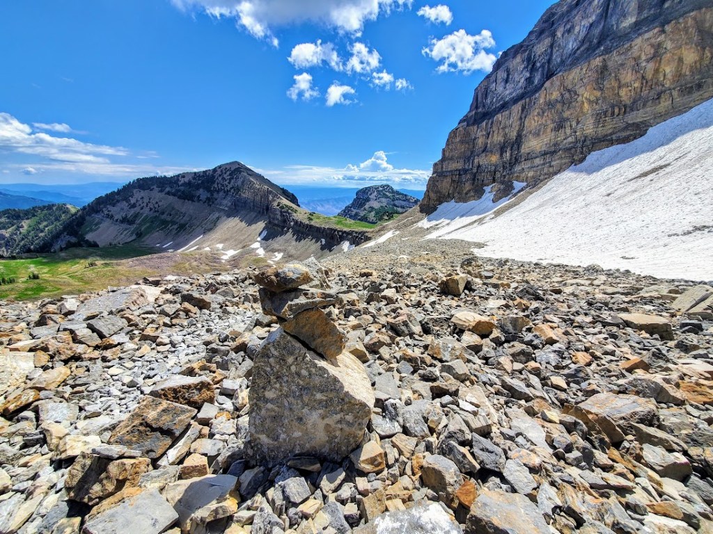
Getting there: There are no signs for this trailhead. It’s marked only by a huge cairn pyramid at the start of the trail and at the bottom. At Goosenecks State Park, take the dirt road at mile marker 3 (before the entry gate) and stay left when it forks. A 2WD car can make it to the first unmarked “parking area,” and it’s just .25+ to the trailhead from there. Otherwise, a 4 WD, high-clearance vehicle can take you to a “parking area” closer to the trailhead.
It’s a scenic drive as well.
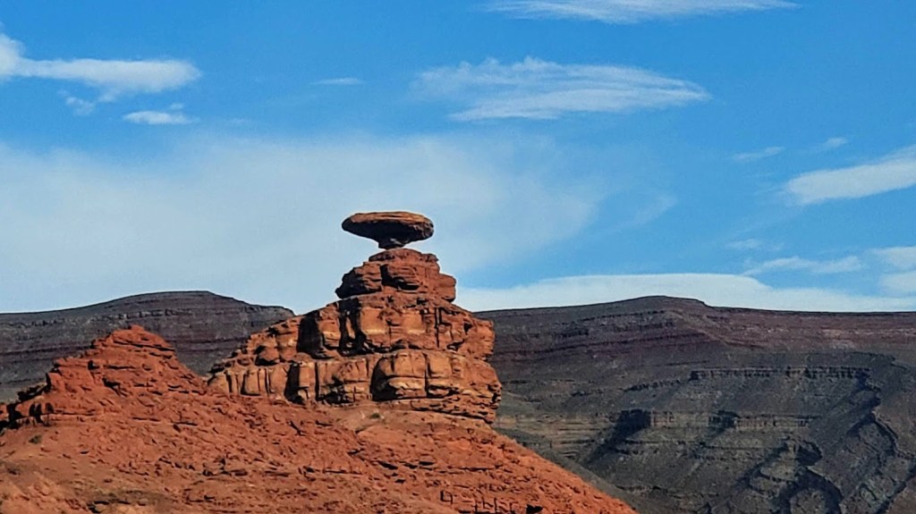
Oh, and here’s a pic of Mexican Hat along the way. Beauty everywhere you look.
Happy Trails!