Adventures Near & Far, St. George Yoga & Hike Retreats, Popup Yoga, Local Guiding
Search Icon
Author: livevigorously
Greetings, I’m a St. George local who is passionate about blending my love for yoga, and the great outdoors to create an unforgettable experience just for you. Enjoy outdoor yoga (all levels) in an iconic setting and/or a guided hike to secret petroglyphs, caves, and slot canyons. With stunning Snow Canyon as my backyard, I'd love to be your guide to the best this area has to offer! Ask about my "home stay" options.
First stop on the Utah road trip after 6 hours cooped up in the car, the Red Cliffs Desert Reserve rolled out their welcome trails. Not a bad stop to stretch the legs for hike or a mountain bike cruise. This picturesque reserve with expansive views out to the snow capped mountain range is right next to town and boasts 200 miles of non-motorized trails. (Yes, that’s 200 miles so you can stretch those legs of yours to your hearts content.)
The reserve was established in 1996 to protect critical desert tortoise habitat form being destroyed by development. It worked. You’ll notice tortoise scat on the rocks everywhere. And if you’re lucky, you might see one.
I only hiked a couple miles here, but look forward to coming back to explore more. Perhaps on 2-wheels next time…
Note: the trails can be hard to follow in this terrain so bring a good map or GPS if you venture out very far, and plenty of water, of course, as it’s all exposed.
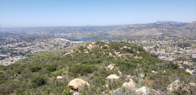
This small 40-acre park near Lakeside has 1 short trail that takes you up a consistent, steep incline to a great vista above Escondido and Lake Jennings.
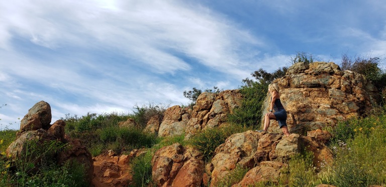
Once you reach the saddle you can go east to reach a short peak or west to climb Silverdome Peak or south for Flynn’s Peak. I’m not sure which one we scrambled up, but it was definitely a scramble.
It’s rated as moderate, but if you are less than moderately fit, it’s likely you will suffer. (Especially if it’s a hot day as the trail is completely exposed.) That being said, it’s a good, short workout and “bun burner”.
A little trail eye candy
I wouldn’t go out of my way for this one, but if you’re driving by and want a leg stretcher / burner—go for it.
There’s picnic tables and a lovely wood pavilion too.
San Diego County’s 3-tiered seasonal waterfall in Cleveland National Forest is definitely worth a visit when the water is running.
At the beginning of the hike, these 3 lovely trees will greet you.
The falls are much more impressive than you might expect. As you hike down the trail, you can see the frothy, white veils in the distance.
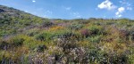
For me, it was vaguely reminiscent of Yosemite. Of course, I was fortunate to experience the area after a rainy season, during the spring super bloom. The hillsides were green and sprinkled generously with wildflowers. If you’ve been following my superbloom posts (Walker Canyon, Diamond Valley Lake, Denk Mountain) this spring, you know I can’t get enough of these wildflowers. (I wasn’t expecting any on this hike and what a wonderful surprise to see the colorful abundance along the trail – perfect wildflower filters for my distant water shots.)
It’s a pleasant single-track, out & back trail that takes you down to the falls and then bring you back up to the parking area.
The falls are a wonderful spot to have a picnic, cool off, and while away the afternoon – that is if you don’t mind being joined by too many humans who have the same idea. (Heavy sigh.) Be forewarned, this is one of San Diego’s most popular hikes so go early or be prepared for the crowds and a full parking lot.
If you want to add on another hike, the Cedar Creek Falls hike is in the vicinity too. Since I’ve done that one already, I decided to take the scenic drive out the other side on Descanso Road.
The Scoop on 3 Sisters Waterfall Hike
Distance: 4 miles RT (out & back)
Elevation gain/loss :1000 ft (downhill on the way out, uphill on the way back)
Difficulty: Easy to moderate, depending on your fitness level. Trail run friendly on a non-crowded morning.
Getting there: From the town of Julian, turn left on Pine Hills Road, right on Eagle Creek, and left on Boulder Creek Road, which will become dirt road for the last 5 miles.
Note: Both Boulder Creek and Descanso are dirt roads with potholes, but no suv or 4-wheel drive needed. A regular passenger car with adequate ground clearance will do the trick as you have patience with potholes and bumps. However, it might not be prudent to attempt it without a SUV or 4-wheel drive after a heavy rain.
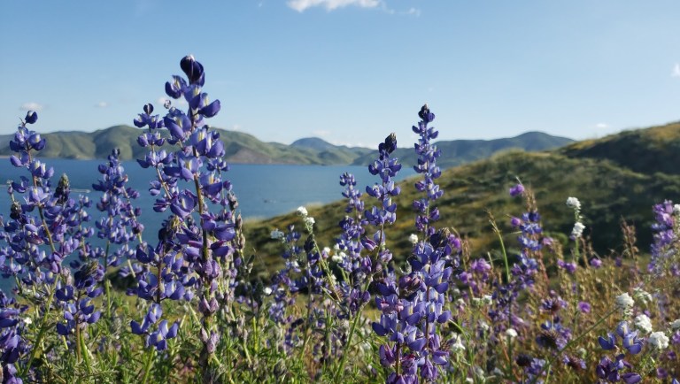
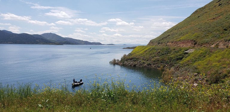
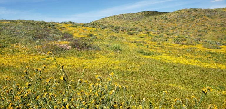
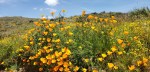
Cruising the 21.8 mile Lakeview trail around Diamond Valley reservoir on mountain bike during the wildflower super bloom last weekend was a delight. It’s a flat, family-friendly fire-road with lake and snow -capped mountain views that don’t disappoint. Yes, this was seeing it dressed in its wildflower season best. And no, you probably won’t want to do it in the blazing heat of the summer as it’s all exposed. But it’s just right, right now – for running, hiking, biking, boating, and fishing. (It’s stocked with rainbow trout, large mouth bass, striped bass, bluegill, small mouth bass – catch and release only though.)
Lupine Filter
Lupine Filter
Poppy Filter
How many places can you take a scenic, peaceful 21 mile bike ride and have it virtually all to yourself on a weekend? Ok, Catalina, but where else? (Granted the little wildflower hike was much busier, but less by the time I was done with my mountain bike ride.)
Mellow yellow wildflower extravaganza
Birds, bees, wildflowers and snow capped mountains
Here’s your wildflower sampling: Poppies, Arroyo Lupine, California Goldfields, Brittlebush, Owl’s Clover, Canterbury Bells, Chia, Baby Blue Eyes, and more!
Did I mention to be on the lookout for rattlesnakes?
[Rattlesnake video courtesy of Ken Wells.]
Fee: $10 per car, $3 per person for trail entry – worth it.
Getting there:
The entrance to Diamond Valley Lake is off of Domenigoni Parkway, which connects with Highway 79 on the west side of the lake and State Street on the east. You can take State Street south from Highway 74 in Hemet.
Mileage and Driving Times to Diamond Valley Lake
Miles
Hours
Mins.
Anaheim
77
1
24
Los Angeles
93
1
37
Pomona
63
1
10
Riverside
40
0
48
San Diego
87
1
34
Santa Barbara
188
3
06
Can’t get enough of the California Wildflower Superbloom 2019? Neither can I. Check out my Walker Canyon and Denk Mountain posts.
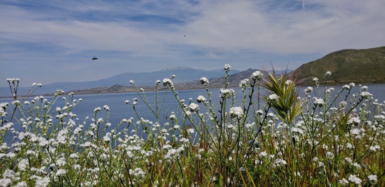
Granted, I was lucky enough to hit this hike at its most beautiful, during the spring super bloom (poppies and native wildflowers galore), but year-round, on clear days , you can enjoy lovely views of Batiquitos Lagoon and the coastline from Camp Pendleton to La Jolla.
Denk Mountain is part of Rancho La Costa, a habitat conservation area in Carlsbad made up of several non-contiguous parcels of land, including Denk Mountain and Ridgeline Trail above Box Canyon. These are some of the most rugged in the area, which make it a local mountain bikers’ favorite.
Trail notes: You have choices on this loop trail. For surer footing sake, I recommend you go up the steeper, more rugged / rocky Mule Deer Trail and come down the more moderate, less rugged Switchback Trail. The hike is completely exposed so be prepared with sunscreen, a hat and sunglasses.
Total Distance:
3.5 miles
Difficulty:
Easy to moderate – depending on your fitness level
Total Ascent
690 feet
Dogs
Leashed dogs allowed
Mt. Bikes
Bikes allowed
Facilities
None
Parking
FREE, along Corte Romero
Getting there: From the 5, take the La Costa Ave exit East and continue for 4 miles. Turn left onto Rancho Santa Fe Road and at .8 miles, turn right onto Camino Junipero, then in ~ .2 miles turn left onto Corte Romero. Park along the street. The trail head is on the right.