Bloods Lake Trail, A Short, Pleasant Park City Trail. Beware the Parking Sticker Shock!

Distance: ~3 Miles

Elevation Gain: 462 FT

Difficulty: Easy +, depending on your fitness level and altitude acclimation

Elevation: 9,174 – 9,519 FT

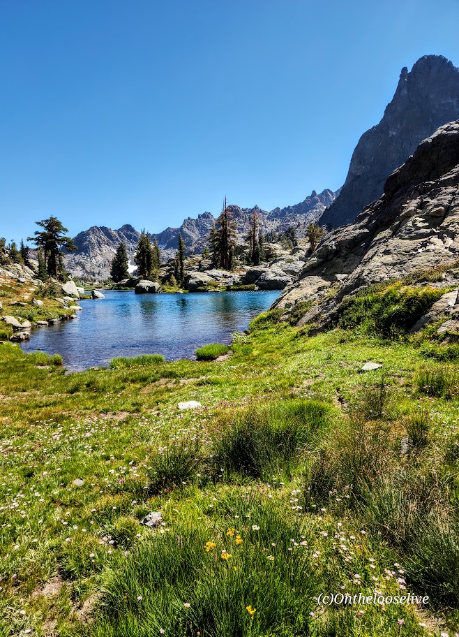
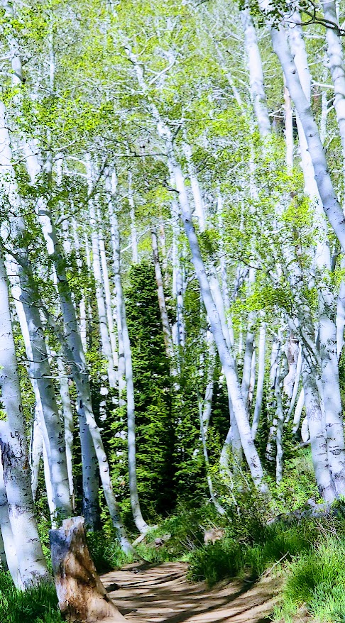
Named after the Bloods family, a pioneering family who homesteaded the area (not for what’s circulating in your veins or the lake color), the Bloods Lake trail is a short, pleasant stroll through the woods with a gradual incline on the smooth terrain of a well-groomed trail (trail runnable).

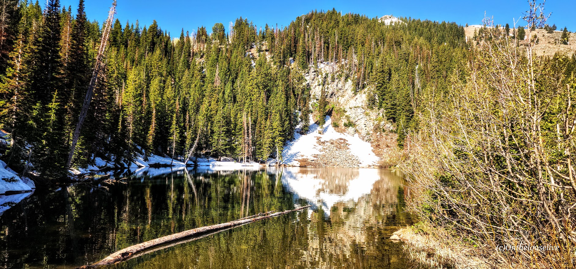
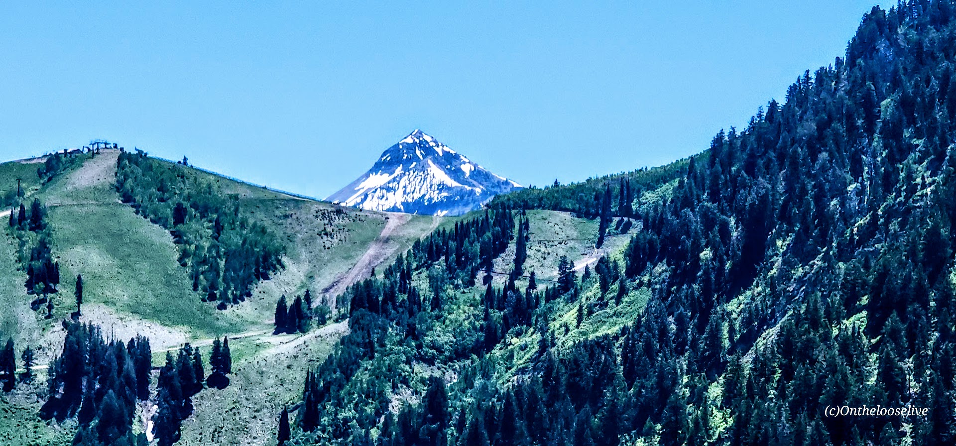
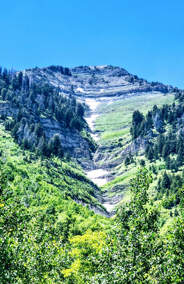
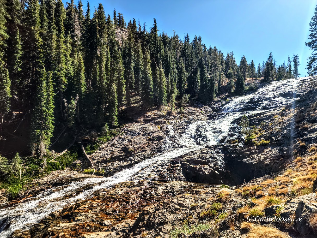
I wanted to make this shortie longer, but there was far too much snow beyond this lake. If you arrive after snow melt or have snowshoes, you can continue on to Lake Lackawaxen, named after its namesake river in Pennsylvania (2.6 miles, 1 way), Clayton Peak (2.7 miles, 1k FT elevation gain, 1 way), and Peak 10420 (2.5 miles, 1 way). Even if you hit them all, you won’t be able to get much mileage here.

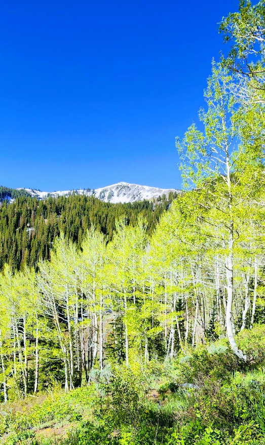
This area is part of the Bonanza Flat Conservation Area, which was saved from development in 2017 thanks to a collaborative effort of various organizations and individuals. While that is indeed something to celebrate, they are recouping their costs aggressively, presumably to “manage increasing use, reduce congestion, and protect the area”. This is the most expensive trailhead parking scheme I have EVER encountered. They charge by the hour! It’s $5 per hour on weekdays and $8 per hour on weekends. Apparently, those who are privileged enough to live in the 84060 Park City zip code can apply for a free parking permit.

I paid $16 in advance, hoping I would make it to Clayton Peak and back. Deep snow stopped me at Bloods Lake, so I finished my hike within an hour with no recourse for a refund. Was it worth $8, yes – $16, no. As you can tell, I find this fee system utterly obnoxious. Though the silver lining is that it does motivate you to keep a fast pace, which I like- lol.

Getting there: The trailhead is one of several hiking trails along the super scenic Guardsman Pass.

Notes: Parking fills early on the weekends! Exorbitant hourly parking fees ($5 per hour on weekdays and $8 per hour on weekends)!

Happy Trails!

Anasazi (Tempi’po’op) and Tutkupetsi Trails, a Local, Family Friendly Favorite for Petroglyphs, Fall Colors, and Grand Views

Difficulty: Easy

Distance: Short: 1-5 miles; you can combine trails to make a longer loop

Sometimes, we take the people and things closest to us for granted. That’s the case for me and my local Anasazi (Ivins) and Tukupetsi trails (Santa Clara). These easily accessible, connecting trails are short (runnable and mountain bikeable), featuring the intriguing Land Hill petroglyph site, a fenced-in farmstead ruin once used to store food and herbs, and grand views in every direction.

I like these trails best when the Cottonwoods light up the rugged desert landscape with their vibrant flash of yellow, tracing the meandering (and meager) path of the Santa Clara River below. You can find me there, chasing leaves and golden light in my annual frenzy to catch it just right.

Take in the panoramic views of Red Mountain, Pine Valley Mountain, and, on a clear day, as far out to Zion from the ridge.

I will only post a couple of petroglyph pictures. I’d like you to be able to discover them for yourself.

If you’re interested in learning more about petroglyphs, my hiker/yogi friend, Sue Birnbaum, an adventure blogger, has thoroughly researched and written a great post on the subject, including recommendations for further reading.

Here are some highlights from the Tukupetsi side in Santa Clara from the vantage points of the upper and lower trails.

And more from Fall 2025.

Notes: Remember to leave no trace and respect all ancient petroglyphs and ruins. Please do not touch, step, sit on, or deface them. Oils in your hand can damage them, as can debris from your shoes. Perhaps think of them as outdoor museum art and appreciate their mystery.

These easy, short, fun hikes are offered by onthelooselive yoga and hike retreats and day adventures.

Happy Trails!

Stupendous Stewart Falls in the Summer and Fall, Sundance, UT

Distance: ~3.5 miles out and back via lower trail

Elevation Gain: 650 ft (You’re starting at about 6,100 ft)

Difficulty: Easy to moderate, depending on your fitness level

I finally made it to the spectacular 200-foot, double-tiered Stewart Falls! What took me so long?

(The truth is, I’m guilty of prioritizing marvelous Mount Timpanogos via the Aspen Grove or Timpooneke routes when I’m up here and rarely have time to fit in this quickie.) This time, I fit in Lake Blanche in the morning and made this my afternoon destination. A bit of driving, but worth it.

This lovely, runnable, single-track trail through the forest is especially enchanting in the Fall, with the Aspens at the height of their color. You can’t beat the splendid reward of this shortie

Make a day of it; check out the beautiful grounds of the Sundance Resort, grab a bite, and browse the shops.

Turns out Stewart Falls is just as splendid in the summer. In fact, with the snow melt, it really rushes and mists, and you may get to see additional falls!

Getting there: The trail begins at the Aspen Grove Trailhead parking lot. The entrance fee is $10 or free with a National Park Pass. This lot fills early, and they do ticket cars along the street. Pay close attention to the “No Parking” signs; they’re easy to miss.

Happy Trails!

Spectacular Shadow of the Minaret, Inyo National Forest, Mammoth, CA.

The Shadow to the Minaret (Agnew Meadows to Devil’s Postpile) route packs so much breathtaking beauty into a challenging 17-mile hike. Backpacking might be the best way to experience it, or you can choose a waterfall or any of the 7 amazing alpine lakes (Olaine, Shadow, Ediza, Iceberg, Cecile, Minaret, and Johnston) along the way as your destination for a shorter out-and-back hike. I wanted to see as much as I could in the limited time I had in the area, so I did it as a day hike.

Miles: 17, or create your own out-and-back adventure (~7 miles RT to enchanting Ediza Lake with only 400 feet elevation is an excellent option for a shorter day hike and is popular for good reason ).

Elevation gain: ~2.529

Difficulty: Hard/Challenging, especially for a day hike

From Agnew Meadows, you’ll encounter Olaine Lake first, then the gorgeous tiered Shadow Creek Falls, Shadow Lake, and dazzling Ediza Lake.

Enchanting Ediza Lake

Take the trail above Ediza Lake for a glimpse of dramatic Iceberg Lake.

From there, if you wish to venture beyond, you’ll have to climb/scramble the rugged loose scree and talus cliffs to reach Cecile Lake.

Note that I wouldn’t recommend attempting this if snow is present. There’s an argument if you’ve come this far to keep going. You’ll need to boulder hop for a half mile or so around Cecile to get to the slippery, rugged drop into Minaret Lake.

Scaling Iceberg’s cliffs, boulder hopping around Cecile, and “sliding down” the loose sandy “trail” into Minaret can be quite time-consuming despite these sections’ short distances. (Some AllTrails hikers reported it taking 2 hours for these miles 9 & 10 .) I made it up Iceberg in 20 minutes or so, but I am accustomed to scaling rugged, steep landscape. The boulder hopping around Cecile Lake was slow going for me, and the slide down into Minaret was even slower as my knees did not appreciate the vertical angle.  

From Minaret to Devil’s Postpile, it’s all downhill with some rocky sections. Highlights include a wonderful, wide, terraced waterfall, and close to the end, a cool canyon area with a stream going through it, and finally, Johnston Lake.

Notes:

Get to the Agnew Meadows trailhead before 7am for self-drive and parking, or take the shuttle.

Equipment: Would poles have helped on the descent to Minaret? I’m not sure. Personally, I prefer to have my hands free. Prophylactically for me, knee braces would have been a good call, but not needed until the Minaret descent. If you’re going over 12 miles, I’d recommend hiking shoes. Much as I love hiking in light trail runners, my feet were beaten up/done at the end of this 17-mile day.

Was it worth it? ABSOLUTELY! I hope you can see why.

Happy Trails!

Ruby Mountains, a Sparkling Crowned Jewel in the Humboldt-Toiyabe National Forest, NV

The Eastern Sierras Ruby Mountain range (often compared to the Alps) was named for the gems found there during the gold rush. The name is a misnomer, though, as the dark red gems discovered in these mountains were garnets, not rubies.

While no gold was ever found in the Ruby Mountains, treasures abound—two dozen dazzling alpine lakes and streams lively with Rainbow, Brook, and Lahontan Cutthroat Trout, meadows, and healthy forests. This rich wilderness area is home to one of the largest mule deer herds in Nevada and populations of mountain goats, bighorn sheep, and Himalayan Snowcock. (Oddly, I didn’t see any of them on my overnight backpack.)

The Ruby Mountains’ craggy, glacier-carved peaks rise nearly 5,000 feet above the valley below and are capped by Ruby Dome at 11,387 feet. The elevation on the trails ranges from 7,ooo ft to 11k. Trail length varies from a couple of miles to multi-day thru-hikes—choose your adventure. The main trails are well-marked and maintained, easy to follow, and easy on the feet. Explore for an afternoon or overnight backpack, as I did. If you’re like me, you’ll be dazzled by the glimmering alpine lakes and the sparkling night sky.

I went on an overnight backpacking trip here in September 2023. Yes, I’m way behind in my posts (understatement). I explored half a dozen lakes, including Liberty Lake, Lamoile Lake, Farvre Lake, and Castle Lake. I shall return and will provide more details then. Until then, click here for more info about the Rubies from “Travel Nevada.”

By now, you know that I have a thing for alpine lakes. While I could have lingered for days at any of the gems I visited, I did venture up above the treeline to take in the grand views as well. As you can see, it’s a completely ifferent vibe at a higher elevation – there are ten peaks over 10k feet here, and the highest is Ruby Dome at 11,387 feet

Night skies are wonderful here (Saw a rocket launch and a huge meteor!) And even on a weekend, solitude abounds!

Note of caution: Elko is 21 miles away from the Ruby’s; you’d think a place so close to this spectacular wilderness area would take pride in its gateway status. Sadly, Elko has one of the highest crime rates in America compared to communities of all sizes. (Elko’s population is only 20K!) The chance of becoming a victim of violent or property crime is 1 in 30. YIKES! Making it your adventure base camp, especially if you are a woman traveling solo, is ill-advised. Bring a hiking buddy and head for the mountains. (Common sense—don’t leave any valuables in the car.

Elko history: Elko was settled in 1869 with the development of the Transcontinental Railroad and became a base for gold and silver mining and livestock ranching. Unfortunately, it seems that it’s been downhill since then. There are 6 legal brothels in this small town of 20k, and the seedy element they attract is

Getting there:

From Elko, follow State Route 227 southeast toward the tiny town of Lamoille. Just before entering Lamoille town limits, turn right on the paved 12-mile Lamoille Canyon Scenic Byway and follow it to the parking area at its terminus.

Happy Trails!

(Here I am overloaded with my old heavyweight gear (3 lb surf backpack, 3.5 lb sleeping bag, 7.5 lb tent, 4 liters/8 lbs of water, etc., etc.). My last overnight backpack was years ago on Mt. Whitney. I guess my knees and back could still handle a heavy, poorly distributed load then. This time, the struggle was real. In the picture here, who knows if I’m grimacing or smiling in relief that most of the climbing was done. Since then I have opted for ultralight camping gear, which cuts my load by more than half. Stay tuned for an upcoming gear post.