Ruby Mountains, a Sparkling Crowned Jewel in the Humboldt-Toiyabe National Forest, NV

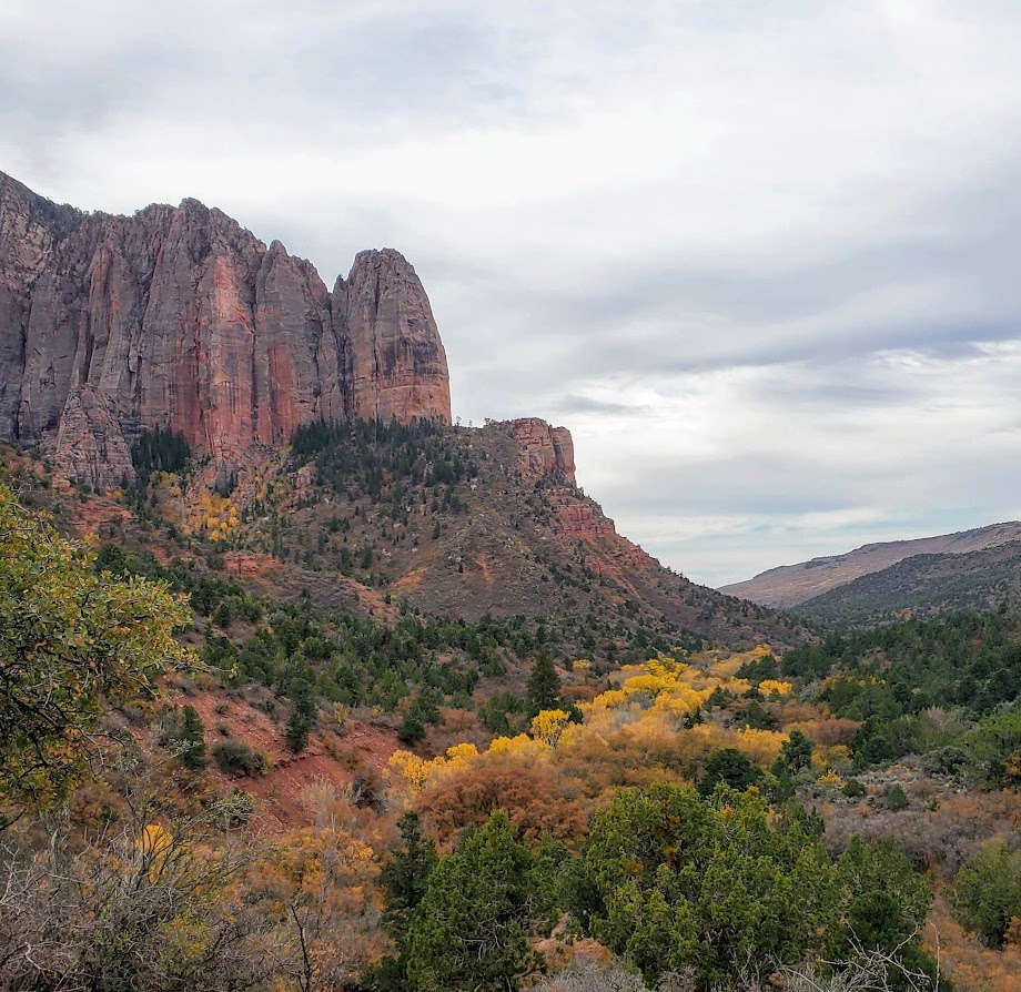
The Eastern Sierras Ruby Mountain range (often compared to the Alps) was named for the gems found there during the gold rush. The name is a misnomer, though, as the dark red gems discovered in these mountains were garnets, not rubies.

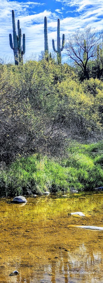
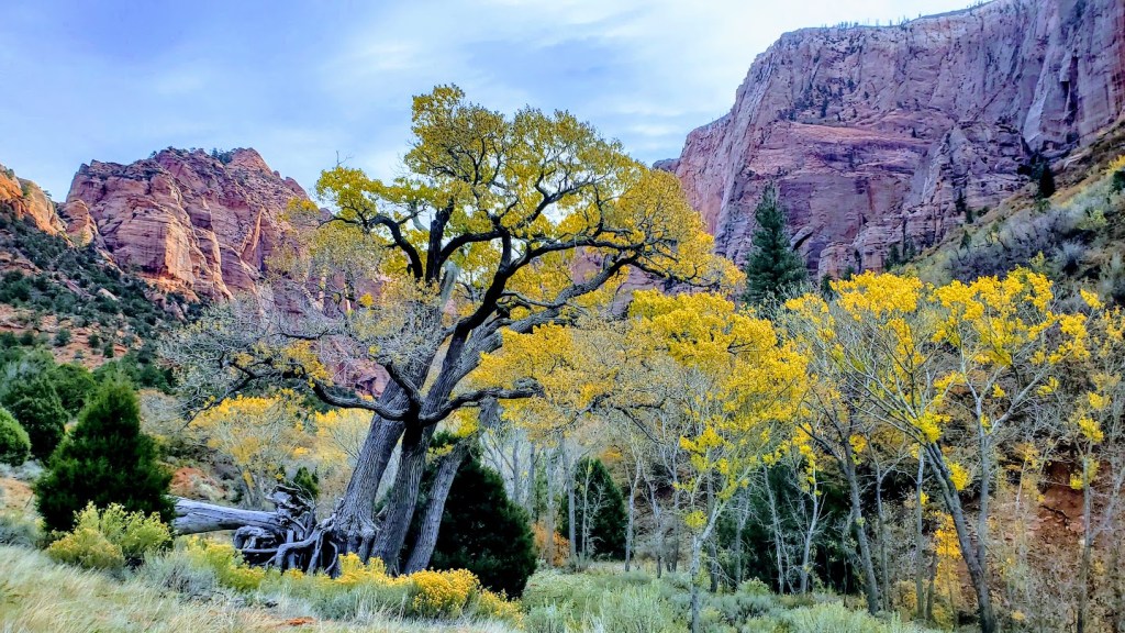
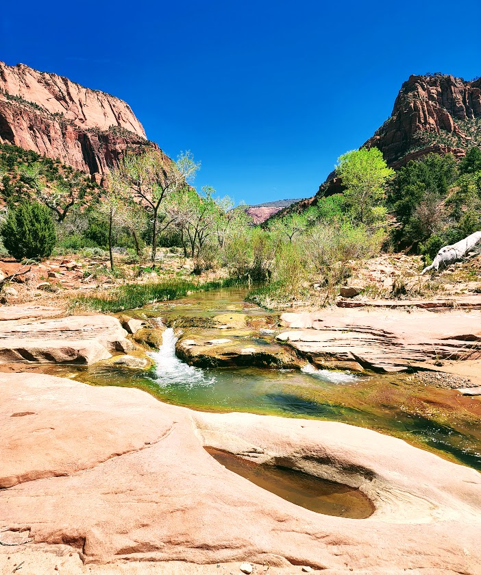
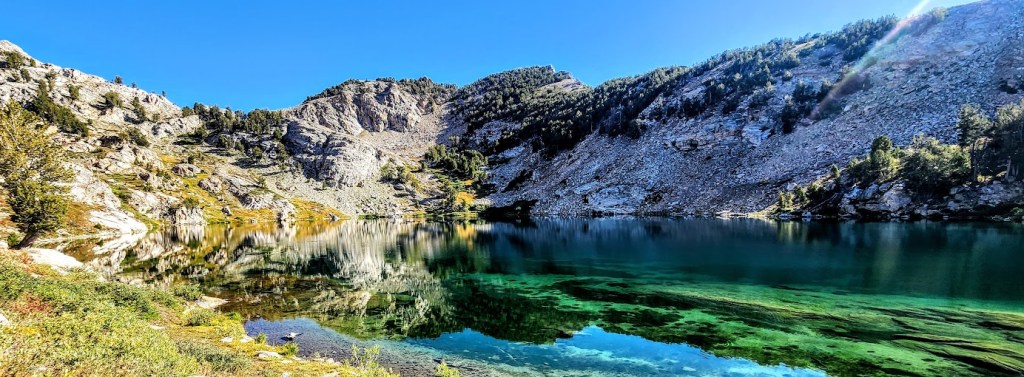
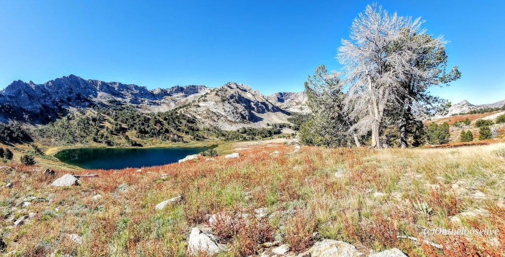
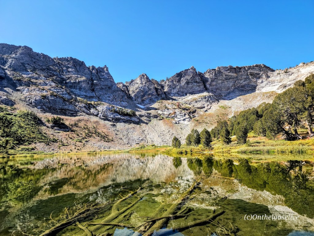
While no gold was ever found in the Ruby Mountains, treasures abound—two dozen dazzling alpine lakes and streams lively with Rainbow, Brook, and Lahontan Cutthroat Trout, meadows, and healthy forests. This rich wilderness area is home to one of the largest mule deer herds in Nevada and populations of mountain goats, bighorn sheep, and Himalayan Snowcock. (Oddly, I didn’t see any of them on my overnight backpack.)

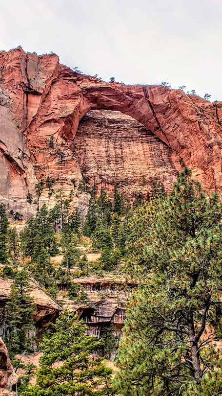
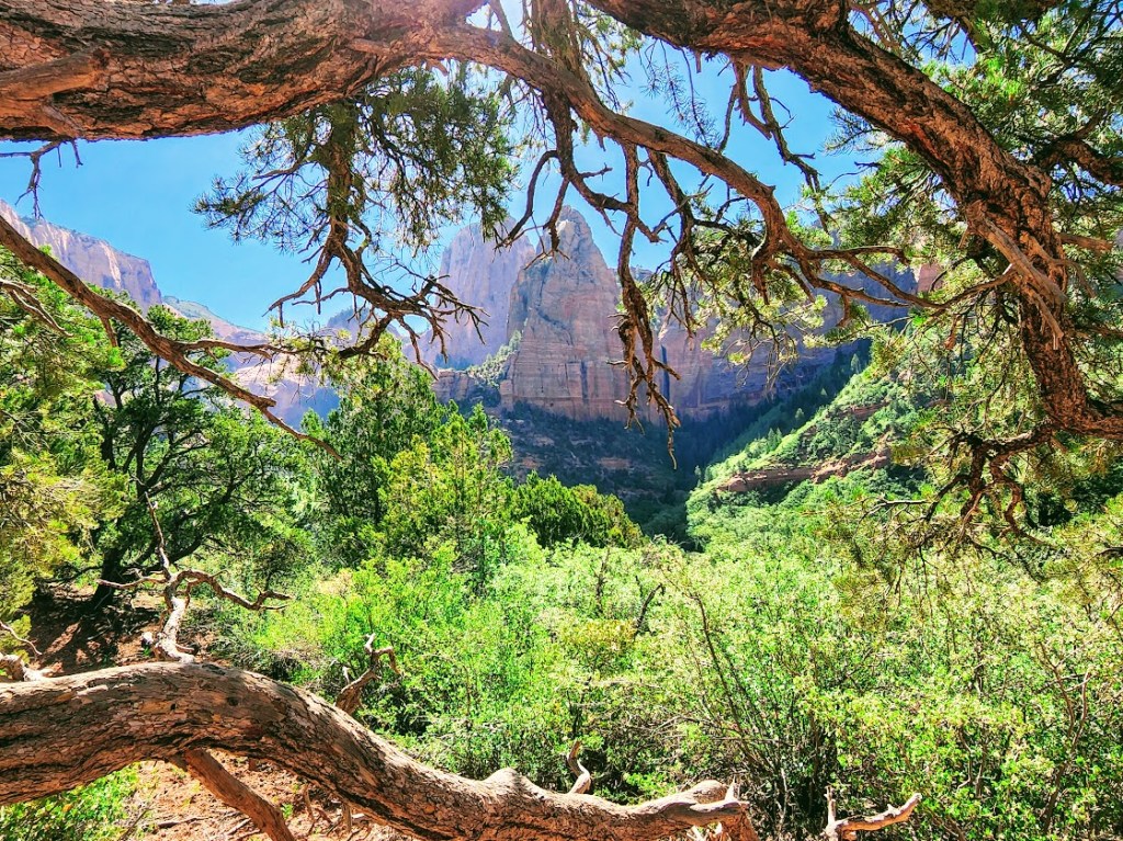
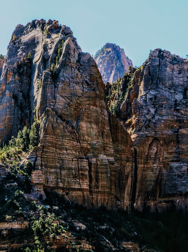
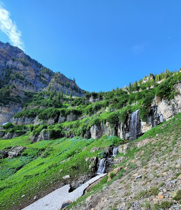
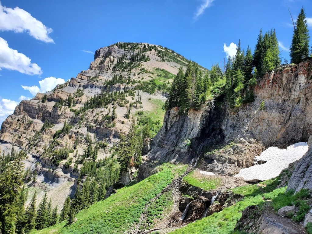
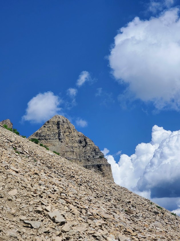
The Ruby Mountains’ craggy, glacier-carved peaks rise nearly 5,000 feet above the valley below and are capped by Ruby Dome at 11,387 feet. The elevation on the trails ranges from 7,ooo ft to 11k. Trail length varies from a couple of miles to multi-day thru-hikes—choose your adventure. The main trails are well-marked and maintained, easy to follow, and easy on the feet. Explore for an afternoon or overnight backpack, as I did. If you’re like me, you’ll be dazzled by the glimmering alpine lakes and the sparkling night sky.

I went on an overnight backpacking trip here in September 2023. Yes, I’m way behind in my posts (understatement). I explored half a dozen lakes, including Liberty Lake, Lamoile Lake, Farvre Lake, and Castle Lake. I shall return and will provide more details then. Until then, click here for more info about the Rubies from “Travel Nevada.”

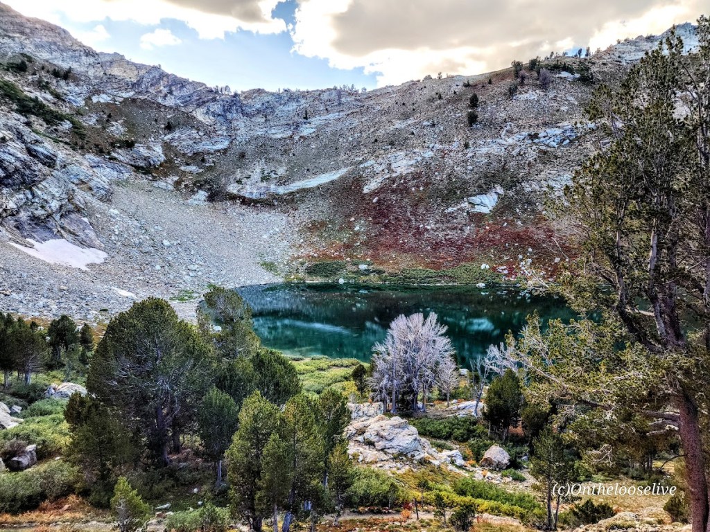
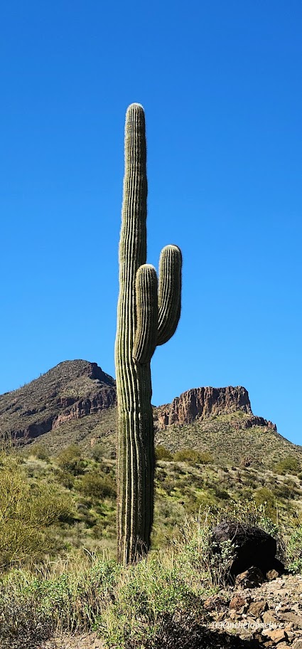
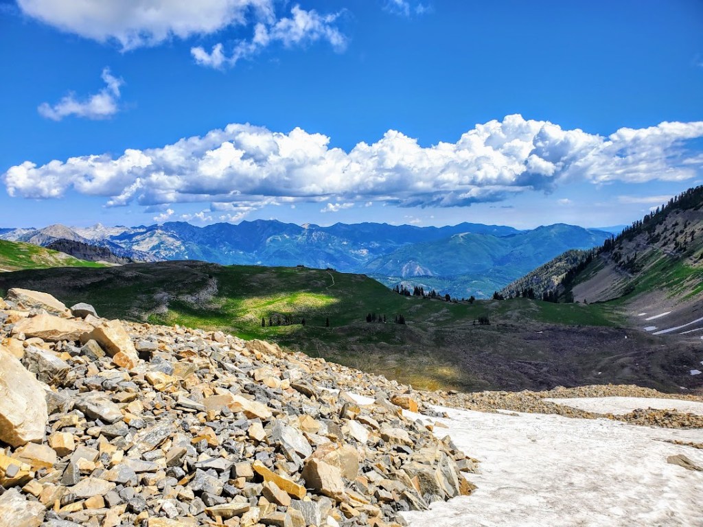
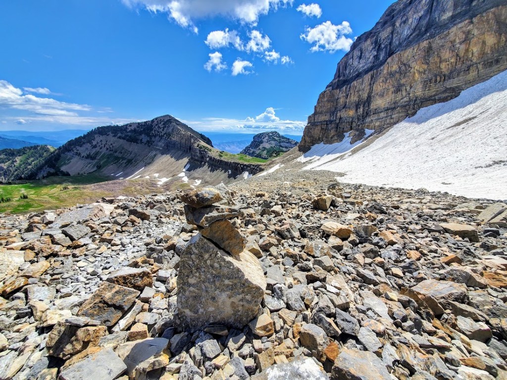
By now, you know that I have a thing for alpine lakes. While I could have lingered for days at any of the gems I visited, I did venture up above the treeline to take in the grand views as well. As you can see, it’s a completely ifferent vibe at a higher elevation – there are ten peaks over 10k feet here, and the highest is Ruby Dome at 11,387 feet

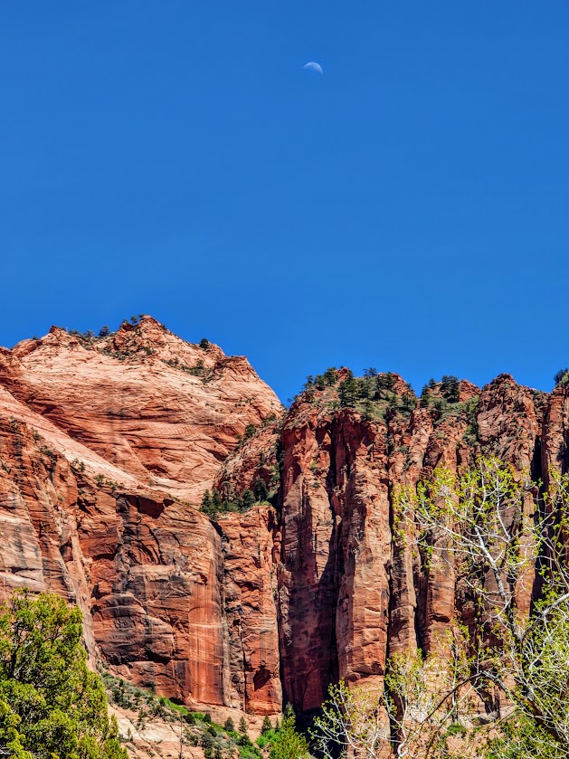
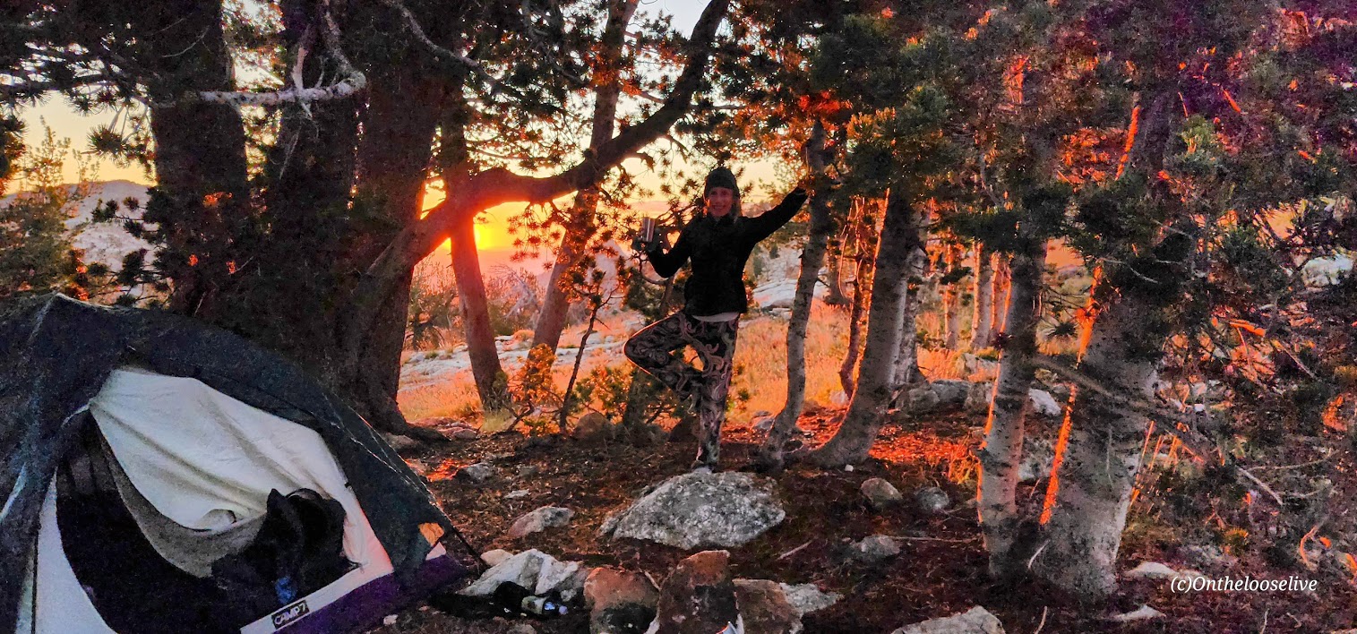
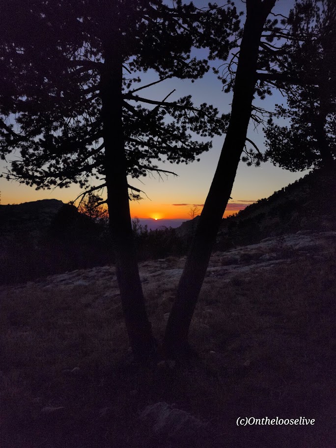
Night skies are wonderful here (Saw a rocket launch and a huge meteor!) And even on a weekend, solitude abounds!

Note of caution: Elko is 21 miles away from the Ruby’s; you’d think a place so close to this spectacular wilderness area would take pride in its gateway status. Sadly, Elko has one of the highest crime rates in America compared to communities of all sizes. (Elko’s population is only 20K!) The chance of becoming a victim of violent or property crime is 1 in 30. YIKES! Making it your adventure base camp, especially if you are a woman traveling solo, is ill-advised. Bring a hiking buddy and head for the mountains. (Common sense—don’t leave any valuables in the car.

Elko history: Elko was settled in 1869 with the development of the Transcontinental Railroad and became a base for gold and silver mining and livestock ranching. Unfortunately, it seems that it’s been downhill since then. There are 6 legal brothels in this small town of 20k, and the seedy element they attract is

Getting there:

From Elko, follow State Route 227 southeast toward the tiny town of Lamoille. Just before entering Lamoille town limits, turn right on the paved 12-mile Lamoille Canyon Scenic Byway and follow it to the parking area at its terminus.

Happy Trails!

(Here I am overloaded with my old heavyweight gear (3 lb surf backpack, 3.5 lb sleeping bag, 7.5 lb tent, 4 liters/8 lbs of water, etc., etc.). My last overnight backpack was years ago on Mt. Whitney. I guess my knees and back could still handle a heavy, poorly distributed load then. This time, the struggle was real. In the picture here, who knows if I’m grimacing or smiling in relief that most of the climbing was done. Since then I have opted for ultralight camping gear, which cuts my load by more than half. Stay tuned for an upcoming gear post.

Climbing Corkscrew Peak, Death Valley National Park, CA

Distance: ~8 miles

Elevation gain: ~3,360 ft

Difficulty: Moderate to strenuous, depending upon your fitness level (3k ft climb in ~2 miles). Class 2.

Corkscrew Peak (5,804 ft) is the imposing sentinel in the Grapevine Mountains of northern Death Valley National Park. It looks intimidating from afar and upon the approach, but the trail isn’t bad, and it’s a great workout. Definitely one of the most unique peaks I’ve seen.

Speaking of trails, the first portion requires some route finding. Head West from the Corkscrew Peak sign and follow the wide wash towards the peak. The route is cairned, gentle, and gradual, leading you to a narrow canyon area at about the 2-mile mark. Here, you’ll scramble up and out of the wash on the left. You’ll climb the spiraling rocky trail for the next 2 miles. Watch your footing, as there are many spots of loose gravel. All told you’ll be climbing 3,360 feet to the top—most of it packed into a somewhat intense 2 miles.

Right before you reach the top, there’s a cool natural window, a nice spot to return to enjoy a snack, and the view before the steep, slippery descent.

From the top, you’ll enjoy splendid views of Death Valley and surrounding peaks, including Langley, Whitney, and Telescope. You can also document your peak bag in the summit record, which is in a metal container wedged between some rocks at the top.

Getting there:

From the Visitors Center at Furnace Creek, drive ~ 11 miles N on State Highway 190 to the signed, paved Daylight Pass Cutoff Road toward Beatty, NV. Turn right and follow this road 10 miles to a signed road fork at Hell’s Gate. Go right onto Daylight Pass Road and drive 0.9 miles. Park on the dirt shoulder.

Notes: The initial section of the trail is a wide wash north of the road. The trail is slippery in sections with loose gravel “marbles; choose hiking or trail running shoes with the best traction. Some recommend poles for the way down. Personally, I do better on slippery downhill if my hands are free. It’s possible to trail run up, but be cautious on the way down.

Happy Trails!

Spur Cross Ranch Conservation Area, Cave Creek, AZ

Distance: You choose ~2 miles to 19.7 miles

Difficulty: Easy to moderate, varies depending on the trail(s) chosen, length, and your fitness level

If you’re in the Scottsdale area and have time for a field trip, I highly recommend an excursion to Cave Creek. Hike the Spur Cross Ranch Conservation Area and enjoy the Saguaro “forest”, refreshing shaded creek-side trail, and if you keep your eyes open, you may get lucky and spot some petroglyphs too.

Choose your own adventure from 16 hiking and equestrian trails in this 2,154-acre area. My friend and I combined a couple of trails (Spur Crossing, Tortuga, and Dragonfly) for ~8 miles with ~1k of climbing. The terrain is mostly run-friendly.

FUN FACT: Did you know that Saguaro “arms” typically appear at 50–70 years, and they can live over 150–200 years, growing up to 40-50 feet tall?!

After your adventure, head to town to quench your thirst, refuel, and shop in this blended authentic/tourist-trap Western town settled in 1870. If you’re a burger fiend, Big Earls is a sure bet.

Getting there: 29 miles from Scottsdale, via AZ-101 Loop N and N Scottsdale Rd, 44000 N Spur Cross Rd, Cave Creek, AZ 85331

Notes: Spur Cross Ranch Conservation Area $3 per person fee. Picnic tables and port-a-potties are available at the trailhead parking area. Leashed dogs allowed.

We all scream for ice cream at the City Creamery.

I had the best ice cream of my life at The City Creamery, home of handmade, small-batch ice cream in 16 favorite varieties and exotic seasonal flavors. (I’m not that much of an ice cream monger, but oh, my—delicious, chocolate infused with orange!) Also, their scoop portions are HUGE. However, I did manage to eat it all.

Happy trails!

Cheers from Stumbalina’s Cantina!

Kolorful Kolob Arch Trail, Zion Wilderness

Distance: 15 miles RT

Elevation gain: ~2K

Difficulty: Moderate to strenuous depending on your fitness level, definitely a little longer than your standard day hike, mostly smooth, sandy terrain, great for trail running

The trail begins at the Lee Pass Trailhead off of Kolob Canyon Road / Scenic Drive. You’ll drop quickly into the canyon (770 ft in .75 mile) and traverse through the forest on a gentle, sandy path for the first 4 miles or so.

And then it gets even better. Zion vibes without the Zion crowds. After descending another 1k ft, you find yourself surrounded by dancing aspens and majestic red cliffs. This is where you’ll get your first glimpse of lovely La Verkin Creek. Oh, my—a perfect spot to pause and take in all the beauty. I’ll be back just for it. Fall is a splendid time for this hike, but I’m sure spring and early summer are delightful as well.

Continue following the trail along the creek another mile or so until you reach the junction for Kolob Arch. This trail is less distinct and a little more rugged. The distant view of the arch (possibly the largest free-standing arch in North America) is ok, but wow factor is a bit muted without a blue sky backdrop.)

You can continue up the canyon to Beartrap Canyon and Willis Canyon or head out to Holob Canyon and Kolob Terrace Road.

There are 13 camping sites along the trail. Reservations are required and can be made online, but 2 backpackers I met on the trail told me that they were able to get their pass the same day.

Notes: Sadly, toxic cyanobacteria have been detected in La Verkin Creek. No dogs are allowed in Zion Wilderness (a good thing as dogs have been known to die within minutes of exposure to the cyanobacteria). Bring plenty of water as you can not filter water with cyanobacteria.

Happy Trails!

Revisited the trail recently to see La Verkin Creek show off her Spring look. She did not disappoint.

Funny wildlife encounter story. Well, it’s not funny if you’re the frogs or me. While I was “Wim Hoffing” it in the creek (careful not to submerge my head), I sat on 2 frogs in the midst of a tryst. Unfortunately, it would be their final, though eternal, encounter. (Gives new meaning to “happy ending”, doesn’t it?) In the meantime, as I was exiting the delightful natural pool, I almost grabbed onto a snake. There’s bound to be one in paradise, right? Notes to self, look before sitting and before placing a handhold. The harmless snake was lying in wait for the plentiful frogs. Little did he know that I’d arranged a 2 for 1 for him. Back on shore, a frog eyed and ID’d me as the culprit.

Other than that, the play/day was uneventful and beautiful. And, yes I still feel guilty about the frogs.

Summiting Magnificent Mount Timpanogos: Waterfalls, Wildflowers, Wildlife, & Wild Views—Oh my!

Elevation gain:5,384ft

Mileage: ~15 Miles RT

Summit: 11,752ft, the 2nd highest mountain in Utah

Difficulty: Hard, strenuous – due to altitude, elevation gain, and ~1.5 miles ea way of an unstable, tortuous, talus field

Happened to be in the area and made the spontaneous decision to hike Mount Timpanogos via the Aspen Grove Trailhead. So glad I did. By far, Mount Timp (as the locals call it) is my new, all-time favorite hike / peak. And I’ve done a ton of hiking across the country and around the world. I couldn’t stop smiling all the way to the 11,752-foot summit and back. Ok, maybe my smile was a bit of a grimace through the 1.5 miles back and forth across the treacherous talus strewn avalanche field.  Rest assured, the grimace quickly reverted to ear to ear, exuberant glee once I reached the summit and then again as I descended back down to the lake.

What’s make Mount Timpanogos so wonderful, you ask? Well, the title gave it way, but in case you missed it:

  • Abundant colorful, wildflowers of more varieties than I’ve ever seen
  • Dazzling waterfalls around nearly very switchback
  • Pristine alpine lake and snow field a couple miles from the summit
  • Muscular mountain goats guarding the upper slopes and frolicking by the lake
  • 5,384 ft elevation gain in altitude delivers a fitness challenge and solid workout
  • Sweeping views of Utah Valley from the saddle and spectacular panoramic views from the summit

This hike had it all—absolutely enchanting.

Started the trail in a steady rain, and walked up a verdant paved path for about a mile and a half or so before the pavement gave way to the elements.  Plentiful wildflowers and sparkling waterfalls distracted from the effort of the climb and the sun’s radiance soon highlighted all of the beauty, mist rising. The trail is easy to follow with plenty of switchbacks to help mitigate the elevation gain. It felt almost tropical at times.

The lovely Hidden Lake Basin and Emerald Lake are destinations for many, including the mountain goats.

Those who push on beyond the mile and ½ talus torture field and onward and upward still, are well rewarded at the summit.

Pay your respects to the kings of the mountain along the way. If you have good eyesight, you might spy the summit hut from thousands of feet below. It’s a bit daunting and exciting because it seems so far away, almost out of reach.

From the summit, you’ll take in dizzying 360 degree views of Utah Valley and Utah Lake to the west, Lone Peak and American Fork Twin Peaks to the north and expansive views everywhere in between.

Disclaimer: I experienced Mt. Timp in her July glory. I was told by locals that I wouldn’t recognize her in the Fall when the waterfalls are dry, the wildflowers have disappeared, and the green meadows have turned to yellow hay. Others report that Fall colors are nice here. Someday, perhaps I’ll be back to see for myself. In the meantime, if you’ve been in another season, let me know what it was like.

Notes: I’d say hiking shoes are a must to navigate the talus field. There were some hard core, ultra runners in trail runners. (I know – WOW!) Hiking poles are also a nice to have, given the elevation gain and loss. Layers are always smart at altitude. Be aware of weather changes and avalanche danger.

Getting there: I-15N to Pleasant Grove, exit 275. Follow N County Blvd and UT-92 E to the Aspen Grove Trailhead.

Stay tuned: I’ll be posting the videos soon!

Happy trails!