Elevation Gain: ~2,800 FT (Evenly distributed across the 3.5 miles.)
Difficulty: Moderate +/-, depending upon your fitness level
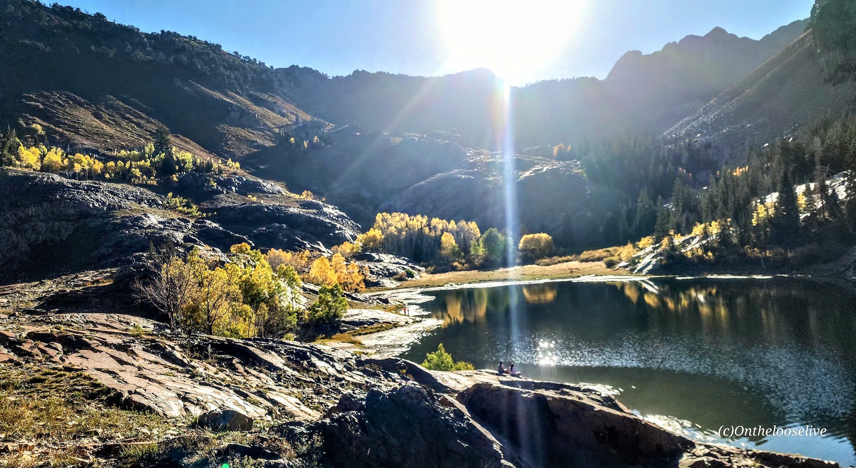
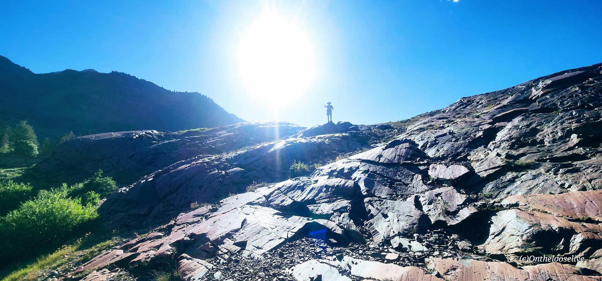
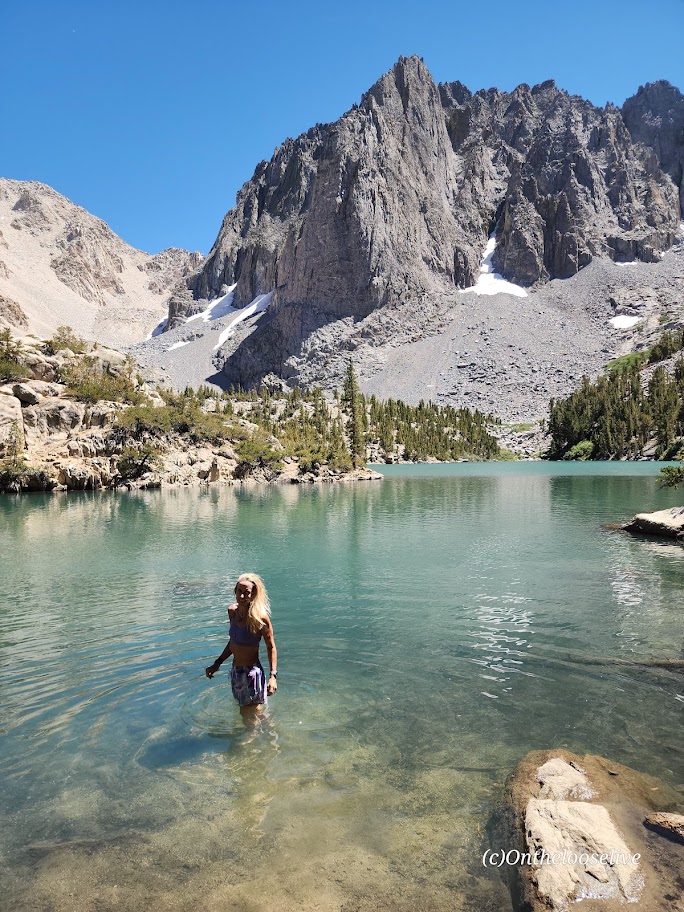
Known as one of the best hikes in the Twin Peaks Wilderness Area, Lovely Lake Blanche, with its dramatic granite spire backdrop (Sundial Peak), has an allure of its own. Hence, its well-documented, high-profile social media status and popularity.
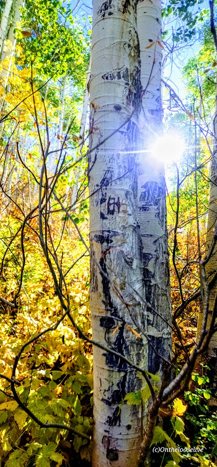
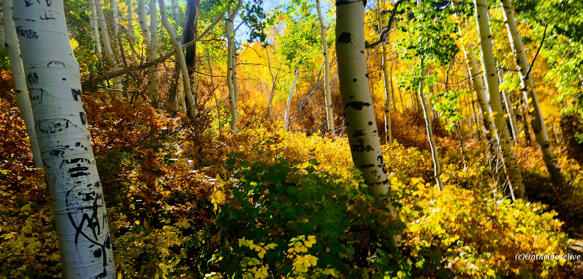
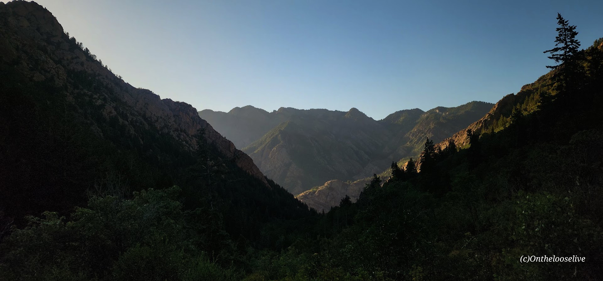
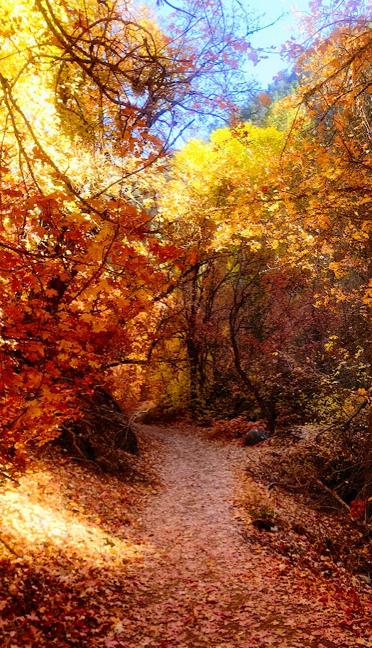
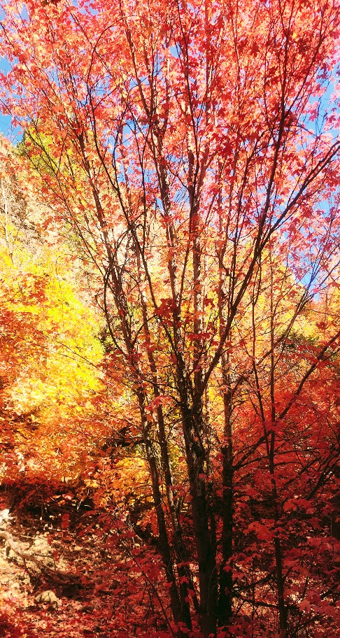
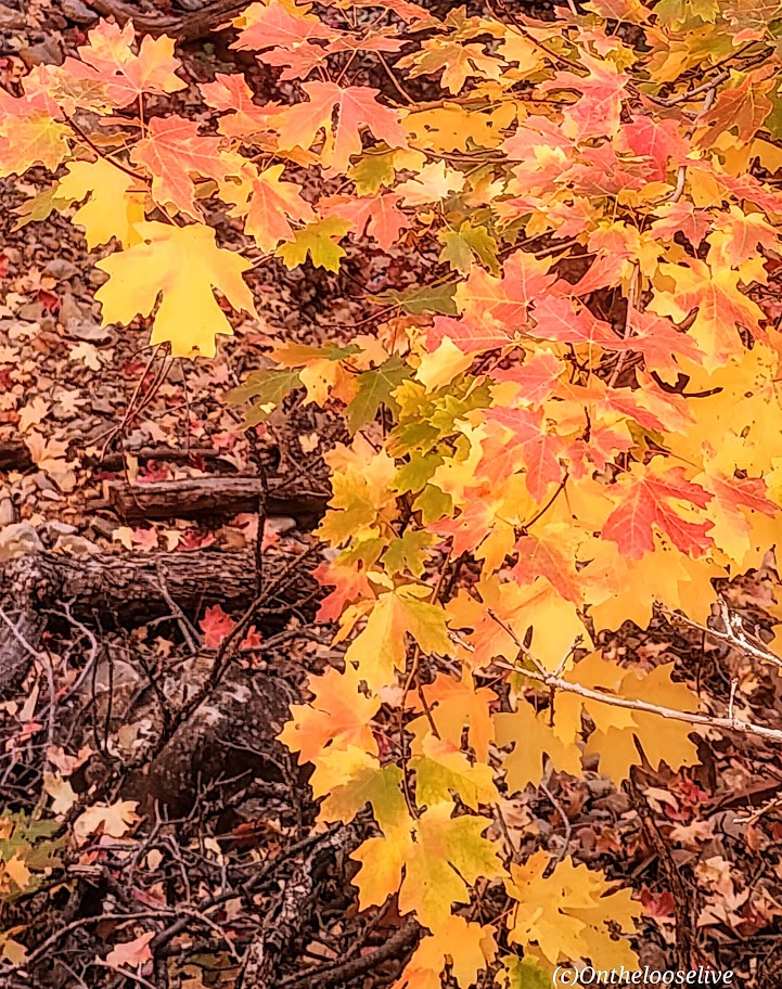
Begin your hike along the rushing creek on your left and make your first right onto the Lake Blanche Trail. The climb is gradual and consistent, with colorful foliage (in the Fall) and peak-a-boo, foreshadowing views of Sundial Peak up ahead and down the canyon to the Great Salt Lake Valley to the West. I kept waiting for the climb to get steeper as I’d read reports that this hike was “challenging.” Perhaps I was just transfixed by the scenery, as you’ll see why.
Lake Blanche and its smaller sister lakes, Florence and Lillian, sit at 8,888 feet. The lakes were a bit low but still high on the beauty scale. While it’s a popular hike, there’s plenty of room to find your zen once you reach the lakes. Just keep strolling past Lake Blanche, where most people seem to congregate.
There’s an off-trail hike up Sundial Peak; I’ll have to try it next. Unfortunately, I didn’t have time this time.
I revisited in late July and just missed the wildflowers! Must go earlier next year. This time, I was running short on daylight, so off-trail exploration is still to come.
Directions: Take Big Cottonwood Canyon Road to the Mill B South Fork Trailhead. The parking lot fills FAST as in FULL at 7 AM on a Saturday.) Parking is allowed along the road, but that fills quickly, too!
Notes: Unfortunately, dogs and swimming aren’t allowed due to the area being a protected watershed.
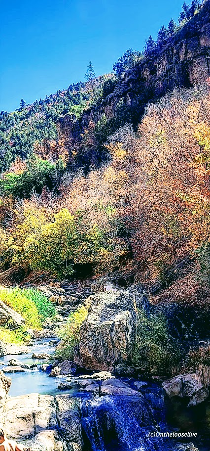
Fifth Water Hot Springs has been on my radar for years. I’ve seen the gorgeous pictures on IG and FB, but I knew the experience would be more like an “attraction” than a hike, so I haven’t gone out of my way to check it out. On this adventure trip, it was on my way with daylight to burn. While its popularity is a major deterrent, I decided to brave the “crowds” and finally see it for myself.
I arrived midday. (Yes, it was a mistake, but it was either now or never). (If you can, go at dawn.) The parking lot was full. People were parked at risk along the roadside. Luckily, I found a pullout a mile back and didn’t get towed or ticketed. (However, I did see a tow truck getting busy on the way back.)
Lots of people (too many) on the trail and in the pools, as you’d expect. It definitely has more of a water park vibe. I guess that’s to be expected with an easy, short, 4.5-mile roundtrip hike near a big city (SLC).
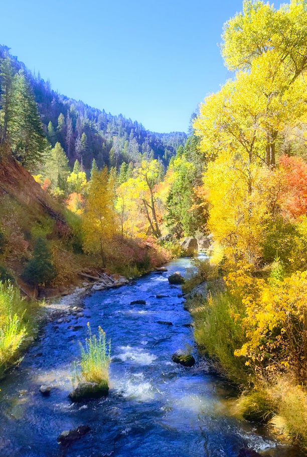
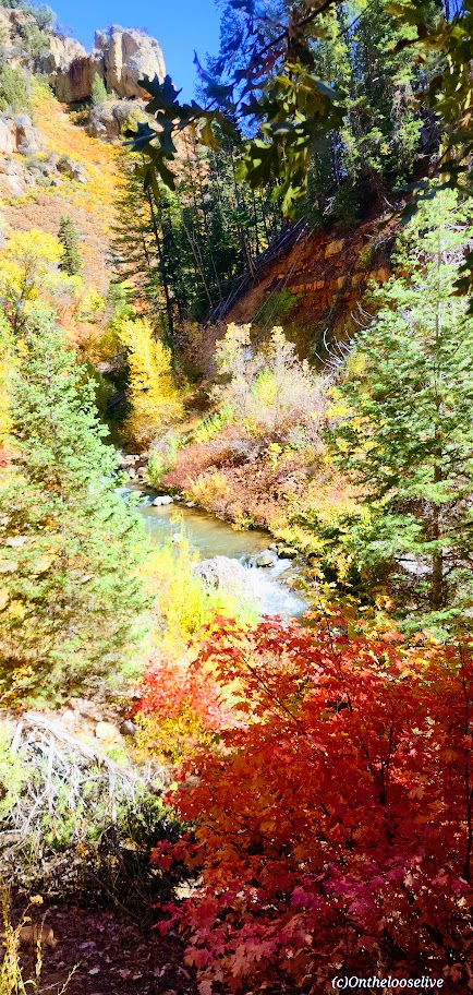
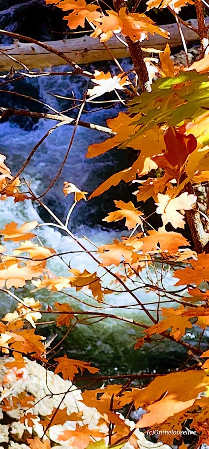
The trail to the pools along the stream is especially lovely in the Fall.
As you get closer, there’s a slight smell of sulfur that seems to dissipate when you reach the pools.
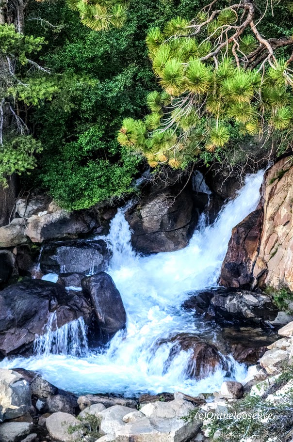
The waterfall at the end was a nice surprise.
I satisfied my curiosity. Would I go back? Only if I can make it to the trailhead at dawn.
Notes: The road is closed in the winter. Info here. Harmful bacteria may be present in the hot springs. Info here
Getting there: Take the US-6 towards Price and make a left on Diamond Fork Road.
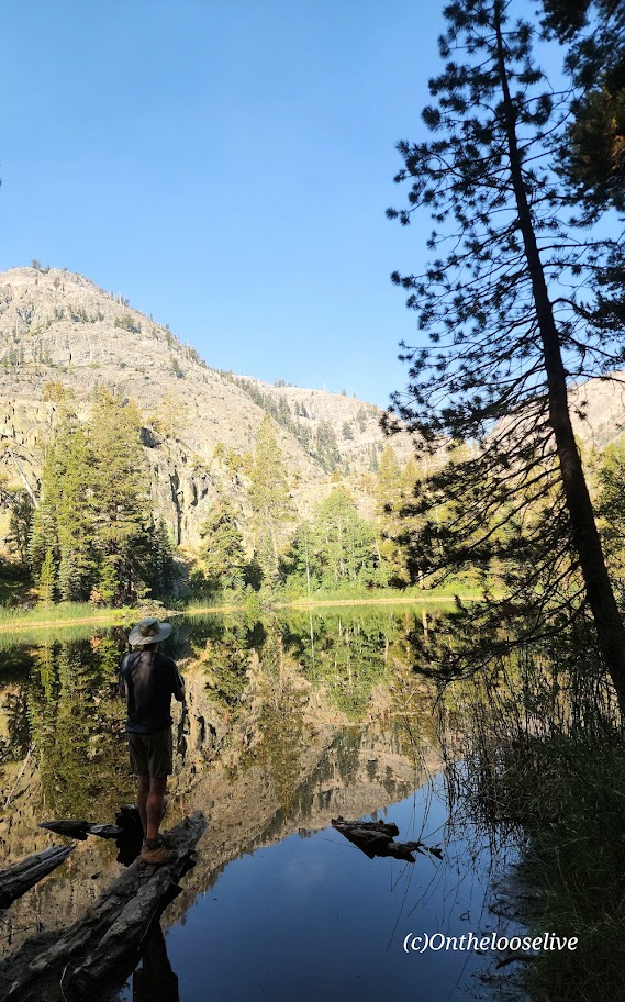
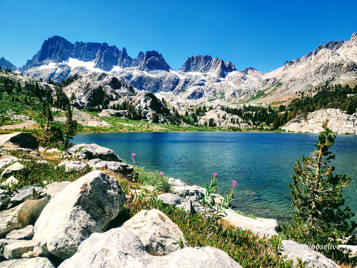
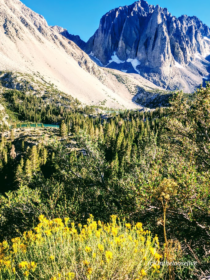
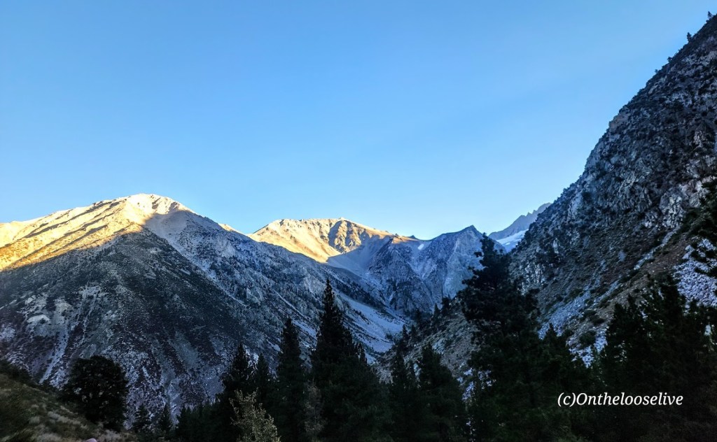
The Shadow to the Minaret (Agnew Meadows to Devil’s Postpile) route packs so much breathtaking beauty into a challenging 17-mile hike. Backpacking might be the best way to experience it, or you can choose a waterfall or any of the 7 amazing alpine lakes (Olaine, Shadow, Ediza, Iceberg, Cecile, Minaret, and Johnston) along the way as your destination for a shorter out-and-back hike. I wanted to see as much as I could in the limited time I had in the area, so I did it as a day hike.
Miles: 17, or create your own out-and-back adventure (~7 miles RT to enchanting Ediza Lake with only 400 feet elevation is an excellent option for a shorter day hike and is popular for good reason ).
Elevation gain: ~2.529
Difficulty: Hard/Challenging, especially for a day hike
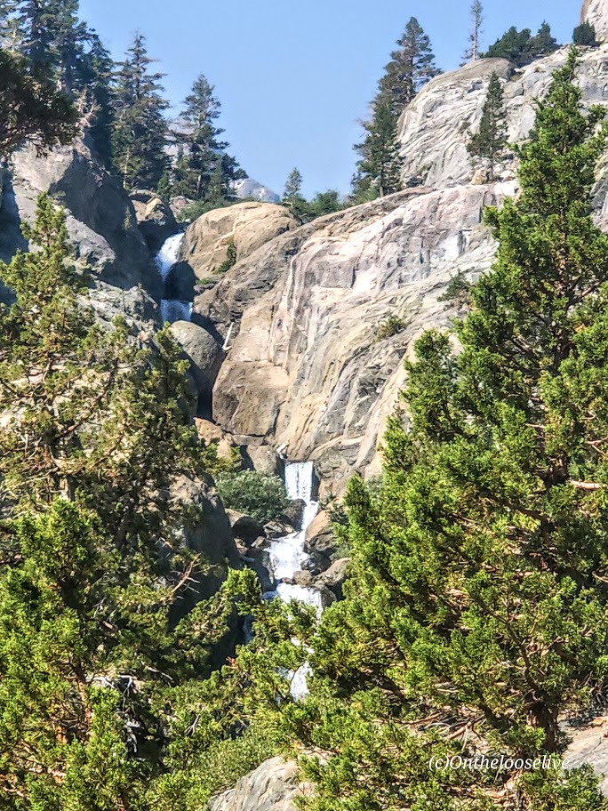
From Agnew Meadows, you’ll encounter Olaine Lake first, then the gorgeous tiered Shadow Creek Falls, Shadow Lake, and dazzling Ediza Lake.
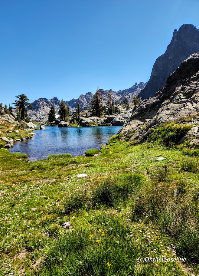
Enchanting Ediza Lake
Take the trail above Ediza Lake for a glimpse of dramatic Iceberg Lake.
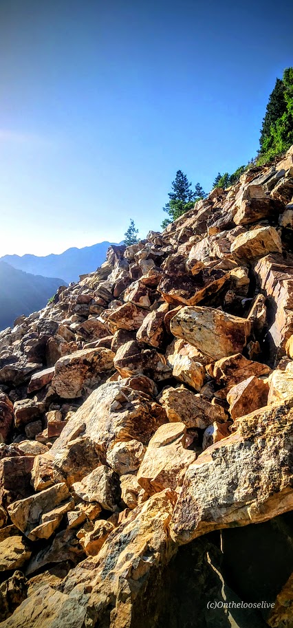
From there, if you wish to venture beyond, you’ll have to climb/scramble the rugged loose scree and talus cliffs to reach Cecile Lake.
Note that I wouldn’t recommend attempting this if snow is present. There’s an argument if you’ve come this far to keep going. You’ll need to boulder hop for a half mile or so around Cecile to get to the slippery, rugged drop into Minaret Lake.
Scaling Iceberg’s cliffs, boulder hopping around Cecile, and “sliding down” the loose sandy “trail” into Minaret can be quite time-consuming despite these sections’ short distances. (Some AllTrails hikers reported it taking 2 hours for these miles 9 & 10 .) I made it up Iceberg in 20 minutes or so, but I am accustomed to scaling rugged, steep landscape. The boulder hopping around Cecile Lake was slow going for me, and the slide down into Minaret was even slower as my knees did not appreciate the vertical angle.
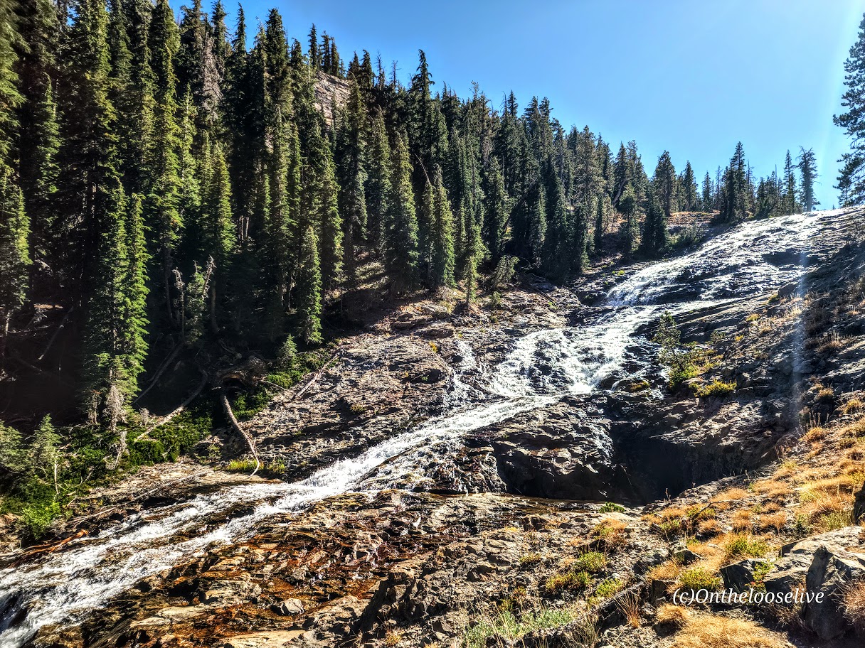
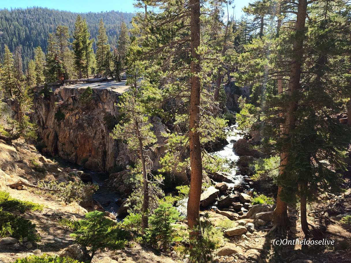
From Minaret to Devil’s Postpile, it’s all downhill with some rocky sections. Highlights include a wonderful, wide, terraced waterfall, and close to the end, a cool canyon area with a stream going through it, and finally, Johnston Lake.
Notes:
Get to the Agnew Meadows trailhead before 7am for self-drive and parking, or take the shuttle.
Equipment: Would poles have helped on the descent to Minaret? I’m not sure. Personally, I prefer to have my hands free. Prophylactically for me, knee braces would have been a good call, but not needed until the Minaret descent. If you’re going over 12 miles, I’d recommend hiking shoes. Much as I love hiking in light trail runners, my feet were beaten up/done at the end of this 17-mile day.
Was it worth it? ABSOLUTELY! I hope you can see why.
Rats, all the scenery is too “grand” to fit in the featured photo. Please excuse the rough edit.
My route: Up the Big Pine Lakes North Fork Trail (Lakes 1-7 with the spur to Summit Lake), and down via the Black Lake Trail
Length: ~15.5 Miles
Elevation Gain: 3,986 ft
Difficulty: Depends on your fitness level and how far you go; while the elevation gain is gradual, it is significant, constant, and at altitude.
Trail Quality: Excellent, trail runnable! Well-marked and easy to follow!
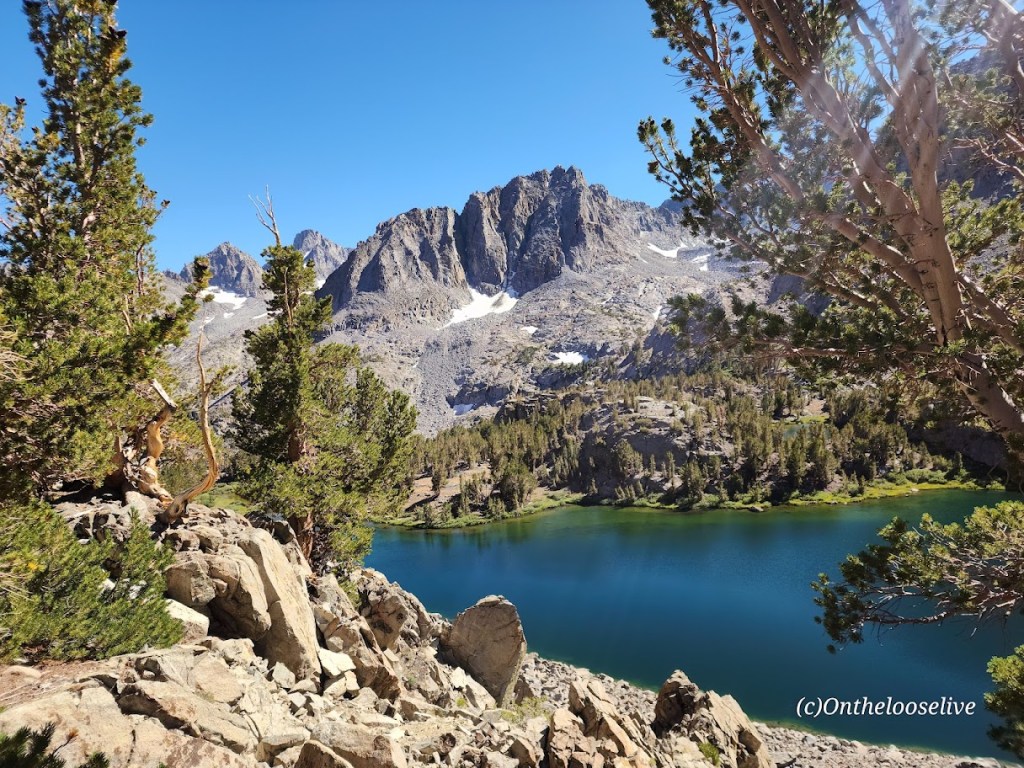
This trail was a long unrequited love of mine. While I initially explored the area on two occasions decades ago, I never made it to all 1-7 numbered Lakes and Summit Lake and Black Lake until now. I fell in love all over again. It was even more stunning than I remembered.
Take 1
My first ill-fated overnight trip to the Big Pine North Fork Trail resulted in my hiking companion Chip getting altitude sickness and us having to make a hasty retreat. (Of course, we’d done everything you’re not supposed to do – we drove up from sea level to the trailhead at 7,660, charged up the trail 4 miles (gaining ~2k+elevation) to set up the tent near stunning Lake 2 before dark. With no time to eat dinner, we’d munched on fresh rosemary bread on the way up. Once we had the tent up, Chip became violently ill, vomiting multiple times. Meanwhile, his dog Chatz was becoming agitated- hair standing up, growling – this is bear country. I remember worrying about an apple I had in the tent; at the time, I didn’t realize that Chip was creating a bear smorgasbord outside. As Chip became sicker, it became obvious we had to abort our overnighter. It was dire enough that we thought about leaving the tent behind. There were no other hikers or campers around. I wondered how I would manage if I needed to carry Chip down. I worried that Chatz was going to have a run-in with a bear. Luckily, we all made it down the trail safely. As for Chip, predictably, he began to feel slowly but progressively better on the descent and was almost 100% within an hour of driving down from the trailhead. Since then, he has had an aversion to rosemary bread and higher altitudes. Despite being concerned about Chip’s well-being as marched down the trail with our headlamps, I recall being transfixed by the stark, ragged granite peaks glistening in the moonlight, the silence, and stillness. I vowed to return.
Take 2
When I returned a decade or so later, no idea what took me so long, I came with a mountain biking buddy who wanted to charge up the trail to the Palisade Glacier (the largest glacier in the Eastern Sierra). The trail spur to reach the glacier is about a 1/2 mile beyond Third Lake. Given that we prioritized the Palisade Glacier as our day hike destination (19 miles with 4,646 ft of elevation gain) and didn’t get an early start, we barely had time to nod to the 3 spectacular lakes we “ran” by on the way up and down. (If you know me, you know I’m more of an alpine lake person than a glacier person.) Once again, I vowed to return to immerse myself in those lakes’ beauty.
Take 3
Over a decade later (again, I have no idea what took me so long), I returned with my hiking buddy and expert back-country guide, Colin, the most earnest person I know about getting the most out of every hike. And this was no exception. We hit EVERY numbered alpine lake (1-7) plus Summit Lake and Black Lake, with ample time to bliss out at each.
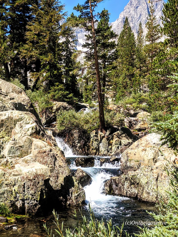
How had I forgotten about the mesmerizing trailside rushing rapids and waterfalls of Big Pine Creek? I’m guessing there must not have been much snowmelt when I went previously.
I’m not going to number the lakes for you. You need to go discover them one by one for yourself. Here’s a sampling:
If you fish, you might get as lucky as the fellow who caught and released this big beauty.
On the Black Lake trail down, we were treated to patches of colorful wildflowers and breathtaking views of the lakes from above.
And there was also time for my yoga pose photobombing and blissful immersion! I vow to return before another decade passes!
And so the sun must set on even the most beloved adventure so another one can begin.
Happy Trails!
Tell me, what trails have you fallen in love with, and do you long to return to?
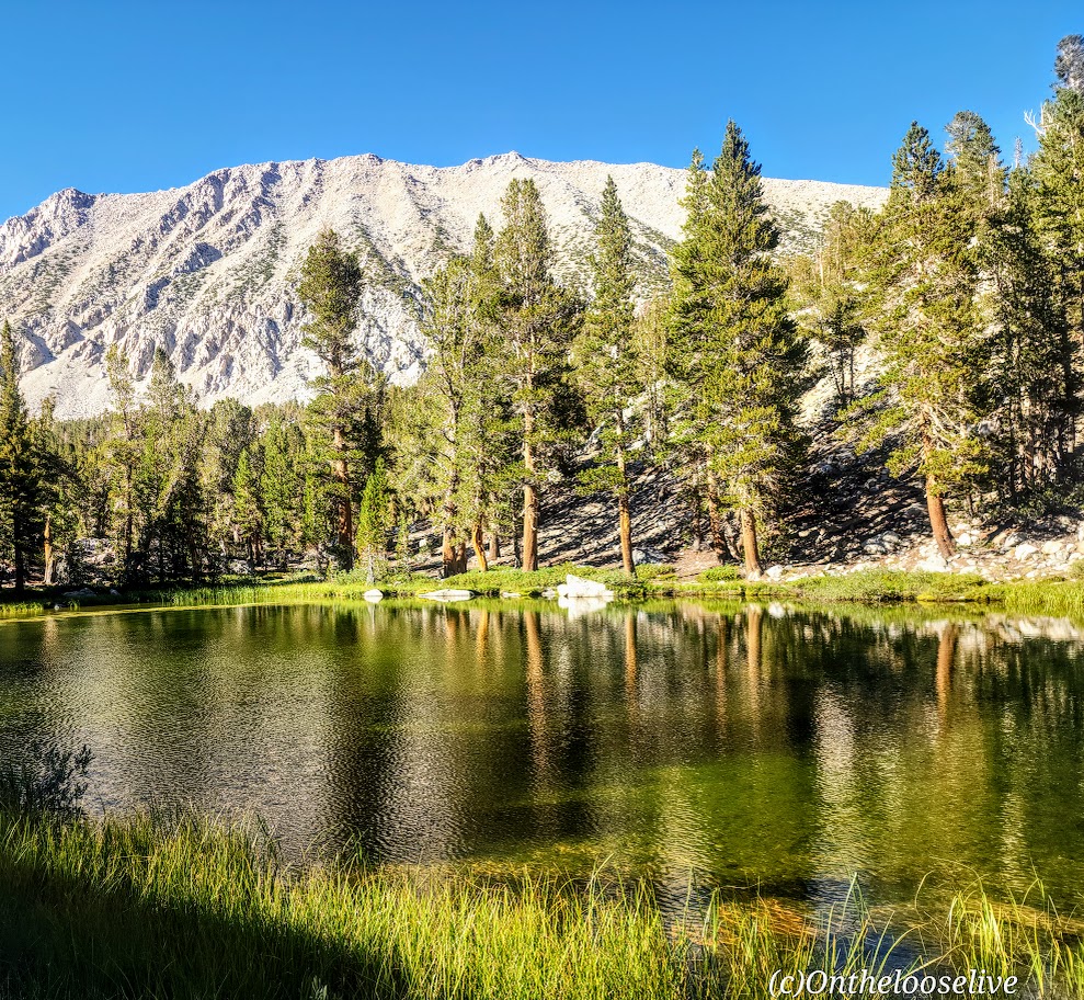
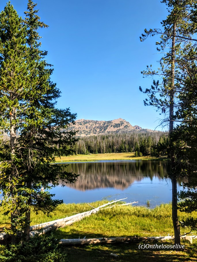
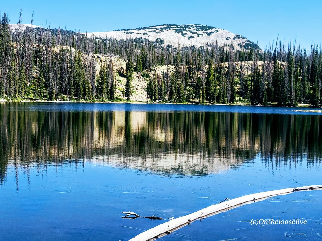
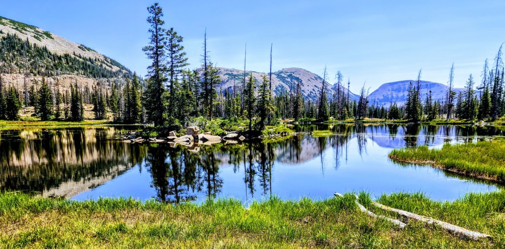
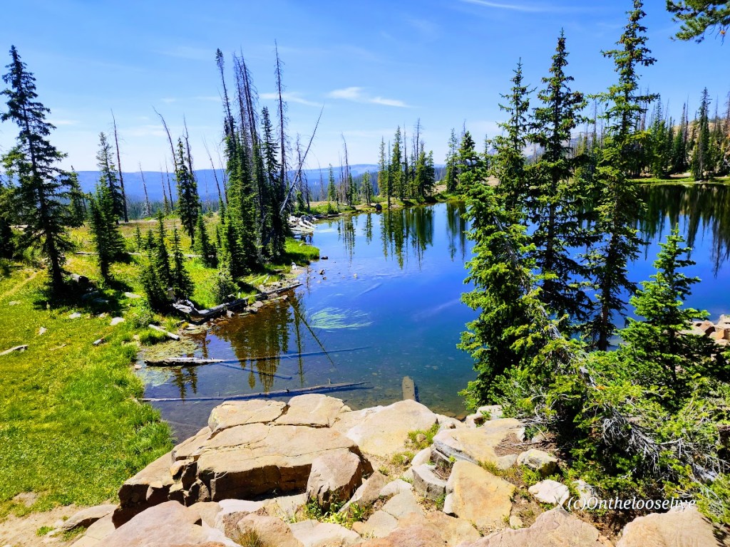
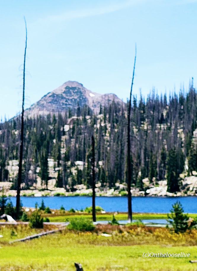
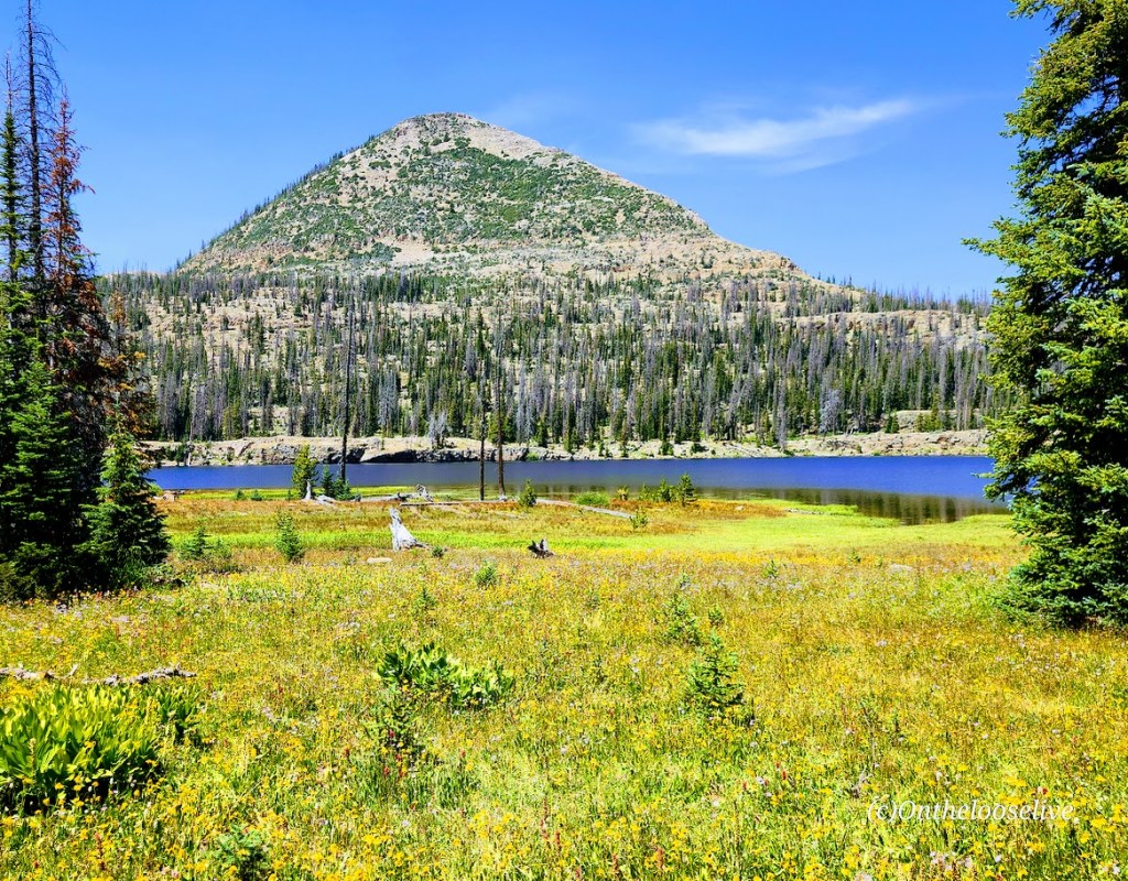
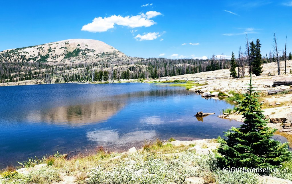
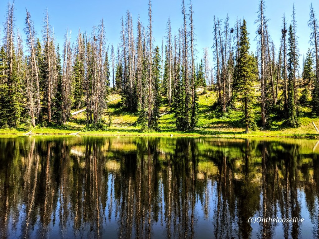
If you like alpine lakes and friendly trails, you’ll have plenty to choose from, starting at the Crystal Lake Trail and hiking in virtually any direction. Forget peak bagging for the day and enjoy some lake hopping instead. This area wins my record for most lakes and ponds in the least mileage. The more miles you cover, the more lakes and ponds you’ll see in this dazzling area of the Western Unitas. I combined 2 loops going in opposite directions and visited a mind-blowing 32 lakes and ponds in 15 miles—yep, that’s a whopping 2 sparkling lakes per mile. (But whose counting? LOL, the Garmin, thank goodness, as I lost track!) Despite the parking lots being jam-packed, surprisingly enough, the trails weren’t overrun. (Island Lake had the most people—big family groups.) Overall, I saw more lakes and ponds than people—now that’s a perfect scenario.
Distance: Create your own lake-hopping adventure.
Difficulty: Easy to moderate+, depending on your fitness level and altitude acclimation
Altitude: All hikes in the 10k ft range
Getting there: Milepost 25.5 off of the Mirror Lake Highway. (This highway is closed from late October through Memorial Day.)
Notes: Parking and overflow lots fill fast in peak season, especially on the weekends. There are several campsites in the area, but most require reservations. Boondocking and backpacking are options.