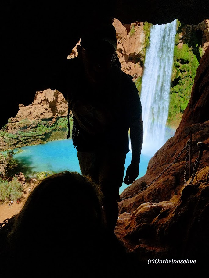
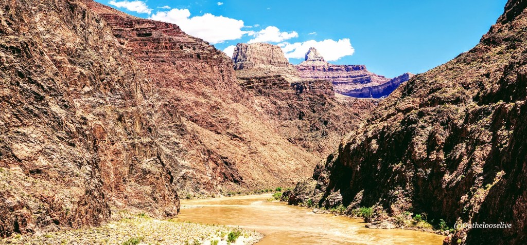
The descent to Mooney Falls requires ducking through a narrow, low sandstone tunnel carved into the cliffside, followed by cautious navigation down eroded and slippery sandstone “footholds” to the ladder far below. While there are chains bolted into the rock for handholds in the most exposed sections, even with them, it feels a bit sketchy. The new wood ladder was slick with mud and mist, and its rungs were spaced wider than a comfortable leg stretch for me. With 6 years of rugged hiking, scrambling, and the occasional canyoneering adventure in Utah under my belt, you’d think I’d have less trepidation navigating this than I did in my younger years. But still, it gave me moments of pause. (On the way back up, I saw a toddler and a young boy scramble ahead of their parents up the cliffside. Yikes!)
The power of the waterfall and the amount of mist the rushing water created were tremendous! The sunlight through the mist caused a magical effect in my photo on the right.
Beaver Falls
~3 Miles from Mooney Falls
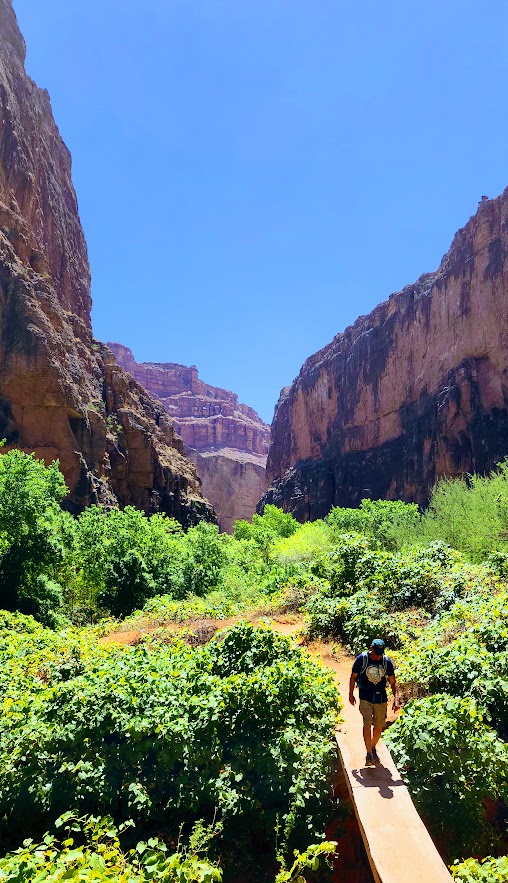
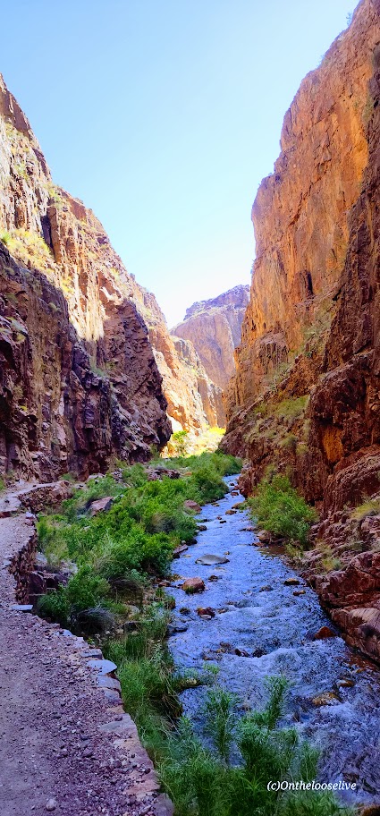
I’d never ventured beyond Mooney Falls before—there was never enough time. So I was especially grateful for the chance to explore further on this trip. The 3-mile hike from Mooney Falls to Beaver Falls is both enchanting and engaging, winding through a lush corridor of vines and trees along the turquoise creek. It feels like stepping into a jungle, with hidden oases revealing themselves around every bend.
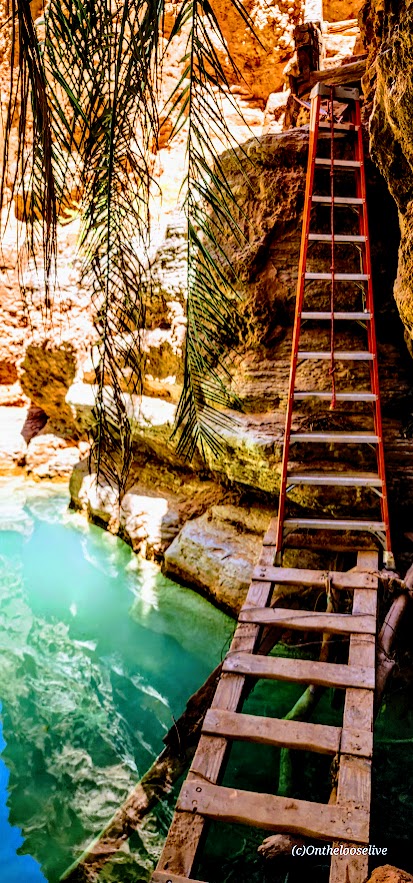
After a few refreshing creek crossings, the trail leads you through a striking sandstone archway to a short make-shift mini-bridge water crossing, followed by a ladder cliff climb. Thankfully, the footing here was drier and more stable than the slippery ladder at Mooney Falls.
Beaver Falls was truly stunning—cascading tiers of turquoise water —but it was also crowded. I hardly took any photos. A brief moment of uninterrupted zen there below.
Thankfully, there were plenty of quieter “private” oases along the way, perfect for a peaceful dip or simply taking a moment to soak it all in. Beaver Falls is absolutely worth it, and the hike to it is fun—just be sure to get an early start if you’d like to experience it in solitude.
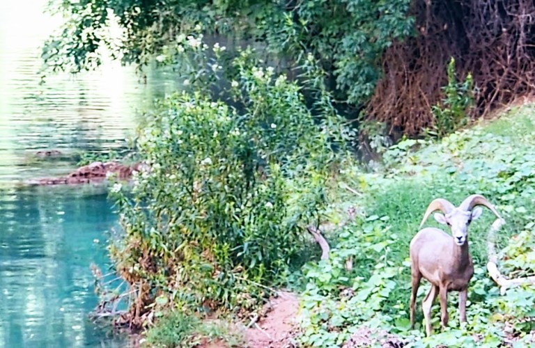
On the hike back, it was nearing critter hour. Much to my surprise, a bighorn sheep was just off the trail, seemingly scouting out a peaceful spot by the water to settle in for a nap. I had no idea that there were big horn down here!
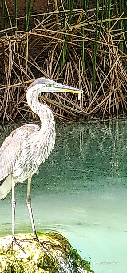
Closer to the campgrounds, I spotted a blue heron, focused, mid-hunt—clearly having some luck with its evening catch. Pics are a bit blurry due to distance.
Leaving Eden
We started our return hike from the village just after dawn, hoping to beat the heat. Fortunately, most of the trail remained shaded until the final climb out of the canyon, which is fully exposed. Fortunately, there are a few rocky overhangs along the way—perfect spots to catch your breath and escape the unforgiving sun for a moment.
This adventure was nothing short of epic. I felt a pang of sadness as it came to an end, but also immense gratitude for the chance to return (thanks to my friend Bernie for securing the permits) and the opportunity to explore more than I ever had before. Among all my adventures near and far, the exquisite beauty and spiritual essence of Havasupai will forever hold a special place in my heart. I’ve never experienced anything quite like it. It remains one of my all-time favorites.
I’ve had the privilege of visiting this sacred Eden three times before. The first time was in 1993. I’ve hiked in, camped twice, and stayed at the Lodge—now twice. On one of those trips, a friend surprised me with a scenic, 10-minute helicopter ride back up to the rim. (He wasn’t keen on hiking out with a pack—or waiting while I did—so I scored my first helicopter ride, a quick thrill in exchange for sacrificing a good workout.)
Those earlier trips were quick overnights, back in the day—before permit complications and prohibitive costs. And two of them were after recent flash floods, so the water was churning chocolate.
While still awe-inspiring in any state, the falls are much more magnificent in their rushing turquoise glory.
In all my worldwide adventure travels, Havasupai and its falls remain unmatched. I’m so grateful that I had the opportunity to experience this special place again.
Background
Havasupai Village at the bottom of the south rim of the Grand Canyon is considered one of the most remote Indian Reservations in the country. The Havasupai Native American tribe has lived in the Grand Canyon for ~ 800 years. The name Havasupai translates to “people of the blue-green water” and refers to the stunning turquoise waters of Havasu Creek and its spectacular waterfalls (Navajo Falls, Havasu Falls, Fifty-foot Falls, Mooney Falls, Beaver Falls). The water’s surreal turquoise hue comes from a high concentration of calcium carbonate (lime) in the water. Over time, the lime deposits build up around sticks, leaves, and other debris, forming natural terraces that add to the spectacular landscape.
Why Pay the Price?
Words can’t begin to capture the magic and spiritual energy of this place. Yes, the most popular waterfalls—Havasu Falls, Mooney Falls, and Beaver Falls—draw the crowds. But the good news is, tucked along the trail are hidden oases that you can have all to yourself. Hopefully, the pictures speak for themselves.
Day 1: Grand Canyon Rim to Havasupai Village and Havasu Falls
Distance to Village: 8 miles Elevation Loss: 2,500 Ft
Circa 1998 vs 2025. It’s hard to out 6-pack my younger self, but I’m still trying and still finding as much or possibly more joy in my active adventures.
The hike down from the rim, through the dry Hualapai Wash and into the village via the Havasupai Trail, may feel unremarkable to those familiar with other Grand Canyon hikes.
Aside from a few interesting rock formations, the trail is mostly a sandy, gravelly, waterless, hot, dusty, potentially blister-inducing slog.
(1993 and 2025 – same spot, but there must have been an enormous rock slide, as you can see the huge slabs to the right of me in the recent pic !)
But of course, every step is 100% worth it! (Just be prepared with ample water, sunscreen, hat, moleskin, etc.)
Distance to Havasu Falls from the Village: ~4 miles RT
The pic below is from my first visit in 1993.
After grabbing a bite at the restaurant, we dropped our bags at the lodge and made a beeline for Havasu Falls—one of Havasupai’s crown jewels.
The lovely views begin about a mile from the village.
Havasu Falls was even more breathtaking than I remembered. The only thing better than marveling at its splendor is immersing yourself in it.
What’s Changed
As mentioned, the costs of visiting this sacred place have skyrocketed. It has been dubbed the most expensive hike/camping trip in America.
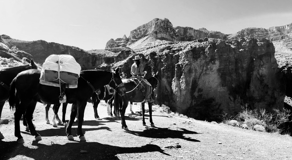
As of July 2025, it’s $455 per person for a 3-night stay at the campground and $2,277 total for a 3-night stay at the lodge in a double room. Note it’s a mandatory 3-night payment requirement in both cases—no refunds for shorter stays. For the luxury of having a mule carry your pack, it’s $400 RT for up to 4 bags; each bag must weigh less than 32 pounds. All I can say is if the system keeps the crowds down and supports the locals, I’m for it.
The cost of a helicopter ride to/from the village is $150 per person each way, with the additional cost of $50 per pack/bag.
The Good
I noticed more families and younger locals living in the village than my past visits, a shift that reflects community renewal. There’s now a Head Start program for young children and a new, modern medical clinic. The Lodge has been renovated as well; the air-conditioned double rooms are clean and updated, featuring comfortable beds, a fridge, and a microwave.
The village restaurant has also been upgraded. Its expanded menu now includes healthier options like salads and grilled chicken sandwiches, alongside traditional frybread and the usual burger-and-fries fare. Barstools at a large window offer a front-row view of the village center—including the regular whirlwind of helicopter landings and takeoffs with their sudden sandstorms and dust clouds.
There also seemed to be far fewer dogs roaming the village than in past visits—and the ones I did see appeared relatively healthy. I want to be clear: I understand that when people are struggling with basic necessities, pet care can’t be a priority. Still, in previous years, the heartbreaking sight of malnourished nursing dogs and sickly puppies left a lasting impression that deterred me from visiting again – until now. ( A friend secured the permit, and when he offered me the opportunity, I couldn’t refuse.)
Those images stayed with me—not in photos, but in memory. Possibly in response to past negative press surrounding animal treatment here, a strict no-photography policy now applies to pack animals and dogs, as well as the village itself and its residents. This is entirely understandable to protect the villagers’ privacy, dignity, and culture.
The Bad—Paradise Lost?
I’m not sure how long ATVs have been in use in the village, but they seem to be increasingly popular with locals. While I understand their practicality—and, no doubt, their fun—they do detract from the experience, especially in such a remote and natural place. The noise, dust, and trail erosion are hard to ignore. A local woman I spoke with shared her unsolicited disapproval of them.
The Ugly—Soapbox Warning
What disturbed me most on this trip, though, was the amount of trash—mainly empty plastic water and Gatorade bottles—littered everywhere along the Havasupai Trail—literally a Trail of Trash. I don’t recall seeing anything like this on previous visits. Next to animal welfare, littering is my “pet peeve”.
I honestly don’t understand it. People are paying a premium to visit this incredible place—yet they are disrespecting it and the locals by littering? Yes, hiking in the heat with a heavy pack is tough, but these bottles are empty. Carrying them out takes almost no effort. What the heck, people? Who does this? It’s truly appalling.
Thankfully, there’s noticeably less litter in the campgrounds and around the waterfalls—likely thanks to regular cleanup crews and maybe because the Instagrammers don’t want to tarnish their photos there. But the trail itself deserves the same care and respect. This place is a treasure, and it deserves better from all of us.
Despite the cons, there are still moments of paradise here for me. What about you?
What’s the Solution?
Havasupai should implement steep penalties for littering—$1,000 fine—and use the revenue to fund a dedicated litter patrol program employing local workers. Another idea: offer small incentives to visitors who pack out the trash they collect along the trail—perhaps a discount at the restaurant, Lodge, or campground. (Though yes, I know… someone will always try to game the system by raiding the trash can near the village.)
I’m just brainstorming here, trying to imagine practical solutions to this heartbreaking issue. I will never understand how people can journey to such an awe-inspiring place only to defile it with trash. It makes no sense.
If Arizona adopted a “bottle bill” like some other states—placing a refundable deposit on bottles and cans—I have no doubt it would reduce the problem dramatically. Short of that, maybe they could offer an off-season camping weekend in exchange for a few hours of supervised trail cleanup. A give-back program for those willing to help restore what others have damaged.
Although the “Leave No Trace” policy is clearly stated in the reservations paperwork, including a $1,000 fine for leaving trash or gear behind, I didn’t see any signage reinforcing this policy on the trail or at the campgrounds. What I did see, unfortunately, was tons of litter. Posting visible reminders about the rules and the consequences might help discourage the defilers.
Perhaps the tribe could also consider installing designated trash receptacles at key points, with a budget allocated from the high permit fees to manage its removal. I understand the original goal of a strict pack-in/pack-out system, but it’s clearly not working. I’d be very curious to know how many fines have been issued—and whether those funds have gone back into trail maintenance or cleanup efforts.
What do you think would make a difference?
So that’s the good, bad, and ugly of it. Is it worth it still? Emphatically 100%!
Plan Ahead: Permits are hard to get. Camping permits are available from February 1 through November 30, and reservations for the Lodge are available from April 1 through November 30. The area is closed in December and January.
Permits go on sale February 1 at 8 AM Arizona Time/Mountain Time. Up to 12 people can be on a camping permit for $455 each. If you don’t land a permit on February 1st, you can check in their transfer page, where newly available permits are listed daily at 8AM.
In 2025, there was a 2-week presale from December 16 to January 3. You pay a non-refundable $20 per person fee for the chance of securing one of your 3 reservation start times. If you win your permit, you’ll then pay the full price of either camper or lodging reservations. (Permits are only transferable through the official website.)
Note, Havasupai can close unexpectedly due to flash floods. Monsoons are frequent in the summer months. Pay attention to the weather forecasts.
Since there is no refund policy to cover this or any other eventuality, you may want to consider securing travel insurance before your trip.
Before you begin your hike, the designated trip leader must check in at Grand Canyon Caverns Inn to pick up the required documents and bag tags the night before or by 12 noon the day you wish to hike in; otherwise, your reservation will be canceled.
Stay tuned for the videos and the Mooney and Beaver Falls post.
Rim2Rim Grand Canyon: North Kaibab, North Rim to Bright Angel, South Rim
Distance: ~25 Miles [I added on a little side-trip.]
Elevation Gain: 4,534 Feet (Elevation loss 5, 850)
Difficulty: Hard, Strenuous
My Stats
Moving time: 7 hours, 57 minutes (Yay, barely sub 8 hours, but I’ll take it at nearly 60 years old for my first R2R.) I don’t think I could have had a better hike.
Start Time: 5:42 AM
Finish Time: 2:53 PM (including 2 stops)
Break Time: 3:04 PM After waiting (impatiently) for a seat on the bench at the Terrace overlook, I took my first real rest stop to soak in the views and put my legs up! Wish they served cocktails here!
I did the thing
So I did the thing, even though I’m not into doing things that are mainstream “things,” and even though last month’s South Kaibab Phantom Ranch hike experience was suboptimal due to crowds and the heat.
Why? Because it’s there and friends were into doing the thing. So, as typical of me, I did the last-minute Lydia thing. Sure, I booked the Jacob Lodge in January when everyone was hyped up, but that was the extent of my commitment. And I joined in on the training/scouting hikes from North Kaibab to Manzanita last October and South Kaibab to Phantom Ranch and up Bright Angel. Naturally, I kept up my vigorous, ongoing backcountry hiking adventures.
It turns out rugged, extended off-trail slick rock explorations and thick sand slog traverses are just the thing to make R2R seem like a walk in the park (The North Kaibab, while rocky and sand-slippery, turns into an easy, smooth trail from Manzanita through Phantom Ranch, and the trail up Bright Angel is also easy footing the entire way—no obstacles, no scrambling.
Of course, it’s not a “walk in the park.” It’s a hike to be taken very seriously.
Less than 1% of the 6 million annual Grand Canyon visitors do Rim 2 Rim, and many prepare for months, some even years.
In fact, R2R is considered one of the most dangerous hikes in the US for many reasons:
Exertion hazards
Cardiac arrest
Dehydration and its opposite, hyponatremia
Risk of rhabdomyolysis: Accumulated muscle trauma causes the break down of myoglobin, a protein that can damage kidneys
Environmental hazards
Heat Stroke
Heat Exhaustion
Hypothermia when temperatures dip at night
Rattlesnakes (The only pink rattlesnake (C. oreganus abyssus) in the world lives in the GC, AZ & UT.)
Hike your own hike
While not recommended, I hiked “the thing”solo. Why? Because I need to hike at a pace that feels right to me. I feel strongly that you can compromise your safety (and enjoyment) if you slow your pace for others. It’s hard to find compatible hikers. My rationale—given that it’s a mainstream trail, there are plenty of hikers and rangers around should an emergency arise. (An instance of “Do as I say, not as I do.”)
On the morning of, I figured I had options—hike out and back or do “the thing.”
The goal was to be at the trailhead at o’dark thirty (4:30 AM ish) to beat the heat. To outpace the heat was critical for me as I found Devil’s Corkscrew unpleasant in the heat of the day and wanted to avoid it. I heard that the “dreaded box canyon” section can be brutally hot, too. I wanted to limit my time in the dark because I have terrible vision and didn’t want to sabotage my hiking prospects with a fall/injury. As it happened, I arrived at first light. While I wasn’t hungry and rarely eat in the morning, I forced myself to chow down half of my turkey sub before hitting the trail. (I do better on long hikes when I have “real”/solid food—usually at the halfway point of a long hike, but I suspected I wouldn’t want anything solid/heavy on this hike’s halfway point.)
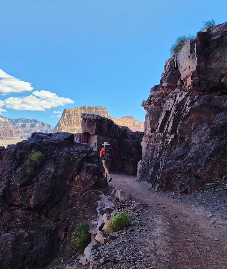
I felt strong and made great time down to the bottom of the canyon. Since I’ve done this portion of the trail before, I only took a couple of pictures on the way down when the light caught my eye.
I thoroughly enjoyed the section between Manzanita and Phantom Ranch, which was entirely “new to me.” It was so refreshing and exhilarating, with the stream rushing along the trail and having it all virtually to myself. I stopped to take the most pictures along here. At one point, I looked at my watch and was shocked to see I was doing a 10-minute mile. I didn’t feel like I was running, but I did feel exuberant and euphoric. I was beyond the halfway point and feeling optimistic about doing this “thing!”
I took a slight detour down the Ribbon Falls trail. The bridge was out, which made my decision to pass on this side addition much easier. I didn’t want to add 2 miles roundtrip to my R2R or lose the momentum of my hike.
The only injury I sustained was cactus needles in the back of the forearm when I crouched too low to take a picture.
I was a little obsessed with the miles and my pace, taking pictures of my watch all along the way to track my progress because my watch battery had run out on my last big hike. And if it’s not documented, it didn’t happen, right?
I reached Phantom Ranch (14.29 miles) in 4 hours and 16 minutes with no breaks.
While there were far fewer people there than in April, there was still a line at the canteen for lemonade and food. In retrospect, I might have skipped this, but I didn’t think the handful of people in front of me would take 25 minutes, and the lemonade was a major highlight and perhaps a lifesaver when I hiked down in April. I committed to standing in line, which was building behind me, so it seemed silly to give up my place when it would be “any minute now”…Sigh. Finally, I downed my lemonade and refill, topped off my water, and got back on the trail.
I didn’t feel like taking a break or eating anything, but I forced myself to have a caffeinated cola gu and took out some electrolyte-infused gel blocks to have in my hand. From this point on, after each mile, I would eat a block to celebrate and electrolyte balance.) Back in the day, when I used to run marathons, I’d have a mint to commemorate additional miles after the halfway point.
By the 5-hour mark, I had covered 17 miles.
I arrived at Havasupai Gardens, Mile 20- (4.5+ miles from the top) at a little over the 6-hour mark.
I topped off my water, took a few bites of a Slim Jim, and drank my Gatorade on the way up. It occurred to me that it might be possible to do this “thing” in 8 hours or less. (The average total time, including breaks, is 12-15 hours.) I was pumped and channeling my old triathlete/trail running self.) There was a slight breeze, so the hot spots were blissfully not as hot as in April. I still felt good but the muscle fatigue was starting to build in my legs.
At 23 miles, I was over 7 hours, and for the first time, my pace per mile increased to well over 20 minutes. I was forced to consider the possibility that I wouldn’t make sub 8 hours. Laughing outloud to myself that if I didn’t make sub 8, I would have to do it it again so I better haul ass now! And phew—just barely!
My Inspiration
Did I really hike it solo? Not really; I had my Dad with me. He died years ago, but I carry him in my heart and wear the talisman of his old-fashioned skeleton house key on my necklace, so he comes with me on all my hikes. When I do challenging hikes or activities, I think of him and how his stroke left him paralyzed and confined to a wheelchair for the last decade of his life. I think about how difficult that was for him and it inspires me to stay strong and keep moving.
I also thought a lot about my beloved trail running days with my best trail running partner, Allison Robar. I repeated our mantra from our crazy trail runs , “Light and Easy.” So, both my Dad and Allison were on the trail with me in spirit.
And as mentioned, I felt so exhilirated hiking along the river, taking in the incredible beauty and enjoying my solo connection with nature. It was a transcendent/spiritual experience for me. I was one, vigorously with the Universe.
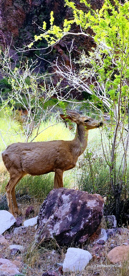
Of course, I met some cool people along the way too: trailrunners doing it for charity for the 5th year in a row, a buff backpacker named Billy taking on R2R2R. (I nicknamed him Billy Goat in my mind.) And there were others, including 2 “deer” Grand Canyon residents.
What worked for me
I chose light trail running shoes. I feel the terrain doesn’t call for hiking shoes per se. Sure, my feet were a bit battered and tender at the end of the day, but I feel quicker and lighter than I would have with hiking shoes. It’s a trade-off.
I wore knee braces on both knees from the start of the hike. (I have Grade 4 chondromalacia – bone on bone in both knees.)
I brought 1 pole and used it as needed (to help support my knees for large step-downs or step-ups). I like having my hand free, but I think having it helped, and was worth the tradeoff of carrying it.
I felt better after this hike than when I did the South Kaibab to Phantom and up Bright Angel loop. I attribute that to my prophylactic knee bracing, pole usage, and slightly cooler weather,
What I learned
Start at first light (or earlier)
Choose a day where temps at the bottom won’t exceed the low 90s.
Choose a weekday unless you like crowds
Select the North Kaibab to Bright Angel route
Soak your stuff (hat, scarf, shirt) and yourself every chance you get
Take pickle juice and electrolytes to prevent cramps.
Recommendations
Use your long training hikes to discover what’s best for you (nutrition, hydration, equipment, shoes, hiking partners, etc.) Cancel if temperatures are in the mid-90s to triple digits.
Equipment
Use a hydration bladder for hands-free drinking (Camelback or Osprey)
Take a pole or 2
Water filter (Sawyer SP129)
Electrolytes (I had electrolyte-enriched water, Gatorade, and gel blocks.)
Training
As part of your R2R training, if possible, I’d highly recommend doing the North Kaibab to Manzanita or Ribbon Falls hike and South Kaibab to Phantom Ranch and up Bright Angel hike, as well as a couple of hikes from the Grotto to the West Rim in Zion. Hiking those hikes in the GC, you’ll know exactly what you’re getting into and out of at the end of the day. It preps you both physically and psychologically.
Do hikes that simulate the elevation gain, distance, and desert heat factor
Do cross-training—bike, swim, etc. Do yoga & restorative stretching
Do strength training—squats, lunges, leg extensions & curls, calf raises, pushups, pullups, and core work. (Note: training with super heavy weights and low reps can increase muscle bulk, which can be counterproductive for endurance activities.There’s a fine line between gaining strength and lean body mass—more muscle mass requires more oxygen and is heavy—both of which can make climbing, especially at altitude, more difficult. It’s the difference between a bodybuilder and a triathlete. I’ve embodied both body types, and I can tell you from personal experience that lean muscle mass is the best for endurance activities.
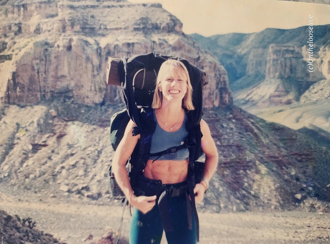
Here’s a pic of me backpacking the Grand Canyon in my body building days circa 1998 and me the day after R2R.
Route
I’m aligned with the majority that North to Bright Angel is the way to go. (Unless you’re doing R2R2R, and in that case, you don’t need my advice.)
North Kaibab (Rugged/rocky,sandy and slippery ascent/descent) ~5,781 ft elevation gain
Bright Angel (smooth and scenic trail with some shade)~4,400 ft elevation gain
South Kaibab (exposed trail) ~4,800 ft elevation gain
Logistics: If you’re “only” doing R2R, you’ll need to find a way back to your car on whichever side you left it. Fortunately, there’s the Trans-Canyon Shuttle that runs twice a day ($120pp). Or maybe your fortunate like I was to a have a friend willing to do an out and back hike on N. Kaibab and drive 4 hours over to the South Rim to meet you. Might be better to have a nonhiking friend meet you on the other side or key swap with friends hiking in the opposite direction. I guess that’s motivation for R2R2R, no logistics issues-lol.
Pre-hike dinner was at Jacob Lodge with fellow R2R hikers. The homade blueberry pie and cookies are delicious! Post-hike celebration at the rimside Arizona Steakhouse was delicious with great service and food!
Difficulty: Strenuous/hard due to distance, elevation change, sun exposure, heat
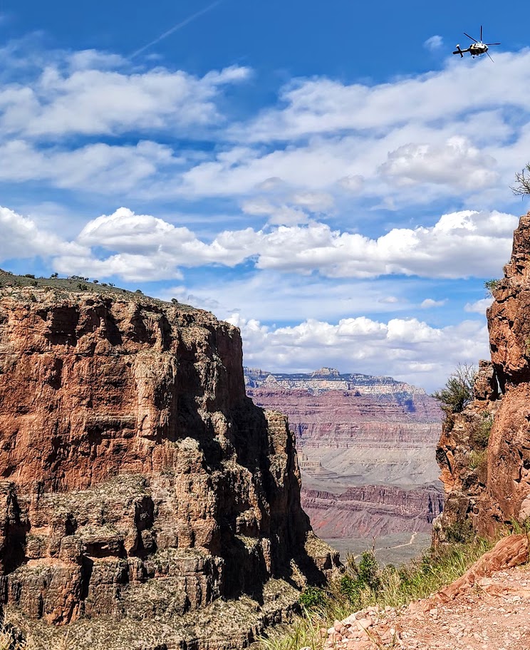
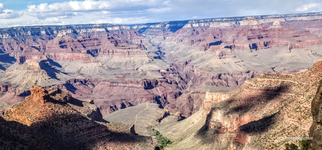
Grand views, but hiking the Grand Canyon is a bit of a circus. There are so many (way too many) people on the trails. It really detracts from the experience. (I’ll state the unpopular opinion that they should permit this hike, N.Rim, and Rim-to-Rim.)
I’ve been hiking (lengthy elevation gain hikes) and working out regularly (in anticipation of a possible Rim-to-Rim hike next month). This loop was an excellent training challenge. I have knee “issues”, so I wore knee braces. Fortunately, my knees were fine all the way down to Phantom Ranch (7.5 miles).
My hiking buddy and I arrived at Phantom Ranch after noon. We enjoyed two full 16-ounce glasses of refreshing lemonade (a must-do— $6 with a free refill!) I’d heard a lot about how cool Phantom Ranch is. It is a lovely, natural oasis with shady, gurgling Bright Angel Creek as backdrop and the comforts of campsites, rustic cabins, a restaurant, and a tiny store. Perhaps it’s charming when no one is around, but its charm was completely lost when I was there on an overrun weekend. The line for water refill there was at least 30 people long. I didn’t take any pictures at the ranch itself because I was so overwhelmed by the crowds
After downing 32 ounces of lemonade and a brief munchie break, we started climbing the switchbacks of Devil’s Corkscrew. By this time, the temperature was in the 90s. During the 3.5-mile climb up (1,300 ft), the completely exposed switchbacks, I slowed down, and my heart rate soared 20 points. By this point, my drinking water was the same temperature as my mouth. I couldn’t discern if I was drinking or if my Camelback Tube was twisted. Note, I was wearing a hat and a white shirt to deflect the sun’s rays. I don’t want to imagine what this section would feel like in triple-digit heat, which is common in the summer. I hadn’t acclimated to desert heat hiking yet because it was still Spring.
The second I came into the shade approaching Havasupai Gardens (water was available), my heart rate dropped 10 points. It returned to its active normal after I immersed my feet and my hat in the shallow stream. That immersion and the dragonfly below were the highlights here. We would have taken a longer break to wait for shadows to form on the steep Bright Angel Trail (4.5 miles, 3k elevation gain), but the area was completely overrun by noisy crowds. No pictures other than the dragonfly here, as I was too bummed out by the crowds. For me, it was the antithesis of a pleasant experience in nature.
We left in a hurry, eager to put the crowds behind me. I felt stronger on the climb out than when I hiked North Kaibab to Manzanita Springs out and back. My knees started complaining about a mile and a half from the top—poles might have helped.
After enjoying a celebratory ice cream at the top, my friend and I decided to “walk” to the parking lot, adding another 2.5 miles. That was the straw that broke the camel’s back for me. At about the 2-mile mark, both of my legs viciously cramped and seized, throwing me to the ground and rendering me helpless for at least 5-minutes, and hobbled for the remaining half-mile and day. If that had happened on the way up, I would have been incapacitated and might have required assistance. Scary. Why did it happen? Hard to say, but likely due to dehydration and lack of electrolytes. I had trouble drinking when I was overheated because my water was hot. next time, if there is one, I will bring metal containers to keep the water/electrolyte liquid cool.
Notes:Don’t underestimate the challenges of hiking in the Grand Canyon North or South, or Rim-to-Rim, especially in the summer. Even without extreme heat to factor in, hiking here is a serious undertaking. Don’t overestimate your abilities. Get as much elevation and heat training in as you can. Know your limits, hike with a buddy, and be prepared with adequate water, water purifier, electrolytes, and food. I wore trail running shoes with good tread. I prefer lighter footwear to heavy hiking boots and like having my hands free. The trails are mostly well-groomed. I did not use poles, but I might take them if I do Rim to Rim. Since I don’t do well drinking warm water, I’ll take on the extra weight of metal containers for cooler water next time.
“END” Notes
About a dozen people die in the Grand Canyon every year. The first cause of death is airplane and helicopter crashes (this comes in as first as it reflects the 128 deaths from the pre-FAA 1956 commercial airline collision). The second common causes are falls, jumps from, or driving off cliffs/ledges, and the third most common cause is due to the Grand Canyon’s extreme environmental hazards, including intense heat (temps can reach 120 degrees) dehydration/overhydration, cardiac arrest, flash floods, and lightning strikes.
Elevation gain: ~1K (Trail high point is ~2,900 feet.)
Difficulty: Moderate to strenuous depending on your speed and fitness level.
Popular with locals and visitors alike, this trail is a great go-to if you’re in the area and have a limited window for a hike or trail run. You’ll be rewarded with panoramic views and a great workout. I enjoyed jogging the climb so much, I forgot to take pictures-lol, so you’ll have to come see the views for yourself. The trail doesn’t let you scramble to the actual peak, but tops out and then drops you down the other side.
Notes: Parking is free, but limited. Weekdays are less busy than weekends. Pinnacle Peak Park has a visitor center and restrooms, interpretive signs along the trail, and apparently rock climbing routes too. They offer fun activities as well, including moonlight walks, astronomy talks, yoga classes.
Getting there: 26802 N. 102nd Way Scottsdale, AZ 85262 · (480) 312-0990.