2 Splendid, Scenic Road Bike Routes: N. Rim Grand Canyon, Az

Route: Grand Canyon Lodge to Cape Royal and Imperial Point

Mileage:~52

Elevation gain: ~3,950ft of climbing at an elevation around ~8000ft

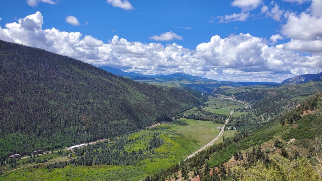
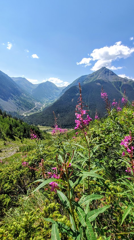
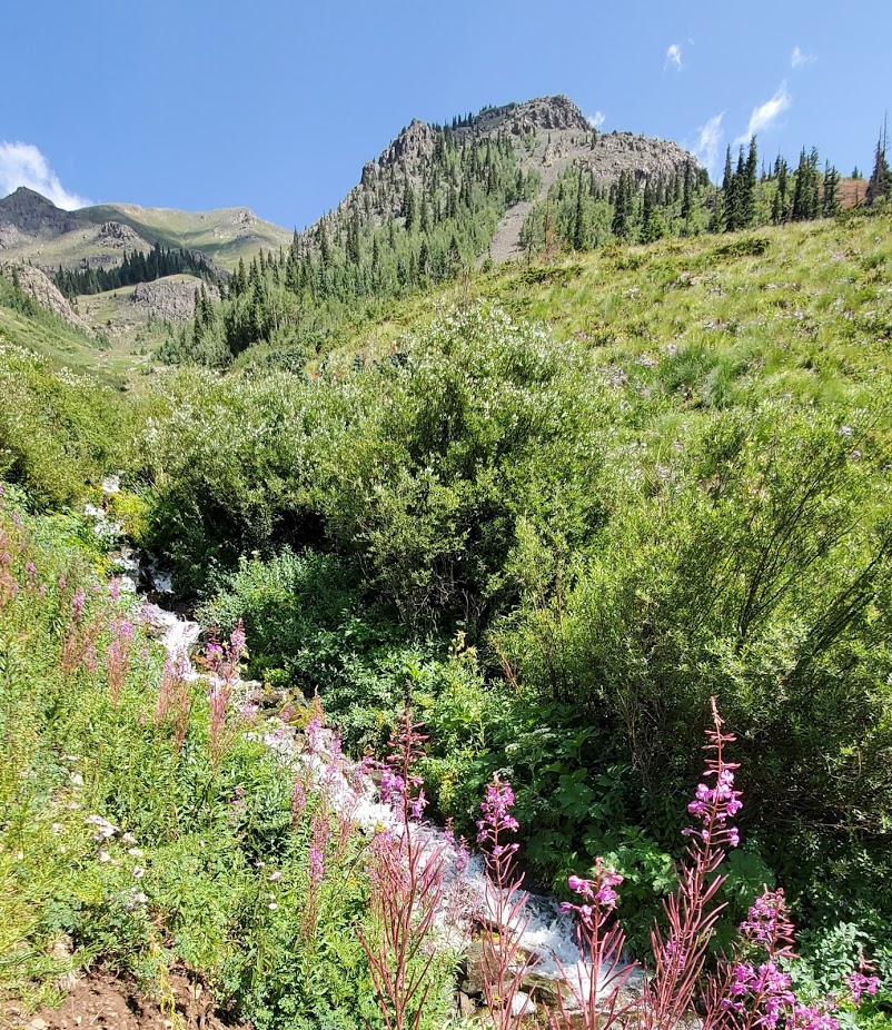
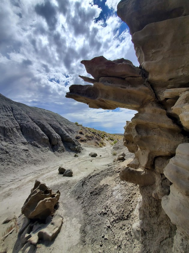
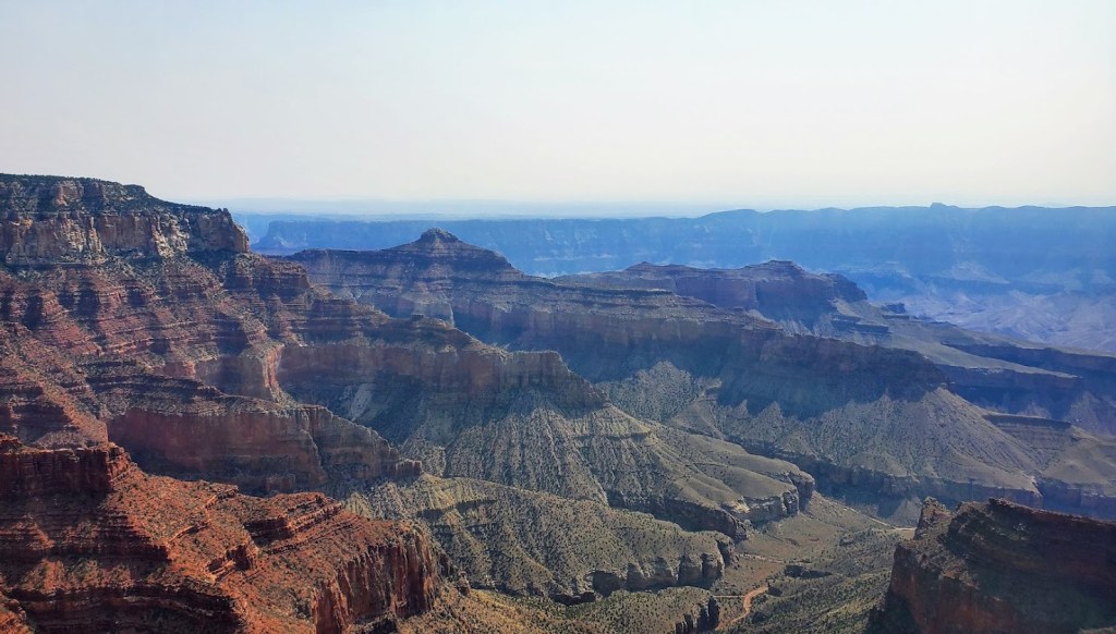
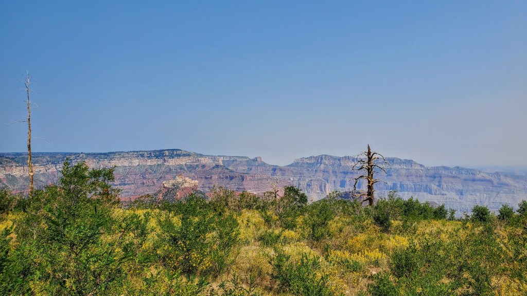
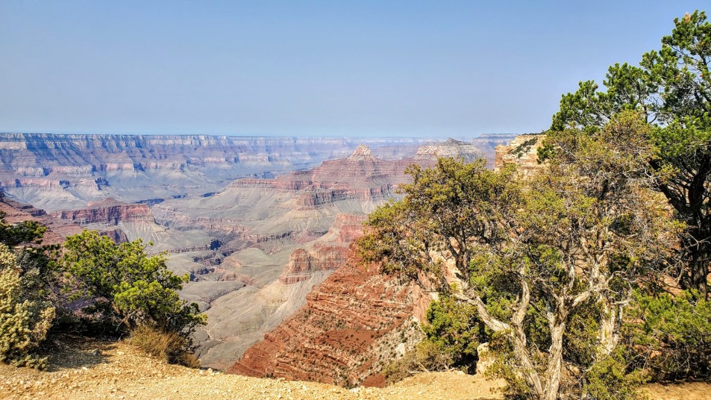
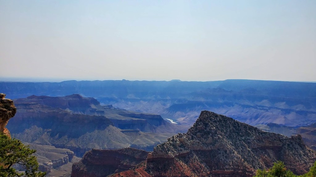
The road sign for Cape Royal says narrow and windy, not recommended for campers so there are no campers on it and very few cars, especially if you get an early start. I defaulted to my gravel bike as I feel a little more secure on it, should I need to suddenly swerve off road. While there isn’t much, if any, of a shoulder most of the time, I felt safe. A road bike would be perfectly fine and a bit faster. Inn my opinon, Cape Royal offers the most dramatic views even though Imperial Point is the highest lookout at 8,800ft. Also, for some reason, the sky was much clearer at Cape Royal. Consider packing some goodies and having your snack at Cape Royal. I was lucky enough to hit it in full wildflower bloom. (My pictures just hint at the incredible views!)

Happy Cycling!

Route: Grand Canyon Lodge to Jacob’s Lake

Mileage: ~41 (1 way)

Elevation gain: ~1,700

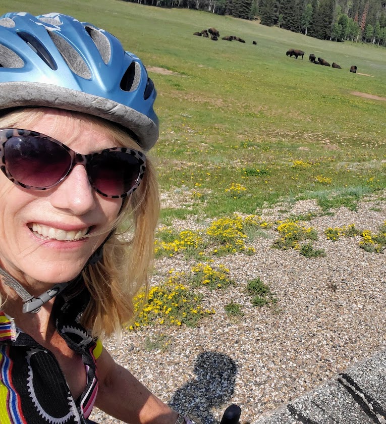
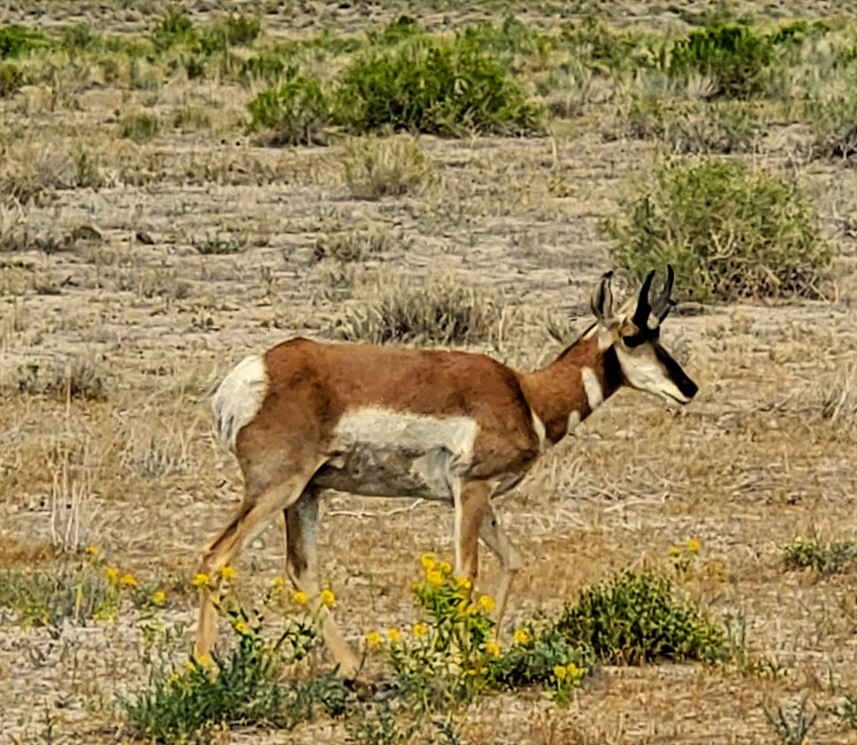
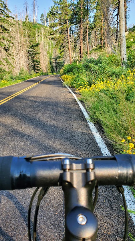
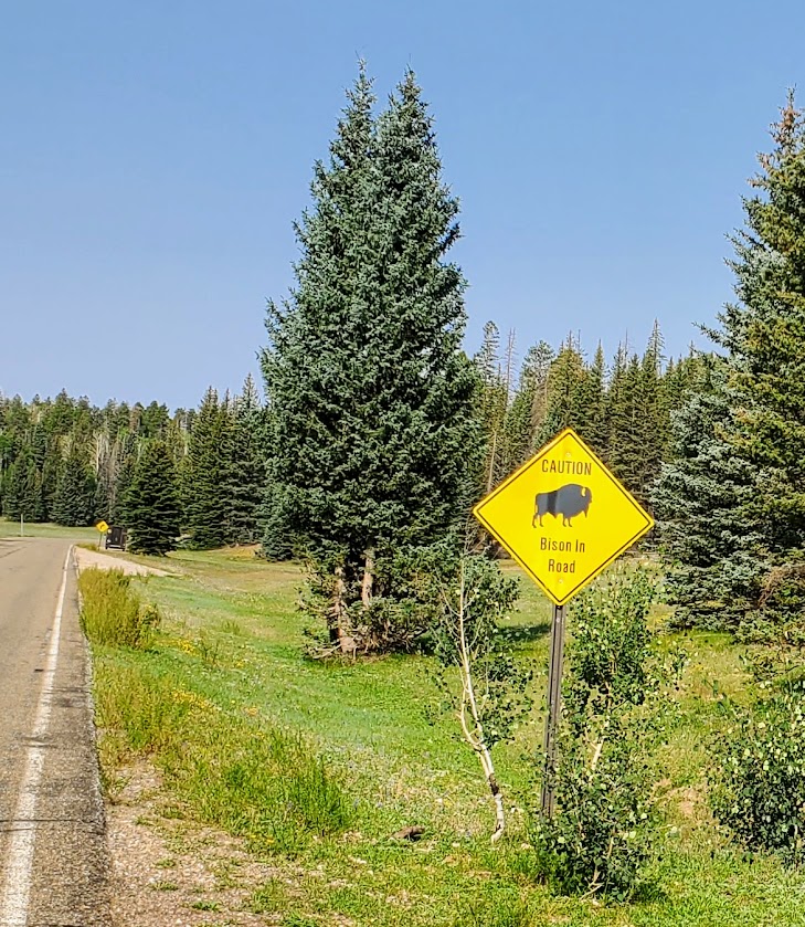
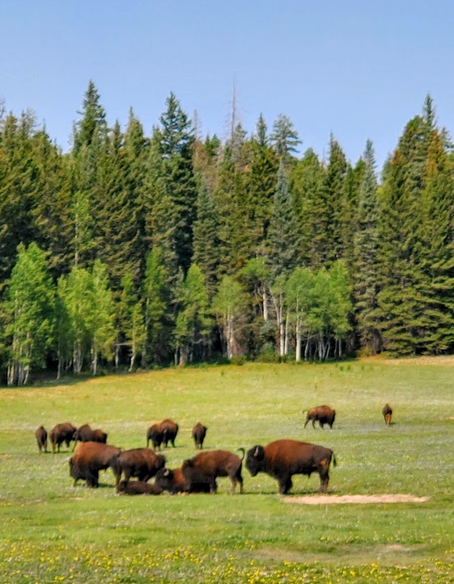
A great second day ride in the North Rim, heading back out the park to Jacob’s Lake. Perhaps you have some noncyclist friends who would opt for picking you up in Jacob’s Lake on the way home, or perhaps you’d like to double your mileage for an out and back? Have lunch in Jacob’s Lake and climb back to the rim? Whatever your pleasure, it will be a pleasure. The scenery is lovely to enjoy from a secure shoulder. Some, but not much car traffic, makes for a serene ride. Bison traffic may be a factor if you’re lucky. Keep a safe distance – they can charge 35 mph, (jump 6ft high), and I’ve heard they have a “thing” for bikers. (Recalling my cross-Catalina ride bison encounter.)

Since the North Rim of the Grand Canyon only receives 10% the visitation of the South Rim, it’s quite peaceful with minimal car traffic. Got to love it!

Thanks, Jud! Taking in the panoramic Jud Wiebe Memorial Trail, Telluride, CO

Elevation gain: 1,300 ft (From 8,750ft to 10,050ft)

Distance: 3.1 miles, loop (Note the 2 ends of the loop are about a half mile apart)

Difficulty: Moderate ++, depending upon your fitness level and altitude acclimation, most of the incline is packed into the 1st mile either way you go.

This wonderful panoramic trail was the vision of former Forest Service Recreation Manager Jud Wiebe and it is indeed a vision—from the panoramic view of Telluride below, the mountains beyond, the aspen groves, the foresty vibes, and the wildflowers sprinkled along the trail. You’ll be breathless from the beauty and the thin air.

Ps. There’s a short offshoot waterfall trail here that’s a must do too. Post coming soon.

Getting there:  S. Take UT-46 E, CO-90 E and CO-145 S to N Aspen St in Telluride

Happy Trails!

Heavenly Hematite Lake, Silverton, CO

Elevation gain:2,615

Mileage: 4 Roundtrip

Difficulty: Hard— steep climb in altitude 10k-12k+

Hematite Lake, you had me at hello with your plentiful wildflowers, gurgling streams, and sparkling gem of a lake. So much quintessential Colorado beauty packed into this short, steep, sweet hike. I’ll let the pictures speak for themselves.

Note: The trail is single track consistent incline with few switchbacks; consider poles.

Getting there: US-550 S to Silverton, left on Co Rd 2305 ft, left on Greene St and right in CO Rd 2. The trailhead is 0.2mi before the bridge that crosses the Animas. The parking area is on the south side of the road, and the trail begins as two tracks that lead up a grassy hill. Soon it turns into single track and up and away you go. (There are trails beyond the lake to some mine shafts if you wish to explore further.)

Happy Trails!

Beautiful Bridal Veil Falls, Provo, UT

Too many wedding guests, but if you’re up for the scramble to the bride, you’ll lose the crowds.* Since this lovely 607-foot-tall, double cataract waterfall is just off US189 within close reach of a metropolis (SLC), it’s heavily trafficked (overrun). More of an attraction than an excursion, this 1.4 mile stroll is on a paved and dirt path. It is literally a walk in the park with the added scenic bonus of the Provo River running alongside the trail.

https://www.youtube.com/watch?v=W5CeQgqmavo

*Disclaimer: Scrambling can be hazardous—a man fell to his death hiking here not long after I visited. https://www.usatoday.com/story/news/nation/2021/07/19/man-bridal-veil-falls-utah-falls-death-boy-left-alone/8018440002/

Apparently, there is nearby trail to an upper falls – aptly named “Upper Falls”, but it’s unmarked and difficult to find—maybe next time.

Getting there:  UT-52 E/W 800 N and US-189 N/E Provo Canyon Rd and follow the signs.

Nice stop to stretch the legs if you’re road tripping to Sundance or Park City.

Happy Trails!

Otherworldly Fantasy Canyon, a roadside geological wonderland

A small, relatively untraveled, roadside attraction, miniature Fantasy Canyon contains some of the most unusual geologic features in the world. Here, 3 types of rocks (mudstone, claystone, and sandstone) eroded at different paces, creating wild formations that rise from the barren badland topography like a sci-fi city.

A short 0.6-mile loop trail will transport you into a bizarre world. You’ll walk by dragons, intricate gates, and alcoves. It’s a stone Rorschach experience—a place to let your imagination run free.

Speaking of running free, if you’re lucky, you might see some of Utah’s wild horses and pronghorn frolicking around this remote area. It’s quite a treat!

(What’s not a treat, is seeing all the oil drilling on BLM land.)

Getting there:
From Vernal take UT 45 for 25 miles southeast, then go south on the oil company service road. Follow the signs for Fantasy Canyon.

Happy road tripping!