Elevation Gain: 650 ft (You’re starting at about 6,100 ft)
Difficulty: Easy to moderate, depending on your fitness level
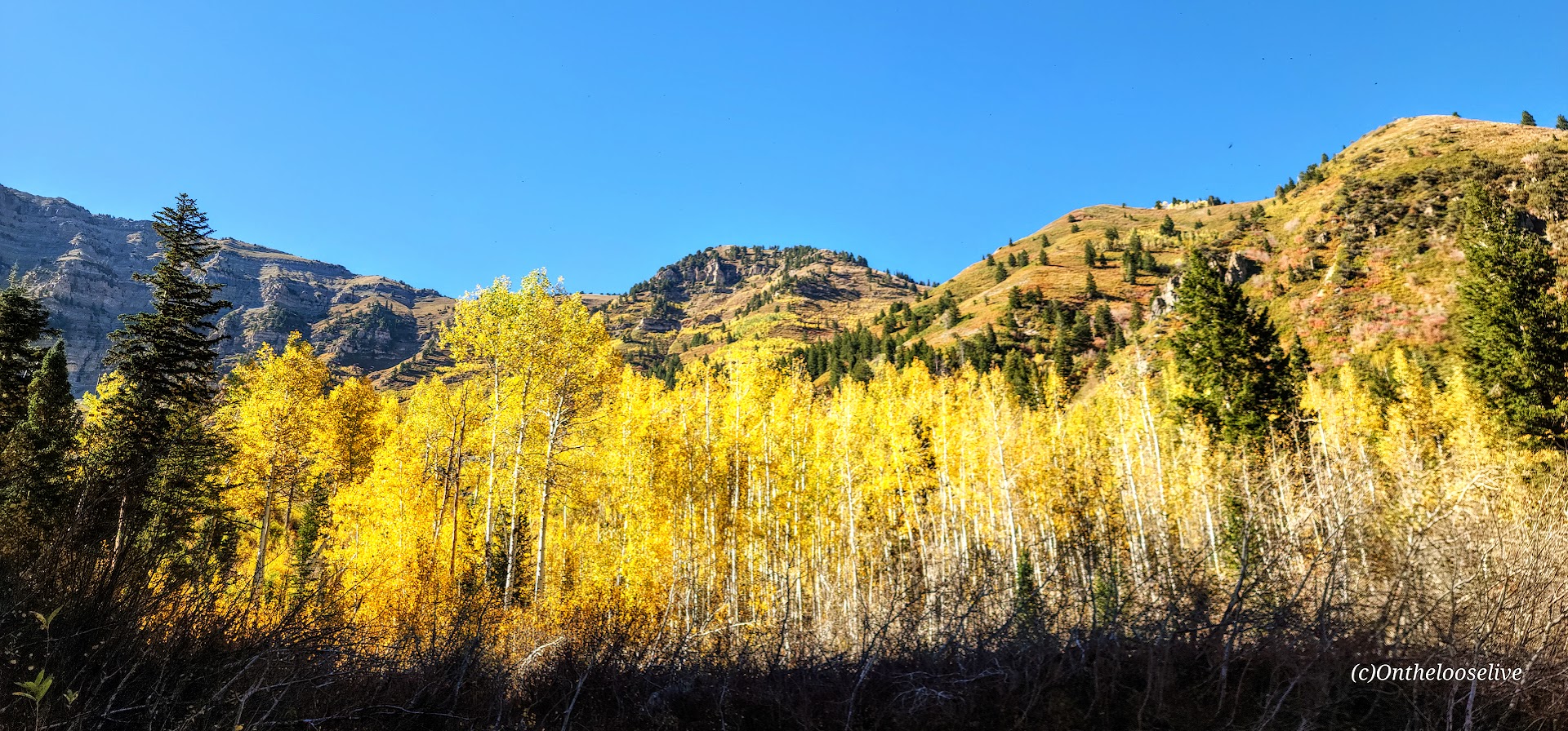
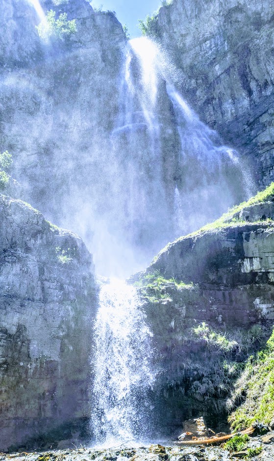
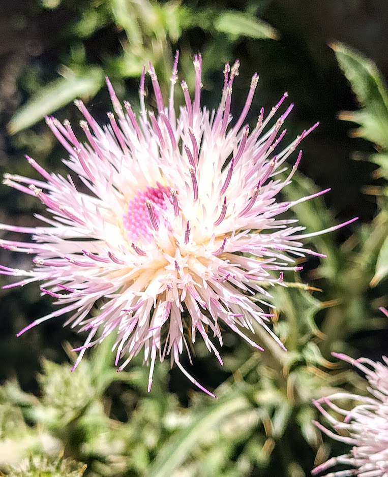
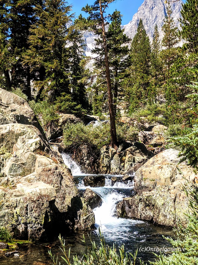
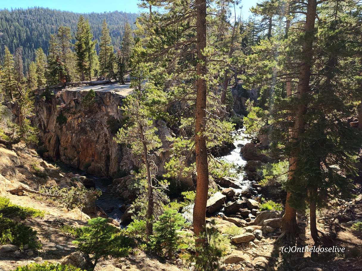
I finally made it to the spectacular 200-foot, double-tiered Stewart Falls! What took me so long?
(The truth is, I’m guilty of prioritizing marvelous Mount Timpanogos via the Aspen Grove or Timpooneke routes when I’m up here and rarely have time to fit in this quickie.) This time, I fit in Lake Blanche in the morning and made this my afternoon destination. A bit of driving, but worth it.
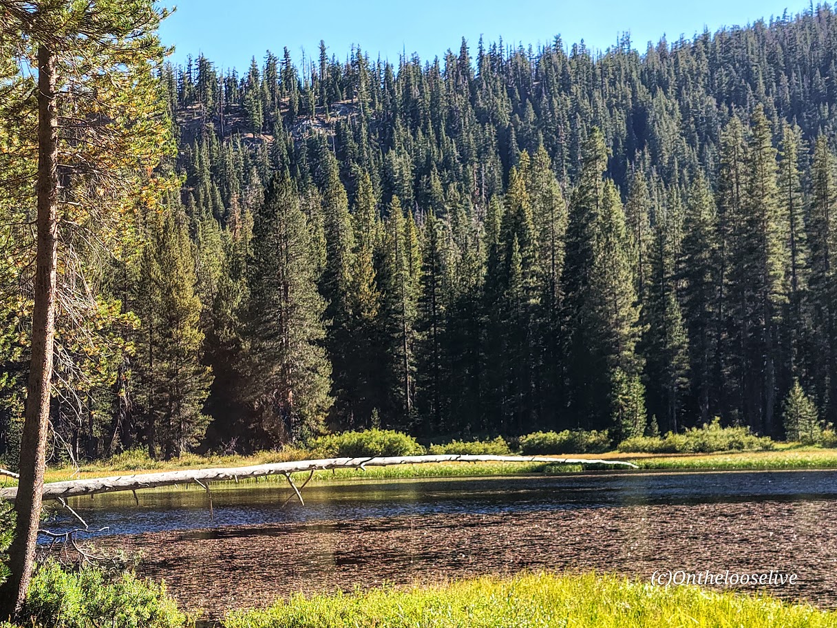
This lovely, runnable, single-track trail through the forest is especially enchanting in the Fall, with the Aspens at the height of their color. You can’t beat the splendid reward of this shortie
Make a day of it; check out the beautiful grounds of the Sundance Resort, grab a bite, and browse the shops.
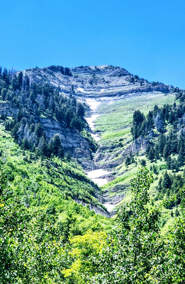
Turns out Stewart Falls is just as splendid in the summer. In fact, with the snow melt, it really rushes and mists, and you may get to see additional falls!
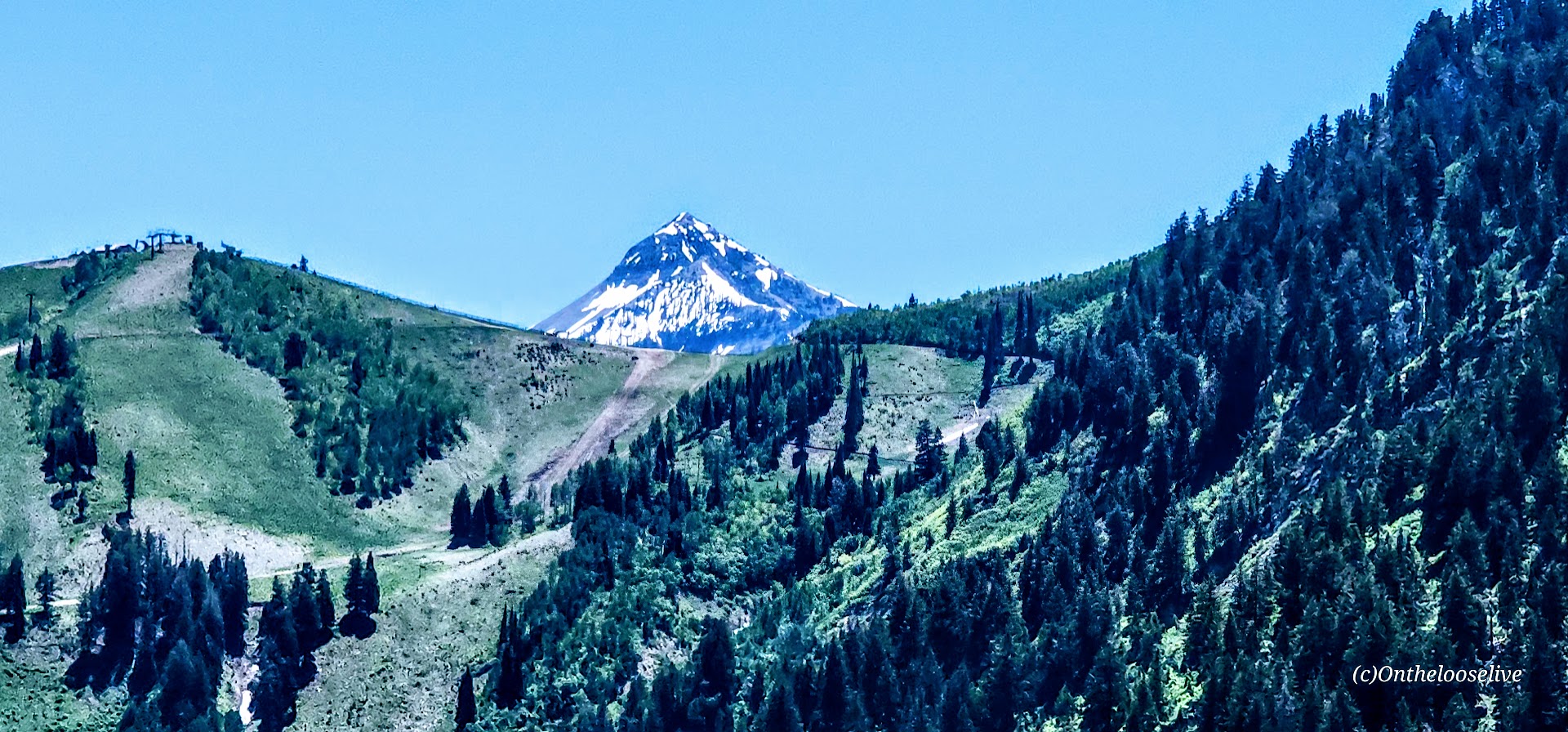
Getting there: The trail begins at the Aspen Grove Trailhead parking lot. The entrance fee is $10 or free with a National Park Pass. This lot fills early, and they do ticket cars along the street. Pay close attention to the “No Parking” signs; they’re easy to miss.
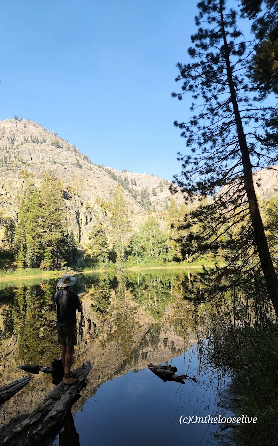
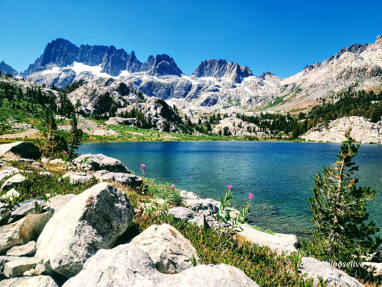
The Shadow to the Minaret (Agnew Meadows to Devil’s Postpile) route packs so much breathtaking beauty into a challenging 17-mile hike. Backpacking might be the best way to experience it, or you can choose a waterfall or any of the 7 amazing alpine lakes (Olaine, Shadow, Ediza, Iceberg, Cecile, Minaret, and Johnston) along the way as your destination for a shorter out-and-back hike. I wanted to see as much as I could in the limited time I had in the area, so I did it as a day hike.
Miles: 17, or create your own out-and-back adventure (~7 miles RT to enchanting Ediza Lake with only 400 feet elevation is an excellent option for a shorter day hike and is popular for good reason ).
Elevation gain: ~2.529
Difficulty: Hard/Challenging, especially for a day hike
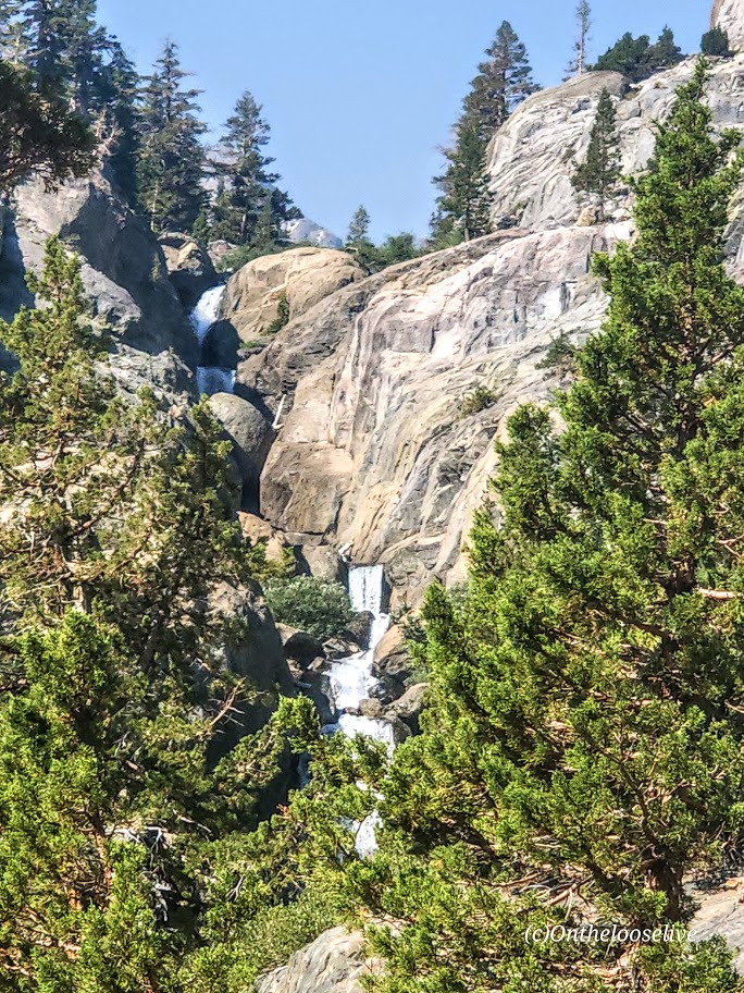
From Agnew Meadows, you’ll encounter Olaine Lake first, then the gorgeous tiered Shadow Creek Falls, Shadow Lake, and dazzling Ediza Lake.
Enchanting Ediza Lake
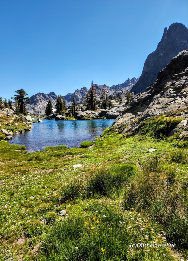
Take the trail above Ediza Lake for a glimpse of dramatic Iceberg Lake.
From there, if you wish to venture beyond, you’ll have to climb/scramble the rugged loose scree and talus cliffs to reach Cecile Lake.
Note that I wouldn’t recommend attempting this if snow is present. There’s an argument if you’ve come this far to keep going. You’ll need to boulder hop for a half mile or so around Cecile to get to the slippery, rugged drop into Minaret Lake.
Scaling Iceberg’s cliffs, boulder hopping around Cecile, and “sliding down” the loose sandy “trail” into Minaret can be quite time-consuming despite these sections’ short distances. (Some AllTrails hikers reported it taking 2 hours for these miles 9 & 10 .) I made it up Iceberg in 20 minutes or so, but I am accustomed to scaling rugged, steep landscape. The boulder hopping around Cecile Lake was slow going for me, and the slide down into Minaret was even slower as my knees did not appreciate the vertical angle.
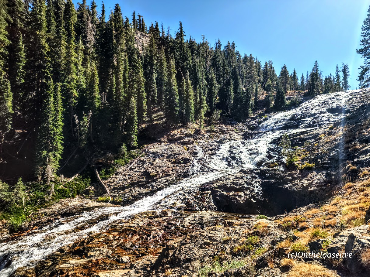
From Minaret to Devil’s Postpile, it’s all downhill with some rocky sections. Highlights include a wonderful, wide, terraced waterfall, and close to the end, a cool canyon area with a stream going through it, and finally, Johnston Lake.
Notes:
Get to the Agnew Meadows trailhead before 7am for self-drive and parking, or take the shuttle.
Equipment: Would poles have helped on the descent to Minaret? I’m not sure. Personally, I prefer to have my hands free. Prophylactically for me, knee braces would have been a good call, but not needed until the Minaret descent. If you’re going over 12 miles, I’d recommend hiking shoes. Much as I love hiking in light trail runners, my feet were beaten up/done at the end of this 17-mile day.
Was it worth it? ABSOLUTELY! I hope you can see why.
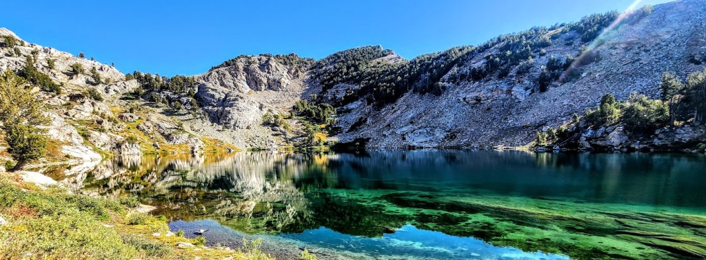
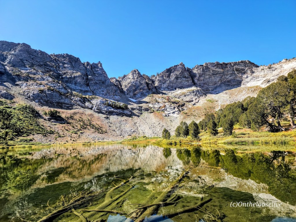
The Eastern Sierras Ruby Mountain range (often compared to the Alps) was named for the gems found there during the gold rush. The name is a misnomer, though, as the dark red gems discovered in these mountains were garnets, not rubies.
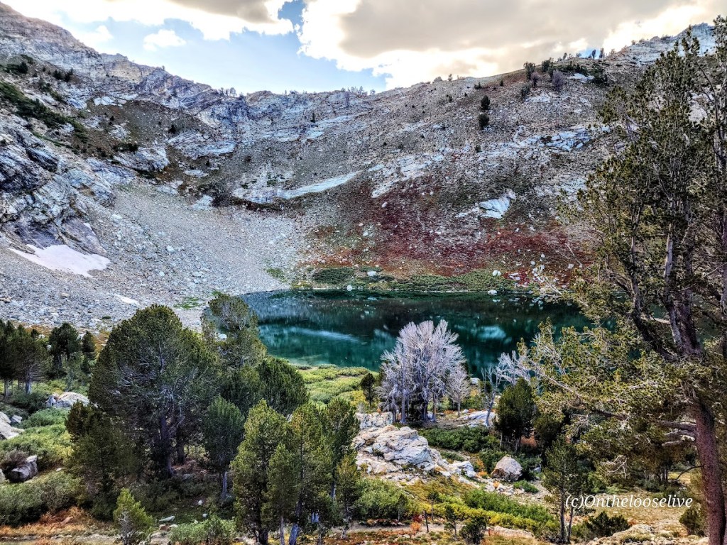
While no gold was ever found in the Ruby Mountains, treasures abound—two dozen dazzling alpine lakes and streams lively with Rainbow, Brook, and Lahontan Cutthroat Trout, meadows, and healthy forests. This rich wilderness area is home to one of the largest mule deer herds in Nevada and populations of mountain goats, bighorn sheep, and Himalayan Snowcock. (Oddly, I didn’t see any of them on my overnight backpack.)
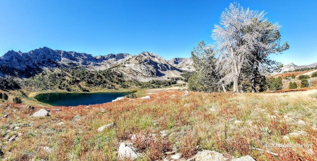
The Ruby Mountains’ craggy, glacier-carved peaks rise nearly 5,000 feet above the valley below and are capped by Ruby Dome at 11,387 feet. The elevation on the trails ranges from 7,ooo ft to 11k. Trail length varies from a couple of miles to multi-day thru-hikes—choose your adventure. The main trails are well-marked and maintained, easy to follow, and easy on the feet. Explore for an afternoon or overnight backpack, as I did. If you’re like me, you’ll be dazzled by the glimmering alpine lakes and the sparkling night sky.
I went on an overnight backpacking trip here in September 2023. Yes, I’m way behind in my posts (understatement). I explored half a dozen lakes, including Liberty Lake, Lamoile Lake, Farvre Lake, and Castle Lake. I shall return and will provide more details then. Until then, click here for more info about the Rubies from “Travel Nevada.”
By now, you know that I have a thing for alpine lakes. While I could have lingered for days at any of the gems I visited, I did venture up above the treeline to take in the grand views as well. As you can see, it’s a completely ifferent vibe at a higher elevation – there are ten peaks over 10k feet here, and the highest is Ruby Dome at 11,387 feet
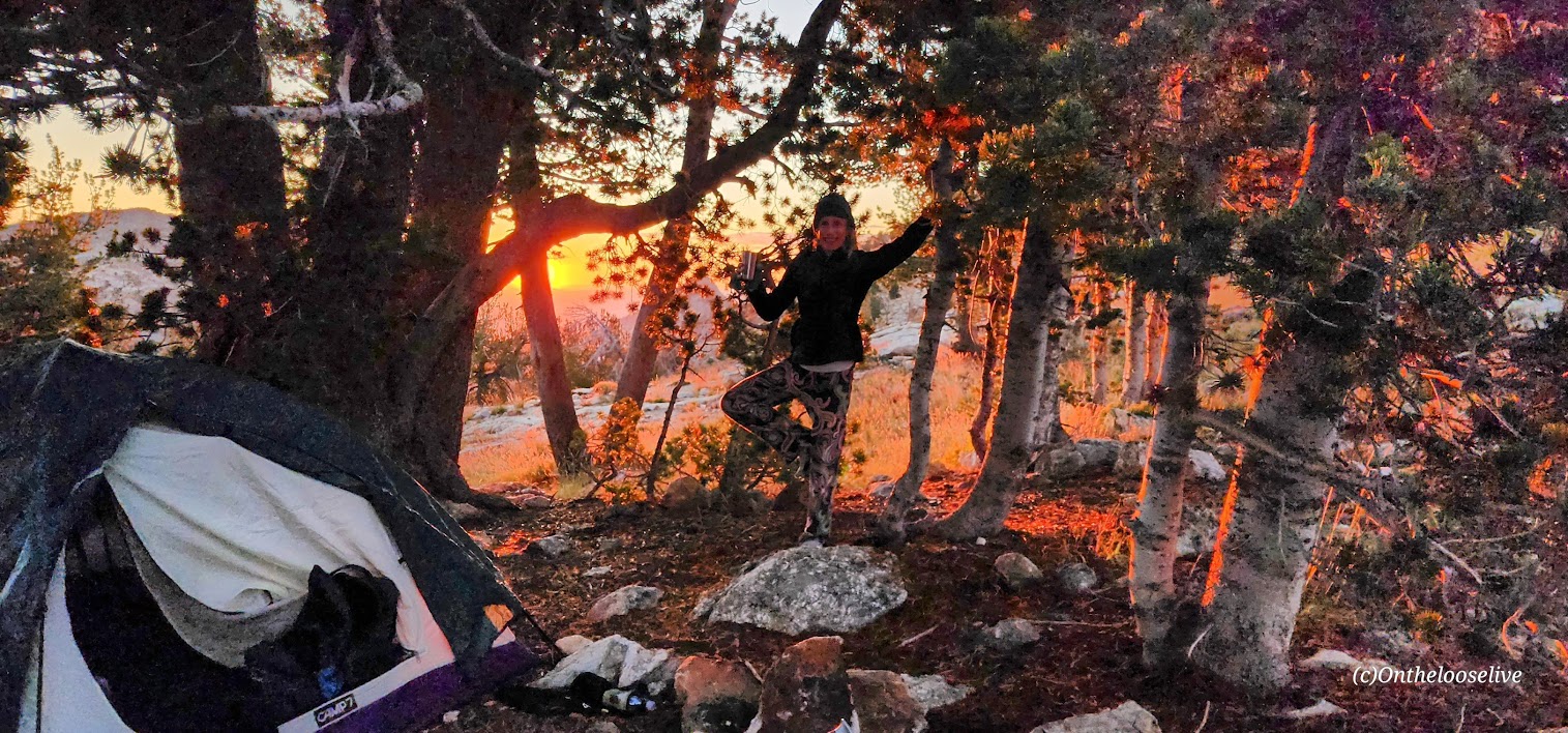
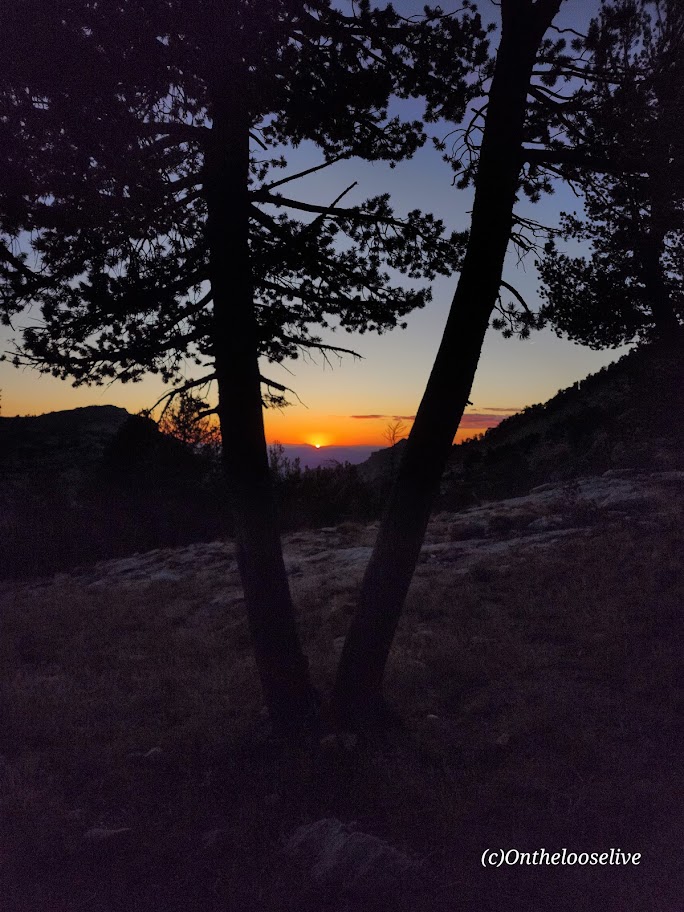
Night skies are wonderfulhere (Saw a rocket launch and a huge meteor!) And even on a weekend, solitude abounds!
Note of caution: Elko is 21 miles away from the Ruby’s; you’d think a place so close to this spectacular wilderness area would take pride in its gateway status. Sadly, Elko has one of the highest crime rates in America compared to communities of all sizes. (Elko’s population is only 20K!) The chance of becoming a victim of violent or property crime is 1 in 30. YIKES! Making it your adventure base camp, especially if you are a woman traveling solo, is ill-advised. Bring a hiking buddy and head for the mountains. (Common sense—don’t leave any valuables in the car.
Elko history: Elko was settled in 1869 with the development of the Transcontinental Railroad and became a base for gold and silver mining and livestock ranching. Unfortunately, it seems that it’s been downhill since then. There are 6 legal brothels in this small town of 20k, and the seedy element they attract is
Getting there:
From Elko, follow State Route 227 southeast toward the tiny town of Lamoille. Just before entering Lamoille town limits, turn right on the paved 12-mile Lamoille Canyon Scenic Byway and follow it to the parking area at its terminus.
Happy Trails!
(Here I am overloaded with my old heavyweight gear (3 lb surf backpack, 3.5 lb sleeping bag, 7.5 lb tent, 4 liters/8 lbs of water, etc., etc.). My last overnight backpack was years ago on Mt. Whitney. I guess my knees and back could still handle a heavy, poorly distributed load then. This time, the struggle was real. In the picture here, who knows if I’m grimacing or smiling in relief that most of the climbing was done. Since then I have opted for ultralight camping gear, which cuts my load by more than half. Stay tuned for an upcoming gear post.
Difficulty: Moderate to hard, depending on your fitness level and acclimation to altitude
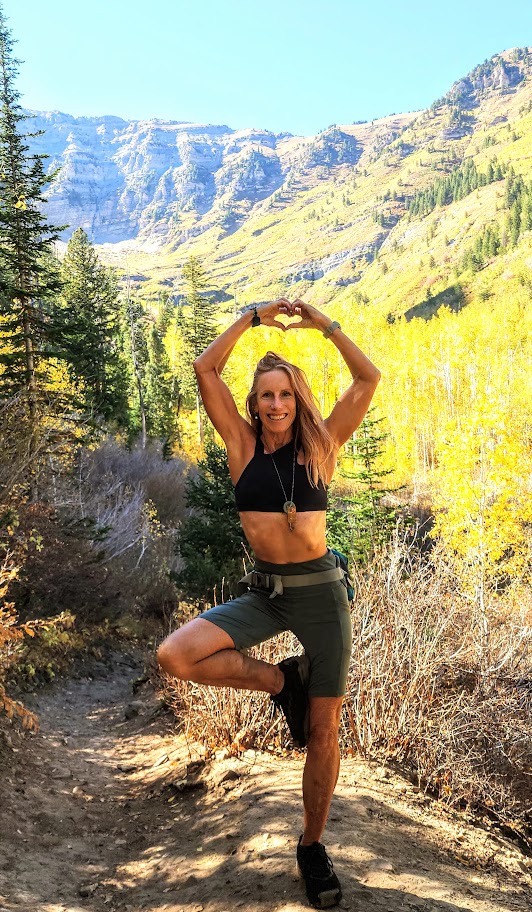
My second splendid summit of Mount Timpanogos (11,753 ft) was via the Timpooneke Trailhead. (And yep, I’m sticking with the same title. Mount Timpanogos simply has ALL the ingredients for a great hike. I’ve seen Mt. Timpanogos from both sides now (Aspen Grove Trailhead and Timpooneke), and both routes are gorgeous. Mount Timpanogos still ranks as the best US hike I’ve done.
Trail Notes: Keep your eyes open; at Mile 1, the trail takes a sharp right turn. (I kept going straight on what appeared to be a wide, well-traveled trail that stopped short across a stream. I ended up scaling a waterfall avalanche chute before it dawned on me that I was on another one of my “off trail explorations”—yep, I know, lol. I later learned I wasn’t the only one and suggested to the ranger that a sign might be advisable.)
At the 3-mile mark, a “snow bridge” had collapsed across the middle of a waterfall, requiring careful traversing of the slanted, slippery snow field. The picture below may not look too treacherous, but there is a waterfall crevasse directly under the snow. One slip could be a big, potentially final slip if you know what I mean.
Crampons would help, but given the onslaught of the heat wave we’ve been having, this section won’t be an obstacle for long. Other than that, the trail is well-marked until you reach the Emerald Lake juncture. The Summit Trail (054) is the unmarked (I’m not sure why) trail to the right.
Cons: This route seems busier/more crowded. (I was there on a weekend. I’m sure it’s better on a weekday.) You may want to challenge yourself with the extra 1k of elevation that the Aspen Grove route delivers.)
Pros: It’s easier—there is 1,000 feet less elevation gain, and a couple of miles shorter. Best of all, you completely bypass the tortuous snow and talus field that takes forever to painstakingly cross on the Aspen Grove route. (See picture below.) Footing is easy the entire way on the Timpooneke route perhaps that’s why it’s so popular with trail runners.
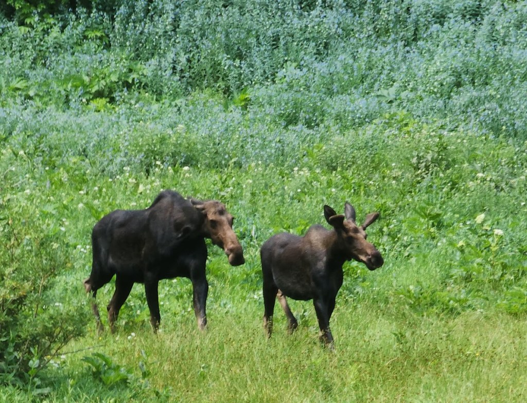
On the way up, you’ll go through what I’ll call “Moose Meadow,” where I saw the moose below with her calf.
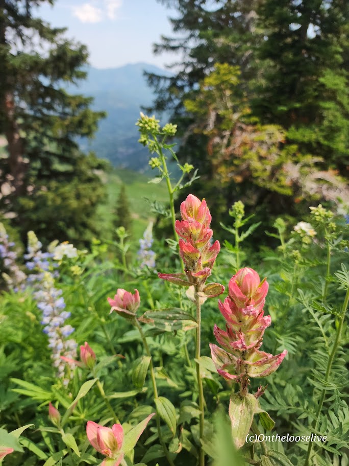
You get a great “bowl” view of Timp’s peak above and surrounding peaks from the wildflower-filled meadow basin.
After which, the trail begins to climb in earnest to the Timp Saddle, where you’ll enjoy sweeping views of Utah Valley and the summit ahead. If you’re lucky, you may see grazing, napping, or salt-licking mountain goats along the way. Give the mountain goats space and respect. I(I have a great magnifier on my camera.) (While the goats look docile, they have been known to kill loose dogs that harass them (3 loose dogs were killed by goats last year) and gore people who get too close.)
I saw several off-leash dogs—doesn’t seem prudent! I’m guessing the moose wouldn’t take kindly to the loose dogs, either.
To reach the summit, mild scrambling is required. The section is short and nontechnical, but it is not for the faint of heart or those scared of heights. The panoramic views are tremendous, but it was a bit hazy when I summited—perhaps due to the wildfires in the surrounding areas.
Caution: This hike involves significant elevation gain and hiking at elevation. Be aware of the signs of altitude sickness. It can sneak up on you even if you’ve never had it before. It happened to me recently on Wheeler Peak. On the way down Timpanogos, a teenage girl was in a fetal position by the trail, holding her head. Her family had called for rescue. Hopefully, she’s okay.
Difficulty: Moderate to strenuous, depending upon your fitness level (3k ft climb in ~2 miles). Class 2.
Corkscrew Peak (5,804 ft) is the imposing sentinel in the Grapevine Mountains of northern Death Valley National Park. It looks intimidating from afar and upon the approach, but the trail isn’t bad, and it’s a great workout. Definitely one of the most unique peaks I’ve seen.
Speaking of trails, the first portion requires some route finding. Head West from the Corkscrew Peak sign and follow the wide wash towards the peak. The route is cairned, gentle, and gradual, leading you to a narrow canyon area at about the 2-mile mark. Here, you’ll scramble up and out of the wash on the left. You’ll climb the spiraling rocky trail for the next 2 miles. Watch your footing, as there are many spots of loose gravel. All told you’ll be climbing 3,360 feet to the top—most of it packed into a somewhat intense 2 miles.
Right before you reach the top, there’s a cool natural window, a nice spot to return to enjoy a snack, and the view before the steep, slippery descent.
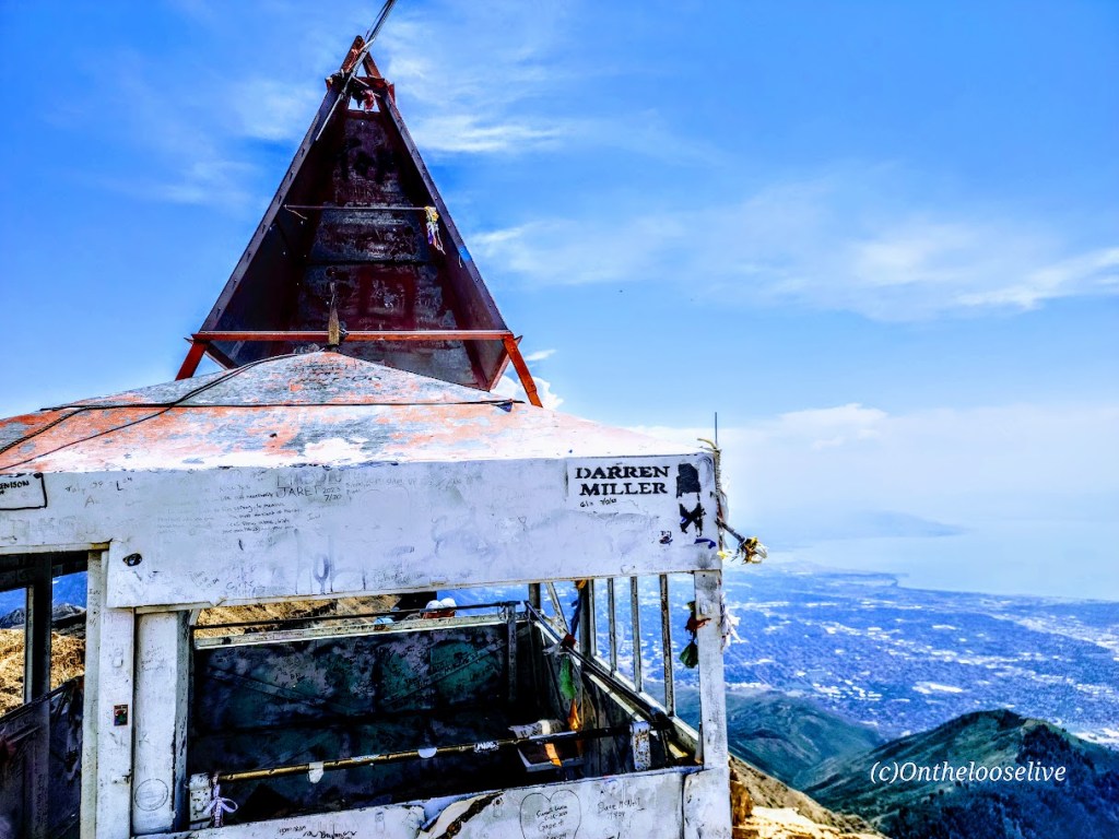
From the top, you’ll enjoy splendid views of Death Valley and surrounding peaks, including Langley, Whitney, and Telescope. You can also document your peak bag in the summit record, which is in a metal container wedged between some rocks at the top.
Getting there:
From the Visitors Center at Furnace Creek, drive ~ 11 miles N on State Highway 190 to the signed, paved Daylight Pass Cutoff Road toward Beatty, NV. Turn right and follow this road 10 miles to a signed road fork at Hell’s Gate. Go right onto Daylight Pass Road and drive 0.9 miles. Park on the dirt shoulder.
Notes: The initial section of the trail is a wide wash north of the road. The trail is slippery in sections with loose gravel “marbles; choose hiking or trail running shoes with the best traction. Some recommend poles for the way down. Personally, I do better on slippery downhill if my hands are free. It’s possible to trail run up, but be cautious on the way down.