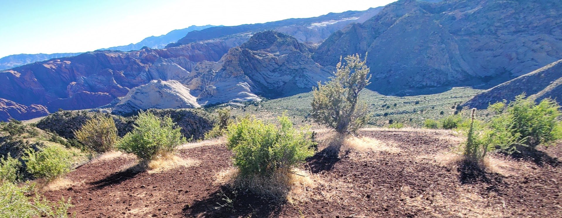
Difficulty: Easy, but there is another option via Paradise Rim that’s a little more rugged / interesting.
Stairway to heavenly views
Great hike, cool cave, splendid views!
Not a bad spot for a little yoga practice too.
Need I say more? I think not. If you’re in the area for a limited time, this is a good one for your “to do” list.
Getting there: Snow Canyon State Park, Ivins’ entrance. The trailhead is on the right before you reach the park gate. Park in the lot on the left. If you’d like a little more challenging / rugged approach, you can take Lakota Drive to the trailhead for Paradise Rim and come in from the backside. You can also add on a couple miles (~2 each way) if you park at the Chuckwalla parking lot and take the Turtle Rock Trail to connect to the Paradise Rim trail. Anyway, you go, you can’t go wrong.
A little more choppy and a little more climbing on the Paradise Rim Trail
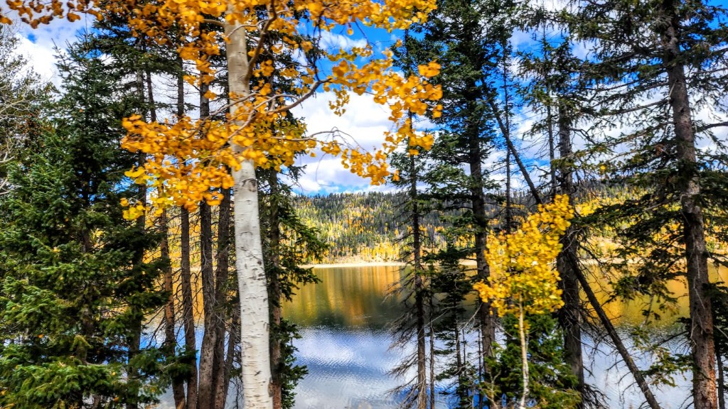
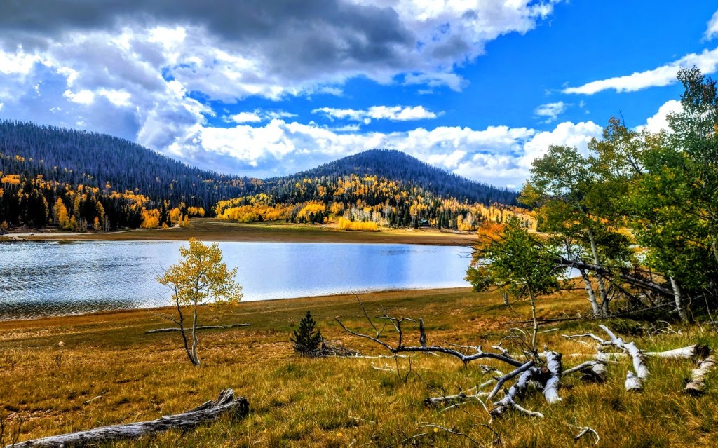
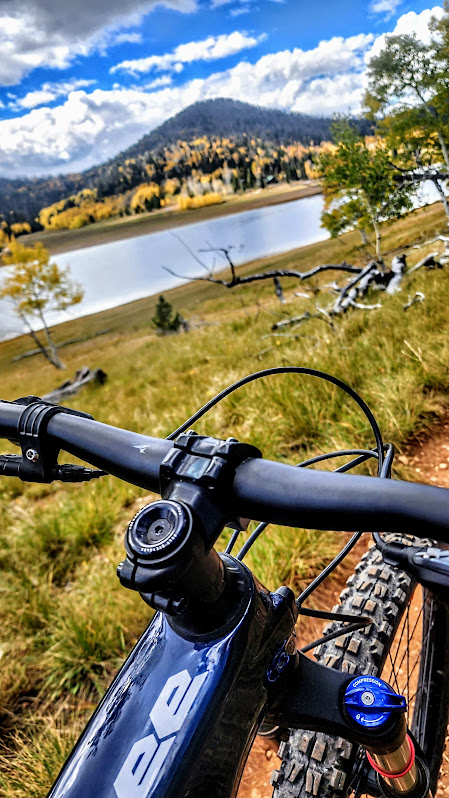
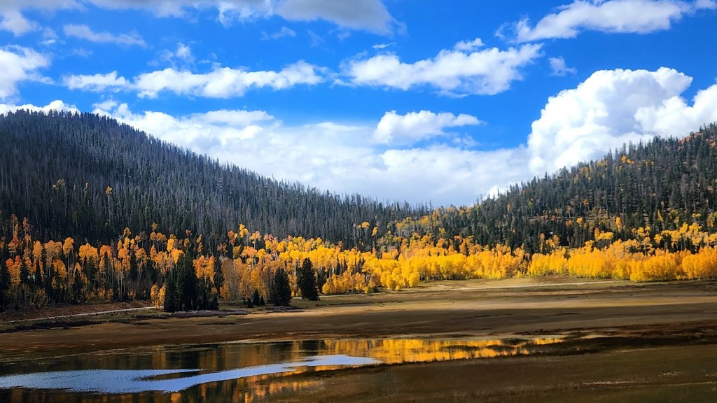
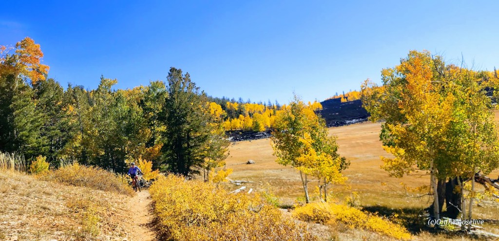
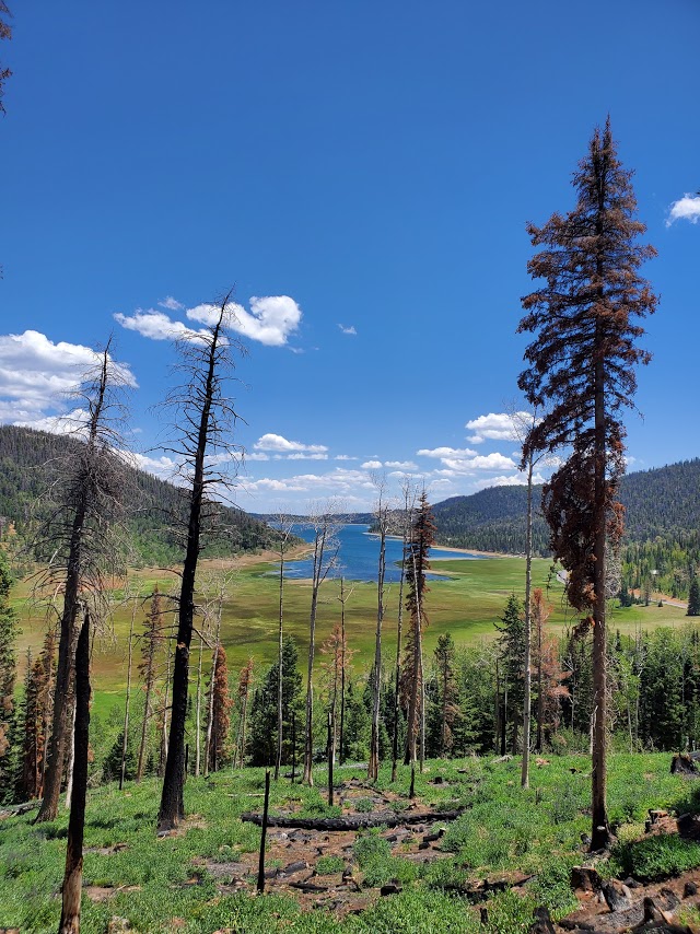
I don’t tend to throw the word epic around much, though I have been on some epic mountain bike rides – Tahoe’s Flume Trail, Lake Crescent’s Spruce Railroad Trail, and while not epic per se, that little gem, Diamond Valley Lake was quite lovely too. Fond memories of those rides were stirred up by my ride today on the Navajo Lake Trail. As you can see, Navajo Lake and the surrounding area are dazzling in the Fall. It’s quite sweet in the Summer too, a great spot to escape the heat of St. George as it’s usually at least 10 degrees cooler.
It’s a sweet, highly scenic, nontechnical single-track cruise via the Navajo Lake Loop Trail and the Virgin River Rim Trail, aka the other half of the Navajo Lake Loop Trail. Great for mountain biking, trail running, or hiking.
Interesting fact: The lake was created when a lava flow dammed the eastern end of the valley.
Distance:11 Miles
Staring elevation: 9,035′
Elevation gain: 827 ft
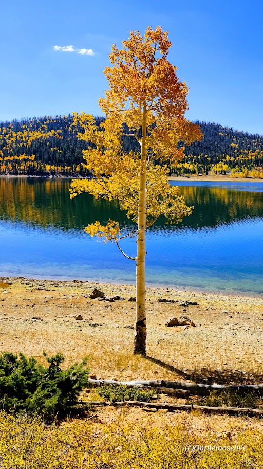
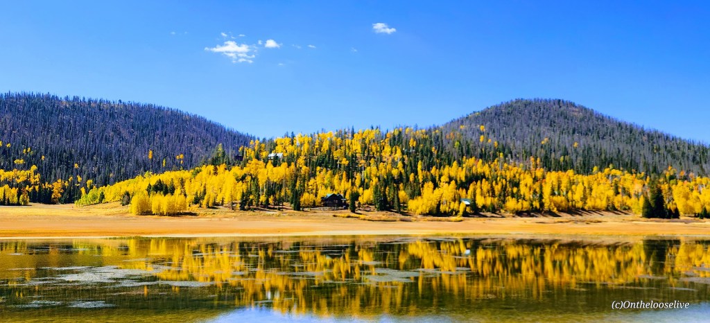
Navajo Lake Summer vibes – View from the Rim Trail section
Winter vibes—taken from a hill above Deer Valley cross country and snowshoe area.
Getting there: From Cedar City go east on Scenic Byway SR 14, 25 miles to the Navajo Lake road turnoff and keep your eyes open for the Navajo Lake Loop Trailhead parking sign on the right side of the road. It’s free to park.
Ps. There are campgrounds, and fishing, boating, and swimming are allowed.
Yes, it’s right off highway 18 at Diamond Valley and super short—so yeah, those are the top 2 reasons not to go. But if you don’t, you’ll miss out big time as we often do when we fail to take those little spontaneous stops that beckon us from near and far. And sometimes, it’s those off the freeway and /or off the beaten track stops that yield the biggest rewards. Remembering my Kooteney Falls stop a couple years ago.
This hike is definitely short – a mere 1.7 miles, but as the spoiler alert headline says it’s LONG on panoramic views. Apologies for the fast spin, I was too excited!
Due to loose lava rock near the top, I’d suggest hardy, grippy shoes . It’s starts out flat, takes you around the back on a mostly dirt trail and then starts climbing at the .60 mile point. Yes, you can make a scramble straight up &/or down, but you’ll likely leave some DNA on the lava rocks. And by nature of the scramble, leave another indented trail on the cone.
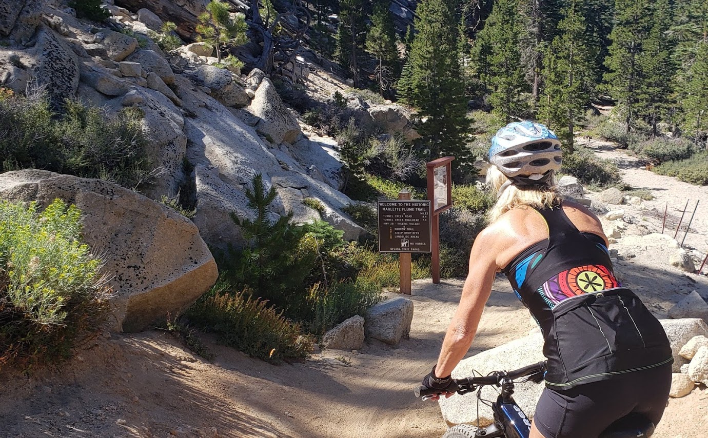
While there are plenty of more technical and longer rides around Lake Tahoe, the Flume Trail is world-renown for its scenic beauty and an absolute “must do” if you’re in the area. (I’m sure you’ll see why after you watch the videos.)
Difficulty: Moderately difficult due to elevation of 7000′ to 8157 and a 1000 ft climb in the 1st 4 miles, technically simple
Description: Ride begins at the trailhead in the Spooner Lake Day Use Area in the Lake Tahoe Nevada State Park on the east side of Lake Tahoe. Follow the Flume Trail signs from the parking area via the North Canyon Road. In the first 4 miles, you’ll climb 1000 feet on fire road through aspen groves and meadows, followed by short descent to picturesque Marlette Lake.
Marlette LakeMarlette LakeFlume Trail Single TrackLake Tahoe and Snow Capped Mountains BeyondFun Times on the Flume Trail
After ~1.5 miles of riding the dirt road along the lake, you’ll have ~4.5 miles of smooth, flat single track and breathtaking views 1600 feet above the east shore of Lake Tahoe. If you’re afraid of heights. some of the single-track sections might feel sketchy. Slow down and savor the beauty – the best section ends too quickly. You descend on a 3-mile fire road with lots of sand traps – beware.
Hourly shuttles summer and fall: $18 The Flume Trail Bike Shop (mtb rentals too), 1115 Tunnel Creek Road, 775-298-2501
Notes: I’d say a shuttle is a must. In my opinion (and others’) it’s not safe to ride on the roads in Lake Tahoe.
I did this trail 4 years ago and didn’t stop once on the climb. This time the ride was more of a workout with stops for me—a humbling combination of altitude, lack of bike training, the fact that I was in the hospital 2 weeks prior, and perhaps being 4 years older (sigh). Would definitely do it again if I have the chance–those views (unlike me) never get old.
Spent a leisurely morning exploring a few of the wonderful State Parks and scenic reservoirs near St. George, UT.
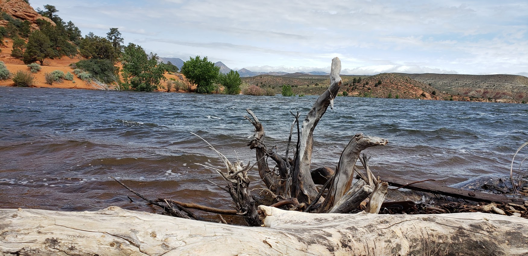
What’s great about the reservoirs in Utah, is not only are they breathtakingly beautiful, but you’re also allowed to boat, fish, and swim in them.
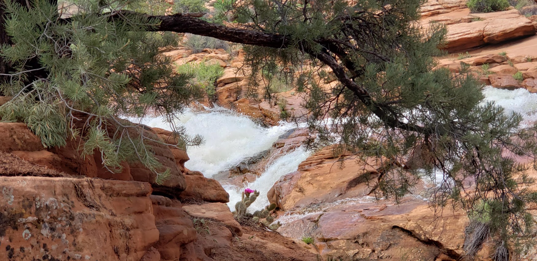
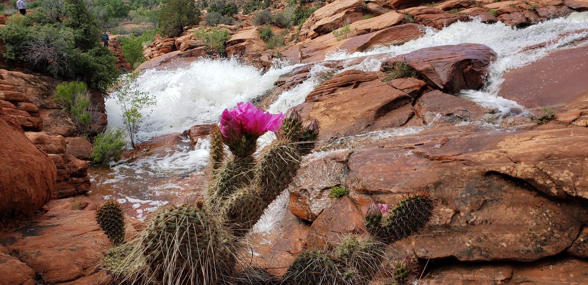
The 66-acre Gunlock reservoir, as you can see from the picture above is overflowing with scenic beauty. (Pun intended.) We heard that the falls haven’t flowed in about seven years so we got a special treat-they’re quite spectacular as you can see. Unfortunately, people have died cliff jumping here so immerse yourself in the beauty wisely. The park is approximately 15 miles northwest of St. George and the dam was constructed in 1970 for irrigation water and flood control.
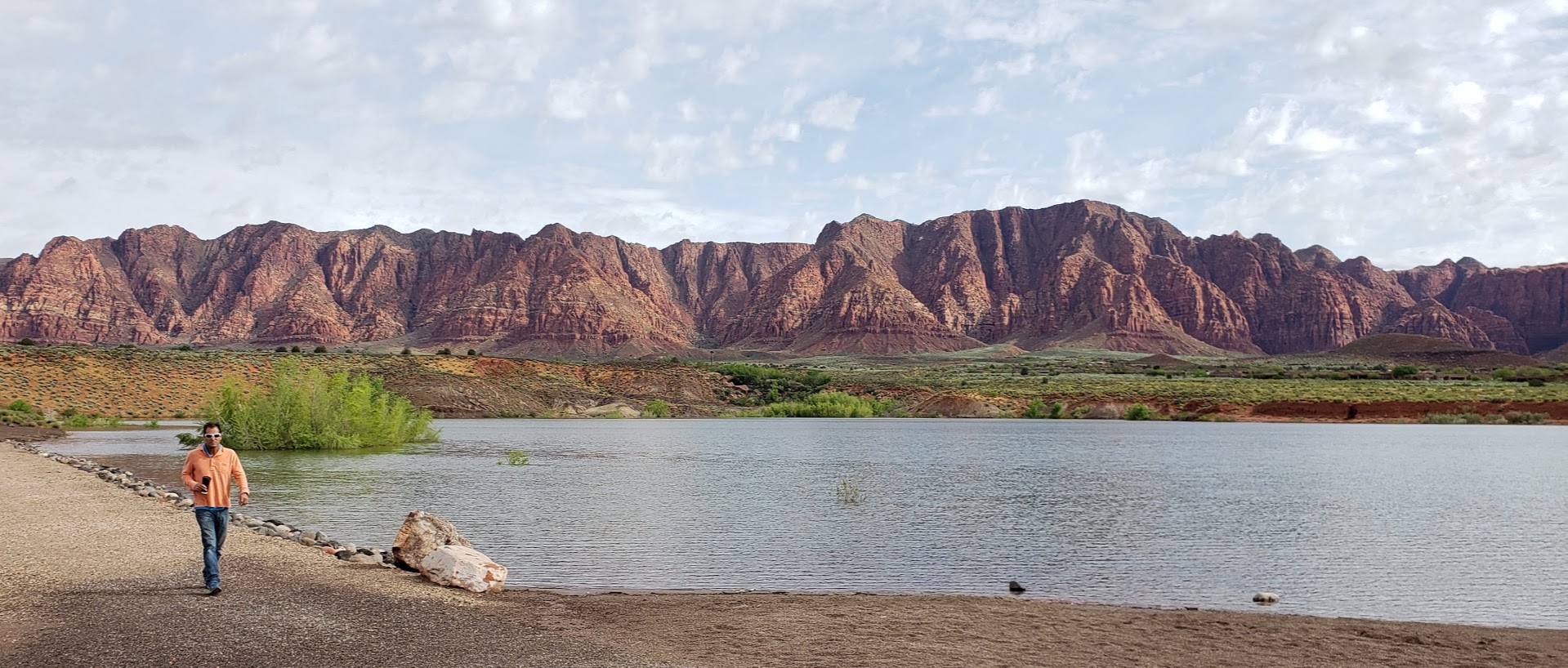
Meanwhile, back in Ivins, enjoying a coffee (not as hard to find in Mormon country as you might think) and a stroll around the reservoir. Ivins is a “bedroom community” of St. George that features its own little reservoir and the dazzling artist’s and retirees’ enclave of Kayenta. They have a coffee shop / restaurant, lovely gardens, galleries, and a theater there. Imaging waking up to this view every morning. In the other direction, a snow capped mountain range. Absolutely gorgeous!