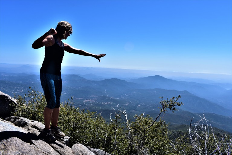
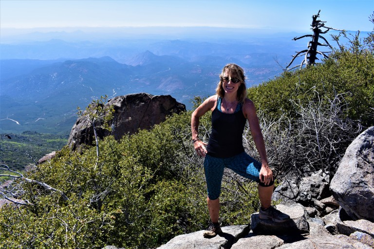
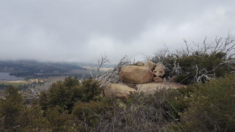
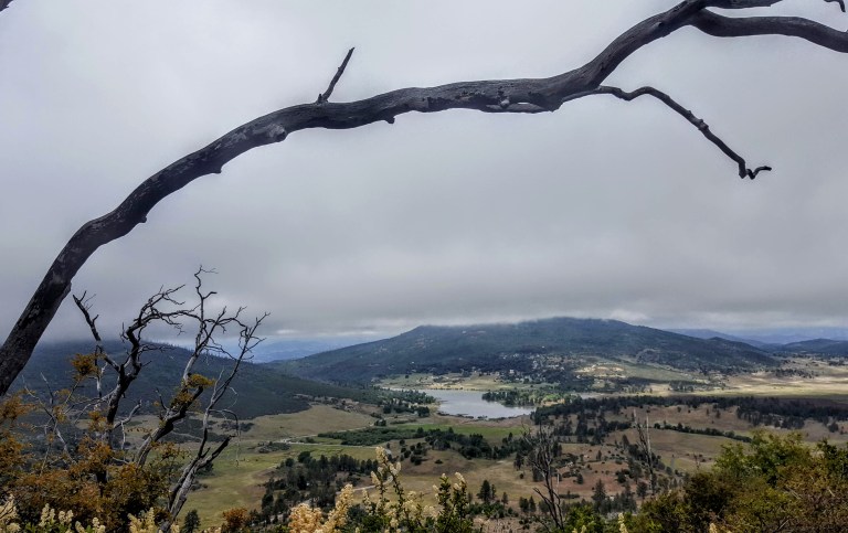
Cuyamaca Peak‘s little sister, Stonewall Peak, (5,730 feet) outshines her big sister with her stunning granite crown, haunting tree skeletons (remnants of the Cedar Fire) and lovely vistas of Cuyamaca State Park and out to Anza Borrego. Before I moved to North County and started exploring the area, I had no idea that all this wonderful natural beauty is an easy drive from greater San Diego.


Planning your Cuyamaca adventure
You can make it a day or a weekend adventure and do as much or as little hiking as you like. Ambitious, fit hikers can take on both peaks (Cuyamaca & Stonewall) in a day. For the less ambitious, there are plenty of opportunities to add on easy short strolls by the lake and up to Stonewall Mine. Lots of wildlife viewing with trails for the whole family. Stay tuned for my next post. Happy trails!
The historic gold mining town of Julian is a mile or two away with its quaint shops, B&Bs, restaurants and famous pies.
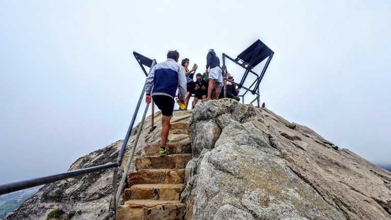
Notes: This is the most popular hike in the park so go early to avoid the crowds. After you reach the Stonewall Peak spur trail and make a right, there’s a really short scramble over some rocks before you hit the last rocky stairway. Keep your eyes open for the metal handrails. On the way back, I recommend taking a right at the junction for a different route down ton what becomes a pleasant single track trail d. At about 3.7 miles, you come to a trail intersection. Make the left onto Vern Whitaker Trail. Shortly after that (around 3.9 miles) there’s another junction, continue to stay left. At 4.2 miles or so,you’ll encounter another side trail; stay your course to the left again.
Miles: ~<4 miles rt if you just go up and down the main trail. My scenic route adds about a mile & a half for ~5.5 miles rt.
Elevation gain: 1,050 feet
Terrain: Mostly sweet, clear terrain (as in trail runnable). It’s gets a bit rocky and pesky for a while near the top so watch your footing. .The single track down was mostly friendly.
Difficulty: Easy to moderate. Depends on your fitness level and the route you take.
Trailhead: Across the street from the Paso Picacho campground, Cuyamaca State Park
Parking: $10 State Park Fee
Dogs: Only allowed on paved roads and must be leashed.
Camping: Paso Picacho campground has family campsites with tables, firepits, running water and bathrooms.


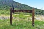 If you reach this sign, refill you water at the spring, but you want to turn back and follow the fireroad about a 1/4 mile to the Coneja Trail connector and take that on up to the peak.