Difficulty: Easy to moderate, depending upon your fitness level
This is definitely one of the more engaging official trails in Zion and now one of my favorites. From the trailhead, it begins as a tame, wide-open, flat route.
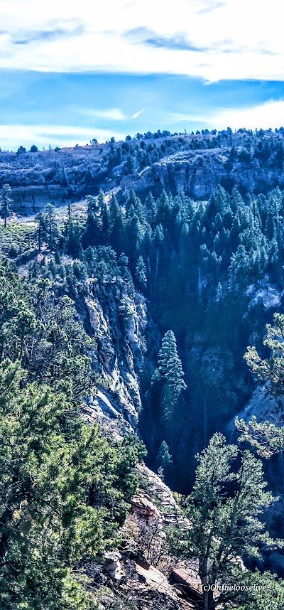
After a mile or so in, stop and look back for a glimpse into a dark canyon below.
As you continue along the trail, you’ll be treated to distant views of Zion, but don’t forget to watch your step as you descend the rocky trail into the lightly forested valley.
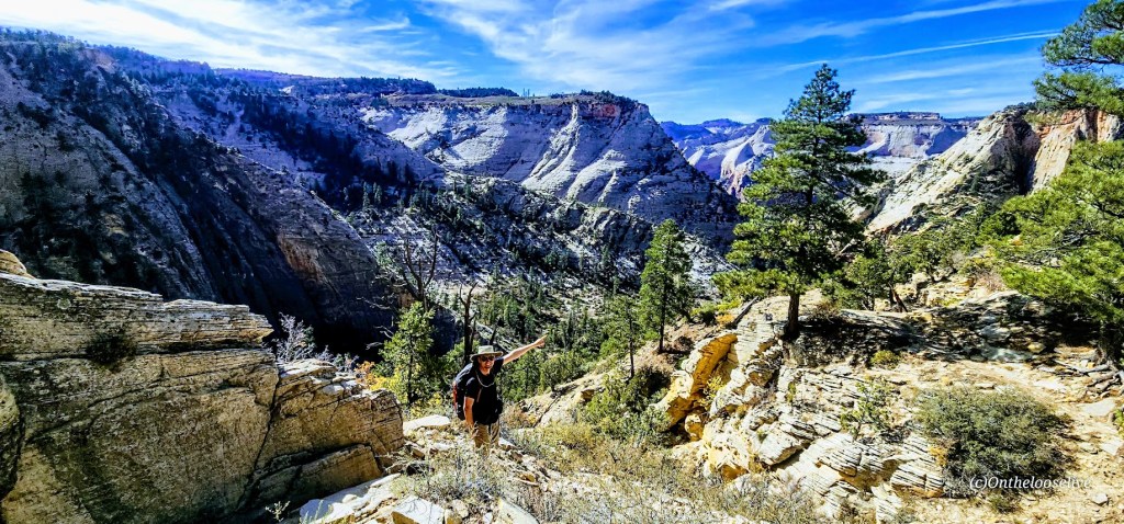
After reaching the other side of the valley, the climb will begin in earnest along the remnants of a concrete trail, zigzagging up to higher ground. It’s a friendly grade and easy terrain for fast hiking or trail running. It’s reminiscent of Walter’s Wiggles on Angel’s Landing, but the big difference is that you’ll likely have it and most of the hike from Stave Springs all to yourself!
This was my favorite part of the hike—a great workout with great scenery! (The picture above was taken on the return trip down.)
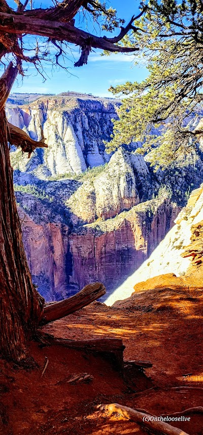
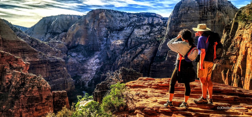
Once you reach the zenith, the views into Zion Valley are spellbinding, but you’ll want to keep your eye on your footing as you traverse along the slim cliff rim. (If you’re subject to vertigo and have a strong fear of heights, this might not be the hike for you.)
As you approach Observation Point, you can see Angel’s Landing below and across from you, a very cool perspective! This hike doesn’t have the rugged, chained, cliff-hanging social media over-posted appeal and crowds, and that’s exactly why it appeals to me.
Looks like angels are landing on Angel’s Landing. The picture above is taken from the trail along the rim. How dangerous is it? Might depend upon whom you’re with… In 1997, James Bottarin was accused of pushing his wife, Patricia Bottarini, off the cliff to her death here. Choose your hiking (and life partners) carefully!
Yes, Observation Point Views are grand, but in my opinion, they are no better than what you see en route, so you can always skip the last 1/2 mile or so if you want to skip the crowds.
There are two downsides: one is the long drive to reach the remote Stave Springs Trailhead, which is actually an upside, as it keeps the humans away. The second is the crowds you’ll encounter at Observation Point, who have taken the easier, shorter, less engaging route from East Mesa. It can be a shock to the system, especially after enjoying the splendid solitude of the Stave Springs route. Select the hike that suits you, but please note that both trailheads have limited parking, so arrive early to secure a spot.
If you’re lucky, you might encounter some of the locals.
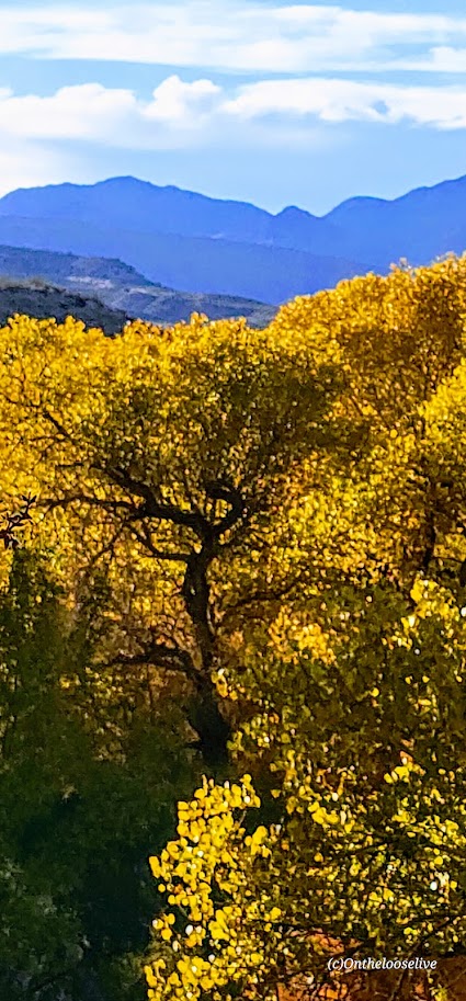
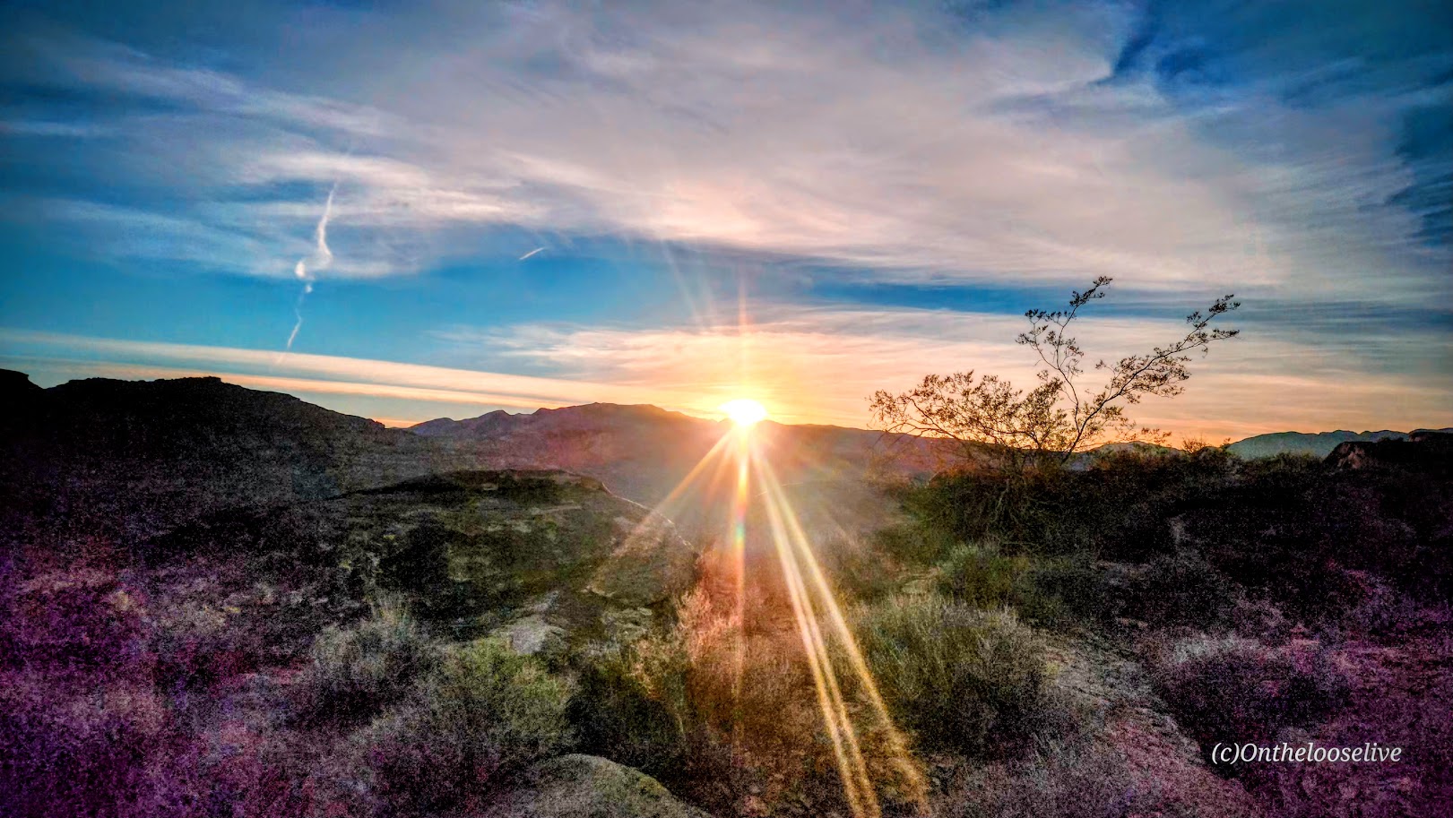
Driving back through Zion and capturing golden light is always a delight.
Getting there: Use the Zion Ponderosa Ranch Resort address for your GPS: Twin Knolls Rd, Orderville, UT 84758. Once there, signs will direct you to the trailhead. It’s a gravel road with a couple of rough spots by the small parking area. High clearance recommended.
Distance: Short: 1-5 miles; you can combine trails to make a longer loop
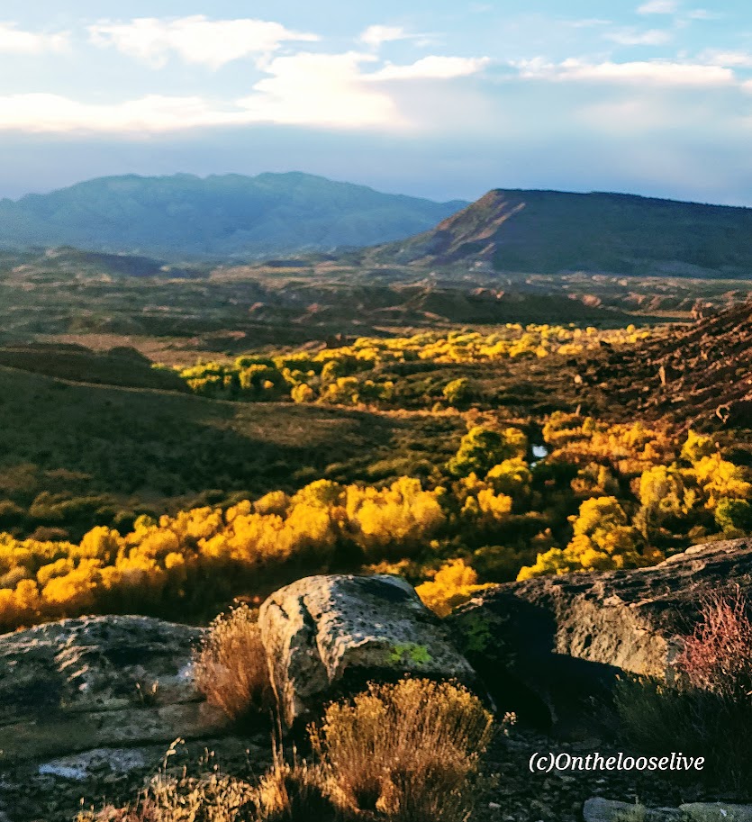
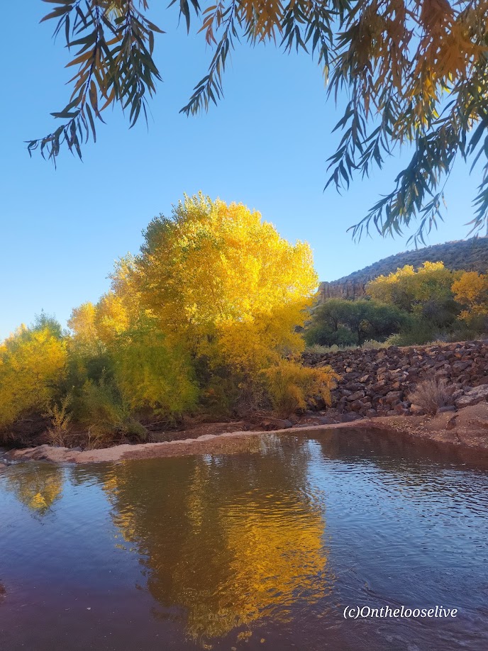
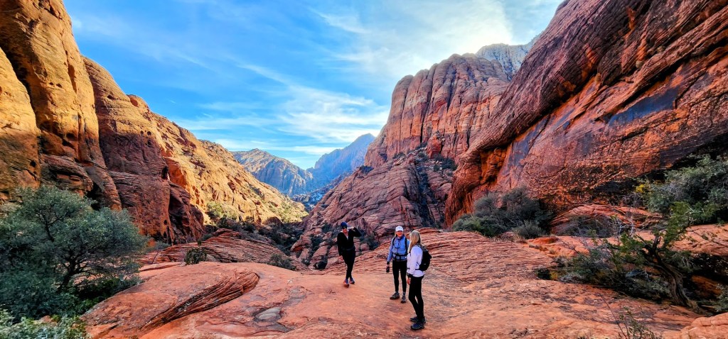
Sometimes, we take the people and things closest to us for granted. That’s the case for me and my local Anasazi (Ivins) and Tukupetsi trails (Santa Clara). These easily accessible, connecting trails are short (runnable and mountain bikeable), featuring the intriguing Land Hill petroglyph site, a fenced-in farmstead ruin once used to store food and herbs, and grand views in every direction.
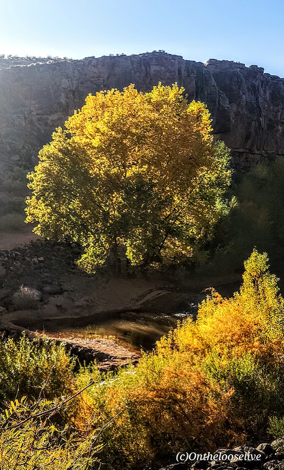
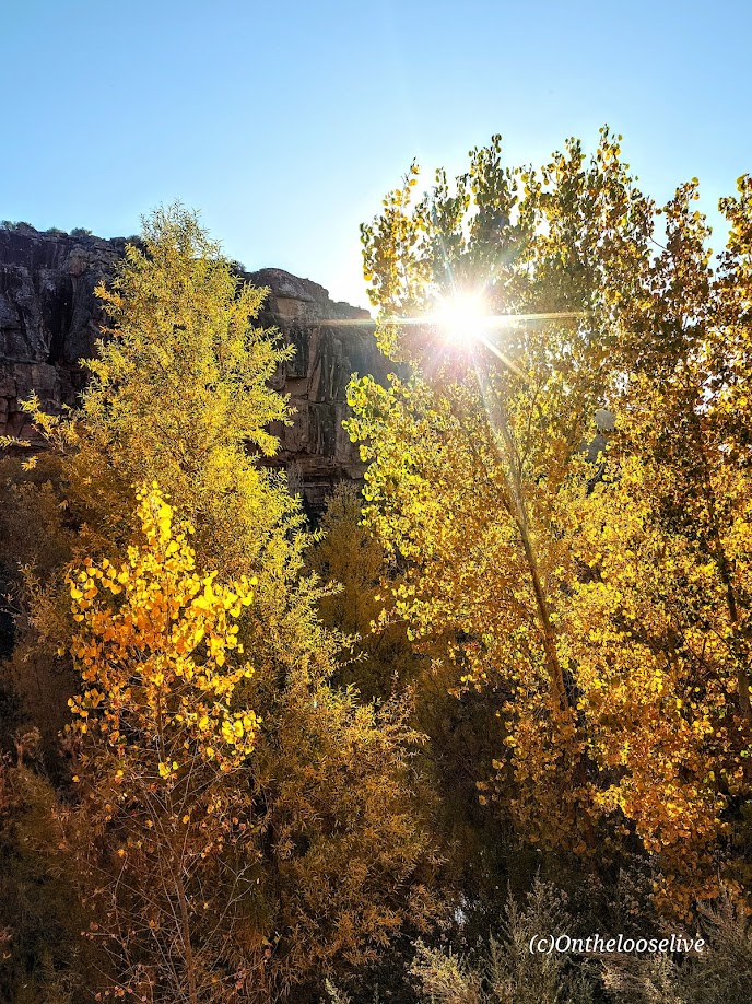
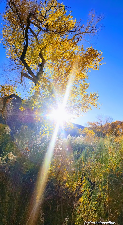
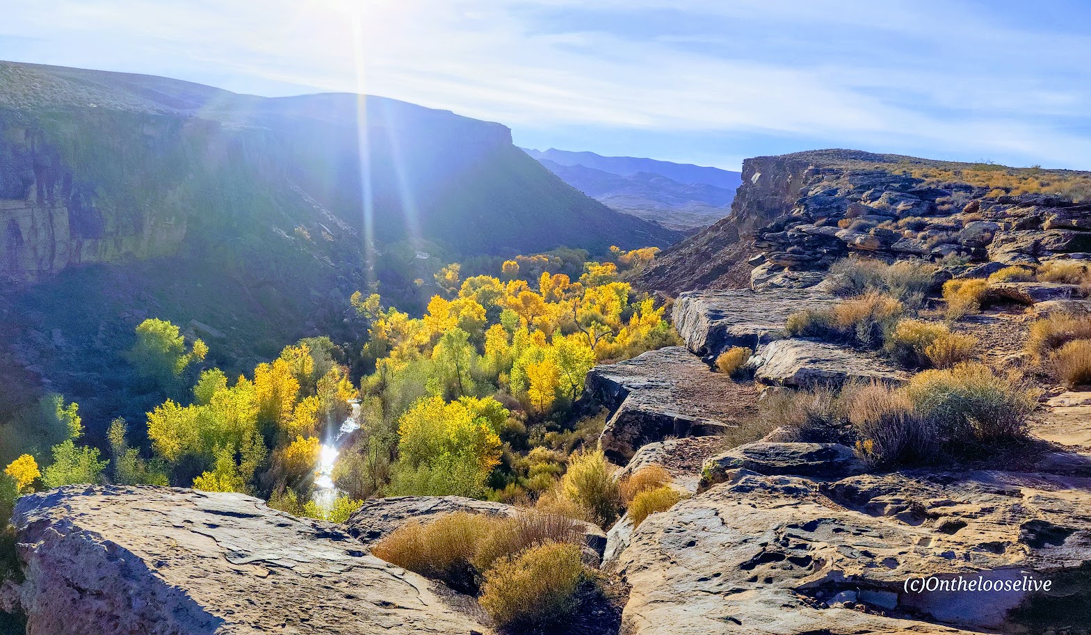
I like these trails best when the Cottonwoods light up the rugged desert landscape with their vibrant flash of yellow, tracing the meandering (and meager) path of the Santa Clara River below. You can find me there, chasing leaves and golden light in my annual frenzy to catch it just right.
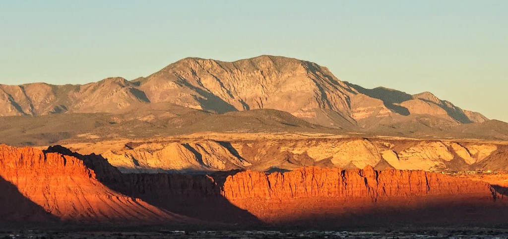
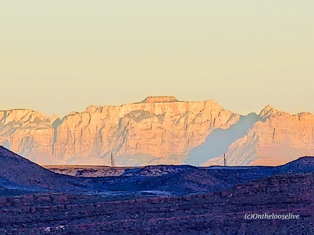
Take in the panoramic views of Red Mountain, Pine Valley Mountain, and, on a clear day, as far out to Zion from the ridge.
I will only post a couple of petroglyph pictures. I’d like you to be able to discover them for yourself.
Here are some highlights from the Tukupetsi side in Santa Clara from the vantage points of the upper and lower trails.
And more from Fall 2025.
Notes: Remember to leave no trace and respect all ancient petroglyphs and ruins. Please do not touch, step, sit on, or deface them. Oils in your hand can damage them, as can debris from your shoes. Perhaps think of them as outdoor museum art and appreciate their mystery.
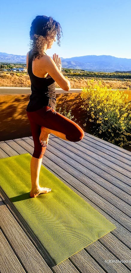
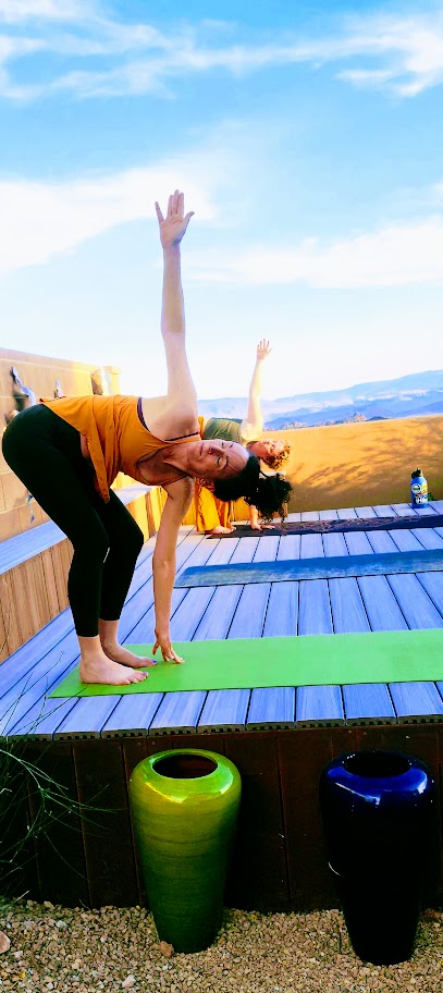
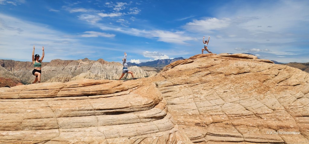
These easy, short, fun hikes are offered by onthelooselive yoga and hike retreats and day adventures.
Distance: (Choose your own adventure) to the Arch ~7.5 one-way, Coyote Natural Bridge ~10 miles one-way, ~11+ miles Swiss Cheese Falls
Difficulty: Easy via Hurricane Wash out & back, other routes are more challenging
Elevation Gain:~591 FT
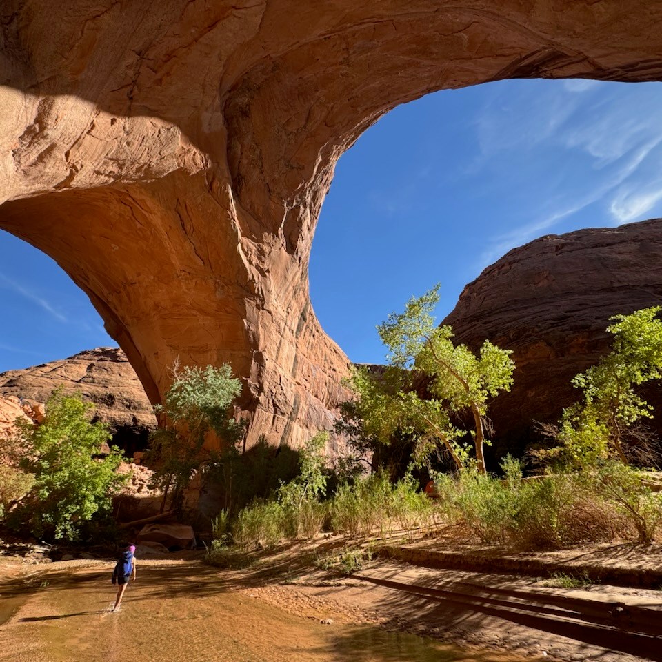
I chose the easy way to the arch via the Hurricane Wash Trailhead as I was testing my new backpacking gear. As the trail name suggests, you hike through a sandy, rocky wash for about 4.5 miles. Beyond that, you enter the river canyon, encountering shallow water crossings (inches deep and 6 feet wide in spots), dodging quicksand, and bushwacking through overgrowth and reeds. Gradually, you begin to catch glimpses of the towering red walls, and the scenery becomes more compelling, distracting you from the slog portions of this oft-proclaimed “epic hike.”. In about ~3 miles you reach the spectacular Jacob Hamblin Arch. I
If you venture beyond the arch another 2.5 miles or so to the right, you’ll come upon Coyote Natural Bridge, and beyond that, “Swiss Cheese Falls” and, just beyond that, a lovely water pocket/pool area—an unexpected highlight. Normally, it would have called for an immersion, but I had to skip it due to fleeting daylight and temperature considerations. Next time!
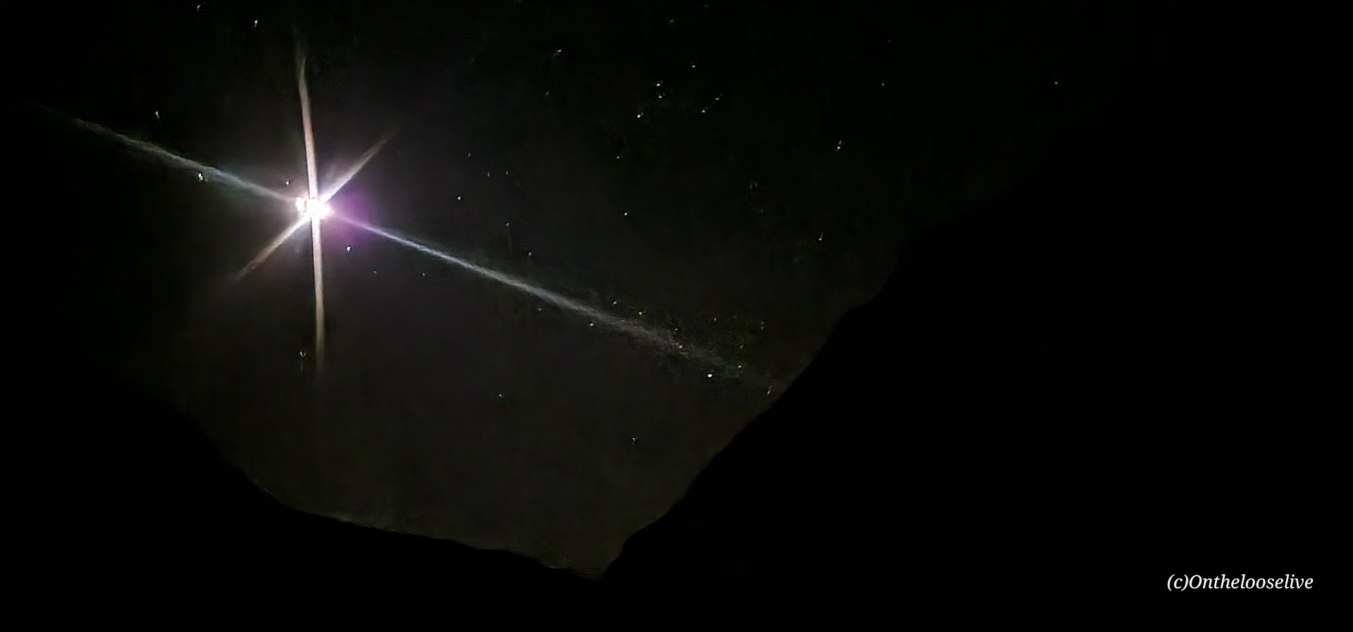
I retraced my steps back to the arch and a couple of miles further and set up camp for the night. The goal was to shorten the next morning’s hike out, as Golden Cathedral was on the agenda for the afternoon. It was lovely to sleep under the stars with the bright, beautiful moon watching over me.
Getting there: Head east from Escalante, UT on Highway 12, past mile marker 64. Look for Hole in the Rock Road, also know as BLM 220, on the right and take it for~ 33.8 miles to the dirt trailhead parking lot. 4-wheel drive with high clearance is highly recommended; this road is rugged and notoriously washboard!
Notes: There are other more interesting/ challenging routes to the arch, namely, “Sneaker” and “Crack-in-the-Wall.” Now that I’m comfortable with my gear, I’ll give the loop a try next time, I might do it as a day hike, tbd. Stay tuned for the gear report as well. Always bring ample water, even the cooler seasons. My water filter clogged, but I had ample water reserves and a lifestraw just in case.
Happy Trails!
Did you know? Onthelooselive offers yoga and hike retreats, as well as adventure itineraries to help you get the most out of your Utah adventures!
Welcome to a transformative escape where yoga bliss meets the thrill of hiking in the stunning greater Zion area. I’m passionate about blending my love for yoga, fitness, and the great outdoors to create an unforgettable experience just for you. Whether you’re a first-time or long-time yogi, a novice or seasoned hiker, a competitive athlete, someone who wants to kick start their fitness, or simply someone who wants to kick back, see the local beauty and enjoy some laidback nature immersion, I would love to be your host.
Personalized Yoga, Hike, & Fitness Retreats
Enjoy private or semi-private personalized yoga (Vinyasa, Yin, Restorative-ALL levels and ages)
Enrich your experience with options like sound baths, massage, dream journaling/ creative writing, wine tasting, night sky viewing with an astronomer, personal training sessions, golf, and more!
Elevate your heart rate with options like canyoneering, rock climbing, open-water swimming, stand-up paddling & yoga, kayaking, and more!
Popup Sunrise & Sunset Yoga
Join us for private or semi-private sunrise or sunset flows, or unwind with restorative night yoga.
Local Hike Guiding
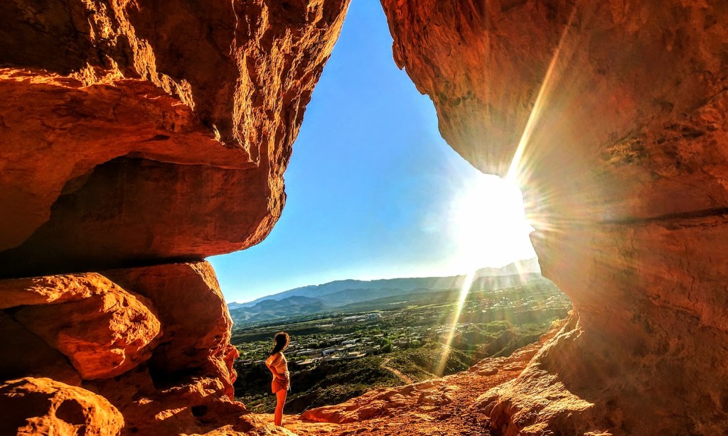
Discover hidden gems like petroglyphs, slot canyons, caves, and waterfalls!
Backcountry Adventures for Seasoned Hikers
Explore the wilder side of Utah with an experienced backcountry guide.
Tailored Itineraries
Make the most of your time in this amazing area with an itinerary customized to your interests.
Local Insights
Get the insider’s scoop on the best local restaurants and unique experiences.
Contact me to create your blissful escape into the wild, ravishing Southwest! (If you’d like to explore my adventures near and far, the easiest way to navigate the site is to go to the browse option on the right and pick your category of interest.)
Offering a plethora of diverse, nearby hiking adventures for hikers of all fitness levels and interests (petroglyphs, caves, waterfalls, peaks, etc). Excursions to Zion can also be arranged, but backcountry beauty, solitude, and bliss can be found within a couple-mile radius of my home.
About Me
Yoga Instructor since 2020 (200 Hour YTT Certified, Yin and Restorative Yoga Certified. Registered with Yoga Alliance.)
Certified Personal Trainer since 1998 & Certified Yoga Coach (International Sports Sciences Association)
Rim2Rim Grand Canyon: North Kaibab, North Rim to Bright Angel, South Rim
Distance: ~25 Miles [I added on a little side-trip.]
Elevation Gain: 4,534 Feet (Elevation loss 5, 850)
Difficulty: Hard, Strenuous
My Stats
Moving time: 7 hours, 57 minutes (Yay, barely sub 8 hours, but I’ll take it at nearly 60 years old for my first R2R.) I don’t think I could have had a better hike.
Start Time: 5:42 AM
Finish Time: 2:53 PM (including 2 stops)
Break Time: 3:04 PM After waiting (impatiently) for a seat on the bench at the Terrace overlook, I took my first real rest stop to soak in the views and put my legs up! Wish they served cocktails here!
I did the thing
So I did the thing, even though I’m not into doing things that are mainstream “things,” and even though last month’s South Kaibab Phantom Ranch hike experience was suboptimal due to crowds and the heat.
Why? Because it’s there and friends were into doing the thing. So, as typical of me, I did the last-minute Lydia thing. Sure, I booked the Jacob Lodge in January when everyone was hyped up, but that was the extent of my commitment. And I joined in on the training/scouting hikes from North Kaibab to Manzanita last October and South Kaibab to Phantom Ranch and up Bright Angel. Naturally, I kept up my vigorous, ongoing backcountry hiking adventures.
It turns out rugged, extended off-trail slick rock explorations and thick sand slog traverses are just the thing to make R2R seem like a walk in the park (The North Kaibab, while rocky and sand-slippery, turns into an easy, smooth trail from Manzanita through Phantom Ranch, and the trail up Bright Angel is also easy footing the entire way—no obstacles, no scrambling.
Of course, it’s not a “walk in the park.” It’s a hike to be taken very seriously.
Less than 1% of the 6 million annual Grand Canyon visitors do Rim 2 Rim, and many prepare for months, some even years.
In fact, R2R is considered one of the most dangerous hikes in the US for many reasons:
Exertion hazards
Cardiac arrest
Dehydration and its opposite, hyponatremia
Risk of rhabdomyolysis: Accumulated muscle trauma causes the break down of myoglobin, a protein that can damage kidneys
Environmental hazards
Heat Stroke
Heat Exhaustion
Hypothermia when temperatures dip at night
Rattlesnakes (The only pink rattlesnake (C. oreganus abyssus) in the world lives in the GC, AZ & UT.)
Hike your own hike
While not recommended, I hiked “the thing”solo. Why? Because I need to hike at a pace that feels right to me. I feel strongly that you can compromise your safety (and enjoyment) if you slow your pace for others. It’s hard to find compatible hikers. My rationale—given that it’s a mainstream trail, there are plenty of hikers and rangers around should an emergency arise. (An instance of “Do as I say, not as I do.”)
On the morning of, I figured I had options—hike out and back or do “the thing.”
The goal was to be at the trailhead at o’dark thirty (4:30 AM ish) to beat the heat. To outpace the heat was critical for me as I found Devil’s Corkscrew unpleasant in the heat of the day and wanted to avoid it. I heard that the “dreaded box canyon” section can be brutally hot, too. I wanted to limit my time in the dark because I have terrible vision and didn’t want to sabotage my hiking prospects with a fall/injury. As it happened, I arrived at first light. While I wasn’t hungry and rarely eat in the morning, I forced myself to chow down half of my turkey sub before hitting the trail. (I do better on long hikes when I have “real”/solid food—usually at the halfway point of a long hike, but I suspected I wouldn’t want anything solid/heavy on this hike’s halfway point.)
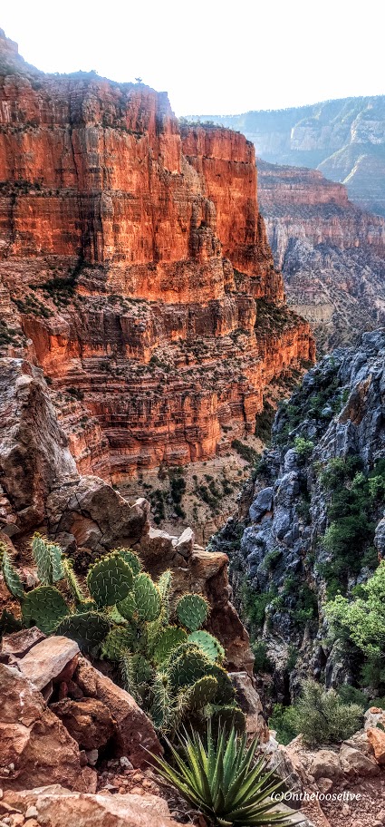
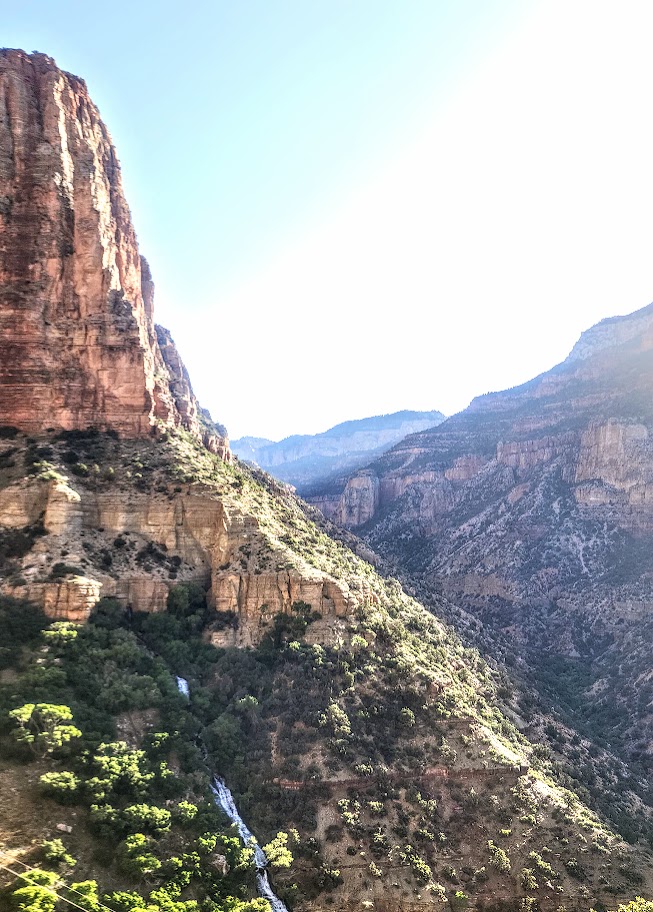
I felt strong and made great time down to the bottom of the canyon. Since I’ve done this portion of the trail before, I only took a couple of pictures on the way down when the light caught my eye.
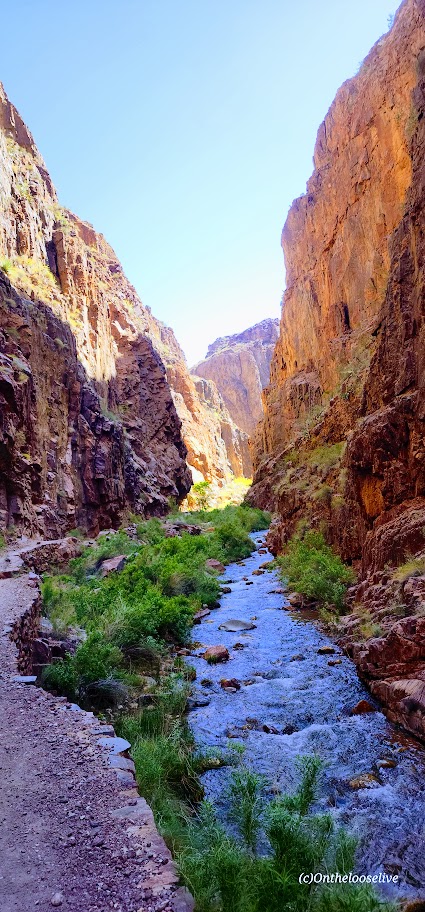
I thoroughly enjoyed the section between Manzanita and Phantom Ranch, which was entirely “new to me.” It was so refreshing and exhilarating, with the stream rushing along the trail and having it all virtually to myself. I stopped to take the most pictures along here. At one point, I looked at my watch and was shocked to see I was doing a 10-minute mile. I didn’t feel like I was running, but I did feel exuberant and euphoric. I was beyond the halfway point and feeling optimistic about doing this “thing!”
I took a slight detour down the Ribbon Falls trail. The bridge was out, which made my decision to pass on this side addition much easier. I didn’t want to add 2 miles roundtrip to my R2R or lose the momentum of my hike.
The only injury I sustained was cactus needles in the back of the forearm when I crouched too low to take a picture.
I was a little obsessed with the miles and my pace, taking pictures of my watch all along the way to track my progress because my watch battery had run out on my last big hike. And if it’s not documented, it didn’t happen, right?
I reached Phantom Ranch (14.29 miles) in 4 hours and 16 minutes with no breaks.
While there were far fewer people there than in April, there was still a line at the canteen for lemonade and food. In retrospect, I might have skipped this, but I didn’t think the handful of people in front of me would take 25 minutes, and the lemonade was a major highlight and perhaps a lifesaver when I hiked down in April. I committed to standing in line, which was building behind me, so it seemed silly to give up my place when it would be “any minute now”…Sigh. Finally, I downed my lemonade and refill, topped off my water, and got back on the trail.
I didn’t feel like taking a break or eating anything, but I forced myself to have a caffeinated cola gu and took out some electrolyte-infused gel blocks to have in my hand. From this point on, after each mile, I would eat a block to celebrate and electrolyte balance.) Back in the day, when I used to run marathons, I’d have a mint to commemorate additional miles after the halfway point.
By the 5-hour mark, I had covered 17 miles.
I arrived at Havasupai Gardens, Mile 20- (4.5+ miles from the top) at a little over the 6-hour mark.
I topped off my water, took a few bites of a Slim Jim, and drank my Gatorade on the way up. It occurred to me that it might be possible to do this “thing” in 8 hours or less. (The average total time, including breaks, is 12-15 hours.) I was pumped and channeling my old triathlete/trail running self.) There was a slight breeze, so the hot spots were blissfully not as hot as in April. I still felt good but the muscle fatigue was starting to build in my legs.
At 23 miles, I was over 7 hours, and for the first time, my pace per mile increased to well over 20 minutes. I was forced to consider the possibility that I wouldn’t make sub 8 hours. Laughing outloud to myself that if I didn’t make sub 8, I would have to do it it again so I better haul ass now! And phew—just barely!
My Inspiration
Did I really hike it solo? Not really; I had my Dad with me. He died years ago, but I carry him in my heart and wear the talisman of his old-fashioned skeleton house key on my necklace, so he comes with me on all my hikes. When I do challenging hikes or activities, I think of him and how his stroke left him paralyzed and confined to a wheelchair for the last decade of his life. I think about how difficult that was for him and it inspires me to stay strong and keep moving.
I also thought a lot about my beloved trail running days with my best trail running partner, Allison Robar. I repeated our mantra from our crazy trail runs , “Light and Easy.” So, both my Dad and Allison were on the trail with me in spirit.
And as mentioned, I felt so exhilirated hiking along the river, taking in the incredible beauty and enjoying my solo connection with nature. It was a transcendent/spiritual experience for me. I was one, vigorously with the Universe.
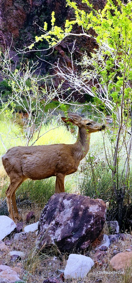
Of course, I met some cool people along the way too: trailrunners doing it for charity for the 5th year in a row, a buff backpacker named Billy taking on R2R2R. (I nicknamed him Billy Goat in my mind.) And there were others, including 2 “deer” Grand Canyon residents.
What worked for me
I chose light trail running shoes. I feel the terrain doesn’t call for hiking shoes per se. Sure, my feet were a bit battered and tender at the end of the day, but I feel quicker and lighter than I would have with hiking shoes. It’s a trade-off.
I wore knee braces on both knees from the start of the hike. (I have Grade 4 chondromalacia – bone on bone in both knees.)
I brought 1 pole and used it as needed (to help support my knees for large step-downs or step-ups). I like having my hand free, but I think having it helped, and was worth the tradeoff of carrying it.
I felt better after this hike than when I did the South Kaibab to Phantom and up Bright Angel loop. I attribute that to my prophylactic knee bracing, pole usage, and slightly cooler weather,
What I learned
Start at first light (or earlier)
Choose a day where temps at the bottom won’t exceed the low 90s.
Choose a weekday unless you like crowds
Select the North Kaibab to Bright Angel route
Soak your stuff (hat, scarf, shirt) and yourself every chance you get
Take pickle juice and electrolytes to prevent cramps.
Recommendations
Use your long training hikes to discover what’s best for you (nutrition, hydration, equipment, shoes, hiking partners, etc.) Cancel if temperatures are in the mid-90s to triple digits.
Equipment
Use a hydration bladder for hands-free drinking (Camelback or Osprey)
Take a pole or 2
Water filter (Sawyer SP129)
Electrolytes (I had electrolyte-enriched water, Gatorade, and gel blocks.)
Training
As part of your R2R training, if possible, I’d highly recommend doing the North Kaibab to Manzanita or Ribbon Falls hike and South Kaibab to Phantom Ranch and up Bright Angel hike, as well as a couple of hikes from the Grotto to the West Rim in Zion. Hiking those hikes in the GC, you’ll know exactly what you’re getting into and out of at the end of the day. It preps you both physically and psychologically.
Do hikes that simulate the elevation gain, distance, and desert heat factor
Do cross-training—bike, swim, etc. Do yoga & restorative stretching
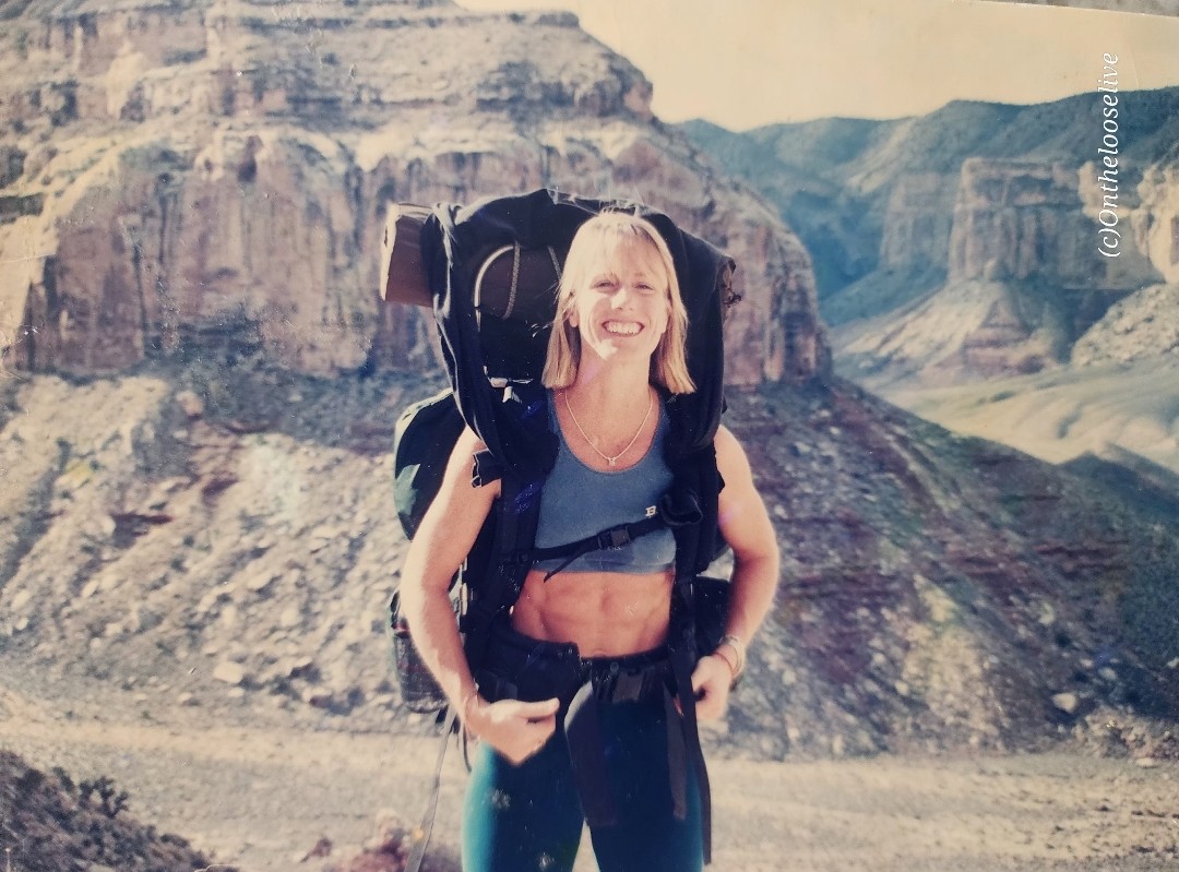
Do strength training—squats, lunges, leg extensions & curls, calf raises, pushups, pullups, and core work. (Note: training with super heavy weights and low reps can increase muscle bulk, which can be counterproductive for endurance activities.There’s a fine line between gaining strength and lean body mass—more muscle mass requires more oxygen and is heavy—both of which can make climbing, especially at altitude, more difficult. It’s the difference between a bodybuilder and a triathlete. I’ve embodied both body types, and I can tell you from personal experience that lean muscle mass is the best for endurance activities.
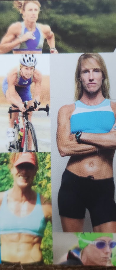
Here’s a pic of me backpacking the Grand Canyon in my body building days circa 1998 and me the day after R2R.
Route
I’m aligned with the majority that North to Bright Angel is the way to go. (Unless you’re doing R2R2R, and in that case, you don’t need my advice.)
North Kaibab (Rugged/rocky,sandy and slippery ascent/descent) ~5,781 ft elevation gain
Bright Angel (smooth and scenic trail with some shade)~4,400 ft elevation gain
South Kaibab (exposed trail) ~4,800 ft elevation gain
Logistics: If you’re “only” doing R2R, you’ll need to find a way back to your car on whichever side you left it. Fortunately, there’s the Trans-Canyon Shuttle that runs twice a day ($120pp). Or maybe your fortunate like I was to a have a friend willing to do an out and back hike on N. Kaibab and drive 4 hours over to the South Rim to meet you. Might be better to have a nonhiking friend meet you on the other side or key swap with friends hiking in the opposite direction. I guess that’s motivation for R2R2R, no logistics issues-lol.
Pre-hike dinner was at Jacob Lodge with fellow R2R hikers. The homade blueberry pie and cookies are delicious! Post-hike celebration at the rimside Arizona Steakhouse was delicious with great service and food!