Highlights: Spectacular red rock and Santa Clara River gorge views with the bonus of petroglyphs and ancient ruins.
Getting there: The trailhead is just off old US highway 91, near gorgeous Ivin’s reservoir so you can take a dip after your hike. Just look for the Anasazi Trail sign.
Difficulty: Easy, it’s a gradual incline and a short hike that’s suitable for the whole family. Terrain is mostly easy footing, but entirely exposed so plan accordingly and bring plenty of water, a hat, and sunblock.
The main trail takes you by 1,000 year old remnants of an ancient Indian farmstead, through the petroglyphs, and up along the rim of the Santa Clara River gorge.
This slideshow requires JavaScript.
Length: The main trail is a 2.9 mile loop, but there are many more spur trails to explore that traverse the ridge and valleys.
Free entry. Mountain bikes and leashed dogs allowed.
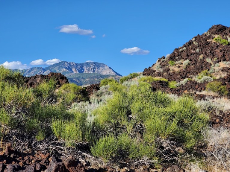
Yes, it’s right off highway 18 at Diamond Valley and super short—so yeah, those are the top 2 reasons not to go. But if you don’t, you’ll miss out big time as we often do when we fail to take those little spontaneous stops that beckon us from near and far. And sometimes, it’s those off the freeway and /or off the beaten track stops that yield the biggest rewards. Remembering my Kooteney Falls stop a couple years ago.
This hike is definitely short – a mere 1.7 miles, but as the spoiler alert headline says it’s LONG on panoramic views. Apologies for the fast spin, I was too excited!
Due to loose lava rock near the top, I’d suggest hardy, grippy shoes . It’s starts out flat, takes you around the back on a mostly dirt trail and then starts climbing at the .60 mile point. Yes, you can make a scramble straight up &/or down, but you’ll likely leave some DNA on the lava rocks. And by nature of the scramble, leave another indented trail on the cone.
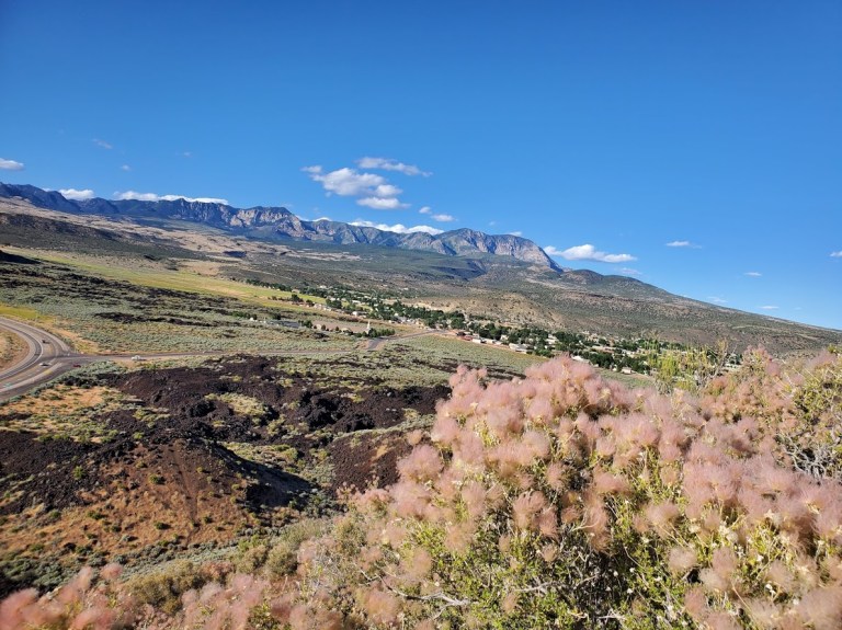
Views out across Snow CanyonPine Mountain views from the trailPink fluff, black lava and Pine Mtn range vistasHappy trails always
Solace in nature, always. At least that’s what I’ve always said. And yes, you can say I’m an outlier as social distancing is my default mode anyway. However, I’ve always maintained that our lack of connection with nature and our physical selves is at the root of so many of our 21st century ailments—physical and emotional. We are wired to spend 8+ hours a day being active, outdoors and I believe that is the key to really thriving.
Of course, for most of us, that’s not practical. But certainly, squeezing in some form of outdoor activity every day is. Probably, if you’re reading this, it’s because you’re like-minded and already reap the benefits of outdoor activities. It’s our indoor, sedentary neighbors we need to convert. Perhaps, the silver lining of social distancing is that people will get stir crazy enough to venture outside and explore their corner of the natural world. #optoutside
Here are some pictures from yesterday’s suburban hike in San Marcos. What a pleasant surprise to find a little network of trails right behind Palomar College. You can take a steep, direct approach to the “P”, or opt for the more, roundabout, meandering one. (You can probably guess, which one I took.)
Once at the top, you can trace your way across the ridges as long as your heart desires.
Either way, you’ll be rewarded with lovely views of the surrounding mountains and out to the Pacific. The air was so fragrant and clean. The red dirt and delicious post-rain scents reminded me of hiking in Hawaii.
Apparently, this area is popular with the off-roaders as evidenced by the debris. It appears many of them have lost control—careening and crashing through the rocks and scrub.
The social distance—just right for a suburban hike.
Difficulty: Moderate or Difficult, depending on your fitness level and daring level with the ropes on top. (Some call it strenuous. All call it steep.)
The trail climbs persistently through the pine, cedar, and hemlock trees.
After countless switchbacks, you’ll be treated to several expansive views of Lake Crescent and, if you’re lucky, out to the Strait of Juan de Fuca.
The maintained trail ends at about 1.3 miles. If you are “up” for it, pun intended, you can continue on the “climbers trail”. Your scramble to further heights will be aided by several sections of ropes.
Ken on the ropes
Proceed with caution, it’s quite exposed and super slippery.
On the way down, follow the short marked trail to Marymere Falls for the cool solace of Barnes Creek and the waterfall.
Getting there: Parking and the trail head for both this hike and the Marymere Falls hike is located right next to the Storm King ranger station, Lake Crescent right off Hwy 101, 20 miles west of Port Angeles, milepost 228.
Parking: Free
Be sure to stop by The Lake Crescent Lodge and beach for some refreshments and photo ops before you leave.
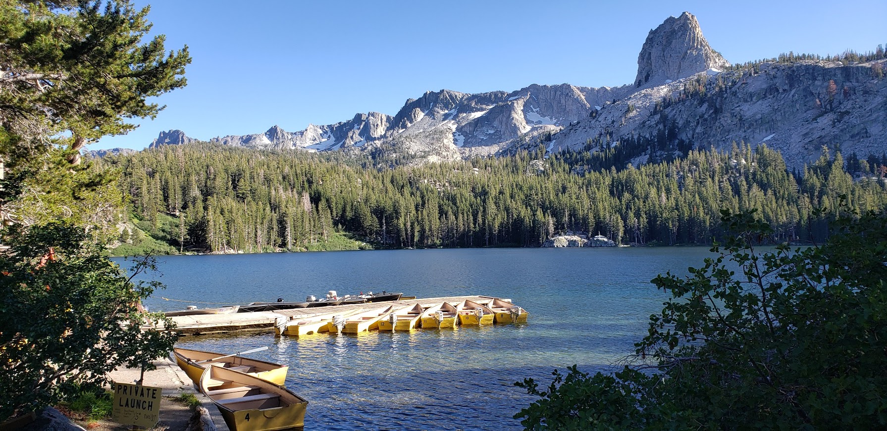
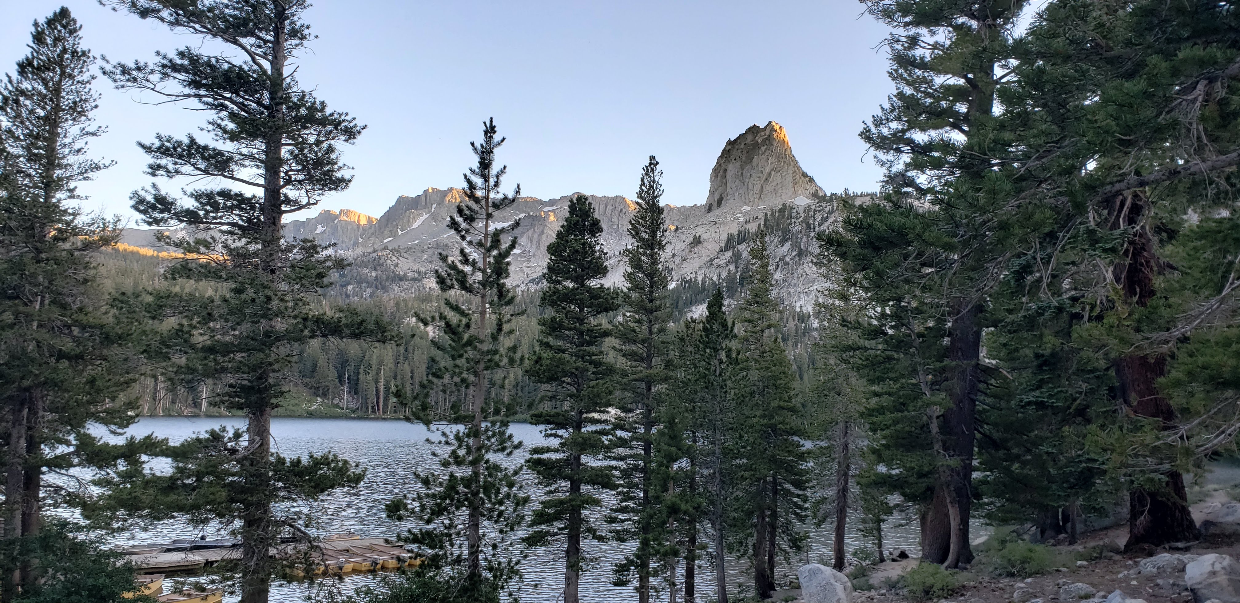
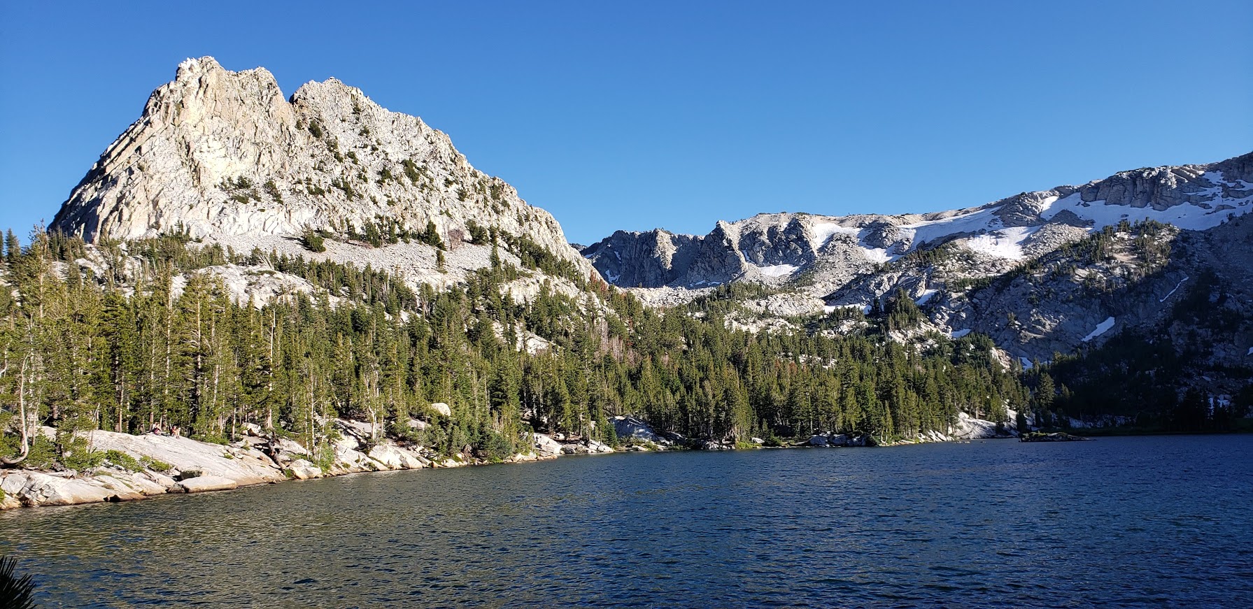
Framed by the iconic Crystal Crag and the wall of Mammoth Crest, Lake George is lovely spot for a quick nature immersion and possible wildlife sighting. It’s just a short drive out of town, and the highest road-accessible lake at 9,250 foot elevation.
Features: Hiking, fishing, camping, rustic cabins, boat rentals, a tackle and snack shop (seasonal), bear proof food storage, and bear sightings
Lake GeorgeLake George’s Clear Waters Lake George Light Lingering on the Granite
Winter access to Lake George is by ski or snowshoe only
Crystal Lake Trail at Lake George
Distance: ~2.7 miles
Difficulty: Easy to moderate,
depending on your fitness level & altitude acclimation
Highlights: Panoramic views of the Mammoth Lakes Basin, captivating Crystal Lake
Panoramic Views From the Trail: Lake George and Lake MaryGranite Rocks and Mountain VistasCrystal LakeCrystal LakeAlong the Crystal Lake Trail
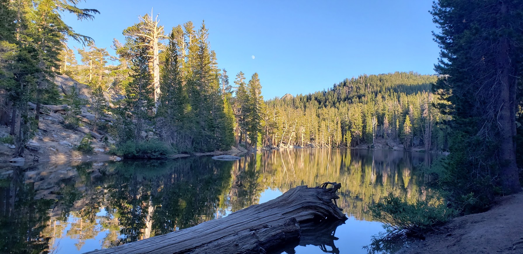
Bartlett Lake & TJ Lakes
Distance: ~1.5 miles
Difficulty: Easy
Big views for little effort.
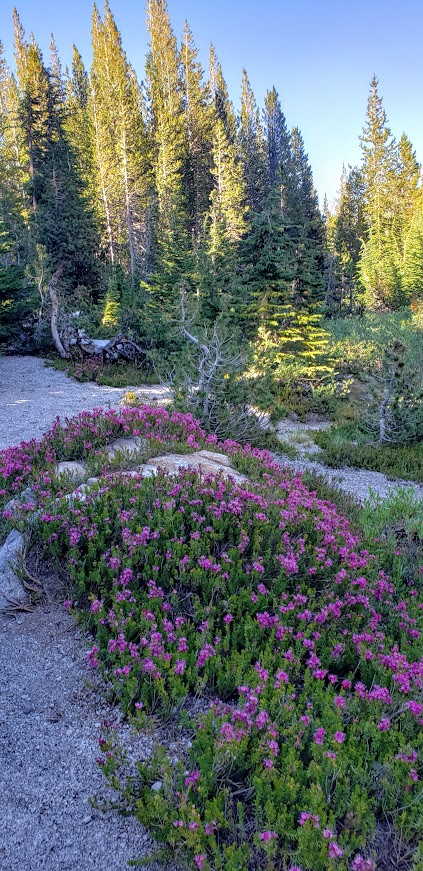
The trail crosses a stream then meanders up through lodgepole pines, hemlocks,
western white pines to the shore of Barrett Lake.
It was along this trail on the edge of Lake St. George that we encountered a large brown bear. I was coming around the corner fast (trying to get as much hiking in before sunset as possible) when I heard a fisherman standing in the lake say in a low voice “Bear there.”
Fisherman on the left. Shadow of the bear center bottom.
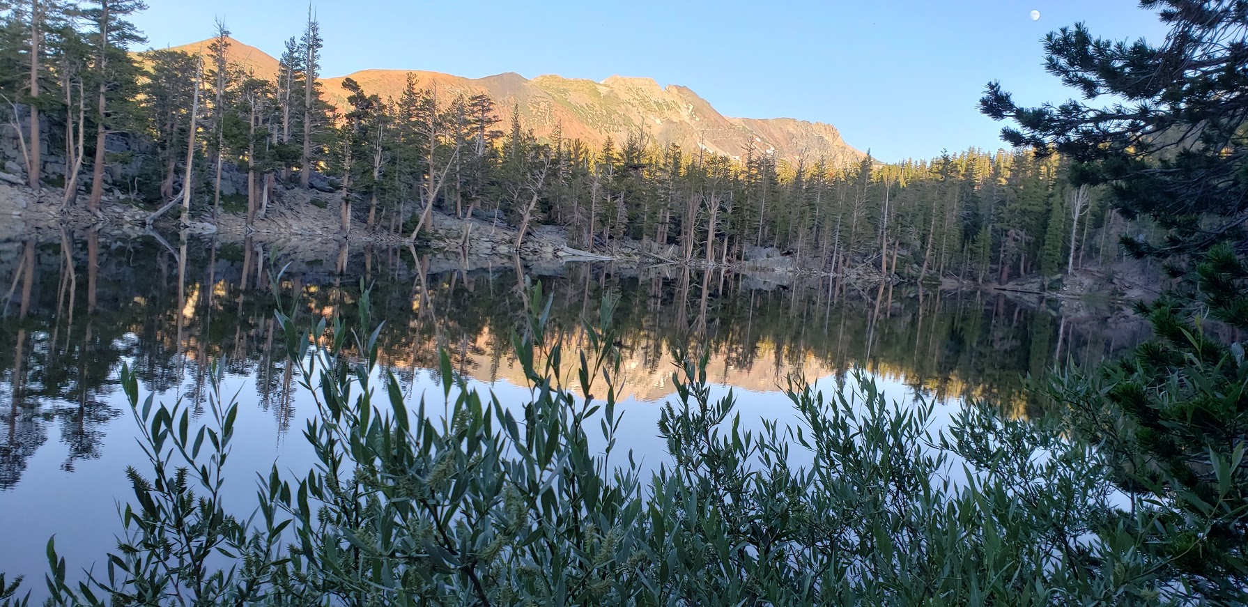
I stopped in my tracks. The bruin was blocking the trail and had its broad back to me. It was busy foraging in the fisherman’s backpack and appeared not to notice us. We quietly retreated up to a high spot off the trail. At one point, the bear looked up, I think he must have detected our scent. That’s when I snapped the shot. After taking another bear detour above the trail, we completed the TJ Lake loop, first passing Barrett Lake, Very picturesque and the light was perfect for reflection shots.
A Charming Section of the TJ Loop Trail Pic Doesn’t Do It JusticeI Couldn’t Get Enough of These Vistas
More Eye Candy On the TJ Lake LoopBarrett Lake ReflectionBarrett Lake ReflectionBarrett Lake Reflection
In all my years of hiking, this was my first bear encounter. (Well, I think there was one outside of my tent one night on top of San Jacinto, but I didn’t go out to greet it- just made loud noises to deter it.) What makes me sad is that this wild bear’s days are likely numbered due to it’s habituation to people.
More Mammoth Hikes
If you have more time than I did this trip, check out some of my favorite, longer hikes in the area :