Wandering the Whipple Valley Trail, Pine Valley, UT

Distance: 12 miles round trip

Elevation gain: 2,776 Feet

Difficulty: Moderate due to elevation gain & distance

A trip to the mountains is closer than you might think. From St, George. Pine Valley is a mere 30 miles away, but it’s worlds away in so many ways—at an elevation of 6,800, the temperature averages a refreshing ~20 degrees less than St. George.

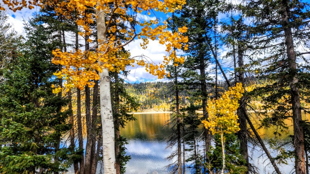
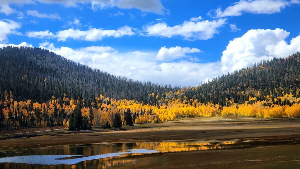
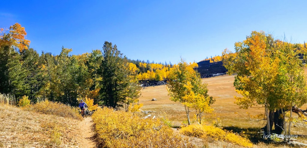
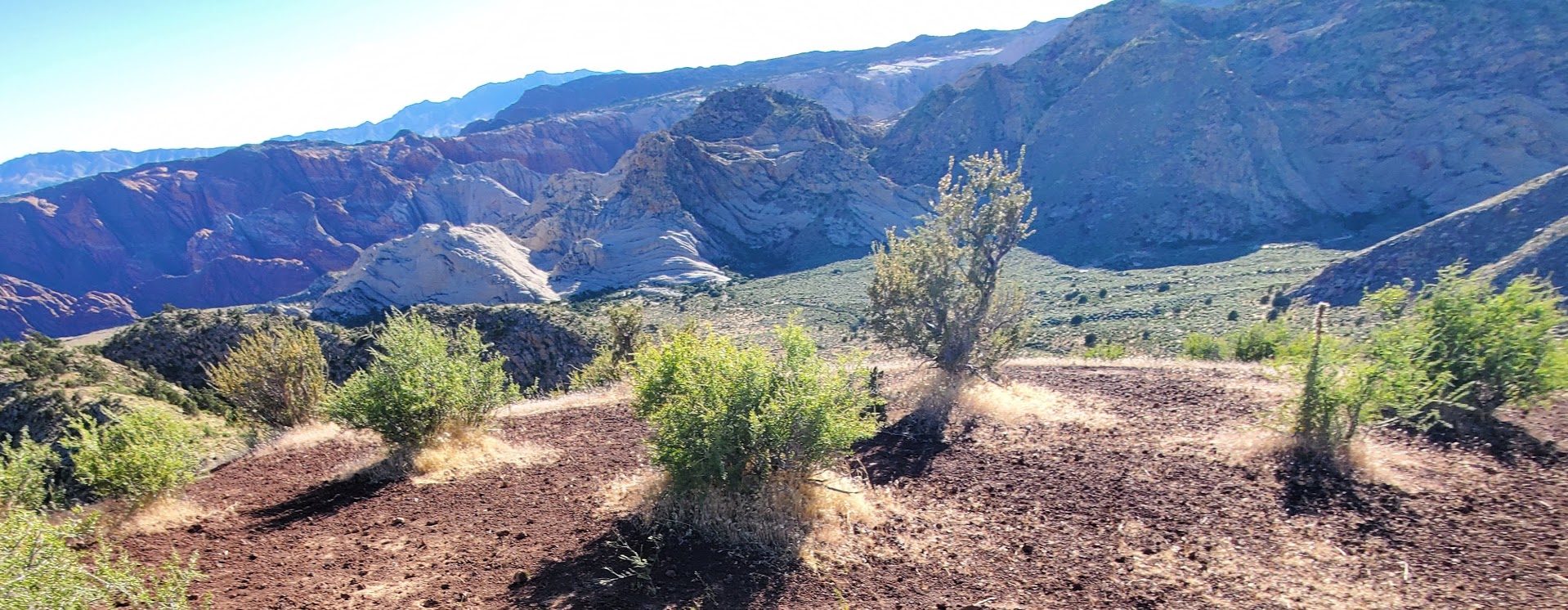
Indeed when you enter picturesque, historic pine valley, you have arrived at an entirely different ecosystem. Mountain scenery and the Dixie Mountain Forest greet you.

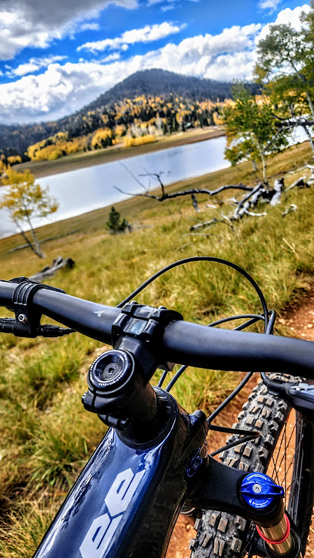
If you’re looking for a wonderful hike in the woods and a solid workout, the Whipple Valley Trail will not disappoint. (It could more apply be named the Switchback Trail.) The single track trail terrain is running shoe friendly and will challenge your fitness level with a gradual, but insistently, consistent climb. At the beginning and end of the hike, you’ll be treated to the nature’s soundtrack of a gurgling stream.

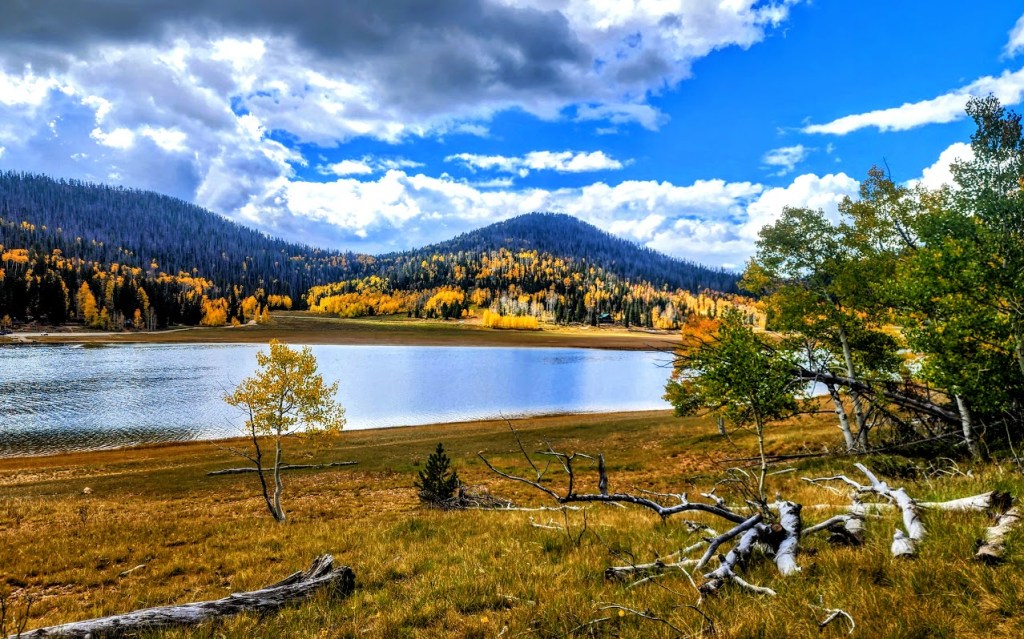
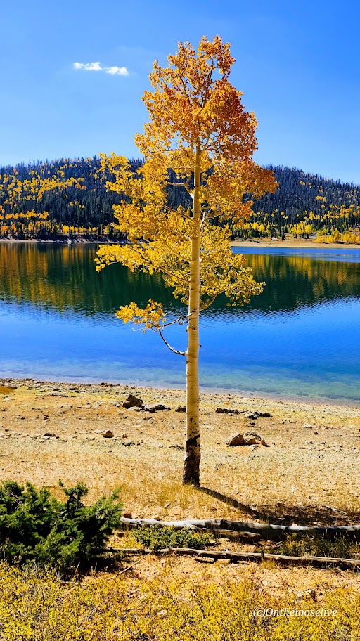
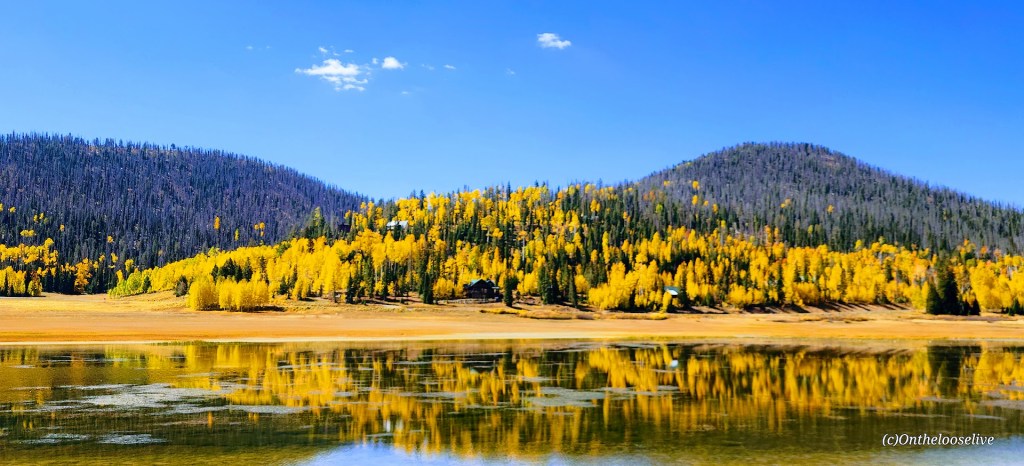
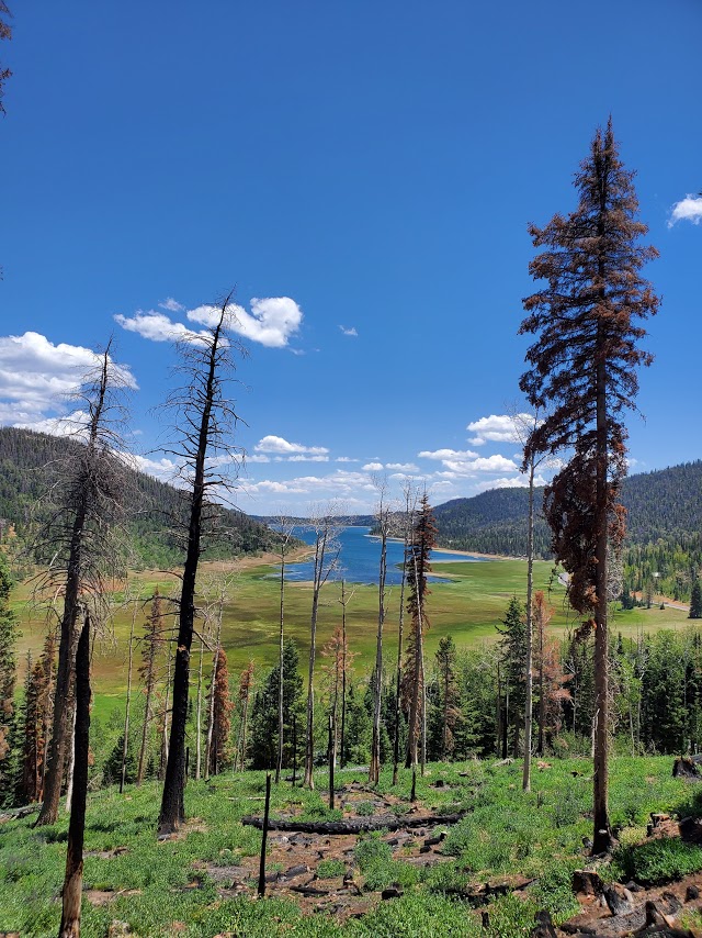
Views of Pine Valley from the trail are lovely and Whipple Valley is delightful. I’ll admit the valley felt incomplete to me as I found myself yearning to take a dip in an alpine lake. (Yes there’s the reservoir back at the campground and I could have soaked my feet in the stream on the way back, but that’s just not the same.)

This slideshow requires JavaScript.

While I found the hike enjoyable and a great workout, I’m not sure I would do it again. This spoiled hiking snob found the views a bit repetitive and the hike a bit long for just a pretty valley reward. If you’ve got mountain fever and need some relief from the heat, this Pine Valley hike is a perfect fix.

You can continue the journey from the Whipple Valley juncture, perhaps I’ll explore those options from another starting point on another day.

trail sign

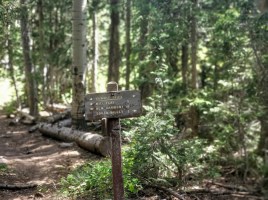
Getting there: From St. George take the 18N and follow the signs for Pine Valley. Hike starts near the back of the campground.

Snow Canyon Red Mountain Trail Keeps Me Coming Back for More, Dammeron Valley, UT

Why? For the stunning views of Snow Canyon and Pine Mountain, the colorful wildflowers sprinkled along the trail, and the vast horizon!

Distance: 12.1 out and back. Note: This hike takes longer than the mileage would have you expect due to the varied, ornery terrain.

This slideshow requires JavaScript.

The first mile and a half of the initial approach from Red Mountain Trail is forgettable. And it should be noted that for the duration of the hike, you’ll be slogging through rocks and dirt, deep sand, some slip rock, and more deep sand. If you persevere to the Snow Canyon Overlook – just about 2.5 miles in, you’ll be rewarded by unforgettable views – ranking among the best in Southern Utah some say.

The first time, I did the hike I had to turn around near the first overlook. The 2nd time, I made it a couple miles further, but had to turn around because night was descending and I didn’t have my head lamp. Walking through rocks in the dark, not recommended.

Will I do again? Most likely–the views are stunning, it’s close by, and I’m stubborn. I’d like to make it over to the Ivins’ side just to take in that view. And yes, I could start there and do the scramble, but I’m notorious for walking off obvious trails, so probably not prudent. TBD, I’ll post an update on my next visit.

Getting there: You can start this hike from the bottom at Ivins or from Dammeron Valley off the 18N. The Ivins’ way is the hard way for several reasons—it’s a straight up scramble with few trail markers. Rescues happen often here.

Since the Dameron Valley trailhead – Red Mountain Trail is just down the street from me, I defaulted to that–I love climbs, but am not into risks that could take me out the game.

Navajo Lake Loop: MTB Nirvana, Cedar City, UT

I don’t tend to throw the word epic around much, though I have been on some epic mountain bike rides – Tahoe’s Flume Trail, Lake Crescent’s Spruce Railroad Trail, and while not epic per se, that little gem, Diamond Valley Lake was quite lovely too. Fond memories of those rides were stirred up by my ride today on the Navajo Lake Trail. As you can see, Navajo Lake and the surrounding area are dazzling in the Fall. It’s quite sweet in the Summer too, a great spot to escape the heat of St. George as it’s usually at least 10 degrees cooler.

It’s a sweet, highly scenic, nontechnical single-track cruise via the Navajo Lake Loop Trail and the Virgin River Rim Trail, aka the other half of the Navajo Lake Loop Trail. Great for mountain biking, trail running, or hiking.

Interesting fact: The lake was created when a lava flow dammed the eastern end of the valley.

Distance: 11 Miles

Staring elevation: 9,035′

Elevation gain: 827 ft

Navajo Lake Summer vibes – View from the Rim Trail sectionNLT vista 1

Winter vibes—taken from a hill above Deer Valley cross country and snowshoe area.

Frozen Navajo Lake

Getting there: From Cedar City  go east on Scenic Byway SR 14, 25 miles to the Navajo Lake road turnoff and keep your eyes open for the Navajo Lake Loop Trailhead parking sign on the right side of the road. It’s free to park.

Ps. There are campgrounds, and fishing, boating, and swimming are allowed.

Exploring the Anasazi Trail, Ivins, UT: Panoramic views, petrogylphs, and ancient ruins

Highlights: Spectacular red rock and Santa Clara River gorge views with the bonus of petroglyphs and ancient ruins.

Getting there: The trailhead is just off old US highway 91, near gorgeous Ivin’s reservoir so you can take a dip after your hike. Just look for the Anasazi Trail sign.

Difficulty: Easy, it’s a gradual incline and a short hike that’s suitable for the whole family. Terrain is mostly easy footing, but entirely exposed so plan accordingly and bring plenty of water, a  hat, and sunblock.

The main trail takes you by 1,000 year old remnants of an ancient Indian farmstead, through the petroglyphs, and up along the rim of the Santa Clara River gorge.

This slideshow requires JavaScript.

Length: The main trail is a 2.9 mile loop, but there are many more spur trails to explore that traverse the ridge and valleys.

Free entry. Mountain bikes and leashed dogs allowed. 

The Cinder Cone, Diamond Valley, UT: Short hike that’s long on views

Yes, it’s right off highway 18 at Diamond Valley and super short—so yeah, those are the top 2 reasons not to go. But if you don’t, you’ll miss out big time as we often do when we fail to take those little spontaneous stops that beckon us from near and far. And sometimes, it’s those off the freeway and /or off the beaten track stops that yield the biggest rewards. Remembering my Kooteney Falls stop a couple years ago.

This hike is definitely short – a mere 1.7 miles, but as the spoiler alert headline says it’s LONG on panoramic views. Apologies for the fast spin, I was too excited!

Due to loose lava rock near the top, I’d suggest  hardy, grippy shoes . It’s starts out flat, takes you around the back on a mostly dirt trail and then starts climbing at the .60 mile point. Yes, you can make a scramble straight up &/or down, but you’ll likely leave some DNA on the lava rocks. And by nature of the scramble, leave another indented trail on the cone.

snow canyon from cinde cone
Views out across Snow Canyon

vistas from teh cinder cone trail
Pine Mountain views from the trail

contrasts om the cindercone trail
Pink fluff, black lava and Pine Mtn range vistas

L top of cindercone
Happy trails always