I can be all about roughing it, but I do like to mix in a bit of luxury too (especially as a grand finale). After the hiking the Paradise Loop trail, I found a slice of heaven at the historic Timberline Lodge. Constructed of native timber and stone, the exquisitely crafted lodge was built during the depression era as part of the Franklin D. Roosevelt’s Works Progress Administration (WPA) program between 1936 and 1938. Read more
Category: Explorations
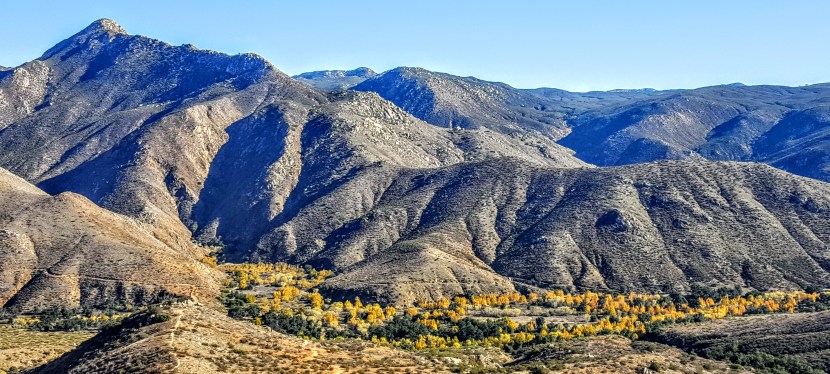
Ramona, CA: Cedar Creek Falls Trail
My expectations for the Cedar Creek Falls Trail were low as I’d read about crowds and litter here. Hiking in the off-season has it’s perks – no crowds and no litter – yay! (The trade off, just the damp shadow on the rock tracing where the 80 foot water fall flows.) Otherwise, I was very pleasantly surprised. The terrain is perfect for trail running if you can handle a consistent ~ 2 mile descent, followed, of course, by the consistent ascent. My knees can’t take the downhill anymore, but I sure enjoyed the run back up.
In the summer the temps can climb to 115 degrees so heat stroke and dehydration are concerns. Not the place to take your pooch or that friend who hasn’t worked out in recent memory – there have been several deaths. Also, people have been seriously injured for jumping off the rock into the shallow pool (duh). Those who live in this area of Eastern San Diego are accustomed to the hum of helicopters flying in to pick up the pieces. There were some cross country high-school boys risking it while I was there. Showing off for their girlfriends. Boys will be boys and survival of the smartest applies here.
Distance: 6 Miles Round Trip for this out & back
Rating: Moderate to easy if you are in shape, difficult otherwise
Permit needed.
Washington’s Beacon Rock Trail: a shortie with sweet views
Geological origins
According to some experts, Beacon Rock or Che-Che-op-tin, which means the navel of the world, is the second largest, free-standing monolith in North America. (Supposedly approaching the ranks of El Capitan, Devils Tower, Uluru/Ayers Rock, and other notables.) Composed of Basalt, it is the core of an ancient volcano. Through the ages, massive floods carved their way through the Columbia River Gorge and through the volcano, leaving only the core of Beacon Rock in their wake.
The trail
The Beacon Rock Trail was built directly onto the side of the rock, and ascends to the top of the rock (850’ elevation) by way of 52 switchbacks. Along the way there are sparkling panoramic views of the Columbia River Gorge, the Bonneville Dam, and the Pierce Wildlife Refuge. The “peak” area is small and doesn’t offer much in the way of scenery. It’s a short and relatively easy ~1.6 mile out and back with a 680 foot elevation gain. There’s a fair amount of traffic as it’s right off Highway 14, perfect for a quick run up and down. (Of course, I happened to hit it at high noon on Washington’s hottest day in a record-breaking heat wave. Dangerous for pets or anyone not up to extreme temps.)
The story behind the trail
The story goes that the United States Army Corps was going to cannibalize the rock for material to build a jetty at the mouth of the Columbia River. In 1915, philanthropist, Henry Biddle, bought the rock for $1, and together with Charles Johnson, built the trail over the next 3 years. After Biddle’s death, the family offered to make it a state park. Washington initially declined, but accepted the offer after Oregon expressed interest.
Details
Located near Stevenson, WA off of Highway 14
Discover Pass must be purchased and displayed in your car.
Raleigh, NC: Bucolic biking on the Neuse River Greenway Trail
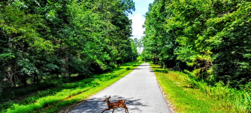
Borrowed my sister’s sweet Orbea tri bike for an out and back cruise on the Neuse River Greenway Trail. Bucolic beauty, tame riding (flat), and deer sightings along the river and over 7 bridges (2 suspension bridges) through wetlands and countryside. (I coaxed the little guy out of the brush so he could join his peeps on the other side of the path.) It’s an easy, paved, multi-use, 27.5 mile trail. I turned around at the 25 mile marker as I had to get back. This trail is part of Raleigh’s Capital Area Greenway System, and notably, also a portion of the Mountains-to-Sea Trail, a 1,150 mile hiking trail that crosses North Carolina through the Great Smoky Mountains and concludes in the Outer Banks. (Perhaps something to add to my “to do” list though from the little I’ve seen, my preference would be to bike it over hiking it…)
The downside
Posted trail speed limit is 10 mph, which is ridiculous for road bikers. I went on a weekday afternoon when there weren’t many walkers or casual bikers so I broke the rule. If I lived there, it would drive me nuts not to be able to ride the trail at realistic road bike speeds. Of course, safety is of the utmost importance, but how can you have a decent mileage path that allows bikes and expect people not to exceed 10 mph? (Heck, I ride 14 mph on my mt. bike on the road.) It’s a big deterrent to this cyclist. Perhaps the sentiment is if you’re a real cyclist, you’ll ride on the road. I don’t know about you, but I get more than my fill of riding on the road in California so anytime I have a chance to ride and not worry about cars, I’m all over it. I’d be working with city council and bike advocates to change the rule or adopt some measure to establish designated times or days when road cyclists can ride at speed. All that being said, once you get the 25 mile marker, the roads look very rideable with minimal car traffic. You could probably make your own century ride out of it.
Mt. Hood, Oregon: Timberline / PCT Trail & Paradise Found
Got a late afternoon start so we set out for a quick, couple mile out and back on the Pacific Crest Trail (2000) also known as Timberline trail (600) behind the historic and grand Timberline Lodge. However, the Paradise Loop trail (757) marker about 4 miles in was too tempting to resist with its wildflower-sprinkled meadow and snow-crowned Mt. Hood in the distance.
Round trip distance : ~12 miles Elevation gain: ~2,300 feet Scenery: Oh, my!
Rating: Difficult (Length & areas of incline) Terrain: Easy (Running shoe-friendly.)
Not that the first 4 miles wasn’t scenic too. Views of Mount Jefferson and the Three Sisters to the south accompany you along the way. And you pass several streams (waterfalls in other seasons), and impressive Zig Zag Canyon too.
This was an all-around stunning hike and a great workout too. Exhilarating and breathtaking in every sense of the word. I’ve always wanted to take the Timberline Trail around the circumference of Mt. Hood. (It’s a 38.4 mile hike with 8k elevation gain.) There are some ultra-runners who do it in a day. Most make a 3-5 day trip of it. There may be a return trip in my future. Will I be able to resist Paradise Loop next time? Probably not.
And now for a refreshing cocktail followed by a delectable feast and a luxurious night at my top pick Timberline Lodge.