RT: 8.6 miles (started from the campground and added on the Alpine Lake Lake Loop)
Elevation Gain: 3,000ft
Peak Altitude: 13,065 ft
Difficulty: Moderate to Hard, depending on your fitness level and altitude acclimation…
Located in Great Basin National Park (Nevada), Wheeler Peak is a relatively easy peak to bag with a short hike up (<4 miles) and a total elevation gain of 3k. The hike doesn’t get serious (intense) until you hit the 3-mile mark. By then, you’re at about 12,000 ft elevation with another 1,000 ft of climbing packed into the last scrappy scree and talus-filled mile.
At 13,065 ft, Wheeler Peak is the tallest mountain in the Snake Range and the second-highest peak in Nevada. (Boundary Peak is the highest at 13,147 ft.) For perspective, in the first picture above, those tiny linear marks are people on the scree and talus section of the”trail”.
By “I got wonky”, I mean I got altitude sickness. And I don’t mean to downplay the potential seriousness of it. I’ve done higher peaks (Mount Whitney 14, 495 ft) and experienced headaches, but I’ve never experienced altitude-induced “aphasia.” It happened on the way down after spending over an hour taking in the views from the top. (Apparently, too long for me.)
After descending about a mile, I said something to my hiking partner, and my words came out jumbled. (I knew what I wanted to say, but the wrong words were coming out in random order.) Either I was having a stroke or experiencing altitude sickness. My heart rate was relatively low, 75 bpm, and I’m relatively fit – while that doesn’t rule out a stroke, altitude sickness was more likely. There were no other symptoms, although I stumbled a couple of times towards the top and on the way down, which I attributed to the loose, rocky terrain (talus and scree) and my bad knees.
It didn’t help that we drove from an altitude of 3,000 feet directly to the campground and trailhead, which sits at 10,000 feet and started hiking vigorously immediately. (We made it to the top in 2 hours.) In retrospect, this was probably not the best plan, but I’ve never experienced more than a headache at altitude, so I considered myself relatively impervious. (False; just because you haven’t had altitude sickness doesn’t mean you won’t get it. No one is impervious. Altitude sickness strikes randomly.) I had hiked in the local mountains to 10,000 feet that week without incident.
What to do? The best treatment for altitude sickness is to descend immediately, so I did. It took another 1,000 feet of descending before my ability to speak coherently returned, much to my relief. I count myself lucky, as there have been incidents of high-altitude hikers experiencing aphasia for as long as six months—yikes!
Of note, a thin 20-something-year-old man dressed in a black sweatshirt and sweatpants (overdressed for 70-80-degree temperatures) appeared to be having some difficulty as he approached the last 100 feet of the climb. He seemed out of it, angry/unfriendly, as we gave him the right of way on the single-track trail. As we were hiking out our last mile, a ranger approached us and asked if we’d seen a young man dressed in black as they’d received a distress call about a fellow with altitude sickness…
Flash forward to the following weekend; on my way down from Mount Timpanogos Peak (11,752 feet) a slight teenage girl was curled into a fetal position on the side of the trail, holding her head. Her father and brothers stood around her. They had brought her down as far as they could, but she was incapacitated with severe nausea and a headache. The rescue team was on its way.
Other than my bout of altitude sickness, Mount Wheeler is a “relatively easy” peak to bag though the last steep slippery scree and talus section isn’t much fun if you’re not nimble-footed or if you have knee issues. Both apply to me. I used a pole on the way down to keep myself from taking a spill.
I was back to feeling fine, so we added on a leisurely stroll around the scenic Alpine Lakes Loop Trail for views of Teresa and Stella lakes, both of which looked more alluring than the last time I visited them. Perhaps I just caught the light right this time? If you’re not into bagging peaks, the lake loop is an easy 2.6 mile trail, but the altitude of 10,000 feet can still be a factor.
Altitude SicknessPSA
There are 3 syndromes of altitude sickness: acute mountain sickness (AMS), high-altitude cerebral edema (HACE), and high-altitude pulmonary edema (HAPE)
Acute mountain sickness (AMS)
Symptoms: Headache, Dizziness. Loss of appetite, Nausea, Vomiting, Fatigue / Loss of Energy, Shortness of Breath, Irritability, Dizziness, Muscle Aches, Insomnia
High-altitude cerebral edema (HACE) is a potentially life-threatening form of AMS where the brain swells due to lack of oxygen. Symptoms: Extreme fatigue /Drowsiness, Confusion, Loss of Coordination, Hallucinations
High-altitude pulmonary edema (HAPE) is also a potentially life-threatening form of AMS that impacts the lungs. It can occur in rapid ascents above 8,200 feet when blood vessels narrow due to lack of oxygen, leading to fluid build-up in the lungs. Symptoms: Shortness of breath, Weakness, Cough
Altitude Sickness Facts
75% of people experience mild symptoms of AMS at elevations over 10,000 feet, dependent upon the elevation, the rate of ascent, and individual susceptibility.
14% of people with HAPE will also have HACE
Anyone (fit/unfit, old/young, male/female) can get altitude sickness
Men are more susceptible
Obese individuals are more susceptible
Genetics play a role
Fast rate of ascent can play a role
Your body loses water through respiration at high altitudes twice as fast as it does at sea level
Preventive Measures
Hydrate well
Carb load
Allow at least a day to acclimate to the altitude if possible
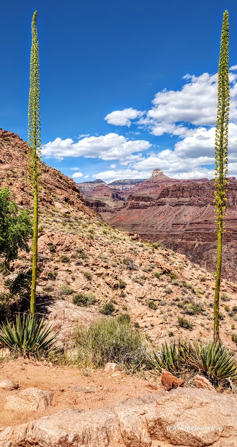
Rim2Rim Grand Canyon: North Kaibab, North Rim to Bright Angel, South Rim
Distance: ~25 Miles [I added on a little side-trip.]
Elevation Gain: 4,534 Feet (Elevation loss 5, 850)
Difficulty: Hard, Strenuous
My Stats
Moving time: 7 hours, 57 minutes (Yay, barely sub 8 hours, but I’ll take it at nearly 60 years old for my first R2R.) I don’t think I could have had a better hike.
Start Time: 5:42 AM
Finish Time: 2:53 PM (including 2 stops)
Break Time: 3:04 PM After waiting (impatiently) for a seat on the bench at the Terrace overlook, I took my first real rest stop to soak in the views and put my legs up! Wish they served cocktails here!
I did the thing
So I did the thing, even though I’m not into doing things that are mainstream “things,” and even though last month’s South Kaibab Phantom Ranch hike experience was suboptimal due to crowds and the heat.
Why? Because it’s there and friends were into doing the thing. So, as typical of me, I did the last-minute Lydia thing. Sure, I booked the Jacob Lodge in January when everyone was hyped up, but that was the extent of my commitment. And I joined in on the training/scouting hikes from North Kaibab to Manzanita last October and South Kaibab to Phantom Ranch and up Bright Angel. Naturally, I kept up my vigorous, ongoing backcountry hiking adventures.
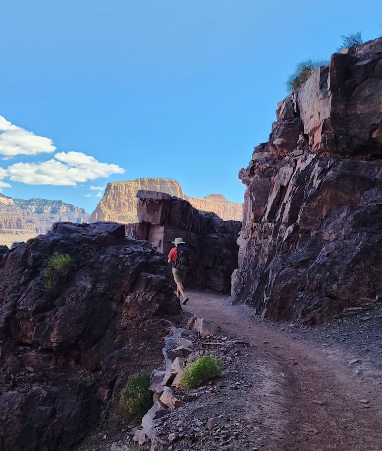
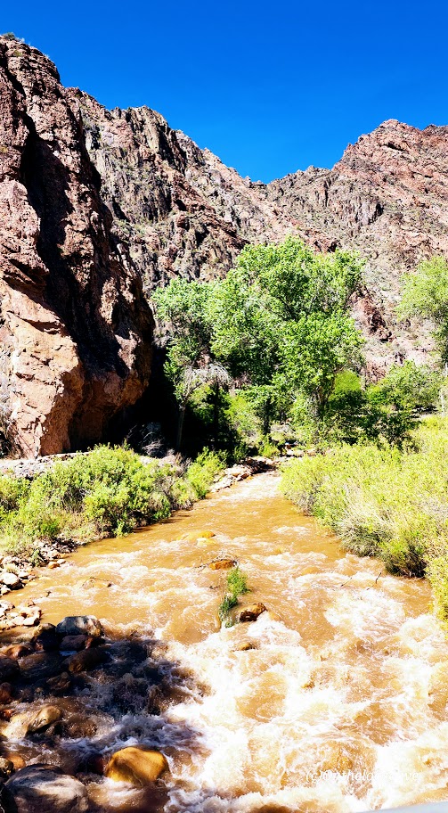
It turns out rugged, extended off-trail slick rock explorations and thick sand slog traverses are just the thing to make R2R seem like a walk in the park (The North Kaibab, while rocky and sand-slippery, turns into an easy, smooth trail from Manzanita through Phantom Ranch, and the trail up Bright Angel is also easy footing the entire way—no obstacles, no scrambling.
Of course, it’s not a “walk in the park.” It’s a hike to be taken very seriously.
Less than 1% of the 6 million annual Grand Canyon visitors do Rim 2 Rim, and many prepare for months, some even years.
In fact, R2R is considered one of the most dangerous hikes in the US for many reasons:
Exertion hazards
Cardiac arrest
Dehydration and its opposite, hyponatremia
Risk of rhabdomyolysis: Accumulated muscle trauma causes the break down of myoglobin, a protein that can damage kidneys
Environmental hazards
Heat Stroke
Heat Exhaustion
Hypothermia when temperatures dip at night
Rattlesnakes (The only pink rattlesnake (C. oreganus abyssus) in the world lives in the GC, AZ & UT.)
Hike your own hike
While not recommended, I hiked “the thing”solo. Why? Because I need to hike at a pace that feels right to me. I feel strongly that you can compromise your safety (and enjoyment) if you slow your pace for others. It’s hard to find compatible hikers. My rationale—given that it’s a mainstream trail, there are plenty of hikers and rangers around should an emergency arise. (An instance of “Do as I say, not as I do.”)
On the morning of, I figured I had options—hike out and back or do “the thing.”
The goal was to be at the trailhead at o’dark thirty (4:30 AM ish) to beat the heat. To outpace the heat was critical for me as I found Devil’s Corkscrew unpleasant in the heat of the day and wanted to avoid it. I heard that the “dreaded box canyon” section can be brutally hot, too. I wanted to limit my time in the dark because I have terrible vision and didn’t want to sabotage my hiking prospects with a fall/injury. As it happened, I arrived at first light. While I wasn’t hungry and rarely eat in the morning, I forced myself to chow down half of my turkey sub before hitting the trail. (I do better on long hikes when I have “real”/solid food—usually at the halfway point of a long hike, but I suspected I wouldn’t want anything solid/heavy on this hike’s halfway point.)
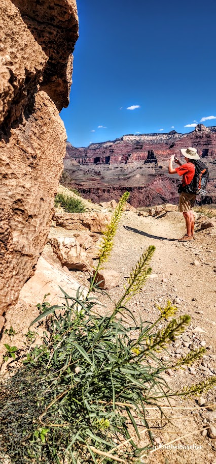
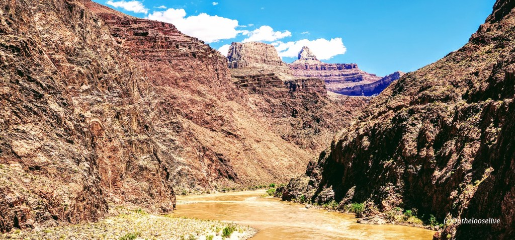
I felt strong and made great time down to the bottom of the canyon. Since I’ve done this portion of the trail before, I only took a couple of pictures on the way down when the light caught my eye.
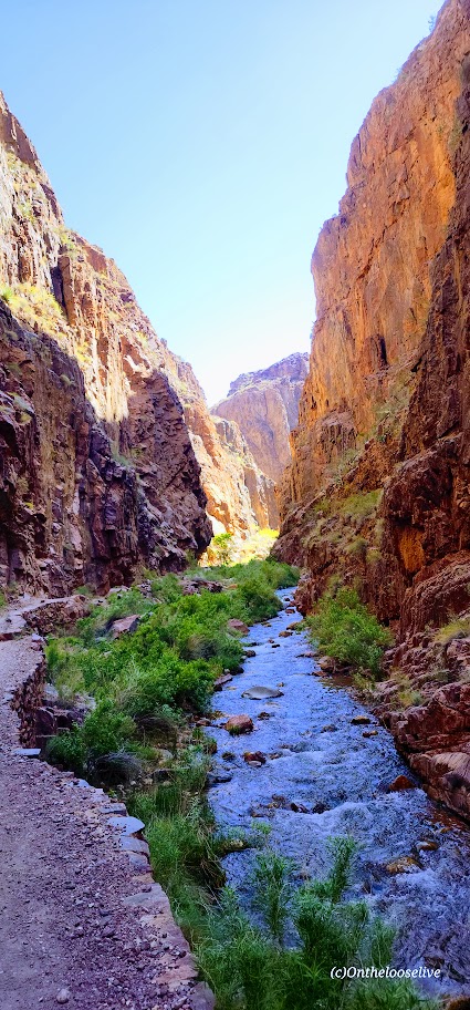
I thoroughly enjoyed the section between Manzanita and Phantom Ranch, which was entirely “new to me.” It was so refreshing and exhilarating, with the stream rushing along the trail and having it all virtually to myself. I stopped to take the most pictures along here. At one point, I looked at my watch and was shocked to see I was doing a 10-minute mile. I didn’t feel like I was running, but I did feel exuberant and euphoric. I was beyond the halfway point and feeling optimistic about doing this “thing!”
I took a slight detour down the Ribbon Falls trail. The bridge was out, which made my decision to pass on this side addition much easier. I didn’t want to add 2 miles roundtrip to my R2R or lose the momentum of my hike.
The only injury I sustained was cactus needles in the back of the forearm when I crouched too low to take a picture.
I was a little obsessed with the miles and my pace, taking pictures of my watch all along the way to track my progress because my watch battery had run out on my last big hike. And if it’s not documented, it didn’t happen, right?
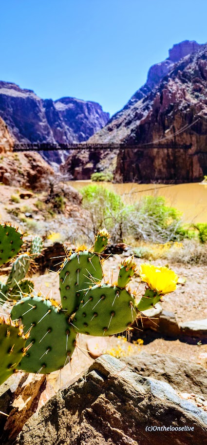
I reached Phantom Ranch (14.29 miles) in 4 hours and 16 minutes with no breaks.
While there were far fewer people there than in April, there was still a line at the canteen for lemonade and food. In retrospect, I might have skipped this, but I didn’t think the handful of people in front of me would take 25 minutes, and the lemonade was a major highlight and perhaps a lifesaver when I hiked down in April. I committed to standing in line, which was building behind me, so it seemed silly to give up my place when it would be “any minute now”…Sigh. Finally, I downed my lemonade and refill, topped off my water, and got back on the trail.
I didn’t feel like taking a break or eating anything, but I forced myself to have a caffeinated cola gu and took out some electrolyte-infused gel blocks to have in my hand. From this point on, after each mile, I would eat a block to celebrate and electrolyte balance.) Back in the day, when I used to run marathons, I’d have a mint to commemorate additional miles after the halfway point.
By the 5-hour mark, I had covered 17 miles.
I arrived at Havasupai Gardens, Mile 20- (4.5+ miles from the top) at a little over the 6-hour mark.
I topped off my water, took a few bites of a Slim Jim, and drank my Gatorade on the way up. It occurred to me that it might be possible to do this “thing” in 8 hours or less. (The average total time, including breaks, is 12-15 hours.) I was pumped and channeling my old triathlete/trail running self.) There was a slight breeze, so the hot spots were blissfully not as hot as in April. I still felt good but the muscle fatigue was starting to build in my legs.
At 23 miles, I was over 7 hours, and for the first time, my pace per mile increased to well over 20 minutes. I was forced to consider the possibility that I wouldn’t make sub 8 hours. Laughing outloud to myself that if I didn’t make sub 8, I would have to do it it again so I better haul ass now! And phew—just barely!
My Inspiration
Did I really hike it solo? Not really; I had my Dad with me. He died years ago, but I carry him in my heart and wear the talisman of his old-fashioned skeleton house key on my necklace, so he comes with me on all my hikes. When I do challenging hikes or activities, I think of him and how his stroke left him paralyzed and confined to a wheelchair for the last decade of his life. I think about how difficult that was for him and it inspires me to stay strong and keep moving.
I also thought a lot about my beloved trail running days with my best trail running partner, Allison Robar. I repeated our mantra from our crazy trail runs , “Light and Easy.” So, both my Dad and Allison were on the trail with me in spirit.
And as mentioned, I felt so exhilirated hiking along the river, taking in the incredible beauty and enjoying my solo connection with nature. It was a transcendent/spiritual experience for me. I was one, vigorously with the Universe.
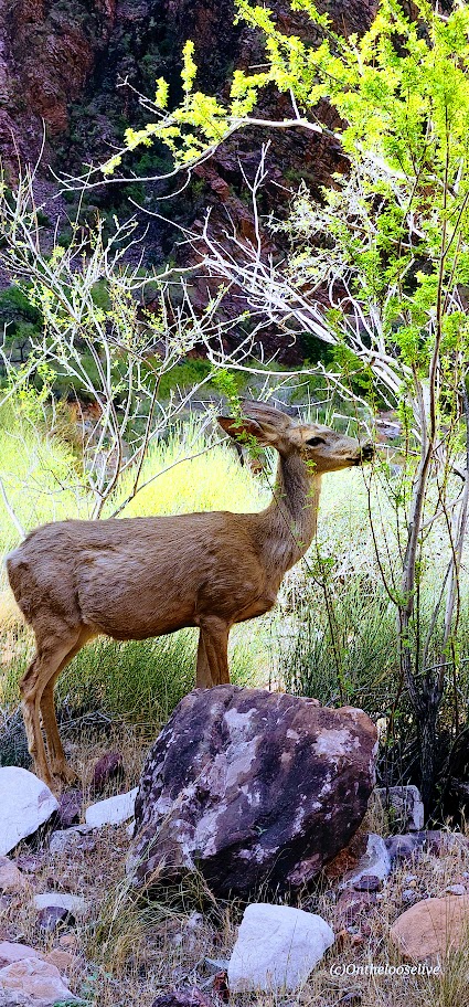
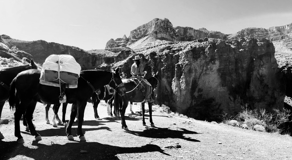
Of course, I met some cool people along the way too: trailrunners doing it for charity for the 5th year in a row, a buff backpacker named Billy taking on R2R2R. (I nicknamed him Billy Goat in my mind.) And there were others, including 2 “deer” Grand Canyon residents.
What worked for me
I chose light trail running shoes. I feel the terrain doesn’t call for hiking shoes per se. Sure, my feet were a bit battered and tender at the end of the day, but I feel quicker and lighter than I would have with hiking shoes. It’s a trade-off.
I wore knee braces on both knees from the start of the hike. (I have Grade 4 chondromalacia – bone on bone in both knees.)
I brought 1 pole and used it as needed (to help support my knees for large step-downs or step-ups). I like having my hand free, but I think having it helped, and was worth the tradeoff of carrying it.
I felt better after this hike than when I did the South Kaibab to Phantom and up Bright Angel loop. I attribute that to my prophylactic knee bracing, pole usage, and slightly cooler weather,
What I learned
Start at first light (or earlier)
Choose a day where temps at the bottom won’t exceed the low 90s.
Choose a weekday unless you like crowds
Select the North Kaibab to Bright Angel route
Soak your stuff (hat, scarf, shirt) and yourself every chance you get
Take pickle juice and electrolytes to prevent cramps.
Recommendations
Use your long training hikes to discover what’s best for you (nutrition, hydration, equipment, shoes, hiking partners, etc.) Cancel if temperatures are in the mid-90s to triple digits.
Equipment
Use a hydration bladder for hands-free drinking (Camelback or Osprey)
Take a pole or 2
Water filter (Sawyer SP129)
Electrolytes (I had electrolyte-enriched water, Gatorade, and gel blocks.)
Training
As part of your R2R training, if possible, I’d highly recommend doing the North Kaibab to Manzanita or Ribbon Falls hike and South Kaibab to Phantom Ranch and up Bright Angel hike, as well as a couple of hikes from the Grotto to the West Rim in Zion. Hiking those hikes in the GC, you’ll know exactly what you’re getting into and out of at the end of the day. It preps you both physically and psychologically.
Do hikes that simulate the elevation gain, distance, and desert heat factor
Do cross-training—bike, swim, etc. Do yoga & restorative stretching
Do strength training—squats, lunges, leg extensions & curls, calf raises, pushups, pullups, and core work. (Note: training with super heavy weights and low reps can increase muscle bulk, which can be counterproductive for endurance activities.There’s a fine line between gaining strength and lean body mass—more muscle mass requires more oxygen and is heavy—both of which can make climbing, especially at altitude, more difficult. It’s the difference between a bodybuilder and a triathlete. I’ve embodied both body types, and I can tell you from personal experience that lean muscle mass is the best for endurance activities.
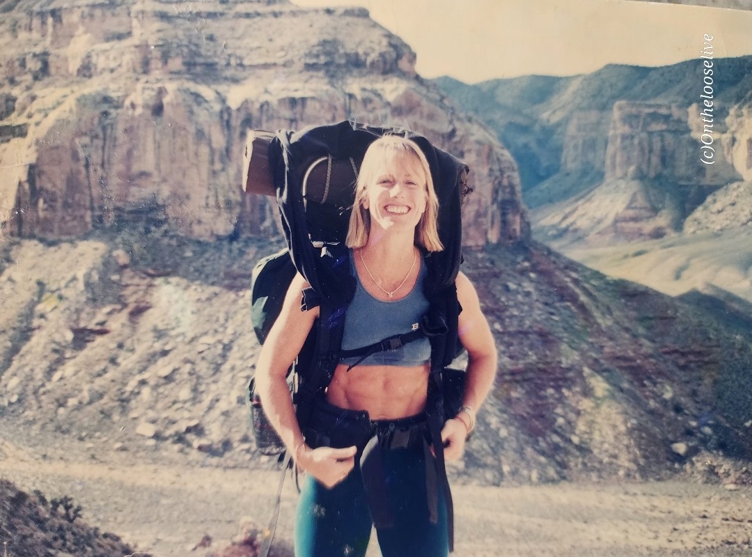
Here’s a pic of me backpacking the Grand Canyon in my body building days circa 1998 and me the day after R2R.
Route
I’m aligned with the majority that North to Bright Angel is the way to go. (Unless you’re doing R2R2R, and in that case, you don’t need my advice.)
North Kaibab (Rugged/rocky,sandy and slippery ascent/descent) ~5,781 ft elevation gain
Bright Angel (smooth and scenic trail with some shade)~4,400 ft elevation gain
South Kaibab (exposed trail) ~4,800 ft elevation gain
Logistics: If you’re “only” doing R2R, you’ll need to find a way back to your car on whichever side you left it. Fortunately, there’s the Trans-Canyon Shuttle that runs twice a day ($120pp). Or maybe your fortunate like I was to a have a friend willing to do an out and back hike on N. Kaibab and drive 4 hours over to the South Rim to meet you. Might be better to have a nonhiking friend meet you on the other side or key swap with friends hiking in the opposite direction. I guess that’s motivation for R2R2R, no logistics issues-lol.
Pre-hike dinner was at Jacob Lodge with fellow R2R hikers. The homade blueberry pie and cookies are delicious! Post-hike celebration at the rimside Arizona Steakhouse was delicious with great service and food!
Difficulty: Strenuous/hard due to distance, elevation change, sun exposure, heat
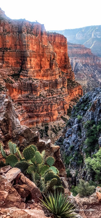
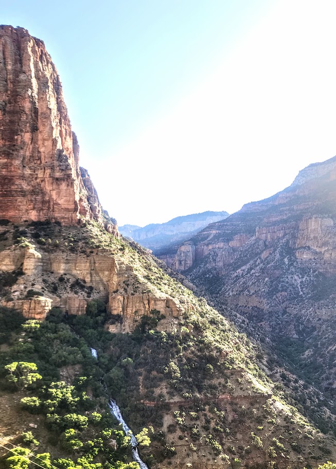
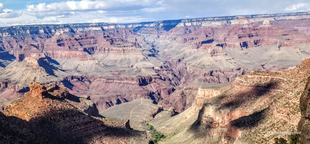
Grand views, but hiking the Grand Canyon is a bit of a circus. There are so many (way too many) people on the trails. It really detracts from the experience. (I’ll state the unpopular opinion that they should permit this hike, N.Rim, and Rim-to-Rim.)
I’ve been hiking (lengthy elevation gain hikes) and working out regularly (in anticipation of a possible Rim-to-Rim hike next month). This loop was an excellent training challenge. I have knee “issues”, so I wore knee braces. Fortunately, my knees were fine all the way down to Phantom Ranch (7.5 miles).
My hiking buddy and I arrived at Phantom Ranch after noon. We enjoyed two full 16-ounce glasses of refreshing lemonade (a must-do— $6 with a free refill!) I’d heard a lot about how cool Phantom Ranch is. It is a lovely, natural oasis with shady, gurgling Bright Angel Creek as backdrop and the comforts of campsites, rustic cabins, a restaurant, and a tiny store. Perhaps it’s charming when no one is around, but its charm was completely lost when I was there on an overrun weekend. The line for water refill there was at least 30 people long. I didn’t take any pictures at the ranch itself because I was so overwhelmed by the crowds
After downing 32 ounces of lemonade and a brief munchie break, we started climbing the switchbacks of Devil’s Corkscrew. By this time, the temperature was in the 90s. During the 3.5-mile climb up (1,300 ft), the completely exposed switchbacks, I slowed down, and my heart rate soared 20 points. By this point, my drinking water was the same temperature as my mouth. I couldn’t discern if I was drinking or if my Camelback Tube was twisted. Note, I was wearing a hat and a white shirt to deflect the sun’s rays. I don’t want to imagine what this section would feel like in triple-digit heat, which is common in the summer. I hadn’t acclimated to desert heat hiking yet because it was still Spring.
The second I came into the shade approaching Havasupai Gardens (water was available), my heart rate dropped 10 points. It returned to its active normal after I immersed my feet and my hat in the shallow stream. That immersion and the dragonfly below were the highlights here. We would have taken a longer break to wait for shadows to form on the steep Bright Angel Trail (4.5 miles, 3k elevation gain), but the area was completely overrun by noisy crowds. No pictures other than the dragonfly here, as I was too bummed out by the crowds. For me, it was the antithesis of a pleasant experience in nature.
We left in a hurry, eager to put the crowds behind me. I felt stronger on the climb out than when I hiked North Kaibab to Manzanita Springs out and back. My knees started complaining about a mile and a half from the top—poles might have helped.
After enjoying a celebratory ice cream at the top, my friend and I decided to “walk” to the parking lot, adding another 2.5 miles. That was the straw that broke the camel’s back for me. At about the 2-mile mark, both of my legs viciously cramped and seized, throwing me to the ground and rendering me helpless for at least 5-minutes, and hobbled for the remaining half-mile and day. If that had happened on the way up, I would have been incapacitated and might have required assistance. Scary. Why did it happen? Hard to say, but likely due to dehydration and lack of electrolytes. I had trouble drinking when I was overheated because my water was hot. next time, if there is one, I will bring metal containers to keep the water/electrolyte liquid cool.
Notes:Don’t underestimate the challenges of hiking in the Grand Canyon North or South, or Rim-to-Rim, especially in the summer. Even without extreme heat to factor in, hiking here is a serious undertaking. Don’t overestimate your abilities. Get as much elevation and heat training in as you can. Know your limits, hike with a buddy, and be prepared with adequate water, water purifier, electrolytes, and food. I wore trail running shoes with good tread. I prefer lighter footwear to heavy hiking boots and like having my hands free. The trails are mostly well-groomed. I did not use poles, but I might take them if I do Rim to Rim. Since I don’t do well drinking warm water, I’ll take on the extra weight of metal containers for cooler water next time.
“END” Notes
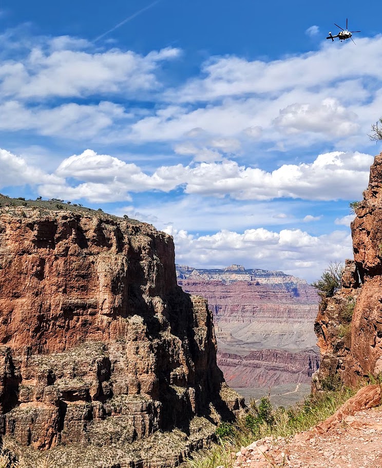
About a dozen people die in the Grand Canyon every year. The first cause of death is airplane and helicopter crashes (this comes in as first as it reflects the 128 deaths from the pre-FAA 1956 commercial airline collision). The second common causes are falls, jumps from, or driving off cliffs/ledges, and the third most common cause is due to the Grand Canyon’s extreme environmental hazards, including intense heat (temps can reach 120 degrees) dehydration/overhydration, cardiac arrest, flash floods, and lightning strikes.
Difficulty: Moderate to strenuous, depending upon your fitness level (3k ft climb in ~2 miles). Class 2.
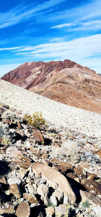
Corkscrew Peak (5,804 ft) is the imposing sentinel in the Grapevine Mountains of northern Death Valley National Park. It looks intimidating from afar and upon the approach, but the trail isn’t bad, and it’s a great workout. Definitely one of the most unique peaks I’ve seen.
Speaking of trails, the first portion requires some route finding. Head West from the Corkscrew Peak sign and follow the wide wash towards the peak. The route is cairned, gentle, and gradual, leading you to a narrow canyon area at about the 2-mile mark. Here, you’ll scramble up and out of the wash on the left. You’ll climb the spiraling rocky trail for the next 2 miles. Watch your footing, as there are many spots of loose gravel. All told you’ll be climbing 3,360 feet to the top—most of it packed into a somewhat intense 2 miles.
Right before you reach the top, there’s a cool natural window, a nice spot to return to enjoy a snack, and the view before the steep, slippery descent.
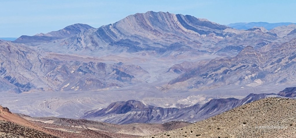
From the top, you’ll enjoy splendid views of Death Valley and surrounding peaks, including Langley, Whitney, and Telescope. You can also document your peak bag in the summit record, which is in a metal container wedged between some rocks at the top.
Getting there:
From the Visitors Center at Furnace Creek, drive ~ 11 miles N on State Highway 190 to the signed, paved Daylight Pass Cutoff Road toward Beatty, NV. Turn right and follow this road 10 miles to a signed road fork at Hell’s Gate. Go right onto Daylight Pass Road and drive 0.9 miles. Park on the dirt shoulder.
Notes: The initial section of the trail is a wide wash north of the road. The trail is slippery in sections with loose gravel “marbles; choose hiking or trail running shoes with the best traction. Some recommend poles for the way down. Personally, I do better on slippery downhill if my hands are free. It’s possible to trail run up, but be cautious on the way down.
Difficulty: Strenuous to moderate, depending on your fitness level. Trail runnable until you reach the top scree and talus portion.
The unofficial trail begins at the north end of the Dantes View parking lot. The unmarked single-track rim trail climbs and descends different ridges eventually leading to the peak of Mt. Perry (5,378 ft). The vast views in every direction are enchanting—across the valley to snow-capped Telescope Peak and down to the mesmerizing turquoise, emerald waters of Badwater Basin below.
Towards the peak, the loose scree and talus field get gnarly and may require a “4 on the floor”(hands and feet) approach. There’s no shame in stopping short if the rugged terrain becomes too disagreeable—the view is spectacular all along the way and at any of 3 false summits.
If you don’t have time to hike, Dante’s View is worth the drive up, especially at sunrise or sunset.
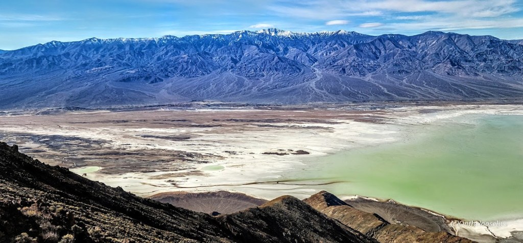
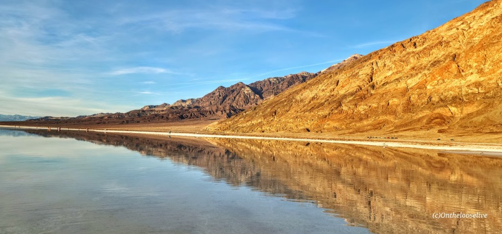
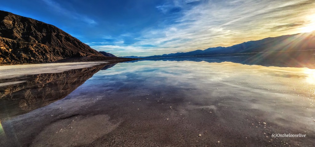
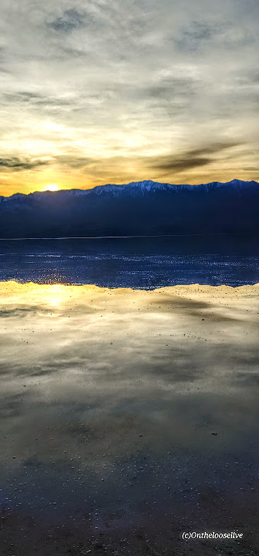
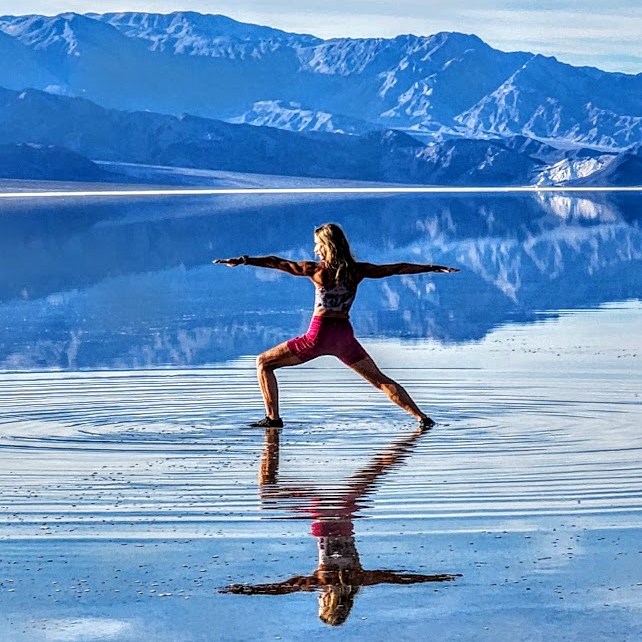
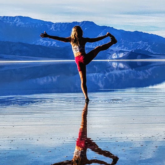
A once-in-a-lifetime opportunity to see Lake Manly/ Badwater Basin with water!
Whether you drive by it or up to Dante’s for the bird’s eye view, you must visit Badwater Basin, especially now! The lowest point in North America and the United States, Badwater Basin, an expansive salt flat, is the remnant of a vast and deep (600 ft deep) ancient lake that existed tens of thousands of years ago. During the past six months, thanks to the recent record-setting “atmospheric rivers,” the ancient “lake” has resurfaced into a 6-mile by 3-mile shallow (1 ft deep) “lake”. With warmer temperatures around the corner, the lake will evaporate before long, leaving only the vast, barren salt flat. For those lucky enough to see Lake Manly with water, that ephemeral glimmering experience will remain imprinted like a mirage flickering in our memories (and captured in our photos).
Happy Trails!
Couldn’t resist the once-in-a-lifetime yogi pose reflection photoshoot at Badwater!
Getting there: Dante’s View is a ~45-minute drive from Furnace Creek. Take the main Highway 190 route SE for 11 miles. Pass Zabriskie’s Point and turn right on Dante’s View Road (13 miles). Badwater Basin is a 17-mile drive from Furnace Creek via the 190, turn right on Badwater Basin Road.
Hike smart: Dante’s View to Mt. Perry is completely exposed. Summer hiking after 10AM is not recommended.