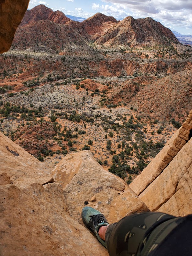
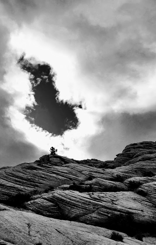
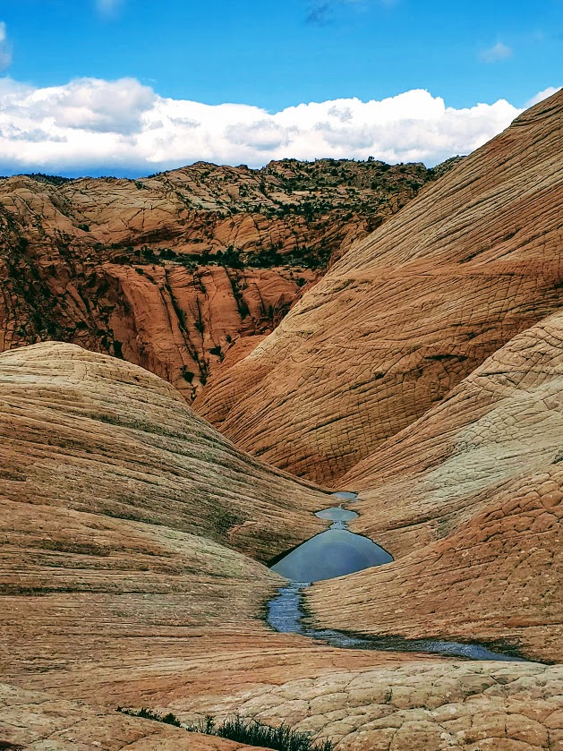
Also known as Candy Cliffs, this rocky wonderland is more than sweet- it requires a default to the overused superlative “EPIC” with an added “for sure”!
Only the first mile is a sandy trail, the rest is create your own adventure (at your own risk) across all types of fascinating colored and textured rock topography. Some steep, slippery sections… If you’re lucky, you might find the one crevasse that will take you down to the wash that you barely see in the distance way down below. Or like me, you may choose the wrong route and end up at a dead end, which could turn into a dead end in more ways than 1.
Length: 2-infinity miles
Getting there (4-wheel drive with clearance recommended): Cottonwood Springs Road in St. George to FR903
Notes: Would not attempt the drive or hike in the rain
For similar views at a slightly smaller scale and without the need for a 4-wheel drive, check out the Snow Canyon Overlook Trail
So close and yet so far to the wash below – the point of my return this time
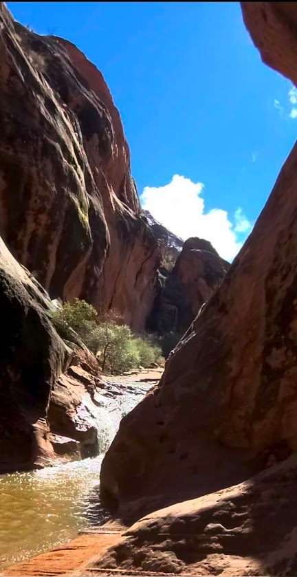
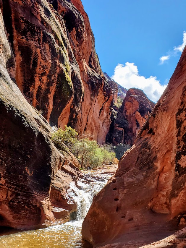
Short and splendid, this incredibly scenic area features a waterfall, a creek, a slot canyon, a cave, a mini-rock / rope climb, cliffs to scale—oh, my! So much is the span of a short out and back trail (2 miles total). It’s like a mini-Zion. The bad news is that it has the crowds to match. (Sigh.) (Reality pic is the last one in the slide show.) Thankfully everyone is respecting the natural beauty and leaving no trace. The good news is that solitude it just an upcliff scramble or mini-rope rock climb away…
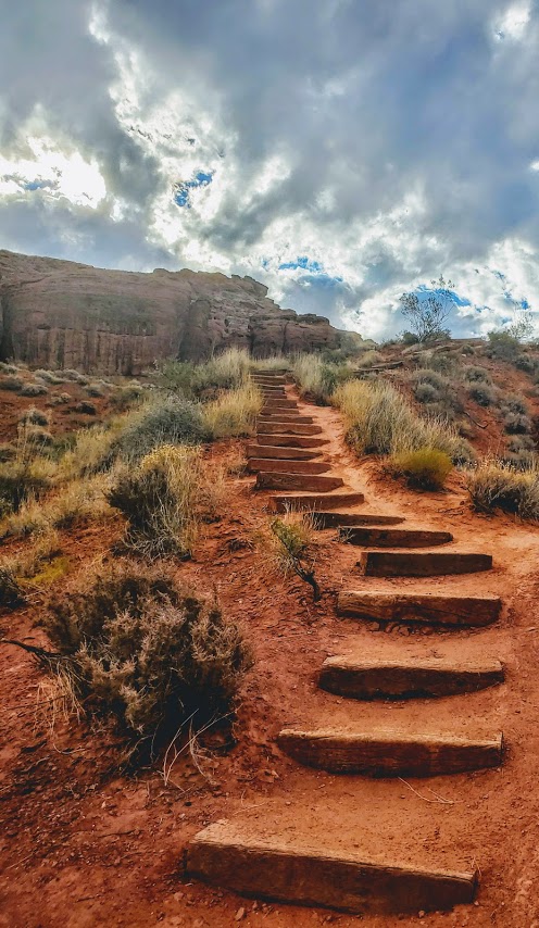
My friend, Robin, easily managing the moki steps in the pics below – looks more treacherous than it is.
Beyond the Moki steps, you’ll find more scrambling “opportunities” and more great views.
Getting there: Exit 22 towards UT-228 N, right on old highway 91 to the Red Cliffs National Conservation area
Elevation gain: ~2,600 ft of climbing (the climb up Snow Canyon alone is 4 miles, 4% grade, and 1,450 ft elevation gain). Clockwise or counter clockwise – either climb Snow Canyon or “The Wall”
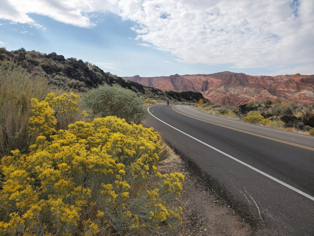
Highlights: Gunlock Reservoir, Snow Canyon State Park, Veyo Pie shop, cinder cones, horses, cows, goats, deer, hawks, quail, road runners, and not a single stoplight (though I once had to slow to let some free range cattle cross)
This incredibly scenic, well-marked route has the distinction of being the 1st official designated cycling route in Washington County, UT, it takes you through the towns of Diamond Valley, Dammeron Valley, Veyo, Gunlock, and Ivins. The Vejo Pie Shop is a an opportunity to refuel and indulge in a piece of their famed pies or pastries. The loop is a popular training route for triathletes for the Ironman 70.3 St. George and it was part of the full Ironman St. George course and the recent “Tour de St. George” century ride. I’m so fortunate to have this spectacular ride as my local “go to” ride. If you’re a road biker, this is a must-do if you’re in the area.
Notes: Snow Canyon State Park has an entry fee of $10 for locals/ $15 for out-of-towners; you can also bypass the park and climb or descend the 18 highway instead. There’s a bike path that runs parallel to the 18 northbound; the hills are quite a bit steeper than the highway (knee grinders). For the most part, there’s ample room on the highway, but there are 18-wheelers and trucks with trailers whizzing by so it’s not for the faint of heart…Also, be forewarned there’s a fair amount of debris on the roadsides – glass, steel radial, etc…Be prepared, bring your tough tires and a couple of tubes, Co2s, a hand pump, and plenty of water, especially in the summer. Enjoy the ride!
Difficulty: Easy, but there is another option via Paradise Rim that’s a little more rugged / interesting.
Stairway to heavenly views
Great hike, cool cave, splendid views!
Not a bad spot for a little yoga practice too.
Need I say more? I think not. If you’re in the area for a limited time, this is a good one for your “to do” list.
Getting there: Snow Canyon State Park, Ivins’ entrance. The trailhead is on the right before you reach the park gate. Park in the lot on the left. If you’d like a little more challenging / rugged approach, you can take Lakota Drive to the trailhead for Paradise Rim and come in from the backside. You can also add on a couple miles (~2 each way) if you park at the Chuckwalla parking lot and take the Turtle Rock Trail to connect to the Paradise Rim trail. Anyway, you go, you can’t go wrong.
A little more choppy and a little more climbing on the Paradise Rim Trail
For those of you who might be wondering, here’s a sample of what biking (road biking and mountain biking) looks like around St. George, Utah. As you can see, the views for much of this 60-mile ride were splendid, quintessential Utah—Virgin River, canyons, red rock, and snow-capped mountains. Road quality varied. (Utah drivers were not quite as courteous as I’d hoped. Lots of trucks sped by us without moving to the left or braking.)
Roadside Red Rock off the 7Virgin River Views From River Rock Roasting CompanyVirgin River Views From River Rock Roasting CompanyRiver Rock Roasting Company: Definitely the Best Coffee / Gastropub and Views Around!
Not bad, eh?
Toquerville /La Verkin Road Bike Loop ~60 Miles, ~2500 feet of climbing
A friend of mine, now a St. George local, guided us on this 60-mile road bike sampler with ~2500 feet of climbing on surrounding highways and byways. We took the lovely, low traffic 7 to Sand Hollow Road (rough surface) by Sand Hollow Reservoir (Half-Ironman site) across to State Street / 9. (The 9 is a main thoroughfare with heavy, fast traffic -not so nice. Maybe save this one for Sunday mornings when most of the locals are at church.)
At the halfway point, we enjoyed some refreshments and superb views at the super scenic, ever popular River Rock Roasting, which is perched on a cliff overlooking Virgin River in La Verkin. If you’re in the area, River Rock Roasting is a must stop and is definitely my top pick for coffee, food, brews and views. It’s slammed on Sundays (apparently everyone who is not in church goes here) so pick a weekday if possible.
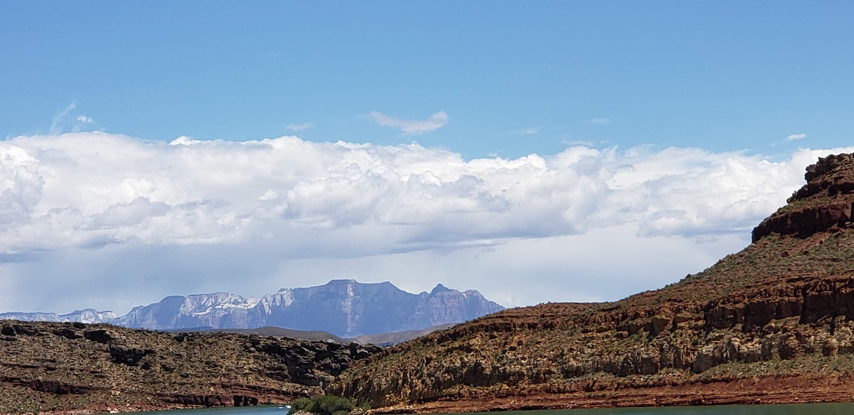
Our route back on State Street/9 was topped off with a stop at dazzling Quail Creek State Park and Reservoir. And yes, you can swim in it. No, I didn’t this time, but will next! It’s 120 feet deep in places and stocked with rainbow trout, bullhead catfish, crappie, largemouth bass. There’s boating, kayaking, SUPs, hiking, biking and camping here.
The Veyo Loop is another amazingly scenic route through the Gunlock and Snow Canyon area—one of the top ten routes in Utah -minimal traffic and maximum views!
Desert Canyons Mountain Bike Trails: Pushing Tin and Secret Sauce ~8 miles
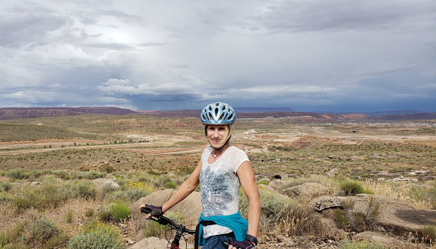
Our mountain bike sampler was limited as it had recently rained, but we’ve heard there’s tons of epic trails around here. The driest trail option was the newly developed Desert Canyons Trail System. We cruised around two of the trails, Pushing Tin and Secret Sauce, both pleasant easy to moderate with views from the top of the mesa out to the horizon. Unfortunately, these views are slated to be filled in by a Master Community in the near future. (The developer’s concession / gift was this mountain bike trail system.) We were lucky to have it to ourselves with no building encroachment yet.
Wildflowers and Mesa Top ViewsMetal ArtKara Highlighting Crazy Technical OpportunitiesOpen Views for Now…
Directions: From St. George, take the I-15 S to Desert Canyon s exit and take a left under the overpass
We were told that there’s plenty of great mountain biking in and near St. George, but it wasn’t in the cards for this trip. We did make it to Moab for an epic mountain bike ride – stay tuned for that post.
As far as these 2 rides go, I’ll give them 2 thumbs up.