Distance: 7.3 Miles RT (According to my Garmin, 6.8 miles according to Alltrails, and 5 miles according to the sign in the parking lot-lol.)
Difficulty: Easy (depending on fitness level and altitude acclimation), gradual ascent and descent on an old service road.
Elevation Gain: 1,332 ft over 3.5 miles to reach the fire lookout at the peak.
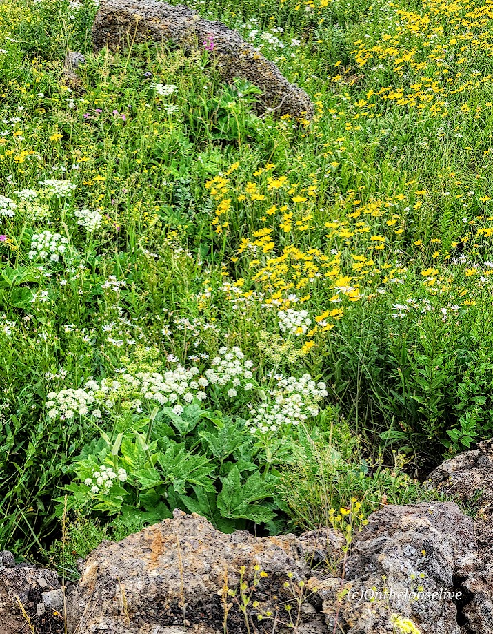
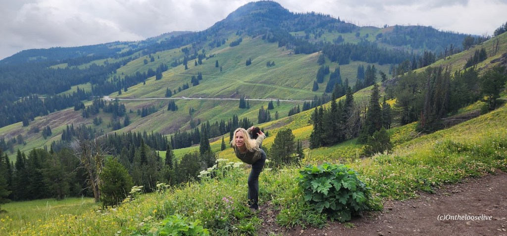
Wonderful Mount Washburn, at an elevation of 10,219 feet, is the most popular summit hike in Yellowstone National Park. It’s easy to see why. Named in 1870 after Henry D. Washburn, the Washburn–Langford–Doane Expedition leader, the hike features panoramic views from the start, wildflowers, wildlife sightings (only chipmunks and a grouse for me), a fire lookout tower with interpretive exhibits, an enclosed observation deck, and restrooms. Bagging this peak is relatively easy as you ascend gradually on an old service road.
Notes: No dogs. Be prepared for rapid weather changes and afternoon thunder and lightning storms, especially in the summer. Be bear alert and bring bear spray just in case. (They love this trail too.)
South & North Trailheadoptions: The South Trailhead is located along the Grand Loop Road between Canyon and Tower (7-mile route). To access the north trailhead (shorter route with a little less elevation ~5 miles), take the unpaved Chittenden Road 1.3 miles to the trailhead. From the top, I spied a couple more trails to explore, but alas, I ran out of time.
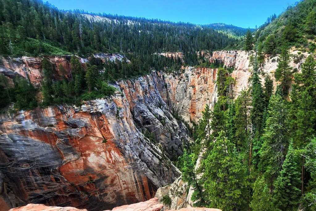
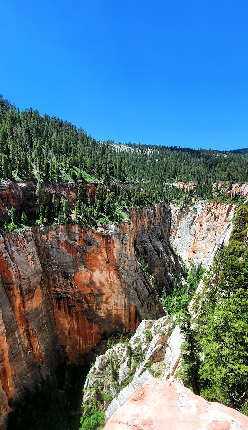
Enjoy spectacular views and leave the crowds behind in the parking lot at Artist’s Point. Fortunately, few people venture beyond the overlook. In fact, of all national park visitors, it’s estimated that only 10% ever leave the comfort of their car or camper, and of those, only 5% take to the trails. Unbelievable to me, but I’m certainly not mad about it. 😊 Most agree (as do I) that the views are more sublime along this gentle rim-side trail than at the actual destination/dead end of “Sublime Point”.
Most agree (as do I) that the views are more sublime along this gentle rim-side trail than the actual destination/ dead end of “Sublime Point”. It’s mesmerising to take in the multicoloured canyon walls that plunge 1,200 feet below and frame the turquoise, rushing Yellowstone River and waterfall. It’s obvious why photographers and painters and ordinary folks like me can’t get enough of this awe inspiring landscape.
Don’t believe me? Perhaps these pictures will convince you.
Fun Fact: The Grand Canyon of Yellowstone is nearly 25 miles long and up to 4,000 feet wide, and 1,200 feet deep.
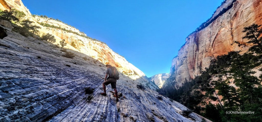
Via ferrata translates to “iron way”. A via ferrata is a route along a mountain or cliff face consisting of steel safety cables alongside thin steel rungs that you climb like a ladder. Simpler than rock climbing and canyoneering, it makes it possible for people to traverse cliffs and mountains that would otherwise be inaccessible. You wear a harness with 2 clips that you hook and unhook to the cable (one at a time) as you go.
Via ferratas can be traced back to the mid-19th century (presumably when they used iron to construct them instead of steel). During the First World War, the Italian Army used them to get troops through otherwise untraversable portions of the Alps. Via ferratas have since become popular as a safer, simpler option to rock climbing that still affords adventure seekers a thrill and adrenaline rush. (Especially if you’re scared of heights like me.)
My boyfriend, Bernie, invited me to join him on this local via ferrata adventure. I hesitated for a second as videos of the dizzying and daunting via ferratas of Europe played in my head. But the appeal of Zion backcountry’s rarely seen, dramatic vistas “pushed me over the edge,” so to speak. Not to mention, I enjoy trying new things, getting out of my comfort zone, and challenging myself in new ways.
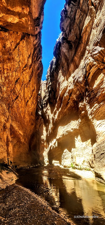
As it turns out, the Above Zion via Ferrata is quite tame. They’ve designed the course to be accessible for anyone “ages 8 to 80”. They equip you with the harnesses, clips, and helmets and a guide.Theoretically, if you can climb a ladder, you can handle it as long as your fear of heights doesn’t paralyze you. Views into this remote back canyon on the outskirts of Zion are splendid. The course is short, with 2 “exciting” sections and more trail walking than via Ferrata for a total of 2 miles roundtrip. A group ahead kept us waiting for them to finish at various junctures. The total moving time my Garmin recorded was 1 hour and 10 minutes. They describe it as a 4-hour adventure. (More like 2 hours at best, unless there are people in your group who really take it slow or freeze.) Sure, you can spend more time enjoying the views at the major lookout spots (as long as a group isn’t coming up behind you). There was a lovely waterfall in the distance, but we never got close enough for a good picture. I was hoping we’d go under it.
I’m sure good guides are hard to find, but… Ours was 20 minutes late and had a propensity to talk about himself. He missed one of the via ferrata sections and didn’t take us back to do it. At the end, he “slow walked” us on the trail and then forgot the combination to the gate while we waited in the side-by-side to get back to the starting point. (Actually, I got out and hiked up and was nearly there by the time they came by.) While he was nice enough to take pictures of us on his phone, he forget to send them.
Yep, that all happened. To be fair, it was the guide’s second day. Guess they are still working out the “kinks”. Cost was $130 per person to join a group. (We got lucky with a private experience.) Not the smoothest run operation, but it made for a fun morning, and a good introduction to via ferrata.
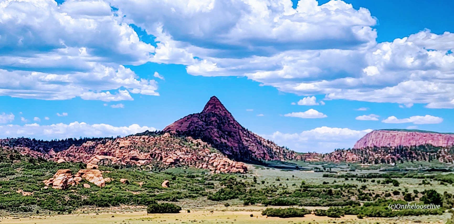
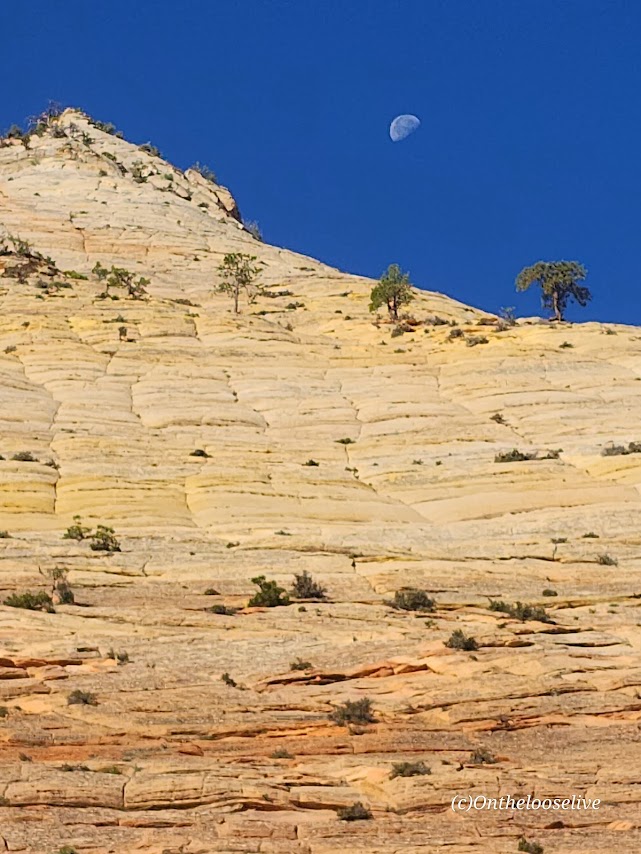
Kolob Canyon road views on the way are always nice too.
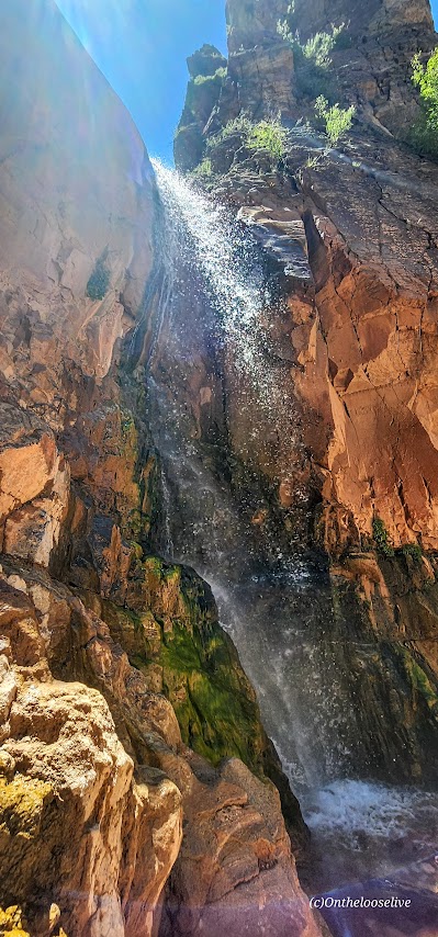
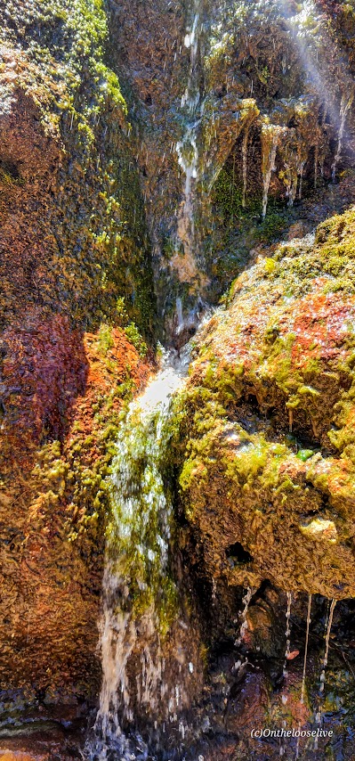
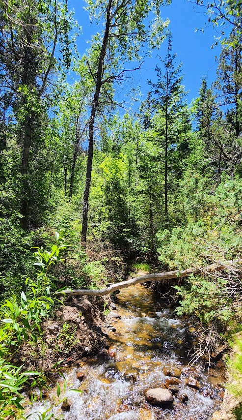
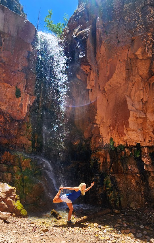
A short, shady stroll with some trail washout and a little scrambling at the end delivers a wonderful waterfall reward.
Great to top off another hike, take a roadtrip leg stretch, or have a lovely picnic spot.
Stay tuned for the videos.
Getting there:
The trailhead parking lot is located on the north side of SR-143, otherwise known as the Brian Head-Panguitch Lake Scenic Byway. Enjoy the entire scenic route if you can.
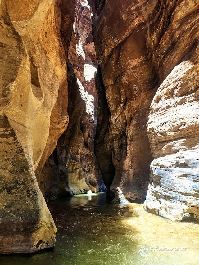
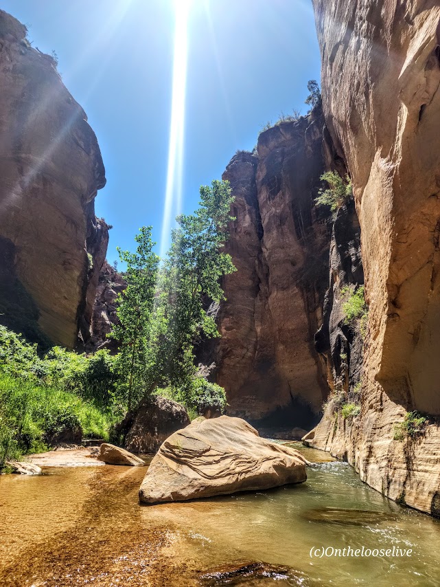
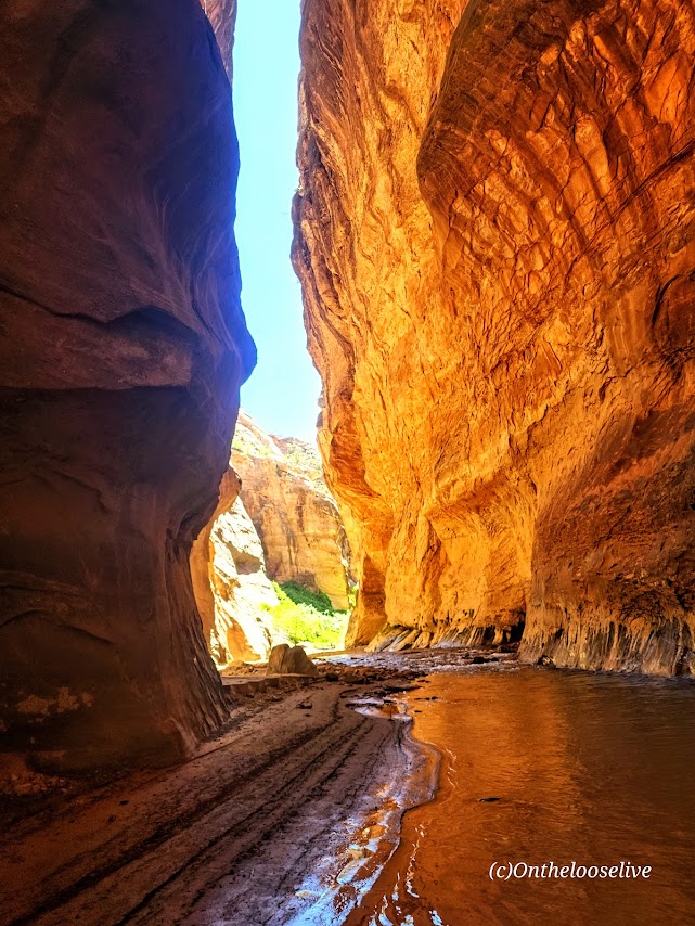
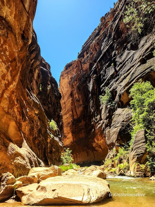
Challenging and strenuous ~16 Miles RT, including some sketchy scrambles, several slick rock traverses, and multiple MILES of exposed DEEP SAND SLOGGING. (Explains why no other humans are present.)
The scariest part was getting my phone wet despite it being in a dry bag and it blacking out. I feared the worst. Not really caring about the phone itself, but the prospect of losing all these hard-earned photos and videos!
My bliss—splendid solitude and immersion in the sublime natural beauty!
Excellent navigation skills, a GPS, First Aid kit, water, and a water purifier are essential for backcountry adventures.
Lucky for me, one of my best hiking buddies is an experienced backcountry guide who is always prepared for every eventually, including me forgetting my water back at home in the fridge.
He always points me in the right direction.
Happy Trails!
PSA: It’s the season for heat exhaustion and heat stroke. Play it safe— avoid hiking in the heat of the day on exposed trails. Wear sun protection—sunblock, hats, and light clothes with SPF and bring plenty of water and a water filter!