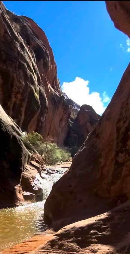
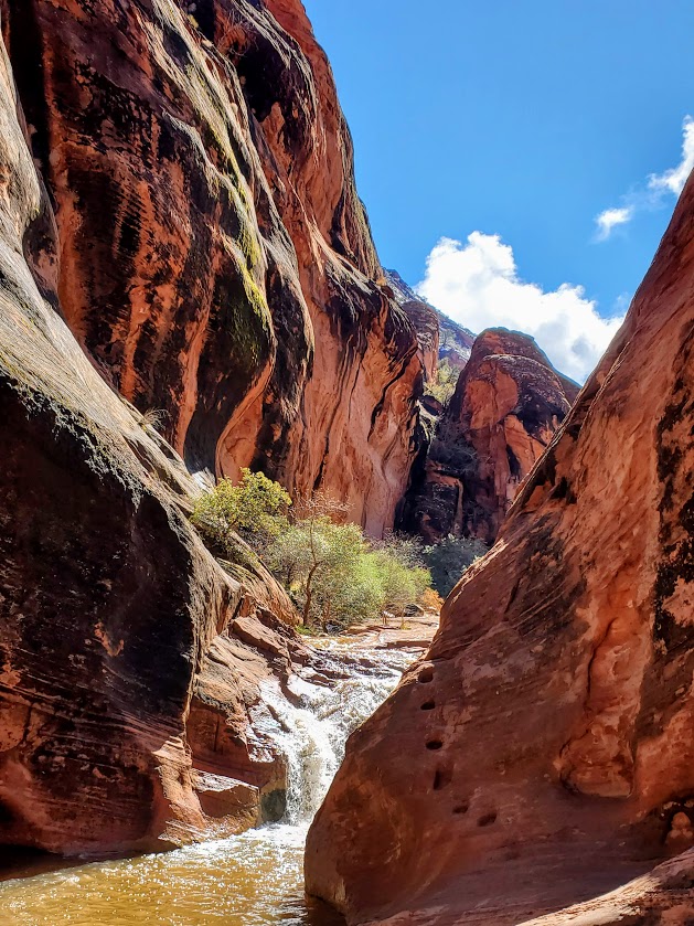
Short and splendid, this incredibly scenic area features a waterfall, a creek, a slot canyon, a cave, a mini-rock / rope climb, cliffs to scale—oh, my! So much is the span of a short out and back trail (2 miles total). It’s like a mini-Zion. The bad news is that it has the crowds to match. (Sigh.) (Reality pic is the last one in the slide show.) Thankfully everyone is respecting the natural beauty and leaving no trace. The good news is that solitude it just an upcliff scramble or mini-rope rock climb away…
My friend, Robin, easily managing the moki steps in the pics below – looks more treacherous than it is.
Beyond the Moki steps, you’ll find more scrambling “opportunities” and more great views.
Getting there: Exit 22 towards UT-228 N, right on old highway 91 to the Red Cliffs National Conservation area
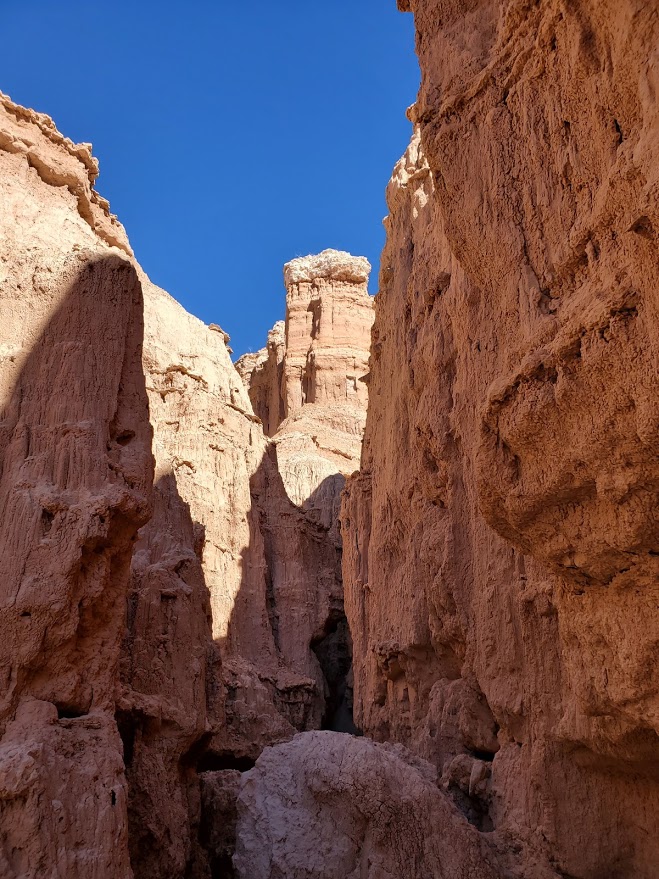
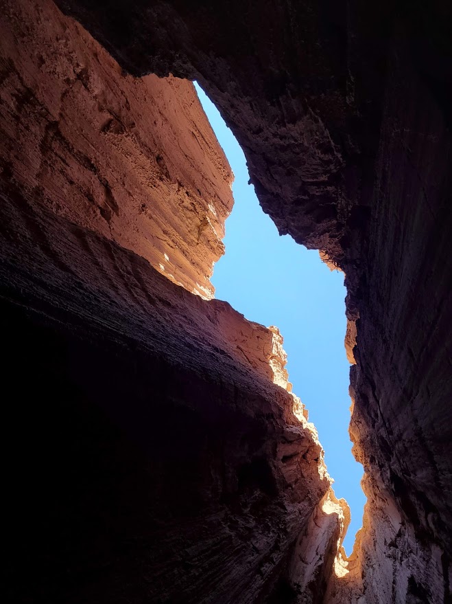
While there’s not much hiking to be done here (a grand total of 5.5 miles if you hit all 5 trails), what you will find is an otherworldly playground of caves, caverns, and catacombs. Between the spires and bluff-colored cliffs, you can follow one slot canyon into the next in aMAZEment.
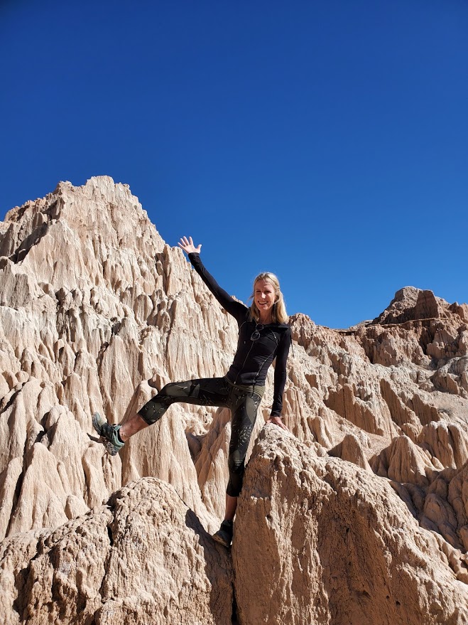
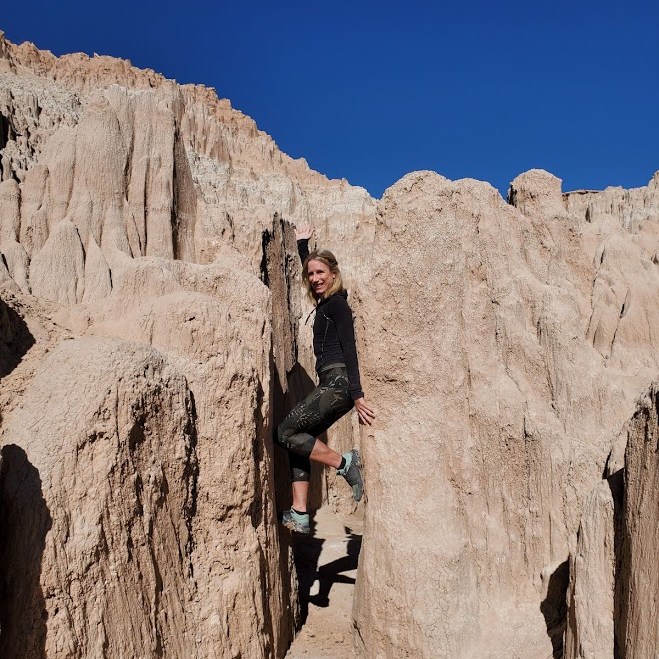
One of Nevada’s first four state parks, Cathedral Gorge was established in 1935 as a geologic preserve. It features dramatic, other-wordly landscape of eroded soft bentonite clay that covers close to 2k acres. The amazing spires, cliffs, and slot canyons are the result of millions of years of geologic activity sparked by volcanic eruptions that dispersed layers of ash hundreds of feet deep to the region. Faulting formed a valley over time, which eventually filled with water and became a freshwater lake. Over the centuries, this prehistoric lake began to gradually drain, and erosion began to expose and form the ash and pumice.
Enjoy the incredible views from the Miller Point Overlook gazebo (originally constructed by the CCC) and then create your own adventure in the abundant caves, slot canyons, catacombs, and slot canyons.
The formations at Cathedral Gorge remind me of the sand castles that my brother and I used to create by squeezing wet sand through our hands and letting the drips accumulate into peaks of various heights and girths. Indeed, the firmness and stability of the formations in Cathedral Gorge vary substantially so you must be alert at all times, taking care that you don’t break through the surface or fall into a chasm. (The trail guide included stats on trail firmness and stability.) Yes, it’s a bit sketchy, but totally cool. Kids would be amazed by this place and entertained for hours. For safety’s sake, I’d suggest that you keep them and pets on a tight leash!
Address: 111 Cathedral Gorge State Park Road, Panaca, NV 89042, a must-do, easy day trip from my base camp, St. George, UT, and about 2.5 hours northeast of Las Vegas on Highway 93,
Notes: $5 day use fee, camp at one of the 22 camp sites for $15 per night (first-come, first served), each with a table, grill and shade. Electrical hookups are available for an additional $10. Water and flushing restrooms with coin-operated showers are open year-round, with handicap-accessible sites available. Pets must be kept on a leash of < six feet.
Difficulty: Easy, but rocky terrain in wash (lower trail), sandy terrain (upper trail)
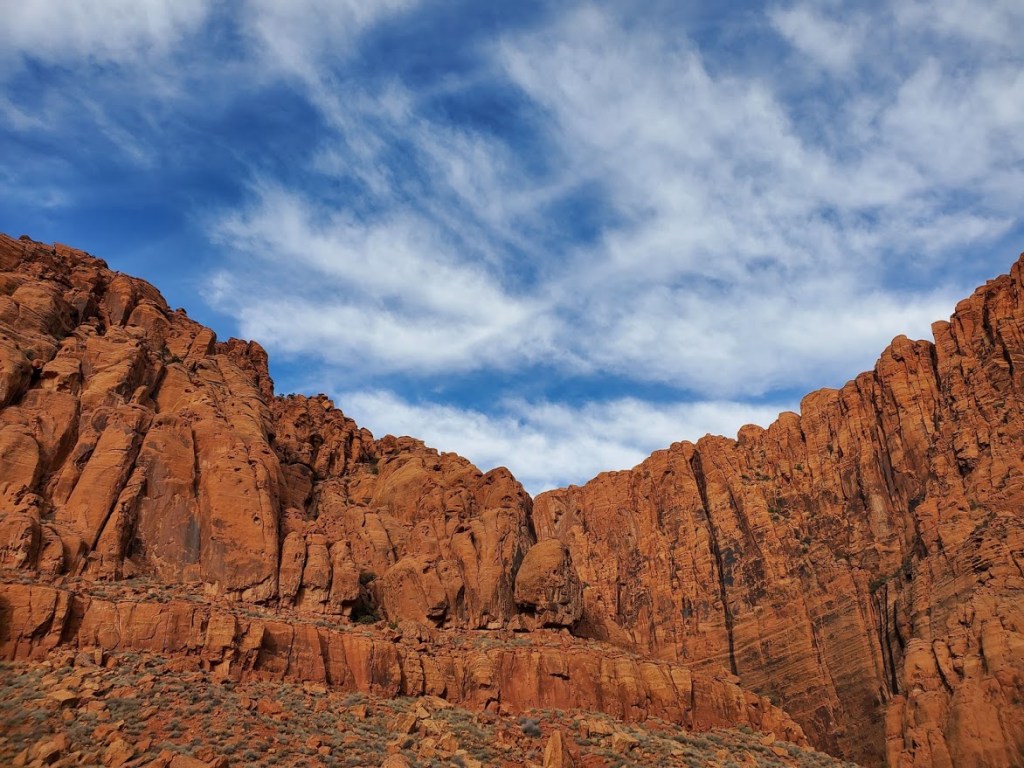
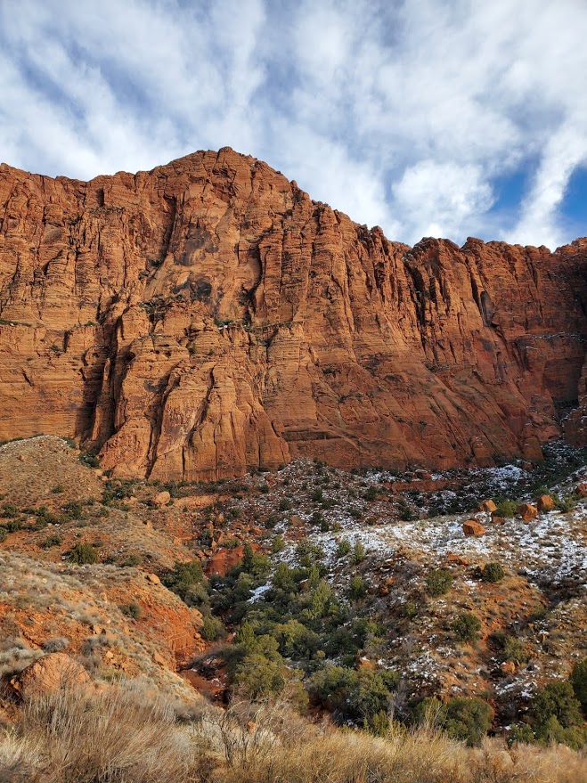
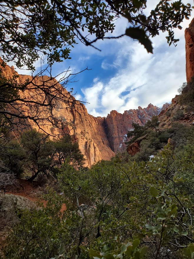
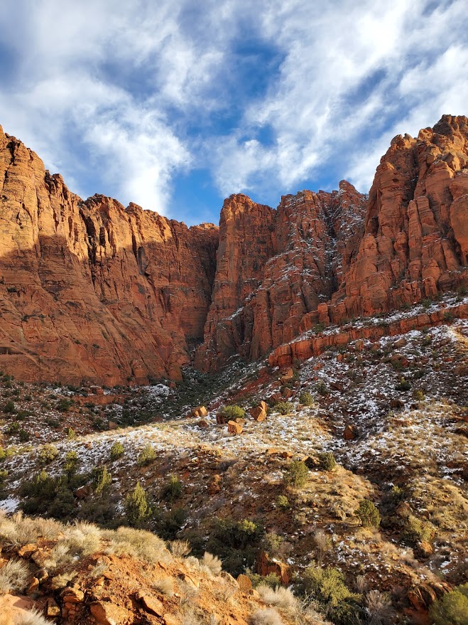
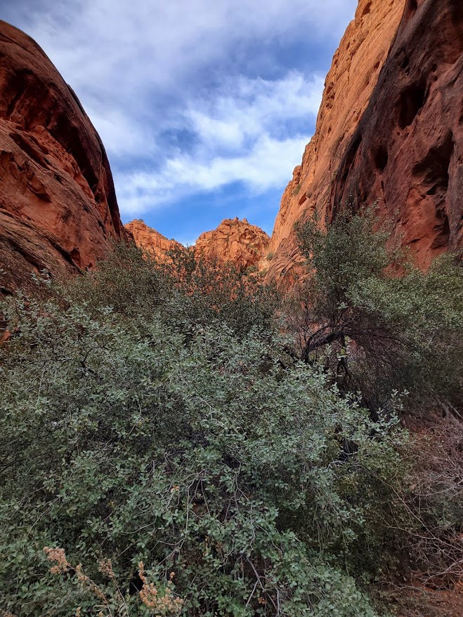
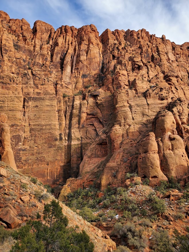
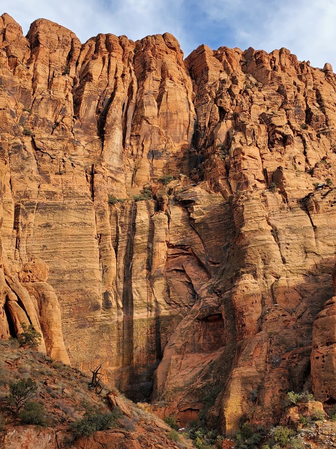
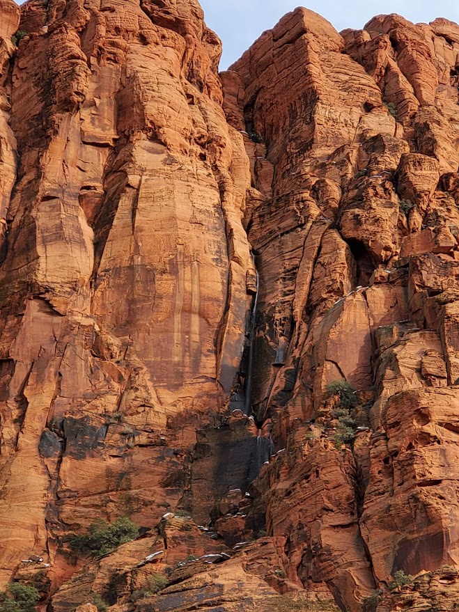
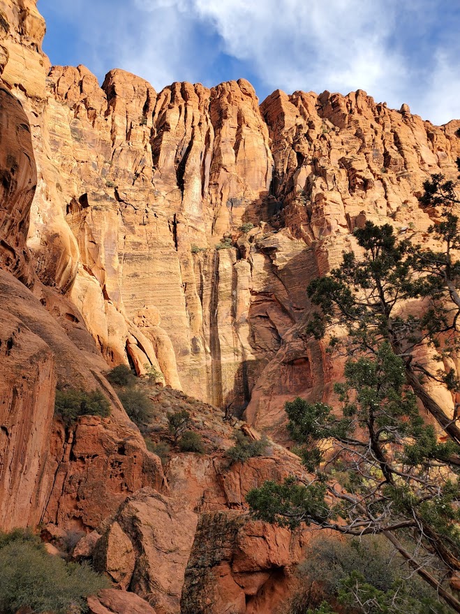
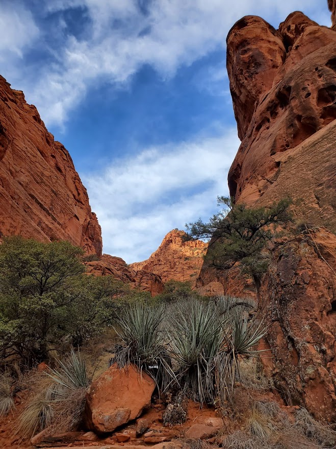
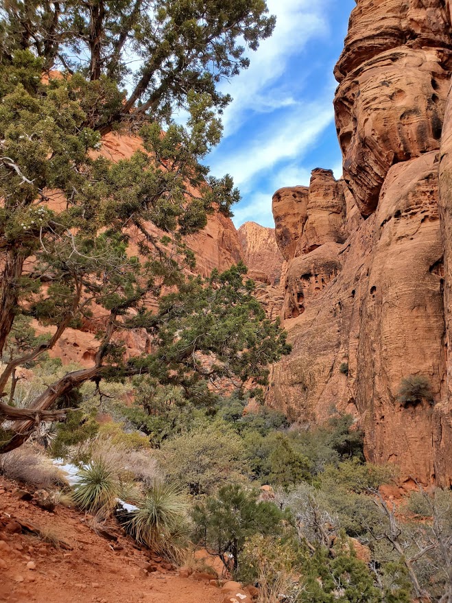
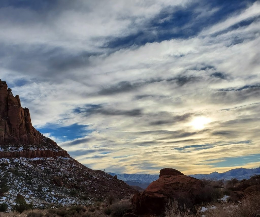
Magnificent red mountain views, panoramic vistas, and the possibility of waterfalls await. After a recent rain or snow, if the timing is right, and you’re lucky, you just might sight one of the rare and wonderful waterfalls.
You can take the lower wash trail and navigate a continuous rock field or you can take the sandy upper trail above the wash. For variety, take 1 out and the other back. Once you’re on top of the ridge, stop and listen for the sound of water, look carefully and closely at the dark veins running down the red cliffs. Watch for movement and light reflecting.
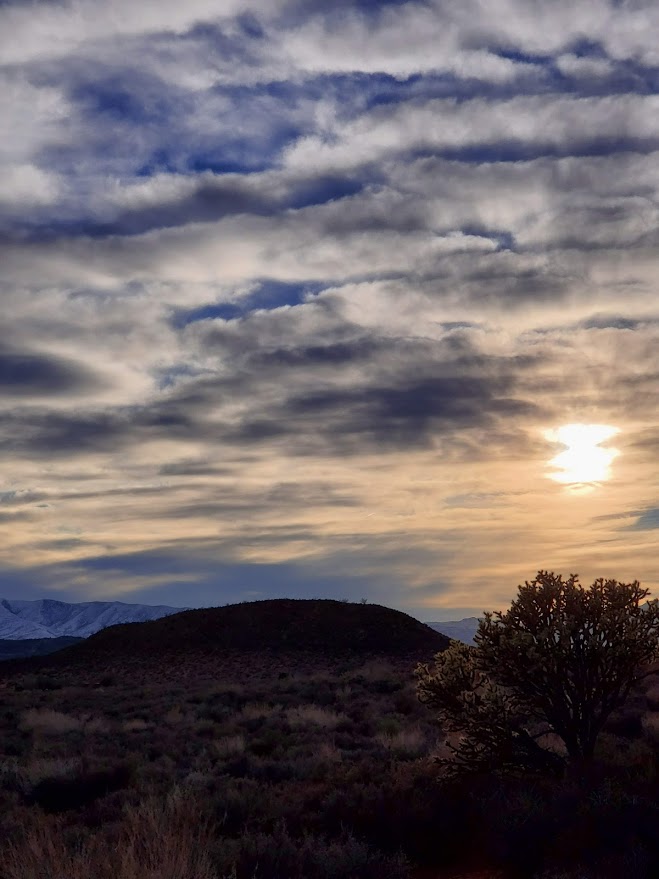
Continue hiking to very back of the canyon for some bouldering and scrambling fun. Be safe!
Notes: Exposed hike, best enjoyed in Winter, Spring, Fall
Getting there: Park along 779 Taviawk Dr, Ivins, UT
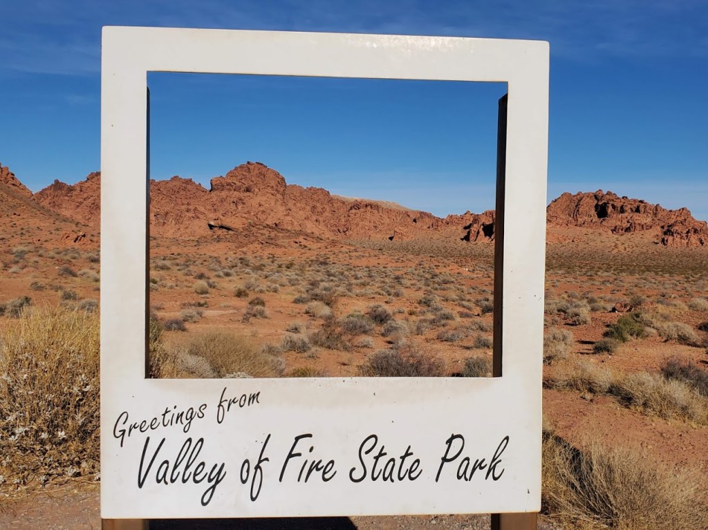
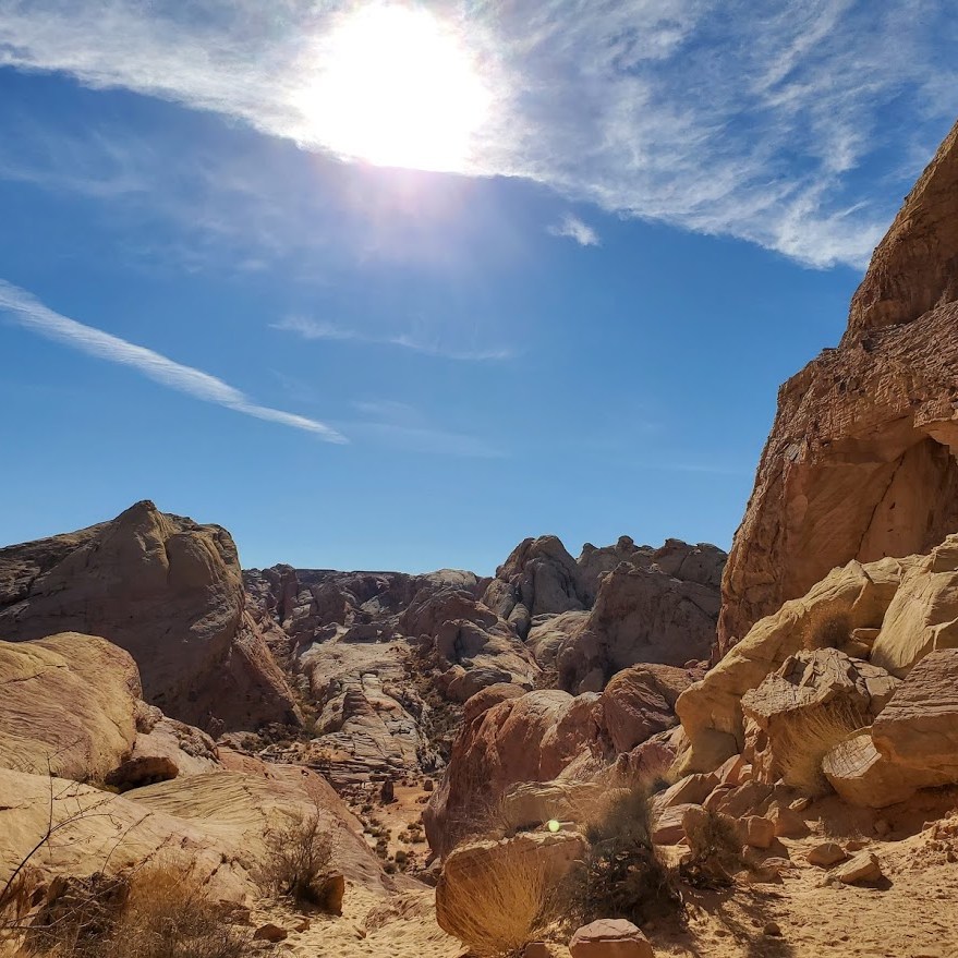
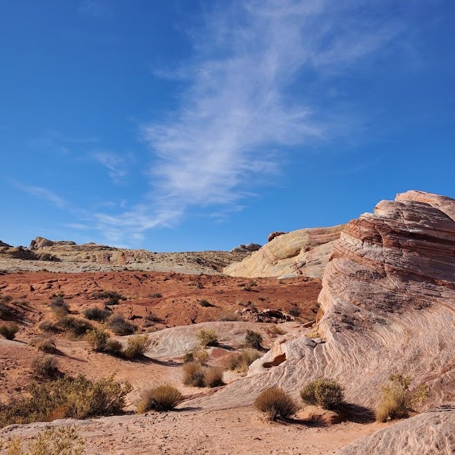
Why luke warm? I’ve seen some spectacular photos of Valley of Fire on social media–sometimes it’s hard for real life to live up to the hype—even in nature. The day I was there the light was not magnificent and the place was overrun with humans. The park’s close proximity to Las Vegas (55 miles) makes it an easy road trip for many (too many). (Granted, I made the rookie mistake of going on a weekend.) Also, I was disappointed by the hikes—the majority were short—just park and walk a mile or so on heavily stomped paths. Basically, you can see most of the park without much effort, which is great for families and those who can’t or don’t like to walk far.
I covered 7 of the hikes/ attractions in a half day. There were a couple of longer hikes that interested me, but 1 had signs warning about the trail not being marked, and the other 2 were slogs through deep sand. Since I was solo, I opted out of the poorly marked hike, not wanting to become another hiker lost, wandering in the desert…
Elephant Rock Loop (1.25 Miles) At the East Entrance of the park, Elephant Rock can be seen from your car. Like me, you may opt to stretch your legs and take a hike here. (Note half of the hike runs parallel with the road with the road visible so it’s a tad anticlimactic.)
Clark Memorial and [Charlie’s Spring (4.6 Miles RT, Natural Arches Trail] The Clark Memorial commemorates Sargent John J. Clark, a pioneer traveling cross-country who died of dehydration at the spot. There are 2 trailheads for longer hikes on the right side of the road. Both invite you to slog for miles through deep sand in either direction for negligible rewards. (The sign at the beginning of the Arch trail notes that the arch has crumbled and Charlie’s Spring starts with a tunnel under the road and offers a spring at the end…) While I wanted to a longer hike, I wasn’t enticed by the prospect of slogging through deep sand. Perhaps after a rain if the sand firms up instead of muds up? I went a half mile on through the tunnel into the wash on the Charlie’s Spring hike before I opted out.
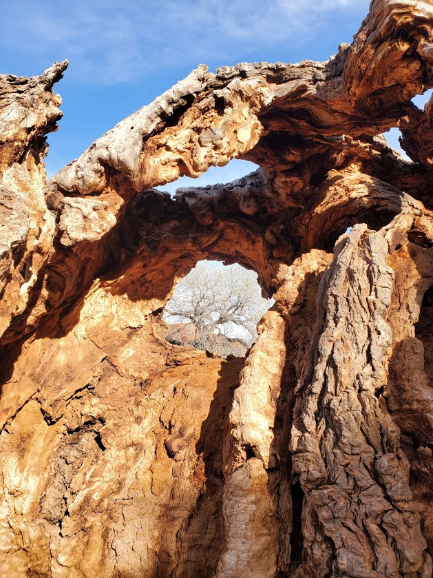
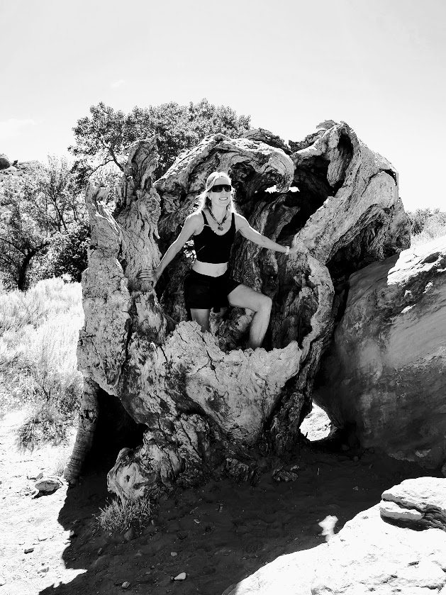
Petrified Logs and historic CCC cabins Another roadside stop, this attraction features logs from an ancient forest of 225 million years ago. You can keep driving another ½ mile or so, or hike from the petrified log site to the historic native sandstone cabins built by the Civilian Conservation Corps in 1930s to provide shelter to travelers.
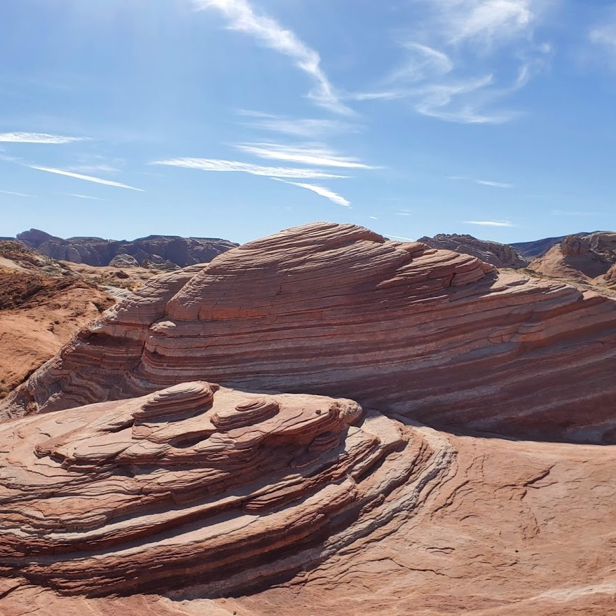
White Domes (1.36 miles) This was the most scenic of the hikes that I did. Several western movies were filmed here. There are arches, cool rock formations, and even a slot canyon to discover here.
Fire Wave (1.74 miles) This rock formation is most likely one of the most popular in the park. Since I’m accustomed to seeing this type of formation where I live, I was underwhelmed by the sight and overwhelmed by the crowd.
Rainbow Vista (1 mile) Single track stroll to a colorful rock overlook.
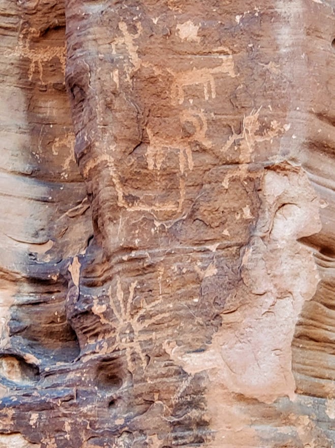
Mouse’s Tank (.78 Mile) This interesting little trail takes you to some of the best petroglyphs I’ve seen.
Don’t get me wrong, there’s plenty of breathtaking sights to see and lots of variety in the half dozen short hikes I mentioned, and more if you venture beyond. I’m just spoilt-rotten because but I happen to live within a couple miles of a similar stunning destination—Snow Canyon State Park, St. George. ( See Scout’s Cave, one of my favorite hikes.) Personally, I won’t go out of my way to return, but if it’s on your way—go for it.
Difficulty: Moderate + due to steepness and fickle footing
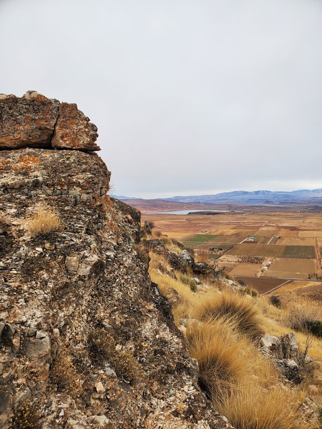
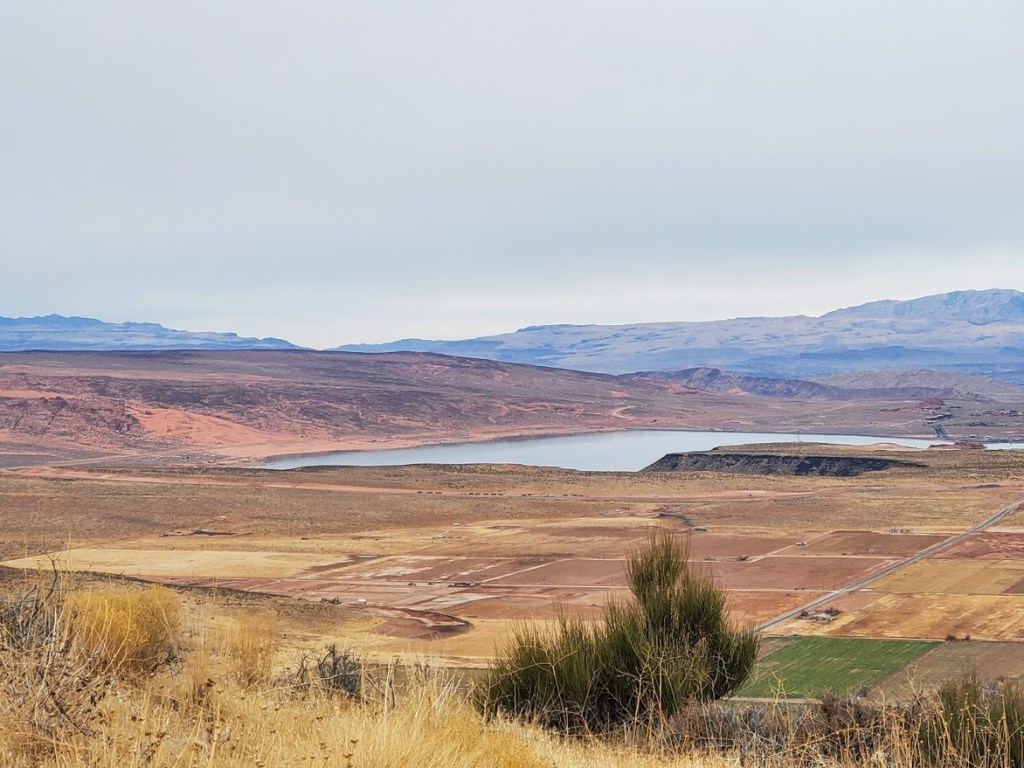
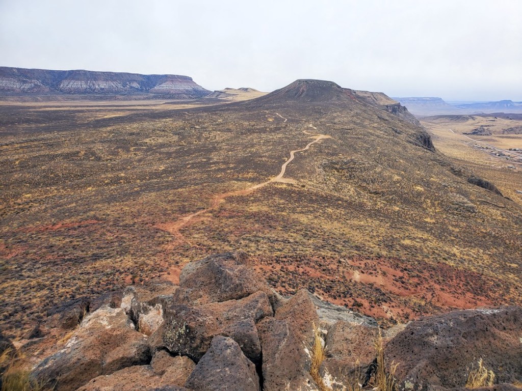
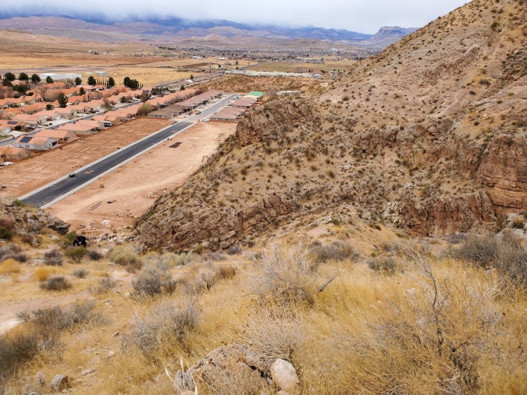
This suburban quickie is worth a scramble for the views and the workout. I didn’t catch it on a clear day, but the panoramic views were still quite expansive. The trail climbs steeply up out of the growing subdivision. I recommend hiking boots – the more traction the better as it’s all loose rocks and sand that rolls like marbles under foot. Not recommended in the rain, unless you want to take a slide down the slippery slope. There’s a cool wash area at the bottom and further up the road, there are some interesting caves to explore…
As John Maxwell says, and those who know me, know I agree wholeheartedly, “Everything worthwhile is uphill, EVERYTHING.” So get some good incline in today!